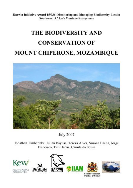
the biodiversity and conservation of mount chiperone ... - IIAM
the biodiversity and conservation of mount chiperone ... - IIAM
the biodiversity and conservation of mount chiperone ... - IIAM

Create successful ePaper yourself
Turn your PDF publications into a flip-book with our unique Google optimized e-Paper software.
Darwin Initiative Award 15/036: Monitoring <strong>and</strong> Managing Biodiversity Loss in<br />
South-east Africa's Montane Ecosystems<br />
THE BIODIVERSITY AND<br />
CONSERVATION OF<br />
MOUNT CHIPERONE, MOZAMBIQUE<br />
July 2007<br />
Jonathan Timberlake, Julian Bayliss, Tereza Alves, Susana Baena, Jorge<br />
Francisco, Tim Harris, Camila da Sousa<br />
Forestry Research<br />
Institute <strong>of</strong> Malawi
Biodiversity <strong>and</strong> Conservation <strong>of</strong> Mt Chiperone, Mozambique, FINAL 29 June 2007, page 2 <strong>of</strong> 33<br />
LIST OF CONTENTS<br />
1. INTRODUCTION 3<br />
2. STUDY AREA 3<br />
Geology <strong>and</strong> Geomorphology 5<br />
Climate 5<br />
L<strong>and</strong>use 5<br />
3. PREVIOUS STUDIES 6<br />
4. VEGETATION TYPES 6<br />
Vegetation Mapping 7<br />
Historical Change 11<br />
Vegetation Types 11<br />
Summit Thicket 12<br />
High-Altitude Forest 12<br />
Medium-Altitude Forest 13<br />
Miombo <strong>and</strong> Similar Woodl<strong>and</strong> Types 13<br />
Disturbed Woodl<strong>and</strong> <strong>and</strong> Fallows 14<br />
Rocky Outcrops 15<br />
5. BOTANY 15<br />
6. ZOOLOGY 16<br />
Local Hunter Records 17<br />
Small Mammals 18<br />
Birds 18<br />
Reptiles <strong>and</strong> Amphibians 20<br />
Lepidoptera 20<br />
Coleoptera <strong>and</strong> Hemiptera 22<br />
7. THREATS AND CONSERVATION ISSUES 23<br />
8. RECOMMENDATIONS 24<br />
Research Issues 24<br />
9. CONCLUSIONS 24<br />
10. REFERENCES 25<br />
ANNEX 1. Participants on Mt Chiperone Expedition, Nov/Dec 2006 27<br />
ANNEX 2. Plant checklist from Mt Chiperone above 800 m 28<br />
ANNEX 3. List <strong>of</strong> birds seen on Mt Chiperone, 15–18 December 2005 32
Biodiversity <strong>and</strong> Conservation <strong>of</strong> Mt Chiperone, Mozambique, FINAL 29 June 2007, page 3 <strong>of</strong> 33<br />
1. INTRODUCTION<br />
A scientific expedition to Mount Chiperone in nor<strong>the</strong>rn Mozambique was carried out from 22<br />
November to 5 December 2006. The expedition was funded under a Darwin Initiative grant to <strong>the</strong><br />
Royal Botanic Gardens, Kew – "Monitoring <strong>and</strong> Managing Biodiversity Loss on South-East<br />
Africa's Montane Ecosystems". The expedition was a collaborative effort between Kew, <strong>the</strong><br />
Instituto de Investigação Agraria de Moçambique (<strong>IIAM</strong>), <strong>the</strong> Mulanje Mountain Conservation<br />
Trust (MMCT), <strong>and</strong> <strong>the</strong> Forest Research Institute <strong>of</strong> Malawi (FRIM). A full list <strong>of</strong> participants is<br />
given in Appendix 1.<br />
The objectives <strong>of</strong> <strong>the</strong> expedition <strong>and</strong> study were:<br />
1. To undertake botanical <strong>and</strong> vegetation field survey <strong>of</strong> Mount Chiperone<br />
2. To ga<strong>the</strong>r additional zoological information on <strong>the</strong> <strong>mount</strong>ain<br />
3. To train a team <strong>of</strong> Mozambican <strong>and</strong> Malawian biologists in botanical <strong>and</strong> vegetation survey<br />
techniques<br />
4. To asses <strong>the</strong> extent <strong>and</strong> status <strong>and</strong> threats to <strong>the</strong> moist forest <strong>and</strong> o<strong>the</strong>r <strong>biodiversity</strong> on <strong>the</strong><br />
<strong>mount</strong>ain<br />
5. Based on ga<strong>the</strong>red field data, to develop species <strong>and</strong> habitat recovery plans.<br />
This report attempts to document what is known on <strong>the</strong> <strong>biodiversity</strong> <strong>and</strong> physical attributes <strong>of</strong><br />
Mount Chiperone, to present <strong>the</strong> results <strong>of</strong> <strong>the</strong> expedition, <strong>and</strong> to outline <strong>the</strong> threats to that<br />
<strong>biodiversity</strong>. It also outlines <strong>conservation</strong> management issues, with particular reference to moist<br />
forest above 1000 m altitude, <strong>and</strong> gives some <strong>conservation</strong> recommendations. Species <strong>and</strong> habitat<br />
recovery plans will be outlined in ano<strong>the</strong>r report towards <strong>the</strong> end <strong>of</strong> <strong>the</strong> project.<br />
2. STUDY AREA<br />
Location<br />
Mount Chiperone in nor<strong>the</strong>rn Mozambique is a semi-isolated peak situated some 50 km south <strong>of</strong> <strong>the</strong><br />
Mount Mulanje massif in sou<strong>the</strong>rn Malawi. It lies in Milange District <strong>of</strong> Zambézia Province, 40 km<br />
SSW <strong>of</strong> <strong>the</strong> District Centre <strong>of</strong> Milange. The area <strong>of</strong> Mount Chiperone above 600 m covers about<br />
100 km 2 , with around 4915 ha (in planimetric view) above 800 m altitude, 2770 ha above 1000 m,<br />
<strong>and</strong> only 110 ha over 1800 m. The massif is centred on 16 o 29'S, 35 o 43'E, with <strong>the</strong> highest point at<br />
2054 m (c. 16 o 28'44"S, 35 o 42'88"E).<br />
The surrounding plains to <strong>the</strong> north form part <strong>of</strong> <strong>the</strong> central African plateau, here lying at around<br />
400–450 m altitude, while <strong>the</strong> l<strong>and</strong> to <strong>the</strong> south falls away rapidly to 200–350 m towards <strong>the</strong> coast<br />
some 200 km away from <strong>the</strong> Zambezi Delta. The Shire valley, part <strong>of</strong> <strong>the</strong> East African Rift Valley,<br />
lies 35 km to <strong>the</strong> west at an altitude at this point <strong>of</strong> 50–100 m.<br />
Starting from a road-head in Sabelua village (16 o 30'48"S, 35 o 46'08"E, alt. 400 m) on <strong>the</strong> SE slopes,<br />
expedition members walked up <strong>the</strong> south-eastern flank through cleared <strong>and</strong> regenerating woodl<strong>and</strong><br />
vegetation, across two ridges, <strong>and</strong> established a base camp just inside <strong>the</strong> nearest patch <strong>of</strong> moist<br />
forest (16 o 30'35.4"S, 35 o 43'42.7"E) at an altitude <strong>of</strong> 1029 m. Most <strong>of</strong> <strong>the</strong> survey work was<br />
concentrated in <strong>the</strong> forest <strong>and</strong> miombo woodl<strong>and</strong> within relatively easy access <strong>of</strong> <strong>the</strong> camp. In<br />
addition, reconnaissance trips were made up along <strong>the</strong> NW–SE trending summit ridge <strong>and</strong> on <strong>the</strong><br />
eastern slopes above Marega village (16 o 28'1.4"S, 35 o 45'45.1"E, alt. 502 m). Collecting localities<br />
<strong>and</strong> areas visited are shown in Figure 1.
Figure 1. Map <strong>of</strong> Chiperone area <strong>and</strong> collecting localities.<br />
Biodiversity <strong>and</strong> Conservation <strong>of</strong> Mt Chiperone, Mozambique, FINAL 29 June 2007, page 4 <strong>of</strong> 33
Biodiversity <strong>and</strong> Conservation <strong>of</strong> Mt Chiperone, Mozambique, FINAL 29 June 2007, page 5 <strong>of</strong> 33<br />
Logistics <strong>and</strong> <strong>the</strong> full itinerary are given in a separate report (J. Bayliss, Trip Report – Mount<br />
Chiperone Expedition, 22 Nov–5 Dec 2006).<br />
Geology <strong>and</strong> Geomorphology<br />
Mount Chiperone, a semi-isolated peak, appears to rise rapidly out <strong>of</strong> <strong>the</strong> surrounding plateau, <strong>and</strong><br />
has a distinctive small pointed peak when viewed from <strong>the</strong> north or east. There is a NW–SE<br />
trending ridge, with a main peak (2054 m, ONC charts) slightly towards <strong>the</strong> NW end. However<br />
published figures vary slightly, from 2017 m [Google Earth] to 2065 m [1:250,000 map]. O<strong>the</strong>r<br />
minor high points are seen along <strong>the</strong> ridge, some <strong>of</strong> which are almost devoid <strong>of</strong> woody cover.<br />
O<strong>the</strong>rwise <strong>the</strong> slopes coming <strong>of</strong>f <strong>the</strong> ridge are steep <strong>and</strong> mostly covered in closed moist forest.<br />
The <strong>mount</strong>ain is composed <strong>of</strong> fairly recent syenite (Jurassic/Cretaceous period, c.150 Mya),<br />
intruded <strong>the</strong> surrounding country rock, which comprises migmatites (metamorphic rock injected<br />
with igneous material) <strong>of</strong> <strong>the</strong> Namarroi series (850–1100 Mya). In this respect, Chiperone differs<br />
from most <strong>of</strong> <strong>the</strong> o<strong>the</strong>r massifs or hills in nor<strong>the</strong>rn Mozambique, which are composed <strong>of</strong><br />
migmatities or granites (e.g. Mt Namuli, <strong>the</strong> inselbergs around Ribaue <strong>and</strong> Nampula). The<br />
exceptions are Mt Tembe at Morrumbala <strong>and</strong> Mount Tumbine above Milange town, <strong>and</strong> much<br />
fur<strong>the</strong>r to <strong>the</strong> south, a large part <strong>of</strong> Mount Gorongosa. Mt Mulanje, formed 130 Mya at<br />
approximately <strong>the</strong> same time as Chiperone, is composed <strong>of</strong> syenite, quartz-syenite <strong>and</strong> granite<br />
(Garson & Walshaw 1969, Eastwood 1988), nomenclature depending on <strong>the</strong> level <strong>of</strong> quartz (syenite<br />
if quartz is essentially absent).<br />
The main drainage <strong>of</strong>f <strong>the</strong> <strong>mount</strong>ain is to <strong>the</strong> south west. These small rivers, <strong>the</strong> Rio Macololo<br />
(becoming <strong>the</strong> Rio Metambe) <strong>and</strong> <strong>the</strong> Rio Muse, are probably not perennial. They both drain into<br />
<strong>the</strong> Shire River in sou<strong>the</strong>rn Malawi above <strong>the</strong> town <strong>of</strong> Nsanje.<br />
Climate<br />
Climatic data on <strong>the</strong> area are not available. From coarse-scale maps, mean annual rainfall is around<br />
1400 mm/year. Meteorological data from Milange, 40 km away (Kassam et al. 1981), give a mean<br />
annual rainfall <strong>of</strong> 1733.9 mm (28 years), with a mean annual temperature <strong>of</strong> 23 o C, mean maximum<br />
<strong>of</strong> 28.9 o C <strong>and</strong> mean minimum <strong>of</strong> 17.1 o C. Vegetation on <strong>the</strong> lower slopes <strong>of</strong> <strong>the</strong> <strong>mount</strong>ain, however,<br />
suggests that rainfall is somewhat lower, perhaps around 1000 mm/year.<br />
L<strong>and</strong>use<br />
There are two villages <strong>and</strong> settlements at <strong>the</strong> base <strong>of</strong> Mt Chiperone on <strong>the</strong> south <strong>and</strong> south-eastern<br />
slopes, Sabelua <strong>and</strong> Marega. The peneplain here has been extensively cleared <strong>and</strong> is cultivated at<br />
subsistence level. The nor<strong>the</strong>rn, north-eastern <strong>and</strong> western slopes seem little affected by human<br />
activity, although <strong>the</strong>y were not visited on <strong>the</strong> ground. On <strong>the</strong> lower slopes on <strong>the</strong> south <strong>and</strong> sou<strong>the</strong>ast<br />
<strong>the</strong>re has been patchy clearance for cultivation <strong>of</strong> maize, cassava <strong>and</strong> beans, <strong>and</strong> extensive<br />
burning, particularly in <strong>the</strong> Marega area. The l<strong>and</strong>scape <strong>of</strong> Mt. Chiperone is a mosaic <strong>of</strong> cultivation,<br />
disturbed woodl<strong>and</strong> <strong>and</strong> fallows/regenerating woodl<strong>and</strong> <strong>of</strong> various ages. This continues through <strong>the</strong><br />
miombo woodl<strong>and</strong> belt until <strong>the</strong> edge <strong>of</strong> <strong>the</strong> moist forest. There is virtually no cultivation or cleared<br />
patches above 1000 m altitude on <strong>the</strong> sou<strong>the</strong>rn <strong>and</strong> south-western slopes, but cleared patches are<br />
found up to 1400 m on <strong>the</strong> (presumably moister or more mesic) south-eastern slopes.<br />
The moist forest itself appears very little disturbed, apart from fire along <strong>the</strong> boundaries,<br />
particularly marked in <strong>the</strong> gullies. This lack <strong>of</strong> anthropogenic disturbance is possibly due to <strong>the</strong><br />
local belief <strong>of</strong> malevolent spirits residing in <strong>the</strong> forest.
Biodiversity <strong>and</strong> Conservation <strong>of</strong> Mt Chiperone, Mozambique, FINAL 29 June 2007, page 6 <strong>of</strong> 33<br />
Water was identified as a particular problem for villages at <strong>the</strong> base <strong>of</strong> <strong>the</strong> <strong>mount</strong>ain. There are a<br />
few small streams running <strong>of</strong>f, but during <strong>the</strong> dry season <strong>the</strong>se dry up or become a trickle. There are<br />
apparently no wells or boreholes in <strong>the</strong> vicinity.<br />
3. PREVIOUS STUDIES<br />
It appears that very little published information is available on Mt Chiperone <strong>and</strong> <strong>the</strong> immediate<br />
surrounding area. This is ra<strong>the</strong>r surprising considering <strong>the</strong> wealth <strong>of</strong> information – geological,<br />
biological, historical – on Mt Mulanje in Malawi, just 50 km away. However, rarely did researchers<br />
<strong>and</strong> o<strong>the</strong>rs based in Malawi extend <strong>the</strong>ir study or visit across <strong>the</strong> border, even though in <strong>the</strong> first<br />
part <strong>of</strong> <strong>the</strong> 20th century access to this part <strong>of</strong> Malawi was <strong>of</strong>ten by train through Mozambique <strong>and</strong><br />
up <strong>the</strong> Shire Valley. Dixey, <strong>the</strong> Nyasal<strong>and</strong> Government Geologist, for example, does not mention<br />
Chiperone in his study on <strong>the</strong> "Mlanje Mountains <strong>of</strong> Nyasal<strong>and</strong>" (Dixey 1927), <strong>and</strong> Jim Chapman, a<br />
Forester who spent many years working <strong>and</strong> collecting on <strong>and</strong> around Mt Mulanje, has also not<br />
visited (pers. comm. 2007). Vincent, in his mammoth bird-collecting trip across sou<strong>the</strong>rn Malawi<br />
<strong>and</strong> nor<strong>the</strong>rn Mozambique, did not visit, but saw <strong>the</strong> "isl<strong>and</strong>" Mt Chiperone from afar <strong>and</strong> said it<br />
"..... should hold much interest to <strong>the</strong> naturalist". The main knowledge <strong>of</strong> Chiperone among many<br />
residents <strong>of</strong> Malawi would appear to be through <strong>the</strong> so-called "<strong>chiperone</strong>" wea<strong>the</strong>r, a 5-day misty<br />
wea<strong>the</strong>r system that is reputed to generate over Chiperone <strong>and</strong> which <strong>the</strong>n moves towards Mulanje,<br />
bringing light rainfall. Such wea<strong>the</strong>r is <strong>of</strong> particular significance <strong>and</strong> benefit to <strong>the</strong> tea plantations<br />
<strong>the</strong>re.<br />
The first recorded biological collecting from Mount Chiperone was <strong>of</strong> birds, carried out from 25–31<br />
July 1950 by Jali Makawa, a collector for <strong>the</strong> famous ornithologist C.W. Benson (reported in<br />
Benson 1950 <strong>and</strong> Spottiswoode et al. 2006). Over 6 days at an altitude <strong>of</strong> around 1500 m Makawa<br />
collected at least one specimen <strong>of</strong> 18 species, with 9 additional sight records, including a number <strong>of</strong><br />
threatened or range-restricted species (see Parker 2001). Eight were new records for Mozambique at<br />
that time. He reported that <strong>the</strong>re was extensive evergreen forest on <strong>the</strong> eastern slopes (3 square<br />
miles or 780 ha), more extensive <strong>the</strong>n than anything in sou<strong>the</strong>rn Malawi. There are reports <strong>of</strong> small<br />
mammals <strong>and</strong> birds being collected around 2002 by persons from <strong>the</strong> Chicago Field Museum <strong>and</strong><br />
Department <strong>of</strong> Biology <strong>of</strong> Universidade Eduardo Mondlane in Maputo, but results are not yet<br />
available. In December 2005, Claire Spottiswoode, Hassam Patel, Eric Herrmann <strong>and</strong> Julian Bayliss<br />
recorded forest birds in <strong>the</strong> same part <strong>of</strong> <strong>the</strong> <strong>mount</strong>ain visited by <strong>the</strong> present expedition, <strong>and</strong> also<br />
collected some <strong>of</strong> <strong>the</strong> main plants. A report on this study <strong>and</strong> an assessment <strong>of</strong> forest extent is given<br />
in Spottiswoode et al. (2007).<br />
4. VEGETATION TYPES<br />
At a regional scale <strong>the</strong> Chiperone massif is relatively small, but even so both Wild <strong>and</strong> Barbosa<br />
(1967) in <strong>the</strong> vegetation map <strong>of</strong> <strong>the</strong> Flora Zambesiaca area, <strong>and</strong> Frank White (1983) in his major<br />
work on African vegetation, depict it. White shows Chiperone as a forest patch <strong>of</strong> East African<br />
coastal mosaic (type 16b), similar to that on o<strong>the</strong>r montane massifs in nor<strong>the</strong>rn Mozambique, <strong>and</strong><br />
surrounded by Drier Zambezian Miombo Woodl<strong>and</strong> (type 26). The more detailed map by Wild &<br />
Barbosa (1967), which formed <strong>the</strong> basis <strong>of</strong> White's map, shows it as Moist Evergreen Forest<br />
(medium <strong>and</strong> low altitude), surrounded by Brachystegia spiciformis–Julbernardia Woodl<strong>and</strong>. Our<br />
observations support this, although little B. spiciformis was seen in <strong>the</strong> surrounding woodl<strong>and</strong>s, <strong>and</strong><br />
<strong>the</strong> moist forest was primarily medium altitude, not low altitude.<br />
Earlier studies include Barbosa's (1952) study on <strong>the</strong> vegetation <strong>of</strong> Zambézia Province. He<br />
describes <strong>the</strong> vegetation <strong>of</strong> Mt Chiperone, along with that on o<strong>the</strong>r massifs such as Mt Mabu <strong>and</strong>
Biodiversity <strong>and</strong> Conservation <strong>of</strong> Mt Chiperone, Mozambique, FINAL 29 June 2007, page 7 <strong>of</strong> 33<br />
Morrumbala, as Unit 1, Moist Tropical Montane Forest (rain <strong>and</strong> clouds). He says that in general<br />
trees are evergreen, 18–20 m high with 3 or 4 strata, <strong>and</strong> forest is only found at over 1200 m<br />
altitude. The herbaceous layer is poor, but ferns are common. He also points out that additional<br />
moisture is available to <strong>the</strong>se forests through clouds being formed as <strong>the</strong> prevailing moist sou<strong>the</strong>asterly<br />
airflow is forced over <strong>the</strong> <strong>mount</strong>ains <strong>and</strong> cools. Above a certain, unspecified, altitude<br />
temperatures are sufficiently cool that a xerophytic thicket vegetation is encountered dominated by<br />
species from <strong>the</strong> Ericaceae <strong>and</strong> Proteaceae families. This is what <strong>the</strong> present survey found at around<br />
1900–2000 m. According to Barbosa, typical moist forest species include: Albizia gummifera,<br />
Anthocleista gr<strong>and</strong>iflora, C<strong>of</strong>fea ligustroides, Cussonia arborea, Entada rheedei, Harungana<br />
madagascariensis, Heteropyxis natalensis, Macaranga spp., Maesa lanceolata, Newtonia<br />
buchananii, Oxyanthus speciosus, Parinari curatellifolia, Parinari excelsa, Smilax anceps, Trichila<br />
dregeana, Vitex spp., <strong>and</strong> <strong>the</strong> herbs Afromomum spp., Costus sp, Ensete sp. <strong>and</strong> Piper umbellatum.<br />
A number <strong>of</strong> <strong>the</strong>se species, although not all, were noted in <strong>the</strong> forests <strong>of</strong> Mt Chiperone.<br />
Pedro & Barbosa (1955) produced a map <strong>of</strong> <strong>the</strong> vegetation <strong>of</strong> Mozambique, which later formed <strong>the</strong><br />
basis <strong>of</strong> <strong>the</strong> Mozambique section <strong>of</strong> Wild & Barbosa's Flora Zambesiaca map. They do not give<br />
details <strong>of</strong> vegetation in our study area as apparently this was only seen from afar, but <strong>the</strong>y state that<br />
vegetation at 1000–1800 m is part <strong>of</strong> Complex 79 (Montane zones <strong>of</strong> Zambézia–Niassa), while<br />
those parts above 1800 m fall into Complex 80 (Subalpine zones <strong>of</strong> Zambézia).<br />
Vegetation Mapping<br />
Vegetation mapping, specifically determination <strong>of</strong> <strong>the</strong> extent <strong>of</strong> moist forest, was carried out using<br />
two separate techniques. These were manual interpretation <strong>of</strong> remotely-sensed data supported by<br />
study <strong>of</strong> available air photos, <strong>and</strong> <strong>the</strong> supervised classification <strong>of</strong> a combination <strong>of</strong> L<strong>and</strong>sat ETM+<br />
<strong>and</strong> ASTER digital imagery. In addition, <strong>the</strong> historical air photos were used to determine<br />
approximate moist forest extent in 1969. These studies are elaborated upon below.<br />
Forest is here defined as a continuous st<strong>and</strong> <strong>of</strong> trees with interlocking crowns, mostly over 10 m in<br />
height. It differs from <strong>the</strong> FAO definition, which covers most st<strong>and</strong>s <strong>of</strong> woody plants including<br />
what we would term woodl<strong>and</strong>.<br />
The only air photos available were from 1969 at a scale <strong>of</strong> 1:46,500. Unfortunately cloud cover<br />
over <strong>the</strong> peak <strong>and</strong> shadows from it reduced <strong>the</strong>ir usefulness. Orientation once up <strong>the</strong> <strong>mount</strong>ain was<br />
difficult owing to <strong>the</strong> steeply-dissected terrain, lack <strong>of</strong> locatable l<strong>and</strong>marks, <strong>and</strong> uncertainty on<br />
extent <strong>of</strong> vegetation clearance <strong>and</strong> infrastructural changes since 1969.<br />
Air photos <strong>of</strong> Mt Chiperone, 1:46,500 scale, 1969<br />
path 76 39/ 168–171<br />
path 77 39/ 193–195<br />
a) Manual Interpretation<br />
Manual interpretation <strong>of</strong> forest extent was carried out using a grey-scale L<strong>and</strong>sat ETM image from<br />
May 2002 as <strong>the</strong> base, <strong>and</strong> supported by use <strong>of</strong> 1969 air photos <strong>and</strong> field knowledge from <strong>the</strong><br />
sou<strong>the</strong>rn slopes. This polygon was digitised <strong>and</strong> put into a GIS (Figure 3). Based on this, forest<br />
extent was calculated to be 1717 ha (Table 1).<br />
b) Digital Classification<br />
Initially a draft vegetation map was made based on an unsupervised classification (maximum<br />
likelihood algorithm, applied to a 6-b<strong>and</strong> stack image) <strong>of</strong> a L<strong>and</strong>sat ETM+ image acquired from<br />
May 2002 (path 167, row 071). Nine classes were recognised, including two different forest types
Biodiversity <strong>and</strong> Conservation <strong>of</strong> Mt Chiperone, Mozambique, FINAL 29 June 2007, page 8 <strong>of</strong> 33<br />
with an additional 'shadow' class. Based on this initial interpretation, it was calculated that 2063 ha<br />
<strong>of</strong> forest was present, with approximately 92% <strong>of</strong> this lying above 800 m altitude.<br />
Following fieldwork <strong>and</strong> <strong>the</strong> recording <strong>of</strong> 170 ground control points (GPS readings in areas clearly<br />
ei<strong>the</strong>r forest, woodl<strong>and</strong> or cleared), a final vegetation map was developed using a L<strong>and</strong>sat ETM+<br />
image acquired from May 2002 (30 m resolution, Figure 2a) <strong>and</strong> an ASTER image acquired in<br />
September 2001 (15 m resolution, Figure 2b). Both images (path/row 167/071) were registered to<br />
UTM Zone 36 S (WGS 84) with radiometric <strong>and</strong> geometric correction. Following an initial<br />
inspection <strong>of</strong> both images, L<strong>and</strong>sat proved to discriminate different vegetation types more<br />
accurately despite its coarser resolution. In order to gain information from <strong>the</strong> ASTER image, <strong>the</strong><br />
NDVI was developed <strong>and</strong> stacked to <strong>the</strong> 6-b<strong>and</strong> L<strong>and</strong>sat product. A supervised classification was<br />
<strong>the</strong>n performed on <strong>the</strong> combination <strong>of</strong> original L<strong>and</strong>sat b<strong>and</strong>s <strong>and</strong> NDVI. The following vegetation<br />
types were separated: forest, open forest, woodl<strong>and</strong>, open savanna <strong>and</strong> cultivation. High-altitude<br />
forest was not spectrally different from medium-altitude forest, <strong>the</strong>refore a threshold <strong>of</strong> 1600 m was<br />
used to differentiate <strong>the</strong>m. The resulting map is shown in Figure 4, with <strong>the</strong> extent <strong>of</strong> forest types<br />
given in Table 1.<br />
Figures 2a <strong>and</strong> 2b. Mt Chiperone area – L<strong>and</strong>sat ETM+ image, May 2002 (left) <strong>and</strong> ASTER<br />
satellite image, September 2001 (right).<br />
Relatively minor differences can be seen between <strong>the</strong> extent <strong>of</strong> forest as determined using <strong>the</strong> two<br />
techniques. As forest was hardly noted in <strong>the</strong> field below 1000 m, at least on <strong>the</strong> sou<strong>the</strong>rn <strong>and</strong><br />
eastern slopes, it is possible that <strong>the</strong> forest category also includes some miombo (Brachystegiadominant)<br />
woodl<strong>and</strong> areas.<br />
Table 1. Forest extent (2002) on Mt Chiperone determined using different methods.<br />
Forest extent (ha)<br />
Supervised Manual<br />
Open forest - medium altitude 241.6 –<br />
Open forest - high altitude 165.4 –<br />
Forest - medium altitude 1051.5 1307<br />
Forest - high altitude 176.6 410<br />
TOTAL 1635.1 1717
Figure 3. Extent <strong>of</strong> forest on Mt Chiperone (visual interpretation).<br />
Biodiversity <strong>and</strong> Conservation <strong>of</strong> Mt Chiperone, Mozambique, FINAL 29 June 2007, page 9 <strong>of</strong> 33
Figure 4. Vegetation types on Mt Chiperone, supervised classification.<br />
Biodiversity <strong>and</strong> Conservation <strong>of</strong> Mt Chiperone, Mozambique, FINAL 29 June 2007, page 10 <strong>of</strong> 33
Biodiversity <strong>and</strong> Conservation <strong>of</strong> Mt Chiperone, Mozambique, FINAL 29 June 2007, page 11 <strong>of</strong> 33<br />
In <strong>the</strong> digital classification map <strong>the</strong> separation between forest <strong>and</strong> open forest is not clear owing to<br />
lack <strong>of</strong> ground control points in this area <strong>and</strong> from casual ground observation. A better figure for<br />
forest extent is probably obtained by combining <strong>the</strong>se two classes. As can be seen from Table 1,<br />
this is around 1635 ha. As mentioned previously, <strong>the</strong> separation <strong>of</strong> medium <strong>and</strong> high altitude forest<br />
was based solely on <strong>the</strong> 1600 m contour.<br />
Ground control points were limited to <strong>the</strong> sou<strong>the</strong>rn slopes, with a few on <strong>the</strong> eastern slopes (see<br />
Figure 1). The limited distribution <strong>of</strong> <strong>the</strong>se points across <strong>the</strong> <strong>mount</strong>ain was a severe impediment to a<br />
more accurate determination <strong>of</strong> vegetation patterns.<br />
c) Historical Forest Cover<br />
The 1969 extent <strong>of</strong> moist forest cover was determined from stereoscopic visual analysis <strong>of</strong><br />
historical air photos. The mapped extent was calculated manually using a dot planimeter as no<br />
reliable control points were available to enter it into a GIS. Allowance was made for edge-distortion<br />
by calculating areas only from <strong>the</strong> central parts <strong>of</strong> <strong>the</strong> air photos. Total area was calculated to be<br />
around 2500 ha.<br />
Historical Change<br />
The limited comparisons possible on <strong>the</strong> extent <strong>of</strong> forest cover as seen on historical air photos, on<br />
recent satellite imagery <strong>and</strong> on <strong>the</strong> ground suggest that forest cover has diminished by 800–1000 ha<br />
over <strong>the</strong> intervening 37 years, or between 32 <strong>and</strong> 40%. This would appear to be primarily from <strong>the</strong><br />
sou<strong>the</strong>rn <strong>and</strong> south-eastern slopes between 800–1200 m, in some <strong>of</strong> <strong>the</strong> nor<strong>the</strong>rn valleys at similar<br />
altitudes, <strong>and</strong> on lower south-western slopes at 600–1000 m.<br />
Ground observation shows that fire is used extensively for clearing fallow l<strong>and</strong> before replanting,<br />
<strong>and</strong> <strong>the</strong>se fires eat into <strong>the</strong> remaining forest, particularly in gullies where fires are fiercer owing to a<br />
denser combustible layer <strong>of</strong> plant matter (= fuel). Evidence for this can be seen in severely firedamaged<br />
forest trees now st<strong>and</strong>ing clear <strong>of</strong> <strong>the</strong> remaining forest, <strong>and</strong> in <strong>the</strong> frequency <strong>of</strong> secondary<br />
woody species growing into <strong>the</strong> forest. Even 50 m inside <strong>the</strong> present forest margin, evidence <strong>of</strong> fire<br />
on <strong>the</strong> trunks <strong>of</strong> forest trees can be seen. Apart from on <strong>the</strong> sou<strong>the</strong>rn <strong>and</strong> south-eastern slopes, it is<br />
possible that much <strong>of</strong> <strong>the</strong> agricultural clearance in recent years is actually <strong>of</strong> pre-existing cleared<br />
l<strong>and</strong>, or l<strong>and</strong> that 50 years ago or more supported woodl<strong>and</strong>, ra<strong>the</strong>r than true moist forest.<br />
Vegetation Types<br />
Broadly speaking, Mt Chiperone is covered with medium <strong>and</strong> higher altitude forest above about<br />
1000 m, with miombo or similar woodl<strong>and</strong> types below that <strong>and</strong> on <strong>the</strong> ridges above with shallow<br />
soils. The topography on <strong>the</strong> mid-slopes is very dissected <strong>and</strong> <strong>of</strong>ten steep, hence soils are shallow.<br />
This may be an explanation for <strong>the</strong> comparatively low number <strong>of</strong> large diameter trees. Species<br />
composition <strong>and</strong> structure <strong>of</strong> <strong>the</strong> forest gradually changes at around 1600–1800 m, with shorter,<br />
more sclerophyllous tree species festooned with 'bearded' lichen (probably Usnea spp.), indicating<br />
cooler conditions <strong>and</strong> more frequent moist air (i.e. mists <strong>and</strong> cloud). At <strong>the</strong> very peak an odd<br />
sclerophyllous thicket vegetation is found, insufficiently investigated or collected, comprising Erica<br />
(previously Phillipia) shrubs <strong>and</strong> <strong>the</strong> shrubby Aloe arborescens. The general vegetation patterns<br />
<strong>and</strong> composition are similar to those recorded from Mt Mulanje by Chapman & White (1970).<br />
From a <strong>conservation</strong> viewpoint, <strong>the</strong> most important habitat is moist forest. Such forests are<br />
particularly extensive <strong>and</strong> relatively undisturbed on Mt Chiperone compared to many areas in<br />
adjacent Malawi. Moist forest can be subdivided into medium altitude <strong>and</strong> high altitude, with <strong>the</strong><br />
division occurring around 1600 m. In practice <strong>the</strong>re is probably a broad transition zone ranging<br />
from 1600–1800 m depending on slope <strong>and</strong> aspect. Some tree species more typical <strong>of</strong> higher
Biodiversity <strong>and</strong> Conservation <strong>of</strong> Mt Chiperone, Mozambique, FINAL 29 June 2007, page 12 <strong>of</strong> 33<br />
altitude forest are found in medium altitude forest, <strong>and</strong> in more sheltered <strong>and</strong> favourable positions<br />
medium altitude forest species, e.g. Khaya antho<strong>the</strong>ca <strong>and</strong> Strombosia scheffleri, can be found as<br />
high as 1800 m. From limited observations it appears <strong>the</strong> forest canopy is around 20–30 m high at<br />
1500 m altitude, reduced to 10–20 m high at 1700 m.<br />
Unlike some o<strong>the</strong>r <strong>mount</strong>ains in <strong>the</strong> region (e.g. Namuli, Gorongosa, Mulanje), Mt Chiperone has<br />
no grassl<strong>and</strong>, a habitat that <strong>of</strong>ten supports endemic species. The main open areas are patches <strong>of</strong> bare<br />
or barely vegetated or scrubby rock outcrops.<br />
Much <strong>of</strong> <strong>the</strong> woodl<strong>and</strong> below 800 m altitude has been cleared for subsistence cultivation, at least<br />
where soils are more fertile. Large patches <strong>of</strong> miombo woodl<strong>and</strong> are still present on <strong>the</strong> western <strong>and</strong><br />
nor<strong>the</strong>rn slopes (<strong>the</strong>se areas were not visited), where human settlements are very few. Much <strong>of</strong> this<br />
cleared area supports regenerating or secondary woodl<strong>and</strong> <strong>and</strong> fallows. The main vegetation types<br />
are described below.<br />
Summit Thicket<br />
This type is only reported from <strong>the</strong> exposed peak at around 1900–2000 m altitude to <strong>the</strong> summit,<br />
<strong>and</strong> probably has an extent <strong>of</strong> only 2–5 ha. It comprises an impenetrable thicket <strong>of</strong> Erica cf.<br />
johnstoniana shrubs 2–3 m high, previously classified under Phillipia, with a mass <strong>of</strong> decumbent<br />
stem aloes (Aloe arborescens). A small succulent, Crassula swaziensis, was found on rocks, along<br />
with <strong>the</strong> fern Mohria lepigera. The three persons from <strong>the</strong> expedition who reached this point found<br />
it too difficult to hack away through to <strong>the</strong> actual (unmarked) peak. Epiphytic "bearded" lichens<br />
(cf.Usnea spp.) are common.<br />
Unfortunately, owing to time constraints, very little collecting was done here. It would appear this<br />
type is rarely, if ever, exposed to fire, <strong>and</strong> is rarely visited by humans. It is under no threat, <strong>and</strong> is <strong>of</strong><br />
<strong>conservation</strong> interest.<br />
High-altitude Forest<br />
Above about 1600 m forest species composition starts to change. Shorter <strong>and</strong> more sclerophyllous<br />
trees predominate, many festooned with lichens. Total extent is probably around 400 ha. This forest<br />
type was only superficially explored on <strong>the</strong> sou<strong>the</strong>rn ridges, hence <strong>the</strong> description below must be<br />
considered provisional.<br />
The main woody species appear to be Peddiea africana, Diospyros whyteana, Maytenus undata, M.<br />
acuminata, Myrsine africana, Ochna holstii, Vepris (Oricia) bachmannii <strong>and</strong> Olea capensis subsp.<br />
macrocarpa. O<strong>the</strong>r common species include Garcinia kingaensis, Tricalysia sp., Lasianthus<br />
kilim<strong>and</strong>scharicus, Psychotria zombamontana, Rawsonia lucida, Xymalos monospora,<br />
Tabernaemontana stapfiana, Schefflera goetzenii, Rinorea angustifolia subsp. ardisiifolia <strong>and</strong><br />
Rapanea melanophloeos. Various species <strong>of</strong> fern <strong>and</strong> Selaginella kraussiana are more common<br />
here than lower down. Trees more typical <strong>of</strong> medium altitude forest also found at 1600 m include<br />
Diospyros cf. abyssinica, Khaya antho<strong>the</strong>ca, Strombosia scheffleri, Syzygium guineense subsp.<br />
afromontanum, Rawsonia lucida, Myrianthus holstii, Garcinia volkensii <strong>and</strong> Drypetes gerrardii.<br />
At <strong>the</strong>se altitudes <strong>the</strong>re are also patches <strong>of</strong> woodl<strong>and</strong> <strong>and</strong> forest margins or open areas associated<br />
with rocky outcrops. Common species include Carissa bispinosa, Schefflera goetzenii, Dovyalis<br />
macrocalyx, Erythroxylum emarginatum, Tricalysia acocan<strong>the</strong>roides <strong>and</strong> <strong>the</strong> lithophytic fern<br />
Ole<strong>and</strong>ra distenta.
Biodiversity <strong>and</strong> Conservation <strong>of</strong> Mt Chiperone, Mozambique, FINAL 29 June 2007, page 13 <strong>of</strong> 33<br />
No evidence <strong>of</strong> fire was seen, <strong>and</strong> little evidence <strong>of</strong> human use or visitation. Accessibility is<br />
difficult, <strong>and</strong> <strong>the</strong> terrain is rugged. This type is <strong>of</strong> particular <strong>conservation</strong> interest, although <strong>the</strong><br />
extent is limited <strong>and</strong> <strong>the</strong> species are commonly found on o<strong>the</strong>r montane areas in sou<strong>the</strong>rn Africa.<br />
Medium-altitude Forest<br />
This vegetation type probably comprises <strong>the</strong> majority <strong>of</strong> <strong>the</strong> area on <strong>the</strong> <strong>mount</strong>ain above 800 m<br />
altitude, although <strong>the</strong>re is very little forest on <strong>the</strong> side visited below about 1000 m. Unfortunately,<br />
only <strong>the</strong> forests <strong>of</strong> <strong>the</strong> sou<strong>the</strong>rn slopes from 1000–1200 m were adequately explored, hence medium<br />
altitude forests on o<strong>the</strong>r parts <strong>of</strong> Mt Chiperone may differ from <strong>the</strong> description below. The<br />
approximate extent is 1300 ha, most <strong>of</strong> it on steep slopes with very few gaps or breaks. Tree heights<br />
can reach 40–50 m in gullies <strong>and</strong> o<strong>the</strong>r favourable localities, but generally trees are 20–30 m high.<br />
Canopy height decreases with increasing altitude <strong>and</strong> on more shallow soils. The stocking rate <strong>of</strong><br />
large diameter trees is lower than in some o<strong>the</strong>r regional medium altitude forests.<br />
The main tree species are Newtonia buchananii (particularly prominent on ridges), Strombosia<br />
scheffleri (with purplish flaking bark), <strong>the</strong> thinner-stemmed Rinorea convallarioides, fluted trunks<br />
<strong>of</strong> Chrysophyllum gorungosanum <strong>and</strong> scattered large individuals <strong>of</strong> Khaya antho<strong>the</strong>ca, some <strong>of</strong><br />
<strong>the</strong>m quite magnificent. There are very few emergents. Large strangling Ficus trees are few <strong>and</strong><br />
scattered throughout. O<strong>the</strong>r common trees include Rothmannia urcelliformis, Drypetes gerrardii<br />
<strong>and</strong> Myrianthuis holstii, while somewhat smaller or sub-canopy trees include <strong>the</strong> large-leaved<br />
Funtumia africana, Rawsonia inermis, Rinorea ferruginea, Garcinia kingaensis, G. volkensii,<br />
Trilepisium madagascariense <strong>and</strong> Pleiocarpa pycnantha. The understorey vegetation is not thick<br />
<strong>and</strong> is characterised by Dracaena fragrans <strong>and</strong> Pseuderan<strong>the</strong>mum subviscosum, along with<br />
scattered forest grasses <strong>and</strong> <strong>the</strong> scrambling Behnia reticulata. There are a lot <strong>of</strong> young regenerating<br />
plants <strong>and</strong> seedlings <strong>of</strong> Chrysophyllum <strong>and</strong> Rinorea convallarioides. Lianas such as Agelaea<br />
pentagyna are not very common.<br />
Where <strong>the</strong> forest adjoins woodl<strong>and</strong> or l<strong>and</strong> cleared for agriculture, typical forest edge species are<br />
Albizia cf. gummifera, Macaranga capensis <strong>and</strong> Trema orientalis, with large individuals <strong>of</strong><br />
Englerophytum magalismontanum <strong>and</strong> Parinari excelsa on <strong>the</strong> ridges.<br />
The three main features <strong>of</strong> <strong>conservation</strong> interest are (i) <strong>the</strong> extensive area <strong>of</strong> forest found, (ii) <strong>the</strong><br />
uninterrupted altitudinal sequence it covers from 1000 to 2000 m, <strong>and</strong> (iii) <strong>the</strong> relatively intact <strong>and</strong><br />
undisturbed nature <strong>of</strong> <strong>the</strong> forest. There has been some minor tree-felling close to <strong>the</strong> forest margins,<br />
but <strong>the</strong> biggest threat is uncontrolled fire from field clearance eating into <strong>the</strong> forest, especially in <strong>the</strong><br />
gullies. There is evidence <strong>of</strong> such fires severely damaging or destroying even large forest trees up to<br />
50 m from <strong>the</strong> margins, with an associated loss <strong>of</strong> humus from <strong>the</strong> forest floor <strong>and</strong> destruction <strong>of</strong> <strong>the</strong><br />
low shrub <strong>and</strong> herbaceous layers. Once this happens, a number <strong>of</strong> forest gap or edge species such as<br />
Trema <strong>and</strong> Albizia establish <strong>the</strong>mselves inside <strong>the</strong> forest along with a thick herbaceous<br />
undergrowth, which can inhibit regeneration <strong>of</strong> forest trees through excessive competition.<br />
Miombo <strong>and</strong> Similar Woodl<strong>and</strong> Types<br />
Miombo woodl<strong>and</strong> is seasonally-deciduous with canopy cover ranging from 20–80% comprising<br />
trees <strong>of</strong> Brachystegia <strong>and</strong>/or Julbernardia, <strong>and</strong> with a well-developed grass layer underneath. On<br />
Mt Chiperone such woodl<strong>and</strong> is mainly characterised by various Brachystegia species, but <strong>the</strong>re are<br />
also some areas without Brachystegia but with o<strong>the</strong>r miombo-associated species.<br />
The woodl<strong>and</strong>s studied were at an altitude <strong>of</strong> 600–1100 m on <strong>the</strong> sou<strong>the</strong>rn <strong>and</strong> south-eastern flanks.<br />
At lower altitudes woodl<strong>and</strong>s have <strong>of</strong>ten been cut <strong>and</strong>/or frequently burnt, but were in a better<br />
condition at altitudes above 900 m. At 600–800 m woodl<strong>and</strong> covered <strong>the</strong> slopes <strong>of</strong> ridges as well as<br />
<strong>the</strong> ridge-tops, with <strong>the</strong> less steep l<strong>and</strong> having been cleared for cultivation, while at higher altitudes
Biodiversity <strong>and</strong> Conservation <strong>of</strong> Mt Chiperone, Mozambique, FINAL 29 June 2007, page 14 <strong>of</strong> 33<br />
woodl<strong>and</strong> was mostly confined to <strong>the</strong> shallow soil ridges, sometimes almost surrounded by moist<br />
forest. Various woodl<strong>and</strong> types were noted. Most ridges were dominated by Brachystegia<br />
spiciformis, whilst o<strong>the</strong>rs supported B. utilis or B. tamarindoides subsp. microphylla (= B.<br />
glaucescens), while one ridge at 1200 m had an open woodl<strong>and</strong> <strong>of</strong> Acacia abyssinica. Brachystegia<br />
boehmii <strong>and</strong> some typical miombo species (e.g. Schrebera trichoclada, Securidaca<br />
longepedunculata, Ozoroa reticulata, Elephantorrhiza goetzei) were only found at an altitude <strong>of</strong><br />
650 m or below.<br />
The small extent <strong>of</strong> 5–10 m high Acacia abyssinica woodl<strong>and</strong> was unusual <strong>and</strong> seemed to be<br />
confined to just one ridge. Associated species included <strong>the</strong> fern Pteridium aquilinum, a scrambling<br />
Rubus sp. <strong>and</strong> with Trema orientalis at <strong>the</strong> forest/woodl<strong>and</strong> boundary. Of particular note was <strong>the</strong><br />
high number <strong>of</strong> epiphytic ferns, orchids <strong>and</strong> lichens on <strong>the</strong> Acacia branches, while <strong>the</strong> root parasite<br />
Sarcophyte sanguinea subsp. piriei was very common <strong>and</strong> visible on <strong>the</strong> ground underneath. It was<br />
flowering extensively in late November, appearing above ground in blackish-red masses.<br />
Brachystegia spiciformis-dominated woodl<strong>and</strong> with a 10–15 m high canopy also contained miombo<br />
species such as Bridelia micrantha, Combretum molle, Pericopsis angolensis, Pterocarpus<br />
angolensis, Erythrina abyssinica, Cussionia arborea, Uapaca kirkiana, Uapaca nitida,<br />
Psorospermum febrifugum, Parinari excelsa, Faurea saligna, <strong>and</strong> some typical forest edge species<br />
such as Harungana madagascariensis <strong>and</strong> Albizia gummifera. Epiphytic orchids <strong>and</strong> ferns were<br />
also very common on <strong>the</strong> branches. It does not appear as if <strong>the</strong>se areas previously supported forest,<br />
at least over <strong>the</strong> last 50–100 years.<br />
Although most wooded ridges were dominated by B. spiciformis, o<strong>the</strong>rs were somewhat drier or<br />
dominated by trees <strong>of</strong> Brachystegia utilis 8–10 m high, owing to more shallow, less moistureretentive<br />
soils. Associated species were Julbernardia globiflora, Uapaca kirkiana, Protea<br />
welwitschii, Pterocarpus angolensis <strong>and</strong> Monotes africana, with one patch <strong>of</strong> <strong>the</strong> fine-leaved<br />
Brachystegia tamarindoides subsp. microphylla.<br />
The upper reaches <strong>of</strong> gullies below <strong>the</strong> ridges mostly support regenerating woodl<strong>and</strong> <strong>and</strong>/or forest<br />
with secondary species such as Trema orientalis, Macaranga capensis <strong>and</strong> Bridelia micrantha.<br />
These gullies may well have supported some type <strong>of</strong> forest previously, now destroyed by fire.<br />
Although interesting, such woodl<strong>and</strong>s <strong>and</strong> <strong>the</strong> species comprising <strong>the</strong>m are very widespread across<br />
this part <strong>of</strong> Africa. They have a useful role in forming part <strong>of</strong> <strong>the</strong> forest–woodl<strong>and</strong>–shrubl<strong>and</strong><br />
vegetation mosaic on <strong>the</strong> <strong>mount</strong>ain <strong>and</strong> acting as a buffer to <strong>the</strong> forest itself, <strong>and</strong> <strong>the</strong>re are<br />
undoubtedly a number <strong>of</strong> plant, vertebrate <strong>and</strong> invertebrate species that on Chiperone are only<br />
found here.<br />
Disturbed Woodl<strong>and</strong> <strong>and</strong> Fallows<br />
Most <strong>of</strong> this vegetation type was found below 900 m altitude <strong>and</strong> in <strong>the</strong> lower reaches <strong>of</strong> gullies<br />
between ridges. In most cases it is probable that it was previously (5–50 years ago) forest or forestedge<br />
vegetation, but has been destroyed by frequent fires <strong>and</strong> perhaps partial clearance. This type<br />
was not investigated or collected in any detail owing to its low <strong>conservation</strong> value <strong>and</strong> potential.<br />
In <strong>the</strong> gullies vegetation could be quite thick, making progress difficult. In more recent fallow it<br />
was more open, <strong>and</strong> a number <strong>of</strong> areas had been cleared within <strong>the</strong> last two years. Characteristic<br />
trees included Trema orientalis, Dombeya burgessiae, Bridelia cathartica, along with <strong>the</strong> plants <strong>of</strong><br />
lower height such as Smilax anceps, Anonna senegalensis, Afromomum spp., Mucuna pruriens,<br />
clumps <strong>of</strong> bananas (Musa) <strong>and</strong> <strong>the</strong> bamboo Oxytenan<strong>the</strong>ra abyssinica. The liana Entada rheedei<br />
with characteristic large woody pods was found in some places.
Biodiversity <strong>and</strong> Conservation <strong>of</strong> Mt Chiperone, Mozambique, FINAL 29 June 2007, page 15 <strong>of</strong> 33<br />
Lower down <strong>the</strong> slopes, at around 800 m <strong>and</strong> below, significant areas <strong>of</strong> bamboo (Oxytenan<strong>the</strong>ra<br />
abyssinica) thicket were found. These appear to develop after clearance for cropping, particularly in<br />
gullies, <strong>and</strong> are tolerant <strong>of</strong> repeated fire.<br />
Also at lower altitudes (c.600 m) a riparian forest fringe can be found along larger watercourses.<br />
Although extensively cleared in places, remnant large trees still remain, including Treculia<br />
africana, Synsepalum (=Pachystela) brevipes, <strong>and</strong> Ficus species.<br />
Rocky Outcrops<br />
There were a few areas <strong>of</strong> bare, or almost bare, rock on <strong>the</strong> <strong>mount</strong>ain, but only two or three were<br />
visited owing to access problems. From airphotos <strong>the</strong>re appears to be a greater extent <strong>of</strong> such<br />
outcrops on <strong>the</strong> north <strong>and</strong> north-eastern part <strong>of</strong> <strong>the</strong> <strong>mount</strong>ain.<br />
Surprisingly, even <strong>the</strong> rugged <strong>and</strong> narrow ridges have woody vegetation on <strong>the</strong>m. Where rock is<br />
exposed over an area, vegetation consists <strong>of</strong> low shrubs, Aloe, <strong>and</strong> grasses/sedges, typical <strong>of</strong> such<br />
environments elsewhere. Through binoculars it appeared that some rock outcrops had been burnt.<br />
Fur<strong>the</strong>r information is not available.<br />
5. BOTANY<br />
Plants were collected fairly extensively in <strong>the</strong> area around <strong>the</strong> main Forest Camp on <strong>the</strong> sou<strong>the</strong>rn<br />
flanks <strong>of</strong> Mt Chiperone (Figure 1 shows collecting points) <strong>and</strong> along <strong>the</strong> track to <strong>the</strong> village below.<br />
More limited collecting was done above Marega village on <strong>the</strong> eastern side. In addition, plant<br />
specimens were collected from <strong>the</strong> summit ridge at altitudes <strong>of</strong> 1500 <strong>and</strong> above, which proved to be<br />
most interesting as vegetation composition appears to change above 1600–1800 m.<br />
Most specimens were collected with notes on locality <strong>and</strong> habit. Unfortunately, time did not allow<br />
for good notes to be recorded from collections on <strong>the</strong> summit ridge. Labelled specimens are<br />
deposited at <strong>the</strong> LMA Herbarium at <strong>IIAM</strong> in Maputo <strong>and</strong> at <strong>the</strong> Kew Herbarium in London. A<br />
partial third set is deposited in Zomba (MAL). A total <strong>of</strong> over 400 numbered <strong>and</strong> unnumbered<br />
specimens were recorded.<br />
A species list compiled from both specimens <strong>and</strong> confirmed field sightings is given as Annex 2. The<br />
great majority <strong>of</strong> records are from above 800 m altitude, although some woodl<strong>and</strong> species from<br />
below this altitude are included. Of <strong>the</strong> 229 taxa listed, 145 are woody plants (trees, shrubs, lianas).<br />
A number <strong>of</strong> species (around 15) are not listed in <strong>the</strong> Sabonet Mozambique plant checklist (Da<br />
Silva, Izidine & Amude 2004). However, this checklist is incomplete <strong>and</strong> only represents<br />
collections in <strong>the</strong> National Herbarium in Maputo. When citations from families published in <strong>the</strong><br />
Flora Zambesiaca are incorporated, virtually all taxa are recorded from Mozambique, <strong>the</strong> great<br />
majority being recorded from <strong>the</strong> Z, MS or N divisions. However, <strong>the</strong>re may be some new taxa for<br />
Mozambique in as yet unpublished family treatments. It should also be noted that nor<strong>the</strong>rn<br />
Mozambique is known to be poorly <strong>and</strong> patchily collected, part <strong>of</strong> <strong>the</strong> justification for <strong>the</strong> present<br />
study.<br />
Species or points <strong>of</strong> particular notes include:<br />
Widdringtonia whytei — although common on Mt Mulanje, this tree was not seen on Chiperone.
Biodiversity <strong>and</strong> Conservation <strong>of</strong> Mt Chiperone, Mozambique, FINAL 29 June 2007, page 16 <strong>of</strong> 33<br />
Aloe arborescens (Aloaceae) – thicket-forming stem Aloe on rock outcrops at higher altitudes <strong>and</strong><br />
on <strong>the</strong> peak. Very local here, but common on Mt Mulanje.<br />
Cyperus amauropus (Cyperaceae) — first record for Mozambique.<br />
Dracaena fragrans (Dracaenaceae) — first record for Mozambique Z.<br />
Pollia condensata (Commelinaceae) – common forest undergrowth herb. First record <strong>of</strong> <strong>the</strong> genus<br />
from <strong>the</strong> FZ area.<br />
Abrus melanospermus (Fabaceae: Papilionoideae) — first record for Mozambique.<br />
C<strong>of</strong>fea mufindensis (Rubiaceae) — regarded as Vulnerable in <strong>the</strong> Mozambique Red Data List.<br />
Crassula swaziensis (Crassulaceae) — this species has a number <strong>of</strong> varieties, one <strong>of</strong> which is<br />
apparently confined to <strong>the</strong> Namuli massif in N Mozambique. Material was insufficient for fur<strong>the</strong>r<br />
determination, but this collection may well extend <strong>the</strong> known range <strong>of</strong> what was considered a<br />
Namuli endemic.<br />
Plectranthus kapatensis (Lamiaceae) — first record for Mozambique Z.<br />
Strychnos sp. (Loganiaceae) – a forest liana not possible to match at Kew; a potentially interesting<br />
taxon.<br />
Three species <strong>of</strong> Rinorea were found in <strong>the</strong> forest (R. convallarioides, R. ferruginea, R. angustifolia<br />
subsp. ardisiiflora) compared to only one (Strugnell 2006) or two (White, Dowsett-Lemaire &<br />
Chapman 2001) recorded from <strong>the</strong> more extensive forests on Mt Mulanje. It is not known why this<br />
should be. R. convallarioides is common at around 1000–1200 m, while R. angustifolia appears to<br />
be more common at altitudes above 1600 m. Rinorea is primarily a genus <strong>of</strong> smaller trees from<br />
coastal or lowl<strong>and</strong> forests, which may suggest Chiperone has more lowl<strong>and</strong> or coastal influence<br />
than Mt Mulanje. This lowl<strong>and</strong> <strong>and</strong> 'East African coastal' influence can also be seen in <strong>the</strong> presence<br />
<strong>of</strong> Funtumia africana <strong>and</strong> Englerophyum natalense <strong>and</strong> Aporrhiza paniculata, <strong>and</strong>, on <strong>the</strong> lower<br />
slopes, Treculia africana <strong>and</strong> Synsepalum brevipes. In Zimbabwe, all Rinorea species are<br />
considered Critically Endangered as <strong>the</strong>y are only found in small remnant patches <strong>of</strong> low-altitude<br />
forest.<br />
The only recorded species from Chiperone in a formal threat category (Vulnerable, Endangered or<br />
Critically Endangered) for Mozambique in <strong>the</strong> Sabonet Red Data List (Izidine & B<strong>and</strong>iera 2002) is<br />
C<strong>of</strong>fea mufindensis. However, some species found are considered threatened in Zimbabwe as <strong>the</strong>y<br />
are low altitude forest species <strong>the</strong>re confined to small remnant forest parches along <strong>the</strong> Haroni <strong>and</strong><br />
Rusitu rivers, but are more widespread in adjacent parts <strong>of</strong> Mozambique.<br />
6. ZOOLOGY<br />
Despite <strong>the</strong> close proximity <strong>and</strong> accessibility <strong>of</strong> Mt Chiperone to Mt Mulanje in Malawi<br />
considerably less biological work has been undertaken into <strong>the</strong> <strong>biodiversity</strong> <strong>of</strong> this area compared to<br />
<strong>the</strong> large volume <strong>of</strong> work undertaken on Mt Mulanje. There have been two previous visits to assess<br />
aspects <strong>of</strong> <strong>the</strong> biology <strong>of</strong> <strong>the</strong> area. The first was by Mr Jali Makawa, a bird collector for C.W.<br />
Benson, who made a 6-day collecting expedition in 1950 to Mt Chiperone as part <strong>of</strong> a wider birding<br />
survey <strong>of</strong> montane areas in Zambézia province (Benson 1950). Since <strong>the</strong>n <strong>the</strong> only documented
Biodiversity <strong>and</strong> Conservation <strong>of</strong> Mt Chiperone, Mozambique, FINAL 29 June 2007, page 17 <strong>of</strong> 33<br />
visit was made in November 2005 by Claire Spottiswoode, Hassam Patel, Eric Herrmann <strong>and</strong> Julian<br />
Bayliss in preparation for this current Darwin expedition. During this latter trip <strong>the</strong> threatened<br />
avifauna was assessed <strong>and</strong> some plants collected. There are unconfirmed reports <strong>of</strong> an earlier visit<br />
(around 2002) by <strong>the</strong> American Field Museum <strong>of</strong> Natural History to collect birds <strong>and</strong> small<br />
mammals, but no results are available.<br />
Findings from <strong>the</strong> present expedition show that generally <strong>the</strong> moist forest area was relatively<br />
undisturbed with no evidence <strong>of</strong> logging. However, <strong>the</strong>re was much evidence <strong>of</strong> man-made fires on<br />
ridges, possibly as a result <strong>of</strong> preparation for small scale cultivation. The forest area above 1000 m<br />
is hunted with <strong>the</strong> main method being gin trapping. The main animals hunted are Bushbuck<br />
Tragelaphus scriptus, Bushpig Potamochoerus larvatus, <strong>and</strong> a duiker Cephalophus spp. Gin traps<br />
are apparently commonly available in local markets. The Leopard Pan<strong>the</strong>ra pardus is reputed to be<br />
common throughout <strong>the</strong> forest. Of particular note was <strong>the</strong> mention on several occasions <strong>of</strong> <strong>the</strong><br />
presence <strong>of</strong> Buffalo Syncerus caffer on <strong>the</strong> northwestern side <strong>of</strong> Mt Chiperone. The forest is also<br />
utilised for honey collecting.<br />
A relatively high incidence <strong>of</strong> calling bushbabies was recorded from around <strong>the</strong> main forest camp at<br />
c.1000 m. The calls sounded similar to those <strong>of</strong> <strong>the</strong> Lesser Bushbaby that occurs on Mt Mulanje,<br />
which has been identified as Galago grantii. This would merit fur<strong>the</strong>r investigation.<br />
This study found two endemic species previously only known to occur on Mt Mulanje in Malawi,<br />
60 km to <strong>the</strong> north, one lizard <strong>and</strong> one butterfly. This is not wholly surprising as <strong>the</strong> distance is<br />
relatively small, but such records represent important new discoveries for Mozambique.<br />
Local Hunter Records<br />
One <strong>of</strong> <strong>the</strong> forest guides employed on <strong>the</strong> expedition also utilised <strong>the</strong> area for hunting. Employing<br />
local hunters as forest guides is a good practice as <strong>the</strong>y are <strong>of</strong>ten <strong>the</strong> most knowledgeable people on<br />
<strong>the</strong> area <strong>and</strong> know where various ground traps have been set, traps that can severely injure humans.<br />
Table 2. Mammals recorded as being found on Mt Chiperone.<br />
Common Scientific name<br />
Local name Notes<br />
Name<br />
(in Khokhola)<br />
Bushpig Potamochoerus larvatus Nguluwe<br />
Blue Monkey Cercopi<strong>the</strong>cus mitis Nchimwe<br />
Vervet Monkey Cercopi<strong>the</strong>cus aethiops Nakahmwa Black face. Woodl<strong>and</strong><br />
Baboon Papio cynocephalus Nyani Woodl<strong>and</strong><br />
Duiker Cephalophus spp Nazoro Black body, reddish head<br />
Rock Hyrax Procavia capensis Mbila<br />
Bush baby Galago granti? Nchanga<br />
Bushbuck Tragelaphus scriptus Nanse<br />
Porcupine Hystrix africaeaustralis Nansununga Forest <strong>and</strong> woodl<strong>and</strong><br />
"Big Rat" ? Ncheza White <strong>and</strong> black spots, small tail twice<br />
length <strong>of</strong> back leg<br />
Black Rat Rattus rattus? Nyenga Same size as Ncheza but with 30 cm tail<br />
Mole Rat Nafoko Brown/grey back, white belly. No tail.<br />
Woodl<strong>and</strong>. Lives underground<br />
Zorilla Ictonyx striatus Rat-like teeth, round small ears<br />
The most common form <strong>of</strong> trapping in Mt Chiperone is 'gin-trapping' (also know as Bear Traps in<br />
<strong>the</strong> western world), not snares or <strong>the</strong> setting <strong>of</strong> fires to flush animals into traps as is <strong>the</strong> case on Mt<br />
Mulanje. A local hunter <strong>and</strong> guide, Besta, was interviewed on <strong>the</strong> animals present in <strong>the</strong> forest <strong>and</strong><br />
which were commonly hunted by <strong>the</strong> local population. His responses are given in Table 2.
Biodiversity <strong>and</strong> Conservation <strong>of</strong> Mt Chiperone, Mozambique, FINAL 29 June 2007, page 18 <strong>of</strong> 33<br />
Small Mammals<br />
Small mammal species were also opportunistically collected. Such studies largely centred around<br />
<strong>the</strong> mist netting <strong>of</strong> bats. Although time was very limited, several species were caught (Table 3). The<br />
capture <strong>of</strong> Miniopterus inflatus represents an important new record for <strong>the</strong> region. As can be seen<br />
from <strong>the</strong> distribution map (Figure 5) it has a very restricted range <strong>and</strong> is only known from a few<br />
localities. It was previously unknown from Mozambique <strong>and</strong> was only recently caught at Mt<br />
Gorongosa (Ara Monadjem, pers. comm.), about 300 km south <strong>of</strong> Chiperone. The Chiperone record<br />
is only <strong>the</strong> second for <strong>the</strong> country.<br />
Table 3. Small mammals collected from Mt Chiperone (identified by<br />
Peter Taylor, Durban Natural History Museum).<br />
Species Sex Comments<br />
Miniopterus inflatus F *Greatest skull length (CIL=16.0)<br />
Myotis tricolor F *CIL. 6 molars top <strong>and</strong> bottom<br />
Myotis tricolor F *CIL. 6 molars top <strong>and</strong> bottom<br />
Praomys delectorum<br />
Figure 5. Known records for Miniopterus inflatus in Sou<strong>the</strong>rn Africa (Peter Taylor, 2007).<br />
Birds<br />
The avifauna <strong>of</strong> nor<strong>the</strong>rn Mozambique is very poorly known, <strong>and</strong> many montane areas are still<br />
largely unexplored for birds except from single collecting expeditions between 1932 <strong>and</strong> 1950 (e.g.<br />
Vincent 1933a, 1933b, 1934). Consequently <strong>the</strong>re have been repeated calls for fur<strong>the</strong>r descriptive<br />
information on <strong>the</strong> extent, <strong>conservation</strong> status <strong>and</strong> avifauna <strong>of</strong> <strong>the</strong> evergreen forests <strong>of</strong> this region<br />
(Collar & Stuart 1988, Stattersfield et al. 1998, Parker 2001), with particular focus on <strong>the</strong> status <strong>of</strong><br />
<strong>the</strong> rapidly declining Thyolo Ale<strong>the</strong> Ale<strong>the</strong> choloensis (BirdLife International 2006).<br />
Mt Chiperone was visited 15–18 December 2005 by Claire Spottiswoode, Hassam Patel, Eric<br />
Herrmann <strong>and</strong> Julian Bayliss in preparation for this expedition in November 2006 (Spottiswoode et<br />
al. 2007, in press). Bird species were detected by sightings, with cassette <strong>and</strong> minidisc recordings<br />
sometimes subsequently used for playback, <strong>and</strong> by mist-netting. Mist-nets were opened for a total<br />
<strong>of</strong> 56 net-hours. To investigate <strong>the</strong> forest areas a camp was made at 1050 m; <strong>the</strong> highest altitude<br />
reached was 1260 m. Incidental observations were also made while hiking through mixed
Biodiversity <strong>and</strong> Conservation <strong>of</strong> Mt Chiperone, Mozambique, FINAL 29 June 2007, page 19 <strong>of</strong> 33<br />
woodl<strong>and</strong>s <strong>and</strong> cultivation at lower altitudes (500–1000 m). The resulting checklist is given in<br />
Annex 3.<br />
According to Spottiswoode (pers. comm.) <strong>the</strong> two globally threatened species collected by Makawa<br />
in 1950 were both found in 2005. A territorial pair <strong>of</strong> Thyolo Ale<strong>the</strong> Ale<strong>the</strong> choloensis<br />
(Endangered) were seen <strong>and</strong> tape-recorded in ridge forest at altitude 1200 m (16°30'12"S,<br />
35°43'50"E), <strong>and</strong> a pair <strong>of</strong> White-winged Apalis Apalis chariessae (Vulnerable) were seen in a<br />
forest clearing at altitude 1120 m (16°30'20"S, 35°43'50"E).<br />
Fur<strong>the</strong>r to <strong>the</strong>se findings a considerable range extension was represented by <strong>the</strong> numerous<br />
individuals <strong>of</strong> Eastern Bronze-naped Pigeon Columba delegorguei, heard constantly at 1100–1200<br />
m <strong>and</strong> seen pursuing territorial chases. This is <strong>the</strong> only record between Zimbabwe's Eastern<br />
Highl<strong>and</strong>s <strong>and</strong> central Tanzania, o<strong>the</strong>r than <strong>the</strong> h<strong>and</strong>ful <strong>of</strong> records from Thyolo Mountain in Malawi<br />
(Dowsett-Lemaire & Dowsett 2006), where it is now likely to be extinct in view <strong>of</strong> virtual complete<br />
deforestation <strong>of</strong> this area. The fact that Makawa did not find this species in 1950 is not surprising.<br />
He visited <strong>the</strong> area in <strong>the</strong> non-breeding season (July) when this species, if not calling, would have<br />
been very inconspicuous (Benson & Irwin 1966).<br />
In addition to <strong>the</strong>se montane species, o<strong>the</strong>r species typical <strong>of</strong> forest margins, miombo <strong>and</strong> mixed<br />
woodl<strong>and</strong> <strong>and</strong> Pennisetum grassl<strong>and</strong> habitats were recorded, such as <strong>the</strong> Olive-headed Weaver<br />
Ploceus oliveiceps <strong>and</strong> Cabanis' Bunting Emberiza cabanisi (miombo), <strong>and</strong> Marsh Tchagra Tchagra<br />
minuta <strong>and</strong> Singing Cisticola Cisticola cantans (grassl<strong>and</strong>).<br />
Occurrence <strong>of</strong> globally threatened, biome-restricted, <strong>and</strong>/or range-restricted species were noted.<br />
Table 4 shows globally threatened species in bold type, along with <strong>the</strong>ir 2005 threat status. Biome<br />
<strong>and</strong> Endemic Bird Area (EBA) membership for biome-restricted <strong>and</strong> range-restricted species<br />
(Fishpool & Evans 2001) is indicated by <strong>the</strong> following: A07 Afrotropical Highl<strong>and</strong>s Biome; A09<br />
East African Coast Biome; A10 Zambesian Biome; 105: Tanzania-Malawi Mountains EBA.<br />
Records for Mt Chiperone from 1950 are from Benson (1950).<br />
Table 4. Globally threatened, biome-restricted, <strong>and</strong>/or range-restricted bird species from<br />
Mt Chiperone (from Spottiswoode et al., in press).<br />
Species Biome EBA Chiperone<br />
1950<br />
Chiperone<br />
2005<br />
Bar-tailed Trogon Apoloderma vittatum A07 x<br />
Grey Cuckooshrike Coracina caesia A07 x<br />
Striped-cheeked Greenbul Andropadus milanjensis A07 x<br />
Orange Ground-thrush Zoo<strong>the</strong>ra gurneyi A07 x<br />
Thyolo Ale<strong>the</strong> Ale<strong>the</strong> choloensis EN A07 105 x x<br />
White-starred Robin Pogonocichla stellata A07 x<br />
East Coast Akalat Sheppardia gunningi VU A09<br />
Olive-flanked Robin-chat Cossypha anomala A07 x<br />
White-winged Apalis Apalis chariessa VU A09 105 x x<br />
Yellow-throated Warbler Phylloscopus ruficapilla A07 x x<br />
White-tailed Crested Flycatcher Elminia albonotatus A07 x<br />
Green-headed Oriole Oriolus chlorocephalus A09 x x<br />
Eastern Double-collared Sunbird Nectarinia mediocris A07 x<br />
East African Citril Serinus hypostictus A07 x<br />
Red-faced Crimson-wing Cryptospiza reichenovii A07 x<br />
Swee Waxbill Estrilda melanotis A07 x<br />
Bertram’s Weaver Ploceus bertr<strong>and</strong>i A07 x<br />
Olive-headed Weaver Ploceus olivaceiceps A10 x
Biodiversity <strong>and</strong> Conservation <strong>of</strong> Mt Chiperone, Mozambique, FINAL 29 June 2007, page 20 <strong>of</strong> 33<br />
Reptiles <strong>and</strong> Amphibians<br />
Reptiles <strong>and</strong> amphibians were collected opportunistically but non-intensively during <strong>the</strong> expedition.<br />
Only a few records have been collated for Mt Chiperone, but which contain some notable <strong>and</strong><br />
interesting results (Table 5).<br />
Of particular note was <strong>the</strong> observation record <strong>of</strong> <strong>the</strong> Gaboon Viper (Bitis gabonica), seen on <strong>the</strong><br />
forest margin on 25 November 2006. It is <strong>the</strong> first record <strong>of</strong> this species from Mt Chiperone <strong>and</strong> <strong>the</strong><br />
first record from this region <strong>of</strong> Mozambique since 1950. The earliest record from nor<strong>the</strong>rn<br />
Mozambique, <strong>and</strong> apparently <strong>the</strong> only voucher specimen from this half <strong>of</strong> <strong>the</strong> country (Don<br />
Broadley, pers. comm. 2007), is from Wilhelm Peters in 1846 (published in Reise nach<br />
Mossambique: 146, as Bitis rhinoceros) from Prazo Boror (c.100–200 m altitude), just south <strong>of</strong><br />
Morrumbala Mountain <strong>and</strong> about 140 km SE <strong>of</strong> Mt Chiperone. The Gaboon Viper has not been<br />
recorded from nearby Mt Mulanje, despite <strong>the</strong> presence <strong>of</strong> apparently suitable habitat. In Malawi it<br />
has only been ever recorded from <strong>the</strong> Mzuzu–Nkhata Bay area at 500–600 m altitude, almost 600<br />
km away (Don Broadley, pers. comm.).<br />
Table 5. Reptiles recorded from Mt Chiperone.<br />
Lizards (Order Lacertilia)<br />
Gekkonidae<br />
King Dwarf Day Gecko<br />
Chamaeleonidae<br />
Pygmy Chameleon<br />
Snakes (Order Serpentes)<br />
Typhlopidae<br />
Blunt Blind Snake<br />
Colubridae<br />
Mulanje Water Snake<br />
Mozambique Twig Snake<br />
Viperidae<br />
Gaboon Viper<br />
Frogs (Order Anura)<br />
Arthroleptidae<br />
Dwarf Squeaker<br />
Lygodactylus rex<br />
Rhampholeon champmanorum<br />
Le<strong>the</strong>obia obtusus<br />
Lycodonomorphus mlanjensis<br />
Thelotornis mossambicanus<br />
Bitis gabonica<br />
Arthroleptis xenodactyloides<br />
Ano<strong>the</strong>r notable record was <strong>the</strong> capture <strong>of</strong> <strong>the</strong> gecko Lygodactylus rex. This species has only<br />
recently been discovered on Mt Mulanje in Malawi, to which it was previously thought to be<br />
endemic. Its discovery on Mt Chiperone is <strong>the</strong> first record for Mozambique (Bill Branch, pers.<br />
comm.).<br />
Lepidoptera<br />
The Lepidoptera <strong>of</strong> Mt Chiperone were opportunistically collected over <strong>the</strong> course <strong>of</strong> <strong>the</strong> expedition<br />
by Julian Bayliss. The majority <strong>of</strong> specimens were collected with a 4-fold h<strong>and</strong> net or (for <strong>the</strong><br />
Charaxinae <strong>and</strong> certain Satyridae) through baited aerial traps using fermenting bananas.<br />
A total <strong>of</strong> 56 butterfly species were collected <strong>and</strong> were sent to <strong>the</strong> African Butterfly Research<br />
Institute (ABRI) in Nairobi, Kenya for formal identification. ABRI is <strong>the</strong> recognized institute where<br />
<strong>the</strong> main African butterfly reference collection is stored. There appear to be no previous records <strong>of</strong><br />
Lepidoptera from Mt Chiperone, <strong>and</strong> <strong>the</strong>refore <strong>the</strong> list in Table 6 presents <strong>the</strong> first records from this<br />
site.
Biodiversity <strong>and</strong> Conservation <strong>of</strong> Mt Chiperone, Mozambique, FINAL 29 June 2007, page 21 <strong>of</strong> 33<br />
The range <strong>of</strong> butterflies typically represents a wet forest, forest edge <strong>and</strong> miombo woodl<strong>and</strong><br />
collection. Of particular note was <strong>the</strong> capture <strong>of</strong> Cymothoe melanjae (an endemic previously only<br />
known from Mt Mulanje), Eurema senegalensis, Eurema floricola, Bicyclus vansoni, An<strong>the</strong>ne<br />
lunube <strong>and</strong> Platylesches vasta. These are <strong>the</strong> first records <strong>of</strong> <strong>the</strong>se species from Mozambique (Steve<br />
Collins, pers. comm.).<br />
Table 6. List <strong>of</strong> butterflies collected from Mt Chiperone (Nov/Dec 2006), identified by<br />
J. Bayliss <strong>and</strong> S. Collins (ABRI).<br />
Family/subfamily Species/authority<br />
Hesperiidae<br />
Hesperiinae Acada bieriatus Mabille 1893<br />
Hesperiinae Platylesches rasta Holl<strong>and</strong> 1896<br />
Pyrginae Eagris sabadius Lathy 1901<br />
Pyrginae Tagiades flesus Fabricius 1781<br />
Lycaenidae<br />
Lipteninae Alaena amazoula Hawker Smith 1933<br />
Lipteninae Teriomima puella Kirby 1887<br />
Polyommatinae An<strong>the</strong>ne barnesi Stevenson 1940<br />
Polyommatinae An<strong>the</strong>ne lunulata Doubleday 1847?<br />
Polyommatinae Euchrysops malathana Boisduval 1833<br />
Polyommatinae Leptotes pirithous Linnaeus 1767<br />
Theclinae Axiocerces sp.<br />
Nymphalidae<br />
Acraeinae Acraea acrita Hewitson 1865<br />
Acraeinae Acraea calderena Hewitson 1877<br />
Acraeinae Acraea egina areca Cramer 1775<br />
Acraeinae Acraea johnstoni Godman 1855<br />
Acraeinae Acraea natalica Boisduval 1847<br />
Acraeinae Acraea oncaea Hopffer 1855<br />
Acraeinae Acraea zetes Linnaeus 1758<br />
Argynninae Lachnoptera ayresii Trimen 1879<br />
Biblidinae Eurytela hiarbas Rothschild & Jordan 1903<br />
Charaxinae Charaxes brutus natalensis Staudinger & Schatz 1886<br />
Charaxinae Charaxes c<strong>and</strong>iope Godart 1824<br />
Charaxinae Charaxes cithaeron nyassae van Someren 1964<br />
Charaxinae Charaxes protoclea azota Hewitson 1877<br />
Charaxinae Charaxes pollus geminus Rothschild & Jordan 1900<br />
Charaxinae Charaxes violetta melloni Fox 1963<br />
Charaxinae Euxan<strong>the</strong> wakefieldi Ward 1873<br />
Danainae Amauris niavius dominicanus Trimen 1879<br />
Limenitinae Cymothoe melanjae Bethune-Baker 1926<br />
Limenitinae Neptis alta Overlaet 1955<br />
Limenitinae Neptis saclava Hopffer 1855<br />
Limenitinae Neptis swynnertoni neavi Trimen 1912<br />
Nymphalinae Junonia artaxia Hewitson 1864<br />
Nymphalinae Junonia natalensis Felder & Felder 1860<br />
Nymphalinae Antanartia schaenia dutia Howarth 1966<br />
Nymphalinae Precis antilope Feisthamel 1850<br />
Nymphalinae Precis tugela Trimen 1879<br />
Nymphalinae Salamis parhassus Drury 1782<br />
Papilionidae<br />
Papilioninae Graphium angolanus Goeze 1779
Biodiversity <strong>and</strong> Conservation <strong>of</strong> Mt Chiperone, Mozambique, FINAL 29 June 2007, page 22 <strong>of</strong> 33<br />
Papilioninae Graphium policenes Cramer 1775<br />
Papilioninae Papilio dardanus tibullus Kirby 1880<br />
Papilioninae Papilio echeriodes shirensis Hancock 1987<br />
Papilioninae Papilio nireus Doubleday 1845<br />
Pieridae<br />
Coliadinae Catopsilia florella Fabricius 1775<br />
Coliadinae Eurema floricola Boisduval 1883<br />
Coliadinae Eurema regularis Butler 1876<br />
Coliadinae Eurema senegalensis Boisduval 1836<br />
Pierinae Appias sabina phoebe Butler 1901<br />
Pierinae Mylothris sagalla Butler 1896<br />
Pierinae Nepheronia thalassine de Boisduval 1836<br />
Satyridae<br />
Satyrinae Bicyclus safitza Westwood 1850<br />
Satyrinae Bicyclus vansoni Condamin 1965<br />
Satyrinae Gnophodes betsimena diversa Butler 1880<br />
Satyrinae Henotesia (Heteropsis) perspicua Trimen 1873<br />
Satyrinae Melanitis leda Westwood 1851<br />
Satyrinae Melanitis libia Distant 1882<br />
Several day-flying moths were also captured <strong>and</strong> most await identification. The capture <strong>of</strong> <strong>the</strong><br />
geometrid moth Cartaletis nigricosta is an indicator <strong>of</strong> much wetter forest. It was originally<br />
described from Mt Mulanje which was <strong>the</strong> only known locality until specimens were collected from<br />
Mt Rungwe (Tanzania) <strong>and</strong> now Mt Chiperone (Herman Staude, pers. comm.). Larvae <strong>of</strong> a moth<br />
attacking Khaya seedlings, probably Hypsipyla robusta, were later found hatching from seeds<br />
collected on <strong>the</strong> lower slopes <strong>of</strong> Mt Chiperone (T. Alves, pers. comm.).<br />
Coleoptera <strong>and</strong> Hemiptera<br />
The following are some preliminary identifications by Cornell Dudley <strong>of</strong> Coleoptera (beetles),<br />
Hemiptera (bugs) <strong>and</strong> Diptera (flies) collected during <strong>the</strong> expedition to Mt Chiperone.<br />
Coleoptera: Cetoniidae<br />
Amaurodes passerinii Westwood common<br />
Rhabdotis aulica Fabricius<br />
very common<br />
Diplognatha silicea MacLeay<br />
very common<br />
Plaesiorrhina mohondana Oberthür uncommon<br />
Stethopseudinca maculatus Valak Lucassen rare, previously only known from Mt Mulanje<br />
Coleoptera: Scarabaeidae-Coprinae<br />
Diostellopalpus neavei d'Orbigny common, but previously only known from Mulanje<br />
Coleoptera: Rutelidae<br />
Anomala sp.<br />
large difficult genus<br />
Coleoptera: Cerambycidae-Lamiinae<br />
Tragocephala pretiosa Hintz<br />
rare<br />
Coleoptera: Chrysomelidae-Cassidinae<br />
Aspidomorpha sp.<br />
common, but unable to identify<br />
Hemiptera-Homoptera: Cicadidae<br />
Ioba leopardina (Distant)<br />
very common<br />
?Taipinga sp.<br />
uncommon in collections, genus unsure<br />
Diptera: Tabanidae<br />
Tabanus sp.<br />
Common large genus; species unlikely to be new.
7. THREATS AND CONSERVATION ISSUES<br />
Biodiversity <strong>and</strong> Conservation <strong>of</strong> Mt Chiperone, Mozambique, FINAL 29 June 2007, page 23 <strong>of</strong> 33<br />
Mt Chiperone is under no form <strong>of</strong> formal <strong>conservation</strong> <strong>and</strong> has no specific status. However, <strong>the</strong><br />
forest <strong>and</strong> its wildlife should be protected under <strong>the</strong> Forest <strong>and</strong> Wildlife Act (Lei No. 10/99 <strong>of</strong><br />
1999). The Environmental Act (Lei No. 20/97 <strong>of</strong> 1997) prohibits cultivation <strong>of</strong> annual crops on<br />
slopes greater than 7 o <strong>and</strong> perennial crops on slopes greater than 14 o , which many <strong>of</strong> Chiperone's<br />
slopes exceed.<br />
Both Mount Namuli <strong>and</strong> Chiperone are recognised as Important Bird Areas (MZ 009 <strong>and</strong> MZ 010<br />
respectively) by Parker (2001). A brief description <strong>of</strong> <strong>the</strong> area is given <strong>the</strong>re along with a list <strong>of</strong> <strong>the</strong><br />
forest bird species <strong>of</strong> interest – Ale<strong>the</strong> choloensis, Apalis chariessa (only known site in<br />
Mozambique), <strong>and</strong> <strong>the</strong> woodl<strong>and</strong> species Nectarinia shelleyi. The <strong>conservation</strong> status <strong>of</strong> <strong>the</strong>se bird<br />
species is fundamentally determined by <strong>the</strong> extent <strong>and</strong> condition <strong>of</strong> <strong>the</strong> forest habitat.<br />
At <strong>the</strong> base <strong>of</strong> <strong>the</strong> sou<strong>the</strong>rn <strong>and</strong> eastern flanks, <strong>the</strong>re are a few villages with a population around<br />
1000–2000 people. However, <strong>the</strong>re is no clean water supply o<strong>the</strong>r than <strong>the</strong> small streams coming <strong>of</strong>f<br />
<strong>the</strong> <strong>mount</strong>ain. The nearest wells or boreholes are some kilometres away. From an interview with<br />
Chief Sap<strong>and</strong>e Marega at Marega locality on <strong>the</strong> eastern slopes <strong>of</strong> Mt Chiperone it appears that <strong>the</strong><br />
forests on <strong>the</strong> upper slopes have little perceived value to <strong>the</strong> local population. The only persons<br />
going <strong>the</strong>re are bushmeat hunters, a small select group. Even traditional medicinal practitioners tend<br />
to collect medicinal plants from <strong>the</strong> disturbed <strong>and</strong> woodl<strong>and</strong> areas lower down.<br />
During <strong>the</strong> course <strong>of</strong> this interview, <strong>the</strong> Chief mentioned that <strong>the</strong>re was said to be "tea" plants<br />
growing on <strong>the</strong> lower nor<strong>the</strong>rn slopes <strong>of</strong> <strong>the</strong> <strong>mount</strong>ain, but it is likely this does not refer to <strong>the</strong> tea <strong>of</strong><br />
commerce. There has been minimal extraction <strong>of</strong> timber from <strong>the</strong> forests, only from <strong>the</strong> woodl<strong>and</strong>s<br />
around where Pterocarpus angolensis, Lonchocarpus capassa <strong>and</strong> Pericopsis angolensis have been<br />
harvested on a small-scale.<br />
Interestingly, he also pointed out that people clear shambas (small fields) <strong>and</strong> grow maize <strong>and</strong> beans<br />
on <strong>the</strong> steep slopes with shallow rocky soils because in bad rainfall years <strong>the</strong>se fields ensure at least<br />
a small harvest. In good rainfall years, fields below <strong>the</strong> <strong>mount</strong>ain have a much higher production,<br />
but in times <strong>of</strong> drought fields on <strong>the</strong> <strong>mount</strong>ain slopes provide some food. This is probably related to<br />
incoming moist air <strong>and</strong> reduced evapotranspiration on <strong>the</strong> middle slopes compared to <strong>the</strong> hot dry<br />
plains.<br />
In Malawi, folk history links Mt Chiperone with Mt Mulanje through <strong>the</strong> advent <strong>of</strong> <strong>the</strong> '<strong>chiperone</strong>'<br />
wea<strong>the</strong>r front that appears to start on Chiperone <strong>and</strong> move across into Malawi. This misty wea<strong>the</strong>r<br />
is important for <strong>the</strong> tea plantations as it brings moisture during <strong>the</strong> dry season. A good case can be<br />
made for linking <strong>conservation</strong> <strong>of</strong> <strong>the</strong> two <strong>mount</strong>ains in a form <strong>of</strong> transfrontier initiative. In both<br />
cases <strong>the</strong> key issue is moisture <strong>and</strong> water, which relies on forest cover for its generation <strong>and</strong><br />
continued supply.<br />
The suggestion for transfrontier cooperation has already been discussed between <strong>the</strong> Mulanje<br />
Mountain Conservation Trust in Malawi <strong>and</strong> <strong>the</strong> District Administrator <strong>of</strong> Milange District in<br />
Mozambique. The District Administrator has expressed great interest in getting technical<br />
cooperation <strong>and</strong> assistance for forest <strong>conservation</strong> <strong>and</strong> control <strong>of</strong> natural resource degradation in his<br />
area. It is intended to discuss <strong>the</strong> issue fur<strong>the</strong>r with <strong>the</strong> Provincial Governor <strong>and</strong> provincial<br />
authorities in Quelimane during 2007.
8. RECOMMENDATIONS<br />
Biodiversity <strong>and</strong> Conservation <strong>of</strong> Mt Chiperone, Mozambique, FINAL 29 June 2007, page 24 <strong>of</strong> 33<br />
From a <strong>conservation</strong> perspective, although Mt Chiperone has threats to its habitats <strong>and</strong> <strong>biodiversity</strong>,<br />
<strong>the</strong>se are generalised, <strong>and</strong> not specific at any particular species or habitat. The threats to <strong>the</strong> forest<br />
above 1000 m appear to be primarily from: (a) encroachment by clearance for cultivation (localised,<br />
but are a particular concern on <strong>the</strong> sou<strong>the</strong>rn <strong>and</strong> eastern slopes, <strong>and</strong> (b) from wild fires eating into<br />
<strong>the</strong> forest margin, particularly in gullies. The following specific <strong>conservation</strong> recommendations are<br />
<strong>the</strong>refore given:<br />
• Conserve <strong>the</strong> remaining areas <strong>of</strong> moist forest, especially those above <strong>the</strong> 1000 m contour. Stop<br />
wherever possible any clearance <strong>of</strong> vegetation above this line, or perhaps even as low as 900 m.<br />
• Control wildfires along <strong>the</strong> margins <strong>of</strong> moist forest. Fires resulting from bush clearance on steep<br />
slopes, especially gullies, burn up into <strong>the</strong> forest <strong>and</strong> destroy younger trees <strong>and</strong> <strong>the</strong> regenerating<br />
layer. Subsequently, soils do not appear to retain as much moisture, <strong>and</strong> <strong>the</strong> areas are invaded by<br />
secondary or forest margin species.<br />
• Transfrontier cooperation <strong>and</strong> <strong>conservation</strong> initiatives with MMCT <strong>and</strong> o<strong>the</strong>rs in Malawi should<br />
be actively encouraged. Issues <strong>of</strong> forest <strong>conservation</strong> should be linked in to water supply <strong>and</strong><br />
rainfall. This could be initiated through a meeting with <strong>the</strong> Governor <strong>of</strong> Zambézia Province.<br />
• A meeting should be arranged between <strong>the</strong> Provincial Director <strong>of</strong> Agriculture, <strong>the</strong> Milange<br />
District Administrator, MMCT <strong>and</strong> provincial representatives <strong>of</strong> <strong>IIAM</strong>, to determine how<br />
<strong>conservation</strong> <strong>of</strong> Mt Chiperone <strong>and</strong> <strong>the</strong> improvement <strong>of</strong> agricultural practices could best be<br />
tackled.<br />
• Experience <strong>of</strong> catastrophic l<strong>and</strong>slips on Mt Tumbine above Milange town owing to deforestation,<br />
should be used as an illustration <strong>of</strong> what unregulated forest destruction can do.<br />
Research Issues<br />
• Investigate why woodl<strong>and</strong>s <strong>and</strong> forests <strong>of</strong> western <strong>and</strong> nor<strong>the</strong>rn slopes, which appear more<br />
intact although perhaps drier, are more intact than those on sou<strong>the</strong>rn <strong>and</strong> eastern slopes.<br />
• Determine what <strong>the</strong> altitudinal transition point <strong>of</strong> medium <strong>and</strong> higher altitude forest types is,<br />
<strong>and</strong> whe<strong>the</strong>r this transition is similar on all sides <strong>of</strong> <strong>the</strong> <strong>mount</strong>ain.<br />
• Fur<strong>the</strong>r botanical <strong>and</strong> ornithological survey work is required on moist forest areas on <strong>the</strong> northwestern<br />
<strong>and</strong> eastern slopes <strong>of</strong> <strong>the</strong> <strong>mount</strong>ain. Fur<strong>the</strong>r collecting is also needed in <strong>the</strong> areas <strong>of</strong><br />
shrubl<strong>and</strong> <strong>and</strong> rocky outcrops, both <strong>of</strong> which are likely to support some interesting species <strong>and</strong><br />
outlying populations.<br />
9. CONCLUSIONS<br />
Mt Chiperone is a steep-sided montane massif that is relatively undisturbed above c. 1000 m<br />
altitude up to <strong>the</strong> summit at just over 2000 m. Owing to its conical shape, <strong>the</strong> area above 1800 m is<br />
quite small. The wooded slopes, many <strong>of</strong> which have been cleared for agriculture on <strong>the</strong> sou<strong>the</strong>rn<br />
<strong>and</strong> eastern sides, give way to moist forest at around 1000 m altitude on <strong>the</strong> steeper slopes up to <strong>the</strong><br />
summit. The forest is well-developed, is around 1700 ha in extent (estimates from 1635 to 1720),
Biodiversity <strong>and</strong> Conservation <strong>of</strong> Mt Chiperone, Mozambique, FINAL 29 June 2007, page 25 <strong>of</strong> 33<br />
<strong>and</strong> has an uninterrupted altitudinal sequence from medium altitude to high altitude. This feature is<br />
increasingly rare to find on montane massifs in <strong>the</strong> region owing to encroachment on lower slopes.<br />
The exposed summit ridge supports a fynbos-type scrub vegetation <strong>of</strong> very limited extent, <strong>and</strong> small<br />
patches <strong>of</strong> miombo-type woodl<strong>and</strong>s are found on <strong>the</strong> ridges from 800–1200 m.<br />
Owing to difficulties with access, <strong>the</strong> study was primarily confined to <strong>the</strong> sou<strong>the</strong>rn <strong>and</strong> eastern<br />
slopes up to 1200 m. It is possible that findings may differ significantly on <strong>the</strong> nor<strong>the</strong>rn slopes, <strong>and</strong><br />
<strong>conservation</strong> conclusions should be interpreted accordingly.<br />
The plant species found are mostly fairly widespread across o<strong>the</strong>r Eastern African <strong>mount</strong>ains from<br />
South Africa through Zimbabwe <strong>and</strong> Mozambique to Malawi <strong>and</strong> Tanzania. Although a few new<br />
records for N Mozambique were recorded, no threatened species or species <strong>of</strong> particular interest or<br />
concern were noted.<br />
Mt Chiperone supports perhaps <strong>the</strong> largest known population <strong>of</strong> <strong>the</strong> Thyolo Ale<strong>the</strong>, a threatened<br />
bird species, which is under increasing threat in Malawi owing to forest destruction. A number <strong>of</strong><br />
interesting new records for birds, small mammals, reptiles <strong>and</strong> butterflies were also noted, making<br />
<strong>the</strong> <strong>mount</strong>ain <strong>of</strong> particular <strong>conservation</strong> interest <strong>and</strong> concern for Mozambique.<br />
10. REFERENCES<br />
Barbosa, L.A.G. (1952). Esboço da Vegetação da Zambézia. Separate from Documentário<br />
Moçambique No. 69. Centro de Investigação Científica Algodoeira, Lourenço Marques.<br />
Bayliss, J. (2006). Trip Report, Mount Chiperone Expedition, 22 November–5 December 2006.<br />
MMCT, Mulanje.<br />
Benson, C.W. (1950). A collection from Chiperoni Mountain, Portuguese East Africa. Bulletin<br />
British Ornithological Club 70: 51.<br />
Chapman, J.D. & White, F. (1970). The Evergreen Forests <strong>of</strong> Malawi. Commonwealth Forestry<br />
Institute, Oxford.<br />
Collar, N.J. & Stuart, S.N. (1985). Threatened Birds <strong>of</strong> Africa <strong>and</strong> Related Isl<strong>and</strong>s. International<br />
Council for Bird Preservation, Cambridge.<br />
Da Silva, M.C., Izidine, S. & Amude, A.B. (2004). A preliminary checklist <strong>of</strong> <strong>the</strong> vascular plants <strong>of</strong><br />
Mozambique. Sou<strong>the</strong>rn African Botanical Diversity Network Report No.30. SABONET,<br />
Pretoria.<br />
Dixey, F. (1927). The Mlanje Mountains <strong>of</strong> Nyasal<strong>and</strong>. Geographical Review 17: 61–626.<br />
Dowsett-Lemaire, F. (1989). Ecological <strong>and</strong> biogeographical aspects <strong>of</strong> forest bird communities in<br />
Malawi. Scopus 13: 1–80.<br />
Eastwood, F. (1988). Guide to <strong>the</strong> Mulanje Massif (3rd edition). Lorton Communications,<br />
Johannesburg.<br />
Izidine, S. & B<strong>and</strong>iera, S.O. (2002). Mozambique. In: Sou<strong>the</strong>rn African Plant Red Data Lists<br />
(edited by J.S. Golding), pp. 43–60. SABONET, Pretoria.
Biodiversity <strong>and</strong> Conservation <strong>of</strong> Mt Chiperone, Mozambique, FINAL 29 June 2007, page 26 <strong>of</strong> 33<br />
Kassam, A.H., Van Velthuizen, H.T., Higgins, G.M., Christ<strong>of</strong>orides, A., Voortman, R.L. & Spiers,<br />
B. (1981). Climatic data bank <strong>and</strong> length <strong>of</strong> growing period analysis. Field Document No. 33,<br />
Project MOZ/75/011, Assessment <strong>of</strong> L<strong>and</strong> Resources for Rainfed Crop Production in<br />
Mozambique. FAO, Rome.<br />
Parker, V. (2001). Mozambique. In: Important Bird Areas in Africa <strong>and</strong> Associated Isl<strong>and</strong>s:<br />
Priority sites for <strong>conservation</strong> (edited by L.D.C. Fishpool & M.I. Evans), pp. 627–638. Pisces<br />
Publications/BirdLife International, Newbury & Cambridge.<br />
Pedro, J.G. & Barbosa, L.A.G. (1955). A Vegetação. Esboço de Reconhecimento Ecólogica-<br />
Agricola de Moçambique. Centro de Investigação Científica Algodoeira, Lourenço Marques.<br />
Spottiswoode, C.N., Patel, I.H., Hermann, E., Timberlake, J.R. & Bayliss, J. (2006). Threatened<br />
bird species on two little-known <strong>mount</strong>ains (Mabu <strong>and</strong> Chiperone) in nor<strong>the</strong>rn Mozambique.<br />
Paper submitted to Ostrich for publication.<br />
Stattersfield, A.J., Crosby, M.J., Long A.J. & Wege, D.C. (1998). Endemic Bird Areas <strong>of</strong> <strong>the</strong><br />
World: Priorities for <strong>biodiversity</strong> <strong>conservation</strong>, BirdLife International, Cambridge.<br />
Strugnell, A.M. (2006). A checklist <strong>of</strong> <strong>the</strong> spermatophytes <strong>of</strong> Mount Mulanje, Malawi. Scripta<br />
Botanica Belgica 34. National Botanic Garden, Meise, Belgium.<br />
Vincent, J. (1933). The birds <strong>of</strong> Nor<strong>the</strong>rn Portuguese East Africa. Comprising a list <strong>of</strong>, <strong>and</strong><br />
observations on, <strong>the</strong> collections made during <strong>the</strong> British Museum Expedition <strong>of</strong> 1931–32. Part<br />
1. Ibis 13: 611–652.<br />
White, F. (1983). The Vegetation <strong>of</strong> Africa. Natural Resources Research No.20. UNESCO, Paris.<br />
White, F., Dowsett-Lemaire, F. & Chapman, J.D. (2001). Evergreen Forest Flora <strong>of</strong> Malawi. Royal<br />
Botanic Gardens Kew, London.<br />
Wild, H. & Barbosa, L.A.G. (1968). Vegetation map <strong>of</strong> <strong>the</strong> Flora Zambesiaca area., M.O. Collins,<br />
Harare.<br />
Suggested citation: Timberlake, J.R., Bayliss, J., Alves T., Baena, S.,<br />
Francisco, J., Harris, T. & da Sousa, C. (2007). The Biodiversity <strong>and</strong><br />
Conservation <strong>of</strong> Mount Chiperone, Mozambique. Report produced under<br />
<strong>the</strong> Darwin Initiative Award 15/036. Royal Botanic Gardens, Kew, London.<br />
pp. 33.
Biodiversity <strong>and</strong> Conservation <strong>of</strong> Mt Chiperone, Mozambique, FINAL 29 June 2007, page 27 <strong>of</strong> 33<br />
ANNEX 1. Participants on Mt Chiperone expedition, Nov/Dec 2006<br />
Tereza Alves, Forestry Research Section, <strong>IIAM</strong>, Marracuene, Mozambique.<br />
Aurélio Constantino Banze, Plant Collector, National Herbarium, <strong>IIAM</strong>, Maputo, Mozambique.<br />
Julian Bayliss, Darwin Project Regional Coordinator, Mulanje Mountain Conservation Trust,<br />
Mulanje, Malawi.<br />
Domingos de Azevedo Chiconeca, Pastures Section, Chobela Livestock Research Station, <strong>IIAM</strong>,<br />
Chobela, Mozambique.<br />
Jorge R. Francisco, GIS Unit, L<strong>and</strong> & Water Department, <strong>IIAM</strong>, Maputo, Mozambique.<br />
Tim Harris, Herbarium, RBG Kew, London, UK.<br />
Rogério Mauro da Costa Jamice, Station Manager, Madonge Forest Research Station, <strong>IIAM</strong>,<br />
Chimoio, Mozambique.<br />
Ivete Frederico Maluleque, Forestry Technician, Regional Research Station, <strong>IIAM</strong>, Nampula,<br />
Mozambique.<br />
Celestino Moises, Driver, <strong>IIAM</strong>, Chimoio, Mozambique.<br />
Steven Mphamba, Herbarium Assistant, Forestry Research Institute <strong>of</strong> Malawi, Zomba, Malawi.<br />
David Nangoma, Ecologist, Mulanje Mountain Conservation Trust, Mulanje, Malawi. Email:<br />
Artur Olisse, Driver, <strong>IIAM</strong>, Maputo, Mozambique.<br />
Hassam Patel, Botanist, Mulanje Mountain Conservation Trust, Mulanje, Malawi.<br />
Camila de Sousa, Forestry Research Section, <strong>IIAM</strong>, Marracuene, Mozambique.<br />
Christopher Tembo, Herbarium Assistant, National Herbarium & Botanic Gardens, Zomba,<br />
Malawi.<br />
Jonathan Timberlake, Project Coordinator, Herbarium, RBG Kew, London, UK.
Biodiversity <strong>and</strong> Conservation <strong>of</strong> Mt Chiperone, Mozambique, FINAL 29 June 2007, page 28 <strong>of</strong> 33<br />
ANNEX 2. Plant checklist from Mt Chiperone above 800 m.<br />
T - tree; S - shrub; t - small tree; cl - liana; h - herb; gr - grass; ps - parasite; ge - geophyte;<br />
su - succulent; ep – epiphytic<br />
MF-h - moist forest, high altitude; MF-m - moist forest, medium altitude; W - miombo woodl<strong>and</strong>;<br />
D/F - heavily disturbed/fallow; Shrub - shrubl<strong>and</strong>; R - riverine<br />
Family Species Alt. L/F Habitat Conf. Notes<br />
PTERIDOPHYTA<br />
Fern Asplenium anisophyllum Kunze 1000-1800 h MF-h √<br />
Fern Asplenium dregeanum Kunze 1000 h MF-m √<br />
Fern Asplenium s<strong>and</strong>ersonii Hook. 1800 h MF-m/h √<br />
Fern Marattia fraxinea Sm. 1000 h MF-m √<br />
Fern Mohria lepigera (Baker) Baker 2000 h Shrub √<br />
Fern Ole<strong>and</strong>ra distenta Kunze 1800 ep W √<br />
Fern Pellaea doniana Hook. 1000 h W √<br />
Fern Polypodium polypodiodes (L.) Hitchcock subsp. ecklonii (Kunze) Schelpe 1000 ep W √<br />
Pteridaceae Pteridium aquilinum (L.) Kuhn 1000 h W √<br />
Fern Selaginella kraussiana (Kunze) A.Braun 1800 h MF-h √<br />
MONOCOTYLEDONS<br />
Aloaceae Aloe arborescens Mill. 2000 su Shrub √ summit<br />
Aloaceae Aloe sp. 1000 su W miombo<br />
Amaryllidaceae Scadoxus multiflorus (Martyn) Raf. subsp. multiflorus 1000 ge D/F √<br />
Araceae Culcasia falcifolia Engl. 1000 cl MF-m √<br />
Araceae Gonatopus clavatus Mayo at 500m h D/F √<br />
Asparagaceae Asparagus africanus Lam. var. africanus 1000 h W √<br />
Asparagaceae Asparagus virgatus Baker 800 h D/F √<br />
Behniaceae Behnia reticulata (Thunb.) Didr. 1000 cl MF-m √<br />
Commelinaceae Commelina zambesica C.B.Clarke 1000 h MF-m √<br />
Commelinaceae Murdannia simplex (Vahl) Brenan 1000 h W √<br />
Commelinaceae Pollia condensata C.B.Clarke 1000 h MF-m √ new to FZ area<br />
Cyperaceae Cyperus cf. amauropus Steud. 1000 h W √ new to Moz<br />
Cyperaceae Cyperus hemisphaericus Boeck. 1000 h W √<br />
Cyperaceae Cyperus pseudoleptocladus Kule 1800 h W √<br />
Cyperaceae Cyperus sp. 1000 h W<br />
Cyperaceae Coleochloa cf. setigera (Ridl.) Gilly 2000 h Shrub √<br />
Dracaenaceae Dracaena fragrans (L.) Ker Gawl. 1000 S MF-m √ new to Moz Z:<br />
Dracaenaceae Dracaena laxissima Engl. 1800 S MF-h √<br />
Dracaenaceae Dracaena mannii Baker 1000 S MF-m √<br />
Iridaceae Gladiolus sp. ge W<br />
Hyacinthaceae Drimia altissima (L.f.) Ker Gawl. 800 ge W √<br />
Hyacinthaceae Ledebouria revoluta (L.f.) Jessop 1000 ge D/F √<br />
Hypoxidaceae Hypoxis angustifolia Lam. 1000 h W √<br />
Musaceae Ensete ventricosum (Welw.) Cheesman 1000 S MF-m,W √<br />
Orchidaceae Aerangis sp. 1000 ep W<br />
Poaceae Andropogon schirensis Hochst. 1000 gr W √<br />
Poaceae Hyparrhenia sp. 1000 gr D/F<br />
Poaceae Leptaspis cochleata Thwaites 1000 gr MF-m √<br />
Poaceae Oxytenan<strong>the</strong>ra abyssinica (A.Rich.) Munro 1000 S D/F √<br />
Poaceae Pennisetum purpureum Schumach. 1000 gr D/F √<br />
Smilacaceae Smilax anceps Willd. 1000 cl D/F √<br />
Zingiberaceae Afromomum albiflorum Lock 1000 ge W √<br />
Zingiberaceae Siphonochilus aethiopicus (Schweinf.) B.L.Burtt 1000 ge W √<br />
Zingiberaceae Siphonochilus kirkii (Hook.f.) B.L.Burtt 1000 ge W √<br />
DICOTYLEDONS<br />
Acanthaceae Cross<strong>and</strong>ra pyrophila Vollesen 1000 h D/F √<br />
Acanthaceae Pseuderan<strong>the</strong>mum subviscosum (C.B.Clarke) Stapf 1000 S MF-m √<br />
Acanthaceae Ruellia prostrata Poir. 850 h W √<br />
Acanthaceae Thunbergia lancifolia T.Anders. 850 h W √<br />
Amaranthaceae Achyran<strong>the</strong>s aspera L. var. pubescens (Moq.) Townsend 1000 h W √<br />
Amaranthaceae Achyran<strong>the</strong>s aspera L. var. sicula L. 1000 h D/F √<br />
Anacardiaceae Lannea discolor (Sond.) Engl. 1000 T W √
Biodiversity <strong>and</strong> Conservation <strong>of</strong> Mt Chiperone, Mozambique, FINAL 29 June 2007, page 29 <strong>of</strong> 33<br />
Family Species Alt. L/F Habitat Conf. Notes<br />
Anacardiaceae Ozoroa insignis Delile subsp. reticulata (Baker f.) Gillett at 500m t D/F √<br />
Annonaceae Annona senegalensis Pers. 1000 t D/F √<br />
Apiaceae<br />
Heteromorpha arborescens (Spreng.) Cham.& Schltd.<br />
1000 t W √<br />
var. montana P.J.D.Winter<br />
Apiaceae Steganotaenia araliacea Hochst. 1000 t W, D/F √<br />
Apocynaceae Carissa bispinosa (L.) Brenan subsp. zambesiensis Kupicha 1500 S W √<br />
Apocynaceae Carvalhoa campanulata K.Schum. 1000 S MF-m √<br />
Apocynaceae Diplorhynchus condylocarpon (Müll.Arg.) Pichon 1000 T W √<br />
Apocynaceae Funtumia africana (Benth.) Stapf 1000 T MF-m √<br />
Apocynaceae L<strong>and</strong>olphia sp. cl MF-m<br />
Apocynaceae Pleiocarpa pycnantha (K.Schum.) Stapf 1000 T/S MF-m √<br />
Apocynaceae Rauvolfia caffra Sond. T MF-m √<br />
Apocynaceae Tabernaemontana stapfiana Britten 1800 T MF-h √<br />
Araliaceae Cussonia arborea A.Rich. 1000 T W, D/F √<br />
Araliaceae Cussonia spicata Thunb. 1000 T W/F √<br />
Araliaceae Polyscias fulva (Hiern) Harms 1000 T MF-m √<br />
Araliaceae Schefflera goetzenii Harms 1800 T MF-h,W √<br />
Asclepiadaceae Glossostelma carsonii (N.E.Br.) Bullock 1000 h W √<br />
Asclepiadaceae Margaretta rosea Oliv. subsp. whytei (K.Schum.) Mwanyambo 700 h D/F √<br />
Asteraceae Berkhaya zeyheri Oliv.& Hiern 1000 h W √<br />
Asteraceae Conyza bonariensis (L.) Cronquist 1000 h D/F √<br />
Asteraceae Gerbera viridifolia (DC.) Sch. 1000 h W √<br />
Asteraceae Nidorella auriculata DC. 1000 h D/F √<br />
Balanophoraceae Sarcophyte sanguinea Sparrm. subsp. sanguinea 1000 ps W √<br />
Balsamaceae Impatiens walleriana Hook.f. 1000-1500 h MF-m √<br />
Bignoniaceae Markhamia obtusifolia (Baker) Sprague 1000 t W √<br />
Campanulaceae Wahlenbergia abyssinica (A.Rich.) Thulin subsp. abyssinica 1000 h D/F √<br />
Cecropiaceae Myrianthus holstii Engl. 1000-1500 T MF-m √<br />
Celastraceae Catha edulis (Vahl) Endl. 1000 T MF-m,W √<br />
Celastraceae Maytenus acuminata (L.f.) Loes. var. acuminata 1800 t MF-h √<br />
Celastraceae Maytenus undata (Thunb.) Blakelock 1800 t MF-h √<br />
Chrysobalanaceae Parinari excelsa Sabine 1000 T W √<br />
Clusiaceae Garcinia kingaensis Engl. 1000-1500 T MF-m/h √<br />
Clusiaceae Garcinia volkensii Engl. 1000 T MF-m √<br />
Clusiaceae Harungana madagascariensis Poir. 1000-1600 t MF-m √<br />
Clusiaceae Psorospermum febrifugum Spach 1000 t W √<br />
Combretaceae Combretum molle G.Don. 1000 t W, D/F √<br />
Connaraceae Agelaea pentagyna (Lam.) Baill. 1500 cl MF-m √<br />
Convolvulaceae Astripomoea malvacea (Klotzsch) Meeuse var. malvacea 1000 h W √<br />
Crassulaceae Crassula swaziensis Schonl. 2000 su Shrub √<br />
Cucurbitaceae Coccinea adoensis Cogn. 800 h W √<br />
Cucurbitaceae Momordica foetida Schumach. 1000 h D/F √<br />
Dipterocarpaceae Monotes africanus A.DC. 1000 T W √<br />
Ebenaceae Diospyros abyssinica (Hiern) F.White subsp. attenuata F.White 1000-1800 T MF-m √<br />
Ebenaceae Diospyros whyteana (Hiern) F.White 2000 t MF-h √<br />
Ericaceae Erica cf. johnstoniana Britten 2000 S Shrub √<br />
Erythroxylaceae Erythroxylum emarginatum Thonn. 1000-2000 t W √<br />
Euphorbiaceae Acalypha villicaulis Hochst. 1000 h W √<br />
Euphorbiaceae Acalypha welwitschiana Müll. 1800 S W √<br />
Euphorbiaceae Antidesma membranaceum Müll. 1000 t W √<br />
Euphorbiaceae Bridelia micrantha (Hochst.) Baill. 1000 T W,D/F √<br />
Euphorbiaceae Croton sylvaticus Hochst. 1800 t MF-h √<br />
Euphorbiaceae Drypetes gerrardii Hutch. var. gr<strong>and</strong>ifolia Radcl.-Sm. 1000-1800 T MF-mh √<br />
Euphorbiaceae Drypetes sp. 1000 T MF-m unmatched<br />
Euphorbiaceae Erythrococca poly<strong>and</strong>ra (Pax & K.H<strong>of</strong>fm.) Prain 1000 t W, MF-m √<br />
Euphorbiaceae Macaranga capensis (Baill.) Sim 1000 T MF-m √<br />
Euphorbiaceae Margaritarea discoidea (Baill.) G.L.Webster var. nitida (Pax) Radcl.-Sm. 600 t D/F √<br />
Euphorbiaceae Neoboutonia macrocalyx Pax 1000 t MF-m √<br />
Euphorbiaceae Uapaca kirkiana Müll.Arg. 1000 T W √<br />
Euphorbiaceae Uapaca nitida Müll.Arg. var. nitida 1000 t W √<br />
Fab: Caesalpinioideae Brachystegia boehmii Taub. at 500m T W √<br />
Fab: Caesalpinioideae Brachystegia spiciformis Benth. 1000 T W √<br />
Fab: Caesalpinioideae Brachystegia tamarindoides Benth. subsp. microphylla (Harms) Chikuni 1000 T W √
Biodiversity <strong>and</strong> Conservation <strong>of</strong> Mt Chiperone, Mozambique, FINAL 29 June 2007, page 30 <strong>of</strong> 33<br />
Family Species Alt. L/F Habitat Conf. Notes<br />
Fab: Caesalpinioideae Brachystegia utilis Hutch.& Burtt Davy 1000 T W √<br />
Fab: Caesalpinioideae Julbernardia globiflora (Benth.) Troupin 1000 T W √<br />
Fab: Mimosoideae Acacia abyssinica Benth. 1200 T W √<br />
Fab: Mimosoideae Acacia nilotica (L.) Delile subsp. kraussiana (Vatke) Brenan at 500m T D/F √<br />
Fab: Mimosoideae Albizia adianthifolia (Schumach.) W.Wight 1000 T MF-m √<br />
Fab: Mimosoideae Dichrostachys cinerea (L.) Wight & Arn. subsp. africana Brenan & Brummitt 500m S W √<br />
Fab: Mimosoideae Elephantorrhiza goetzei (Harms) Harms subsp. goetzei at 500m S D/F √<br />
Fab: Mimosoideae Entada rheedei Spreng. 800 cl W √<br />
Fab: Mimosoideae Newtonia buchananii (Baker) G.C.C.Gilbert & Boutique 1000 T MF-m √<br />
Fab: Papilionioideae Abrus melanospermus Hassk. subsp. suffruticosus (Boutique) D.K.Harder 1000 h W √ new to Moz<br />
Fab: Papilionioideae Aeschynomene nyassana Taub. 1000 h W √<br />
Fab: Papilionioideae Dalbergia nitidula Baker at 500m t W,D/F √<br />
Fab: Papilionioideae Desmodium gangeticum (L.) DC. 800 h W √<br />
Fab: Papilionioideae Dolichos kilim<strong>and</strong>scharicus Taub. subsp. kilim<strong>and</strong>scharicus 800 h D/F √<br />
Fab: Papilionioideae Erythrina abyssinica DC. 1000 T W √<br />
Fab: Papilionioideae Millettia stuhlmannii Taub. at 500m T W √<br />
Fab: Papilionioideae Mucuna pruriens (L.) DC. var. pruriens 1000 cl D/F √<br />
Fab: Papilionioideae Pericopsis angolensis (Baker) Meeuwen 1000 T W √<br />
Fab: Papilionioideae Pterocarpus angolensis DC. 1000 T W √<br />
Flacourtiaceae Dovyalis macrocalyx (Oliv.) Warb. 1000-1800 S MF-h,W √<br />
Flacourtiaceae Flacourtia indica (Burm.f.) Merr. 600 t W/D √<br />
Flacourtiaceae Rawsonia lucida Harv.& Sond. 1000-1500 t MF-mh √<br />
Gesneriaceae Streptocarpus cf. goetzei Engl. 1500 ep MF-h √<br />
Lamiaceae Achryospermum laterale Baker 1500 h W √<br />
Lamiaceae Leucas milanjiana Gürke 1000 h W,D/F √<br />
Lamiaceae Ocimum obovatum Benth. subsp. obovatum 1000 h W √<br />
Lamiaceae Plectranthus cf. hadiensis (Forssk.) E.A.Bruce 1000 h W √<br />
Lamiaceae Plectranthus kapatensis (R.E.Fr.) J.K.Morton 1000 h W √ new to Moz Z:<br />
Lamiaceae Scutellaria schweinfurthii Briq. subsp. paucifolia (Baker) Paton 1000 h MF-m √<br />
Lamiaceae Vitex cf. doniana Sweet 1000 t W √<br />
Loganiaceae Anthocleista gr<strong>and</strong>iflora Gilg 1000 T MF-m √<br />
Loganiaceae Buddleja salviifolia (L.) Lam. 1800 t Shrub √<br />
Loganiaceae Mostuea brunonis Didr. var. brunonis 1800 S MF-h √ new to Moz Z:<br />
Loganiaceae Nuxia floribunda Benth. 1500 t MF-m √<br />
Loganiaceae Strychnos spinosa Lam. 1000 t W √<br />
Loganiaceae Strychnos sp. - forest climber 1000 cl MF-m unmatched<br />
Loranthaceae Agelanthus subulatus (Engl.) Polhill & Wiens 1000 ep W √<br />
Malvaceae Hibiscus fuscus Garcke 1000 h D/F √<br />
Melastomataceae Dissotis sp. 1000 S D/F<br />
Melastomataceae Dissotis sp. 2000 S Shrub √<br />
Meliaceae Ekebergia capensis Sparm. 1800 T MF-h √<br />
Meliaceae Khaya antho<strong>the</strong>ca (Welw.) C.DC. 1000-1500 T MF-m √<br />
Meliaceae Trichilia dregeana Sond. 1000 T MF-m √<br />
Monimiaceae Xymalos monospora (Harv.) Warb. 1800 T MF-h √<br />
Moraceae Ficus exasperata Vahl. 1000 T W √<br />
Moraceae Ficus scassellatii Pamp. 1000 T MF-m √<br />
Moraceae Ficus sp. - strangling 1000 T MF-m<br />
Moraceae Ficus sur Forssk. 1000 T W √<br />
Moraceae Treculia africana Decne subsp. africana var. africana at 500 m T W √<br />
Moraceae Trilepisium madagascariense DC. 1000 T MF-m √<br />
Myricaceae Morella pilulifera (Rendle) Killick 1000 t W √<br />
Myrsinaceae Maesa lanceolata Forssk. 1000 t W √<br />
Myrsinaceae Myrsine africana L. 2000 S MF-h √<br />
Myrsinaceae Rapanea melanophloeos (L.) Mez 1000 T W √<br />
Myrtaceae Psidium guajava L. 1000 t D/F √<br />
Myrtaceae Syzygium cordatum C.Krauss 1000 T W √<br />
Myrtaceae Syzygium guineense (Willd.) DC. subsp. afromontanum F.White 1000-1800 T MF-mh √<br />
Ochnaceae Ochna holstii Engl. 1800 t MF-h √<br />
Ochnaceae Ochna cf. mossambicensis Klotzsch at 500m S D/F √<br />
Olacaeae Strombosia scheffleri Engl. 1000-1600 T MF-m √<br />
Olacaeae Ximenia caffra Sond. var. natalensis Sond. at 500m S W √<br />
Oleaceae Olea capensis L. subsp. macrocarpa (C.H.Wright) I.Verd. 1600 T MF-h √<br />
Oleaceae Schrebera trichoclada Welw. at 500 m t D/F √
Biodiversity <strong>and</strong> Conservation <strong>of</strong> Mt Chiperone, Mozambique, FINAL 29 June 2007, page 31 <strong>of</strong> 33<br />
Family Species Alt. L/F Habitat Conf. Notes<br />
Passifloraceae Adenia digitata (Harv.) Engl. 1000 h W √<br />
Passifloraceae Adenia rumicifolia Engl.& Harms var. rumicifolia 1000 h MF-m √<br />
Piperaceae Piper capensis L.f. 1000 S MF-m √<br />
Polygalaceae Securidaca longepedunculata Fresen. at 500m T W √<br />
Proteaceae Faurea saligna Harv. 1000 T W √<br />
Proteaceae Protea welwitschii Engl. 1000 t W √<br />
Rubiaceae Chassalia parvifolia K.Schum. 1000 S MF-m √<br />
Rubiaceae C<strong>of</strong>fea mufindiensis Bridson subsp. australis Bridson 1000-1500 S MF-m √<br />
Rubiaceae C<strong>of</strong>fea salvatrix Swynn.& Phillipson 1000 t MF-m √<br />
VU<br />
Rubiaceae Cremospora triflora (Thonn.) K.Schum. 1000 S MF-m √<br />
Rubiaceae Lasianthus kilim<strong>and</strong>scharicus K.Schum. 2000 S MF-h √<br />
Rubiaceae Mussaenda arcuata Poir. 1000 S W √<br />
Rubiaceae Ole<strong>and</strong>ra distenta Kunze 1800 S W √<br />
Rubiaceae Oxyanthus speciosus DC. subsp. stenocarpus (K.Schum.) Bridson 1000 S MF-m √<br />
Rubiaceae Pauridiantha symplocoides (S.Moore) Bremek. 1800 S W √<br />
Rubiaceae Pavetta chapmannii Bridson 1800 S W √<br />
Rubiaceae Pavetta sp. A 1600 S W √<br />
Rubiaceae Psychotria zombamontana (Kuntze) Petit 1600 t MF-h,W √<br />
Rubiaceae Pyrostria sp. 1800 S MF-h √<br />
Rubiaceae Rothmannia urcelliformis (Hiern) Robyns 1000 T MF-m √<br />
Rubiaceae Rytigynia uhligii (K.Schum.& K.Krause) Verdc. 1000 t MF-m √<br />
Rubiaceae Tricalysia acocan<strong>the</strong>roides K.Schum. 1800 t W √<br />
Rubiaceae Rytigynia uhligii (K.Schum.& K.Krause) Verc. 1000 S MF-m √<br />
Rubiaceae Vangueria infausta Burchell subsp. rotundata (Robyns) Verdc. 1000 t W √<br />
Rutaceae Clausena anisata (Willd.) Benth. S W<br />
Rutaceae Toddalia asiatica (L.) Lam. 1000 cl MF-m √<br />
Rutaceae Vepris cf. bachmannii (Engl.) W.Mziray 1500-2000 t MF-h √<br />
Rutaceae Vepris nobilis (Delile) W.Mziray 1600 t MF-h √<br />
Rutaceae Zanthoxylum gilletti (De Wild.) P.G.Waterman 1000 T MF-m<br />
Sapindaceae Allophylus cf. chaunostachys Gilg 1500-2000 S MF-h √<br />
Sapindaceae Blighia unijugata Baker 1000 t MF-m √<br />
Sapindaceae Dodonea viscosa Jacq. 2000 S Shrub √ uncertain<br />
Sapindaceae Macphersonia gracilis O.H<strong>of</strong>fm. var. hildebr<strong>and</strong>tii (O.H<strong>of</strong>fm.) Capuron 1500 S MF-h √<br />
Sapotaceae Chrysophyllum gorungosanum Engl. 1000 T MF-m √<br />
Sapotaceae Englerophytum magalismontanum (Sond.) T.D.Penn. 1000 T W √<br />
Sapotaceae Englerophytum natalense (Sond.) T.D.Penn. 1000 T MF-m √<br />
Sapotaceae Synsepalum brevipes (Baker f.) T.D.Penn. at 500m T R √<br />
Sapotaceae Synsepalum muelleri (Kupicha) T.D.Penn. 1000-1800 t MF-mh √<br />
Scrophulariaceae Cycnium adonense Benth. 1000 h W √<br />
Simaroubaceae Harrisonia abyssinica A.Juss. 1000 t W<br />
Solanaceae Solanum cf. giganteum Jacq. 1200-1500 S MF-mh √<br />
Sterculiaceae Cola greenwayii Brenan 1000 T MF-m √<br />
Sterculiaceae Dombeya burgessiae Harv. 1000 S D/F √<br />
Thymeleaceae Peddiea africana Harv. 1500-2000 t MF-h √<br />
Tiliaceae Triumfetta cf. pilosa Roth var. effusa (Harv.) Wild 1000 h D/F √<br />
Turneraceae Tricliceras longepedunculatum (Mast.) R.Fern. 800 h D/F √<br />
Ulmaceae Celtis gomphophylla Baker 1000 T MF-m √<br />
Ulmaceae Trema orientalis (L.) Blume 1000 T D/F √<br />
Violaceae Rinorea angustifolia (Thouars) Baill. subsp. ardisiiflora (Oliv.) Grey-Wilson 1000-1800 t MF-m/h √<br />
Violaceae Rinorea convallarioides (Baker f.) Eyles 1000 T MF-m √<br />
Violaceae Rinorea ferruginea Engl. 1000 T MF-m √<br />
Vitaceae Cyphostemma cf. congestum (Baker) Descoings 1000 h D/F √<br />
Vitaceae Rhoicissus tridentata (L.f.) Wild.& R.B.Drumm. 1000 cl W √<br />
NB. Altitude given as 1000 m implies can be found from 800–1200 m in suitable habitat.
Biodiversity <strong>and</strong> Conservation <strong>of</strong> Mt Chiperone, Mozambique, FINAL 29 June 2007, page 32 <strong>of</strong> 33<br />
ANNEX 3. List <strong>of</strong> birds seen on Mt Chiperone, 15–18 December 2005 (from Claire<br />
Spottiswoode & Eric Herrmann).<br />
Scientific name<br />
Pernis apivorus<br />
Buteo augur<br />
Hieraaetus pennatus<br />
Francolinus hildebr<strong>and</strong>ti<br />
Francolinus afer<br />
Treron calvus<br />
Turtur tympanistria<br />
Turtur afer<br />
Columba delegorguei<br />
Columba larvata<br />
Tauraco livingstonii<br />
Chrysococcyx klaas<br />
Bubo africanus<br />
Strix woodfordii<br />
Macrodipteryx vexillarius<br />
Apaloderma narina<br />
Bycanistes bucinator<br />
Bycanistes brevis<br />
Stactolaema leucotis<br />
Pogoniulus bilineatus<br />
Campe<strong>the</strong>ra cailliautii<br />
Dendropicos fuscescens<br />
Psalidoprocne orientalist<br />
Hirundo abyssinica<br />
Campephaga flava<br />
Coracina caesia<br />
Andropadus virens<br />
Andropadus importunus<br />
Phyllastrephus flavostriatus<br />
Pycnonotus barbatus<br />
Nicator gularis<br />
Cossypha heuglini<br />
Cercomela familiaris<br />
Ale<strong>the</strong> choloensis<br />
Phylloscopus trochilus<br />
Phylloscopus ruficapilla<br />
Cisticola cantans<br />
Prinia subflava<br />
Heliolais erythroptera<br />
Apalis chariessa<br />
Apalis melanocephala<br />
Camaroptera brachyura<br />
Bradornis pallidus<br />
Platysteira peltata<br />
Turdoides jardineii<br />
Cyanomitra olivacea<br />
Hedydipna collaris<br />
Cinnyris venusta<br />
Zosterops senegalensis<br />
Common name<br />
European Honey Buzzard<br />
Augur Buzzard<br />
Booted Eagle<br />
Hildebr<strong>and</strong>t's Francolin<br />
Red-necked Spurfowl<br />
African Green Pigeon<br />
Tambourine Dove<br />
Blue-spotted Wood Dove<br />
Eastern Bronze-naped Pigeon<br />
Lemon Dove<br />
Livingstone’s Turaco<br />
Klaas's Cuckoo<br />
Spotted Eagle Owl<br />
African Wood Owl<br />
Pennant-winged Nightjar<br />
Narina's Trogon<br />
Trumpeter Hornbill<br />
Silvery-cheeked Hornbill<br />
White-eared Barbet<br />
Yellow-rumped Tinkerbird<br />
Green-backed Woodpecker<br />
Cardinal Woodpecker<br />
Eastern Saw-wing<br />
Lesser Striped Swallow<br />
Black Cuckoo-Shrike<br />
Grey Cuckoo-Shrike<br />
Little Greenbul<br />
Sombre Greenbul<br />
Yellow-streaked Bulbul<br />
Common Bulbul<br />
Eastern Nicator<br />
White-browed Robin-Chat<br />
Familiar Chat<br />
Thyolo Ale<strong>the</strong><br />
Willow Warbler<br />
Yellow-throated Woodl<strong>and</strong> Warbler<br />
Singing Cisticola<br />
Tawny-flanked Prinia<br />
Red-winged Warbler<br />
White-winged Apalis<br />
Black-headed Apalis<br />
Grey-backed Camaroptera<br />
Pale Flycatcher<br />
Black-throated Wattle-eye<br />
Arrow-marked Babbler<br />
Eastern Olive Sunbird<br />
Collared Sunbird<br />
Variable Sunbird<br />
Yellow White-eye
Biodiversity <strong>and</strong> Conservation <strong>of</strong> Mt Chiperone, Mozambique, FINAL 29 June 2007, page 33 <strong>of</strong> 33<br />
Telophorus nigrifrons<br />
Tchagra anchietae<br />
Dryoscopus cubla<br />
Laniarius aethiopicus<br />
Oriolus chlorocephalus<br />
Dicrurus ludwigii<br />
Cinnyricinclus leucogaster<br />
Ploceus bertr<strong>and</strong>i<br />
Ploceus ocularis<br />
Ploceus bicolor<br />
Ploceus olivaceiceps<br />
Lagonosticta rhodopareia<br />
Estrilda quartinia<br />
Estrilda astrild<br />
Vidua macroura<br />
Serinus citrinelloides<br />
Emberiza cabanisi<br />
Black-fronted Bush-Shrike<br />
Anchieta’s Tchagra<br />
Black-backed Puffback<br />
Tropical Boubou<br />
Green-headed Oriole<br />
Square-tailed Drongo<br />
Violet-backed Starling<br />
Bertram’s Weaver<br />
Spectacled Weaver<br />
Dark-backed Weaver<br />
Olive-headed Weaver<br />
Jameson’s Firefinch<br />
Yellow-bellied Waxbill<br />
Common Waxbill<br />
Pin-tailed Whydah<br />
African Citril<br />
Cabanis’s Bunting