

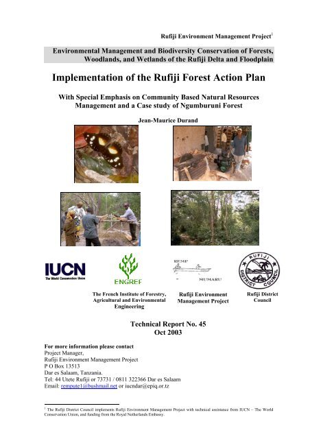
Implementation of the Rufiji Forest Action Plan - Coastal Forests of ...
Implementation of the Rufiji Forest Action Plan - Coastal Forests of ...
Implementation of the Rufiji Forest Action Plan - Coastal Forests of ...

Create successful ePaper yourself
Turn your PDF publications into a flip-book with our unique Google optimized e-Paper software.
<strong>Rufiji</strong> Environment Management Project 1<br />
Environmental Management and Biodiversity Conservation <strong>of</strong> <strong>Forest</strong>s,<br />
Woodlands, and Wetlands <strong>of</strong> <strong>the</strong> <strong>Rufiji</strong> Delta and Floodplain<br />
<strong>Implementation</strong> <strong>of</strong> <strong>the</strong> <strong>Rufiji</strong> <strong>Forest</strong> <strong>Action</strong> <strong>Plan</strong><br />
With Special Emphasis on Community Based Natural Resources<br />
Management and a Case study <strong>of</strong> Ngumburuni <strong>Forest</strong><br />
The French Institute <strong>of</strong> <strong>Forest</strong>ry,<br />
Agricultural and Environmental<br />
Engineering<br />
Jean-Maurice Durand<br />
<strong>Rufiji</strong> Environment<br />
Management Project<br />
Technical Report No. 45<br />
Oct 2003<br />
For more information please contact<br />
Project Manager,<br />
<strong>Rufiji</strong> Environment Management Project<br />
P O Box 13513<br />
Dar es Salaam, Tanzania.<br />
Tel: 44 Utete <strong>Rufiji</strong> or 73731 / 0811 322366 Dar es Salaam<br />
Email: rempute1@bushmail.net or iucndar@epiq.or.tz<br />
<strong>Rufiji</strong> District<br />
Council<br />
1 The <strong>Rufiji</strong> District Council implements <strong>Rufiji</strong> Environment Management Project with technical assistance from IUCN – The World<br />
Conservation Union, and funding from <strong>the</strong> Royal Ne<strong>the</strong>rlands Embassy.
<strong>Rufiji</strong> Environment Management Project – REMP<br />
Project Goal<br />
To promote <strong>the</strong> long-term conservation through ‘wise use’ <strong>of</strong> <strong>the</strong> lower <strong>Rufiji</strong> forests,<br />
woodlands and wetlands, such that biodiversity is conserved, critical ecological functions are<br />
maintained, renewable natural resources are used sustainably and <strong>the</strong> livelihoods <strong>of</strong> <strong>the</strong> area’s<br />
inhabitants are secured and enhanced.<br />
Objectives<br />
• To promote <strong>the</strong> integration <strong>of</strong> environmental conservation and sustainable development<br />
through environmental planning within <strong>the</strong> <strong>Rufiji</strong> Delta and Floodplain.<br />
• To promote <strong>the</strong> sustainable use <strong>of</strong> natural resources and enhance <strong>the</strong> livelihoods <strong>of</strong><br />
local communities by implementing sustainable pilot development activities based on<br />
wise use principles.<br />
• To promote awareness <strong>of</strong> <strong>the</strong> values <strong>of</strong> forests, woodlands and wetlands and <strong>the</strong><br />
importance <strong>of</strong> wise use at village, district, regional and central government levels, and<br />
to influence national policies on natural resource management.<br />
Project Area<br />
The project area is within <strong>Rufiji</strong> District in <strong>the</strong> ecosystems affected by <strong>the</strong> flooding <strong>of</strong> <strong>the</strong> river<br />
(floodplain and delta), downstream <strong>of</strong> <strong>the</strong> Selous Game Reserve and also including several<br />
upland forests <strong>of</strong> special importance.<br />
Project <strong>Implementation</strong><br />
The project is run from <strong>the</strong> district Headquarters in Utete by <strong>the</strong> <strong>Rufiji</strong> District Administration<br />
through a district Environmental Management Team coordinated by <strong>the</strong> District Executive<br />
Director. The Project Manager is employed by <strong>the</strong> project and two Technical Advisers are<br />
employed by IUCN.<br />
Project partners, particularly NEMC, <strong>the</strong> Coast Region, RUBADA, The Royal Ne<strong>the</strong>rlands<br />
Embassy and <strong>the</strong> Ministry <strong>of</strong> Natural Resources and Tourism, collaborate formally through<br />
<strong>the</strong>ir participation in <strong>the</strong> Project Steering Committee and also informally.<br />
Project Outputs<br />
At <strong>the</strong> end <strong>of</strong> <strong>the</strong> first five –year phase (1998-2003) <strong>of</strong> <strong>the</strong> project <strong>the</strong> expected outputs are:<br />
An Environmental Management <strong>Plan</strong>: an integrated plan for <strong>the</strong> management <strong>of</strong> <strong>the</strong><br />
ecosystems (forests, woodlands and wetlands) and natural resources <strong>of</strong> <strong>the</strong> project area that<br />
has been tested and revised so that it can be assured <strong>of</strong> success - especially through<br />
development hand-in-hand with <strong>the</strong> District council and <strong>the</strong> people <strong>of</strong> <strong>Rufiji</strong>.<br />
Village (or community) Natural Resource Management <strong>Plan</strong>s: These will be produced in pilot<br />
villages to facilitate village planning for natural resource management. The project will<br />
support <strong>the</strong> implementation <strong>of</strong> <strong>the</strong>se plans by researching <strong>the</strong> legislation, providing training<br />
and some support for zoning, mapping and gazettement <strong>of</strong> reserves.<br />
Established Wise Use Activities: These will consist <strong>of</strong> <strong>the</strong> successful sustainable development<br />
activities that are being tried and tested with pilot village and communities and are shown to<br />
be sustainable<br />
Key forests will be conserved: <strong>Forest</strong>s in <strong>Rufiji</strong> District that have shown high levels <strong>of</strong> plant<br />
biodiversity, endemism or o<strong>the</strong>r valuable biodiversity characteristics will be conserved by<br />
gazettement, forest management for conservation, and /or awareness-raising with <strong>the</strong>ir<br />
traditional owners.
REMP Technical Report 45: <strong>Implementation</strong> <strong>of</strong> <strong>the</strong> <strong>Rufiji</strong> <strong>Forest</strong> <strong>Action</strong> <strong>Plan</strong><br />
Summary<br />
Natural forests cover approximately <strong>the</strong> half <strong>of</strong> <strong>the</strong> Tanzanian national territory and most <strong>of</strong> <strong>the</strong>m<br />
are rich in vegetation types. Yet, <strong>the</strong> decrease in this forest cover started several decades ago.<br />
Droughts, but also fires and illegal exploitation are <strong>the</strong> main reasons for this degradation. For a<br />
long time <strong>the</strong> Tanzanian forest policy has been focusing both on strict conservation and production.<br />
But <strong>the</strong> results <strong>of</strong> this policy have shown its limits. In <strong>the</strong> nineties, a world-wide trend to promote<br />
systems <strong>of</strong> local management involving rural communities was developed, most <strong>of</strong>ten under <strong>the</strong><br />
leadership <strong>of</strong> international donors. In eastern and sou<strong>the</strong>rn African countries, and particularly in<br />
Tanzania, this trend was expressed by a flurry <strong>of</strong> new forest acts facilitated by <strong>the</strong> development <strong>of</strong><br />
more democratic systems.<br />
It is up to <strong>the</strong> District Council to enforce <strong>the</strong> new laws in <strong>Rufiji</strong> where over exploitation and<br />
deforestation are becoming a worrying issue. Promoted by <strong>the</strong> IUCN <strong>Rufiji</strong> Environment<br />
Management Project (REMP), a <strong>Forest</strong> <strong>Action</strong> <strong>Plan</strong>, approved by <strong>the</strong> Council in April 2003, aims<br />
to help <strong>the</strong> District to improve forest management with special emphasis on <strong>the</strong> communities’<br />
participation, in order to reverse <strong>the</strong> trend <strong>of</strong> over exploitation and destruction. The Council<br />
decided to start <strong>the</strong> implementation <strong>of</strong> <strong>the</strong> plan by transferring <strong>the</strong> management <strong>of</strong> <strong>the</strong> Ngumburuni<br />
District <strong>Forest</strong> Reserve to <strong>the</strong> adjacent communities. This operation required an inventory <strong>of</strong> <strong>the</strong><br />
resource and a study <strong>of</strong> <strong>the</strong> human context.<br />
The Ngumburuni forest 165 km South <strong>of</strong> Dar es Salaam, covers an area <strong>of</strong> 10 000 ha (including <strong>the</strong><br />
3000 to 4000 ha District Reserve) to <strong>the</strong> nor<strong>the</strong>ast <strong>of</strong> Ikwiriri. It is mainly composed <strong>of</strong> primary and<br />
secondary (or disturbed) coastal forest. Yet, it is interspersed with Miombo and woodland patches.<br />
Ngumburuni still contains high biodiversity value areas, constituting a unique habitat for rare,<br />
endemic or threatened species. But over harvesting has severely diminished <strong>the</strong> forest capital and<br />
<strong>the</strong> average basal area is one <strong>of</strong> <strong>the</strong> lowest in <strong>Rufiji</strong>. The forest is criss-crossed by many trails and<br />
logging sites can be found even in <strong>the</strong> deepest parts. O<strong>the</strong>r activities like charcoal burning or<br />
agriculture also damage it.<br />
But Ngumburuni is also a place where <strong>the</strong> neighbouring communities find basic livelihoods. People<br />
<strong>of</strong> six villages, Mangwi, Mkupuka, Muyuyu Umwe Centre, North and South used to harvest<br />
timber, firewood, edible plants or building materials in <strong>the</strong> forest. Most <strong>of</strong> <strong>the</strong>m are aware <strong>of</strong> <strong>the</strong><br />
bad condition <strong>of</strong> <strong>the</strong> forest and <strong>the</strong>y <strong>of</strong>ten maintain that Ngumburuni is threatened with becoming<br />
an open woodland. Never<strong>the</strong>less, opinion is divided about <strong>the</strong> establishment <strong>of</strong> a participatory<br />
management. Some stakeholders are doubtful about <strong>the</strong> real will <strong>of</strong> <strong>the</strong> District Council to<br />
empower <strong>the</strong> communities. Some o<strong>the</strong>rs think that it will be difficult for <strong>the</strong>m to succeed where <strong>the</strong><br />
authorities failed. Yet, many people are convinced that <strong>the</strong>y must seize this opportunity and<br />
manage <strong>the</strong>ir natural resources <strong>the</strong>mselves. In fact, no significant obstacle should hamper <strong>the</strong><br />
implementation <strong>of</strong> a community-based (or a joint) forest management. The national and local<br />
institutional tools are now operational. But it will be indispensable to develop confident<br />
relationships between <strong>the</strong> communities and <strong>the</strong> District authorities.<br />
After two discussion rounds with <strong>the</strong> different stakeholders, <strong>the</strong> current report also proposes a<br />
framework for <strong>the</strong> development <strong>of</strong> a management plan, which will take into account <strong>the</strong> results <strong>of</strong><br />
<strong>the</strong> forest analyses, <strong>the</strong> human context and <strong>the</strong> demands and <strong>the</strong> expectations <strong>of</strong> <strong>the</strong> communities.<br />
The main unifying threads are:<br />
• combining <strong>the</strong> necessary conservation and improvement <strong>of</strong> <strong>the</strong> coastal forest and <strong>the</strong><br />
communities’ legitimate demand for livelihoods;<br />
• encouraging current and new non-timber activities;<br />
• stopping <strong>the</strong> most damaging uses;<br />
• empowering <strong>the</strong> communities for crucial issues like guarding, managing village areas, etc.<br />
These proposals are accompanied by a time frame planning <strong>the</strong> next steps <strong>of</strong> <strong>the</strong> process up to <strong>the</strong><br />
start <strong>of</strong> <strong>the</strong> management plan enforcement, by September 2004. A crucial item pointed out is <strong>the</strong><br />
i
REMP Technical Report 45: <strong>Implementation</strong> <strong>of</strong> <strong>the</strong> <strong>Rufiji</strong> <strong>Forest</strong> <strong>Action</strong> <strong>Plan</strong><br />
search for financial support, which has already begun since REMP successfully applied to<br />
Switzerland for financial aid. Yet, <strong>the</strong>se encouraging results will need intensive follow-up by <strong>the</strong><br />
District.<br />
It could be one <strong>of</strong> <strong>the</strong> major lessons learnt from this study: <strong>the</strong> pilot role <strong>of</strong> <strong>the</strong> District Council<br />
must increase. Indeed, o<strong>the</strong>r forests need action (Ruhoi, Utete, Kichi Hills…) and <strong>the</strong> authorities<br />
must now find <strong>the</strong>ir own way to fur<strong>the</strong>r <strong>the</strong> <strong>Forest</strong> <strong>Action</strong> <strong>Plan</strong>, which has hardly started. It is not<br />
too late. This study proposes elements <strong>of</strong> methodology, but <strong>the</strong> key words should be dynamism and<br />
initiative. Initiative for making a credible workplan, for finding funds but also for developing <strong>the</strong><br />
indispensable relationship <strong>of</strong> trust with <strong>the</strong> communities who will, from now on, be partners<br />
impossible to ignore.<br />
ii
REMP Technical Report 45: <strong>Implementation</strong> <strong>of</strong> <strong>the</strong> <strong>Rufiji</strong> <strong>Forest</strong> <strong>Action</strong> <strong>Plan</strong><br />
Muhtasari<br />
Misitu ya asili inafunika karibu nusu ya Tanzania, na mingi ina utajiri wa uoto mbalimbali. Hata<br />
hivyo kupungua kwa maeneo yaliy<strong>of</strong>unikwa na misitu hii kumeanza miaka mingi iliyopita. Ukame,<br />
moto na uvunaji holela/haramu ni baadhi ya sababu za uharibifu wa misitu. Kwa miaka mingi, Sera<br />
ya Taifa ya Misitu imekuwa ikisisitiza na kutia mkazo uhifadhi na uzalishaji wa misitu. Lakini<br />
matokeo ya Sera hii yameonyesha ufinyu kama siyo mapungufu. Miaka ya tisini (kuanzia 1990),<br />
mfumo wa dunia wa ushirikishwaji jamii katika usimamizi ulianzishwa kupitia wahisani wa<br />
kimataifa. Katika nchi za Mashariki na Kusini mwa Afrika, hasa Tanzania, mtazamo huu<br />
ulijionyesha kwa kuwa na sheria za misitu zilizotungwa kwa kufuata mifumo ya demokrasia.<br />
Ni jukumu la Halmashauri ya Wilaya ya <strong>Rufiji</strong> kutumia sheria hizi Wilayani hasa ukizingatia<br />
ukweli kuwa uvunaji holela na ukataji wa misitu ni suala la kutisha sana Wilayani. Kupitia Mradi<br />
wa Usimamizi wa Mazingira <strong>Rufiji</strong> (MUMARU) uliyoanzishwa na shirika la usimamizi wa<br />
mazingira duniani (IUCN), Mpango wa Usimamizi wa Misitu wilaya ya <strong>Rufiji</strong> ulipitishwa na<br />
Baraza la Waheshimiwa madiwani mwezi Aprili 2003. Dhumuni kuu la mpango huu ni kusaidia<br />
Wilaya katika kuboresha usimamizi wa misitu hasa kuzingatia ushirikishwaji wa jamii kwa lengo<br />
la kupunguza mwelekeo wa uvunaji uliyokithiri na uharibifu wa misitu. Halmashauri imeshaanza<br />
kutekeleza mpango huu wa Wilaya kwa kukabidhi jukumu la usimamizi wa Msitu wa Ngumburuni<br />
(msitu wa Halmashauri) kwa jamii inayozunguka msitu huu. Shughuli hii ilihitaji utafiti wa<br />
kuelewa raslimali ya msitu na kujua mahusiano ya kibinadamu na raslimali hizi.<br />
Msitu wa Ngumburuni upo kilomita 165 kusini mwa Da es Salaam, una eneo la hekta 10,000<br />
(inajumuisha hekta 3000 hadi 4000 za msitu wa serikali ya mitaa) kwa upande wa kazikazini-<br />
Mashariki mwa Ikwiriri. Msitu huu wa Kanda ya Pwani una maeneo yenye miti ya asili ambayo<br />
haijaharibiwa (ina misitu ya awali "Primary forest") sana na sehemu zingine msitu una maeneo<br />
yaliyoharibiwa, una miti inayomea/ kuchipua kwa upya baada ya kukatwa/kuharibiwa (Secondary<br />
forest). Aidha msitu huu una mabaki ya maeneo yenye miti ya Miombo na vifufutu/ uwanda wa<br />
vichaka,manyasi na miti mikubwa ya hapa na pale. Ngumburuni bado ina maeneo yenye bioanuai<br />
ya dhamani kubwa ambayo hulea aina mbalimbali ya viumbe hai. Baadhi ya viumbe hivi aidha si<br />
rahisi kupatikana au vinapatikana sehemu hii tu, ama vipo katika hatari ya kutoweka. Hata hivyo<br />
uvunaji uliyokithiri umepunguza sana mtaji wa msitu huu hasa ukiangalia idadi ya aina ya miti kwa<br />
eneo (hekta) ni wa kiwango cha chini sana ukilinganisha na misitu yote Wilayani <strong>Rufiji</strong>. Msitu una<br />
vinjia/mapito mengi na uvunaji wa miti hufanyika hadi katika miteremko mikali mno. Shughuli<br />
zingine kama vile uchomaji wa mkaa na kilimo zinachangia pia kuharibu msitu huu.<br />
Hata hivyo, Ngumburuni ni mahali ambapo jamii inayozunguka hujipatia vyanzo vya maisha yao.<br />
Watu wa vijiji sita vya Mangwi, Mkupuka, Muyuyu, Umwe Kati, Kaskazini na kusini huvuna<br />
mbao/ magogo, kuni, mazao ya msitu yanayoliwa na nguzo za kujengea katika msitu huu. Watu<br />
wengi wanaelewa kuwa hali ya msitu ni mbaya. Aidha wengine wanafikia kusema kuwa<br />
Ngumburuni inatishia kuwa uwanda wenye miti ya hapa na pale. Hata hivyo watu hut<strong>of</strong>autiana<br />
katika mtizamo wa mawazo kuhusu uanzishwaji wa usimamizi shirikishi wa jamii. Wengine<br />
wanah<strong>of</strong>u kuhusu utayari wa halmashuri kutoa madaraka kwa jamii. Wengine wanahisi kuwa ikiwa<br />
halmashauri kama serikali imeshindwa, basi ni vigumu kwa jamii kufanikiwa. Hata hivyo watu<br />
waliowengi wanasema, ni vyema kutumia mwanya huu waliopewa ili wa simamie maliasili zao<br />
wenyewe. Kusema kweli hakuna kikwazo cha kutishia utekelezaji wa usimamizi wa msitu ama<br />
kijamii au kwa njia ya ubia. Vitendea kazi vya kitaifa na kiasasi vimeanza kutumika. Lakini ni<br />
muhimu sana kuunda mahusiano yenye kuaminika na thabiti kati ya jamii na utawala wa Wilaya.<br />
Baada ya mizunguko miwili ya mazungumzo na wadau mbalimbali, taarifa hii ya sasa<br />
inapendekeza muundo wa kutengeneza mpango wa kusimamia msitu huu. Mpango huu utilie<br />
maanani matokeo ya utafiti wa awali, wa kuelewa kwa undani msitu na mahusiano yake na jamii<br />
husika, hususani mahitaji na matarajio yao kwa ujumla. Masuala muhimu ya kuzingatia ili kuwa na<br />
mafanikio mema ni:<br />
• Kuoanisha mambo muhimu ya uhifadhi na uboreshaji wa msitu wa pwani na haki ya<br />
kisheria na mahitaji ya jamii kimaisha.<br />
iii
REMP Technical Report 45: <strong>Implementation</strong> <strong>of</strong> <strong>the</strong> <strong>Rufiji</strong> <strong>Forest</strong> <strong>Action</strong> <strong>Plan</strong><br />
• Kuhamasisha shughuli za sasa na zitakazobuniwa ambazo hazina athari kwa msitu<br />
(hazihusiani na mbao, magogo n.k)<br />
• Kusimamisha kabisa matumizi ambayo yanazidi uharibifu<br />
• Kuwapa uwezo jamii kwa masuala yenye tija hususani ulinzi/ doria na usimamizi wa eneo<br />
la kijiji husika n.k<br />
Mapendekezo haya yanafuatana na rasimu ya mpango wa kazi wa kuendelea na hatua zingine za<br />
kufuatwa hadi kufikia utekelezaji na usimamizi wa mpango ifikapo mwezi Septemba 2004. Suala<br />
muhimu lililojitokeza ni utafutaji wa msaada wa fedha.Hili limeshaanzwa kufanyiwa kazi kupitia<br />
mradi wa MUMARU ambao umeshaomba fedha kutoka mfuko wa msaada wa fedha nchini<br />
Swizalend. Hata hivyo matokeo haya yanayotia moyo yanahitaji ufuatiliaji wa Karibu wa Wilaya.<br />
Ingelikuwa moja ya masuala makuu ya kujifunza kutokana na utafiti huu: Jukumu hili la mfano<br />
katika halmashauri ya Wilaya ni lazima liongezeke. Kweli, misitu mingine bado inahitaji<br />
kutendewa kazi (Misitu ya Ruhoi, Utete, Vilima vya Kichi.) na mamlaka ya Wilaya ni lazima sasa<br />
kutafuta njia yao ya kuendeleza zaidi mpango wa usimamizi wa misitu Wilayani, ambao kwa<br />
uhakika tunaweza kusema bado haujaanza kutekelezwa. Haina maana kuwa shughuli hii<br />
imechelewa, ila utafiti huu unapendekeza njia ya kiutendaji.Hata hivyo neno kuu liwe kuuendeleza<br />
na kuuanzisha. Kuuanzisha kwa kuunda mpango wa utekelezaji wenye tija kwa kutafuta fedha na<br />
pia kuendeleza mahusiano yenye uwazi na uaminifu kwa jamii ambao watakuwa wabia, hivyo si<br />
vyema kuwapuuza kuanzia sasa na kuendelea.<br />
iv
REMP Technical Report 45: <strong>Implementation</strong> <strong>of</strong> <strong>the</strong> <strong>Rufiji</strong> <strong>Forest</strong> <strong>Action</strong> <strong>Plan</strong><br />
Acknowledgements<br />
This work was conducted between May and September 2003 as part <strong>of</strong> my training period at<br />
ENGREF, <strong>the</strong> French Institute <strong>of</strong> <strong>Forest</strong>ry, Agricultural and Environmental Engineering under <strong>the</strong><br />
supervision <strong>of</strong> Georges Smektala.<br />
I would like to thank <strong>the</strong> entire REMP-IUCN staff in Utete and Dar es Salaam and <strong>the</strong> <strong>Rufiji</strong><br />
District Council and technical staff for <strong>the</strong>ir help and kindness during <strong>the</strong> making <strong>of</strong> this study.<br />
Mr Richard Elibariki, a free-lance forester with many years <strong>of</strong> experience on participatory forest<br />
management in <strong>Rufiji</strong>, Ms Rose Hogan REMP Technical Adviser and Mr Mohamed L. Chande,<br />
District Lands Natural Resources and Environment Officer provided guidance and essential<br />
backstopping to <strong>the</strong> process. The field team with Mr Jonas Nambua, Assistant <strong>Forest</strong> Officer, Mr<br />
Revocatus X. L. Nandi, Land Use <strong>Plan</strong> Officer and Mr Hadji Mkungula, Assistant Game Officer<br />
and resource persons Mr Athman Ngwele and Mr Rachidi Meza from <strong>the</strong> local communities,<br />
endured with me <strong>the</strong> hardships <strong>of</strong> <strong>the</strong> fieldwork in <strong>the</strong> forest.<br />
Thanks are due to Stéphanie Duvail from CEH Wallingford/IRD for having accorded <strong>the</strong> first<br />
priority to <strong>the</strong> geometric correction and georeferencing <strong>of</strong> <strong>the</strong> aerial photographs <strong>of</strong> Ngumburuni.<br />
I also wish to present very, very special thanks to Olivier Hamerlynck for his confidence, his<br />
always relevant pieces <strong>of</strong> advice and <strong>the</strong> discovery <strong>of</strong> <strong>the</strong> coastal forest <strong>of</strong> eastern Africa. Maybe<br />
one day, somewhere else on <strong>the</strong> Earth…<br />
Lastly, I do not want to forget Pat Viollier for revising <strong>the</strong> English.<br />
v
REMP Technical Report 45: <strong>Implementation</strong> <strong>of</strong> <strong>the</strong> <strong>Rufiji</strong> <strong>Forest</strong> <strong>Action</strong> <strong>Plan</strong><br />
Table <strong>of</strong> Contents<br />
Summary........................................................................................................................................................... i<br />
Muhtasari........................................................................................................................................................ iii<br />
Acknowledgements.......................................................................................................................................... v<br />
List <strong>of</strong> Tables.................................................................................................................................................. vii<br />
List <strong>of</strong> Figures ............................................................................................................................................... viii<br />
List <strong>of</strong> Photographs ...................................................................................................................................... viii<br />
List <strong>of</strong> Abbreviations...................................................................................................................................... ix<br />
1 Introduction............................................................................................................................................ 1<br />
2 Context <strong>of</strong> <strong>the</strong> Study .............................................................................................................................. 2<br />
2.1 Tanzania and <strong>Rufiji</strong> District: a general overview........................................................................... 2<br />
2.2 A flurry <strong>of</strong> forest reforms, with special emphasis on participatory management, in Eastern and<br />
Sou<strong>the</strong>rn Africa............................................................................................................................................. 6<br />
2.3 Tanzanian forestry resources and new policy................................................................................. 7<br />
2.4 The <strong>Rufiji</strong> Environment Management Project promoter <strong>of</strong> <strong>the</strong> <strong>Forest</strong> <strong>Action</strong> <strong>Plan</strong> ..................... 10<br />
3 Problem Analysis and Methodology................................................................................................... 12<br />
3.1 Objectives and problem analysis.................................................................................................. 12<br />
3.2 Context and brief description <strong>of</strong> <strong>the</strong> Ngumburuni forest.............................................................. 12<br />
3.3 Materials and Methods ................................................................................................................. 14<br />
4 Development <strong>of</strong> <strong>the</strong> Ngumburuni forest management plan ............................................................. 19<br />
4.1 Main features and description <strong>of</strong> <strong>the</strong> Ngumburuni forest............................................................. 19<br />
4.2 Analysis <strong>of</strong> <strong>the</strong> human context ..................................................................................................... 41<br />
4.3 Discussion on <strong>the</strong> conditions for successful implementation <strong>of</strong> <strong>the</strong> participatory management in<br />
Ngumburuni................................................................................................................................................ 65<br />
4.4 Framework for <strong>the</strong> development <strong>of</strong> <strong>the</strong> management plan ........................................................... 67<br />
4.5 Next steps and time frame to bring <strong>the</strong> process to a successful conclusion.................................. 89<br />
5 Lessons Learned from <strong>the</strong> study and some proposals to fur<strong>the</strong>r <strong>the</strong> <strong>Forest</strong> <strong>Action</strong> <strong>Plan</strong><br />
implementation .............................................................................................................................................. 91<br />
5.1 First evaluation <strong>of</strong> <strong>the</strong> operational action plan matrix implementation ........................................ 91<br />
5.2 Proposals to facilitate <strong>the</strong> implementation <strong>of</strong> <strong>the</strong> <strong>Forest</strong> <strong>Action</strong> <strong>Plan</strong>........................................... 95<br />
6 Conclusion ............................................................................................................................................ 99<br />
7 Bibliography....................................................................................................................................... 100<br />
8 Appendices.......................................................................................................................................... 103<br />
Appendix 1: Analysis <strong>of</strong> <strong>Forest</strong> Inventory Data............................................................................. 104<br />
Appendix 2: List <strong>of</strong> Species ........................................................................................................... 151<br />
Appendix 3: Transect Walks Report .............................................................................................. 159<br />
Appendix 4: GPS Co-ordinates...................................................................................................... 162<br />
Appendix 5: Map <strong>of</strong> Sample Plot Location.................................................................................... 164<br />
Appendix 6:Stakeholder Questionaires.......................................................................................... 165<br />
vi
REMP Technical Report 45: <strong>Implementation</strong> <strong>of</strong> <strong>the</strong> <strong>Rufiji</strong> <strong>Forest</strong> <strong>Action</strong> <strong>Plan</strong><br />
List <strong>of</strong> Tables<br />
Table 1: <strong>Forest</strong> reserves in <strong>Rufiji</strong> District, surface areas and status (<strong>Forest</strong> <strong>Action</strong> <strong>Plan</strong>, 2002) ....... 9<br />
Table 2: Time frame <strong>of</strong> <strong>the</strong> study ..................................................................................................... 14<br />
Table 3: Participatory methods used in order to obtain information................................................ 17<br />
Table 4: Height / diameter equations used in Ngumburuni forest.................................................... 23<br />
Table 5: Single tree volumes equations............................................................................................ 23<br />
Table 6: Stand parameters in <strong>the</strong> main ecological units <strong>of</strong> <strong>the</strong> Ngumburuni forest. ........................ 23<br />
Table 7: Comparison <strong>of</strong> <strong>the</strong> stand parameters in Ngumburuni and in four o<strong>the</strong>r forests <strong>of</strong> <strong>the</strong> <strong>Rufiji</strong><br />
District...................................................................................................................................... 24<br />
Table 8: Localisation <strong>of</strong> <strong>the</strong> different tree species ........................................................................... 24<br />
Table 9: List <strong>of</strong> timber species identified in <strong>the</strong> 44 sample plots..................................................... 25<br />
Table 10: The distribution <strong>of</strong> timber tree species by size classes in <strong>the</strong> Miombo patches<br />
(*Frequency <strong>of</strong> <strong>the</strong> regeneration and poles <strong>of</strong> <strong>the</strong> timber species in <strong>the</strong> 44 sample plots -%) . 29<br />
Table 11:The distribution <strong>of</strong> timber tree species by size classes in <strong>the</strong> <strong>Coastal</strong> forest patches<br />
(*Frequency <strong>of</strong> <strong>the</strong> regeneration and poles <strong>of</strong> <strong>the</strong> timber species in <strong>the</strong> 44 sample plots -%). 30<br />
Table 12: Areas <strong>of</strong> <strong>the</strong> different patches included in <strong>the</strong> main stands types map <strong>of</strong> <strong>the</strong> Ngumburuni<br />
forest......................................................................................................................................... 39<br />
Table 13: The number <strong>of</strong> interviewed stakeholders and <strong>the</strong>ir living places (* m.: men; w.: women)<br />
.................................................................................................................................................. 46<br />
Table 14: Syn<strong>the</strong>sis <strong>of</strong> <strong>the</strong> forest uses by <strong>the</strong> forest-adjacent communities ..................................... 48<br />
Table 15: The different trees species used by <strong>the</strong> economic operators around Ngumburuni........... 49<br />
Table 16: The first volunteers for scouting, after <strong>the</strong> July 2003 meetings....................................... 58<br />
Table 17: Community-based management process acceptance for all villages ............................... 63<br />
Table 18: Comparison <strong>of</strong> <strong>the</strong> advantages / drawbacks <strong>of</strong> C.B.F.M., J.F.M. and a mixed system.... 69<br />
Table 19: List <strong>of</strong> <strong>the</strong> potential uses, ranking <strong>the</strong>ir effects on <strong>the</strong> forest ........................................... 73<br />
Table 20: Minimum felling DBH for <strong>the</strong> main commercial tree species (<strong>Forest</strong> rules – Government<br />
notices n o 462 and 463 – 1996; Malimbwi, 2000).................................................................... 77<br />
Table 21: Timber species that do not qualify for harvesting in Ngumburuni .................................. 77<br />
Table 22: Annual cuts in each vegetation unit ................................................................................. 78<br />
Table 23: Harvesting plan for <strong>the</strong> qualified timber species.............................................................. 79<br />
Table 24: Income per year likely to be generated by <strong>the</strong> full-tree licensing.................................... 79<br />
Table 25: Percentages <strong>of</strong> <strong>the</strong> fuel wood supply for various planted areas <strong>of</strong> Cassia siamea............ 80<br />
Table 26: Matching forestry actions and uses to parts <strong>of</strong> <strong>the</strong> forest................................................. 86<br />
Table 27: Practical indicators <strong>of</strong> Management success (according to Anonymous, 2002 c) ........... 88<br />
Table 28: Proposed operational matrix for <strong>the</strong> next steps <strong>of</strong> <strong>the</strong> implementation <strong>of</strong> <strong>the</strong> Ngumburuni<br />
management process ................................................................................................................ 89<br />
Table 29: Assessment <strong>of</strong> implementation <strong>of</strong> <strong>the</strong> <strong>Forest</strong> <strong>Action</strong> <strong>Plan</strong> operational matrix in August<br />
2000.......................................................................................................................................... 92<br />
Table 30: <strong>Rufiji</strong> forests surveyed by REMP and number <strong>of</strong> recorded sample plots (Malimbwi,<br />
2000) ........................................................................................................................................ 97<br />
vii
REMP Technical Report 45: <strong>Implementation</strong> <strong>of</strong> <strong>the</strong> <strong>Rufiji</strong> <strong>Forest</strong> <strong>Action</strong> <strong>Plan</strong><br />
List <strong>of</strong> Figures<br />
Figure 1: Location map <strong>of</strong> Tanzania (doc. S.C.P.M.E.)..................................................................... 3<br />
Figure 2: Location <strong>of</strong> <strong>the</strong> <strong>Rufiji</strong> District on <strong>the</strong> Tanzanian political map (Doc. Blay-Foldex). ......... 4<br />
Figure 3: Landscape designations in <strong>Rufiji</strong> District (REMP). ........................................................... 5<br />
Figure 4: A rough location map <strong>of</strong> <strong>the</strong> Ngumburuni <strong>Forest</strong> Reserve and <strong>of</strong> <strong>the</strong> different<br />
neighbouring villages (O. Hamerlynck, REMP - 2003)........................................................... 13<br />
Figure 5: Size and shape <strong>of</strong> a sample plot........................................................................................ 16<br />
Figure 6: Surface geology <strong>of</strong> <strong>the</strong> east African coastal region (Burgess et al., 2000) ....................... 20<br />
Figure 7: Distribution <strong>of</strong> <strong>the</strong> different timber species found in <strong>the</strong> Ngumburuni forest (number <strong>of</strong><br />
trees in <strong>the</strong> 44 sample plots)..................................................................................................... 27<br />
Figure 8: Distribution <strong>of</strong> <strong>the</strong> most abundant timber trees stems by diameter classes, in <strong>the</strong> 44<br />
sample plots.............................................................................................................................. 28<br />
Figure 9:Ecological Units in Ngumburuni <strong>Forest</strong> ............................................................................ 31<br />
Figure 10: Main stands types in Ngumburuni <strong>Forest</strong>....................................................................... 33<br />
Figure 11: Location <strong>of</strong> <strong>the</strong> villages and settlements......................................................................... 42<br />
Figure 12: Spatial organisation <strong>of</strong> an ancient inside-forest settlement: Ngumburuni. ..................... 43<br />
Figure 13: Spatial organisation <strong>of</strong> a recent forest-adjacent sub-village - Njianne ........................... 44<br />
Figure 14: The different stakeholders and <strong>the</strong>ir relationships with <strong>the</strong> forest.................................. 45<br />
Figure 15: All-encompassing diagram showing <strong>the</strong> goods and services provided by <strong>the</strong><br />
Ngumburuni forest ................................................................................................................... 52<br />
Figure 16: Main trading networks <strong>of</strong> <strong>the</strong> Ngumburuni products...................................................... 56<br />
Figure 17: Overlap between <strong>the</strong> Ikwiriri extension project and <strong>the</strong> Ngumburuni forest.................. 60<br />
Figure 18: Position <strong>of</strong> <strong>the</strong> future Songas pipeline within <strong>the</strong> Ngumburuni forest............................ 62<br />
Figure 19: A possible Ngumburuni management diagram, based upon most <strong>of</strong> <strong>the</strong> stakeholders’<br />
requests..................................................................................................................................... 71<br />
List <strong>of</strong> Photographs<br />
Photo No. 1 to 7: Biodiversity in Ngumburuni. 1: Black and white Colobus; 2: Elephant-shrew (photo<br />
Tanzanian <strong>Forest</strong> Conservation Group); 3: East Coast Akalat, a rare vulnerable endemic bird (photo O.<br />
Hamerlynck- REMP); 4: Baboon; 5: Dense coastal forest; 6: Elephant skull; 7: Dense Miombo.............. 22<br />
Photo No. 8: Mkongo (Afzelia quanzensis)................................................................................................ 26<br />
Photo No. 10: Mninga (Pterocarpus angolensis). ....................................................................................... 26<br />
Photo No. 9: Mvule (Milicia excelsa) commercially extinct in Ngumburuni............................................. 26<br />
Photo No. 11: Mnangu (Hymenaea verrucosa)........................................................................................... 26<br />
Photos No. 12 and No. 13: The two main manual sawing methods used in Ngumburuni. The second one is<br />
a pit-sawing site.......................................................................................................................................... 50<br />
Photo No. 14: A traditional house in Mkupuka, with a pole stock. ............................................................ 51<br />
Photo No. 15: A charcoal burner with a bag sold 2000 Tsh (1,94 $). Behind him, a small size kiln. ........ 51<br />
Photos No. 16 to 20: The most damaging activities, according to <strong>the</strong> stakeholders. 16: A charcoal earth<br />
mound kiln; 17: Agricultural clearing; 18: Overharvesting and wasting wood (an immature felled Mkongo<br />
– Afzelia quanzensis); 19: Truck traffic inside <strong>the</strong> coastal forest; 20: One <strong>of</strong> <strong>the</strong> numerous fires in <strong>the</strong> dry<br />
season. ........................................................................................................................................................ 55<br />
Photos No. 21 and 22: Mkongo seeds (“lucky beans”). They used to be sold as ornaments (necklaces) and<br />
charms. In South Africa, <strong>the</strong>y are called Mkehli (betro<strong>the</strong>d girl) by <strong>the</strong> Zulu, for those black seeds, with<br />
<strong>the</strong>ir orange aril suggest a maiden’s red-ochred head-dress, which used to be worn in <strong>the</strong> period prior to<br />
marriage (PALGRAVE, 2002). .................................................................................................................. 82<br />
Photo No. 23: A twenty year old Cassia siamea plantation in Umwe South. ............................................. 82<br />
Photo No. 24: a low-cost hive under a Mkwaju (Tamarindus indica). ....................................................... 84<br />
Photo No. 25: Edible mushrooms are abundant in Ngumburuni (O. Hamerlynck). ................................... 84<br />
Photo No. 27: The Ruhoi <strong>Forest</strong> Reserve is mostly covered with closed woodland................................... 96<br />
Photo No. 26: <strong>Coastal</strong> forest relics in Ruhoi <strong>Forest</strong> Reserve (Sterculia appendiculata and Afzelia<br />
quanzensis). ................................................................................................................................................ 96<br />
Photo No. 28: Logs in <strong>the</strong> overharvested Utete <strong>Forest</strong> reserve................................................................... 96<br />
Photo No. 29: High biodiversity value coastal forests on <strong>the</strong> Kichi Hills. ................................................. 96<br />
viii
REMP Technical Report 45: <strong>Implementation</strong> <strong>of</strong> <strong>the</strong> <strong>Rufiji</strong> <strong>Forest</strong> <strong>Action</strong> <strong>Plan</strong><br />
List <strong>of</strong> Abbreviations<br />
C.B.F.M.: Community Based <strong>Forest</strong> Management<br />
D.F.A.P.T.F.: District <strong>Forest</strong> <strong>Action</strong> <strong>Plan</strong> Task Force<br />
ENGREF: The French Institute <strong>of</strong> <strong>Forest</strong>ry, Agricultural and Environmental Engineering<br />
F.B.D.: <strong>Forest</strong> and Beekeeping Division<br />
G.I.S.: Geographic Information System<br />
G.P.S.: Global Positioning System<br />
GTZ: Gesellschaft für Technische Zusammenarbeit<br />
IUCN: The World Conservation Union<br />
J.F.M.: Joint <strong>Forest</strong> Management<br />
N.T.S.P.: National Tree Seeds Project<br />
P.F.M.: Participatory <strong>Forest</strong> Management<br />
REMP: <strong>Rufiji</strong> Environment Management Project<br />
RUBADA: <strong>Rufiji</strong> Basin Development Authority<br />
Tsh: Tanzanian shilling: 1030 Tsh = 1 $ (August 2003)<br />
WWF: The World Wide Fund<br />
ix
1 Introduction<br />
REMP Technical Report 45: <strong>Implementation</strong> <strong>of</strong> <strong>the</strong> <strong>Rufiji</strong> <strong>Forest</strong> <strong>Action</strong> <strong>Plan</strong><br />
Tanzania has a wealth <strong>of</strong> natural forests ranging from mangroves to mountain and dry forests. More<br />
than 50 % <strong>of</strong> <strong>the</strong> country is covered with forests or woodland, which play a significant role in <strong>the</strong><br />
national economy, but also in <strong>the</strong> daily lives <strong>of</strong> many rural communities. Former forest policies mainly<br />
focused on <strong>the</strong> preservation <strong>of</strong> <strong>the</strong> natural resources from exploitation and <strong>the</strong> exclusion <strong>of</strong> people from<br />
protected forests, meanwhile overlooking <strong>the</strong> vital needs <strong>of</strong> <strong>the</strong> local communities. Yet, <strong>the</strong> 2002 new<br />
<strong>Forest</strong> Act, taking note <strong>of</strong> <strong>the</strong> failures <strong>of</strong> <strong>the</strong>se policies, promotes participatory management.<br />
The <strong>Rufiji</strong> District, <strong>the</strong> sou<strong>the</strong>rnmost <strong>of</strong> <strong>the</strong> six districts in <strong>the</strong> Pwani (Coast) region, is at <strong>the</strong> heart <strong>of</strong><br />
<strong>the</strong>se new orientations. Indeed, <strong>the</strong> exploitation <strong>of</strong> <strong>the</strong> important forest resources has been conducted as<br />
a mining operation in <strong>Rufiji</strong> and almost all <strong>the</strong> forest are overharvested. Some valuable species are<br />
commercially extinct. In 2003, <strong>the</strong> District Council approved a <strong>Forest</strong> <strong>Action</strong> <strong>Plan</strong> promoted by <strong>the</strong><br />
IUCN <strong>Rufiji</strong> Environment Management Project (REMP). This <strong>Plan</strong> aims to improve <strong>the</strong> management<br />
<strong>of</strong> <strong>the</strong> forests and to stop <strong>the</strong>ir destruction all over <strong>the</strong> District with special emphasis on community<br />
based management, according to <strong>the</strong> spirit <strong>of</strong> <strong>the</strong> new law.<br />
The District Council put a high priority on <strong>the</strong> Ngumburuni forest in order to start <strong>the</strong> implementation<br />
<strong>of</strong> <strong>the</strong> <strong>Plan</strong>, with <strong>the</strong> idea that this study case could become a model for similar management transfers<br />
elsewhere in <strong>Rufiji</strong>. Indeed, Ngumburuni includes a District <strong>Forest</strong> Reserve which <strong>the</strong> foresters have<br />
failed to control. In contrast, <strong>the</strong> forest still harbours exceptional biodiversity and in 2002 <strong>the</strong> finding <strong>of</strong><br />
a population <strong>of</strong> <strong>the</strong> puguensis race <strong>of</strong> <strong>the</strong> Pale-breasted Illadopsis is one <strong>of</strong> <strong>the</strong> most significant<br />
ornithological discoveries made in Tanzania over <strong>the</strong> past 5 years. As some forest-adjacent<br />
communities asked to start a community based management system, <strong>the</strong> Council decided to survey <strong>the</strong><br />
forest in close collaboration with <strong>the</strong> surrounding villages. Thus, this study, commissioned both by<br />
REMP and <strong>the</strong> <strong>Rufiji</strong> District Council, aims to develop a method <strong>of</strong> establishing a management plan<br />
and learning lessons from this pilot operation, to carry out a first assessment <strong>of</strong> <strong>the</strong> <strong>Forest</strong> <strong>Action</strong> <strong>Plan</strong><br />
implementation.<br />
After a presentation <strong>of</strong> <strong>the</strong> national and local context and <strong>of</strong> <strong>the</strong> methodology, <strong>the</strong> current report will set<br />
out <strong>the</strong> results and analysis <strong>of</strong> <strong>the</strong> inventory <strong>of</strong> <strong>the</strong> Ngumburuni forest in order to describe <strong>the</strong> forest, its<br />
potential and physical constraints. Then, we will study <strong>the</strong> human context, i.e. <strong>the</strong> history <strong>of</strong> <strong>the</strong> forest,<br />
its perception by <strong>the</strong> different stakeholders, <strong>the</strong> wishes and expectations <strong>of</strong> <strong>the</strong> adjacent communities<br />
and <strong>the</strong>ir degree <strong>of</strong> motivation for a community based or a joint forest management.<br />
The outcome <strong>of</strong> <strong>the</strong>se analyses, aiming also to verify <strong>the</strong> feasibility <strong>of</strong> a collaborative management<br />
process, will be <strong>the</strong> establishment <strong>of</strong> <strong>the</strong> framework <strong>of</strong> a management plan based on <strong>the</strong> main results<br />
and <strong>the</strong> recommendations and claims <strong>of</strong> <strong>the</strong> stakeholders. This part will be completed by <strong>the</strong> proposal<br />
<strong>of</strong> a program and a time frame to bring <strong>the</strong> operation to a successful conclusion.<br />
Finally, we will learn <strong>the</strong> lessons <strong>of</strong> this case study and develop proposals in order to help <strong>the</strong> District<br />
Council to fur<strong>the</strong>r <strong>the</strong> <strong>Forest</strong> <strong>Action</strong> <strong>Plan</strong>. By reviewing all <strong>the</strong> planned actions proposed in <strong>the</strong><br />
operational matrix, we will pinpoint <strong>the</strong> constraints and weaknesses and make suggestions in order to<br />
facilitate its implementation.<br />
1
REMP Technical Report 45: <strong>Implementation</strong> <strong>of</strong> <strong>the</strong> <strong>Rufiji</strong> <strong>Forest</strong> <strong>Action</strong> <strong>Plan</strong><br />
2 Context <strong>of</strong> <strong>the</strong> Study<br />
2.1 Tanzania and <strong>Rufiji</strong> District: a general overview<br />
2.1.1 A brief presentation <strong>of</strong> Tanzania<br />
The United Republic <strong>of</strong> Tanzania is <strong>the</strong> largest country in Eastern Africa with a land area <strong>of</strong> 945 000<br />
km 2 . It is located between latitudes 1 o 00’ S and 11 o 48’ S and longitudes 29 o 30’ E to 40 o 30’ E (Sayer<br />
et al., 1992; Collective, 1998). Tanzania shares borders with eight countries: Malawi and Mozambique<br />
in <strong>the</strong> south; Burundi, Congo (D.R.C.), Rwanda and Zambia in <strong>the</strong> west; Kenya and Uganda in <strong>the</strong><br />
north. The eastern side is <strong>the</strong> Indian Ocean coastline (about 1000 km).<br />
The climatic conditions range from coastal to alpine deserts on Mount Kilimanjaro. The coastal area<br />
experiences a tropical climate and is influenced by two monsoon winds: <strong>the</strong> south-east monsoon<br />
blowing northwards from March to September and bringing heavy intermittent rains; from December<br />
to March <strong>the</strong> north-east monsoon blows southwards and brings <strong>the</strong> hottest temperatures. The rainfall is<br />
generally erratic and varies from 400 mm in <strong>the</strong> central regions to 2500 mm in <strong>the</strong> highlands<br />
(Collective, 1998).<br />
According to <strong>the</strong> 1988 census, a population <strong>of</strong> 22 to 23 million was recorded. As <strong>the</strong> population grows<br />
by 2,8 to 3 % annually, we can now expect a total population <strong>of</strong> 35 million. Over 80 % <strong>of</strong> <strong>the</strong><br />
Tanzanians are living in rural areas and most <strong>of</strong> <strong>the</strong>m depend on land and natural resources for<br />
subsistence. The quality and <strong>the</strong> availability <strong>of</strong> arable land explain for <strong>the</strong> most part <strong>the</strong> internal<br />
population distribution. Obviously, population growth will increase pressure on land and natural<br />
resources. Agriculture and livestock keeping are still traditional and mainly extensive and <strong>the</strong> practice<br />
is not about to change. As <strong>the</strong> soils are generally naturally poor (<strong>the</strong>y are typical tropical soils with low<br />
nutrient content), <strong>the</strong>y become quickly exhausted, increasing land requirement. Agriculture mainly<br />
produces food crops and moreover, <strong>the</strong> production <strong>of</strong> export crops (sisal, cashew nuts,…) dropped due<br />
to unfavourable international market conditions.<br />
The country is divided into administrative regions, twenty on <strong>the</strong> mainland and five in Zanzibar, which<br />
has a special status and its own government. These regions are fur<strong>the</strong>r divided into districts. Politically,<br />
<strong>the</strong> districts are governed by two entities. The Central Government is represented at this level by a<br />
District Commissioner who is <strong>the</strong> chief spokesman and in charge <strong>of</strong> all government matters. There is<br />
also a local political entity, which is <strong>the</strong> District Council, i.e. <strong>the</strong> assembly <strong>of</strong> councillors elected from<br />
each ward. The District Executive Director is <strong>the</strong> spokesman <strong>of</strong> <strong>the</strong> Council and <strong>the</strong> head <strong>of</strong> all <strong>the</strong> civil<br />
servants working within (Collective, 1997).<br />
Several standing committees and technical departments help <strong>the</strong> District Council to build and execute<br />
its policy.<br />
2
REMP Technical Report 45: <strong>Implementation</strong> <strong>of</strong> <strong>the</strong> <strong>Rufiji</strong> <strong>Forest</strong> <strong>Action</strong> <strong>Plan</strong><br />
Figure 1: Location map <strong>of</strong> Tanzania (doc. S.C.P.M.E.).<br />
* RUFIJI<br />
3
REMP Technical Report 45: <strong>Implementation</strong> <strong>of</strong> <strong>the</strong> <strong>Rufiji</strong> <strong>Forest</strong> <strong>Action</strong> <strong>Plan</strong><br />
2.1.2 Pr<strong>of</strong>ile <strong>of</strong> <strong>the</strong> <strong>Rufiji</strong> District<br />
<strong>Rufiji</strong> is one <strong>of</strong> six districts in <strong>the</strong> Pwani region. The headquarters are in Utete, located about 200 km<br />
south <strong>of</strong> Dar es Salaam. It is divided into 91 registered villages, 19 wards and 6 divisions. Each village<br />
has its own government. The wards are run by <strong>the</strong> ward development committees headed by <strong>the</strong>ir<br />
respective councillors. They also have executive <strong>of</strong>ficers. At <strong>the</strong> division level <strong>the</strong>re are divisional<br />
<strong>of</strong>ficers (Collective, 1997).<br />
<strong>Rufiji</strong><br />
District<br />
Figure 2: Location <strong>of</strong> <strong>the</strong> <strong>Rufiji</strong> District on <strong>the</strong> Tanzanian political map (Doc. Blay-Foldex).<br />
The <strong>Rufiji</strong> District covers an area <strong>of</strong> 13 339 km 2 . Thirty eight percent <strong>of</strong> that area is covered by<br />
registered <strong>Forest</strong> Reserves (1668 km 2 ) and <strong>the</strong> Selous Game Reserve (3436 km 2 ). The <strong>Rufiji</strong> River, <strong>the</strong><br />
largest in Tanzania and <strong>the</strong> fifth in Africa for <strong>the</strong> flow (900 m 3 /s), runs west – east to <strong>the</strong> Indian Ocean<br />
and cuts <strong>the</strong> territory <strong>of</strong> <strong>the</strong> district into two (Collective, 1997). There are also 13 lakes and several<br />
swamp areas.<br />
4
REMP Technical Report 45: <strong>Implementation</strong> <strong>of</strong> <strong>the</strong> <strong>Rufiji</strong> <strong>Forest</strong> <strong>Action</strong> <strong>Plan</strong><br />
Ngumburuni<br />
<strong>Forest</strong><br />
Ikwiriri<br />
Figure 3: Landscape designations in <strong>Rufiji</strong> District (REMP).<br />
5
REMP Technical Report 45: <strong>Implementation</strong> <strong>of</strong> <strong>the</strong> <strong>Rufiji</strong> <strong>Forest</strong> <strong>Action</strong> <strong>Plan</strong><br />
The rainfall pattern is characterised by <strong>the</strong> two seasons described above. The average annual<br />
rainfalls vary from 850 mm at Utete to 1000 mm at Mohoro. There is a slight variation <strong>of</strong><br />
temperature between <strong>the</strong> delta and <strong>the</strong> inland areas, because <strong>of</strong> <strong>the</strong> stabilising influence <strong>of</strong> <strong>the</strong> sea.<br />
The average temperature varies from 24 o C in June to 28 o C between December and February.<br />
The current population, according to <strong>the</strong> 2002 census is about 203,000 persons. It seems that <strong>the</strong>re<br />
are more women than men. The major ethnic group is <strong>the</strong> Wandengereko. O<strong>the</strong>r groups are also<br />
represented: Wanyagatwa, in <strong>the</strong> delta, Wamatumbi around <strong>the</strong> Kichi and <strong>the</strong> Matumbi Hills and<br />
Wapogo and Ngindo from neighbouring districts (Collective, 1997). The main economic activities<br />
in <strong>the</strong> District are fishing and subsistence agriculture and many <strong>of</strong> <strong>the</strong> field operations are done<br />
manually. The local populations have no tradition <strong>of</strong> keeping cattle and <strong>the</strong> presence <strong>of</strong> <strong>the</strong> tse-tse<br />
is not encouraging <strong>the</strong>m to begin animal husbandry, except for poultry. Yet, recently, livestock<br />
keepers have been coming from <strong>the</strong> nor<strong>the</strong>rn regions <strong>of</strong> Tanzania, attracted by <strong>the</strong> large grassland<br />
areas. At <strong>the</strong> most recent count (August 2003), <strong>the</strong>re were 11,000 heads <strong>of</strong> cattle in <strong>the</strong> District, to<br />
be compared with a few hundred before 2002. There is also an un<strong>of</strong>ficial economy and illegal<br />
logging is probably an important part <strong>of</strong> it, as it can be guessed considering <strong>the</strong> high number <strong>of</strong><br />
lorries crossing Utete, Ikwiriri or Kibiti. Be that as it may, <strong>the</strong> <strong>Rufiji</strong> District is one <strong>of</strong> <strong>the</strong> less<br />
developed in Tanzania on criteria such as standard <strong>of</strong> living or access to services and basic<br />
amenities.<br />
2.2 A flurry <strong>of</strong> forest reforms, with special emphasis on participatory management,<br />
in Eastern and Sou<strong>the</strong>rn Africa<br />
In spite <strong>of</strong> <strong>the</strong> fact that involving people in forest management has become common all over <strong>the</strong><br />
world for a long time, participatory forest management in Africa has been slow to evolve. In <strong>the</strong><br />
early nineties, Gambia was almost <strong>the</strong> only country which had proclaimed it as a national priority.<br />
But from 1995 to 2000, new forestry acts had been promulgated in many African countries, and<br />
particularly in Zanzibar, South Africa, Malawi, Zambia, Lesotho and Mozambique. From 2000 to<br />
2003, Kenya, Uganda, Tanzania, Namibia and Swaziland joined <strong>the</strong> movement. In fact, nowadays,<br />
more than forty new national forest policies make participatory forest management an objective in<br />
Africa (Alden Wily, 2000).<br />
This reform wave originates in recent political changes. Indeed it occurs as east and sou<strong>the</strong>rn<br />
African countries become more democratic, adopt more liberal economic strategies and new<br />
devolution rules. These forestry reforms have also been favoured by <strong>the</strong> promulgation <strong>of</strong> new land<br />
tenure laws clarifying <strong>the</strong> legal status <strong>of</strong> <strong>the</strong> land property. Yet, <strong>the</strong> incentive role <strong>of</strong> international<br />
donors, and particularly <strong>the</strong> World Bank, must also be emphasized. Indeed, <strong>the</strong> development <strong>of</strong><br />
participatory management is linked to <strong>the</strong> criticism <strong>of</strong> <strong>the</strong> governmental action and <strong>the</strong> emergence<br />
<strong>of</strong> <strong>the</strong> structural adjustment, promoted by liberal ideas <strong>of</strong> <strong>the</strong> main international donors (Buttoud,<br />
2001). At <strong>the</strong> same time, <strong>the</strong> citizens are more and more demanding <strong>of</strong> an important role in<br />
managing <strong>the</strong> natural resources that <strong>the</strong>y can find around <strong>the</strong>ir villages.<br />
Effective participatory management mainly consists <strong>of</strong> <strong>the</strong> transfer <strong>of</strong> <strong>the</strong> management to <strong>the</strong><br />
adjacent communities relieving <strong>the</strong> authorities <strong>of</strong> <strong>the</strong>ir responsibilities concerning <strong>the</strong> results<br />
(Buttoud, 2001).<br />
There are three main types <strong>of</strong> participatory forest management (Alden Wily, 2001):<br />
• Joint <strong>Forest</strong> Management (J.F.M.) or co-management. This system consists in sharing <strong>the</strong><br />
managerial powers, <strong>the</strong> use rights and <strong>the</strong> benefits between <strong>the</strong> foresters and <strong>the</strong><br />
communities. In practice, <strong>the</strong> agreement can vary from passive cooperation to active<br />
management partnership. It depends on <strong>the</strong> degree <strong>of</strong> confidence between <strong>the</strong> authorities<br />
and <strong>the</strong> communities, but also on <strong>the</strong> real will to empower <strong>the</strong>se communities;<br />
• Designated Management (first type <strong>of</strong> Community-Based <strong>Forest</strong> Management – C.B.F.M.).<br />
The community is empowered as <strong>the</strong> only manager <strong>of</strong> <strong>the</strong> forest, even if it is a Local or<br />
National Government Reserve. The management entity generally operates with a<br />
6
REMP Technical Report 45: <strong>Implementation</strong> <strong>of</strong> <strong>the</strong> <strong>Rufiji</strong> <strong>Forest</strong> <strong>Action</strong> <strong>Plan</strong><br />
management plan agreed with <strong>the</strong> authorities. But <strong>the</strong> Government stays <strong>the</strong> owner <strong>of</strong> <strong>the</strong><br />
forest;<br />
• Owner Management (second type <strong>of</strong> Community-Based <strong>Forest</strong> Management – C.B.F.M.).<br />
In that case, <strong>the</strong> community is not only <strong>the</strong> manager <strong>of</strong> <strong>the</strong> forest but also <strong>the</strong> owner. This<br />
system is being widely established with respect to those forests which are not forest<br />
reserves.<br />
Of course, each country is following its own way and we can now find a large diversity <strong>of</strong><br />
management regimes. Thus, Lesotho and South Africa return <strong>the</strong> national forests to <strong>the</strong>ir original<br />
owners, hoping at <strong>the</strong> same time that <strong>the</strong>y will contract specialised agencies to manage <strong>the</strong> more<br />
commercial and valuable ones. Uganda, Ethiopia or Niger have made <strong>the</strong> choice <strong>of</strong> developing<br />
P.F.M. in <strong>the</strong>ir most valuable forest reserves. Tanzania has made <strong>the</strong> main experiences in currently<br />
unreserved areas (Alden Wily, 2001). In that sense, <strong>the</strong> Ngumburuni operation, promoting a<br />
management transfer, could become a reference at least in <strong>Rufiji</strong> and maybe in <strong>the</strong> country.<br />
Much is expected from <strong>the</strong>se new policies, maybe too much, and <strong>the</strong> donors supported it with<br />
important funds. Today, we can say that <strong>the</strong> various experiences have not always lived up to <strong>the</strong><br />
expectations. To be efficient, participatory management must be implemented in favourable sociopolitical<br />
conditions. Particularly, <strong>the</strong> devolution laws must be really able to empower <strong>the</strong><br />
communities (Buttoud, 2001). And sometimes things do not go as planned. For example, in <strong>the</strong><br />
Dwesa-Cwebe <strong>Forest</strong> Reserve in <strong>the</strong> former Transkei region <strong>of</strong> <strong>the</strong> Eastern Cape (South Africa),<br />
<strong>the</strong> question <strong>of</strong> who has <strong>the</strong> power over decision-making is not solved, despite seven years <strong>of</strong><br />
negotiations. This relative failure originates in <strong>the</strong> weakening <strong>of</strong> traditional leadership. Indeed its<br />
traditional authority over <strong>the</strong> allocation <strong>of</strong> land and resources has been challenged. On <strong>the</strong> o<strong>the</strong>r<br />
hand, <strong>the</strong> new community institutions lack local legitimacy (Anonymous, 2003).<br />
This example demonstrates that successful management needs more than so-called democratic<br />
institutional community structures. In Tanzania, this pattern <strong>of</strong> potential conflict can arise because<br />
<strong>the</strong> democratic structures have been imposed by <strong>the</strong> Government. Obviously, in Zimbabwe,<br />
Rwanda or Burundi, a similar risk exists, increased by <strong>the</strong> currently tense political situation.<br />
Fortunately, success stories also exist, for example in Namibia where four national forest reserves<br />
have been demarcated to be transferred to <strong>the</strong> neighbouring communities. Some o<strong>the</strong>r examples can<br />
be found in Tanzania or in Uganda (Alden Wily, 2000). In fact, successful participatory forest<br />
management needs strong support from both government and really empowered communities<br />
(Anonymous, 2003).<br />
In <strong>the</strong> case <strong>of</strong> Ngumburuni, after having studied <strong>the</strong> forest and <strong>the</strong> human context, we will analyse a<br />
list <strong>of</strong> criteria to verify that <strong>the</strong>se supports exist and that <strong>the</strong> main conditions for a successful<br />
transfer <strong>of</strong> management are verified (cf. chapter III.3).<br />
2.3 Tanzanian forestry resources and new policy<br />
2.3.1 Tanzania is rich in vegetation types<br />
Estimates for closed forests in Tanzania vary from about 9000 km 2 to 16,000 km 2 according to <strong>the</strong><br />
different authors (Sayer et al., 1992). But <strong>the</strong> whole country is reputed to be covered by 400,000<br />
km 2 <strong>of</strong> various woodland types, i.e. almost <strong>the</strong> half <strong>of</strong> <strong>the</strong> national area. In fact, <strong>the</strong> real surface is<br />
not well known, but it is probably decreasing because <strong>of</strong> fires, droughts and unplanned<br />
exploitation.<br />
Yet, Tanzania is still acknowledged for its forest richness. The main forest types are varied as <strong>the</strong>y<br />
include montane forests, lowland forests, coastal forests, woodlands, thickets and bushlands,<br />
mangroves and swamps (Holmes, 1995). The woodlands (Miombo) and <strong>the</strong> coastal forests will be<br />
defined in <strong>the</strong> next chapters. The coastal forests, which are very important ecologically, are now<br />
greatly depleted, degraded and fragmented. All mangroves are legally protected never<strong>the</strong>less <strong>the</strong>y<br />
7
REMP Technical Report 45: <strong>Implementation</strong> <strong>of</strong> <strong>the</strong> <strong>Rufiji</strong> <strong>Forest</strong> <strong>Action</strong> <strong>Plan</strong><br />
are threatened too by overharvesting, conversion to agricultural land, salt production pans and<br />
prawn farming.<br />
In fact, most forests have been significantly exploited in a recent past. Encroachment, <strong>of</strong>ten for<br />
shifting cultivation, overharvesting, <strong>of</strong>ten illegal, and burning are <strong>the</strong> more damaging factors. In<br />
many places intensive pit-sawing has replaced mechanical logging. We will see that it is <strong>the</strong> case in<br />
Ngumburuni in particular.<br />
Timber, <strong>of</strong> legal or illegal origin, is most <strong>of</strong>ten exported, particularly and recently to east Asian<br />
countries. But a local market also exists, particularly for furniture. But it is not really organised and<br />
local high value products could be more developed. Firewood and charcoal demands are also<br />
increasing with <strong>the</strong> demographic growth. Obviously, more or less all <strong>of</strong> Tanzania depends on forest<br />
resources for cooking. Firewood accounts between 90 and 92 % <strong>of</strong> <strong>the</strong> total energy used in<br />
Tanzania and for around 95 % <strong>of</strong> <strong>the</strong> total wood products consumed in <strong>the</strong> country (Milledge,<br />
2003). It is likely to continue in <strong>the</strong> foreseeable future.<br />
2.3.2 Institutional framework <strong>of</strong> <strong>the</strong> Tanzanian forestry sector<br />
“The forests <strong>of</strong> Tanzania are covered by laws passed, or inherited and accepted, by <strong>the</strong> National<br />
Assembly. These laws are published by <strong>the</strong> Government Printer, Dar es Salaam as Chapters,<br />
Supplements, Orders or Notices which, until revoked or amended, remain <strong>the</strong> primary legislative<br />
control <strong>of</strong> <strong>the</strong> woody vegetation <strong>of</strong> <strong>the</strong> country” (Holmes, 1995).<br />
Until recently, <strong>the</strong>se Tanzanian forest laws, <strong>of</strong>ten inherited from <strong>the</strong> colonial period, essentially<br />
promoted <strong>the</strong> state management or in some cases <strong>the</strong> management by district authorities (like for<br />
example in Ngumburuni). Indeed, historically, Tanzania had a former tradition <strong>of</strong> strict<br />
conservation as it is proved by <strong>the</strong> numerous national parks (11), game reserves (16) and <strong>the</strong><br />
extensive forest reserves network (Sayer et al., 1992). Some productive forests exist too. But this<br />
policy is not very efficient in many cases because it is inhibited by shortages <strong>of</strong> staffs and<br />
implementation funds. Surveillance <strong>of</strong> large territories is indeed quite difficult for reduced teams<br />
and <strong>the</strong> people living in <strong>the</strong> neighbourhood do not feel involved in <strong>the</strong> management and are<br />
tempted to get what <strong>the</strong>y can in <strong>the</strong> public domain.<br />
Yet, in 1999, Tanzania radically changed <strong>the</strong> legal status <strong>of</strong> <strong>the</strong> land common laws. The new act<br />
recognizes <strong>the</strong> common laws and allows people to get, own and transfer land rights and to gazette<br />
title deeds (Alden Wily, 2000). This major political change favours <strong>the</strong> new forest strategies aiming<br />
to allow <strong>the</strong> communities to create <strong>the</strong>ir own forest reserves. This first step was followed by a<br />
second one. Indeed, <strong>the</strong> new 2002 <strong>Forest</strong> Act (passed by Parliament in April 2002) designates<br />
community-based forest management as a major objective, also facilitated by <strong>the</strong> new land acts. In<br />
fact, as noted in I.2, it is a regional tendency and Malawi, Lesotho, Uganda or Mozambique, for<br />
example, voted similar laws. The <strong>Forest</strong> Act <strong>of</strong> 2002, which replaced <strong>the</strong> <strong>Forest</strong> ordinance <strong>of</strong> 1957,<br />
<strong>the</strong> Grass Fire Ordinance <strong>of</strong> 1943 and <strong>the</strong> Export <strong>of</strong> Timber Ordinance <strong>of</strong> 1953 (amended in 1989),<br />
and <strong>the</strong> National <strong>Forest</strong> Programme (2001-2010) are currently <strong>the</strong> main instruments to implement<br />
<strong>the</strong> Tanzanian forest policy.<br />
Community – based management is now developing in Tanzania and this new strategy is also<br />
favoured by existing local power structures. Indeed, <strong>the</strong> management by a community is based on<br />
<strong>the</strong> hypo<strong>the</strong>sis that social control is more efficient than administrative control (Babin et al., 1998).<br />
As mentioned in I.2, to be effective, this principle must be supported by a real decentralisation and<br />
a real will to empower <strong>the</strong> communities. In Tanzania, where <strong>the</strong> Government was omnipresent<br />
during several decades, particularly <strong>the</strong> seventies and <strong>the</strong> eighties, it was not obvious. In fact, <strong>the</strong><br />
Tanzanian community – based forest management finds its origin in a successful recovery <strong>of</strong><br />
forests by thirteen communities (1991 – 1995). Initially, <strong>the</strong> Government planned to class <strong>the</strong>m as<br />
national forest reserves. But <strong>the</strong> local populations were determined to get all <strong>the</strong>y could before<br />
losing <strong>the</strong>m. Incursions and damages were increasing and outsiders took part in it too. Eventually,<br />
in view <strong>of</strong> stopping <strong>the</strong> decline <strong>of</strong> <strong>the</strong> forests, <strong>the</strong> Government resolved to entrust <strong>the</strong>ir management<br />
8
REMP Technical Report 45: <strong>Implementation</strong> <strong>of</strong> <strong>the</strong> <strong>Rufiji</strong> <strong>Forest</strong> <strong>Action</strong> <strong>Plan</strong><br />
to <strong>the</strong> communities. The villagers quickly succeeded in banning <strong>the</strong> damaging practices that <strong>the</strong>y<br />
considered essential for <strong>the</strong>ir livelihoods only a short time before (Alden Wily, 2000). In Tanzania,<br />
<strong>the</strong> community-based management can be regulated by <strong>the</strong>se village authorities. The local<br />
governance can indeed promulgate by-laws, registered by <strong>the</strong> District and applicable to everybody.<br />
Through this legal mechanism, <strong>the</strong> communities can seal <strong>the</strong>ir own forest rules and power<br />
structures into <strong>the</strong> law. It includes <strong>the</strong> right to lay down fines to <strong>of</strong>fenders, to collect royalties and<br />
control <strong>the</strong>ir use. But as a counterpart, <strong>the</strong> community is <strong>of</strong>ficially responsible for <strong>the</strong> management<br />
<strong>of</strong> its forest.<br />
2.3.3 The forestry sector under pressure in <strong>Rufiji</strong><br />
The forestry sector in <strong>Rufiji</strong> District is well described in <strong>the</strong> <strong>Forest</strong> <strong>Action</strong> <strong>Plan</strong> (2002). Through a<br />
bibliographical analysis, this paragraph just aims to extract <strong>the</strong> main lines. In <strong>Rufiji</strong>, <strong>the</strong> term<br />
“forest” refers to both woodland (Miombo and open woodland) and “real” forest. <strong>Rufiji</strong> has<br />
woodlands, coastal forests (cf. III.1.) and also mangroves and tidal forests in <strong>the</strong> delta. According<br />
to <strong>the</strong> <strong>Forest</strong> <strong>Action</strong> <strong>Plan</strong>, <strong>the</strong>re are 18 forest reserves in <strong>the</strong> <strong>Rufiji</strong> District.<br />
Name Area (ha) Status<br />
Ruhoi 68633 Encroached, over exploited<br />
Mangrove 53255 Contains 14357 ha <strong>of</strong> non-forested land<br />
Tamburu 5997 Probably encroached and over exploited<br />
Katundu 5631 Under increasing exploitation<br />
Mtanza 4926 Encroached, over exploited<br />
Namakuttwa-Nyamuete 4700 Protected but starting to be encroached<br />
Rupiage 4118 Under increasing exploitation<br />
Ngumburuni 3104 Encroached, over exploited<br />
Kiwengoma 3104 Protected<br />
Mtita 2998 Over exploited<br />
Ngalakula 2399 Encroached, over exploited<br />
Mohoro 2349 Probably encroached and over exploited<br />
Kipo 1749 Encroached<br />
Kikale 988 Encroached<br />
Kingoma 988 Probably encroached<br />
Mchungu 949 Under increasing exploitation<br />
Utete 900 Under increasing exploitation<br />
Muhoro river 49 Status unknown<br />
Total 166837<br />
Table 1: <strong>Forest</strong> reserves in <strong>Rufiji</strong> District, surface areas and status (<strong>Forest</strong> <strong>Action</strong> <strong>Plan</strong>, 2002)<br />
The four forests written in bold type belong to <strong>the</strong> District authorities. Only <strong>the</strong> two forests<br />
written in italics have management plans.<br />
Over <strong>the</strong> last decade, <strong>the</strong> <strong>Rufiji</strong> forests have come under increasing exploitation. As shown in table<br />
1, about 54 % <strong>of</strong> <strong>the</strong> total forest reserves area is overharvested. We will see that it is particularly <strong>the</strong><br />
case in Ngumburuni. The commercial demand <strong>of</strong> timber and charcoal is <strong>the</strong> main factor explaining<br />
this situation, because <strong>of</strong> <strong>the</strong> relative proximity <strong>of</strong> Dar es Salaam. For example, <strong>the</strong> quantities <strong>of</strong><br />
charcoal produced and traded from <strong>Rufiji</strong> have been multiplied by 2,3 during <strong>the</strong> past ten years, in<br />
spite <strong>of</strong> a decrease in <strong>the</strong> mid nineties. Even in <strong>the</strong> local or national reserves, <strong>the</strong> weak human and<br />
financial capacities <strong>of</strong> <strong>the</strong> <strong>Forest</strong> Departments do not allow <strong>the</strong>m to control illegal logging or<br />
charcoaling with sufficient efficiency (<strong>the</strong> District has only 2 to 3 forest <strong>of</strong>ficers without means).<br />
Moreover, <strong>the</strong> situation <strong>of</strong> <strong>the</strong> forests reserves ruled by <strong>the</strong> District is ambiguous because it is<br />
difficult to find <strong>the</strong> right balance between <strong>the</strong> necessity <strong>of</strong> conservation and <strong>the</strong> need <strong>of</strong> royalties,<br />
which is by far <strong>the</strong> main motivation <strong>of</strong> <strong>the</strong> District policy. We can note that 60 % (150 M Tsh – 146<br />
000 $) <strong>of</strong> revenue generated locally by <strong>Rufiji</strong> District comes from <strong>the</strong> forest. In addition, 7 % (88 M<br />
Tsh – 85 000 $) <strong>of</strong> central government forest revenue (7 % <strong>of</strong> <strong>the</strong> royalties) comes from <strong>Rufiji</strong><br />
9
REMP Technical Report 45: <strong>Implementation</strong> <strong>of</strong> <strong>the</strong> <strong>Rufiji</strong> <strong>Forest</strong> <strong>Action</strong> <strong>Plan</strong><br />
District. Every year, 10 000 m 3 <strong>of</strong> hardwood are exported from <strong>the</strong> District. It is important to know<br />
<strong>the</strong>se figures before proposing a community-based management process.<br />
Presently, forestry in <strong>Rufiji</strong> is <strong>of</strong> a mining type (<strong>the</strong> illegal one, but also <strong>the</strong> legal one). Target<br />
species are logged out one by one until <strong>the</strong>y become commercially extinct. Precious species such as<br />
Mninga (Pterocarpus angolensis) are still being harvested, but most <strong>of</strong>ten under <strong>the</strong> recommended<br />
diameter. The seed sources are disappearing and <strong>the</strong> regeneration is threatened too.<br />
The conversion <strong>of</strong> some parts <strong>of</strong> <strong>the</strong> forests to cultivation is also increasing. Yet, for <strong>the</strong> moment,<br />
<strong>the</strong> land pressure stays relatively reasonable compared with some o<strong>the</strong>r African regions (in Rwanda<br />
or in Madagascar for example). But <strong>the</strong> settlers generally clear large areas because <strong>the</strong>y do shifting<br />
cultivation most <strong>of</strong>ten. As <strong>the</strong> soil is quite poor, <strong>the</strong>y give up <strong>the</strong>ir fields a few years after coming.<br />
Those fields quickly become woodlands or grasslands and have little chance <strong>of</strong> again becoming a<br />
closed forest. This issue could be partly solved by conserving seeding trees, but we note that it has<br />
never been done.<br />
2.4 The <strong>Rufiji</strong> Environment Management Project promoter <strong>of</strong> <strong>the</strong> <strong>Forest</strong> <strong>Action</strong><br />
<strong>Plan</strong><br />
The <strong>Rufiji</strong> Environment Management Project (REMP) is a IUCN project and it aims to “promote<br />
<strong>the</strong> long-term conservation through wise use <strong>of</strong> <strong>the</strong> lower <strong>Rufiji</strong> forests, woodlands and wetlands,<br />
such that biodiversity is conserved, critical ecological functions are maintained, renewable natural<br />
resources are used sustainably and <strong>the</strong> livelihoods <strong>of</strong> <strong>the</strong> area’s inhabitants are secured and<br />
enhanced” (Hogan et al., 1999).<br />
The main REMP objectives are (Hogan et al., 1999):<br />
• to promote <strong>the</strong> integration <strong>of</strong> environmental conservation and sustainable development<br />
through environmental planning within <strong>the</strong> <strong>Rufiji</strong> delta and floodplain;<br />
• to improve <strong>the</strong> natural resources management in <strong>the</strong> district, and to promote <strong>the</strong>ir<br />
sustainable use with special emphasis on <strong>the</strong> community-based management;<br />
• to promote awareness <strong>of</strong> <strong>the</strong> values <strong>of</strong> forests, woodlands and wetlands and <strong>the</strong> importance<br />
<strong>of</strong> wise use at village, district, regional and central government levels, and to influence<br />
national policies on natural resources management.<br />
An E.M.T. (Environmental Management Team), coordinated by <strong>the</strong> District Executive Director and<br />
linked to <strong>the</strong> District Administration, runs <strong>the</strong> Project from <strong>the</strong> District headquarters in Utete.<br />
Financing is given by <strong>the</strong> Dutch government through <strong>the</strong> IUCN regional <strong>of</strong>fice in Nairobi, Kenya.<br />
The main outputs <strong>of</strong> <strong>the</strong> projects should be environmental management plans and among <strong>the</strong>m,<br />
documents dealing with <strong>the</strong> forest conservation. As said in <strong>the</strong> previous paragraphs, wood<br />
resources management is particularly problematical in <strong>Rufiji</strong>. That is why a <strong>Forest</strong> <strong>Action</strong> <strong>Plan</strong> was<br />
designed in view <strong>of</strong> improving this management according to <strong>the</strong> REMP principles and <strong>the</strong> local<br />
and national laws.<br />
The <strong>Forest</strong> <strong>Action</strong> <strong>Plan</strong> (2002) includes eleven key-activities. They aim to improve <strong>the</strong> general<br />
forest management in <strong>the</strong> District and to reverse <strong>the</strong> trend <strong>of</strong> overharvesting and destruction. They<br />
are briefly summarized here below:<br />
1. Demarcation <strong>of</strong> forest boundaries and definition <strong>of</strong> management responsibility and legal<br />
status. It supposes a participatory mapping <strong>of</strong> <strong>the</strong> forest and it aims to clearly know <strong>the</strong> resource,<br />
<strong>the</strong> stakeholders and <strong>the</strong>ir wishes about <strong>the</strong> management.<br />
2. Adoption <strong>of</strong> zoning and harvesting plans, including conservation areas, restrictions on <strong>the</strong><br />
harvest <strong>of</strong> certain species, recommendations for exploiting <strong>the</strong> o<strong>the</strong>r ones (minimum diameters,…).<br />
10
REMP Technical Report 45: <strong>Implementation</strong> <strong>of</strong> <strong>the</strong> <strong>Rufiji</strong> <strong>Forest</strong> <strong>Action</strong> <strong>Plan</strong><br />
3. Defining and controlling charcoal production areas. The villagers should be involved in<br />
licensing and monitoring this activity.<br />
4. Revitalizing and initiating collaborative forest management arrangements. The District has<br />
an active role to play in it by supporting <strong>the</strong> village committees and helping <strong>the</strong>m for mobilising<br />
funds.<br />
5. Effective law enforcement and revenue collection. Some efforts should be made at <strong>the</strong> District<br />
level to improve <strong>the</strong> situation. Some simple measures should be taken: hammering logs in <strong>the</strong><br />
field, mobile check points, etc.<br />
6. Consolidating <strong>the</strong> “whole tree” licensing system in <strong>the</strong> district, instead <strong>of</strong> licensing on <strong>the</strong><br />
basis <strong>of</strong> logs. This measure aims to reduce wood waste.<br />
7. Adopting a moratorium on Mkongo harvesting and o<strong>the</strong>r depleted species. Such a measure<br />
should be adopted until <strong>the</strong>se species achieve again some convincing level <strong>of</strong> regeneration.<br />
8. Promotion <strong>of</strong> Afrormosia angolensis from class V to class II, because <strong>of</strong> its high quality and<br />
an increasing demand for export. Some o<strong>the</strong>r species should also be promoted. It would contribute<br />
to loosening <strong>the</strong> pressure on more depleted species.<br />
9. Improving <strong>the</strong> revenue retention scheme at district level. In fact, <strong>the</strong>se measures aim to<br />
streng<strong>the</strong>n <strong>the</strong> District forestry budget and consequently its action capacities.<br />
10. Revenue generation from <strong>the</strong> seeds. This activity could be a real opportunity, as it should be<br />
supported by <strong>the</strong> National Tree Seed Project which facilitates <strong>the</strong> collection and marketing <strong>of</strong> <strong>the</strong><br />
seeds.<br />
11. Promoting <strong>the</strong> planting <strong>of</strong> indigenous tree species, for replenishment <strong>of</strong> harvested zones for<br />
example. Village wood lots could also be created.<br />
The present study fits into this process and aims to facilitate its implementation. The management<br />
transfer <strong>of</strong> one <strong>of</strong> <strong>the</strong> planned forest will be done according to <strong>the</strong>se principles while, at <strong>the</strong> same<br />
time training a team <strong>of</strong> District <strong>of</strong>ficers. This team will be responsible for <strong>the</strong> next management<br />
transfer operations.<br />
11
REMP Technical Report 45: <strong>Implementation</strong> <strong>of</strong> <strong>the</strong> <strong>Rufiji</strong> <strong>Forest</strong> <strong>Action</strong> <strong>Plan</strong><br />
3 Problem Analysis and Methodology<br />
3.1 Objectives and problem analysis<br />
This study aims mainly to start <strong>the</strong> implementation <strong>of</strong> <strong>the</strong> <strong>Rufiji</strong> <strong>Forest</strong> <strong>Action</strong> <strong>Plan</strong>, with special<br />
emphasis on <strong>the</strong> community-based natural resources management aspects and to formulate some<br />
propositions to facilitate and fur<strong>the</strong>r this plan. Indeed, as we shall note in Chapter IV, its<br />
implementation has hardly begun. For a start, <strong>the</strong> <strong>Rufiji</strong> District has put a high priority on <strong>the</strong><br />
Ngumburuni forest as a pilot area where participatory forest management, including <strong>the</strong><br />
development <strong>of</strong> a management plan, is going to be tried out. Ngumburuni has been chosen because<br />
<strong>the</strong> District did not succeed in controlling it, because <strong>of</strong> its exceptional biodiversity and <strong>the</strong> high<br />
level <strong>of</strong> current threats and also because some adjacent villages declared <strong>the</strong>mselves in favour <strong>of</strong><br />
participatory management. In addition, as <strong>the</strong> human context is relatively complex, this operation<br />
could become a model for o<strong>the</strong>r management transfers in <strong>the</strong> District. That is why one <strong>of</strong> <strong>the</strong> main<br />
goals <strong>of</strong> this work is to design a simple method to develop such an operation, easy to replicate in<br />
o<strong>the</strong>r forests. Thus, <strong>the</strong> present report will set out <strong>the</strong> study <strong>of</strong> <strong>the</strong> Ngumburuni forest and <strong>of</strong> its<br />
human context, <strong>the</strong> framework <strong>of</strong> <strong>the</strong> management plan and <strong>the</strong> lessons learnt from it.<br />
This work has been realised with <strong>the</strong> permanent collaboration and under <strong>the</strong> responsibility <strong>of</strong> <strong>the</strong><br />
Lands, Natural Resources and Environment department <strong>of</strong> <strong>the</strong> <strong>Rufiji</strong> District, which was asking for<br />
methodology. The <strong>Rufiji</strong> Environmental Management Project (REMP), promoter <strong>of</strong> this process,<br />
supplied our team with intellectual and logistical support.<br />
3.2 Context and brief description <strong>of</strong> <strong>the</strong> Ngumburuni forest<br />
As already noted, in order to start <strong>the</strong> implementation <strong>of</strong> <strong>the</strong> <strong>Forest</strong> <strong>Action</strong> <strong>Plan</strong>, REMP and <strong>the</strong><br />
District chose <strong>the</strong> Ngumburuni forest as a pilot area. Indeed, <strong>the</strong> interest <strong>of</strong> this forest has been well<br />
known for a long time. Before <strong>the</strong> First World War, <strong>the</strong> German colonial authorities already<br />
demarcated a forest reserve <strong>the</strong>re. Nowadays, <strong>the</strong> Ngumburuni <strong>Forest</strong> Reserve is managed in <strong>the</strong>ory<br />
by <strong>the</strong> <strong>Rufiji</strong> District. But in fact, it is daily damaged by illegal activities.<br />
We have not restricted ourselves to study only <strong>the</strong> reserve, but we have also surveyed <strong>the</strong> forest<br />
beyond <strong>the</strong>se historical boundaries, which are in fact unmarked. Indeed, <strong>the</strong> villages’ activities<br />
concern this total area. Thus, <strong>the</strong> surveyed area covers about 10 000 ha. According to <strong>the</strong> assertions<br />
<strong>of</strong> most <strong>of</strong> <strong>the</strong> stakeholders, we shall call “Ngumburuni” <strong>the</strong> entire surveyed area and not only <strong>the</strong><br />
District <strong>Forest</strong> Reserve.<br />
Physically, <strong>the</strong> Ngumburuni forest is a mosaic <strong>of</strong> several wood patches which can be easily<br />
distinguished in <strong>the</strong> field:<br />
• <strong>the</strong> coastal forests which are very dense and contain a rich biodiversity (with rare and<br />
endemic species);<br />
• <strong>the</strong> Miombo which are wooded savannas where Julbernardia sp., Brachystegia sp. and<br />
Pterocarpus angolensis are dominant;<br />
• <strong>the</strong> woodlands which are also savannas but with smaller and scarcer trees, more shrubs and<br />
an abundance <strong>of</strong> grasslands;<br />
• <strong>the</strong> riverine forests on <strong>the</strong> floodplain along <strong>the</strong> river beds.<br />
These ecological units will be defined and described in chapter III, but we can give briefly some<br />
descriptive elements. The transition between <strong>the</strong> different patches is generally sharp and abrupt.<br />
Yet <strong>the</strong> different ecological units share an important number <strong>of</strong> species. Commercial timber wood<br />
species used to be abundant in Ngumburuni such as Milicia exelsa (Mvule), Dalbergia<br />
melanoxylon (Mpingo), Pterocarpus angolensis (Mninga) or Khaya antho<strong>the</strong>aca (Mkangazi). But<br />
nowadays all <strong>the</strong> commercial species are over-harvested and trees <strong>of</strong> more than 30 cm in diameter<br />
are scarce. This observation alone may justify <strong>the</strong> implementation <strong>of</strong> a management plan.<br />
12
REMP Technical Report 45: <strong>Implementation</strong> <strong>of</strong> <strong>the</strong> <strong>Rufiji</strong> <strong>Forest</strong> <strong>Action</strong> <strong>Plan</strong><br />
The forest is surrounded by 4 main villages (Mkupuka, Mangwi, Nyamtimba, Muyuyu) and <strong>the</strong><br />
Ikwiriri township.<br />
To Dar es Salaam<br />
To Utete and<br />
Mozambique<br />
Nyamtimba<br />
Figure 4: A rough location map <strong>of</strong> <strong>the</strong> Ngumburuni <strong>Forest</strong> Reserve and <strong>of</strong> <strong>the</strong> different<br />
neighbouring villages (O. Hamerlynck, REMP - 2003)<br />
13
REMP Technical Report 45: <strong>Implementation</strong> <strong>of</strong> <strong>the</strong> <strong>Rufiji</strong> <strong>Forest</strong> <strong>Action</strong> <strong>Plan</strong><br />
3.3 Materials and Methods<br />
The study has been realised according to <strong>the</strong> following time frame, in order to carry out four main<br />
steps: to know <strong>the</strong> Ngumburuni forest; to know <strong>the</strong> stakeholders and to debate with <strong>the</strong>m about <strong>the</strong><br />
management; to propose a framework for <strong>the</strong> management plan; to learn <strong>the</strong> lessons from this case<br />
in order to fur<strong>the</strong>r <strong>the</strong> <strong>Rufiji</strong> <strong>Forest</strong> <strong>Action</strong> plan.<br />
Period <strong>Action</strong><br />
28 th <strong>of</strong> April – 12 th <strong>of</strong> May Installation, bibliography, first visit in<br />
Ngumburuni forest, elaboration <strong>of</strong> <strong>the</strong> work<br />
plan.<br />
13 th <strong>of</strong> May – 20 th <strong>of</strong> June Inventory and description <strong>of</strong> <strong>the</strong> Ngumburuni<br />
forest.<br />
21 st <strong>of</strong> June – 29 th <strong>of</strong> June Mapping <strong>the</strong> forest – designing <strong>the</strong> inquiries<br />
and preparation <strong>of</strong> <strong>the</strong> awareness meetings.<br />
30 th <strong>of</strong> June – 20 th <strong>of</strong> July Inquiries among <strong>the</strong> different stakeholders.<br />
Awareness meetings.<br />
21 st <strong>of</strong> July – 27 th <strong>of</strong> July Collecting more information, particularly in <strong>the</strong><br />
<strong>Forest</strong> and Beekeeping Division (Ministry <strong>of</strong><br />
natural resources and Tourism - Dar es<br />
Salaam).<br />
28 th <strong>of</strong> July – 10 th <strong>of</strong> August Data analysis and elaboration <strong>of</strong> <strong>the</strong> framework<br />
<strong>of</strong> <strong>the</strong> forest management plan<br />
11 th <strong>of</strong> August – 2 nd <strong>of</strong> September Second round <strong>of</strong> meetings in <strong>the</strong> villages,<br />
adoption <strong>of</strong> a time frame for <strong>the</strong> next steps <strong>of</strong><br />
<strong>the</strong> process.<br />
Visit <strong>of</strong> o<strong>the</strong>r forests and reflection about <strong>the</strong><br />
<strong>Rufiji</strong> <strong>Forest</strong> <strong>Action</strong> <strong>Plan</strong>.<br />
3 rd <strong>of</strong> September – 30 th <strong>of</strong> September Writing <strong>of</strong> <strong>the</strong> report.<br />
Table 2: Time frame <strong>of</strong> <strong>the</strong> study<br />
3.3.1 Bibliography and first contact with <strong>the</strong> forest<br />
An abundant literature is available about <strong>the</strong> participatory management <strong>of</strong> natural resources and<br />
about <strong>the</strong> coastal forests ecosystems. The REMP library contains a lot <strong>of</strong> books about <strong>the</strong>se topics<br />
and <strong>the</strong> first task was to study this bibliography. It has been completed by search <strong>of</strong> documents in<br />
Dar es Salaam and <strong>of</strong> websites. Thereafter, a first contact mission was organised in Ngumburuni<br />
forest and in Ikwiriri and Muyuyu. Its main goals were:<br />
• to get a first general view <strong>of</strong> <strong>the</strong> forest;<br />
• to organise <strong>the</strong> team for <strong>the</strong> inventory and <strong>the</strong> inquiries;<br />
• to get into contact with <strong>the</strong> leaders <strong>of</strong> <strong>the</strong> forest-adjacent villages;<br />
• to establish an initial timeframe.<br />
3.3.2 Description – inventory <strong>of</strong> <strong>the</strong> Ngumburuni forest<br />
3.3.2.1 Objectives <strong>of</strong> <strong>the</strong> inventory<br />
The technical study <strong>of</strong> <strong>the</strong> forest aims to:<br />
• delimit <strong>the</strong> different ecological areas, with particular attention on <strong>the</strong> rich coastal forests;<br />
• characterize <strong>the</strong> main forest stands;<br />
• identify suitable areas for conservation, timber wood harvesting but also for plantations and<br />
non-timber activities;<br />
14
REMP Technical Report 45: <strong>Implementation</strong> <strong>of</strong> <strong>the</strong> <strong>Rufiji</strong> <strong>Forest</strong> <strong>Action</strong> <strong>Plan</strong><br />
• identify a possible ecological corridor for <strong>the</strong> fauna (particularly elephants and birds);<br />
• draw forest maps.<br />
3.3.2.2 The work to do<br />
The first task was <strong>the</strong> demarcation <strong>of</strong> <strong>the</strong> surveyed area on a Landsat image, after <strong>the</strong> first<br />
discussions with <strong>the</strong> communities. Thereafter, we used geo-referenced aerial photography prepared<br />
by Dr. Stéphanie Duvail from CEH Wallingford/IRD.<br />
The inventory has been made with sample plots in order to determine <strong>the</strong> different ecological areas<br />
and <strong>the</strong> different stand types. A sampling team was formed with agents <strong>of</strong> <strong>the</strong> District Lands,<br />
Natural Resources and Environment Office: Mr Jonas Nambua, Assistant <strong>Forest</strong> Officer, Mr<br />
Revocatus X. L. Nandi, Subject-matter Specialist on Land Use <strong>Plan</strong>ning (from <strong>the</strong> agricultural<br />
department) and Mr Hadji Mkungula, Assistant Game Officer. Two knowledgeable villagers (Mr<br />
Athman Ngwele and Mr Rachidi Meza) joined <strong>the</strong> team. Their intimate knowledge <strong>of</strong> <strong>the</strong> forest and<br />
its tree species (vernacular names) was essential. I was <strong>the</strong> sixth member and <strong>the</strong> coordinator <strong>of</strong> <strong>the</strong><br />
field team. Mr Richard Elibariki, free-lance forest engineer, joined <strong>the</strong> field team during <strong>the</strong> two<br />
first days to provide help with <strong>the</strong> identification <strong>of</strong> <strong>the</strong> tree species.<br />
3.3.2.3 Materials and equipments<br />
The basic equipment used during <strong>the</strong> inventory was:<br />
• a G.P.S. GARMIN 12 for locating <strong>the</strong> sample plots in <strong>the</strong> field;<br />
• a SUUNTO clinometer for measuring <strong>the</strong> height <strong>of</strong> trees;<br />
• a tape measure for measuring <strong>the</strong> circumference <strong>of</strong> <strong>the</strong> trees at breast height (1,30 m);<br />
• a Landsat image <strong>of</strong> <strong>the</strong> forest with a longitude – latitude grid;<br />
• forms for filling in <strong>the</strong> data;<br />
• chalks for marking <strong>the</strong> trees;<br />
• 15 meters long ropes for materializing <strong>the</strong> sample plots.<br />
3.3.2.4 The inventory method<br />
a) Sampling<br />
A systematic sampling has been used because it is easy to implement in <strong>the</strong> field.<br />
b) Number <strong>of</strong> sample plots<br />
In order to calculate <strong>the</strong> number <strong>of</strong> sample plots, we used <strong>the</strong> following formula:<br />
n = T 2 .cv 2 /e 2<br />
T is given by <strong>the</strong> Student table for a probability level <strong>of</strong> 0,95: T = 2.<br />
To get cv and e, we used <strong>the</strong> results from inventory carried out in similar conditions (particularly<br />
<strong>the</strong> same area for <strong>the</strong> sample plots) in Miombo <strong>of</strong> Kiketo District. Since <strong>the</strong>re are no o<strong>the</strong>r data for<br />
<strong>the</strong> o<strong>the</strong>r forest types, we consider that <strong>the</strong>se figures are valid for <strong>the</strong>m (following <strong>the</strong> example <strong>of</strong><br />
Malimbwi, 2000). They showed that <strong>the</strong> sampling error <strong>of</strong> mean basal area per hectare ranged from<br />
7,7 to 9,8 % and that <strong>of</strong> volume from 8,6 to 12,5 %. Given time constraint <strong>of</strong> <strong>the</strong> training period it<br />
will be considered logical to reduce slightly <strong>the</strong> number <strong>of</strong> sampling spots by increasing <strong>the</strong> error to<br />
15 %. This level <strong>of</strong> precision is within acceptable limits for such natural forests. Taking an average<br />
coefficient <strong>of</strong> variation, cv, <strong>of</strong> estimated volume <strong>of</strong> 0,5 like in Kiketo, <strong>the</strong> number <strong>of</strong> sample plots<br />
in Ngumburuni will be:<br />
n = 4 x 0,25 / 0,0225 = 44<br />
15
REMP Technical Report 45: <strong>Implementation</strong> <strong>of</strong> <strong>the</strong> <strong>Rufiji</strong> <strong>Forest</strong> <strong>Action</strong> <strong>Plan</strong><br />
c) Size and shape <strong>of</strong> sample plots<br />
The sample plots were circular with a radius <strong>of</strong> 15 m. Their area covered 0,071 ha. For <strong>the</strong> study <strong>of</strong><br />
regeneration, we used a reduced concentric sample plot with a radius <strong>of</strong> 5 m.<br />
d) Recorded tree variables<br />
• species names (vernacular and botanical);<br />
• DBH (at 1,30 m);<br />
• number <strong>of</strong> stems;<br />
5m<br />
15 m<br />
Figure 5: Size and shape <strong>of</strong> a sample plot.<br />
• total height <strong>of</strong> three sample trees representative <strong>of</strong> <strong>the</strong> plot;<br />
• presence and names <strong>of</strong> poles and regeneration stems (DBH < 20 cm);<br />
• identification and diameter <strong>of</strong> stumps;<br />
• nature <strong>of</strong> <strong>the</strong> soils, according to a superficial observation.<br />
e) Layout <strong>of</strong> sample plots<br />
The plots were laid out in <strong>the</strong> field with <strong>the</strong> G.P.S. (WGS 84 system). After sampling in <strong>the</strong> forest<br />
<strong>the</strong>y have been loaded in a computer and laid out on <strong>the</strong> maps.<br />
3.3.3 Mapping <strong>the</strong> Ngumburuni forest<br />
The base for mapping <strong>the</strong> forest were 4 scenes <strong>of</strong> a 1:50,000 aerial photography done by REMP in<br />
June 1999. These were geometrically corrected and geo-referenced in <strong>the</strong> WGS 84 system by Dr.<br />
Stéphanie Duvail from CEH Wallingford/IRD. The different vegetation units can be distinguished<br />
on it thanks to <strong>the</strong> contrast. During <strong>the</strong> inventory, we could first draw a rough map <strong>of</strong> <strong>the</strong> forest<br />
comparing <strong>the</strong> image and <strong>the</strong> vegetation patches where <strong>the</strong> sample plots were laid out. After having<br />
refined this first draft in <strong>the</strong> <strong>of</strong>fice, we went back into <strong>the</strong> field to determine <strong>the</strong> nature <strong>of</strong> some<br />
o<strong>the</strong>r points and to precise <strong>the</strong> demarcation <strong>of</strong> <strong>the</strong> different patches. We also discussed <strong>the</strong> current<br />
forest uses with <strong>the</strong> villagers who worked with us. The main trails and settlements were recorded in<br />
<strong>the</strong> G.P.S. too. Eventually, all <strong>the</strong> data were downloaded in a computer using <strong>the</strong> MAPMAKER<br />
G.I.S.<br />
With MAPMAKER, we drew maps showing <strong>the</strong> ecological units, <strong>the</strong> main forest stands and <strong>the</strong><br />
management objectives and suggested forest uses. These maps will be saved on CDs in order to be<br />
used by <strong>the</strong> District staff during <strong>the</strong> following steps <strong>of</strong> <strong>the</strong> process.<br />
3.3.4 Study <strong>of</strong> <strong>the</strong> human context and start <strong>of</strong> <strong>the</strong> participatory process<br />
3.3.4.1 Objectives and target groups for interviews<br />
At first, <strong>the</strong> interviews and meetings aimed to explain <strong>the</strong> process to <strong>the</strong> communities and to<br />
understand <strong>the</strong> history <strong>of</strong> <strong>the</strong> forest, its perception by <strong>the</strong> different stakeholders and <strong>the</strong> interactions<br />
16
REMP Technical Report 45: <strong>Implementation</strong> <strong>of</strong> <strong>the</strong> <strong>Rufiji</strong> <strong>Forest</strong> <strong>Action</strong> <strong>Plan</strong><br />
between <strong>the</strong> forest and <strong>the</strong> different villages or human groups around it. Particularly, it is useful to<br />
understand what <strong>the</strong>y are thinking about <strong>the</strong> current situation and uses <strong>of</strong> <strong>the</strong> forest and what <strong>the</strong>ir<br />
wishes are for <strong>the</strong> future management. Ano<strong>the</strong>r objective was to start to define with <strong>the</strong> villagers<br />
<strong>the</strong> new boundaries <strong>of</strong> <strong>the</strong> future managed forest. We have also discussed <strong>the</strong> main management,<br />
use and guarding rules that <strong>the</strong>y would implement if <strong>the</strong>y were <strong>the</strong> managers.<br />
During <strong>the</strong> mission carried out in <strong>the</strong> beginning <strong>of</strong> May and during <strong>the</strong> inventory we identified a list<br />
<strong>of</strong> stakeholders for interviews. They have been classed in three groups: economic operators, forestadjacent<br />
communities and Authorities (political leaders and civil servants). These three categories<br />
will be detailed in chapter III.2.<br />
In principle, <strong>the</strong> villages which could be involved in <strong>the</strong> management plan are: Muyuyu, Ikwiriri<br />
(Umwe), Mkupuka, Mangwi, Nyamtimba and <strong>the</strong>ir associated sub-villages. The final list was also<br />
discussed with <strong>the</strong> communities.<br />
3.3.4.2 Participatory methodologies for <strong>the</strong> interviews and meetings<br />
The inquiries were implemented in two main ways. At first we used semi-directive questionnaires,<br />
letting people express what <strong>the</strong>y had to say on several <strong>the</strong>mes linked to <strong>the</strong> forest management.<br />
Thereafter or with specialised people, we asked more closed questions in order to precise <strong>the</strong><br />
issues. The <strong>the</strong>mes <strong>of</strong> <strong>the</strong> inquiries were chosen according to <strong>the</strong> recommendations <strong>of</strong> <strong>the</strong> <strong>Forest</strong><br />
<strong>Action</strong> <strong>Plan</strong> <strong>of</strong> <strong>Rufiji</strong> (cf. appendix n° 6).<br />
The following table suggests some participatory methods to facilitate obtaining information on <strong>the</strong><br />
main forest issues.<br />
Process easier methods Issues<br />
Transect walks Condition, problems and future <strong>of</strong> <strong>the</strong> forest.<br />
Social mapping Who lives in <strong>the</strong> forest?<br />
Time lines History <strong>of</strong> <strong>the</strong> forest.<br />
Participatory mapping Do <strong>the</strong> communities know <strong>the</strong> current boundaries?<br />
Where should <strong>the</strong> new boundaries be?<br />
Ranking Least + most damaging uses.<br />
Visioning / drawing <strong>the</strong> ideal scenario How <strong>the</strong> forest should be managed in <strong>the</strong> future?<br />
Role play How <strong>the</strong> forest should be managed in <strong>the</strong> future?<br />
Seasonal calendar <strong>of</strong> forest uses <strong>Forest</strong> uses, pressure from destructive activities.<br />
Table 3: Participatory methods used in order to obtain information<br />
3.3.5 Data analysis and proposal <strong>of</strong> a management framework<br />
In collaboration with all <strong>the</strong> stakeholders, <strong>the</strong> aim was to develop <strong>the</strong> framework <strong>of</strong> a management<br />
plan, including multiple choices and possibilities and which can be finalised by <strong>the</strong> communities<br />
and <strong>the</strong> forest service <strong>of</strong> <strong>the</strong> District.<br />
The first task was <strong>the</strong> analysis <strong>of</strong> <strong>the</strong> data collected in <strong>the</strong> forest in order to map <strong>the</strong> different<br />
ecological areas and <strong>the</strong> main stands types. These maps were <strong>the</strong> basis for <strong>the</strong> discussions with <strong>the</strong><br />
stakeholders and <strong>the</strong>reafter for developing <strong>the</strong> plan. We also calculated different parameters like<br />
basal areas and wood volumes and evaluate (qualitatively) <strong>the</strong> biodiversity, especially in <strong>the</strong> coastal<br />
forests. But in order to characterize <strong>the</strong> forest with practical criteria, we also compared <strong>the</strong>se results<br />
with those used by <strong>the</strong> forest-adjacent communities.<br />
Thereafter, <strong>the</strong> inquiries were also sorted through. Indeed, we had to specify <strong>the</strong> perception <strong>of</strong> <strong>the</strong><br />
forest by <strong>the</strong> different stakeholders, <strong>the</strong> current uses, <strong>the</strong> wishes about future management, etc. We<br />
prioritised a descriptive analysis ra<strong>the</strong>r than developing a statistical one, probably less adapted to<br />
17
our purpose.<br />
REMP Technical Report 45: <strong>Implementation</strong> <strong>of</strong> <strong>the</strong> <strong>Rufiji</strong> <strong>Forest</strong> <strong>Action</strong> <strong>Plan</strong><br />
These results, both from <strong>the</strong> forest analysis and <strong>the</strong> inquiries, were compared with criteria<br />
permitting to formulate an opinion about <strong>the</strong> feasibility <strong>of</strong> a Participatory <strong>Forest</strong> Management<br />
(Chapter III.3). Then, <strong>the</strong> framework <strong>of</strong> <strong>the</strong> management plan was developed using mainly <strong>the</strong><br />
propositions, observations and wishes <strong>of</strong> <strong>the</strong> different stakeholders, but also <strong>the</strong> recommendations<br />
<strong>of</strong> <strong>the</strong> <strong>Forest</strong> <strong>Action</strong> <strong>Plan</strong> and <strong>of</strong> <strong>the</strong> community-based forest management guidelines (Collective,<br />
2001 a). As much as possible, we have proposed several options for <strong>the</strong> different <strong>the</strong>mes evoked in<br />
<strong>the</strong> plan, and particularly for <strong>the</strong> possible uses <strong>of</strong> <strong>the</strong> various identified ecological units. A map <strong>of</strong><br />
<strong>the</strong> management objectives and <strong>of</strong> <strong>the</strong> uses has been proposed. The principle was not to dictate<br />
what should be done but to give <strong>the</strong> decision makers enough elements and proposals to make <strong>the</strong>ir<br />
own choices, with full knowledge <strong>of</strong> <strong>the</strong> constraints and assets <strong>of</strong> <strong>the</strong>ir ecological and human<br />
environment.<br />
Lastly, we also drew up a programme, including a time frame, in order to bring <strong>the</strong> process to a<br />
successful conclusion. Of course, this programme was discussed with <strong>the</strong> communities during <strong>the</strong><br />
meetings <strong>of</strong> <strong>the</strong> end <strong>of</strong> August.<br />
3.3.6 Lessons <strong>of</strong> this study and some proposals to fur<strong>the</strong>r <strong>the</strong> <strong>Rufiji</strong> <strong>Forest</strong> <strong>Action</strong><br />
<strong>Plan</strong><br />
The last part <strong>of</strong> <strong>the</strong> work is a reflection about <strong>the</strong> <strong>Forest</strong> <strong>Action</strong> plan itself. As <strong>the</strong> Ngumburuni<br />
operation is one <strong>of</strong> <strong>the</strong> first actions planned in this document, we have used this experience to<br />
assess <strong>the</strong> first steps <strong>of</strong> its implementation and to propose some elements to facilitate fur<strong>the</strong>r<br />
initiatives.<br />
At first, we reviewed all <strong>the</strong> planned actions <strong>of</strong> <strong>the</strong> operational matrix proposed in <strong>the</strong> <strong>Forest</strong><br />
<strong>Action</strong> <strong>Plan</strong>. After thorough discussions with <strong>the</strong> District staff, we established an evaluation <strong>of</strong><br />
what has started or what has already been done.<br />
But we also pinpointed <strong>the</strong> constraints, weaknesses and bottlenecks. That is why a second step was<br />
devoted to make some proposals in order to facilitate <strong>the</strong> implementation <strong>of</strong> <strong>the</strong> <strong>Plan</strong>. The<br />
Ngumburuni experience, but also <strong>the</strong> visit <strong>of</strong> o<strong>the</strong>r forests and interviews <strong>of</strong> various people in <strong>the</strong><br />
District or in Dar es Salaam were used for this task.<br />
18
REMP Technical Report 45: <strong>Implementation</strong> <strong>of</strong> <strong>the</strong> <strong>Rufiji</strong> <strong>Forest</strong> <strong>Action</strong> <strong>Plan</strong><br />
4 Development <strong>of</strong> <strong>the</strong> Ngumburuni forest management plan<br />
4.1 Main features and description <strong>of</strong> <strong>the</strong> Ngumburuni forest<br />
4.1.1 A piece <strong>of</strong> <strong>the</strong> ecologically rich East African coastal region<br />
The Ngumburuni forest covers about 10,000 ha to <strong>the</strong> nor<strong>the</strong>ast <strong>of</strong> Ikwiriri township, 165<br />
kilometres south <strong>of</strong> Dar es Salaam. The <strong>of</strong>ficial <strong>Forest</strong> Reserve, declared in German colonial times,<br />
is supposed to cover only 3000 to 4000 ha (<strong>the</strong> figures vary from one document to ano<strong>the</strong>r but <strong>the</strong><br />
outline <strong>of</strong> <strong>the</strong> reserve as shown on <strong>the</strong> <strong>of</strong>ficial topographic maps covers 4545 ha). Ngumburuni<br />
suffers from overharvesting and most <strong>of</strong> commercial timber species are about to disappear. The<br />
threat is increasing because some parts <strong>of</strong> <strong>the</strong> forest are being cleared for cultivation, mainly by<br />
people originating from Muyuyu village. Moreover, a new bridge has been built over <strong>the</strong> <strong>Rufiji</strong><br />
river, close to <strong>the</strong> sou<strong>the</strong>rn part <strong>of</strong> Ikwiriri. Undoubtedly, it will increase <strong>the</strong> traffic on <strong>the</strong> road<br />
leading to Dar es Salaam. The export <strong>of</strong> timber and charcoal from <strong>the</strong> forests south <strong>of</strong> <strong>the</strong> river will<br />
increase, and Ngumburuni is also affected because <strong>of</strong> its closeness to Ikwiriri. As we will see in <strong>the</strong><br />
following paragraphs, <strong>the</strong> Ngumburuni forest is a rich area from an ecological point <strong>of</strong> view and<br />
many people get cash income from its natural resources. That is why this forest has been<br />
designated as a pilot area for <strong>the</strong> implementation <strong>of</strong> <strong>the</strong> <strong>Rufiji</strong> <strong>Forest</strong> <strong>Action</strong> <strong>Plan</strong>.<br />
4.1.1.1 Defining <strong>the</strong> coastal forests<br />
The eastern African coastal forests, which are sometimes called “forests <strong>of</strong> Zanzibar – Inhambane<br />
regional mosaic” (White, 1983), stretch from <strong>the</strong> South <strong>of</strong> Somalia to Mozambique. Formerly, this<br />
several hundred kilometres wide strip followed <strong>the</strong> Indian Ocean coast. Nowadays, <strong>the</strong> coastal<br />
forests are quite fragmented and hardly cover 3000 km 2 , half <strong>of</strong> <strong>the</strong> estimated extent being in<br />
Mozambique.<br />
Basically, <strong>the</strong> coastal forests show dense closed canopy tree stands but <strong>the</strong>y do not encompass <strong>the</strong><br />
halophytic mangrove forests. There are several differences between <strong>the</strong> wide spread “miombo”<br />
woodlands and <strong>the</strong> coastal forests. In <strong>the</strong> first case, <strong>the</strong> tree crowns may touch but <strong>the</strong>y generally do<br />
not overlap as <strong>the</strong>y do in <strong>the</strong> second one. In woodlands, grasses are well developed while <strong>the</strong>y are<br />
sparse or absent in coastal forests, but a shrub and liana layer is normally present (Burgess et al.,<br />
2000).<br />
In Ngumburuni, as commonly in <strong>Rufiji</strong>, <strong>the</strong> coastal forests and <strong>the</strong> miombo and woodlands are<br />
juxtaposed in a kind <strong>of</strong> patchwork. Water is probably <strong>the</strong> key to explaining such a configuration.<br />
The drainage capacity <strong>of</strong> soils is also a factor. In <strong>the</strong> coastal plains <strong>of</strong> eastern Africa, <strong>the</strong>re are about<br />
12 soil types supporting coastal forests. They range from “sandy soils with imperfect drainage”,<br />
“loams with imperfect drainage”, “loams with moderately good drainage”, “loams with imperfect<br />
drainage” and “clays with imperfect drainage” (Burgess et al., 2000). In Ngumburuni, most <strong>of</strong> <strong>the</strong><br />
soils are sandy and <strong>the</strong>y are obviously not really suitable for agriculture because <strong>the</strong> farmers<br />
abandon <strong>the</strong>m after two or three years. This sand comes from <strong>the</strong> post Karoo mainly marine - but<br />
also fluviatile and more recent - sediments (Karoo is <strong>the</strong> geological period during which <strong>the</strong> first<br />
marine incursions occurred in Gondwanaland – 290 M.Y.A – 180 M.Y.A.).<br />
19
REMP Technical Report 45: <strong>Implementation</strong> <strong>of</strong> <strong>the</strong> <strong>Rufiji</strong> <strong>Forest</strong> <strong>Action</strong> <strong>Plan</strong><br />
Ngumburuni<br />
Figure 6: Surface geology <strong>of</strong> <strong>the</strong> east African coastal region (Burgess et al., 2000)<br />
The coastal forests seem to be well adapted to <strong>the</strong> variable rainfall regime, which can be found in<br />
<strong>Rufiji</strong>. Average annual rainfall varies from 900 mm to 1400 mm. But <strong>the</strong>re are significant daily,<br />
monthly and annual fluctuations in rainfall. The climate can be characterised by <strong>the</strong>se very variable<br />
rainfall patterns, combined with incident sunlight and high temperature with little seasonal or<br />
annual variations. The coastal forests are obviously able to withstand severe water stresses.<br />
From an ecological point <strong>of</strong> view, <strong>the</strong> coastal forests are very rich. The literature records at least<br />
484 different tree species. The level <strong>of</strong> plant species endemism is high (several hundreds <strong>of</strong><br />
endemic plant species). They have been listed amongst <strong>the</strong> world’s 25 biodiversity hotspots. This<br />
could be explained by <strong>the</strong>ir adaptation to <strong>the</strong> climatic variations. Some people suggest that coastal<br />
forests may be partial relics <strong>of</strong> <strong>the</strong> former pan-African tropical forest, fragments <strong>of</strong> a formerly<br />
contiguous lowland refugium centre for ancient species (Burgess et al., 2000).<br />
For many years, several species <strong>of</strong> mammals (bats, shrews, rodents) and birds have been known to<br />
be endemic in <strong>the</strong> coastal forests. Frequently, elephant-shrews cross <strong>the</strong> trails and several species <strong>of</strong><br />
birds are confined to <strong>the</strong>se particular ecological areas. The Ngumburuni forest is also a corridor for<br />
elephants, and especially <strong>the</strong> Ruhoi River valley. Indeed, many tracks can be found. During <strong>the</strong><br />
inventory, we also observed many monkeys: black and white Colobus, baboons, vervets, blue or<br />
Syke’s monkey.<br />
*<br />
20
REMP Technical Report 45: <strong>Implementation</strong> <strong>of</strong> <strong>the</strong> <strong>Rufiji</strong> <strong>Forest</strong> <strong>Action</strong> <strong>Plan</strong><br />
4.1.1.2 Defining <strong>the</strong> Miombo woodlands<br />
Miombo woodlands are widespread in central, eastern and sou<strong>the</strong>rn Africa. They belong to <strong>the</strong><br />
savannah ecosystems but, when <strong>the</strong>y are mature and undisturbed, <strong>the</strong>y look like close deciduous<br />
non-spinescent woodlands (Campbell, 1996). Miombo is dominated by three main genera:<br />
Brachystegia (21 species are represented all over <strong>the</strong> Miombo African area), Julbernardia and<br />
Isoberlinia. In <strong>Rufiji</strong>, <strong>the</strong> third genus is ra<strong>the</strong>r scarce, but Pterocarpus angolensis was once<br />
common. These genera belong to <strong>the</strong> legume family. The ground is most <strong>of</strong>ten covered with grass<br />
varying from sparse to dense. A shrub layer is generally present and is also variable in density and<br />
composition. With such a structure, it is not surprising that fires are one <strong>of</strong> <strong>the</strong> main characteristic<br />
features <strong>of</strong> Miombo woodlands, unlike <strong>the</strong> coastal forests which fire cannot penetrate. Miombo<br />
generally occur on nutrient-poor soils with a rainfall range from 650 to 1400 mm (Campbell,<br />
1996). When <strong>the</strong> soils are richer and/or <strong>the</strong> climate drier, Miombo are replaced by open woodlands<br />
like Acacia savannahs.<br />
Obviously, faunal richness is lower in <strong>the</strong> Miombo woodlands than in <strong>the</strong> coastal forests. It is<br />
probably a consequence <strong>of</strong> <strong>the</strong> extreme harshness <strong>of</strong> <strong>the</strong> dry season (Campbell, 1996). But <strong>the</strong>re are<br />
herbivores specific to <strong>the</strong> Miombo regions and <strong>the</strong>y have a distinctive avifauna (Grey Tit, Miombo<br />
Rock Thrush). In fact, in a patched structure like Ngumburuni, <strong>the</strong> diversity <strong>of</strong> wildlife in Miombo<br />
woodlands may be enhanced by overlapping with coastal forests zones.<br />
Human population density is still quite low in <strong>the</strong> Miombo regions. The density <strong>of</strong> livestock is low<br />
too. But at present, <strong>the</strong>se densities are increasing and particularly in Tanzania where agricultural<br />
encroachments are spreading. For <strong>the</strong> time being <strong>the</strong> pressure remains moderate in <strong>Rufiji</strong>.<br />
Never<strong>the</strong>less, <strong>the</strong> Miombo woodlands are modified by people who get a large range <strong>of</strong> products<br />
from food and medicines to timber wood <strong>the</strong>re. In Ngumburuni human pressure is likely to increase<br />
because <strong>of</strong> <strong>the</strong> closeness to several villages, to Ikwiriri township and to one <strong>of</strong> <strong>the</strong> main <strong>Rufiji</strong><br />
roads.<br />
4.1.1.3 Defining <strong>the</strong> riverine forests<br />
Riverine forests develop along <strong>the</strong> course <strong>of</strong> <strong>the</strong> rivers, i.e. mainly <strong>the</strong> Ruhoi River in Ngumburuni,<br />
where <strong>the</strong>y form strips generally characterized by a closed canopy. The structure is similar to <strong>the</strong><br />
structure <strong>of</strong> <strong>the</strong> coastal forests and <strong>the</strong>se two types share a lot <strong>of</strong> species. But, in riverine forests <strong>the</strong><br />
species composition depends both on <strong>the</strong> interval between flooding events and <strong>the</strong> dynamics <strong>of</strong><br />
areas drying up following changes in <strong>the</strong> river course (Burgess et al., 2000). The riverine forests<br />
are important for <strong>the</strong> biodiversity and even in <strong>the</strong> dry season, <strong>the</strong> permanent pools are frequented<br />
by <strong>the</strong> elephants or <strong>the</strong> buffalos, for example. They are also nesting places for <strong>the</strong> birds.<br />
21
1<br />
2<br />
3<br />
4<br />
REMP Technical Report 45: <strong>Implementation</strong> <strong>of</strong> <strong>the</strong> <strong>Rufiji</strong> <strong>Forest</strong> <strong>Action</strong> <strong>Plan</strong><br />
5<br />
7<br />
6<br />
Photo No. 1 to 7: Biodiversity in Ngumburuni. 1: Black and white Colobus; 2: Elephantshrew<br />
(photo Tanzanian <strong>Forest</strong> Conservation Group); 3: East Coast Akalat, a rare<br />
vulnerable endemic bird (photo O. Hamerlynck- REMP); 4: Baboon; 5: Dense coastal forest;<br />
6: Elephant skull; 7: Dense Miombo.<br />
22
REMP Technical Report 45: <strong>Implementation</strong> <strong>of</strong> <strong>the</strong> <strong>Rufiji</strong> <strong>Forest</strong> <strong>Action</strong> <strong>Plan</strong><br />
4.1.2 Results <strong>of</strong> inventory and description <strong>of</strong> <strong>the</strong> forest<br />
4.1.2.1 Data analysis<br />
In order to facilitate <strong>the</strong> study <strong>of</strong> <strong>the</strong> forest, we have calculated several parameters in terms <strong>of</strong> stocking,<br />
basal area and volume per hectare based on <strong>the</strong> 44 plots measured.<br />
a) Height / diameter and volume equations<br />
As <strong>the</strong> volume equations require height estimation for each tree, we have calculated height / diameter<br />
equations using <strong>the</strong> sample trees for each ecological unit, Miombo and coastal forests (Table 4). The<br />
calculation is explained in Appendix n o 1.<br />
Ecological unit Height / diameter equation R 2 Standard error N o <strong>of</strong> observations<br />
Miombo ln(H) = 0.722 + 0.590ln(DBH) 0.61 0.17 35<br />
<strong>Coastal</strong> forest ln(H) = 1.187 + 0.548ln(DBH) 0.42 0.23 84<br />
Table 4: Height / diameter equations used in Ngumburuni forest<br />
The single tree volumes were calculated using <strong>the</strong> following equations, determined by Sokoine<br />
University, Morogoro (Malimbwi, 2000):<br />
b) Stand parameters<br />
Ecological unit Equation<br />
Miombo V = 0.00001 . DBH 2,032 . H 0,66<br />
<strong>Coastal</strong> forests V = f . SBH . H<br />
Table 5: Single tree volumes equations<br />
V = tree volume (m 3 )<br />
DBH = diameter at breast height (cm)<br />
SBH = tree cross sectional area at breast height (m 2 )<br />
H = tree height (m)<br />
F = form factor = 0.5<br />
The stand parameters, stocking, basal area and volume per hectare, are shown in <strong>the</strong> following table.<br />
The basal areas and <strong>the</strong> volumes have been calculated both for all species and for <strong>the</strong> commercial<br />
species. The calculation is developed in Appendix n o 1.<br />
Ecological Statistical Stocking Basal area<br />
units calculations. (stems/ha) (m 2 Volume<br />
/ha) (m 3 Commercial Basal area<br />
/ha) (m 2 Commercial Volume<br />
/ha)<br />
(m 3 /ha)<br />
Average 96 10.4 106.4 3.3 40.1<br />
Miombo Standard<br />
deviation<br />
60 6.2 65.1 3.3 47.0<br />
<strong>Coastal</strong> Average 127 11.7 146.5 2.8 34.1<br />
forest Standard<br />
deviation<br />
48.9 6.1 89.6 3.2 41.8<br />
Table 6: Stand parameters in <strong>the</strong> main ecological units <strong>of</strong> <strong>the</strong> Ngumburuni forest.<br />
23
REMP Technical Report 45: <strong>Implementation</strong> <strong>of</strong> <strong>the</strong> <strong>Rufiji</strong> <strong>Forest</strong> <strong>Action</strong> <strong>Plan</strong><br />
We can compare <strong>the</strong>se stand parameters with those found in o<strong>the</strong>r forests <strong>of</strong> <strong>the</strong> <strong>Rufiji</strong> district<br />
(Malimbwi, 2000):<br />
Ecological unit Name <strong>of</strong> forest Basal area<br />
(m 2 Volume<br />
/ha)<br />
(m 3 /ha)<br />
Utete 12 107<br />
Miombo<br />
Weme 12.5 105<br />
Mbunju 13 127<br />
Ngumburuni 10.4 106.4<br />
Utete 9 85<br />
<strong>Coastal</strong> forest Weme 17 139<br />
Kichi 20 172<br />
Ngumburuni 11.7 146.5<br />
Table 7: Comparison <strong>of</strong> <strong>the</strong> stand parameters in Ngumburuni and in four o<strong>the</strong>r forests <strong>of</strong> <strong>the</strong><br />
<strong>Rufiji</strong> District<br />
We can note that in Ngumburuni, <strong>the</strong> basal area is not very high, nei<strong>the</strong>r for Miombo nor for coastal<br />
forests. Generally, it is admitted that <strong>the</strong> basal area in Miombo hardly exceeds 15 m 2 / ha (Malimbwi,<br />
2000), but in Ngumburuni, we can find <strong>the</strong> lowest value in <strong>the</strong> District. The basal area <strong>of</strong> commercial<br />
species is also very low. These observations are indications <strong>of</strong> overharvesting. On <strong>the</strong> o<strong>the</strong>r hand, we<br />
can note that <strong>the</strong> volumes per hectare in Ngumburuni are not so low, compared to <strong>the</strong> values in o<strong>the</strong>r<br />
forests. It can mainly be explained by a more important average height <strong>of</strong> <strong>the</strong> trees, which is an<br />
indicator <strong>of</strong> <strong>the</strong> good productivity <strong>of</strong> <strong>the</strong> site.<br />
c) Species composition<br />
A total <strong>of</strong> 124 tree species were identified in <strong>the</strong> 44 sample plots (including regeneration and future<br />
stems). We have also recorded 7 species <strong>of</strong> shrubs and 2 <strong>of</strong> lianas without especially looking at <strong>the</strong>m).<br />
Appendix n o 2 shows <strong>the</strong> list <strong>of</strong> <strong>the</strong>se species and <strong>the</strong>ir vernacular names (mainly in Kiswahili and<br />
Kidengereko). For 68 species <strong>of</strong> trees (and 2 <strong>of</strong> shrubs), <strong>the</strong> botanical names were identified with <strong>the</strong><br />
help <strong>of</strong> Mr Athman Ngwele and Mr Richard Elibariki and <strong>of</strong> several books and reports (Mbuya et al.,<br />
1994, Beentje, 1994, Palgrave, 2002, Malimbwi, 2000). The distribution <strong>of</strong> <strong>the</strong>se species in <strong>the</strong><br />
different ecological units is shown in Table 8.<br />
Localisation <strong>of</strong> <strong>the</strong> trees Number <strong>of</strong> tree species<br />
In miombo 29<br />
In coastal forests 54<br />
In riverine forests 4<br />
In coastal forests and in miombo 29<br />
In coastal forests and in riverine forests 4<br />
In coastal forests, in riverine forests and in miombo 4<br />
Table 8: Localisation <strong>of</strong> <strong>the</strong> different tree species<br />
It is interesting to note that <strong>the</strong> coastal forest and <strong>the</strong> miombo share 33 species. Although <strong>the</strong>y are<br />
arranged in quite distinct patches, <strong>the</strong>y influence each o<strong>the</strong>r. Obviously, <strong>the</strong> biodiversity <strong>of</strong> miombo is<br />
increased by <strong>the</strong> contiguous coastal forest patches. As expected, <strong>the</strong> three genera Julbernardia,<br />
Brachystegia and Pterocarpus are present in <strong>the</strong> Ngumburuni miombo but are not especially<br />
dominant in <strong>the</strong> surveyed plots. Markhamia, Afrormosia or Acacia are well represented, too.<br />
In coastal forests, <strong>the</strong> biodiversity varies from one place to ano<strong>the</strong>r. In fact, some places are obviously<br />
24
REMP Technical Report 45: <strong>Implementation</strong> <strong>of</strong> <strong>the</strong> <strong>Rufiji</strong> <strong>Forest</strong> <strong>Action</strong> <strong>Plan</strong><br />
secondary forests, maybe former agricultural encroachments now overgrown with a typical coastal<br />
forest vegetation.<br />
d) Timber species<br />
The following table shows <strong>the</strong> timber species found both in coastal forest and Miombo patches. A total<br />
<strong>of</strong> 21 timber species were recorded in <strong>the</strong> inventory.<br />
Name <strong>of</strong> species (scientific) Name <strong>of</strong> species (vernacular) Class<br />
Afrormosia angolensis Mmangangwaru V<br />
Afzelia quanzensis Mkongo II<br />
Albizia versicolor Mtanga III<br />
Amblygonocarpus andongensis Nyamakwenge V<br />
Baphia kirkii Mtasi III<br />
Bombax rhodognaphalon Msufi Pori / Mkunya IV<br />
Brachystegia spiciformis Myombo III<br />
Cordyla africana Mndundu IV<br />
Dalbergia melanoxylon Mpingo I<br />
Hymenaea verrucosa Mnangu V<br />
Julbernardia globiflora Mtondoro III<br />
Markhamia lutea Mpugupugu II<br />
Markhamia obtusifolia Mtaranda / mtalawanda II<br />
Millettia stuhlmannii Mpangapanga / mnyamwea II<br />
Newtonia sp. Mdadarika II<br />
Pterocarpus angolensis Mninga II<br />
Sclerocarya birrea Mngongo V<br />
Sterculia appendiculata Mkweanyani / ngude V<br />
Tamarindus indica Mkwaju V<br />
Trichilia emetica Mlopolopo V<br />
Xeroderris stuhlmannii Mnondondo V<br />
Table 9: List <strong>of</strong> timber species identified in <strong>the</strong> 44 sample plots<br />
They constitute an average <strong>of</strong> 25 % <strong>of</strong> <strong>the</strong> total stocking in Ngumburuni (stems with a diameter<br />
exceeding 20 cm) as it is shown by figure 7.<br />
25
REMP Technical Report 45: <strong>Implementation</strong> <strong>of</strong> <strong>the</strong> <strong>Rufiji</strong> <strong>Forest</strong> <strong>Action</strong> <strong>Plan</strong><br />
Photo No. 8: Mkongo (Afzelia quanzensis).<br />
Photo No. 9: Mvule (Milicia excelsa) commercially<br />
extinct in Ngumburuni.<br />
Photo No. 10: Mninga (Pterocarpus angolensis).<br />
Photo No. 11: Mnangu (Hymenaea verrucosa).<br />
26
REMP Technical Report 45: <strong>Implementation</strong> <strong>of</strong> <strong>the</strong> <strong>Rufiji</strong> <strong>Forest</strong> <strong>Action</strong> <strong>Plan</strong><br />
75%<br />
4%<br />
2%<br />
2%<br />
3%<br />
1%<br />
2%<br />
4%<br />
7%<br />
Mkongo<br />
Mpugupugu<br />
Mtanga<br />
Mtasi<br />
Mnondondo<br />
Mlopolopo<br />
Mnangu<br />
O<strong>the</strong>r timber<br />
species<br />
Non timber<br />
species<br />
Figure 7: Distribution <strong>of</strong> <strong>the</strong> different timber species found in <strong>the</strong> Ngumburuni forest (number <strong>of</strong><br />
trees in <strong>the</strong> 44 sample plots)<br />
During <strong>the</strong> inventory, no mature Mpingo (Dalbergia melanoxylon) was found in <strong>the</strong> sample plots. This<br />
first class species was only present in <strong>the</strong> form <strong>of</strong> regeneration stems and only in one plot. The two<br />
more numerous timber species are Mkongo (Afzelia quanzensis) and Mnangu (Hymenaea verrucosa).<br />
Mkongo has been found mainly in <strong>the</strong> coastal forest plots. Mnangu is present in Miombo, riverine or<br />
coastal forest plots.<br />
As it is suggested on <strong>the</strong> following graphs, <strong>the</strong> large diameter timber trees have become very scarce in<br />
<strong>the</strong> Ngumburuni forest.<br />
Number<br />
10<br />
9<br />
8<br />
7<br />
6<br />
5<br />
4<br />
3<br />
2<br />
1<br />
0<br />
20-30 30-40 40-50 50-60 > 60<br />
Diameter classes (cm)<br />
Number<br />
10<br />
9<br />
8<br />
7<br />
6<br />
5<br />
4<br />
3<br />
2<br />
1<br />
0<br />
20-30 30-40 40-50 50-60 > 60<br />
Diameter classes (cm)<br />
a) Mkongo (Afzelia quanzensis) b) Mpugupugu (Markhamia lutea)<br />
27
Number<br />
10<br />
9<br />
8<br />
7<br />
6<br />
5<br />
4<br />
3<br />
2<br />
1<br />
0<br />
Number<br />
10<br />
9<br />
8<br />
7<br />
6<br />
5<br />
4<br />
3<br />
2<br />
1<br />
0<br />
REMP Technical Report 45: <strong>Implementation</strong> <strong>of</strong> <strong>the</strong> <strong>Rufiji</strong> <strong>Forest</strong> <strong>Action</strong> <strong>Plan</strong><br />
10<br />
9<br />
8<br />
7<br />
6<br />
5<br />
4<br />
3<br />
2<br />
1<br />
0<br />
20-30 30-40 40-50 50-60 > 60<br />
20-30 30-40 40-50 50-60<br />
Diameter classes<br />
> 60<br />
(cm) Diameter classes (cm)<br />
c) Mtanga (Albizia versicolor) d) Mtasi (Baphia kirkii)<br />
20-30 30-40 40-50 50-60 > 60<br />
Diameter classes (cm)<br />
Number<br />
Number<br />
10<br />
9<br />
8<br />
7<br />
6<br />
5<br />
4<br />
3<br />
2<br />
1<br />
0<br />
20-30 30-40 40-50 50-60 > 60<br />
Diameter classes (cm)<br />
e) Mlopolopo (Trichilia emetica) f) Mnangu (Hymenaea verrucosa)<br />
Figure 8: Distribution <strong>of</strong> <strong>the</strong> most abundant timber trees stems by diameter classes, in <strong>the</strong> 44<br />
sample plots<br />
We can note that <strong>the</strong> graphs show a general negative exponential distribution as expected for a natural<br />
forest with an active regeneration. We can also note that <strong>the</strong> stems with a diameter exceeding 50 cm are<br />
scarce, except for Mnangu. For <strong>the</strong> main timber species it is obvious that overharvesting is responsible<br />
for this situation. These observations are confirmed by a more complete study <strong>of</strong> <strong>the</strong> size distributions<br />
<strong>of</strong> all <strong>the</strong> timber species (number <strong>of</strong> stems and volumes per hectare) in <strong>the</strong> Miombo patches and in <strong>the</strong><br />
costal forest, shown in table 10 and 11.<br />
We have also analyzed <strong>the</strong> regeneration <strong>of</strong> <strong>the</strong> timber species in reduced size sample plots (5 m radius),<br />
by noting presence or absence. Tables 10 and 11 give <strong>the</strong> percentage <strong>of</strong> plots where regeneration or/and<br />
future stems have been found. We must precise that <strong>the</strong> regeneration is <strong>of</strong>ten governed by <strong>the</strong> presence<br />
<strong>of</strong> seeding trees close by, but also by <strong>the</strong> local ecological conditions, particularly <strong>the</strong> light. In addition<br />
<strong>the</strong> existence <strong>of</strong> seedlings does not guarantee a fully-grown future without any human intervention.<br />
Never<strong>the</strong>less, if regeneration is present, we can consider that <strong>the</strong> concerned species stand a good<br />
chance <strong>of</strong> being well-represented in <strong>the</strong> future.<br />
In Miombo, Mpugupugu (Markhamia lutea) regeneration and future stems are present in 54,5 % <strong>of</strong> <strong>the</strong><br />
sample plots. The percentage is 27.3 % for Mnangu (Hymenaea verrucosa) and Mtondoro (Julbernardia<br />
globiflora), 18,2 % for Mtanga (Albizia versicolor) and Mpangapanga (Millettia stuhlmannii) and only<br />
9,1 % for Mkongo (Afzelia quanzensis). We have not found any regeneration for 7 Miombo timber<br />
28
REMP Technical Report 45: <strong>Implementation</strong> <strong>of</strong> <strong>the</strong> <strong>Rufiji</strong> <strong>Forest</strong> <strong>Action</strong> <strong>Plan</strong><br />
species and among <strong>the</strong>m Mninga (Pterocarpus angolensis). Yet, we had found a beautiful stand <strong>of</strong><br />
young Mninga in <strong>the</strong> nor<strong>the</strong>astern part <strong>of</strong> <strong>the</strong> Ruhoi floodplain. Unfortunately, <strong>the</strong>y were all cut just<br />
after <strong>the</strong> inventory (cf. appendix n o 3). We can also confirm that <strong>the</strong> first class species Mpingo<br />
(Dalbergia melanoxylon) is likely to disappear because its regeneration has become very scarce. These<br />
high value species are really threatened in Ngumburuni and <strong>the</strong>y are likely to be at least commercially<br />
extinct.<br />
In coastal forest patches, <strong>the</strong> more represented regenerations are Mpugupugu (Markhamia lutea) with<br />
18,5 %, Mnangu (Hymenaea verrucosa) and Mtasi (Baphia kirkii) with 14,8 % and Mtanga (Albizia<br />
versicolor) with 11,1 %. We can still note that <strong>the</strong> Mkongo regeneration is also low in coastal forest<br />
(presence in only 7,4 % <strong>of</strong> <strong>the</strong> surveyed plots). In fact, even if Mkongo is one <strong>of</strong> <strong>the</strong> best-represented<br />
species, <strong>the</strong> diameters are generally quite low. Almost all <strong>the</strong> big Mkongo trees have been cut. A few<br />
Mninga regenerations exist, but probably without any future because it is typical Miombo species.<br />
Regeneration or future stems cannot be found for 7 species.<br />
Name <strong>of</strong> species Name <strong>of</strong> species Rege.<br />
(scientific) (vernacular) Level 20-30 cm class 30-40 cm class 40-50 cm class 50-60 cm class > 60 cm class<br />
*<br />
N (/ha) V (m3/ha) N (/ha) V (m3/ha) N (/ha) V (m3/ha) N (/ha) V (m3/ha) N (/ha) V (m3/ha)<br />
Afrormosia Mmangangwaru 0<br />
angolensis<br />
2.6 1.06<br />
Afzelia quanzensis Mkongo 9.1<br />
1.3 0.51<br />
Albizia versicolor Mtanga 18.2<br />
1.3 0.44 1.3 4.14<br />
Amblygonocarpus Nyamakwenge 0<br />
andongensis<br />
1.3 3.06<br />
Baphia kirkii Mtasi 0<br />
2.6 0.72<br />
Brachystegia Myombo 0<br />
spiciformis<br />
1.3 1.4<br />
Hymenaea verrucosa Mnangu 27.3<br />
1.3 3.54<br />
Julbernardia Mtondoro 27.3<br />
globiflora<br />
1.3 0.83 1.3 10.14<br />
Markhamia lutea Mpugupugu 54.5<br />
1.3 0.29<br />
Millettia stuhlmannii Mpangapanga 18.2<br />
1.3 0.69<br />
Pterocarpus Mninga 0<br />
angolensis<br />
1.3 1.54<br />
Sclerocarya birrea Mngongo 0<br />
1.3 0.79<br />
Tamarindus indica Mkwaju 9.1<br />
Xeroderris stuhlmanii Mnondondo 0<br />
2.6 4.21 2.6 6.62<br />
Table 10: The distribution <strong>of</strong> timber tree species by size classes in <strong>the</strong> Miombo patches<br />
(*Frequency <strong>of</strong> <strong>the</strong> regeneration and poles <strong>of</strong> <strong>the</strong> timber species in <strong>the</strong> 44 sample plots -%)<br />
29
REMP Technical Report 45: <strong>Implementation</strong> <strong>of</strong> <strong>the</strong> <strong>Rufiji</strong> <strong>Forest</strong> <strong>Action</strong> <strong>Plan</strong><br />
Name <strong>of</strong> species Name <strong>of</strong> species Rege.<br />
(scientific) (vernacular) Level 20-30 cm class 30-40 cm class 40-50 cm class 50-60 cm class > 60 cm class<br />
*<br />
N (/ha) V (m3/ha) N (/ha) V (m3/ha) N (/ha) V (m3/ha) N (/ha) V (m3/ha) N (/ha) V (m3/ha)<br />
Afrormosia<br />
angolensis<br />
Mmangangwaru 0<br />
Afzelia quanzensis Mkongo 7.4<br />
Albizia versicolor Mtanga 11.1<br />
Baphia kirkii Mtasi 14.8<br />
Bombax<br />
rhodognaphalon<br />
Msufi Pori 0<br />
Cordyla africana Mndundu 0<br />
Hymenaea<br />
verrucosa<br />
Mnangu 14.8<br />
Markhamia lutea Mpugupugu 18.5<br />
Markhamia<br />
obtusifolia<br />
Mtaranda 3.7<br />
Newtonia sp. Mdadarika 0<br />
Pterocarpus<br />
angolensis<br />
Mninga 3.7<br />
Sterculia<br />
appendiculata<br />
Mkweanyani 0<br />
Tamarindus indica Mkwaju 0<br />
Trichilia emetica Mlopolopo 7.4<br />
Xeroderris<br />
stuhlmannii<br />
Mnondondo 0<br />
0.5 0.22 0.5 0.48<br />
3.7 1.79 1.6 1.42 1 2.02<br />
2.6 0.95<br />
3.7 1.7 0.5 0.64<br />
0.5 0.72<br />
1 1.85<br />
1 0.49 1.05 1.05 0.5 1.35 1.6 5.67 0.5 2.34<br />
2.6 0.91 0.5 0.72<br />
0.5 0.33<br />
0.5 0.37<br />
0.5 0.14 1.6 2.5<br />
1.6 0.68 1 1.06 0.5 1.05<br />
0.5 0.62<br />
0.5 1.46<br />
Table 11: The distribution <strong>of</strong> timber tree species by size classes in <strong>the</strong> <strong>Coastal</strong> forest patches<br />
(*Frequency <strong>of</strong> <strong>the</strong> regeneration and poles <strong>of</strong> <strong>the</strong> timber species in <strong>the</strong> 44 sample plots -%).<br />
4.1.2.2 Map and description <strong>of</strong> <strong>the</strong> forest<br />
The following description is based on <strong>the</strong> maps <strong>of</strong> <strong>the</strong> forest and on <strong>the</strong> observations made during <strong>the</strong><br />
inventory and <strong>the</strong> transects carried out <strong>the</strong>reafter. Figure 9 is a map showing <strong>the</strong> different ecological<br />
units and <strong>the</strong> vegetation types. Figure 10 shows <strong>the</strong> main stands types. The nomenclature <strong>of</strong> this map<br />
has been established by comparing <strong>the</strong> communities’ perceptions and descriptions <strong>of</strong> <strong>the</strong> different parts<br />
<strong>of</strong> <strong>the</strong> forest, <strong>the</strong> basal area in <strong>the</strong> 44 sample plots and our own observations. For example, <strong>the</strong>”primary<br />
coastal forest” corresponds to places where <strong>the</strong> villagers say that “<strong>the</strong> canopy is closed”, where “<strong>the</strong>y<br />
can not see <strong>the</strong> sky”, etc. Generally, <strong>the</strong> basal area is superior to 15 m 2 /ha <strong>the</strong>re. “Secondary or<br />
disturbed coastal forests” are places where <strong>the</strong> trees have small sizes, <strong>the</strong> canopy is open and where<br />
many tracks <strong>of</strong> exploitation can be found. There is also <strong>the</strong> same type <strong>of</strong> differences between dense<br />
Miombo, where big trees are still present (Basal area > 8 m 2 /ha) and disturbed Miombo where <strong>the</strong>y are<br />
scarce and where charcoal kilns and many stumps can be found.<br />
30
Mkupuka<br />
Ikwiriri<br />
Township<br />
Umwe North<br />
Umwe<br />
Umwe<br />
Centre<br />
South<br />
REMP Technical Report 45: <strong>Implementation</strong> <strong>of</strong> <strong>the</strong> <strong>Rufiji</strong> <strong>Forest</strong> <strong>Action</strong> <strong>Plan</strong><br />
Figure 9 : Ecological units in <strong>the</strong> Ngumburuni forest<br />
Umwe<br />
lake<br />
Umwe south<br />
Ngumburuni<br />
To Mangwi<br />
Misuguri<br />
Njianne<br />
1 0 1 2 3<br />
Ruhoi River<br />
floodplain<br />
Figure 9:Ecological Units in Ngumburuni km<br />
<strong>Forest</strong><br />
Muyuyu<br />
EY KEY<br />
W<br />
<strong>Coastal</strong> forest<br />
Riverine forest<br />
Miombo<br />
Woodland<br />
Agriculture<br />
Marshland<br />
Water<br />
Road<br />
Main trails<br />
Villages and<br />
subvillages<br />
N<br />
S<br />
E<br />
Mbawa<br />
31
REMP Technical Report 45: <strong>Implementation</strong> <strong>of</strong> <strong>the</strong> <strong>Rufiji</strong> <strong>Forest</strong> <strong>Action</strong> <strong>Plan</strong><br />
From <strong>the</strong> north to <strong>the</strong> south we can divide <strong>the</strong> forest into four main parts.<br />
The nor<strong>the</strong>rn part, north <strong>of</strong> <strong>the</strong> Ruhoi river floodplain, is mostly coastal forest. The richest part, with<br />
high biodiversity value, is in <strong>the</strong> east (see <strong>the</strong> primary coastal forest patch on figure 10 and <strong>the</strong> forms <strong>of</strong><br />
SP11, SP12, SP14 and SP15 in appendix n°1). Valuable species can be found <strong>the</strong>re: Mkongo (Afzelia<br />
quanzensis), Mnangu (Hymenaea verrucosa), Mdadarika (Newtonia sp.), Mtanga (Albizia versicolor)<br />
or Mmangangwaru (Afrormosia angolensis). In that area <strong>the</strong> average basal area is more than 15 m 2 /ha,<br />
reaching 20 m 2 /ha in some places and <strong>the</strong> volumes range from 170 m 3 /ha to 236 m 3 /ha, but <strong>the</strong> stand is<br />
mainly constituted by a high density <strong>of</strong> relatively young trees. However some <strong>of</strong> <strong>the</strong>m are quite big (for<br />
example, in SP11, a 60.5 cm diameter Hymenaea verrucosa). The west part is more disturbed, with<br />
secondary forests and important Miombo and woodlands areas overlapping. Close to <strong>the</strong> Mangwi trail,<br />
about 35 ha have been cleared for agriculture. Shifting cultivation is practiced in this encroachment.<br />
The Ruhoi river floodplain stretches all along <strong>the</strong> south <strong>of</strong> this part. It is mostly Miombo interspersed<br />
with patches <strong>of</strong> poorer woodland and grassland and with strips <strong>of</strong> riverine forest along <strong>the</strong> drainage<br />
lines, where <strong>the</strong> groundwater table is high over a long period. On <strong>the</strong> edge <strong>of</strong> <strong>the</strong> floodplain <strong>the</strong><br />
Miombo consists <strong>of</strong> a relatively high density <strong>of</strong> commercial species: Mpangapanga (Millettia<br />
stuhlmannii), Mninga (Pterocarpus angolensis), Mtondoro (Julbernardia globiflora) and Mkongo<br />
(Afzelia quanzensis). The basal areas recorded <strong>the</strong>re are close to 12 m 2 /ha and <strong>the</strong> volumes exceed 145<br />
m 3 /ha in some places. The riverine forest strips really look like coastal forests and have more or less<br />
<strong>the</strong> same structure. Species such as Mkongo, Mnangu (Hymenaea verrucosa) or Mtasi (Baphia kirkii)<br />
are frequent in those strips.<br />
The central part <strong>of</strong> <strong>the</strong> forest corresponds approximately to <strong>the</strong> forest reserve. The nor<strong>the</strong>rn and eastern<br />
areas are covered with tall primary coastal forest (cf. figure 10). The average basal area is close to 14<br />
m 2 /ha, reaching 20 m 2 /ha in some places. The highest volumes have been recorded <strong>the</strong>re with a<br />
maximum <strong>of</strong> about 290 m 3 /ha. In fact, <strong>the</strong> basal area should reach and exceed those values everywhere<br />
in that part, but most <strong>of</strong> <strong>the</strong> large diameter high value trees have been harvested. Many stumps can be<br />
found and <strong>the</strong> forest is criss-crossed by many logging trails. Excessive logging has opened <strong>the</strong> canopy<br />
in many places and lianas are invading <strong>the</strong> gaps. Grasses are growing in some places too. This hinders<br />
regeneration, makes <strong>the</strong> forest more prone to fires and eventually favours its transformation into<br />
woodland. This phenomenon is particularly obvious in <strong>the</strong> sou<strong>the</strong>rn area <strong>of</strong> this central part <strong>of</strong> <strong>the</strong><br />
forest. From west to east, <strong>the</strong> coastal forests are interspersed with patches <strong>of</strong> Miombo and woodlands,<br />
sometimes <strong>of</strong> very poor biodiversity. In addition, in <strong>the</strong> west part, and above all in <strong>the</strong> east part, recent<br />
and former agricultural encroachments have totally cleared about 280 ha <strong>of</strong> <strong>the</strong> forest.<br />
The fourth part <strong>of</strong> <strong>the</strong> forest is <strong>the</strong> sou<strong>the</strong>rn one, to <strong>the</strong> east <strong>of</strong> Umwe Lake. The area adjoining <strong>the</strong> lake<br />
is covered with coastal forest where <strong>the</strong> basal area can reach 17 m 2 /ha, but is generally lower than in<br />
<strong>the</strong> o<strong>the</strong>r parts <strong>of</strong> <strong>the</strong> forest. While <strong>the</strong> lake is a natural barrier against loggers, pit-sawing sites can be<br />
found in that area.<br />
32
Mkupuk<br />
REMP Technical Report 45: <strong>Implementation</strong> <strong>of</strong> <strong>the</strong> <strong>Rufiji</strong> <strong>Forest</strong> <strong>Action</strong> <strong>Plan</strong><br />
To Mangwi<br />
Figure<br />
10: Main<br />
stands types in Ngumburuni<br />
<strong>Forest</strong><br />
Ngumburuni<br />
Ikwiriri<br />
Township<br />
Umwe<br />
North<br />
Figure 10 : Main stands types in <strong>the</strong> Ngumburuni forest<br />
Umwe Centre<br />
Umwe<br />
Lake<br />
Umwe South<br />
Njianne<br />
1 0 1 2 3<br />
km<br />
Muyuy<br />
KEY<br />
W<br />
N<br />
S<br />
Ruhoi River<br />
floodplain<br />
Primary coastal forest<br />
Secondary or disturbed<br />
coastal forest<br />
Riverine forest<br />
Dense Miombo<br />
Disturbed Miombo<br />
Woodland<br />
Agriculture<br />
Marshland<br />
Water<br />
Road<br />
Main trails<br />
Villages and subvillages<br />
E<br />
Mbawa<br />
33
REMP Technical Report 45: <strong>Implementation</strong> <strong>of</strong> <strong>the</strong> <strong>Rufiji</strong> <strong>Forest</strong> <strong>Action</strong> <strong>Plan</strong><br />
In fact, <strong>the</strong> entire sou<strong>the</strong>rn area is quite heterogeneous, including Miombo patches, wetlands and<br />
swamps. Some agricultural encroachments also stretch along <strong>the</strong> Ikwiriri – Muyuyu trail. But that<br />
heterogeneity makes this area very interesting, with a high biodiversity value, particularly because<br />
<strong>of</strong> <strong>the</strong> wetlands. With <strong>the</strong> G.I.S., we have measured <strong>the</strong> different areas for each ecological unit. The<br />
results are shown in <strong>the</strong> following table.<br />
Primary coastal<br />
forest<br />
Areas (ha)<br />
Secondary or<br />
disturbed coastal<br />
forest areas (ha)<br />
Dense Miombo<br />
Areas (ha)<br />
Disturbed Miombo<br />
Areas (ha)<br />
Woodlands<br />
Areas (ha)<br />
Riverine forest<br />
Areas (ha)<br />
Agricultural<br />
encroachments (ha)<br />
Total (ha)<br />
North <strong>of</strong> <strong>the</strong> Ruhoi River South <strong>of</strong> <strong>the</strong> Total<br />
Ruhoi River floodplain Ruhoi River<br />
537.32 - 2106.54 2643.86<br />
1439.99 3125.06 4565.05<br />
13.84 217.25 459.35 690.44<br />
176.88 12.87 698.87 888.62<br />
11.13 376.79 293.79 681.71<br />
12.57 235.55 - 248.12<br />
34.40 16.26 279.85 330.51<br />
2226.13 858.72 6963.46 10,048.31<br />
Table 12: Areas <strong>of</strong> <strong>the</strong> different patches included in <strong>the</strong> main stands types map <strong>of</strong> <strong>the</strong><br />
Ngumburuni forest<br />
4.1.2.3 Discussion and general analysis <strong>of</strong> <strong>the</strong> situation <strong>of</strong> <strong>the</strong> forest<br />
The parameters analysed in <strong>the</strong> previous paragraphs, <strong>the</strong> observations and <strong>the</strong> discussions with<br />
villagers and different stakeholders show that <strong>the</strong> main problem <strong>of</strong> <strong>the</strong> Ngumburuni forest is<br />
excessive logging. During <strong>the</strong> inventory, we found between 30 and 40 pit-sawing sites. We<br />
personally caught two logging teams in <strong>the</strong> act. All <strong>the</strong> valuable species are heavily overharvested.<br />
Most <strong>of</strong> <strong>the</strong>m such as Mninga (Pterocarpus angolensis) and Mkongo (Afzelia quanzensis) are now<br />
exploited while immature. The average diameter <strong>of</strong> many stumps is about 30 cm, which is now <strong>the</strong><br />
harvesting diameter. Yet, recommended DBH <strong>of</strong> harvesting for Mkongo (Afzelia quanzensis),<br />
Myombo (Brachystegia spiciformis) or Mninga (Pterocarpus angolensis) could be set at 60 cm.<br />
For Mpangapanga (Millettia stuhlmannii) or Mpingo (Dalbergia melanoxylon), 40 cm could be<br />
permitted as a minimum harvesting size, as <strong>the</strong>se trees are generally naturally small sized<br />
(Malimbwi, 2000). To dispose <strong>of</strong> <strong>the</strong> wood, illegal loggers are now trading <strong>the</strong> small diameter logs<br />
as <strong>of</strong>f-cuts, i.e. that <strong>the</strong>y are <strong>the</strong> branches <strong>of</strong> trees harvested previously instead <strong>of</strong> freshly cut treetrunks.<br />
In addition, <strong>the</strong> pit-sawing places show a high wastage <strong>of</strong> timber. For example, <strong>the</strong> stump heights<br />
exceed most <strong>of</strong>ten 15 cm, reaching 1 m in some places and <strong>the</strong>y are not necessarily belonging to<br />
buttressed tree species.<br />
The analysis <strong>of</strong> <strong>the</strong> main stand parameters, and especially <strong>the</strong> basal area, shows that <strong>the</strong>y are among<br />
<strong>the</strong> lowest in <strong>the</strong> <strong>Rufiji</strong> District, mainly because <strong>of</strong> <strong>the</strong> elimination <strong>of</strong> <strong>the</strong> more interesting big trees.<br />
But now, <strong>the</strong> elimination <strong>of</strong> <strong>the</strong> small trees, which has seriously begun, will have long-term<br />
impacts. The normal rotation times <strong>of</strong> <strong>the</strong> main species are no longer respected. Some species can<br />
disappear because in addition, <strong>the</strong> heavy impact exploitation creates large gaps in which lianas and<br />
grasses are growing, hampering regeneration. But some places are still <strong>of</strong> very high biodiversity<br />
value, particularly <strong>the</strong> north-eastern part, <strong>the</strong> central part and <strong>the</strong> south-western part <strong>of</strong> <strong>the</strong> forest.<br />
39
REMP Technical Report 45: <strong>Implementation</strong> <strong>of</strong> <strong>the</strong> <strong>Rufiji</strong> <strong>Forest</strong> <strong>Action</strong> <strong>Plan</strong><br />
Ano<strong>the</strong>r threat is <strong>the</strong> encroachment by agriculture. In <strong>the</strong> east central part <strong>of</strong> <strong>the</strong> reserve, a first<br />
agricultural area was cleared in <strong>the</strong> sixties but was reversed during Ujamaa (a collectivisation<br />
policy period) (Collective, 2002). Nowadays it is mainly a poor woodland. Recently <strong>the</strong> forest<br />
attracted new settlers and o<strong>the</strong>r encroachments occurred, mainly close to <strong>the</strong> main trails. Although<br />
this illegal occupation is increasing, it has not reached alarming proportions for <strong>the</strong> moment.<br />
Charcoal burning is ano<strong>the</strong>r damaging activity. In Ngumburuni, as in many o<strong>the</strong>r forests, charcoal<br />
is produced through <strong>the</strong> traditional earthmound kilns. It is generally admitted that <strong>the</strong>se kilns are<br />
inefficient and that <strong>the</strong> charcoal recovery rate ranges between 10 and 15 percent on weight basis<br />
(Collective, 2001 b). For <strong>the</strong> moment, <strong>the</strong> kilns are mainly built in Miombo areas and around <strong>the</strong>m<br />
<strong>the</strong> charcoal burners make large harvesting gaps. We found several <strong>of</strong> <strong>the</strong>m during <strong>the</strong> inventory.<br />
The different shapes <strong>of</strong> <strong>the</strong> kilns show that <strong>the</strong> charcoal burners come from different regions <strong>of</strong><br />
Tanzania and not only from <strong>the</strong> <strong>Rufiji</strong> District.<br />
All <strong>the</strong>se activities are most <strong>of</strong>ten illegal although some logging licenses are issued by <strong>the</strong> District<br />
authorities. The exploitation is made easier by <strong>the</strong> important trail network criss-crossing <strong>the</strong> forest<br />
in all directions. In addition, a new wooden bridge is being built over <strong>the</strong> Ruhoi river and will<br />
favour communications between <strong>the</strong> nor<strong>the</strong>rn and sou<strong>the</strong>rn parts <strong>of</strong> <strong>the</strong> forest.<br />
More generally we can conclude that <strong>the</strong> Ngumburuni forest still harbours important biodiversity,<br />
and constitutes a unique habitat for rare or threatened species. During <strong>the</strong> Songas pipeline survey<br />
Afromomum orientale, a plant endemic to <strong>Rufiji</strong> and Mkuranga Districts and two orchids,<br />
Microcoelia exilis and Microcoelia megalorrhiza, were found (Songas, 2003). Moreover it is a<br />
fauna corridor from Selous Game Reserve to <strong>Coastal</strong> areas, as it is proved by <strong>the</strong> numerous animal<br />
prints and dungs we have found during <strong>the</strong> inventory. Ngumburuni is a shelter for elephants,<br />
antelopes and Black-and-white Colobus, for example. Exceptional biodiversity is present for birds<br />
(Boswell et al., 2002) with <strong>the</strong> discovery <strong>of</strong> <strong>the</strong> second known population <strong>of</strong> <strong>the</strong> puguensis race <strong>of</strong><br />
<strong>the</strong> Pale-breasted Illadopsis, <strong>the</strong> presence <strong>of</strong> red-listed species such as Sou<strong>the</strong>rn Banded Snake<br />
Eagle and East Coast Akalat, occurrence <strong>of</strong> <strong>the</strong> rare African Pitta and a host <strong>of</strong> East Coast Biome<br />
species such as Tiny Greenbul, Fisher’s Greenbul, Little Yellow Flycatcher, Chestnut-fronted<br />
Helmet Shrike, Uluguru Violet-backed Sunbird, Kretschmer’s Longbill, Brown-breasted Barbet,<br />
and Black-breasted Starling. The very recent discovery <strong>of</strong> <strong>the</strong> dragonfly Teinobasis alluaudi in <strong>the</strong><br />
Ruhoi floodplain is exciting, as it is only <strong>the</strong> second record <strong>of</strong> for <strong>the</strong> African mainland<br />
(Clausnitzer, 2003).<br />
But Ngumburuni is also a place where many people find basic livelihoods and where outside<br />
stakeholders make money, to such extent that <strong>the</strong> forest capital is really threatened by<br />
overharvesting.<br />
4.1.3 Orientations suggested by <strong>the</strong> data analysis and <strong>the</strong> in field observations<br />
The last remarks <strong>of</strong> <strong>the</strong> previous paragraph suggest that a balance must be found between <strong>the</strong><br />
necessary conservation <strong>of</strong> <strong>the</strong> high biodiversity areas and a sustainable management <strong>of</strong> <strong>the</strong> o<strong>the</strong>r<br />
places and particularly <strong>the</strong> Miombo and woodlands.<br />
a) Conservation and improvement <strong>of</strong> <strong>the</strong> coastal forests<br />
For <strong>the</strong> coastal forests, conservation and improvement should be <strong>the</strong> basic rules. Conservation does<br />
not necessarily signify any human intervention or a hypo<strong>the</strong>tical return to <strong>the</strong> climax. Regeneration<br />
cutting is conceivable for very mature trees. In natural forests, <strong>the</strong> windfall naturally contributes to<br />
<strong>the</strong> regeneration. So it is not a heresy to cut big old trees even in <strong>the</strong> coastal forests, provided that it<br />
is done with low impact and with <strong>the</strong> certainty that regeneration does exist or will appear.<br />
In <strong>the</strong> most damaged areas enrichment plantations <strong>of</strong> local species could improve <strong>the</strong> situation.<br />
Some places should probably be totally closed to logging because <strong>the</strong>y have already been<br />
overharvested and no more big size tree can be found <strong>the</strong>re.<br />
40
REMP Technical Report 45: <strong>Implementation</strong> <strong>of</strong> <strong>the</strong> <strong>Rufiji</strong> <strong>Forest</strong> <strong>Action</strong> <strong>Plan</strong><br />
b) Encouraging non-timber activities<br />
In <strong>the</strong> coastal forests patches (but also in Miombo), non-timber uses can be encouraged and<br />
alternative livelihoods developed. We can think about beekeeping, mushroom harvesting and even<br />
tourist activities, for example, close to Umwe lake.<br />
c) Stopping <strong>the</strong> most damaging uses<br />
The agricultural encroachments and charcoal burning should be stopped. We can admit that <strong>the</strong><br />
existing agricultural settlements can be kept, but new ones must be banned. The former agricultural<br />
encroachments could be replanted as forest, perhaps using quick growing species to settle incomes<br />
on <strong>the</strong> villagers involved in <strong>the</strong> management process. A mixture <strong>of</strong> species with existing ones is<br />
conceivable, for example in poor woodland areas.<br />
In <strong>the</strong> miombo areas, an appropriate management, including sustainable harvesting <strong>of</strong> high value<br />
species and strict control <strong>of</strong> <strong>the</strong> loggers, should be implemented under supervision <strong>of</strong> <strong>the</strong><br />
communities.<br />
All <strong>the</strong>se propositions, just sketched here on a technical basis, must now be confronted with <strong>the</strong><br />
different stakeholders’ point <strong>of</strong> view.<br />
4.2 Analysis <strong>of</strong> <strong>the</strong> human context<br />
As proposed in chapter II, we visited all <strong>the</strong> surrounding villages. After arrival, we met <strong>the</strong> political<br />
leaders - Divisional Secretaries, Village Councillors and Ward Officers - to introduce and explain<br />
<strong>the</strong> process, according to <strong>the</strong> governmental and District policy and <strong>the</strong> REMP principles. We also<br />
explained <strong>the</strong> aim <strong>of</strong> our survey during <strong>the</strong> first month and that it allowed us to say that <strong>the</strong> forest is<br />
ecologically rich. Briefly, we presented <strong>the</strong> main results and <strong>the</strong> first draft <strong>of</strong> <strong>the</strong> map. Thereafter,<br />
we conducted interviews in order to understand <strong>the</strong> human background and <strong>the</strong> different interest<br />
flows between <strong>the</strong> various stakeholders and <strong>the</strong> forest itself. This work was based upon <strong>the</strong><br />
principle: “to inform people, to be informed by people” (D’Arcy, 1993). The analysis <strong>of</strong> <strong>the</strong> human<br />
context results both from <strong>the</strong>se inquiries and <strong>the</strong> awareness meetings we organised in each village.<br />
4.2.1 Brief social overview and identification <strong>of</strong> <strong>the</strong> different stakeholders<br />
During <strong>the</strong> forest inventory, we identified <strong>the</strong> villages, which could be involved in <strong>the</strong> future forest<br />
management. They are located on <strong>the</strong> following map.<br />
41
MKUPUKA<br />
IKWIRIRI<br />
TOWNSHIP<br />
UMWE CENTRE<br />
REMP Technical Report 45: <strong>Implementation</strong> <strong>of</strong> <strong>the</strong> <strong>Rufiji</strong> <strong>Forest</strong> <strong>Action</strong> <strong>Plan</strong><br />
UMWE NORTH<br />
UMWE SOUTH<br />
Misimbo<br />
Ngumburuni<br />
Njianne<br />
MANGWI<br />
Misuguri<br />
MUYUYU<br />
1 0 1 2 3<br />
km<br />
Mbawa<br />
Figure 11: Location <strong>of</strong> <strong>the</strong> villages and settlements<br />
W<br />
N<br />
S<br />
Key<br />
MANGWI<br />
Mbawa<br />
NYAMTIMBA<br />
E<br />
<strong>Forest</strong><br />
Marshland<br />
Water<br />
built-up<br />
areas<br />
Road<br />
Main<br />
trails<br />
Villages<br />
Subvillages<br />
and<br />
settlements<br />
Only Umwe, North (1564 hab., 372 households), Centre (1946 hab., 468 households) and South<br />
(3159 hab., 742 households), Mkupuka (376 hab.), Nyamtimba (2000 hab.), Muyuyu (2344 hab.)<br />
and Mangwi (about 2000 hab.) are villages with a government and a chairman. Ngumburuni and<br />
Njianne, Mbawa, Misimbo are sub-villages respectively <strong>of</strong> Muyuyu, Nyamtimba and Mangwi.<br />
Umwe North, Centre and South are subdivisions <strong>of</strong> Ikwiriri and constitute <strong>the</strong> eastern part <strong>of</strong> <strong>the</strong><br />
city. Ikwiriri is a typical Ujamaa creation. Indeed, from 1967 (Arusha Declaration), hundreds <strong>of</strong><br />
artificial village communities have been created according to <strong>the</strong> Chinese collectivist model. These<br />
populations’ groupings aimed to make access to <strong>the</strong> basic amenities easier. Consequently, most <strong>of</strong><br />
Ikwiriri people come from o<strong>the</strong>r places, particularly from <strong>the</strong> <strong>Rufiji</strong> River floodplain.<br />
The current economic activity is shared among traders, transporters, craftsmen and small industries<br />
(sawmills). Obviously, <strong>the</strong> un<strong>of</strong>ficial economy is important too and many charcoal burners,<br />
medicine men or peasants sell <strong>the</strong>ir production in small markets or on <strong>the</strong> roadside. The Ikwiriri<br />
people’s way <strong>of</strong> life is close to a usual East African urban one and <strong>the</strong> forest does not appear to<br />
<strong>the</strong>m as a vital source <strong>of</strong> livelihoods. On <strong>the</strong> o<strong>the</strong>r hand, <strong>the</strong>y are aware that <strong>the</strong>y can get benefits<br />
out <strong>of</strong> it.<br />
The people <strong>of</strong> <strong>the</strong> small surrounding villages have a different perspective. They depend more on <strong>the</strong><br />
forest for <strong>the</strong>ir livelihoods and an important part <strong>of</strong> <strong>the</strong>ir food, medicines or building materials<br />
derives directly from Ngumburuni. In fact, <strong>the</strong> closer <strong>the</strong>y are, <strong>the</strong> more concerned <strong>the</strong>y feel. In<br />
Ngumburuni and Misuguri settlements, we can find <strong>the</strong> people living <strong>the</strong> most in harmony with <strong>the</strong><br />
forest. It provides <strong>the</strong>m with food, medicines, building poles, palms and spiritual values. They are<br />
42
REMP Technical Report 45: <strong>Implementation</strong> <strong>of</strong> <strong>the</strong> <strong>Rufiji</strong> <strong>Forest</strong> <strong>Action</strong> <strong>Plan</strong><br />
Muslims, but Tambiko leaders can be found among <strong>the</strong>m (cf. 4..2.2.1.) and even <strong>the</strong>ir graveyards<br />
are hidden in <strong>the</strong> deep forest.<br />
To <strong>the</strong> tarmac<br />
road To Mangwi<br />
To Njianne<br />
FOREST<br />
The oldest man’s family<br />
2<br />
5<br />
Polygamous families<br />
2 5 6 3<br />
7 6 7 4 5<br />
FOREST<br />
Number <strong>of</strong><br />
occupants<br />
Each house is surrounded by<br />
Cassava or rice fields +<br />
Fruit trees (bananas, lemons)<br />
FOREST<br />
FOREST<br />
Figure 12: Spatial organisation <strong>of</strong> an ancient inside-forest settlement: Ngumburuni.<br />
The standard <strong>of</strong> living is generally lower in <strong>the</strong> small villages, where people are mostly farmers,<br />
than in Ikwiriri. In addition, <strong>the</strong>re are also differences between <strong>the</strong>m. For example, <strong>the</strong>re are<br />
primary schools in Muyuyu and Mbawa, but not in Njianne. But, with a masjid and a store, Njianne<br />
is a bit more developed than Ngumburuni or Misuguri, which are agricultural settlements located<br />
inside <strong>the</strong> forest. The poverty level globally follows this village hierarchy, but <strong>the</strong>re are also<br />
differences among <strong>the</strong> people inside <strong>the</strong> villages.<br />
43
To Muyuyu<br />
Cashew trees<br />
REMP Technical Report 45: <strong>Implementation</strong> <strong>of</strong> <strong>the</strong> <strong>Rufiji</strong> <strong>Forest</strong> <strong>Action</strong> <strong>Plan</strong><br />
FOREST FOREST<br />
Fields<br />
Masjid<br />
Tea rooms<br />
Store<br />
FOREST FOREST<br />
To Mangwi<br />
Fields<br />
River bed<br />
Figure 13: Spatial organisation <strong>of</strong> a recent forest-adjacent sub-village - Njianne<br />
To Ikwiriri<br />
In <strong>the</strong>se various places and also in Ikwiriri township, <strong>the</strong> different categories <strong>of</strong> stakeholders have<br />
been identified. They can be classed in three groups: economic operators, forest-adjacent<br />
communities and authorities (political leaders and civil servants).<br />
44
Divisional leaders<br />
Carpenters<br />
REMP Technical Report 45: <strong>Implementation</strong> <strong>of</strong> <strong>the</strong> <strong>Rufiji</strong> <strong>Forest</strong> <strong>Action</strong> <strong>Plan</strong><br />
The following figure shows roughly <strong>the</strong>ir relationships with <strong>the</strong> Ngumburuni forest.<br />
Incomes<br />
<strong>Forest</strong><br />
products<br />
Charcoal burners<br />
Economic operators<br />
Ward leaders<br />
Political leaders<br />
Royalties<br />
Loggers<br />
Saw-millers<br />
Village leaders<br />
Authorities<br />
Ngumburuni forest<br />
Customary<br />
and spiritual<br />
relationship<br />
Women<br />
Rules<br />
Villagers<br />
Children<br />
Men<br />
Civil servants<br />
<strong>Forest</strong>-adjacent<br />
communities<br />
“Specialised” villagers<br />
Hunters<br />
<strong>Forest</strong><br />
products<br />
Figure 14: The different stakeholders and <strong>the</strong>ir relationships with <strong>the</strong> forest<br />
Incomes<br />
Livelihoods<br />
Tambiko leaders<br />
(Spirit worshippers)<br />
Among <strong>the</strong>se stakeholders, 183 persons were interviewed in all <strong>the</strong> communities. We chose <strong>the</strong>m<br />
after consultations held with <strong>the</strong> village councils. In addition, we did our best to meet all <strong>the</strong> social<br />
categories: poor and richer strata, old, middle and young people for both genders. In many cases,<br />
we succeeded but it was sometimes difficult to get information from <strong>the</strong> women because <strong>of</strong> <strong>the</strong><br />
Medicine<br />
men/women<br />
45
REMP Technical Report 45: <strong>Implementation</strong> <strong>of</strong> <strong>the</strong> <strong>Rufiji</strong> <strong>Forest</strong> <strong>Action</strong> <strong>Plan</strong><br />
Muslim context. Never<strong>the</strong>less, we met 47 women and some <strong>of</strong> <strong>the</strong>m were really interested in <strong>the</strong><br />
process. The following table shows <strong>the</strong> distribution <strong>of</strong> <strong>the</strong> various interviewed people.<br />
Ngumburuni Njianne Umwe<br />
North<br />
Umwe<br />
centre<br />
Umwe<br />
South<br />
Ikwiriri Mkupuka Muyuyu Nyamtimba-<br />
Mbawa<br />
Mangwi-<br />
Misimbo<br />
Villagers<br />
(men)<br />
2 4 3 12 5 4<br />
Villagers<br />
(women)<br />
5 2 4 6 11<br />
Villagers<br />
(children)<br />
4 6<br />
Tambiko<br />
leaders<br />
1 3<br />
Medicine men 1<br />
Hunters 1<br />
Divisional<br />
leaders<br />
1 1 1<br />
Ward leaders 5 1<br />
Village<br />
12 17 (15 12 (10 10 1 3 (men) 14<br />
leaders<br />
(8 m., 4 m., 2 m., 2 (7 m.,<br />
(6 m., 8<br />
w.) * w.) * w.) * 3 w.)<br />
*<br />
w.) *<br />
Civil servants 1<br />
Poles cutters 15<br />
Loggers 6<br />
Saw-millers 2<br />
Carpenters 5<br />
Charcoal<br />
burners<br />
1 1<br />
Total 3 9 29 21 18 17 33 18 9 26<br />
Table 13: The number <strong>of</strong> interviewed stakeholders and <strong>the</strong>ir living places (* m.: men; w.:<br />
women)<br />
4.2.2 Perception and current uses <strong>of</strong> <strong>the</strong> forest by <strong>the</strong> different stakeholders<br />
4.2.2.1 A place <strong>of</strong> taboos and spiritual events: <strong>the</strong> history <strong>of</strong> <strong>the</strong> Ngumburuni forest<br />
At first, we can note that many people know a few scraps <strong>of</strong> <strong>the</strong> forest history. But very few can tell<br />
<strong>the</strong> entire story. According to <strong>the</strong> different interviews, before <strong>the</strong> German colonization, <strong>the</strong> forest<br />
was in <strong>the</strong> influence area <strong>of</strong> <strong>the</strong> Zanzibar Arabian power. The Arabians used to harvest gum copal<br />
in <strong>the</strong> forest and probably ivory too. They were also slaves traders and captured some <strong>of</strong> <strong>the</strong>m in<br />
that area.<br />
During this period and after, during <strong>the</strong> German colonialization, three main chiefs ruled <strong>the</strong> forest.<br />
Some <strong>of</strong> <strong>the</strong>ir names have been conserved. So in <strong>the</strong> 18 th century, Nyasinda ruled <strong>the</strong> area located<br />
north <strong>of</strong> <strong>the</strong> Ruhoi river. Ano<strong>the</strong>r one, Mwamiya, ruled <strong>the</strong> sou<strong>the</strong>rn part. From Mbawa to Kikale,<br />
<strong>the</strong> area was ruled by a third one called Mkali. All <strong>the</strong> surveyed area seems to be called<br />
Ngumburuni but, formerly, <strong>the</strong> forest was also called Makotwa (maybe a local chief’s name). O<strong>the</strong>r<br />
families, <strong>the</strong> Magombo, <strong>the</strong> Msuko and <strong>the</strong> Kimbanga ruled <strong>the</strong> forest, perhaps in <strong>the</strong> beginning <strong>of</strong><br />
<strong>the</strong> 20 th century. During that period, <strong>the</strong> forest was closed and contained many big trees. People<br />
needed <strong>the</strong> chiefs’ permission to cut a tree. In fact, <strong>the</strong> chiefs allowed or forbade <strong>the</strong> different<br />
activities in <strong>the</strong> forest.<br />
The German colonial authority began <strong>the</strong> demarcation <strong>of</strong> <strong>the</strong> reserve and it was finalised by <strong>the</strong><br />
British. Yet, traditional chiefs still ruled <strong>the</strong> forest during <strong>the</strong> colonial period. There was a kind <strong>of</strong><br />
agreement between <strong>the</strong>m and <strong>the</strong> colonial authorities. For example, <strong>the</strong>y collected <strong>the</strong> taxes in <strong>the</strong><br />
46
REMP Technical Report 45: <strong>Implementation</strong> <strong>of</strong> <strong>the</strong> <strong>Rufiji</strong> <strong>Forest</strong> <strong>Action</strong> <strong>Plan</strong><br />
name <strong>of</strong> <strong>the</strong> colonial power. Never<strong>the</strong>less, <strong>the</strong> loggers had to get permission from <strong>the</strong> forest<br />
authority before working, especially during <strong>the</strong> British period. The traditional power ended after<br />
independence. Then, Ngumburuni became a national forest reserve. During <strong>the</strong> seventies, <strong>the</strong><br />
District got <strong>the</strong> control <strong>of</strong> <strong>the</strong> forest.<br />
During <strong>the</strong> history <strong>of</strong> <strong>the</strong> forest, several settlements appeared inside and close to <strong>the</strong> forest.<br />
Misimbo, for example, was created at <strong>the</strong> end <strong>of</strong> <strong>the</strong> 18 th century. The settlement called<br />
Ngumburuni is probably very ancient too.<br />
O<strong>the</strong>r settlements formerly existed, especially before Ujaama, as it is proved by <strong>the</strong> presence <strong>of</strong> big<br />
mango trees and <strong>of</strong> former agricultural encroachments in several places. On <strong>the</strong> contrary, Njianne is<br />
recent. It was created in 1968. The people came from Ndundu (in <strong>the</strong> <strong>Rufiji</strong> River floodplain), but<br />
nowadays, <strong>the</strong>y administratively depend on Muyuyu. The main event, which increased <strong>the</strong> human<br />
pressure, was <strong>the</strong> creation <strong>of</strong> Ikwiriri township during <strong>the</strong> Ujaama period.<br />
Ngumburuni has also always been a place <strong>of</strong> legends and spiritual activities. According to <strong>the</strong>se<br />
legends, a spirit, called Mchela, lives in <strong>the</strong> deepest parts <strong>of</strong> <strong>the</strong> forest. Formerly, Mchela was a<br />
good spirit. People could pray him for recovery, rainfall or good harvests. For <strong>the</strong> time being, many<br />
people don’t practice and Mchela is not well regarded any more, people fear him. In fact, formerly,<br />
to go into <strong>the</strong> forest was regarded as dangerous. Giant snakes and mysterious orchards were<br />
supposed to exist <strong>the</strong>re. If somebody ate <strong>the</strong> fruits, he was definitely lost. Yet, <strong>the</strong>re was a medicine<br />
to treat this kind <strong>of</strong> event, but <strong>the</strong> Tambiko leaders had also to beg <strong>the</strong> spirit who confused <strong>the</strong><br />
people. Sometimes, if you were lost, you only had to turn your shirt inside out to remember your<br />
way. In o<strong>the</strong>r places, if you cut a tree, it never fell. In fact, <strong>the</strong>re were many taboos in <strong>the</strong> forest and<br />
<strong>the</strong> local people used to respect <strong>the</strong>m. But, nowadays, <strong>the</strong> outsiders cut trees even in <strong>the</strong> Tambiko<br />
sites and nothing happens. So it encourages <strong>the</strong> local people to do <strong>the</strong> same thing.<br />
Formerly, <strong>the</strong> Tambiko spiritual activities took place in three main sites: Nyaugali, Kwa Mzungu<br />
and Kwa Munboka. These sites are supposed to be still active. At <strong>the</strong> end <strong>of</strong> each year, <strong>the</strong> people<br />
practiced Tambiko ceremonies in view <strong>of</strong> being protected during <strong>the</strong> following year. During <strong>the</strong>se<br />
ceremonies, <strong>the</strong> people washed <strong>the</strong>mselves with special forest plants and <strong>the</strong>y <strong>of</strong>ten gave perfumed<br />
objects to <strong>the</strong> divinities. Even nowadays, some particular families are enabled to implement <strong>the</strong>se<br />
Tambiko practices and sometimes, small temples can be found around <strong>the</strong> big trees. Indeed, <strong>the</strong><br />
Tambiko is preferably practiced in non-disturbed parts <strong>of</strong> <strong>the</strong> forest, where big trees can be found.<br />
In fact, for <strong>the</strong> Tambiko leaders, <strong>the</strong> forest is not only a natural resources reservoir, but also a kind<br />
<strong>of</strong> living temple. Tambiko leaders can also help people at home. Then, <strong>the</strong> ceremonies are called<br />
Mbungi and Likwa. Their duration is about two or three days. They use drums, local beer and<br />
dances.<br />
But obviously, <strong>the</strong> Ujaama and <strong>the</strong> development <strong>of</strong> o<strong>the</strong>r religions have diminished <strong>the</strong> number <strong>of</strong><br />
people practicing Tambiko or believing in it. The spiritual dimension <strong>of</strong> <strong>the</strong> forest still exists, but it<br />
is not as essential as it was a few decades ago. So, unfortunately, <strong>the</strong> forest is less respected.<br />
Unplanned harvesting began just after independence and has always increased since that date.<br />
4.2.2.2 The forest is a source <strong>of</strong> incomes and livelihoods for <strong>the</strong> forest-adjacent communities<br />
All forest communities use <strong>the</strong> forest, but to various degrees. People living inside or very close<br />
consider that it is an important part <strong>of</strong> <strong>the</strong>ir livelihoods (between 20 and 30 % and maybe more in<br />
dry years like 2003). For people living in Ikwiriri Township, it ra<strong>the</strong>r appears as an occasional or<br />
complementary source <strong>of</strong> revenue and <strong>the</strong>y harvest wild fruits or plants more rarely. There are also<br />
gender differences. Indeed, women and men generally use <strong>the</strong> forest in different ways and women<br />
avoid going into <strong>the</strong> deepest parts <strong>of</strong> <strong>the</strong> forest. In fact, <strong>the</strong> more lucrative activities are done by<br />
men: commercial harvesting <strong>of</strong> timber and poles, charcoaling. Women ra<strong>the</strong>r deal with useful<br />
domestic activities: collection <strong>of</strong> fruits, edible plants, fuel-wood, weaving and dying materials. Yet,<br />
some activities are shared by both men and women, like medicine or mushroom collection.<br />
Tambiko is also practiced by both <strong>of</strong> <strong>the</strong>m (it depends on <strong>the</strong> ceremony). For shifting cultivation,<br />
<strong>the</strong> forest is cleared by men but cultivation in itself is done by both <strong>of</strong> <strong>the</strong>m. The children <strong>of</strong>ten fish<br />
47
REMP Technical Report 45: <strong>Implementation</strong> <strong>of</strong> <strong>the</strong> <strong>Rufiji</strong> <strong>Forest</strong> <strong>Action</strong> <strong>Plan</strong><br />
in <strong>the</strong> rivers and harvest fruits. They also collect gum for making balls.<br />
Timber (for canoes or carpentry), <strong>of</strong>f-cuts, charcoal are mainly traded. Poles, building and ro<strong>of</strong>ing<br />
materials are produced for both commercial and domestic goals. Fuel-wood, weaving and dying<br />
materials, mushrooms, edible plants and fruits are exclusively intended for domestic use. We can<br />
also note that <strong>the</strong> women from Mkupuka exploit clay for pottery in <strong>the</strong> forest.<br />
Hunting (antelopes and small mammals) and fishing in <strong>the</strong> Ruhoi River or in small swamps within<br />
<strong>the</strong> forest are complementary protein resources for <strong>the</strong> local communities. Medicine collection is<br />
also an important activity. Some Umwe South people consider that about 30 % <strong>of</strong> <strong>the</strong>ir medicine<br />
needs come from <strong>the</strong> forest. In addition, it is a source <strong>of</strong> income for medicine men and women,<br />
who sell <strong>the</strong> medicines in small shops, particularly in Ikwiriri, but also in Dar es Salaam. One <strong>of</strong><br />
<strong>the</strong>m, interviewed in Ikwiriri, explained that he uses many forest shrubs and trees species –<br />
between 25 and 30 - for medicine (leaves, barks or roots). The lowest price for one treatment being<br />
1000 Tsh (about 1 $) and <strong>the</strong> most expensive 128,000 Tsh (124 $) for a spirit affectation, we can<br />
guess that, with an average <strong>of</strong> three patients per day, it is a lucrative business.<br />
<strong>Forest</strong> uses<br />
Gender<br />
Men Women<br />
For<br />
home<br />
use only<br />
For sale Both Trend in use,<br />
according to <strong>the</strong><br />
interviewees:<br />
Increasing (I);<br />
Decreasing (D);<br />
Stable (S)<br />
Timber x x I<br />
Charcoal burning x (x) x I<br />
Building poles<br />
collection<br />
x x I<br />
Ro<strong>of</strong>ing materials<br />
collection<br />
x x x I<br />
Fuel-wood<br />
collection<br />
x x I<br />
Wild honey<br />
collection<br />
x x D<br />
Beekeeping x x x S<br />
Weaving and<br />
dying materials<br />
x x S<br />
Fruits, mushrooms<br />
and edible plants<br />
collection<br />
x x x S<br />
Medicine<br />
collection<br />
x x x S<br />
Clay for pottery x x S<br />
Shifting<br />
cultivation<br />
x x x I<br />
Settlements in <strong>the</strong><br />
forest<br />
x x x S<br />
Hunting x x S<br />
Firing for hunting<br />
and clearing<br />
skidding areas<br />
x x I<br />
Tambiko and ritual<br />
uses<br />
x x x D<br />
Table 14: Syn<strong>the</strong>sis <strong>of</strong> <strong>the</strong> forest uses by <strong>the</strong> forest-adjacent communities<br />
48
REMP Technical Report 45: <strong>Implementation</strong> <strong>of</strong> <strong>the</strong> <strong>Rufiji</strong> <strong>Forest</strong> <strong>Action</strong> <strong>Plan</strong><br />
4.2.2.3 The forest is a source <strong>of</strong> raw materials for economic operators<br />
As explained in chapter I, <strong>the</strong> <strong>Rufiji</strong> forests are under increasing pressure. This is particularly due<br />
to <strong>the</strong> development <strong>of</strong> small industries and <strong>of</strong> commercial harvesting <strong>of</strong> various wood materials.<br />
Around Ngumburuni, we have identified five main types <strong>of</strong> activities using trees. For <strong>the</strong> time<br />
being, <strong>the</strong>ir exploitation is <strong>of</strong> a mining type.<br />
Table 15: The different trees species used by <strong>the</strong> economic operators around Ngumburuni<br />
(*<strong>the</strong> canoe data come from Hamerlynck, 2003)<br />
Tree species Sawmills Poles Pit-sawyers Charcoal Canoes *<br />
Maemba (Mangifera indica) x<br />
Mbebeti (Albizia sp.) x<br />
Mfuru (Vitex doniana) x<br />
Mhanga x<br />
Mkatitu x<br />
Mkongo (Afzelia quanzensis) x x x x<br />
Mkuruti x x<br />
Mkwaju (Tamarindus indica) x<br />
Mlopolopo (Trichilia emetica). x x<br />
Mmangangwaru (Afrormosia angolensis) x x<br />
Mnangu (Hymenaea verrucosa) x x x<br />
Mndototo (Lettowianthus stellatus) x<br />
Mndundu (Cordyla africana) x x<br />
Mneke (Pteleopsis myrtifolia) x<br />
Mninga (Pterocarpus angolensis) x x x<br />
Mningahoka (Apodytes dimidiata) x<br />
Mpangapanga (Millettia stuhlmannii) x x<br />
Mpilipili (Sorindeia madagascariensis) x x<br />
Mpuya (Bersama abyssinica) x<br />
Msekeseke (Swartzia madagascariensis) x x<br />
Msufipori (Bombax rhodognaphalon) x<br />
Msweli (Grewia sp.) x<br />
Mtabwe (Grewia trichocarpa) x<br />
Mtanga (Albizia versicolor) x<br />
Mtasi (Baphia kirkii) x<br />
Mtete (Hymenocardia ulmoides) x<br />
Mtondoro (Julbernardia globiflora) x x x<br />
Mtopetope (Annona senegalensis) x<br />
Mvule (Milicia exelsa) x x x<br />
Mwakala x<br />
Myombo (Brachystegia spiciformis) x<br />
Economically, <strong>the</strong> main activity is <strong>the</strong> production <strong>of</strong> sawn wood. Several economic operators share<br />
this market. The most important are <strong>the</strong> four sawmills located in Ikwiriri. But <strong>the</strong>re are also small<br />
ones around <strong>the</strong> forest. According to <strong>the</strong> interviews, <strong>the</strong>y use eleven species <strong>of</strong> trees. Mninga and<br />
Mvule used to be particularly appreciated for furniture, but as <strong>the</strong>y are now forbidden in <strong>Rufiji</strong>, <strong>the</strong><br />
saw-millers have recently developed <strong>the</strong> exploitation <strong>of</strong> o<strong>the</strong>r species, for example Mtondoro or<br />
Mpangapanga. But it is quite sure that a black market exists for Mninga and Mvule. The sawmillers<br />
explain that <strong>the</strong>se logs come from o<strong>the</strong>r regions, but <strong>the</strong>y probably buy some coming from<br />
Ngumburuni forest, although <strong>the</strong>y are almost commercially extinct. Mkongo has also been an<br />
alternative since <strong>the</strong> middle nineties. In Ikwiriri, it is mainly used for windows by <strong>the</strong> carpenters.<br />
Mkongo is still present in Ngumburuni, but <strong>the</strong> big sized stems are scarce.<br />
The forest is also an income source for <strong>the</strong> unemployed young people <strong>of</strong> <strong>the</strong> surrounding villages.<br />
Many <strong>of</strong> <strong>the</strong>m have become illegal pit-sawyers. Indeed, as <strong>the</strong>y have seen <strong>the</strong> outsiders cutting<br />
many trees without noticeable problems, <strong>the</strong>y joined in <strong>the</strong> movement. As shown in table 15, <strong>the</strong>y<br />
49
REMP Technical Report 45: <strong>Implementation</strong> <strong>of</strong> <strong>the</strong> <strong>Rufiji</strong> <strong>Forest</strong> <strong>Action</strong> <strong>Plan</strong><br />
add harvesting pressure on <strong>the</strong> same species as <strong>the</strong> sawmills. During our transect walks (appendix<br />
n o 3), we have found a Mninga stand that was entirely cut. About ten trees were waiting for<br />
skidding. The maximum diameter was 39 cm. We caught two loggers in <strong>the</strong> act and we asked <strong>the</strong>m<br />
if <strong>the</strong>y were aware <strong>of</strong> <strong>the</strong> District initiative aiming to forbid Mninga harvesting. They said that <strong>the</strong>y<br />
were aware, but <strong>the</strong>y added that <strong>the</strong>y continue this activity because, first and foremost, <strong>the</strong>y are<br />
struggling for survival. The forest appears to <strong>the</strong>m as a means <strong>of</strong> short-term poverty alleviation.<br />
They also specified that in <strong>the</strong> Kibiti and Jaribu-Mpakani check-points, <strong>the</strong> traders are allowed to<br />
pass with furniture made from Mninga wood. The pit-sawyers mainly sell <strong>the</strong> planks to <strong>the</strong> local<br />
carpenters in Ikwiriri and <strong>the</strong>y scarcely deal with <strong>the</strong> saw-millers. They can saw from 5 to 10<br />
planks per week. The planks are 6-8 feet long x 6 inches wide x 2 inches thick. One Mkongo plank<br />
is sold 1500 Tsh (1,5 $) maximum. O<strong>the</strong>r species planks are sold from 800 to 1200 Tsh (0,78 to<br />
1,17 $). They claim that <strong>the</strong> average diameter <strong>of</strong> <strong>the</strong> trees <strong>the</strong>y harvest ranges from 30 to 40 cm.<br />
But in reality, many <strong>of</strong> <strong>the</strong>m also cut smaller trees and sell <strong>the</strong>m as so-called <strong>of</strong>f-cuts, i.e. as<br />
branches <strong>of</strong> trees felled in <strong>the</strong> past.<br />
Ano<strong>the</strong>r category <strong>of</strong> beneficiaries is <strong>the</strong> pole harvesters. In fact everybody is likely to cut poles in<br />
<strong>the</strong> forest to build his own house, because <strong>the</strong> traditional building technique implies <strong>the</strong> erection <strong>of</strong><br />
a pole substructure (cf. photo No. 14).<br />
But this activity has become a commercial and lucrative one. The poles are sold:<br />
• by pieces for <strong>the</strong> big ones: 150 – 200 Tsh (0,15 – 0,20 $) each;<br />
• by batches <strong>of</strong> 25 – 30 poles for <strong>the</strong> small ones: 300 – 400 Tsh (0,30 – 0,40 $) for a batch.<br />
The interviewed pole harvesters told us that each <strong>of</strong> <strong>the</strong>m sells an average quantity <strong>of</strong> 15-20 poles<br />
per week. With <strong>the</strong> population growth, particularly in Ikwiriri, <strong>the</strong> commercial demand for poles is<br />
increasing and becomes a threat to <strong>the</strong> forest. Indeed, <strong>the</strong> poles are not only cut among <strong>the</strong> shrub<br />
species but also among <strong>the</strong> regeneration stems <strong>of</strong> tree species. Fortunately, we can note in table 15<br />
that <strong>the</strong> more precious species are not cut for poles, yet with <strong>the</strong> surprising exception <strong>of</strong> Mkongo<br />
(Afzelia quanzensis).<br />
Photos No. 12 and No. 13: The two main manual sawing methods used in Ngumburuni. The second one is a<br />
pit-sawing site.<br />
50
REMP Technical Report 45: <strong>Implementation</strong> <strong>of</strong> <strong>the</strong> <strong>Rufiji</strong> <strong>Forest</strong> <strong>Action</strong> <strong>Plan</strong><br />
Photo No. 14: A traditional house in Mkupuka, with a pole<br />
stock.<br />
Photo No. 15: A charcoal burner with a bag sold 2000 Tsh<br />
(1,94 $). Behind him, a small size kiln.<br />
Charcoaling is also a widespread activity around Ngumburuni. The charcoal burners generally<br />
work in Miombo and not in <strong>the</strong> coastal forest patches. But, <strong>the</strong>y mainly use species like Mtondoro<br />
(Julbernardia globiflora), Mnangu (Hymenaea verrucosa) or Mkuruti, which are timber species<br />
too. They perceive <strong>the</strong> forest as a mining source <strong>of</strong> raw materials and, consequently, <strong>the</strong>ir activity is<br />
particularly destructive. A charcoal-burning site generally becomes an open woodland.<br />
The charcoal burners use several sizes <strong>of</strong> earth kilns. For example, a small one needs 4 trees (30 cm<br />
diameter) and gives 14 bags. It takes one week to produce this quantity. A larger one needs 35 trees<br />
and gives 100 bags. The production time is one month. The prices <strong>of</strong> <strong>the</strong> bags are:<br />
• 1000 Tsh (0,97 $) in <strong>the</strong> field;<br />
• 1800 – 2000 Tsh (1,75 – 1,94 $) on <strong>the</strong> tarmac roadside.<br />
In fact, <strong>the</strong>ir pr<strong>of</strong>it margin is very low. A study carried out in Ikwiriri (Kaale et al., 2000) showed<br />
that for people producing and selling <strong>the</strong>ir charcoal <strong>the</strong>mselves, average monthly pr<strong>of</strong>it excluding<br />
<strong>the</strong>ir labour cost was around 62,000 Tsh (60,20 $). For those only selling in retail, <strong>the</strong>ir average<br />
monthly pr<strong>of</strong>it was 15,300 Tsh (14,85 $). Surely, this activity provides some money to people with<br />
few alternative sources <strong>of</strong> income, but it does not really help poverty alleviation and it is most<br />
damaging to <strong>the</strong> forest. But <strong>the</strong> wholesalers trading big quantities <strong>of</strong> charcoal in Dar es Salaam with<br />
important pr<strong>of</strong>it margins, are <strong>the</strong> main winners <strong>of</strong> this business<br />
We also mention canoe-making because it is a vital item in <strong>the</strong> <strong>Rufiji</strong> people’s livelihoods and<br />
because some <strong>of</strong> <strong>the</strong> interviewed stakeholders told us that this activity still exists in Ngumburuni.<br />
But it has probably become marginal because it is now very difficult to find <strong>the</strong> preferred species<br />
for canoes with a sufficient diameter. Canoes are now made from less adequate species (table 15),<br />
which have a much lower duration <strong>of</strong> use (Hamerlynck, 2003).<br />
We can also add that <strong>the</strong> forest provides <strong>the</strong> adjacent communities with non-material values. We<br />
already noted that it was <strong>the</strong> case for Tambiko spiritual activities, but nei<strong>the</strong>r can <strong>the</strong> ecological<br />
values be disregarded. Many stakeholders are aware <strong>of</strong> <strong>the</strong> importance <strong>of</strong> <strong>the</strong> forest for issues like<br />
fauna, water and more generally “mazingira” (environment). The following figure aims to<br />
summarize all <strong>the</strong>se observations.<br />
51
REMP Technical Report 45: <strong>Implementation</strong> <strong>of</strong> <strong>the</strong> <strong>Rufiji</strong> <strong>Forest</strong> <strong>Action</strong> <strong>Plan</strong><br />
LIVELIHOODS<br />
4.2.2.3.1.1 Ecological<br />
Food Timber Medicines<br />
values (Erosion control,<br />
water regulation, corridor for<br />
4.2.2.3.1.2<br />
Building and ro<strong>of</strong>ing materials<br />
animals)<br />
Weaving and dying materials<br />
Canoe materials<br />
Energy<br />
4.2.2.3.1.3<br />
HUMAN NEEDS<br />
Spiritual well-being<br />
SERVICES<br />
Spiritual and cultural<br />
Values (Tambiko sites,<br />
cemeteries)<br />
Environment (Mazingira)<br />
Food Health Clo<strong>the</strong>s<br />
Houses Means <strong>of</strong> transport<br />
Figure 15: All-encompassing diagram showing <strong>the</strong> goods and services provided by <strong>the</strong><br />
Ngumburuni forest<br />
52
REMP Technical Report 45: <strong>Implementation</strong> <strong>of</strong> <strong>the</strong> <strong>Rufiji</strong> <strong>Forest</strong> <strong>Action</strong> <strong>Plan</strong><br />
4.2.2.4 The forest is a source <strong>of</strong> royalties for <strong>the</strong> District<br />
As noted in 2.3.3, <strong>the</strong> forestry sector provides <strong>the</strong> District with most <strong>of</strong> its revenue. Obviously,<br />
Ngumburuni and <strong>the</strong> o<strong>the</strong>r District <strong>Forest</strong> Reserves are actually perceived by <strong>the</strong> foresters as a<br />
source <strong>of</strong> income. This income is generated by <strong>the</strong> licenses and <strong>the</strong> fines, mainly collected in<br />
several checkpoints located along <strong>the</strong> tarmac road leading to Dar es Salaam. Yet, due to <strong>the</strong> poor<br />
human capacities to manage <strong>the</strong> forest, <strong>the</strong> District resolved to transfer <strong>the</strong> management <strong>of</strong> <strong>the</strong><br />
forest ei<strong>the</strong>r partly or totally. Indeed, with increased community involvement <strong>the</strong> management will<br />
not be as bad as it was up to now. But for <strong>the</strong> moment, <strong>the</strong> District foresters are a bit doubtful about<br />
<strong>the</strong> capacity <strong>of</strong> <strong>the</strong> communities. In fact, <strong>the</strong> lack <strong>of</strong> trust is shared between <strong>the</strong> District and <strong>the</strong><br />
communities.<br />
4.2.2.5 The perception <strong>of</strong> <strong>the</strong> current management<br />
Only <strong>the</strong> leaders are currently aware that a part <strong>of</strong> <strong>the</strong> forest is, at least <strong>the</strong>oretically, managed by<br />
<strong>the</strong> District. Nobody among <strong>the</strong> villagers and only 50 % <strong>of</strong> <strong>the</strong> economic operators can say who is<br />
<strong>the</strong> manager. Never<strong>the</strong>less a few more people know that a forest reserve exists but only <strong>the</strong> leaders<br />
can approximately locate <strong>the</strong> boundaries and very few <strong>of</strong> <strong>the</strong>m can draw a rough map <strong>of</strong> <strong>the</strong> forest<br />
reserve. Yet, <strong>the</strong> nor<strong>the</strong>rn boundary is better known because it is materialized by a main trail.<br />
Generally speaking, most <strong>of</strong> <strong>the</strong> stakeholders actually have a bad image <strong>of</strong> <strong>the</strong> management by <strong>the</strong><br />
authorities. Their general feeling about this management is that it is a repressive but ineffectual<br />
one. When you ask <strong>the</strong> people what <strong>the</strong> words “environment” and “natural resources” (respectively<br />
mali asili and mazingira in Kiswahili) or “protection <strong>of</strong> nature” (Uhifadhi wa pori) mean to <strong>the</strong>m,<br />
<strong>the</strong>y generally answer in terms <strong>of</strong> forbidding, conservation without any use or fines given by <strong>the</strong><br />
foresters. They are even more bitter since <strong>the</strong>y consider that mali asili is a gift <strong>of</strong> God and that,<br />
<strong>the</strong>refore, <strong>the</strong>y must at least be part <strong>of</strong> <strong>the</strong> management and also get benefits.<br />
But many <strong>of</strong> <strong>the</strong>m are aware that it is necessary to implement a protection policy and a<br />
management plan including <strong>the</strong> forest itself and <strong>the</strong> fauna, because <strong>the</strong>y are convinced that<br />
Ngumburuni is threatened. Simply, <strong>the</strong>y are very doubtful about <strong>the</strong> capacity <strong>of</strong> <strong>the</strong> authorities to<br />
succeed in implementing management decisions and <strong>the</strong> all-repressive policy is less and less<br />
accepted. The participants in <strong>the</strong> transect walks, in particular, were very clear about that (appendix<br />
n o 3).<br />
4.2.2.6 III.2.2.6. The stakeholders perceive <strong>the</strong> forest to be in a bad condition<br />
All <strong>the</strong> stakeholders maintain that <strong>the</strong> forest has significantly changed over <strong>the</strong> past few decades.<br />
Before, <strong>the</strong> canopy was totally closed. Currently, <strong>the</strong> canopy is open and many trucks cross <strong>the</strong><br />
forest thanks to <strong>the</strong> numerous trails. Shrubs, lianas and small trees are more numerous. According<br />
to a villager, “formerly, Ngumburuni was cold and wet, now it is hot and dry”. Consequently, many<br />
animals have left. Particularly, <strong>the</strong> number <strong>of</strong> elephants has diminished. Liechtenstein’s Hartebeest<br />
(Kongoni) and waterbucks were also more abundant a few decades ago.<br />
Most <strong>of</strong> <strong>the</strong> interviewed people are actually aware that excessive logging has increased for 15 years<br />
and that <strong>the</strong> forest is overharvested. It is now difficult to find big trees. Formerly, <strong>the</strong>y were<br />
abundant. Precious species like Mvule or Mpingo were particularly numerous. But, <strong>the</strong>y have<br />
practically disappeared, sometimes since <strong>the</strong> eighties (Mpingo for example). The sawmillers<br />
confirm that <strong>the</strong> main commercial species logs arriving from Ngumburuni in <strong>the</strong> sawmills have a<br />
smaller diameter than before. Most <strong>of</strong> <strong>the</strong> big trees are now from o<strong>the</strong>r species. Mkongo is still<br />
available but <strong>the</strong> diameters are small too.<br />
According to <strong>the</strong> various stakeholders, <strong>the</strong> most damaging causes for all <strong>the</strong>se changes are:<br />
• excessive logging (and truck traffic inside <strong>the</strong> forest);<br />
• commercial harvesting <strong>of</strong> poles;<br />
• charcoaling;<br />
53
• fires;<br />
REMP Technical Report 45: <strong>Implementation</strong> <strong>of</strong> <strong>the</strong> <strong>Rufiji</strong> <strong>Forest</strong> <strong>Action</strong> <strong>Plan</strong><br />
• shifting cultivation (in addition, <strong>the</strong> average productivity duration <strong>of</strong> this kind <strong>of</strong> fields<br />
doesn’t exceed 2 or 3 years, according to <strong>the</strong>m);<br />
• harvesting <strong>of</strong> immature trees, sold as so-called <strong>of</strong>f-cuts;<br />
• lack <strong>of</strong> a harvesting plan.<br />
In contrast, <strong>the</strong>y consider that <strong>the</strong> least damaging uses are:<br />
• collection <strong>of</strong> weaving and dying materials;<br />
• collection <strong>of</strong> building and ro<strong>of</strong>ing materials for local domestic use;<br />
• collection <strong>of</strong> fuel-wood;<br />
• hunting, because it is only done by local people and it remains reasonable for <strong>the</strong> moment;<br />
• collection <strong>of</strong> edible fruits and plants;<br />
• collection <strong>of</strong> medicine;<br />
• collection <strong>of</strong> mushrooms.<br />
All <strong>the</strong> interviewees express a pessimistic feeling about <strong>the</strong> future <strong>of</strong> <strong>the</strong> forest. Most people are<br />
afraid it will become “an open woodland” or even “a desert” if nothing serious is done. Year after<br />
year, logging and fires change <strong>the</strong> aspect <strong>of</strong> <strong>the</strong> forest and it will increasingly become fragmented.<br />
Fire is a natural part <strong>of</strong> <strong>the</strong> Miombo ecosystem, but if repeated during <strong>the</strong> late dry season, humaninduced<br />
fires severely damage trees and hinder regeneration. Some <strong>of</strong> <strong>the</strong> more precious species,<br />
like Mpingo (Dalbergia melanoxylon), are particularly fire-sensitive. The fires are started both by<br />
<strong>the</strong> hunters and <strong>the</strong> loggers, respectively in view <strong>of</strong> driving game and clearing <strong>the</strong> skidding areas. In<br />
any case, it could exhaust <strong>the</strong> forest resources and <strong>the</strong> communities would have more problems<br />
making a living. The modest economic operators, like carpenters, think that maybe after ten years,<br />
<strong>the</strong> currently used species will become as scarce as Mninga is today. They fear that it will be more<br />
and more difficult to find wood.<br />
The Ujamaa operation, <strong>the</strong> industrialisation (creation <strong>of</strong> sawmills, development <strong>of</strong> <strong>the</strong> wood market<br />
in Dar es Salaam) and <strong>the</strong> increasing population in Ikwiriri are considered to be <strong>the</strong> fundamental<br />
causes <strong>of</strong> all <strong>the</strong>se disruptions. But, with common sense, <strong>the</strong> villagers think that <strong>the</strong> main reason is<br />
poverty. Poor people cut trees in view <strong>of</strong> making some money for <strong>the</strong>ir essential needs, especially<br />
in dry years, like 2003. So <strong>the</strong>y think that <strong>the</strong>y have <strong>the</strong>ir own responsibility in <strong>the</strong> demise <strong>of</strong> <strong>the</strong><br />
forest, but with differences among <strong>the</strong> local communities: Ikwiriri people are indicated as <strong>the</strong> most<br />
active users <strong>of</strong> <strong>the</strong> forest (by <strong>the</strong> o<strong>the</strong>r villagers, but also <strong>of</strong>ten by <strong>the</strong>mselves).<br />
Yet, more than 90 % <strong>of</strong> <strong>the</strong> interviewed people are convinced that <strong>the</strong> outsiders damage <strong>the</strong> forest<br />
most. It is thought that <strong>the</strong>y could easily get <strong>the</strong> legal permission from <strong>the</strong> District and even<br />
un<strong>of</strong>ficially from <strong>the</strong> local communities’ leaders (who are paid for that, according to several<br />
interviewees). Even if local people admit that many <strong>of</strong> <strong>the</strong>m also use <strong>the</strong> forest, <strong>the</strong>y maintain that<br />
by far <strong>the</strong> main part <strong>of</strong> <strong>the</strong> benefits go to outsiders, especially logging companies coming from Dar,<br />
where <strong>the</strong>y can sell <strong>the</strong> timber with a high added value. The local people mainly contribute<br />
manpower but for very low salaries.<br />
Local people hope that <strong>the</strong> worst can be avoided, but <strong>the</strong>y think that <strong>the</strong>ir influence to prevent<br />
destruction is ra<strong>the</strong>r limited. At least, awareness must be raised with <strong>the</strong> villagers and all <strong>the</strong><br />
communities must join to manage <strong>the</strong> forest.<br />
54
16<br />
18<br />
19<br />
REMP Technical Report 45: <strong>Implementation</strong> <strong>of</strong> <strong>the</strong> <strong>Rufiji</strong> <strong>Forest</strong> <strong>Action</strong> <strong>Plan</strong><br />
17<br />
20<br />
THREATS<br />
THREATS<br />
Photos No. 16 to 20: The most damaging activities, according to <strong>the</strong> stakeholders. 16: A<br />
charcoal earth mound kiln; 17: Agricultural clearing; 18: Overharvesting and wasting wood<br />
(an immature felled Mkongo – Afzelia quanzensis); 19: Truck traffic inside <strong>the</strong> coastal forest;<br />
20: One <strong>of</strong> <strong>the</strong> numerous fires in <strong>the</strong> dry season.<br />
55
REMP Technical Report 45: <strong>Implementation</strong> <strong>of</strong> <strong>the</strong> <strong>Rufiji</strong> <strong>Forest</strong> <strong>Action</strong> <strong>Plan</strong><br />
4.2.3 Overview <strong>of</strong> <strong>the</strong> main trading networks <strong>of</strong> <strong>the</strong> forest products<br />
FOREST<br />
MANAGEMENT<br />
PRODUCTION<br />
MARKETING<br />
AND<br />
TRANSFORMATION<br />
CONSUMPTION<br />
Licences and fines DISTRICT<br />
Licences and fines<br />
Village individual<br />
Producers<br />
(men, women, children)<br />
KEY:<br />
FOREST RESOURCES<br />
Semi-pr<strong>of</strong>essional<br />
Producers<br />
(farmers - producers)<br />
SAWMILLS<br />
Fuel wood<br />
Timber<br />
Charcoal<br />
Poles<br />
monitors <strong>the</strong> <strong>Forest</strong> Reserve<br />
CARPENTERS CONTRACTORS<br />
VILLAGE CONSUMPTION URBAN CONSUMPTION<br />
Non-timber products<br />
Figure 16: Main trading networks <strong>of</strong> <strong>the</strong> Ngumburuni products<br />
Pr<strong>of</strong>essional<br />
Producers<br />
WHOLESALERS<br />
RETAILERS<br />
EXPORT<br />
56
REMP Technical Report 45: <strong>Implementation</strong> <strong>of</strong> <strong>the</strong> <strong>Rufiji</strong> <strong>Forest</strong> <strong>Action</strong> <strong>Plan</strong><br />
In fact, <strong>the</strong> District controls only <strong>the</strong> <strong>Forest</strong> Reserve. In this area, at least <strong>the</strong>oretically, all <strong>the</strong><br />
products must be <strong>the</strong> object <strong>of</strong> a license <strong>the</strong>re and especially timber. In <strong>the</strong> surrounding areas,<br />
access is free. But in practice, most <strong>of</strong> <strong>the</strong> inside-forest activities shown in figure 16 are done in<br />
illegally. Most <strong>of</strong> <strong>the</strong> stakeholders are aware <strong>of</strong> this and put up with it. Consequently, if <strong>the</strong> District<br />
really wants to change things, it will have to act at each level and not only depend on <strong>the</strong><br />
communities to improve management.<br />
4.2.4 The wishes and suggestions <strong>of</strong> <strong>the</strong> different stakeholders for <strong>the</strong> management<br />
4.2.4.1 Discussion about <strong>the</strong> boundaries <strong>of</strong> <strong>the</strong> community-based managed forest<br />
According to all <strong>the</strong> stakeholders <strong>the</strong> boundary issue is delicate. The general opinion is that all <strong>the</strong><br />
surrounding villages should be party to agreement on external and possible internal boundaries:<br />
Mangwi (+Misimbo), Mkupuka, Muyuyu (+ Njianne, Misuguri and Ngumburuni), Nyamtimba (+<br />
Mbawa), Umwe (N,S and C + Mparange).<br />
Most <strong>of</strong> <strong>the</strong> villagers think that <strong>the</strong> entire surveyed area should be included in <strong>the</strong> future<br />
community-based managed reserve, and not only <strong>the</strong> current District reserve. Yet, Umwe North<br />
and Centre object to including <strong>the</strong> east part <strong>of</strong> Umwe Lake, which is included in <strong>the</strong> future Ikwiriri<br />
extension project (cf. III.2.4.1.). Ano<strong>the</strong>r problem will be <strong>the</strong> Mbawa people’s claim to keep <strong>the</strong><br />
nor<strong>the</strong>astern part <strong>of</strong> <strong>the</strong> forest for <strong>the</strong>ir exclusive use. In addition, many farmers ask for <strong>the</strong> need <strong>of</strong><br />
cultivation areas to be taken into account.<br />
4.2.4.2 What kind <strong>of</strong> organisation should be <strong>the</strong> manager <strong>of</strong> <strong>the</strong> forest ?<br />
The most <strong>of</strong>ten-proposed management system is based upon two levels <strong>of</strong> authority. According to<br />
80 % <strong>of</strong> <strong>the</strong> stakeholders, each village must create its own forest committee. Ano<strong>the</strong>r proposal is to<br />
use <strong>the</strong> recently created environmental committees and to empower <strong>the</strong>m with forest affairs. Above<br />
<strong>the</strong>m, an intervillage committee, composed <strong>of</strong> representatives <strong>of</strong> each village committee, should<br />
control <strong>the</strong> entire forest and manage <strong>the</strong> relationships between <strong>the</strong> different groups <strong>of</strong> stakeholders.<br />
Consequently, <strong>the</strong> villagers suggest to divide <strong>the</strong> forest into demarcated areas, each one managed<br />
by one village committee, under <strong>the</strong> coordination <strong>of</strong> <strong>the</strong> intervillage authority. The village<br />
governments will have to empower <strong>the</strong> management entities so that <strong>the</strong>y will be able to operate<br />
easily.<br />
The issue <strong>of</strong> a joint management system (communities + District) stays open. Most <strong>of</strong> <strong>the</strong><br />
stakeholders think that technical and financial supports are essential and that improved<br />
communication between <strong>the</strong> communities and <strong>the</strong> authorities is necessary to implement efficient<br />
forest management. In addition, <strong>the</strong>y feel inexperienced in forestry and <strong>the</strong>y need training. The<br />
communities remain suspicious <strong>of</strong> <strong>the</strong> authorities and <strong>the</strong>y fear that a huge part <strong>of</strong> <strong>the</strong> benefits will<br />
elude <strong>the</strong>m. The sharing <strong>of</strong> <strong>the</strong> benefits will be <strong>the</strong> key-issue if a joint management system is<br />
decided for part <strong>of</strong> <strong>the</strong> forest.<br />
The composition <strong>of</strong> <strong>the</strong> different committees is also an issue. At first, <strong>the</strong>re is a gender problem.<br />
Most <strong>of</strong> <strong>the</strong> interviewed women want an equal representation with <strong>the</strong> men and some <strong>of</strong> <strong>the</strong>m are<br />
already volunteers, even for scouting. But in a traditional Muslim society, <strong>the</strong> practical<br />
implementation <strong>of</strong> this legitimate claim is not obvious. In addition, men are supposed, even by<br />
women, to know most about <strong>the</strong> forest, because <strong>the</strong>y work <strong>the</strong>re more <strong>of</strong>ten. A second issue is <strong>the</strong><br />
representation <strong>of</strong> <strong>the</strong> economic operators involved in <strong>the</strong> forest exploitation, particularly <strong>the</strong><br />
sawmillers. Opinions are divided. Fifty percent <strong>of</strong> <strong>the</strong> people think that it could be a good thing to<br />
involve <strong>the</strong>m in <strong>the</strong> management process, at least because <strong>the</strong>y know <strong>the</strong> wood market. The o<strong>the</strong>rs<br />
think that <strong>the</strong> sawmillers will just have to respect <strong>the</strong> by-laws decided by <strong>the</strong> communities for <strong>the</strong><br />
forest management. But <strong>the</strong> wood demand exists and this reality must be taken in account. Yet, we<br />
can note that Ngumburuni is only one <strong>of</strong> <strong>the</strong>ir wood sources (5 %, for example for one <strong>of</strong> <strong>the</strong><br />
57
REMP Technical Report 45: <strong>Implementation</strong> <strong>of</strong> <strong>the</strong> <strong>Rufiji</strong> <strong>Forest</strong> <strong>Action</strong> <strong>Plan</strong><br />
interviewed sawmills). The danger is that harmful practices and <strong>the</strong> harvesting <strong>of</strong> forbidden species<br />
will simply move to <strong>the</strong> villages with <strong>the</strong> least effective management.<br />
Finally, a way <strong>of</strong> monitoring <strong>the</strong> progress <strong>of</strong> <strong>the</strong> communities in managing <strong>the</strong> forest must be<br />
found. Most <strong>of</strong> <strong>the</strong> interviewed people think that it must be done by <strong>the</strong> communities <strong>the</strong>mselves<br />
and that <strong>the</strong> District services will just be needed for technical advice during <strong>the</strong> first years <strong>of</strong> <strong>the</strong><br />
process. But <strong>the</strong>y will need to decide on simple and practical indicators.<br />
4.2.4.3 Protection and guarding issues<br />
A crucial issue in <strong>the</strong> future management plan is <strong>the</strong> guarding, and more generally <strong>the</strong> protection <strong>of</strong><br />
<strong>the</strong> forest. Indeed, in view <strong>of</strong> stopping unplanned harvesting, a surveillance system must be<br />
implemented. This is a challenge in itself, because many stakeholders, local or outsiders, got into<br />
<strong>the</strong> habit <strong>of</strong> using <strong>the</strong> forest without any wisdom.<br />
Of course, <strong>the</strong> involvement <strong>of</strong> communities is essential, mainly because <strong>the</strong>y are well placed to do<br />
it and also because <strong>the</strong>re is no o<strong>the</strong>r realistic solution. Most <strong>of</strong> <strong>the</strong> villagers suggest organising<br />
patrols, with voluntary scouts chosen in each village. It is also conceivable to create checkpoints<br />
around <strong>the</strong> forest. The scouts must be sufficiently empowered to apprehend <strong>of</strong>fenders and levy<br />
fines. According to <strong>the</strong> majority <strong>of</strong> interviewed people, <strong>the</strong> village governments should fix <strong>the</strong> fine<br />
levels at <strong>the</strong> intervillage management committee’s suggestion. They view <strong>the</strong> scouts’ task as<br />
essentially repressive, stating that if <strong>of</strong>fenders fail to pay <strong>the</strong> fines, <strong>the</strong>y have to be taken to <strong>the</strong><br />
police or to court. However, alternative solutions should be considered. For example, <strong>of</strong>fenders<br />
could be involved in plantations. If well trained, <strong>the</strong> scouts could also play an educational role.<br />
Yet, to be efficient, <strong>the</strong> scouts must be supported. First, <strong>the</strong>y need training and basic equipment. In<br />
addition most <strong>of</strong> <strong>the</strong> interviewed people think, logically, that <strong>the</strong>y must be paid, at least because <strong>of</strong><br />
<strong>the</strong> time spent and <strong>the</strong> risks incurred. We can add that this is also a good way to avoid corruption.<br />
Maybe in <strong>the</strong> end, <strong>the</strong> necessary funds can be generated by <strong>the</strong> forest revenue, but an initial<br />
investment is probably indispensable.<br />
Their action must also be supported by <strong>the</strong> formulation <strong>of</strong> by-laws, defining clearly <strong>the</strong> rules, <strong>the</strong><br />
forbidden and authorised activities. The necessity <strong>of</strong> a harvesting plan for <strong>the</strong> commercial trees<br />
species is particularly emphasized. With strong enough by-laws and regular patrols, it will be<br />
possible to establish a moratorium on <strong>the</strong> most threatened species. Information boards for public<br />
and users can also streng<strong>the</strong>n <strong>the</strong> surveillance task.<br />
Yet, even if an efficient control system is created, a political problem, well highlighted during <strong>the</strong><br />
transect walks (appendix n o 3), remains. Indeed, if <strong>the</strong> authorities do not play <strong>the</strong> game and let<br />
smugglers pass through <strong>the</strong> checkpoints carrying furniture made from forbidden species, <strong>the</strong><br />
surveillance work will be severely hampered. This fundamental issue is well explained in <strong>the</strong> <strong>Rufiji</strong><br />
<strong>Forest</strong> <strong>Action</strong> <strong>Plan</strong> (2002).<br />
Name <strong>of</strong> volunteer Sex Name <strong>of</strong> <strong>the</strong> village<br />
Likasugana Ally Sobo M Umwe South<br />
Halima Mohamed mkumba F Mkupuka<br />
Omary Shamte Ngaima M Mkupuka<br />
Hussein Said Kiboko M Mkupuka<br />
Zainabu Omary Ndundu F Mkupuka<br />
Amina Ally Mapande F Muyuyu<br />
Rashid Salumu Meza M Ngumburuni (Muyuyu)<br />
Hamisi Mohamed Mkingiye M Umwe North<br />
Table 16: The first volunteers for scouting, after <strong>the</strong> July 2003 meetings<br />
Note that women are well represented<br />
58
REMP Technical Report 45: <strong>Implementation</strong> <strong>of</strong> <strong>the</strong> <strong>Rufiji</strong> <strong>Forest</strong> <strong>Action</strong> <strong>Plan</strong><br />
4.2.4.4 Alternative uses and non-timber activities<br />
As mentioned in 4.2.2.2., forest-adjacent communities already have non-timber activities in<br />
Ngumburuni. But, presently, <strong>the</strong>y are more a livelihood source at subsistence level ra<strong>the</strong>r than a<br />
real means for making money. Yet, with regard to protection <strong>of</strong> <strong>the</strong> forest, <strong>the</strong> development <strong>of</strong> a<br />
sustainable extraction <strong>of</strong> those non-timber products could contribute to <strong>the</strong> conservation. Indeed,<br />
this kind <strong>of</strong> activity is a possible alternative to <strong>the</strong> o<strong>the</strong>r destructive exploitation methods.<br />
Most <strong>of</strong> <strong>the</strong> interviewed people are mainly interested in beekeeping. Some <strong>of</strong> <strong>the</strong> villagers have<br />
already tried it or occasionally harvested wild honey. Three producers groups are supported by <strong>the</strong><br />
District beekeeping development service (Ikwiriri) in <strong>the</strong> Ngumburuni neighbourhood, in Mtunda<br />
and Muyuyu. But, generally, <strong>the</strong> people have no experience and <strong>the</strong>y need training to implement it<br />
on a large scale. In addition, <strong>the</strong>y raise several problems:<br />
• <strong>the</strong> lack <strong>of</strong> funds for <strong>the</strong> starting investments;<br />
• <strong>the</strong> low selling prices;<br />
• a gender problem: <strong>the</strong> women are not always allowed by <strong>the</strong>ir husbands to develop<br />
beekeeping, in spite <strong>of</strong> this <strong>the</strong>y are very interested;<br />
• fires hamper <strong>the</strong> beekeeping development. The hives are burnt, bees are killed and <strong>the</strong><br />
favourable environment is destroyed.<br />
People are also interested in edible plants and mushrooms collection. But, <strong>the</strong> limit for developing<br />
those activities is <strong>the</strong>ir seasonal nature and <strong>the</strong>y think that it is only adequate for <strong>the</strong>ir own<br />
consumption. Medicine collection can also be developed. But in view <strong>of</strong> generating revenues, it<br />
could be better to emphasize <strong>the</strong> harvesting <strong>of</strong> materials used for handcrafts (weaving and dying<br />
materials for example). Hunting is a prized activity and it needs to be planned and better organised.<br />
We have also asked <strong>the</strong>ir opinion about new kinds <strong>of</strong> activities like butterfly farming but <strong>the</strong>y have<br />
never heard about it. On <strong>the</strong> o<strong>the</strong>r hand most <strong>of</strong> <strong>the</strong> interviewed people think that it is conceivable,<br />
and interesting, to promote a tourist activity in <strong>the</strong> forest. Indeed, <strong>the</strong>y are aware <strong>of</strong> <strong>the</strong><br />
Ngumburuni ecological richness and <strong>the</strong>y are convinced that vision tourism could be implemented.<br />
The numerous populations <strong>of</strong> birds, elephants and monkeys and <strong>the</strong> relative proximity <strong>of</strong> Dar es<br />
Salaam are favourable elements. It could be a good source <strong>of</strong> income and encourage <strong>the</strong> forestadjacent<br />
communities to take care <strong>of</strong> <strong>the</strong> forest. Yet, this kind <strong>of</strong> initiative can be hampered by such<br />
issues as <strong>the</strong> Ikwiriri extension project (cf. III.2.5.1). Indeed, if Umwe lake is included in an urban<br />
area, it will be an attraction loss. People are not experienced in organising tourist activities, but<br />
<strong>the</strong>y claim to be ready to welcome tourists. This would probably require investment into a forest<br />
canopy walkway as has been done in Uganda and elsewhere, training <strong>of</strong> local guides, etc.<br />
4.2.4.5 Tree <strong>Plan</strong>tations<br />
Most <strong>of</strong> interviewed villagers think that plantations could be implemented, under <strong>the</strong> supervising <strong>of</strong><br />
<strong>the</strong> management committee(s), for everybody’s benefit. Some <strong>of</strong> <strong>the</strong>m have already tried teak or<br />
cashew trees plantations. But <strong>the</strong>y would ra<strong>the</strong>r try local species like Mkongo or Mninga, for<br />
example. The committee(s) should allocate some plantation areas to each village. The degraded<br />
woodlands and former agricultural encroachments can also get an increased value in this way. It<br />
could compensate for <strong>the</strong> harvesting reduction in o<strong>the</strong>r parts <strong>of</strong> <strong>the</strong> forest<br />
The main difficulty, as for <strong>the</strong> o<strong>the</strong>r activities, will be to find an initial investment. Indeed people<br />
are ready to prepare <strong>the</strong> fields and to supply <strong>the</strong> manpower, but <strong>the</strong>y must buy seeds or seedlings.<br />
Solutions can be found using logging taxes and fines. They can also force <strong>the</strong> loggers to give <strong>the</strong><br />
committee <strong>the</strong> <strong>of</strong>f-cuts <strong>the</strong>y do not need. Selling <strong>the</strong>se <strong>of</strong>f-cuts, <strong>the</strong> villagers would make money for<br />
plantation investment. Some people think about involving private operators. Ano<strong>the</strong>r issue is that<br />
you should allow several decades before getting benefits out <strong>of</strong> <strong>the</strong> plantations. Fast growing<br />
species should be chosen if this problem was considered as a major one (cf. 4.4.5.7).<br />
59
REMP Technical Report 45: <strong>Implementation</strong> <strong>of</strong> <strong>the</strong> <strong>Rufiji</strong> <strong>Forest</strong> <strong>Action</strong> <strong>Plan</strong><br />
4.2.5 Analysis <strong>of</strong> <strong>the</strong> constraints likely to hamper <strong>the</strong> implementation <strong>of</strong> <strong>the</strong><br />
community-based management<br />
4.2.5.1 The Ikwiriri extension project<br />
Umwe North and Centre’s leaders exposed <strong>the</strong> Ikwiriri extension project wich concerns <strong>the</strong> part <strong>of</strong><br />
<strong>the</strong> forest located east <strong>of</strong> Lake Umwe. The G.P.S. coordinates <strong>of</strong> <strong>the</strong> extension show that it overlaps<br />
with 696 ha <strong>of</strong> <strong>the</strong> forest (mainly coastal forest). In addition, Lake Umwe and its connected<br />
marshlands would be included in this area. This extension aims to provide Ikwiriri with new<br />
settlement and agricultural zones.<br />
Ikwiriri<br />
Township<br />
1 0 1<br />
KEY<br />
Ngumburuni forest<br />
Ikwiriri extension project<br />
in <strong>the</strong> forest<br />
Road<br />
Main trails<br />
marshland<br />
Figure 17: Overlap between <strong>the</strong> Ikwiriri extension project and <strong>the</strong> Ngumburuni forest<br />
In Umwe Centre, <strong>the</strong> project was presented only as a possible extension. But, in Umwe North <strong>the</strong><br />
discussion was almost aggressive. They fear that <strong>the</strong> new forest management process can obstruct<br />
<strong>the</strong> extension <strong>of</strong> Umwe North for a bit less than 5 km in an easterly direction. They add that <strong>the</strong>y<br />
don’t want to walk long distances to reach <strong>the</strong>ir future fields.<br />
This project may be worrying for <strong>the</strong> environment near Ikwiriri. Indeed, it would be a very<br />
damaging attack on <strong>the</strong> forest biodiversity. In addition, if <strong>the</strong> Umwe Lake and its connected<br />
wetlands were included in a settlement and agricultural area, <strong>the</strong>y would become a sewer before<br />
long. It is also important to mention that should that part <strong>of</strong> <strong>the</strong> forest be sacrificed, <strong>the</strong> natural<br />
barrier that Lake Umwe constitutes will be lost and access by Ikwiriri township dwellers to <strong>the</strong><br />
km<br />
W<br />
water<br />
N<br />
S<br />
E<br />
60
REMP Technical Report 45: <strong>Implementation</strong> <strong>of</strong> <strong>the</strong> <strong>Rufiji</strong> <strong>Forest</strong> <strong>Action</strong> <strong>Plan</strong><br />
remaining forest will increase. Lastly, we must mention <strong>the</strong> ratification by Tanzania <strong>of</strong> <strong>the</strong><br />
Biodiversity Agreement, and <strong>of</strong> <strong>the</strong> high ecological interest <strong>of</strong> <strong>the</strong> coastal forests, which are one <strong>of</strong><br />
<strong>the</strong> 25 hotspots in <strong>the</strong> world. In fact <strong>the</strong>re should be fur<strong>the</strong>r loss <strong>of</strong> coastal forest anywhere in East<br />
Africa.<br />
Obviously, this project was designed on a geometrical basis, witjout any considerations for<br />
environmental values. It can (and must) be modified through a joint reflection on land use planning<br />
and involve a wide stakeholder community. O<strong>the</strong>r less destructive (and quite more lucrative)<br />
alternatives are surely conceivable for <strong>the</strong> Ikwiriri influenced forest area. And at least, a serious and<br />
exhaustive environmental impact study should be carried out as it has been done for <strong>the</strong> pipeline<br />
project (cf. 4.2.5.2.). Anyway, this issue will have to be strongly taken into account in <strong>the</strong> next<br />
negotiations rounds, without losing sight <strong>of</strong> <strong>the</strong> existence, particularly in Umwe North, <strong>of</strong> a lobby<br />
defending this extension project and presenting it as a crucial item for <strong>the</strong> future.<br />
4.2.5.2 Constraints induced by <strong>the</strong> big infrastructures projects<br />
a) The Songas pipeline<br />
The Songas (a private Canadian company) pipeline will conduct natural gas from Songo Songo<br />
island to a power plant in Dar es Salaam. The pipeline corridor on <strong>the</strong> main land is about 203 km<br />
long, extending from Somanga Fungu seashore to Wazo Hill Cement Factory. It is set to pass<br />
through <strong>the</strong> nor<strong>the</strong>astern part <strong>of</strong> <strong>the</strong> forest, as shown on <strong>the</strong> following map.<br />
An environmental impact study has been made, including recommendations for diminishing <strong>the</strong><br />
impact <strong>of</strong> <strong>the</strong> project, particularly on high biodiversity value areas like Ngumburuni (Songas,<br />
2003). This document advises to clear <strong>the</strong> vegetation in a strip <strong>of</strong> only about 15 – 20 m <strong>of</strong> <strong>the</strong> right<strong>of</strong>-way,<br />
especially on <strong>the</strong> edge <strong>of</strong> <strong>the</strong> Ruhoi floodplain where <strong>the</strong> orchids occur. It also advises that,<br />
during construction, used lubricants, chemicals, machinery parts, plastic bottles and tins should be<br />
disposed <strong>of</strong>f safely away from all habitats along <strong>the</strong> corridor. This issue must not be underestimated<br />
as hundreds <strong>of</strong> workers will be involved in <strong>the</strong> construction.<br />
The construction roads and trails will also probably facilitate access to <strong>the</strong> eastern part <strong>of</strong> <strong>the</strong> forest<br />
and, consequently, it could increase <strong>the</strong> pressure on <strong>the</strong> natural resources, particularly timber.<br />
The future forest management entity will have to take into account a particularly crucial item: <strong>the</strong><br />
fires. If <strong>the</strong>y damage <strong>the</strong> habitat, <strong>the</strong>y can also cause havoc to <strong>the</strong> pipeline and <strong>the</strong> environment in<br />
case <strong>the</strong>re are any accidental gas leaks (Songas, 2003). This event is very unlikely, but it may<br />
happen.<br />
61
REMP Technical Report 45: <strong>Implementation</strong> <strong>of</strong> <strong>the</strong> <strong>Rufiji</strong> <strong>Forest</strong> <strong>Action</strong> <strong>Plan</strong><br />
<strong>Forest</strong><br />
water<br />
Marshland<br />
1 0 1 2 3<br />
Songo Songo<br />
pipeline project<br />
Figure 18: Position <strong>of</strong> <strong>the</strong> future Songas pipeline within <strong>the</strong> Ngumburuni forest<br />
b) The new bridge over <strong>the</strong> <strong>Rufiji</strong> River<br />
The new bridge, located a few kilometers south <strong>of</strong> Ikwiriri township, is likely to change <strong>the</strong><br />
communication flow between <strong>the</strong> sou<strong>the</strong>rn regions and Dar es Salaam. Life in Ikwiriri is likely to<br />
change too. Particularly, it could increase <strong>the</strong> population even more and, consequently, <strong>the</strong> pressure<br />
on <strong>the</strong> forest (confirming <strong>the</strong> Ikwiriri extension project lobby’s opinion). Also it cannot be<br />
excluded that more illegal loggers or settlers coming from south <strong>of</strong> <strong>the</strong> River join in <strong>the</strong> pressures<br />
on Ngumburuni.<br />
4.2.5.3 The forest-adjacent communities internal constraints<br />
During <strong>the</strong> meetings and <strong>the</strong> interviews, we particularly strove to determine <strong>the</strong> degree <strong>of</strong><br />
acceptability <strong>of</strong> <strong>the</strong> process <strong>of</strong> participatory forest management and to assess <strong>the</strong> people’s<br />
motivation level for it. We questioned both leaders and villagers and, generally, <strong>the</strong> first reactions<br />
<strong>of</strong> almost each <strong>of</strong> <strong>the</strong>m were tinged with suspicion. But after a first round <strong>of</strong> explanations, <strong>the</strong><br />
opinions became full <strong>of</strong> nuances. And after three weeks <strong>of</strong> meetings (July 2003), we could draw up<br />
<strong>the</strong> following table.<br />
1:80,000<br />
Key<br />
North<br />
Kms<br />
62
REMP Technical Report 45: <strong>Implementation</strong> <strong>of</strong> <strong>the</strong> <strong>Rufiji</strong> <strong>Forest</strong> <strong>Action</strong> <strong>Plan</strong><br />
Table 17: Community-based management process acceptance for all villages<br />
(1: acceptance without major remarks; 2: acceptance with major remarks; 3: acceptance with doubts; 4:<br />
acceptance with unwillingness; 5: rejection)<br />
Names <strong>of</strong> Degree <strong>of</strong><br />
Details and observations<br />
The villages Acceptance<br />
Muyuyu 1 In general, <strong>the</strong>y agree with <strong>the</strong> process, but <strong>the</strong>y have some issue<br />
with regard to <strong>the</strong> way <strong>the</strong>y will be empowered. They are not<br />
trained for surveillance and <strong>the</strong>y don’t know how to formulate bylaws.<br />
Umwe North 4 The proposals for a community-based forest management process<br />
were very negatively received. They think that <strong>the</strong>y cannot get<br />
any land ownership except from RUBADA (<strong>Rufiji</strong> Basin<br />
Development Authority). So <strong>the</strong>y don’t believe that <strong>the</strong> District<br />
can give <strong>the</strong>m <strong>the</strong> forest to be managed. They want to favour <strong>the</strong><br />
development <strong>of</strong> Ikwiriri township, also to <strong>the</strong> East <strong>of</strong> Lake Umwe<br />
(cf. 4.2.4.1.). They plan to clear a big collective farm in <strong>the</strong><br />
sou<strong>the</strong>rn part <strong>of</strong> <strong>the</strong> forest (in fact, on both sides <strong>of</strong> <strong>the</strong> lake).<br />
They know that <strong>the</strong> District is controlling <strong>the</strong> forest, but <strong>the</strong>y<br />
think that it has already failed. The council seems to be<br />
influenced by a few people involved in <strong>the</strong> agricultural<br />
development. We must add that <strong>the</strong>y <strong>of</strong>ten talk about cash<br />
changing hands.<br />
Umwe Centre 2 In general, <strong>the</strong>y agree, but as Umwe North, <strong>the</strong>y think about <strong>the</strong><br />
extension <strong>of</strong> Ikwiriri in an easterly direction. The women don’t<br />
seem to receive information from <strong>the</strong> men. In fact, all <strong>the</strong><br />
councillors seem to agree with <strong>the</strong> chairman’s points <strong>of</strong> view.<br />
They don’t dare to express <strong>the</strong>ir own opinions. But, actually, <strong>the</strong>y<br />
are aware <strong>of</strong> <strong>the</strong> condition <strong>of</strong> <strong>the</strong> forest and <strong>the</strong>y are convinced<br />
that better management is indispensable. They also have some<br />
ideas for community-based management.<br />
Umwe South 3 They do not really show that <strong>the</strong>y are concerned by <strong>the</strong> process.<br />
Never<strong>the</strong>less, in general, <strong>the</strong>y agree, but <strong>the</strong>y mainly consider <strong>the</strong><br />
potential benefits issues.<br />
Mkupuka 3 In Mkupuka, <strong>the</strong>re is a general feeling <strong>of</strong> fear <strong>of</strong> what could<br />
happen if <strong>the</strong> new management system was implemented.<br />
Never<strong>the</strong>less some people can see <strong>the</strong> interest <strong>of</strong> <strong>the</strong> process and<br />
in fact, <strong>the</strong>y don’t want to be left out <strong>of</strong> it. But <strong>the</strong>y are doubtful<br />
about <strong>the</strong> means. The women are more aware <strong>of</strong> <strong>the</strong> benefits <strong>the</strong>y<br />
can get from <strong>the</strong> forest (<strong>the</strong>y gave <strong>the</strong> example <strong>of</strong> clay collection<br />
for pottery). Indeed, <strong>the</strong> women seem to take part in <strong>the</strong> forest<br />
activities more than in o<strong>the</strong>r villages (even charcoaling).<br />
Mkupuka people are not sure to be able to manage <strong>the</strong> forest<br />
efficiently, but some <strong>of</strong> <strong>the</strong>m are already volunteering for<br />
guarding and patrolling. But <strong>the</strong>y want <strong>the</strong> District to train <strong>the</strong>m.<br />
Eventually, we can note it is relatively easy to assemble <strong>the</strong><br />
Village Council.<br />
Mangwi - 3 The influence <strong>of</strong> <strong>the</strong> Divisional and Ward authorities are very<br />
Misimbo<br />
much appreciated in that community. We could not meet <strong>the</strong><br />
village councillors without <strong>the</strong>m. But <strong>the</strong>se leaders really agree<br />
with <strong>the</strong> process. The problem is that we could not really get <strong>the</strong><br />
opinion <strong>of</strong> <strong>the</strong> villagers. Some <strong>of</strong> <strong>the</strong>m are obviously waiting to<br />
meet <strong>the</strong> o<strong>the</strong>r villages before taking a firm decision. There are<br />
several levels <strong>of</strong> understanding: <strong>the</strong> older people seem to be more<br />
enthusiastic than <strong>the</strong> young. They can positively influence <strong>the</strong><br />
process. The women able to speak are those involved in <strong>the</strong><br />
63
Names <strong>of</strong><br />
The villages<br />
Nyamtimba-<br />
Mbawa<br />
REMP Technical Report 45: <strong>Implementation</strong> <strong>of</strong> <strong>the</strong> <strong>Rufiji</strong> <strong>Forest</strong> <strong>Action</strong> <strong>Plan</strong><br />
Degree <strong>of</strong><br />
Acceptance<br />
Details and observations<br />
village government and <strong>the</strong>y don’t really make a choice.<br />
5 The leaders (divisional secretary, ward staff and village<br />
councillors) appreciate <strong>the</strong> process. But <strong>the</strong>re is a big<br />
misunderstanding between <strong>the</strong>m and Mbawa villagers. The<br />
biggest doubts come from <strong>the</strong> youngest people. The older ones<br />
are more interested in participatory forest management. It seems<br />
that <strong>the</strong>re is a political conflict for <strong>the</strong> leadership. The confidence<br />
between <strong>the</strong> chairman and <strong>the</strong> Mbawa villagers seems to be very<br />
poor. They feel negative about <strong>the</strong> administrative initiatives,<br />
especially village legislation. In addition <strong>the</strong>y think <strong>the</strong>y are<br />
outside <strong>the</strong> forest and that <strong>the</strong>y are not concerned by <strong>the</strong><br />
management. We can also note that no women were present.<br />
Thereafter, during a second meeting, <strong>the</strong> Mbawa people told us<br />
that <strong>the</strong>y did not agree with <strong>the</strong> process. The conflict between <strong>the</strong><br />
generations seems to be evident.<br />
As shown in this table, Nyamtimba-Mbawa and Umwe North are <strong>the</strong> most problematic<br />
communities. Muyuyu and Umwe Centre are <strong>the</strong> most interested and <strong>the</strong> most aware <strong>of</strong> <strong>the</strong> forest<br />
issues. Between <strong>the</strong>se two extremes, <strong>the</strong> o<strong>the</strong>r communities are ra<strong>the</strong>r in an expectant position. In<br />
particular, Mkupuka people feel that <strong>the</strong>y are a bit out <strong>of</strong> <strong>the</strong> process and <strong>the</strong>y want to know what<br />
<strong>the</strong> o<strong>the</strong>r villages are thinking about it. In fact, <strong>the</strong>y fear to get only a very small part <strong>of</strong> <strong>the</strong> forest to<br />
manage. Never<strong>the</strong>less, <strong>the</strong>y want to be part <strong>of</strong> <strong>the</strong> management process because most <strong>of</strong> <strong>the</strong>m use<br />
<strong>the</strong> forest. But <strong>the</strong>se opinions are not fixed and a few weeks after our meetings, we can note that <strong>the</strong><br />
debate is going on within <strong>the</strong> villages and particularly in Mbawa where a more favourable position<br />
seems to appear.<br />
4.2.6 Orientations suggested by <strong>the</strong> human context analysis<br />
a) A need <strong>of</strong> intensive follow-up<br />
Everybody, even <strong>the</strong> more sceptical people, is aware that <strong>the</strong> forest is in a bad condition and that it<br />
is really threatened if nothing is done. But, at this stage in <strong>the</strong> process, many people are still<br />
doubtful about <strong>the</strong> genuine commitment <strong>of</strong> <strong>the</strong> District to implement community-based<br />
management and to share <strong>the</strong> benefits. So <strong>the</strong> first recommendation could be to operate <strong>the</strong> process<br />
continuously in <strong>the</strong> next months in view <strong>of</strong> minimizing <strong>the</strong> awareness intervals among <strong>the</strong> different<br />
stakeholders and among <strong>the</strong> villagers. Village assemblies must be organised to give <strong>the</strong>m more<br />
clarification and to remove any ambiguity. Some people from <strong>the</strong> REMP pilot villages (Ano<strong>the</strong>r<br />
REMP activity) could be involved in awareness meetings, because <strong>the</strong>y are already experienced in<br />
natural resources management.<br />
b) The new management must allow <strong>the</strong> communities to make a livelihood and benefits<br />
Through better management, people are mainly looking for secured livelihoods and <strong>the</strong> generation<br />
<strong>of</strong> benefits. The conservation <strong>of</strong> some ecologically rich parts <strong>of</strong> <strong>the</strong> forest is necessary, according to<br />
<strong>the</strong>m, but a crucial item for its implementation will be to compensate for <strong>the</strong> illegal, but lucrative<br />
logging activity. Obviously, non-timber activities will not be sufficient, at least because <strong>the</strong>y will<br />
concern less people than logging. A joint forest management system could be implemented, at least<br />
for <strong>the</strong> forest reserve, but <strong>the</strong> majority <strong>of</strong> <strong>the</strong> villagers is doubtful about <strong>the</strong> District’s will to share<br />
<strong>the</strong> benefits with <strong>the</strong>m.<br />
c) The forest should be shared in village management areas<br />
For <strong>the</strong> management in itself, <strong>the</strong> generally proposed system is a forest divided into village areas,<br />
managed by village committees, with an intervillage entity supervising <strong>the</strong> entire forest. The<br />
reflection about <strong>the</strong> management system should be developed around <strong>the</strong>se proposals. But it must<br />
also include <strong>the</strong> necessity <strong>of</strong> specific activities areas (beekeeping, logging, plantation, conservation<br />
areas, etc.).<br />
64
REMP Technical Report 45: <strong>Implementation</strong> <strong>of</strong> <strong>the</strong> <strong>Rufiji</strong> <strong>Forest</strong> <strong>Action</strong> <strong>Plan</strong><br />
d) Guarding <strong>the</strong> forest will be a crucial item<br />
Control and guarding will be crucial issues for <strong>the</strong> success <strong>of</strong> <strong>the</strong> process. The role <strong>of</strong> <strong>the</strong> scouts<br />
and <strong>the</strong> different rules must be formulated in by-laws. And information to <strong>the</strong> communities should<br />
be permanent (posters and signals inside <strong>the</strong> forest, involvement <strong>of</strong> <strong>the</strong> public in committee<br />
meetings, etc.). So, a basic investment is needed, at least to start <strong>the</strong> implementation <strong>of</strong> <strong>the</strong><br />
management plan.<br />
4.3 Discussion on <strong>the</strong> conditions for successful implementation <strong>of</strong> <strong>the</strong> participatory<br />
management in Ngumburuni<br />
In a publication prepared for <strong>the</strong> seminar “Sustainable livelihoods in forestry” (Oxford, April<br />
1999), <strong>the</strong> World Bank gave <strong>the</strong> conditions for a successful participatory forest management<br />
(World Bank, 1999). This paragraph aims to review <strong>the</strong>se different key issues and to analyse <strong>the</strong>m<br />
in <strong>the</strong> particular context <strong>of</strong> Ngumburuni described in III.1 and III.2. Indeed, as <strong>the</strong> World Bank is a<br />
potential supporter <strong>of</strong> <strong>the</strong> Ngumburuni process (cf. III.5 and IV), it will be interesting to estimate<br />
<strong>the</strong> level <strong>of</strong> tallying with <strong>the</strong> criteria <strong>of</strong> this institution.<br />
4.3.1 At <strong>the</strong> political and institutional level<br />
4.3.1.1 Is <strong>the</strong>re a governmental will to experiment new forest policies and a political<br />
stability associated with confidence in <strong>the</strong> governmental structures?<br />
As noted in Chapter I, Tanzania has started implementing a new forest policy (<strong>Forest</strong> Act, 2002).<br />
One <strong>of</strong> <strong>the</strong> most important parts <strong>of</strong> this new act deals with <strong>the</strong> participatory forest management and<br />
defines a legal framework to enforce it. Participatory management is also a key issue <strong>of</strong> <strong>the</strong> <strong>Rufiji</strong><br />
<strong>Forest</strong> <strong>Action</strong> <strong>Plan</strong>, written with <strong>the</strong> help <strong>of</strong> REMP and approved by <strong>the</strong> District Council. As, in<br />
addition, <strong>the</strong> Land Act and <strong>the</strong> village political practices (possibility <strong>of</strong> formulating by-laws, etc.)<br />
are favourable, we can say that <strong>the</strong> political will and means really exist, even at <strong>the</strong> District level.<br />
Political stability is also present in Tanzania, especially in comparison with most <strong>of</strong> <strong>the</strong><br />
neighbouring countries. But, paradoxically, <strong>the</strong> level <strong>of</strong> confidence between <strong>the</strong> communities and<br />
<strong>the</strong> “authorities” is, in general, not very high. The explanation is probably historical and <strong>the</strong><br />
Ujaama period has left its mark on <strong>the</strong> populations. This issue is not insoluble but <strong>the</strong> local<br />
authorities must make <strong>the</strong> effort to meet <strong>the</strong> communities as much as needed, to explain <strong>the</strong>ir new<br />
approach and raise <strong>the</strong>ir awareness on <strong>the</strong> potential <strong>of</strong> community involvement in forestry.<br />
4.3.1.2 Does an institutional framework exist and are <strong>the</strong> forest authorities available?<br />
As already noted, <strong>the</strong> new <strong>Forest</strong> Act and, locally, <strong>the</strong> <strong>Forest</strong> <strong>Action</strong> <strong>Plan</strong> are strong institutional<br />
tools. The main problem is probably <strong>the</strong> forest staff. They are totally aware <strong>of</strong> <strong>the</strong> condition <strong>of</strong> <strong>the</strong><br />
forest and <strong>of</strong> its importance for <strong>the</strong> local communities. In addition, <strong>the</strong>y generally agree with <strong>the</strong><br />
new forest policy. They have been well supported by <strong>the</strong> first phase <strong>of</strong> REMP and could benefit<br />
from <strong>the</strong> second phase. But <strong>the</strong>re is a lack <strong>of</strong> means, particularly financial, and consequently a lack<br />
<strong>of</strong> dynamism. Financial support will be a crucial condition for <strong>the</strong> success <strong>of</strong> <strong>the</strong> process. On <strong>the</strong><br />
o<strong>the</strong>r hand, forestry staff are not very numerous and not especially trained for this new forestry<br />
approach. This lack <strong>of</strong> human resources and capacity will probably be <strong>the</strong> main weakness for <strong>the</strong><br />
implementation <strong>of</strong> <strong>the</strong> <strong>Forest</strong> <strong>Action</strong> <strong>Plan</strong>.<br />
4.3.1.3 Does coordination between <strong>the</strong> donors exist?<br />
Several donors are involved in forestry development (Ne<strong>the</strong>rlands, Switzerland, Finland, Denmark,<br />
Norway and, <strong>of</strong> course <strong>the</strong> World Bank). There is no special coordination between <strong>the</strong>m, but <strong>the</strong><br />
<strong>Forest</strong> and Beekeeping Division (F.B.D.) is in charge <strong>of</strong> <strong>the</strong> contacts and <strong>the</strong> follow-up <strong>of</strong> <strong>the</strong>se<br />
issues. Yet, basically, as environment is within <strong>the</strong> mandate <strong>of</strong> local government, <strong>the</strong> District staff<br />
must take <strong>the</strong> follow-up <strong>of</strong> <strong>the</strong> <strong>Rufiji</strong> forest affairs in hand.<br />
65
REMP Technical Report 45: <strong>Implementation</strong> <strong>of</strong> <strong>the</strong> <strong>Rufiji</strong> <strong>Forest</strong> <strong>Action</strong> <strong>Plan</strong><br />
4.3.2 At <strong>the</strong> social level<br />
4.3.2.1 Are <strong>the</strong> stakeholders clearly identifiable? Have <strong>the</strong>y got a common perception <strong>of</strong> <strong>the</strong><br />
forest natural resources, at least partly?<br />
Chapter 4.2 has shown <strong>the</strong> diversity <strong>of</strong> <strong>the</strong> stakeholders. Most <strong>of</strong> <strong>the</strong>m have been identified. They<br />
are involved in <strong>the</strong> current forest activities to a variable degree, but generally, <strong>the</strong>y consider that<br />
Ngumburuni is an important source <strong>of</strong> livelihood. Yet, <strong>the</strong>re is a difference <strong>of</strong> perception between<br />
Ikwiriri (Umwe) people, who have a quasi-urban way <strong>of</strong> life, and <strong>the</strong> forest-adjacent villages.<br />
Umwe people are more worried about income issues than <strong>the</strong> o<strong>the</strong>rs. But, almost all <strong>of</strong> <strong>the</strong><br />
stakeholders are convinced that <strong>the</strong> forest is in bad condition, even if some <strong>of</strong> <strong>the</strong>m, particularly in<br />
Umwe, wish to extend <strong>the</strong> agricultural encroachments.<br />
4.3.2.2 Does a confidence exist between <strong>the</strong> forest users? Are <strong>the</strong>y volunteers for <strong>the</strong><br />
participatory management?<br />
For <strong>the</strong> time being, <strong>the</strong>re is no major conflict between <strong>the</strong> users about <strong>the</strong> forest and <strong>the</strong> level <strong>of</strong><br />
confidence is not bad. The main problem comes from Mbawa sub-village which remains very<br />
doubtful about <strong>the</strong> process. There is a difference <strong>of</strong> opinion between <strong>the</strong>m and <strong>the</strong> major village<br />
(Nyamtimba), where <strong>the</strong> authorities are ra<strong>the</strong>r favourable to <strong>the</strong> development <strong>of</strong> a management<br />
plan. The origin <strong>of</strong> this issue is obviously an internal power conflict. So we can hope that it will be<br />
solved.<br />
Never<strong>the</strong>less, <strong>the</strong> demarcation <strong>of</strong> internal boundaries and <strong>the</strong> formulation <strong>of</strong> restricting by-laws<br />
could cause tensions among <strong>the</strong> communities. The general meeting planned for <strong>the</strong> end <strong>of</strong><br />
September 2003 can contribute to alleviate <strong>the</strong> possible misunderstandings.<br />
4.3.2.3 Are <strong>the</strong> communities able to formulate access and harvesting rules without being<br />
thwarted by <strong>the</strong> authorities?<br />
As already noted, in Tanzania <strong>the</strong> local communities are enabled to formulate by-laws and this<br />
power is particularly well-adapted for a community-based forest management. But an important<br />
work <strong>of</strong> awareness raising and provision <strong>of</strong> information must still be done to facilitate <strong>the</strong><br />
acceptance <strong>of</strong> <strong>the</strong> new system by <strong>the</strong> populations and <strong>the</strong> leadership.<br />
The District authorities are totally involved in <strong>the</strong> process and <strong>the</strong>y probably want to try sincerely<br />
to implement <strong>the</strong> process. Never<strong>the</strong>less, <strong>the</strong>y will have to change some <strong>of</strong> <strong>the</strong>ir opinions, firmly<br />
rooted in <strong>the</strong>ir mind. Indeed, it will not be easy to give up a police attitude and to empower <strong>the</strong><br />
communities without any ambiguity. They must also play <strong>the</strong> game and try to improve <strong>the</strong> law<br />
enforcement, particularly at <strong>the</strong> road checkpoints, where a stricter control <strong>of</strong> <strong>the</strong> wood transport<br />
should be carried out (especially with regard to ‘<strong>of</strong>f-cuts’ <strong>of</strong> species that cannot be harvested such<br />
as Mninga).<br />
4.3.2.4 Are <strong>the</strong> forest users ready to decrease timber harvesting before <strong>the</strong> start <strong>of</strong> <strong>the</strong> new<br />
management?<br />
This issue has not been really discussed. It seems very difficult to stop <strong>the</strong>se practices without<br />
guarding <strong>the</strong> forest, especially in this drought year. It is understandable that <strong>the</strong> people try to<br />
compensate for <strong>the</strong> lack <strong>of</strong> crops by harvesting timber. The District has forbidden <strong>the</strong> exploitation<br />
in Ngumburuni until a new management system is implemented but that is a decision that exists on<br />
paper only.<br />
4.3.2.5 Do village organisations already exist?<br />
Each village is governed by a Council enabled to formulate by-laws and to create committees.<br />
Some quite effective environment management committees have recently been constituted in <strong>the</strong><br />
REMP pilot villages. Discussions about <strong>the</strong> creation <strong>of</strong> such committees have begun in <strong>the</strong><br />
Ngumburuni-adjacent villages. Environment committees would be adequate because <strong>the</strong>ir mandate<br />
would be larger than <strong>the</strong> one <strong>of</strong> simple forest committees. Indeed, <strong>the</strong>ir mandate could include<br />
wildlife management, tourism and agricultural issues. In fact <strong>the</strong> Village Councils (and <strong>the</strong> Village<br />
Assembly) would remain <strong>the</strong> decision-makers. The environment committees would be <strong>the</strong>ir<br />
66
REMP Technical Report 45: <strong>Implementation</strong> <strong>of</strong> <strong>the</strong> <strong>Rufiji</strong> <strong>Forest</strong> <strong>Action</strong> <strong>Plan</strong><br />
technical branch, especially in charge <strong>of</strong> <strong>the</strong> management <strong>of</strong> <strong>the</strong> natural resources, including <strong>the</strong><br />
forest.<br />
The experience <strong>of</strong> <strong>the</strong> pilot villages is likely to be successfully reproduced around Ngumburuni,<br />
However, <strong>the</strong> real challenge will be to organise an inter-village committee, that would be<br />
representative <strong>of</strong> <strong>the</strong> various wishes concerning <strong>the</strong> uses <strong>of</strong> <strong>the</strong> forest and be able to enforce <strong>the</strong><br />
commonly agreed rules.<br />
4.3.3 At <strong>the</strong> forestry level<br />
4.3.3.1 Are <strong>the</strong> stakeholders aware that <strong>the</strong> forest is threatened and that a management has<br />
become necessary?<br />
Most <strong>of</strong> <strong>the</strong> stakeholders, villagers, authorities and economic operators, are convinced that <strong>the</strong><br />
natural resources, wood, fauna, habitats, have decreased in Ngumburuni. They are aware that<br />
charcoaling, excessive (legal and illegal) harvesting, etc. are <strong>the</strong> most damaging uses. That is why<br />
<strong>the</strong>y, in general, have a pessimistic opinion about <strong>the</strong> future <strong>of</strong> <strong>the</strong> forest. Never<strong>the</strong>less, some <strong>of</strong> <strong>the</strong><br />
villagers think that appropriate management could improve <strong>the</strong> condition <strong>of</strong> <strong>the</strong> forest. Since <strong>the</strong><br />
first round <strong>of</strong> meetings in July, <strong>the</strong> idea <strong>of</strong> a C.B.F.M. has gained ground among <strong>the</strong> communities.<br />
4.3.3.2 Is <strong>the</strong> forest small enough to allow <strong>the</strong> users to know <strong>the</strong> boundaries, <strong>the</strong> forest itself<br />
and its potentials?<br />
With an area <strong>of</strong> 10 000 ha, <strong>the</strong> forest is well-grasped by most <strong>of</strong> <strong>the</strong> stakeholders. But,<br />
paradoxically, very few <strong>of</strong> <strong>the</strong>m have a precise idea <strong>of</strong> <strong>the</strong> external boundaries which should be<br />
demarcated. In this report we propose to include <strong>the</strong> entire surveyed area, but <strong>of</strong> course, <strong>the</strong><br />
decision will be taken by <strong>the</strong> communities and <strong>the</strong> District.<br />
On <strong>the</strong> o<strong>the</strong>r hand, <strong>the</strong> villagers have a good knowledge <strong>of</strong> <strong>the</strong> natural resources and <strong>of</strong> <strong>the</strong>ir uses.<br />
They will probably be able to formulate appropriate rules. Yet, <strong>the</strong> main challenge for hem will be<br />
to consider <strong>the</strong> forest not only as a source <strong>of</strong> income and benefits, but also as a common heritage<br />
which <strong>the</strong>y must manage in a sustainable way, i.e. to reconcile <strong>the</strong>ir legitimate livelihood<br />
aspirations and <strong>the</strong> necessary conservation <strong>of</strong> this heritage.<br />
4.3.4 By way <strong>of</strong> conclusion: is participatory management possible in Ngumburuni?<br />
According to this short analysis, no major obstacle should hamper <strong>the</strong> implementation <strong>of</strong> a<br />
community-based (or a joint) forest management in Ngumburuni. The political and institutional<br />
tools exist and <strong>the</strong> communities are now convinced <strong>of</strong> <strong>the</strong> necessity <strong>of</strong> changing <strong>the</strong> rules if <strong>the</strong>y<br />
want to continue to benefit from <strong>the</strong>ir environment. Never<strong>the</strong>less, we have also pointed out some<br />
issues which must be solved for a successful implementation <strong>of</strong> <strong>the</strong> process. One <strong>of</strong> <strong>the</strong> most<br />
important is probably <strong>the</strong> establishment <strong>of</strong> trusting relationships between <strong>the</strong> communities and <strong>the</strong><br />
authorities. The proposals for <strong>the</strong> development <strong>of</strong> <strong>the</strong> future management plan will take into<br />
account <strong>the</strong> conditions and observations mentioned previously.<br />
4.4 Framework for <strong>the</strong> development <strong>of</strong> <strong>the</strong> management plan<br />
In accordance to <strong>the</strong> spirit <strong>of</strong> <strong>the</strong> participatory process, this framework does not aim to formulate<br />
<strong>the</strong> Ngumburuni forest management plan. The formulation <strong>of</strong> <strong>the</strong> management plan is first and<br />
foremost <strong>the</strong> task <strong>of</strong> <strong>the</strong> forest user communities, supported by technical backstopping by <strong>the</strong><br />
District Council staff. For successful implementation it is essential that <strong>the</strong> communities can make<br />
<strong>the</strong>ir own choices. Still, in order to make informed decisions <strong>the</strong>y need to have full knowledge <strong>of</strong><br />
<strong>the</strong> facts. Therefore, <strong>the</strong> main goal here is to provide <strong>the</strong> decision-makers that will be appointed by<br />
<strong>the</strong> communities with a framework for <strong>the</strong> development <strong>of</strong> <strong>the</strong> management plan. This framework<br />
is constructed on <strong>the</strong> basis <strong>of</strong> <strong>the</strong> results <strong>of</strong> <strong>the</strong> previous analyses during <strong>the</strong> fieldwork in <strong>the</strong> area<br />
over <strong>the</strong> past months. Particular attention has been paid to <strong>the</strong> incorporation <strong>of</strong> <strong>the</strong> observations,<br />
remarks and wishes expressed by <strong>the</strong> communities. The framework also incorporates <strong>the</strong><br />
recommendations <strong>of</strong> <strong>the</strong> <strong>Rufiji</strong> <strong>Forest</strong> <strong>Action</strong> <strong>Plan</strong> as approved by <strong>the</strong> <strong>Rufiji</strong> District Council and <strong>of</strong><br />
<strong>the</strong> Community-based forest management guidelines developed by <strong>the</strong> Ministry <strong>of</strong> Natural<br />
67
REMP Technical Report 45: <strong>Implementation</strong> <strong>of</strong> <strong>the</strong> <strong>Rufiji</strong> <strong>Forest</strong> <strong>Action</strong> <strong>Plan</strong><br />
Resources and Tourism.<br />
The main principles for formulating <strong>the</strong> management plan should be simplicity and conciseness,<br />
because it must be a document <strong>of</strong> action, implemented by people not particularly experienced in<br />
forestry. Therefore in <strong>the</strong> present document we examine a range <strong>of</strong> management possibilities, in<br />
view <strong>of</strong> providing <strong>the</strong> stakeholders with a maximum <strong>of</strong> elements to base <strong>the</strong>ir decisions on. But it<br />
should be borne in mind that <strong>the</strong> final plan will have to be brief and easy to implement.<br />
Never<strong>the</strong>less, <strong>the</strong> outline <strong>of</strong> <strong>the</strong> framework can, and probably should, be used for <strong>the</strong> writing <strong>of</strong> <strong>the</strong><br />
operational management plan.<br />
This document covers <strong>the</strong> entire forest and woodland area surveyed during <strong>the</strong> participatory forest<br />
management process (see map).<br />
4.4.1 Background and management objectives<br />
The plan must include a first part describing <strong>the</strong> background: <strong>the</strong> forest, <strong>the</strong> communities and <strong>the</strong><br />
uses. It should also state <strong>the</strong> management objectives. For <strong>the</strong> descriptive part all <strong>the</strong> elements<br />
provided in chapters 4.1 and 4.2 <strong>of</strong> <strong>the</strong> current report can be used. In this section, we will just<br />
expose <strong>the</strong> information that is likely to facilitate <strong>the</strong> formulation <strong>of</strong> <strong>the</strong> purposes <strong>of</strong> putting <strong>the</strong><br />
forest under management.<br />
As a result <strong>of</strong> <strong>the</strong> discussions with <strong>the</strong> different stakeholders, it appears clearly that <strong>the</strong><br />
communities have expectations about benefits and livelihood support from <strong>the</strong> forest. The analyses<br />
<strong>of</strong> <strong>the</strong> state <strong>of</strong> <strong>the</strong> forest and <strong>of</strong> <strong>the</strong> interviews with stakeholders has shown that <strong>the</strong> management<br />
will have to combine conservation objectives with sustainable production objectives. Consequently,<br />
<strong>the</strong> main management objectives are likely to be found among <strong>the</strong> following wider <strong>the</strong>mes:<br />
• establishment <strong>of</strong> <strong>the</strong> forest ownership and demarcation;<br />
• protection and conservation (<strong>of</strong> <strong>the</strong> coastal forest patches, in particular);<br />
• production for livelihood support;<br />
• generation <strong>of</strong> financial benefits;<br />
• regulation <strong>of</strong> <strong>the</strong> forest use in order to ensure sustainability.<br />
4.4.2 Scenarios for <strong>the</strong> management system<br />
Two general options have been discussed with <strong>the</strong> stakeholders: a community-based forest<br />
management (C.B.F.M.) and a joint forest management (J.F.M.). The choice will be made after a<br />
round <strong>of</strong> negotiations, but basically, <strong>the</strong>re are three possibilities:<br />
• a C.B.F.M. for <strong>the</strong> entire forest and woodland block;<br />
• a J.F.M. for <strong>the</strong> entire forest and woodland block;<br />
• a mixed system with areas under C.B.F.M. and o<strong>the</strong>rs under J.F.M. as suggested in <strong>the</strong><br />
<strong>Rufiji</strong> District <strong>Forest</strong> <strong>Action</strong> <strong>Plan</strong>.<br />
Indeed, <strong>the</strong> current situation <strong>of</strong> Ngumburuni does not leave <strong>the</strong> District Council with any o<strong>the</strong>r<br />
option but to share <strong>the</strong> management and <strong>the</strong>refore <strong>the</strong> benefits with <strong>the</strong> local stakeholders. In fact,<br />
for <strong>the</strong> District Council, <strong>the</strong> choice can be summarised with a quip: ei<strong>the</strong>r to accept (for example)<br />
20 % <strong>of</strong> <strong>the</strong> benefits in <strong>the</strong> case <strong>of</strong> a joint management or to lose 100 % <strong>of</strong> <strong>the</strong> benefits in a few<br />
years if no management is implemented.<br />
Even if J.F.M. is considered <strong>the</strong> preferred option by <strong>the</strong> District, it is not well received by <strong>the</strong><br />
communities. From <strong>the</strong> stakeholder analysis it is clear that <strong>the</strong> communities do not have confidence<br />
in <strong>the</strong> management capacity <strong>of</strong> <strong>the</strong> authorities. The experience elsewhere in Tanzania also suggests<br />
that J.F.M. has been less successful than C.B.F.M.<br />
The advantages and drawbacks <strong>of</strong> <strong>the</strong> three main management systems can be summarised as<br />
follows:<br />
68
REMP Technical Report 45: <strong>Implementation</strong> <strong>of</strong> <strong>the</strong> <strong>Rufiji</strong> <strong>Forest</strong> <strong>Action</strong> <strong>Plan</strong><br />
Table 18: Comparison <strong>of</strong> <strong>the</strong> advantages / drawbacks <strong>of</strong> C.B.F.M., J.F.M. and a mixed system<br />
C.B.F.M.<br />
for <strong>the</strong> entire forest<br />
and woodland<br />
block<br />
J.F.M.<br />
for <strong>the</strong> entire forest<br />
and woodland<br />
block<br />
Mixed system<br />
C.B.F.M. + J.F.M.<br />
Advantages Drawbacks<br />
• The responsibility is not<br />
shared.<br />
• The communities feel really<br />
empowered.<br />
• The communities get all <strong>the</strong><br />
benefits.<br />
• The management will<br />
benefit from <strong>the</strong> authority <strong>of</strong><br />
<strong>the</strong> District.<br />
• The communities will<br />
benefit from <strong>the</strong> forestry<br />
•<br />
experience <strong>of</strong> <strong>the</strong> District staff.<br />
The conservation <strong>of</strong> <strong>the</strong><br />
protected areas should in<br />
•<br />
<strong>the</strong>ory be more effective.<br />
The conservation <strong>of</strong> <strong>the</strong><br />
protected J.F.M. areas should<br />
be more effective.<br />
• The communities will<br />
manage and benefit from <strong>the</strong>ir<br />
own forest areas.<br />
• The communities will<br />
benefit from <strong>the</strong> forestry<br />
experience <strong>of</strong> <strong>the</strong> District staff.<br />
• Conservation may be more<br />
problematical: what<br />
immediate benefits can <strong>the</strong><br />
communities derive from it?<br />
• The communities need<br />
more training and support.<br />
• The communities may not<br />
feel sufficiently empowered.<br />
They would probably believe<br />
that <strong>the</strong> District wants to own<br />
a larger chunk <strong>of</strong> forest at<br />
<strong>the</strong>ir expense.<br />
• Difficulties for sharing<br />
benefits and duties.<br />
• Risk <strong>of</strong> confusion: who<br />
will appear as <strong>the</strong> real<br />
manager ?<br />
• Difficulties for sharing<br />
benefits and duties in <strong>the</strong><br />
J.F.M. areas.<br />
In fact, <strong>the</strong> choice among <strong>the</strong>se options will mostly depend on <strong>the</strong> degree <strong>of</strong> confidence, which will<br />
be established between <strong>the</strong> District authorities and <strong>the</strong> villagers and maybe between <strong>the</strong> villagers<br />
<strong>the</strong>mselves. It should be noted that under full implementation <strong>of</strong> <strong>the</strong> District <strong>Forest</strong> <strong>Action</strong> <strong>Plan</strong> <strong>the</strong><br />
role <strong>of</strong> <strong>the</strong> communities in forest management should expand considerably in <strong>the</strong> District thus<br />
liberating <strong>the</strong> forest <strong>of</strong>ficers from some <strong>of</strong> <strong>the</strong>ir current tasks. This could make <strong>the</strong>ir supportive role<br />
more effective and result in an increased presence in <strong>the</strong> field, thus increasing <strong>the</strong> confidence <strong>of</strong> <strong>the</strong><br />
communities in <strong>the</strong>ir management capacity. The next round <strong>of</strong> participatory meetings will be<br />
crucial in determining a management system that is in accordance with <strong>the</strong> will <strong>of</strong> <strong>the</strong> communities<br />
and that specifies <strong>the</strong> role and <strong>the</strong> duties <strong>of</strong> each party.<br />
Whatever <strong>the</strong> choice may be, <strong>the</strong> management authority will most probably have to be exercised at<br />
two levels, according to <strong>the</strong> recommendations <strong>of</strong> most <strong>of</strong> <strong>the</strong> villagers. Thus, each village should<br />
appoint its own environment committee, for example through election by <strong>the</strong> Village Assembly and<br />
with endorsement by <strong>the</strong> Village Council. The composition <strong>of</strong> <strong>the</strong> Village Environment Committee<br />
will have to be defined carefully, so that <strong>the</strong> sub-villages, especially those located inside or close to<br />
<strong>the</strong> forest, will be adequately represented. Lessons on this can be drawn from <strong>the</strong> REMP experience<br />
in <strong>the</strong> pilot villages. As a rule a minimum quota <strong>of</strong> women representatives should also be<br />
guaranteed, this in accordance with <strong>the</strong> legitimate request <strong>of</strong> most <strong>of</strong> <strong>the</strong> women interviewed. The<br />
women are important stakeholders and users <strong>of</strong> <strong>the</strong> forest and <strong>the</strong>y are to be given management<br />
responsibility.<br />
The responsibilities and powers <strong>of</strong> <strong>the</strong> Village Environment Committees, with regard to forest<br />
issues should be defined and <strong>the</strong> relationship <strong>of</strong> <strong>the</strong> committees to <strong>the</strong>ir respective Village Councils<br />
clearly stated. The frequency <strong>of</strong> <strong>the</strong> meetings, <strong>the</strong> quorum (at least 50 %), and <strong>the</strong> best way to<br />
record minutes, will also need to be determined.<br />
As seven villages (Mangwi, Mkupuka, Muyuyu, Nyamtimba, Umwe Centre, North and South) are<br />
69
REMP Technical Report 45: <strong>Implementation</strong> <strong>of</strong> <strong>the</strong> <strong>Rufiji</strong> <strong>Forest</strong> <strong>Action</strong> <strong>Plan</strong><br />
involved in <strong>the</strong> participatory forest management process, a supervising and coordinating committee<br />
is indispensable. Its main goal will be to harmonize <strong>the</strong> actions <strong>of</strong> all <strong>the</strong> Village Environment<br />
Committees and to keep a general overview on all <strong>the</strong> forest management. This inter-village (or<br />
ecosystem management) committee should also be more powerful in dealing with <strong>the</strong> relationships<br />
with <strong>the</strong> different authorities and outside stakeholders. It should be composed <strong>of</strong> representatives<br />
elected by each Village Environment Committee. If a joint management option is chosen,<br />
representatives <strong>of</strong> <strong>the</strong> District should also be members. Some functions (guarding for example),<br />
should be handled by <strong>the</strong> Village Environment Committees so it needs setting out in <strong>the</strong> plan how<br />
<strong>the</strong>se will report to <strong>the</strong> inter-village committee.<br />
For efficient management <strong>the</strong> coordination between <strong>the</strong> different entities is essential. Also,<br />
reporting will be crucial. Thus, <strong>the</strong> Village Environment Committees should periodically report in<br />
writing to <strong>the</strong> Village Councils and to <strong>the</strong> inter-village committee (which, district-wide, could be<br />
formed by groups <strong>of</strong> villages using <strong>the</strong> same functional ecosystem unit, e.g. a lake or a forest ra<strong>the</strong>r<br />
than <strong>the</strong> more administrative ward structure). In <strong>the</strong> case <strong>of</strong> a J.F.M., copies <strong>of</strong> reports should also<br />
go to <strong>the</strong> District foresters. Even in <strong>the</strong> case <strong>of</strong> C.B.F.M. an information flow from <strong>the</strong> communities<br />
to <strong>the</strong> District technical staff would be preferable. Communication on matters on mutual interest<br />
should be organised at <strong>the</strong> inter-village committee level and special meetings could be set up<br />
especially for it.<br />
At each level, record books should be used to store <strong>the</strong> information, decisions and events dealing<br />
with <strong>the</strong> forest management and o<strong>the</strong>r environmental issues. For example, likely record books will<br />
include minutes, <strong>of</strong>fences and fines, and have receipt, permit, patrol and account books.<br />
70
REMP Technical Report 45: <strong>Implementation</strong> <strong>of</strong> <strong>the</strong> <strong>Rufiji</strong> <strong>Forest</strong> <strong>Action</strong> <strong>Plan</strong><br />
The following figure summarises (in a non-exhaustive way) what could be <strong>the</strong> Ngumburuni forest<br />
management system.<br />
Mangwi<br />
area<br />
COMPOSITION<br />
Chairperson<br />
Secretary, Treasurer<br />
Boundaries supervisor<br />
Village representatives<br />
District representatives<br />
(if joint management)<br />
COMPOSITION<br />
Chairperson<br />
Secretary<br />
Treasurer<br />
Patrol supervisor<br />
Scouts, members<br />
Mkupuka<br />
area<br />
Muyuyu<br />
area<br />
Inter-village committee or<br />
joint management<br />
committee<br />
Village environment<br />
committees<br />
Nyamtimba<br />
area<br />
Umwe<br />
Centre area<br />
ACTIONS<br />
- Internal and external boundaries<br />
supervision.<br />
- Conservation areas supervision.<br />
- Conflict resolution.<br />
- Coordination <strong>of</strong> Villages’ actions<br />
coordination<br />
- Patrolling and guarding.<br />
- Day-to-day management.<br />
- <strong>Implementation</strong> <strong>of</strong> <strong>the</strong><br />
villages forest activities<br />
(plantations, licensing, nontimber<br />
activities,…).<br />
Umwe<br />
North area<br />
Figure 19: A possible Ngumburuni management diagram, based upon most <strong>of</strong> <strong>the</strong><br />
stakeholders’ requests<br />
ACTIONS<br />
Umwe<br />
South area<br />
71
REMP Technical Report 45: <strong>Implementation</strong> <strong>of</strong> <strong>the</strong> <strong>Rufiji</strong> <strong>Forest</strong> <strong>Action</strong> <strong>Plan</strong><br />
A crucial item in <strong>the</strong> implementation <strong>of</strong> <strong>the</strong> management will be <strong>the</strong> financial management. The<br />
plan must clearly set out how it expects any funds to be handled. As shown in figure 17, this will be<br />
<strong>the</strong> function <strong>of</strong> <strong>the</strong> treasurers. But <strong>the</strong>ir task should be based upon precise guidelines mentioning:<br />
• who will levy fines and fees;<br />
• who will hold <strong>the</strong> money;<br />
• where <strong>the</strong> money will be kept safely;<br />
• to whom and how <strong>of</strong>ten all funds received must be reported;<br />
• <strong>the</strong> list <strong>of</strong> permitted expenditure.<br />
Maximum transparency should be <strong>the</strong> fundamental rule <strong>of</strong> <strong>the</strong> financial management and any<br />
villagers should be able to access <strong>the</strong> record books if <strong>the</strong>y would request it. The money from forest<br />
management may be spent on items directly linked to <strong>the</strong> forest issues (guarding or planting trees<br />
for example). But, as requested by <strong>the</strong> people, <strong>the</strong>re must also be some direct benefits so that <strong>the</strong><br />
forest contributes to poverty alleviation.<br />
4.4.3 Demarcation and supervision <strong>of</strong> <strong>the</strong> boundaries<br />
According to <strong>the</strong> different meetings in <strong>the</strong> villages, <strong>the</strong> establishment <strong>of</strong> <strong>the</strong> boundaries will not be<br />
an easy process and disputes are likely to arise. Basically, it will need joint meetings in <strong>the</strong> field<br />
involving all <strong>the</strong> neighbouring communities. This work will be facilitated by <strong>the</strong> use <strong>of</strong> a GPS, <strong>the</strong><br />
map included in this report and its digital formats (with <strong>the</strong> help <strong>of</strong> <strong>the</strong> District staff) which can<br />
become <strong>the</strong> Geographic Information System (GIS) <strong>of</strong> <strong>the</strong> area.<br />
The first task will be to demarcate <strong>the</strong> external boundaries. We have noted during <strong>the</strong> interviews<br />
that a majority suggests including <strong>the</strong> entire surveyed area as <strong>the</strong> basic management unit. However,<br />
as a prerequisite, <strong>the</strong> issue <strong>of</strong> <strong>the</strong> proposed extension <strong>of</strong> Ikwiriri (Umwe North) to <strong>the</strong> East <strong>of</strong> Lake<br />
Umwe will have to be resolved. This first step is crucial and an agreement must be reached by all<br />
parties, o<strong>the</strong>rwise <strong>the</strong> unresolved problems will arise again later.<br />
The second step will be <strong>the</strong> demarcation <strong>of</strong> internal management boundaries. Indeed, as <strong>the</strong> forest<br />
is likely to be managed on a village basis, it will be indispensable to fix <strong>the</strong> boundaries between <strong>the</strong><br />
different village areas. Each village should be responsible for agreeing its own boundaries, but <strong>of</strong><br />
course, in agreement with <strong>the</strong> neighbours. If some areas are under joint forest management, <strong>the</strong>ir<br />
boundaries must be demarcated in common with <strong>the</strong> District. It could also be useful to precisely<br />
demarcate <strong>the</strong> existing in-forest and near-forest settlements. Forcibly removing <strong>the</strong>m should be<br />
avoided because <strong>the</strong>ir inhabitants have been living in those places for a long time and <strong>the</strong>ir<br />
knowledge and continuous presence will be useful for <strong>the</strong> management. Never<strong>the</strong>less, it will be<br />
essential to agree with <strong>the</strong> farmers on <strong>the</strong> limits beyond which <strong>the</strong>ir cropping activities will be<br />
banned. Special areas, particularly <strong>the</strong> plantation sites, should also be carefully demarcated.<br />
Inside <strong>the</strong> village areas, sub-divisions corresponding to management zones (conservation areas,<br />
various use areas, etc.) will have to be defined. The purpose <strong>of</strong> each area will be precisely and<br />
carefully described.<br />
In practice, marking <strong>the</strong> boundaries should be done for example by painted markings on trees. Each<br />
sign will have to be recorded by GPS and eventually downloaded in <strong>the</strong> digital map file, so that it<br />
will be possible to join a thorough and comprehensive printed map to <strong>the</strong> management plan. The<br />
best way to organise and supervise <strong>the</strong> work is to appoint a boundary supervisor, as suggested in<br />
figure 1.<br />
Those initial demarcations will have to be regularly maintained and controlled. This will be <strong>the</strong><br />
function <strong>of</strong> <strong>the</strong> scouts, under <strong>the</strong> responsibility <strong>of</strong> <strong>the</strong> boundary supervisor.<br />
Yet, those boundaries need to be <strong>of</strong>ficially recognized. According to <strong>the</strong> usual gazettement process,<br />
after <strong>the</strong> village level agreement, <strong>the</strong> villagers will have to send <strong>the</strong>ir proposal to <strong>the</strong> District<br />
72
REMP Technical Report 45: <strong>Implementation</strong> <strong>of</strong> <strong>the</strong> <strong>Rufiji</strong> <strong>Forest</strong> <strong>Action</strong> <strong>Plan</strong><br />
Council who will submit it to <strong>the</strong> Ministry <strong>of</strong> Natural Resources and Tourism for approval. This<br />
process is likely to be long and can take several months. The committee Chairman and <strong>the</strong> District<br />
staff will have to keep a careful eye on <strong>the</strong> unfolding <strong>of</strong> <strong>the</strong> process. As <strong>the</strong> experience in o<strong>the</strong>r<br />
parts <strong>of</strong> <strong>the</strong> District has shown excessive delays lead to discouragement and loss <strong>of</strong> momentum,<br />
detrimental to <strong>the</strong> management. The swift approval <strong>of</strong> <strong>the</strong> bylaws proposed by <strong>the</strong> communities is<br />
probably <strong>the</strong> most crucial step.<br />
4.4.4 Protection, guarding and enforcement <strong>of</strong> rules<br />
The most crucial item for <strong>the</strong> success <strong>of</strong> <strong>the</strong> management plan is <strong>the</strong> protection <strong>of</strong> <strong>the</strong> forest. Most<br />
<strong>of</strong> <strong>the</strong> interviewed people suggest organising patrol teams, with voluntary scouts selected in each<br />
village. During <strong>the</strong> surveys some volunteers have already proposed <strong>the</strong>ir services and local<br />
knowledge <strong>of</strong> <strong>the</strong> area, <strong>the</strong> tree species and <strong>the</strong>ir uses was <strong>of</strong>ten very impressive. Guarding is<br />
essential but it must be supported by clearly formulated rules.<br />
According to <strong>the</strong> C.B.F.M. guidelines, we can divide those rules in three categories.<br />
Access rules. This category will aim to define who may use <strong>the</strong> forest. In particular, <strong>the</strong><br />
communities will have to decide if outsiders will be allowed or not to enter <strong>the</strong> forest, and if yes,<br />
under which conditions and for which uses. All this without losing sight <strong>of</strong> <strong>the</strong> current bad<br />
condition <strong>of</strong> <strong>the</strong> forest, caused by its effectively open access nature. They will also have to decide if<br />
each village must exclusively use its own managed area or if access to <strong>the</strong> o<strong>the</strong>r parts can be<br />
permitted. Perhaps such inter-village access could be limited to a restricted set <strong>of</strong> activities which<br />
would require <strong>the</strong> permission <strong>of</strong> <strong>the</strong> inter-village committee.<br />
Uses rules. Their main goal is to set out <strong>the</strong> authorised, restricted and forbidden uses. In addition,<br />
<strong>the</strong> plan must specify <strong>the</strong> uses permitted only on licenses with fees, those permitted on <strong>the</strong> issue <strong>of</strong><br />
domestic user permits and those freely allowed for community members. Table 2 can assist in <strong>the</strong><br />
communities’ choice as it makes an assessment <strong>of</strong> <strong>the</strong> potential forest uses and <strong>of</strong> <strong>the</strong>ir effects,<br />
according to <strong>the</strong> elements presented in <strong>the</strong> analyses in <strong>the</strong> full survey report.<br />
O<strong>the</strong>r rules. For example, rules in order to reduce <strong>the</strong> fires. Fires should be strictly controlled and<br />
totally banned in some places, especially in <strong>the</strong> secondary coastal forest patches. Special rules<br />
could also be formulated for hunting or tourism if necessary. A decision should be also taken about<br />
charcoal burning. As noted in <strong>the</strong> full report, this is a very destructive activity. At least, if it is not<br />
possible to totally forbid it, <strong>the</strong> rules should specify <strong>the</strong> authorised species (avoiding <strong>the</strong> more<br />
valuable ones) and ban this activity in <strong>the</strong> more sensitive parts <strong>of</strong> <strong>the</strong> forest.<br />
Table 19: List <strong>of</strong> <strong>the</strong> potential uses, ranking <strong>the</strong>ir effects on <strong>the</strong> forest<br />
Potential <strong>Forest</strong> uses Should be<br />
stopped because<br />
highly damaging<br />
Could be<br />
sustained if<br />
limited<br />
Could be<br />
increased<br />
because less<br />
damaging<br />
Timber x (in coastal x (in Miombo<br />
forest patches) patches)<br />
Charcoal burning x<br />
Settlements<br />
forest<br />
in <strong>the</strong> x<br />
Shifting cultivation x<br />
Fuelwood collection x<br />
Beekeeping x<br />
Wild honey collection x<br />
Fruits, mushrooms and<br />
edible plants collection<br />
x<br />
Building<br />
collection<br />
poles<br />
x<br />
Indifferent<br />
73
REMP Technical Report 45: <strong>Implementation</strong> <strong>of</strong> <strong>the</strong> <strong>Rufiji</strong> <strong>Forest</strong> <strong>Action</strong> <strong>Plan</strong><br />
Potential <strong>Forest</strong> uses Should be<br />
stopped because<br />
highly damaging<br />
Could be<br />
sustained if<br />
limited<br />
Could be<br />
increased<br />
because less<br />
damaging<br />
Indifferent<br />
Ro<strong>of</strong>ing materials<br />
x (if palms) x (if thatching<br />
collection<br />
materials)<br />
Weaving and dying<br />
materials<br />
x<br />
Medicine collection x (roots and<br />
barks)<br />
x (leaves)<br />
Hunting x<br />
Firing for hunting and<br />
clearing skidding areas<br />
x<br />
Clay for pottery<br />
x<br />
Tourism x (has not been<br />
tried)<br />
Butterfly farming x (has not been<br />
tried)<br />
Tambiko and ritual<br />
uses<br />
Rules will be respected only if information and awareness raising are efficient, but also if <strong>the</strong><br />
punishments are a sufficient deterrent. So <strong>the</strong> plan must set out what will be <strong>the</strong> punishments<br />
placed upon <strong>the</strong> <strong>of</strong>fenders. The most common idea, suggested by a majority <strong>of</strong> interviewed people<br />
is to give <strong>the</strong>m fines. The rates should be fixed by <strong>the</strong> management committees, under <strong>the</strong> control<br />
<strong>of</strong> <strong>the</strong> Villages Councils. A harmonization is necessary at <strong>the</strong> inter-village level.<br />
However, poverty is surely one <strong>of</strong> <strong>the</strong> main causes for <strong>of</strong>fences. From <strong>the</strong> villagers’ point <strong>of</strong> view,<br />
poverty is an every day and short-term issue and vital needs <strong>of</strong>ten lead simple people to be<br />
<strong>of</strong>fenders. Consequently, to send <strong>of</strong>fenders consistently to <strong>the</strong> police or to <strong>the</strong> District Court, as it is<br />
<strong>of</strong>ten suggested, is not a very constructive solution. That is why <strong>the</strong> plan should probably<br />
emphasize non-financial punishments. For example, <strong>the</strong> <strong>of</strong>fenders could be required to plant trees<br />
or to maintain trails in <strong>the</strong> forest. This kind <strong>of</strong> sanction has also <strong>the</strong> advantage <strong>of</strong> being educational.<br />
Anyway, <strong>the</strong> full punishment outlay must be clearly described in <strong>the</strong> plan so that <strong>the</strong> scouts and <strong>the</strong><br />
management authorities can apply <strong>the</strong>m without any ambiguity. The bylaws formalising <strong>the</strong>se<br />
arrangements need to be approved by <strong>the</strong> District Council.<br />
As protection is usually <strong>the</strong> heaviest task <strong>of</strong> C.B.F.M., <strong>the</strong> plan must also set out how it must be<br />
organised and carried out. At first, <strong>the</strong> scouts must be appointed, after election or on a voluntary<br />
basis. The management committee must decide <strong>the</strong> extent and duration <strong>of</strong> <strong>the</strong>ir mandate, <strong>the</strong> limits<br />
<strong>of</strong> <strong>the</strong>ir action and how to check on <strong>the</strong>ir performance (and consequently, how to deal with scouts<br />
who abuse <strong>of</strong> <strong>the</strong>ir status, or on <strong>the</strong> contrary, how to reward <strong>the</strong>m for a beneficial intervention). The<br />
size and <strong>the</strong> frequency <strong>of</strong> <strong>the</strong> patrols should also be made explicit.<br />
Yet, even if an efficient protection is carried out, <strong>the</strong> inter-village committee will have to draw <strong>the</strong><br />
authorities’ attention to illegal practices which <strong>the</strong>y fail to effectively stamp out (e.g. wood<br />
smuggling, so-called <strong>of</strong>f-cuts that in fact newly felled trees). The inter-village committee can put<br />
pressure on <strong>the</strong> District and or National authorities so that <strong>the</strong>y will join in <strong>the</strong> hunt and efficiently<br />
apprehend and deal with <strong>the</strong> persistent <strong>of</strong>fenders.<br />
4.4.5 Development <strong>of</strong> forestry actions<br />
This part <strong>of</strong> <strong>the</strong> plan will list and describe any actions aiming to rehabilitate <strong>the</strong> forest and to<br />
x<br />
74
REMP Technical Report 45: <strong>Implementation</strong> <strong>of</strong> <strong>the</strong> <strong>Rufiji</strong> <strong>Forest</strong> <strong>Action</strong> <strong>Plan</strong><br />
develop its potential. Many possibilities are presented here, <strong>of</strong>ten suggested by <strong>the</strong> analysis <strong>of</strong> <strong>the</strong><br />
stakeholder interviews, but <strong>the</strong>y are also based on <strong>the</strong> results <strong>of</strong> <strong>the</strong> forest inventory work. The<br />
communities and <strong>the</strong> District forest <strong>of</strong>fice will have to choose <strong>the</strong>ir own priorities among those<br />
listed and probably to improve, adapt and mature <strong>the</strong>m.<br />
According to <strong>the</strong> objectives given, <strong>the</strong> main lines <strong>of</strong> thinking proposed for <strong>the</strong> development <strong>of</strong><br />
forestry actions will try to combine <strong>the</strong> necessary conservation <strong>of</strong> <strong>the</strong> richest parts <strong>of</strong> <strong>the</strong> forest with<br />
<strong>the</strong> legitimate expectations <strong>of</strong> <strong>the</strong> stakeholders. Thus, if some suggestions are likely to add<br />
constraints to <strong>the</strong> villagers’ habits, some o<strong>the</strong>rs will try to compensate for such constraints by<br />
providing alternatives. Proposals such as <strong>the</strong> as creation <strong>of</strong> plantations, harvesting plans for <strong>the</strong><br />
species that are still available or <strong>the</strong> development <strong>of</strong> non-timber activities, will clearly aim to bring<br />
benefits to <strong>the</strong> communities.<br />
4.4.5.1 Conservation zones and restoration <strong>of</strong> disturbed areas<br />
Effective Joint <strong>Forest</strong> Management agreements between communities and District could be<br />
particularly appropriate for <strong>the</strong> conservation <strong>of</strong> <strong>the</strong> high biodiversity value areas (<strong>the</strong> highest<br />
quality coastal forest patches). Indeed, <strong>the</strong> alliance between <strong>the</strong> communities’ in-field control and<br />
<strong>the</strong> <strong>of</strong>ficial authority <strong>of</strong> <strong>the</strong> District, always respected even if it is denigrated, should be efficient.<br />
Non-destructive activities and low-impact rules<br />
Considering <strong>the</strong> high ecological value <strong>of</strong> <strong>the</strong> coastal forests, it would be <strong>the</strong> best if only nondestructive<br />
activities were allowed inside. But such a rule would be a real constraint for <strong>the</strong><br />
communities, because <strong>the</strong> coastal forest represents 72 % <strong>of</strong> <strong>the</strong> forest area. The plan must define<br />
conservation areas, yet harvesting mature Mnangu (Hymenaea verrucosa) could be allowed inside<br />
on <strong>the</strong> previously described basis. The harvesting should follow low impact exploitation rules, for<br />
example:<br />
• to use <strong>the</strong> existing trails as much as possible;<br />
• to fell <strong>the</strong> trees in a direction which limits <strong>the</strong> damages;<br />
• to prohibit fuel deposits;<br />
• to prohibit pit-sawing in <strong>the</strong> conservation areas.<br />
Favouring regeneration<br />
Subject to <strong>the</strong>se precautions, <strong>the</strong> exploitation <strong>of</strong> a small number <strong>of</strong> very mature trees (about 2<br />
stems/ha) could also favour <strong>the</strong> regeneration without disturbing <strong>the</strong> ecosystems too much. In fact,<br />
harvesting in those area must be organised as a real silvicultural operation. The notion <strong>of</strong><br />
conservation, accepted with difficulty by <strong>the</strong> communities, could be thus well thought <strong>of</strong>, especially<br />
since <strong>the</strong> conservation areas can also be used for non-timber activities.<br />
Restoration and enrichment planting<br />
In <strong>the</strong> secondary or disturbed coastal forest, restoration can be considered. Enrichment planting<br />
could be part <strong>of</strong> <strong>the</strong> solution and a percentage <strong>of</strong> <strong>the</strong> income could be devoted to it. Enrichment<br />
planting has commonly been used for increasing <strong>the</strong> timber volume and <strong>the</strong> economic value <strong>of</strong> <strong>the</strong><br />
secondary forests. The conditions for a successful operation include <strong>the</strong> provision <strong>of</strong> adequate light<br />
conditions, proper supervision and maintenance. Enrichment planting can be in lines or in patches.<br />
Scattered single seedlings or saplings must be avoided because <strong>the</strong>y are generally suppressed by<br />
competition (Anonymous, 2002 c). Local high value species should be chosen for enrichment<br />
planting. For example, reintroducing Mvule (Milicia exelsa) could be interesting because, formerly,<br />
this species used to be abundant in Ngumburuni. So <strong>the</strong> site is favourable and Mvule can grow both<br />
in Miombo and in coastal forest. In addition, in favourable circumstances it is an evergreen tree,<br />
which will have a beneficial effect on <strong>the</strong> ecosystem. Unfortunately it does not have a rapid growth<br />
in height. Mkongo (Afzelia quanzensis) is also an adequate species. In addition, we can note that, as<br />
Mkongo is still well represented in Ngumburuni, it will be essential to keep mature trees for<br />
seeding.<br />
75
REMP Technical Report 45: <strong>Implementation</strong> <strong>of</strong> <strong>the</strong> <strong>Rufiji</strong> <strong>Forest</strong> <strong>Action</strong> <strong>Plan</strong><br />
4.4.5.2 Maintenance <strong>of</strong> a fauna corridor<br />
The Ruhoi River floodplain is not favourable for flood cultivation, because <strong>the</strong> water, which has a<br />
geo<strong>the</strong>rmic origin, is too salty. In fact, this area should be conserved, and particularly <strong>the</strong> riverine<br />
forest strips. Indeed, those riverine forests are shelters for birds and <strong>the</strong>y contain a high<br />
biodiversity. Medicines and edible fruits are collected <strong>the</strong>re. Most <strong>of</strong> <strong>the</strong> Ngumburuni timber tree<br />
species are represented in <strong>the</strong> strips. In addition, this floodplain is a natural corridor for <strong>the</strong> fauna,<br />
particularly <strong>the</strong> elephants and <strong>the</strong> buffalos. But, in order to be efficient in <strong>the</strong> long term, this<br />
corridor must have a continuation in <strong>the</strong> neighbouring Ruhoi <strong>Forest</strong> Reserve and on towards <strong>the</strong><br />
Selous Game Reserve. The maintenance <strong>of</strong> favourable conditions for wildlife migration can both<br />
increase <strong>the</strong> touristic values and <strong>the</strong> potential for bushmeat harvesting. With <strong>the</strong> increasing traffic<br />
on <strong>the</strong> main coastal road Dar es Salaam Mtwara <strong>the</strong>re will be an increase in accidents caused by<br />
collisions between migrating wildlife and transport vehicles. A study on <strong>the</strong> creation <strong>of</strong> a passage<br />
for <strong>the</strong> animals, preferably below <strong>the</strong> road on both sides <strong>of</strong> <strong>the</strong> Ruhoi floodplain (north and south)<br />
should be accorded a high priority. This tunnel should be linked to <strong>the</strong> Ngumburuni and Ruhoi<br />
forests by well- maintained forest corridors that are attractive to migrating animals. Examples exist<br />
in South Africa and Zimbabwe.<br />
4.4.5.3 Fire control, fire management<br />
A moratorium on fires in <strong>the</strong> forest areas<br />
Fires early in <strong>the</strong> dry season (which burn at relatively low temperature) and on a rotational basis<br />
e.g. every 3 or 4 years for a specific patch are acceptable and some typical Miombo species like<br />
Mninga (Pterocarpus angolensis) have developed with fires as part <strong>of</strong> <strong>the</strong>ir natural ecosystem. The<br />
thick bark <strong>of</strong> Mninga, which looks like a crocodile skin, is a natural protection against fire. But if<br />
repeated all along <strong>the</strong> dry season and every year, <strong>the</strong> fires hamper <strong>the</strong> regeneration by destroying<br />
saplings, and <strong>the</strong>y undervalue <strong>the</strong> wood because <strong>the</strong>y cause flaws in it. Periods <strong>of</strong> around three or<br />
four years without fire should be <strong>the</strong> rule in Miombo and inspiration could be taken from <strong>the</strong> fire<br />
management in <strong>the</strong> Selous Game Reserve.<br />
The secondary and disturbed coastal forests are also prone to fire but <strong>the</strong>y must absolutely be<br />
protected against it. Care should be taken to avoid spreading <strong>of</strong> controlled fires from <strong>the</strong> Miombo<br />
to <strong>the</strong> forest. Prevention and early stoppage <strong>of</strong> fires are also essential to <strong>the</strong> development <strong>of</strong> nontimber<br />
activities like beekeeping.<br />
Information, control and surveillance are <strong>the</strong> keys<br />
It would be <strong>the</strong> best if <strong>the</strong> management committee could impose a total fire ban, at least during <strong>the</strong><br />
first five years <strong>of</strong> <strong>the</strong> implementation <strong>of</strong> <strong>the</strong> plan. An awareness campaign on <strong>the</strong> benefits <strong>of</strong><br />
stopping <strong>the</strong> unregulated use <strong>of</strong> fire is important.<br />
4.4.5.4 A wise and controlled timber activity<br />
As noted by all <strong>the</strong> stakeholders, unplanned timber harvesting is currently one <strong>of</strong> <strong>the</strong> most<br />
damaging activities in Ngumburuni. This paragraph aims to determine <strong>the</strong> timber harvesting<br />
potential and to give recommendations, based on technical elements, to <strong>the</strong> decision-makers.<br />
First <strong>of</strong> all, it is important to agree on <strong>the</strong> Minimum harvesting DBH (Diameter at Breast Height,<br />
1.3m above <strong>the</strong> ground) <strong>of</strong> <strong>the</strong> timber species recorded during <strong>the</strong> Ngumburuni inventory. They are<br />
given in Table 3. The proposed diameters have been determined by comparing <strong>the</strong> <strong>of</strong>ficial<br />
recommendations given by <strong>the</strong> <strong>Forest</strong> Rules, which have been considered as a minimum level, and<br />
<strong>the</strong> results and data <strong>of</strong> <strong>the</strong> REMP technical report dealing with o<strong>the</strong>r <strong>Rufiji</strong> forests (Malimbwi,<br />
2000). Malimbwi’s recommendations are <strong>of</strong>ten stricter than <strong>the</strong> <strong>Forest</strong> Rules, particularly<br />
concerning <strong>the</strong> naturally small size species (Millettia stuhlmannii, Dalbergia melanoxylon,<br />
Markhamia lutea). For <strong>the</strong>se he recommends to consistently adopt 40 cm. Considering <strong>the</strong><br />
deteriorated condition <strong>of</strong> <strong>the</strong> forest <strong>the</strong>y are <strong>the</strong> only realistic option. For example, Government’s<br />
recommendation (<strong>Forest</strong> Rules) for Mpingo is 20 cm and Malimbwi’s one is 40 cm. In such a case,<br />
we have adopted <strong>the</strong> second diameter for our study.<br />
76
REMP Technical Report 45: <strong>Implementation</strong> <strong>of</strong> <strong>the</strong> <strong>Rufiji</strong> <strong>Forest</strong> <strong>Action</strong> <strong>Plan</strong><br />
Table 20: Minimum felling DBH for <strong>the</strong> main commercial tree species (<strong>Forest</strong> rules –<br />
Government notices n o 462 and 463 – 1996; Malimbwi, 2000)<br />
Name <strong>of</strong> species (vernacular) Name <strong>of</strong> species (scientific) Minimum harvesting DBH (cm)<br />
Mdadarika Newtonia sp. 50<br />
Mkongo Afzelia quanzensis 60<br />
Mkwaju Tamarindus indica 60<br />
Mkweanyani / Ngude Sterculia appendiculata 50<br />
Mlopolopo Trichilia emetica 40<br />
Mmangangwaru Afrormosia angolensis 50<br />
Mnangu Hymenaea verrucosa 50<br />
Mndundu Cordyla africana 50<br />
Mngongo Sclerocarya birrea 50<br />
Mninga Pterocarpus angolensis 60<br />
Mnondondo Xeroderris stuhlmanii 60<br />
Mpangapanga / Mnyamwea Millettia stuhlmannii 40<br />
Mpingo Dalbergia melanoxylon 40<br />
Mpugupugu Markhamia lutea 40<br />
Msufi Pori / Mkunya Bombax rhodognaphalon 60<br />
Mtanga Albizia versicolor 50<br />
Mtaranda / Mtalawanda Markhamia obtusifolia 40<br />
Mtasi Baphia kirkii 50<br />
Mtondoro Julbernardia globiflora 40<br />
Myombo Brachystegia spiciformis 40<br />
Nyamakwenge Amblygonocarpus andongensis 50<br />
Using <strong>the</strong> distribution <strong>of</strong> timber tree species by size classes and <strong>the</strong> frequency <strong>of</strong> <strong>the</strong> regeneration in<br />
<strong>the</strong> 44 sample plots, we have drawn up <strong>the</strong> list <strong>of</strong> <strong>the</strong> species, which do not qualify for harvesting<br />
under <strong>the</strong> following criteria:<br />
• less than 1 harvestable stem/ha (according to <strong>the</strong> minimum DBH shown in previous table 3)<br />
• absence <strong>of</strong> regeneration in at least 90 % <strong>of</strong> <strong>the</strong> sample plots.<br />
The results are shown in <strong>the</strong> Table 21.<br />
Table 21: Timber species that do not qualify for harvesting in Ngumburuni<br />
Name <strong>of</strong> species (vernacular) Name <strong>of</strong> species (scientific) Justification<br />
Mdadarika Newtonia sp. No harvestable size, no regeneration<br />
Mkongo Afzelia quanzensis No harvestable size, but if protected,<br />
good potential for <strong>the</strong> future<br />
Mkwaju Tamarindus indica No harvestable size and only few<br />
regeneration stems in Miombo<br />
Mkweanyani / Ngude Sterculia appendiculata To few mature trees, no regeneration<br />
Mlopolopo Trichilia emetica To few mature trees and only few<br />
regeneration stems, but if protected, good<br />
potential for <strong>the</strong> future<br />
Mmangangwaru Afrormosia angolensis No harvestable size, no regeneration<br />
Mndundu Cordyla africana No harvestable size, no regeneration<br />
Mngongo Sclerocarya birrea No harvestable size, no regeneration<br />
Mninga Pterocarpus angolensis No harvestable size, no regeneration,<br />
endangered and forbidden by District<br />
rules<br />
Mnondondo Xeroderris stuhlmannii No harvestable size, no regeneration<br />
Mpangapanga / Mnyamwea Millettia stuhlmannii No harvestable size<br />
77
REMP Technical Report 45: <strong>Implementation</strong> <strong>of</strong> <strong>the</strong> <strong>Rufiji</strong> <strong>Forest</strong> <strong>Action</strong> <strong>Plan</strong><br />
Name <strong>of</strong> species (vernacular) Name <strong>of</strong> species (scientific) Justification<br />
Mpingo Dalbergia melanoxylon No harvestable size, no regeneration,<br />
endangered, likely to be commercially<br />
extinct<br />
Mpugupugu Markhamia lutea No harvestable size<br />
Msufi Pori / Mkunya Bombax rhodognaphalon No harvestable size, no regeneration<br />
Mtaranda / Mtalawanda Markhamia obtusifolia No harvestable size and only few<br />
regeneration stems<br />
Mtasi Baphia kirkii No harvestable size, but if protected,<br />
good potential for <strong>the</strong> future<br />
Myombo Brachystegia spiciformis No harvestable size, no regeneration<br />
Nyamakwenge Amblygonocarpus andongensis No regeneration<br />
The results speak volumes about <strong>the</strong> exhausted condition <strong>of</strong> <strong>the</strong> forest. Indeed, only three species<br />
qualify for harvesting: Mnangu (Hymenaea verrucosa), both in Miombo woodland and coastal<br />
forests, Mtanga (Albizia versicolor) and Mtondoro (Julbernardia globiflora) in Miombo. The first<br />
one is in class V and <strong>the</strong> two o<strong>the</strong>rs are in class III. Never<strong>the</strong>less, three o<strong>the</strong>r species have a good<br />
potential for <strong>the</strong> future: Mtasi (Baphia kirkii), Mkongo (Afzelia quanzensis) and Mlopolopo<br />
(Trichilia emetica). If <strong>the</strong>y are protected during <strong>the</strong> implementation <strong>of</strong> this plan, <strong>the</strong>y could qualify<br />
for harvesting in <strong>the</strong> next one. An inventory, targeting <strong>the</strong>se species in particular, should be done at<br />
<strong>the</strong> end <strong>of</strong> this planning period to evaluate <strong>the</strong> harvesting possibilities. Their regeneration should be<br />
protected by management intervention such as fire protection.<br />
Consequently, in this framework document we only propose a harvesting plan for <strong>the</strong> three<br />
qualified species. Since <strong>the</strong>re are no growth and yield data for <strong>the</strong> different forest types in <strong>Rufiji</strong><br />
(Malimbwi, 2000), we have chosen to develop a harvesting plan by annual cuts using area control.<br />
The annual cut is calculated as:<br />
AC = A / R<br />
AC: annual cut (ha/year)<br />
A: area (ha)<br />
R: Rotation age (years); R = 30<br />
The lack <strong>of</strong> data led us to adopt a hypo<strong>the</strong>tical rotation age <strong>of</strong> 60 years assumed in 30 years (1/2<br />
rotation age) felling cycles for both Miombo and coastal forests. This hypo<strong>the</strong>sis, which seems<br />
credible, is generally used by <strong>the</strong> foresters working in <strong>Rufiji</strong> (Malimbwi, 2000). Table 22 shows <strong>the</strong><br />
area for each vegetation type and <strong>the</strong> annual cut calculated with <strong>the</strong> previous formula.<br />
Table 22: Annual cuts in each vegetation unit<br />
Vegetation type Area (ha) Annual cut (ha/year)<br />
<strong>Coastal</strong> forest 7208.91 240<br />
Miombo 1579.06 53<br />
Each year, Mtanga (Albizia versicolor) and Mtondoro (Julbernardia globiflora) will be harvested<br />
in Miombo in 53 ha areas. Mnangu (Hymenaea verrucosa) will be harvested in 240 ha areas only in<br />
coastal forest patches, which are <strong>the</strong> natural ecosystem <strong>of</strong> this species. Mnangu is also present in<br />
Miombo, but <strong>the</strong> inventory results show that only one diameter class is well represented.<br />
Consequently, Table 23 shows <strong>the</strong> allowable cuts for those three timber species.<br />
78
Species<br />
name<br />
Mnangu<br />
(Hymenaea<br />
verrucosa)<br />
Mtondoro<br />
(Julbernardia<br />
globiflora)<br />
Mtanga<br />
(Albizia<br />
versicolor)<br />
REMP Technical Report 45: <strong>Implementation</strong> <strong>of</strong> <strong>the</strong> <strong>Rufiji</strong> <strong>Forest</strong> <strong>Action</strong> <strong>Plan</strong><br />
Table 23: Harvesting plan for <strong>the</strong> qualified timber species<br />
Rotation<br />
age (years)<br />
Minimum<br />
felling<br />
DBH (cm)<br />
Stocking<br />
(stems/ha) *<br />
Stems/annual<br />
cut<br />
Allowable cut<br />
Volume<br />
(m 3 /ha) *<br />
Volume/annual<br />
cut (m 3 )<br />
60 50 2.1 504 8.01 1922<br />
60 40 1.3 69 10.14 537<br />
60 50 1.3 69 4.14 219<br />
According to <strong>the</strong> recommendations <strong>of</strong> <strong>the</strong> <strong>Rufiji</strong> <strong>Forest</strong> <strong>Action</strong> <strong>Plan</strong>, it will be in <strong>the</strong> interest <strong>of</strong> <strong>the</strong><br />
management committee to impose full-tree licensing, i.e. to sell <strong>the</strong> permits on <strong>the</strong> basis <strong>of</strong> <strong>the</strong> fulltree<br />
volume. Consequently, <strong>the</strong> income potentially generated by licensing <strong>the</strong> three qualified<br />
species can be calculated on <strong>the</strong> basis <strong>of</strong> <strong>the</strong> <strong>of</strong>ficial <strong>Forest</strong> Rules fees (Anonymous, 2001 a).<br />
Table 24: Income per year likely to be generated by <strong>the</strong> full-tree licensing<br />
Name <strong>of</strong> species Class Fee per cubic<br />
metre<br />
Tsh ($)<br />
Volume/annual<br />
cut (full tree<br />
licensing)<br />
m 3<br />
Annual Income<br />
Tsh ($)<br />
Mnangu<br />
(Hymenaea verrucosa)<br />
V 10,000<br />
(9.70)<br />
1922 19,220,000<br />
(18,643)<br />
Mtondoro<br />
(Julbernardia globiflora)<br />
III 30,000<br />
(29.10)<br />
537 17,190,000<br />
(15,627)<br />
Mtanga<br />
(Albizia versicolor)<br />
III 30,000<br />
(29.10)<br />
219 6,570,000<br />
(6373)<br />
Total 42,980,000<br />
(41,728)<br />
The potential annual income, reaching almost 43 MTsh, is not exceptional, but, if judiciously used,<br />
it could help <strong>the</strong> communities to equip <strong>the</strong>mselves with basic amenities. Of course, it can also help<br />
<strong>the</strong>m to control and manage <strong>the</strong> forest in a sustainable way, with <strong>the</strong> hope that more species will<br />
qualify for harvesting in <strong>the</strong> next plan. If <strong>the</strong> species are adequately protected during <strong>the</strong> present<br />
one that hope is not vain.<br />
Indeed, <strong>the</strong> implementation <strong>of</strong> such a restricted harvesting plan implies that <strong>the</strong> committees strictly<br />
manage <strong>the</strong> logging activity. They must have <strong>the</strong>ir own hammer and provide <strong>the</strong> guards with <strong>the</strong><br />
means to organise an efficient control <strong>of</strong> <strong>the</strong> harvested species and volumes.<br />
4.4.5.5 Pole harvesting<br />
The collection <strong>of</strong> poles is part <strong>of</strong> <strong>the</strong> day-to-day life <strong>of</strong> <strong>the</strong> forest-adjacent communities.<br />
Never<strong>the</strong>less, this activity should respect several rules. At first, <strong>the</strong> harvesting <strong>of</strong> valuable tree<br />
species should be totally prohibited, because it threatens <strong>the</strong> regeneration and thus <strong>the</strong> future value<br />
<strong>of</strong> <strong>the</strong> forest. Therefore, <strong>the</strong> plan will have to mention that <strong>the</strong> collection <strong>of</strong> poles will be limited to<br />
non-valuable tree and shrub species. This activity should also be banned from <strong>the</strong> conservation<br />
areas.<br />
The issue <strong>of</strong> <strong>the</strong> commercial harvesting stays open. The communities will have to decide if <strong>the</strong>y<br />
want to maintain this possibility. If yes, <strong>the</strong>y will have to fix fees payable on <strong>the</strong>se products and to<br />
strictly control <strong>the</strong> species harvested. But, for <strong>the</strong> use <strong>of</strong> poles for local consumption, it would be<br />
79
REMP Technical Report 45: <strong>Implementation</strong> <strong>of</strong> <strong>the</strong> <strong>Rufiji</strong> <strong>Forest</strong> <strong>Action</strong> <strong>Plan</strong><br />
preferable to maintain this activity as free <strong>of</strong> charge, as it has been asked by a majority <strong>of</strong> <strong>the</strong><br />
interviewees.<br />
4.4.5.6 Energy issues<br />
Limiting fuel-wood collection in <strong>the</strong> conservation areas<br />
Fuel wood collection should be avoided in <strong>the</strong> conservation areas. This measure should be easy to<br />
implement as <strong>the</strong> women, who collect <strong>the</strong> most <strong>of</strong> <strong>the</strong> firewood, generally avoid going into <strong>the</strong><br />
deepest parts <strong>of</strong> <strong>the</strong> forest, which have <strong>the</strong> biggest conservation potential. Dry wood collection can<br />
be allowed elsewhere, particularly in Miombo and this activity should remain free <strong>of</strong> charge for <strong>the</strong><br />
local communities. The collection <strong>of</strong> firewood contributes to <strong>the</strong> reduction <strong>of</strong> <strong>the</strong> fire hazard and<br />
<strong>the</strong>refore contributes to managament.<br />
Development <strong>of</strong> alternatives<br />
The plan should propose innovation and diversification for <strong>the</strong> fuel-wood supply issue. Thus,<br />
progressively, alternative solutions can complete <strong>the</strong> fuel-wood collection in <strong>the</strong> forest with <strong>the</strong> aim<br />
<strong>of</strong> diminishing <strong>the</strong> pressure on <strong>the</strong> natural resource. A first solution could be to progressively cut<br />
down <strong>the</strong> senile cashew trees, which are abundant around <strong>the</strong> forest. These can <strong>the</strong>n be used for<br />
firewood. They could be replaced by fast growing fuel-wood species like for example Cassia<br />
siamea.<br />
We have estimated <strong>the</strong> area to be planted for satisfying different percentages <strong>of</strong> <strong>the</strong> communities’<br />
need for fuel-wood.<br />
a) Estimate <strong>of</strong> <strong>the</strong> total need for fuel-wood<br />
The total population <strong>of</strong> <strong>the</strong> seven villages is about 13,400. As it grows by 2.2 % annually<br />
(Collective, 2001 g), we can expect a population <strong>of</strong> 17,000 by 2014 (for a management plan 2004 –<br />
2014). The average annual consumption <strong>of</strong> fuel wood per capita, determined in Ikwiriri, is 523 kg<br />
(Collective, 2001 g). Then <strong>the</strong> total annual need for fuel wood in 2014 will be 17,000 x 523 =<br />
8,891,000 kg.<br />
b) Estimate <strong>of</strong> <strong>the</strong> quantity <strong>of</strong> fuel-wood produced by Cassia siamea<br />
When we studied a Cassia siamea planted forest in Cameroon, we determined that an average <strong>of</strong><br />
3,5 trees <strong>of</strong> 4 metres high could produce a 40 kg bundle <strong>of</strong> fuel-wood (branches only). This<br />
quantity represents 2,5 – 3 days <strong>of</strong> consumption for a family <strong>of</strong> ten persons (Durand et al., 2003).<br />
c) Calculation <strong>of</strong> <strong>the</strong> area to be planted<br />
If <strong>the</strong> communities want to satisfy 2 % <strong>of</strong> <strong>the</strong>ir fuel-wood need from <strong>the</strong> Cassia plantations, this<br />
will represent 177,820 kg, i.e. 4445 x 40 kg bundles. This quantity can be provided by 3,5 x 4445 =<br />
15,557 trees. If <strong>the</strong> density <strong>of</strong> plantation is at least 300 stems per hectare, <strong>the</strong> annual cut area will be<br />
15,557 / 300 = 52 ha. With a rotation <strong>of</strong> 5 years, <strong>the</strong> total planted area would need to be 260 ha.<br />
This calculation has been made for several percentages:<br />
Table 25: Percentages <strong>of</strong> <strong>the</strong> fuel wood supply for various planted areas <strong>of</strong> Cassia siamea<br />
<strong>Plan</strong>ted area (ha) Percentage <strong>of</strong> <strong>the</strong> fuel<br />
wood consumption<br />
260 2<br />
650 5<br />
1300 10<br />
As shown in Table 25, plantations can satisfy only a small part <strong>of</strong> <strong>the</strong> fuel-wood needs. Non-timber<br />
branches <strong>of</strong> <strong>the</strong> exploited trees can also be used. Indeed <strong>the</strong>y are <strong>of</strong>ten abandoned in <strong>the</strong> forest. The<br />
harvesting rules formulated in <strong>the</strong> plan could force <strong>the</strong> loggers to put <strong>the</strong> <strong>of</strong>f-cuts at <strong>the</strong><br />
communities’ disposal.<br />
80
REMP Technical Report 45: <strong>Implementation</strong> <strong>of</strong> <strong>the</strong> <strong>Rufiji</strong> <strong>Forest</strong> <strong>Action</strong> <strong>Plan</strong><br />
An agreement concerning <strong>the</strong> sawmill residues could also be attempted by <strong>the</strong> inter-village<br />
committee. These residues are already used in Ikwiriri. The quantities, produced by three sawmills,<br />
and consumed by <strong>the</strong> township for fuel wood and charcoal production are respectively 1193 t and<br />
612 t (Collective, 2001 g). If all <strong>the</strong> sawmills are involved and if a precise agreement is formulated<br />
between <strong>the</strong>m and <strong>the</strong> communities, <strong>the</strong> residues can significantly contribute to <strong>the</strong> energy supply.<br />
As suggested in table 18, charcoal burning should be prohibited in all <strong>of</strong> <strong>the</strong> managed forest. As a<br />
compensation, charcoal areas can be demarcated in each village, but outside <strong>of</strong> <strong>the</strong> managed block.<br />
Indeed, open Miombo and woodlands are available around each village. Never<strong>the</strong>less, this activity<br />
should follow strict rules:<br />
• to be forbidden for outsiders;<br />
• <strong>the</strong> most valuable timber species should be avoided;<br />
• <strong>the</strong> charcoal burners must avoid to clear <strong>the</strong>ir entire working area and particularly, <strong>the</strong>y<br />
must conserve seeding trees.<br />
4.4.5.7 The multi-purpose role <strong>of</strong> plantations<br />
<strong>Plan</strong>tations are part <strong>of</strong> <strong>the</strong> strategy for helping <strong>the</strong> communities appropriate <strong>the</strong> new management<br />
system. They can be considered as compensations for <strong>the</strong> constraints caused by <strong>the</strong> creation <strong>of</strong><br />
conservation areas.<br />
Preference for local species<br />
The species to be used should have a traditional economic value or be suitable for existing or<br />
potential activities. In addition, <strong>the</strong>se species should be adapted to <strong>the</strong> local environment and able<br />
to tolerate <strong>the</strong> unfavourable conditions which can be found in <strong>the</strong> degraded areas. The main<br />
targeted uses will be: timber, poles and fuel wood production and restoration <strong>of</strong> degraded areas. As<br />
noted in most <strong>of</strong> <strong>the</strong> interviews, <strong>the</strong> communities have a preference for planting local species. In<br />
view <strong>of</strong> spreading <strong>the</strong> harvesting periods, it could be judicious to create mixed plantations using<br />
different species, for example:<br />
• Mtanga (Albizia versicolor), which is a fast growing species and can be exploited for poles<br />
(after three years) or timber (after forty years);<br />
• Mkangazi (Khaya antho<strong>the</strong>ca), characterised by a medium growing speed;<br />
• Mkongo (Afzelia quanzensis) a high value species for <strong>the</strong> long term.<br />
O<strong>the</strong>r species like Mpingo (Dalbergia melanoxylon), Mninga (Pterocarpus angolensis) or Mvule<br />
(Milicia excelsa) have been successfully planted in <strong>the</strong> neighbouring region <strong>of</strong> Lindi (Milledge et<br />
al., 2003). In <strong>Rufiji</strong>, several successful experiments have been carried out, particularly for Mkongo.<br />
For example, in Ikwiriri, 1000 stems have been planted in <strong>the</strong> college and more than 50% have<br />
survived, without particular care. The seeds are easy to collect and Mkongo seeding trees are<br />
relatively abundant in and around Ngumburuni.<br />
Cassia siamea for fire-wood and reforestation<br />
Non-local species such as Cassia siamea can also be accepted because it is multi-purpose. We have<br />
already mentioned <strong>the</strong> interest for fuel-wood, but it can also produce poles and it is well adapted for<br />
<strong>the</strong> reforestation <strong>of</strong> cleared areas (Collective, 1989 b). In addition, it is a fast growing species. A<br />
plantation already exists between Umwe South and <strong>the</strong> forest.<br />
As a guide, we can give <strong>the</strong> selling prices <strong>of</strong> several tree seeds (Anonymous, 1999 b):<br />
• Mkongo (Afzelia quanzensis): 6000 Tsh/kg (5,80 $); 1 kg can give 260 seedlings;<br />
• Mvule (Milicia excelsa): 36 000 Tsh/kg (35 $);<br />
• Mtanga (Albizia versicolor): 8400 Tsh/kg (8,15 $);<br />
• Cassia siamea: 7200 Tsh/kg (7 $); 1 kg can give 28 000 seedlings;<br />
81
REMP Technical Report 45: <strong>Implementation</strong> <strong>of</strong> <strong>the</strong> <strong>Rufiji</strong> <strong>Forest</strong> <strong>Action</strong> <strong>Plan</strong><br />
Location <strong>of</strong> <strong>the</strong> plantations<br />
<strong>Plan</strong>tations, particularly <strong>of</strong> <strong>the</strong> timber species, could be implemented in <strong>the</strong> agricultural<br />
encroachments located in <strong>the</strong> eastern part <strong>of</strong> <strong>the</strong> forest. These cover a total area <strong>of</strong> 251 ha and,<br />
because <strong>of</strong> <strong>the</strong> exhaustion <strong>of</strong> <strong>the</strong> soils, only a small surface is used for cultivation nowadays. Cassia<br />
siamea would be a good solution for <strong>the</strong> reforestation <strong>of</strong> <strong>the</strong> woodlands located in <strong>the</strong> western part<br />
<strong>of</strong> <strong>the</strong> forest, where about 245 ha are available. Providing alternative areas outside <strong>the</strong> forest could<br />
also be important for developing productive plantations. The communities will have to make a<br />
choice among <strong>the</strong>se various possibilities. But <strong>the</strong> main issue will probably be <strong>the</strong> necessary basic<br />
investment. <strong>Plan</strong>ting trees is expensive and part <strong>of</strong> <strong>the</strong> forest revenue should be used for planations.<br />
Photos No. 21 and 22: Mkongo seeds (“lucky beans”). They used to be sold as ornaments<br />
(necklaces) and charms. In South Africa, <strong>the</strong>y are called Mkehli (betro<strong>the</strong>d girl) by <strong>the</strong> Zulu,<br />
for those black seeds, with <strong>the</strong>ir orange aril suggest a maiden’s red-ochred head-dress, which<br />
used to be worn in <strong>the</strong> period prior to marriage (PALGRAVE, 2002).<br />
Photo No. 23: A twenty year old Cassia siamea plantation in Umwe South.<br />
4.4.5.8 The place <strong>of</strong> non-timber activities in <strong>the</strong> management plan<br />
a) Development <strong>of</strong> beekeeping<br />
82
REMP Technical Report 45: <strong>Implementation</strong> <strong>of</strong> <strong>the</strong> <strong>Rufiji</strong> <strong>Forest</strong> <strong>Action</strong> <strong>Plan</strong><br />
Beekeeping is one <strong>of</strong> <strong>the</strong> most promising non-timber activities and its development has been<br />
suggested by many interviewees. The context is favourable and <strong>the</strong> <strong>Rufiji</strong> production <strong>of</strong> honey has<br />
significantly increased over <strong>the</strong> past 3 years:<br />
• 2000 – 2001: 9 tons;<br />
• 2001 – 2002: 9,8 tons;<br />
• 2002 – 2003: 25 tons.<br />
A beekeeping development project, managed by <strong>the</strong> District, aims to help <strong>Rufiji</strong> people to start<br />
beekeeping, in view <strong>of</strong> poverty alleviation. It targets especially <strong>the</strong> young people and <strong>the</strong> women. It<br />
supports 44 beekeeping groups all over <strong>the</strong> District. In addition, <strong>the</strong>y organise training sessions to<br />
initiate people.<br />
For <strong>the</strong> time being, beekeepers produce three types <strong>of</strong> honey: Miombo (where species like<br />
Mtondoro – Julbernardia globiflora - or Acacia sp. are favourable), mangrove and floodplain. But,<br />
according to <strong>the</strong> <strong>Forest</strong> and Beekeeping Division (F.B.D. – Ministry <strong>of</strong> Natural Resources and<br />
Tourism) it is possible to produce honey in all parts <strong>of</strong> <strong>the</strong> forest, including coastal forest patches.<br />
Moreover, <strong>the</strong> costal forests are particularly favourable to this production because various flowers<br />
can be found almost throughout <strong>the</strong> year. Thus, it could be interesting to create a specific label<br />
“coastal forest honey” as such labelling already exists, for example for mangrove honey. This could<br />
also increase its ‘green’ appeal in European and American markets.<br />
The honey is consumed locally and it is also sent to Kibaha and Dar-es-Salaam for export. At<br />
present, <strong>the</strong> prices <strong>of</strong> honey range from 15,000 Tsh (14.60 $) to 25,000 Tsh (24.20 $) for 20 lts.<br />
The prices <strong>of</strong> beeswax range from 1000 to 2000 Tsh (0.97 to 1.90 $) per kg. The prices depend on<br />
<strong>the</strong> market demand, and this market seems to be reliable, even for beeswax for which <strong>the</strong>re is a real<br />
unsatisfied commercial demand (F.B.D.).<br />
The wholesalers can collect <strong>the</strong> honey directly in <strong>the</strong> villages, if <strong>the</strong> quantity is significant. But if<br />
<strong>the</strong> local producers pack <strong>the</strong>ir honey, <strong>the</strong>y can sell it at least 2000 Tsh per litre and, <strong>of</strong> course, get<br />
more income. But it is necessary to find a basic investment to buy <strong>the</strong> jars and, in addition, <strong>the</strong><br />
quality must be impeccable. On an o<strong>the</strong>r hand, <strong>the</strong> making <strong>of</strong> hives is very easy. The villagers can<br />
group <strong>the</strong>mselves in producers’ organisations. Such structures exist all over <strong>the</strong> country (example<br />
in Kibondo) and some <strong>of</strong> <strong>the</strong>m can be found in <strong>Rufiji</strong>. The <strong>of</strong>ficial policy encourages <strong>the</strong> creation<br />
<strong>of</strong> <strong>the</strong>se organisations.<br />
Therefore, beekeeping should be a good alternative if a reliable market is guaranteed. This activity<br />
is less tiring for <strong>the</strong> people and non destructive for <strong>the</strong> forest. In addition, <strong>the</strong> new Beekeeping Act<br />
(Anonymous, 2002 b) allows <strong>the</strong> creation <strong>of</strong> beekeeping forest reserves and <strong>the</strong> National<br />
Beekeeping Policy document (Anonymous, 1998 b) introduces <strong>the</strong> notion <strong>of</strong> api-agro-forestry. If<br />
<strong>the</strong> communities decide on <strong>the</strong> creation <strong>of</strong> such beekeeping reserves <strong>the</strong>y will have to demarcate<br />
<strong>the</strong>m and to formulate <strong>the</strong> uses rules in by-laws, approved by <strong>the</strong> District.<br />
This activity could be carried out in <strong>the</strong> conservation areas which would be better protected by <strong>the</strong><br />
status <strong>of</strong> beekeeping protected forest. This association could be an argument and an asset for a<br />
good acceptance by <strong>the</strong> communities <strong>of</strong> <strong>the</strong> notion <strong>of</strong> conservation.<br />
83
REMP Technical Report 45: <strong>Implementation</strong> <strong>of</strong> <strong>the</strong> <strong>Rufiji</strong> <strong>Forest</strong> <strong>Action</strong> <strong>Plan</strong><br />
Photo No. 24: a low-cost hive under a Mkwaju (Tamarindus indica).<br />
b) Development <strong>of</strong> traditional activities<br />
The forest provides <strong>the</strong> communities with livelihood support through edible fruits, plants and roots,<br />
mushrooms, medicines, etc. To encourage and develop <strong>the</strong>se activities can help <strong>the</strong> communities to<br />
better conserve and appropriate <strong>the</strong> forest. Indeed, <strong>the</strong> abundance <strong>of</strong> harvestable products is directly<br />
linked to <strong>the</strong> biodiversity.<br />
The management plan will have to mention <strong>the</strong> favourable areas, especially in <strong>the</strong> coastal forests.<br />
The harvesting <strong>of</strong> non-timber forest products should remain free <strong>of</strong> charge for <strong>the</strong> domestic uses<br />
and fees should be payable only for commercial exploitation, except perhaps for medicines. Indeed<br />
medicine-men or -women would simply pass on <strong>the</strong> resulting price rise to <strong>the</strong>ir patients. Such a<br />
measure could have negative social impacts.<br />
The management plan should also be<br />
<strong>the</strong> opportunity to rehabilitate <strong>the</strong><br />
image <strong>of</strong> <strong>the</strong> natural forest products.<br />
Indeed, some highly palatable<br />
products are already actively<br />
exploited, but many o<strong>the</strong>rs are only<br />
harvested during times <strong>of</strong> hardship<br />
and some are regarded as “poormen’s<br />
food” (Burgess et al., 2000).<br />
Therefore, <strong>the</strong> plan should propose<br />
practical measures to streng<strong>the</strong>n <strong>the</strong><br />
knowledge, <strong>the</strong> information and <strong>the</strong><br />
awareness about <strong>the</strong> use <strong>of</strong> plants,<br />
roots, barks, fruits and mushrooms.<br />
Photo No. 25: Edible mushrooms are abundant in Ngumburuni (O. Hamerlynck).<br />
c) Development <strong>of</strong> new activities<br />
During <strong>the</strong> interviews, we discussed possible non-traditional activities and <strong>the</strong> communities<br />
generally showed interest, particularly in tourism. Developing tourism has recently become a<br />
priority in <strong>Rufiji</strong> District and <strong>the</strong> recommendations <strong>of</strong> <strong>the</strong> technical report <strong>of</strong> <strong>the</strong> <strong>Rufiji</strong> Tourism<br />
Development Workshop (August 2003) clearly includes forest discovery. The conservation areas<br />
could be an opportunity <strong>of</strong> developing such an activity. Many trails already exist but <strong>the</strong>y need<br />
maintenance. In addition, reception infrastructures would be necessary.<br />
84
REMP Technical Report 45: <strong>Implementation</strong> <strong>of</strong> <strong>the</strong> <strong>Rufiji</strong> <strong>Forest</strong> <strong>Action</strong> <strong>Plan</strong><br />
Ano<strong>the</strong>r alternative non-timber activity is butterfly farming. Indeed, it is already suited as an<br />
income-earning venture for forest-adjacent communities in several countries like Costa-Rica,<br />
which exports around $ 1million worth <strong>of</strong> live butterflies a year, or Kenya (Gordon et al., 2003). A<br />
reliable project also exist in Tanzania, in Muheza District (Tanga Region). It is expected that <strong>the</strong><br />
villagers would earn at least 100 million Tsh (97,000 $) a year when <strong>the</strong> project reaches its peak<br />
(Libongi, 2003). This is because scarce butterflies, especially those endemic in <strong>the</strong> coastal forests,<br />
are in big demand in Europe and <strong>the</strong> U.S.A.<br />
This activity requires little investment, simple equipment and materials. Necessities are locally<br />
available and <strong>the</strong> basic skills are easily learned (Gordon et al., 2003). In addition this activity can<br />
be linked to conservation because it depends directly on forest resources for both butterflies and<br />
foodplants. Generating curiosity, it can also contribute to develop ecotourism. Such an activity<br />
should be explicitly mentioned in <strong>the</strong> management plan.<br />
Lastly, we can also think about gum copal collection. Gum copal is <strong>the</strong> resin from Mnangu<br />
(Hymenaea verucosa) and it has been harvested for a long time, particularly during <strong>the</strong> Arabian<br />
period. It was mainly traded via Zanzibar to <strong>the</strong> Arabic countries and India. Modern Tanzania<br />
exported about 350 t <strong>of</strong> copal a year around 1950. In Mkupuka, we met people who used to harvest<br />
this gum. It was used to make varnish and incense. Nowadays, it is exclusively harvested for local<br />
uses, because <strong>of</strong> <strong>the</strong> development <strong>of</strong> syn<strong>the</strong>tic resins (Burgess, 2000). But some companies,<br />
particularly in Europe, are looking for this natural gum for high quality traditional varnishes and<br />
lacquers. The marketing potential <strong>of</strong> this product should be studied in more detail, as Mnangu are<br />
abundant in Ngumburuni.<br />
85
REMP Technical Report 45: <strong>Implementation</strong> <strong>of</strong> <strong>the</strong> <strong>Rufiji</strong> <strong>Forest</strong> <strong>Action</strong> <strong>Plan</strong><br />
4.4.6 Zoning <strong>the</strong> forest<br />
After <strong>the</strong> choice and <strong>the</strong> definition <strong>of</strong> <strong>the</strong> forestry actions, it will be useful to include an action map in<br />
<strong>the</strong> management plan. Of course, this report does not aim to draw this map, but we are going to suggest<br />
some management areas likely to satisfy <strong>the</strong> main claims and wishes <strong>of</strong> all <strong>the</strong> stakeholders, taking <strong>the</strong><br />
noted condition <strong>of</strong> <strong>the</strong> forest into account.<br />
<strong>Action</strong>s<br />
and authorised<br />
activities<br />
Table 26: Matching forestry actions and uses to parts <strong>of</strong> <strong>the</strong> forest<br />
AREA 1<br />
Conservation<br />
Timber harvesting X<br />
Only Mnangu<br />
AREA 2<br />
Improvement <strong>of</strong><br />
coastal forests<br />
X<br />
Only Mnangu<br />
AREA 3<br />
Sustainable<br />
exploitation <strong>of</strong><br />
Miombo<br />
X<br />
Mtondoro and<br />
Mtanga<br />
AREA 4<br />
<strong>Plan</strong>tations<br />
X<br />
<strong>Plan</strong>ted species<br />
Pole collection X X X<br />
Ro<strong>of</strong>ing materials<br />
collection<br />
X<br />
Fuel-wood<br />
collection<br />
X X<br />
Fruits, mushrooms<br />
and edible plants<br />
collection<br />
X X X<br />
Weaving and dying<br />
materials collection<br />
X X X<br />
Medicine collection X X X<br />
Wild honey<br />
collection<br />
X X X<br />
Beekeeping X X X<br />
Agriculture X<br />
X<br />
Only in pre- Only in preexisting<br />
areas existing areas<br />
Hunting X X X<br />
Clay for pottery X X<br />
Tourism X X X<br />
Butterfly farming X<br />
X<br />
Caterpillars and Caterpillars and<br />
foodplants foodplants<br />
collection collection<br />
Tambiko uses X X X<br />
86
Mkupuka<br />
Ikwiriri<br />
Township<br />
Umwe Centre<br />
REMP Technical Report 45: <strong>Implementation</strong> <strong>of</strong> <strong>the</strong> <strong>Rufiji</strong> <strong>Forest</strong> <strong>Action</strong> <strong>Plan</strong><br />
Figure x : <strong>Forest</strong>ry actions and uses map<br />
UmweNorth<br />
Umwe South<br />
To MANGWI<br />
Misuguri<br />
Ngumburuni<br />
Njianne<br />
1 0 1 2 3<br />
km<br />
Muyuyu<br />
KEY<br />
Area 1 : conservation<br />
Area 2: Improvement<br />
<strong>of</strong> coastal forests<br />
Area 3: Sustainable<br />
exploitation <strong>of</strong> Miombo<br />
Area 4: <strong>Plan</strong>tations<br />
Agriculture<br />
Woodlands<br />
Marshland<br />
water<br />
Road<br />
W<br />
Footpath<br />
Villages and<br />
sub-villages<br />
N<br />
S<br />
E<br />
Mbawa<br />
87
REMP Technical Report 45: <strong>Implementation</strong> <strong>of</strong> <strong>the</strong> <strong>Rufiji</strong> <strong>Forest</strong> <strong>Action</strong> <strong>Plan</strong><br />
4.4.7 Management monitoring and assessment<br />
A crucial item for <strong>the</strong> success <strong>of</strong> <strong>the</strong> management will be <strong>the</strong> capacity <strong>of</strong> <strong>the</strong> communities (and <strong>of</strong><br />
<strong>the</strong> District foresters in case <strong>of</strong> J.F.M.) to know at various stages <strong>of</strong> its enforcement if this<br />
management is working or not. This assessment requires practical indicators. Some <strong>of</strong> <strong>the</strong>m are<br />
suggested in <strong>the</strong> following table.<br />
Table 27: Practical indicators <strong>of</strong> Management success (according to Anonymous, 2002 c)<br />
Items to assess Indicators<br />
Demarcation <strong>of</strong> <strong>the</strong> forest and <strong>of</strong> <strong>the</strong><br />
management units<br />
Improvement <strong>of</strong> <strong>the</strong> condition <strong>of</strong> <strong>the</strong><br />
forest;<br />
Conservation<br />
• Boundaries<br />
visible and known.<br />
• Cases <strong>of</strong> illegal<br />
felling decreasing.<br />
• Undergrowth<br />
appearing.<br />
• New tree<br />
seedlings increasing.<br />
• No new in-forest<br />
dwellers.<br />
• Fauna<br />
frequenting increasing.<br />
Efficiency <strong>of</strong> guarding • Number <strong>of</strong> fires<br />
decreasing.<br />
• Number <strong>of</strong><br />
sanctioned <strong>of</strong>fences<br />
• Cases <strong>of</strong> illegal<br />
felling decreasing.<br />
• Respect <strong>of</strong> <strong>the</strong><br />
minimum harvesting diameters.<br />
Development <strong>of</strong> plantations • Number <strong>of</strong><br />
hectares.<br />
• Quality <strong>of</strong> <strong>the</strong><br />
plantations.<br />
Development <strong>of</strong> non-timber activities • Number <strong>of</strong> hives<br />
increasing.<br />
• New activities<br />
implementation.<br />
The plan must also mention <strong>the</strong> list <strong>of</strong> <strong>the</strong> persons responsible for collecting <strong>the</strong> information,<br />
making and issuing <strong>the</strong> assessment. A time frame must also be included. As a guide, we can<br />
propose a first assessment after two or three years, ano<strong>the</strong>r one after five years and lastly one at <strong>the</strong><br />
end <strong>of</strong> <strong>the</strong> planning period <strong>of</strong> 10 years. Finally, <strong>the</strong> possibility <strong>of</strong> amending <strong>the</strong> plan on <strong>the</strong> basis <strong>of</strong><br />
<strong>the</strong> assessments must be incorporated.<br />
4.4.8 Time frame<br />
This important part <strong>of</strong> <strong>the</strong> plan will set target dates for decisions and actions. These dates should be<br />
realistic and not over-ambitious. The time frame can be divided in two or three parts, for example:<br />
• immediate actions (during <strong>the</strong> first year);<br />
• medium-term actions (3-5 years);<br />
• long-term actions (> 5 years).<br />
Among <strong>the</strong> immediate actions, we can mention <strong>the</strong> organisation <strong>of</strong> guarding, <strong>the</strong> first meetings, <strong>the</strong><br />
creation <strong>of</strong> record books, <strong>the</strong> formulation <strong>of</strong> by-laws, etc.<br />
88
REMP Technical Report 45: <strong>Implementation</strong> <strong>of</strong> <strong>the</strong> <strong>Rufiji</strong> <strong>Forest</strong> <strong>Action</strong> <strong>Plan</strong><br />
Towards <strong>the</strong> end <strong>of</strong> <strong>the</strong> plan, a simplified inventory, targeting <strong>the</strong> most promising species like<br />
Mtasi (Baphia kirkii), Mkongo (Afzelia quanzensis) and Mlopolopo (Trichilia emetica), should be<br />
planned. Indeed, if <strong>the</strong> communities succeed in protecting <strong>the</strong>m during <strong>the</strong> implementation <strong>of</strong> this<br />
plan, <strong>the</strong>se species could qualify for harvesting in <strong>the</strong> next one. The time frame must mention this<br />
inventory and <strong>the</strong> expenditure for must also be planned.<br />
4.5 Next steps and time frame to bring <strong>the</strong> process to a successful conclusion<br />
A second round <strong>of</strong> meetings with <strong>the</strong> communities was held at <strong>the</strong> end <strong>of</strong> August 2003. The aim<br />
was to present <strong>the</strong> main results <strong>of</strong> <strong>the</strong> study and to explain to each community <strong>the</strong> o<strong>the</strong>rs’ points <strong>of</strong><br />
view. We also discussed a time frame for <strong>the</strong> next steps <strong>of</strong> <strong>the</strong> process (cf. table 27). The main<br />
immediate result <strong>of</strong> <strong>the</strong>se discussions was a general agreement for a meeting involving all <strong>the</strong><br />
communities and <strong>the</strong> District in early October 2003. The main goals <strong>of</strong> this meeting would be:<br />
• to favour <strong>the</strong> exchange <strong>of</strong> ideas among <strong>the</strong> different communities;<br />
• to inform <strong>the</strong> communities more precisely about <strong>the</strong> content <strong>of</strong> a management plan. The<br />
management plan framework part <strong>of</strong> <strong>the</strong> present report (III.4) will be translated into<br />
Kiswahili and given to <strong>the</strong>m before <strong>the</strong> meeting;<br />
• to assist <strong>the</strong> communities with <strong>the</strong> establishment <strong>of</strong> <strong>the</strong> committees;<br />
• to establish a consensual time frame for <strong>the</strong> next steps <strong>of</strong> <strong>the</strong> process on <strong>the</strong> basis <strong>of</strong> <strong>the</strong><br />
proposals given in table 28.<br />
Table 28: Proposed operational matrix for <strong>the</strong> next steps <strong>of</strong> <strong>the</strong> implementation <strong>of</strong> <strong>the</strong><br />
Ngumburuni management process<br />
Objectives <strong>Action</strong>s Responsible actors Time frame<br />
Choice <strong>of</strong> <strong>the</strong><br />
management<br />
system<br />
Establishment <strong>of</strong><br />
<strong>the</strong> Committee(s)<br />
Search for<br />
financial support<br />
Demarcation <strong>of</strong> <strong>the</strong><br />
boundaries and<br />
registration <strong>of</strong> <strong>the</strong><br />
management area<br />
Negotiation between <strong>the</strong> villages<br />
and <strong>the</strong> District.<br />
Decisions at <strong>the</strong> village<br />
government level.<br />
Selection <strong>of</strong> <strong>the</strong> members and<br />
definition <strong>of</strong> how <strong>the</strong><br />
committee(s) will operate.<br />
Presentation <strong>of</strong> <strong>the</strong> file to <strong>the</strong><br />
Ministry and <strong>the</strong> donors (first<br />
contacts in September).<br />
As soon as <strong>the</strong> committee is<br />
constituted, <strong>the</strong>y can apply to a<br />
forest fund managed by IUCN<br />
Ne<strong>the</strong>rlands (liaise with IUCN<br />
Tanzania <strong>of</strong>fice).<br />
Negotiation between <strong>the</strong> different<br />
communities.<br />
Negotiation between <strong>the</strong><br />
communities and <strong>the</strong> District.<br />
Ground survey and marking <strong>of</strong><br />
<strong>the</strong> boundaries within and around<br />
<strong>the</strong> forest (using paint on trunks,<br />
if necessary with different colours<br />
for <strong>the</strong> different zones).<br />
Recording <strong>the</strong> boundaries in <strong>the</strong><br />
G.I.S.<br />
The District needs to make a<br />
register for <strong>the</strong> different types <strong>of</strong><br />
managed forests.<br />
Village leaders<br />
Village assemblies<br />
Ward leaders<br />
Divisional leaders<br />
District administration<br />
Village councils<br />
Village assemblies<br />
District administration<br />
District administration<br />
Management committee(s)<br />
Village councils<br />
Village assemblies<br />
Management committee(s)<br />
District administration<br />
<strong>Forest</strong> and Beekeeping<br />
Division (Ministry)<br />
September -<br />
October 2003<br />
November 2003<br />
September –<br />
December 2003<br />
December 2003 –<br />
June 2004<br />
89
REMP Technical Report 45: <strong>Implementation</strong> <strong>of</strong> <strong>the</strong> <strong>Rufiji</strong> <strong>Forest</strong> <strong>Action</strong> <strong>Plan</strong><br />
Objectives <strong>Action</strong>s Responsible actors Time frame<br />
Start-up <strong>of</strong> <strong>the</strong> awareness<br />
campaign and <strong>of</strong> <strong>the</strong> forest<br />
Preparation <strong>of</strong> <strong>the</strong><br />
management plan<br />
document<br />
Development <strong>of</strong><br />
by-laws and<br />
management<br />
agreements<br />
<strong>Implementation</strong><br />
and monitoring<br />
surveillance.<br />
Choice <strong>of</strong> <strong>the</strong> management<br />
objectives and priorities.<br />
Identification <strong>of</strong> <strong>the</strong> immediate<br />
actions<br />
Writing <strong>of</strong> <strong>the</strong> management plan<br />
using <strong>the</strong> proposed framework.<br />
Writing <strong>the</strong> by-laws and<br />
agreements.<br />
Submission to District committee<br />
<strong>of</strong> works, economy and<br />
environment and later to full<br />
Council for approval.<br />
Enforcement <strong>of</strong> <strong>the</strong> management<br />
plan directives and by-laws.<br />
All <strong>the</strong> communities<br />
Management committee(s)<br />
District administration<br />
Management committee(s).<br />
Village councils.<br />
Ward committees<br />
Management committee(s)<br />
Village councils.<br />
District administration<br />
A crucial item pointed out in this matrix is <strong>the</strong> search for financial support. Indeed, we mentioned<br />
several times that <strong>the</strong> start <strong>of</strong> <strong>the</strong> management plan would need such support. REMP has already<br />
taken <strong>the</strong> initiative by applying to <strong>the</strong> N.C.C.R.-P.A.M.S. fund (Switzerland) for financial aid. This<br />
has been successful and $ 30,000 will be available in 2004 for both Ngumburuni and ano<strong>the</strong>r<br />
ecosystem-based environmental management project around Lake Zumbi. In addition, <strong>Rufiji</strong> is<br />
among <strong>the</strong> 16 Tanzanian districts chosen for implementing a World Bank supported C.B.F.M.<br />
initiative.<br />
Yet, <strong>the</strong>se encouraging results will need some backstopping and intensive follow-up by <strong>the</strong> District,<br />
especially with <strong>the</strong> <strong>Forest</strong> and Beekeeping Division. The role <strong>of</strong> <strong>the</strong> District must increase,<br />
particularly because REMP I will come to a close at <strong>the</strong> end <strong>of</strong> September 2003. The second phase<br />
is not expected before <strong>the</strong> early 2005. The District and <strong>the</strong> communities will have to take <strong>the</strong><br />
process in hand and <strong>the</strong>y will be responsible for a wise use <strong>of</strong> <strong>the</strong> funds.<br />
February – March<br />
2004<br />
March – April<br />
2004<br />
By September<br />
2004 (until<br />
September 2014 or<br />
2019 ?)<br />
90
REMP Technical Report 45: <strong>Implementation</strong> <strong>of</strong> <strong>the</strong> <strong>Rufiji</strong> <strong>Forest</strong> <strong>Action</strong> <strong>Plan</strong><br />
5 Lessons Learned from <strong>the</strong> study and some proposals to fur<strong>the</strong>r <strong>the</strong><br />
<strong>Forest</strong> <strong>Action</strong> <strong>Plan</strong> implementation<br />
The <strong>Rufiji</strong> <strong>Forest</strong> <strong>Action</strong> <strong>Plan</strong> was approved by <strong>the</strong> District Council in April 2003. But <strong>the</strong> draft had<br />
been circulating since March 2002. This chapter aims to assess <strong>the</strong> first steps <strong>of</strong> its implementation<br />
and to formulate some proposals to facilitate it. For <strong>the</strong> time being, <strong>the</strong> main achievement is <strong>the</strong><br />
start <strong>of</strong> <strong>the</strong> recommended collaborative forest management process in Ngumburuni. To date no<br />
o<strong>the</strong>r forest management transfer from local government to communities has been initiated by <strong>the</strong><br />
District. REMP, WWF and <strong>the</strong> Mangrove Management Project had worked on C.B.F.M. and<br />
J.F.M. with pilot communities before <strong>the</strong> approval <strong>of</strong> <strong>the</strong> <strong>Forest</strong> <strong>Action</strong> <strong>Plan</strong>. That is why <strong>the</strong> first<br />
results <strong>of</strong> <strong>the</strong> present Ngumburuni process are a useful contribution to a reflection on <strong>the</strong> <strong>Forest</strong><br />
<strong>Action</strong> <strong>Plan</strong> implementation.<br />
5.1 First evaluation <strong>of</strong> <strong>the</strong> operational action plan matrix implementation<br />
The <strong>Forest</strong> <strong>Action</strong> <strong>Plan</strong> contains an operational matrix pinpointing <strong>the</strong> activities to be carried out,<br />
assigning tasks to responsible stakeholders and proposing a timeframe. The following table takes<br />
stock <strong>of</strong> <strong>the</strong> implementation <strong>of</strong> <strong>the</strong> planned actions.<br />
The main general conclusion is that it is very little has been implemented and even less at <strong>the</strong><br />
proper initiative <strong>of</strong> <strong>the</strong> District without REMP support. An excuse may be that it is difficult to<br />
correctly implement <strong>the</strong> operational matrix with <strong>the</strong> current District staff. The District <strong>Forest</strong> Office<br />
considers that about ten foresters would be needed to effectively implement <strong>the</strong> <strong>Forest</strong> <strong>Action</strong> <strong>Plan</strong>.<br />
Part <strong>of</strong> <strong>the</strong> solution could be to create a forest task force by assembling <strong>the</strong> District staff and <strong>the</strong><br />
staff <strong>of</strong> <strong>the</strong> Mangrove Management Project, which operates in <strong>the</strong> District (based in Kibiti) but is<br />
more or less autonomous at present. Never<strong>the</strong>less, some <strong>of</strong> <strong>the</strong> proposed actions are really easy to<br />
carry out, such as <strong>the</strong> opening <strong>of</strong> a village forest register and starting an awareness campaign<br />
promoting village forest registration.<br />
91
Objectives<br />
To have clearly defined<br />
management responsibility, legal<br />
and management status for all <strong>the</strong><br />
forests in <strong>Rufiji</strong> District<br />
To adopt zoning and harvesting<br />
plans for <strong>the</strong> forests in <strong>the</strong> district<br />
in order to enhance forest<br />
protection and systematic<br />
utilization <strong>of</strong> forest resources<br />
To revitalize and introduce new<br />
collaborative <strong>Forest</strong> Management<br />
initiatives in <strong>the</strong> district for<br />
effective participation <strong>of</strong> local<br />
communities in forest management<br />
REMP Technical Report 45: <strong>Implementation</strong> <strong>of</strong> <strong>the</strong> <strong>Rufiji</strong> <strong>Forest</strong> <strong>Action</strong> <strong>Plan</strong><br />
Table 29: Assessment <strong>of</strong> implementation <strong>of</strong> <strong>the</strong> <strong>Forest</strong> <strong>Action</strong> <strong>Plan</strong> operational matrix in August 2000<br />
<strong>Plan</strong>ned <strong>Action</strong>s Evaluation<br />
• Defining management responsibility, legal and<br />
management status for all <strong>the</strong> forests in <strong>the</strong> district.<br />
• Earmarking forests for protection and utilization<br />
purposes (appendix 3 <strong>of</strong> <strong>the</strong> <strong>Forest</strong> <strong>Action</strong> <strong>Plan</strong>).<br />
• Effective law enforcement in protected areas.<br />
• Harvesting to be allowed only in those forests<br />
which are earmarked for collaborative forest<br />
management.<br />
• Involving villagers in <strong>the</strong> licensing and monitoring<br />
processes with clear benefit sharing mechanisms.<br />
• Enacting a district by-law on minimum harvestable<br />
diameters for different species in <strong>the</strong> district<br />
• Approving by-laws for existing CBFM initiatives<br />
• Introducing new areas for C.B.F.M.<br />
• Revitalizing village level forest committees<br />
• Adopting an elaborate system <strong>of</strong> benefit sharing<br />
and compensating local patrol men<br />
• Awareness raising and close follow up with<br />
technical advice<br />
• Applying for financial support from <strong>the</strong> World<br />
Bank’s initiative on Participatory <strong>Forest</strong><br />
Management<br />
• REMP, with support from IRD is improving <strong>the</strong> maps <strong>of</strong> <strong>the</strong> <strong>Rufiji</strong> forests (to be<br />
completed before <strong>the</strong> end <strong>of</strong> 2003).<br />
• It is up to <strong>the</strong> District to exploit and update <strong>the</strong> existing documents (lists). These tasks<br />
are not particularly difficult and should be done before <strong>the</strong> end <strong>of</strong> 2003.<br />
• No evolution for <strong>the</strong> effective law enforcement. It is now necessary to draw up a<br />
patrolling program.<br />
• A reflection about clear benefit-sharing mechanisms has just begun for Ngumburuni.<br />
The results could be used for o<strong>the</strong>r places.<br />
• For enacting a district by-law on minimum harvestable diameters, <strong>the</strong> table 19 in III.4<br />
<strong>of</strong> this report can be used.<br />
• Ngumburuni is <strong>the</strong> first experience <strong>of</strong> a control transfer from a local government forest<br />
reserve, <strong>the</strong>oretically managed by <strong>the</strong> District to <strong>the</strong> communities.<br />
• Some village forest reserves and <strong>the</strong>ir by-laws have been approved recently by <strong>the</strong><br />
District.<br />
• Kipo and Mmaru villagers have asked <strong>the</strong> District to start a C.B.F.M. process. The<br />
District will have to carry out a fast diagnosis <strong>of</strong> <strong>the</strong>se forests.<br />
• <strong>Rufiji</strong> is among <strong>the</strong> 16 districts chosen for implementing a World Bank supported<br />
CBFM initiative. But lobbying must be carried out. Contacts must be developed with<br />
several possible partners and also with <strong>the</strong> central administration, particularly with Mr<br />
Felician Kilihama, who co-ordinates all <strong>the</strong> financial forest issues.<br />
92
REMP Technical Report 45: <strong>Implementation</strong> <strong>of</strong> <strong>the</strong> <strong>Rufiji</strong> <strong>Forest</strong> <strong>Action</strong> <strong>Plan</strong><br />
Objectives <strong>Plan</strong>ned <strong>Action</strong>s Evaluation<br />
To improve forest law enforcement<br />
and revenue collection situation in<br />
<strong>the</strong> district<br />
To consolidate <strong>the</strong> system <strong>of</strong><br />
issuing licenses on whole trees in<br />
order to minimize wastes in <strong>the</strong><br />
field.<br />
To adopt a moratorium on depleted<br />
species in <strong>the</strong> district in order to<br />
allow for <strong>the</strong>ir regeneration<br />
To promote Afrormosia angolensis<br />
from class V to class II for<br />
improved revenue collection and<br />
• Adopting a systematic harvesting plan which<br />
allows check-points and foresters to rotate in <strong>the</strong><br />
field<br />
• Capacity building by increasing manpower and<br />
transport facilities.<br />
• Restricting licensing to specific days in a week<br />
• Hammering <strong>of</strong> logs and scaling to be done in <strong>the</strong><br />
field<br />
• Introduction <strong>of</strong> new check-points<br />
• Promotion <strong>of</strong> law enforcement through village<br />
level scouts under collaborative forest management<br />
• Frequent checks from <strong>the</strong> FBD<br />
• Adopting and sticking to <strong>the</strong> new system in <strong>the</strong><br />
district as a rule<br />
• Introducing an immediate by-law which bans <strong>the</strong><br />
trade in <strong>of</strong>f-cuts in <strong>the</strong> district<br />
• Liaising with <strong>the</strong> FBD in relation to <strong>the</strong> proposed<br />
species<br />
• Adopting <strong>the</strong> moratorium<br />
• Adopting an implementation strategy that would<br />
ensure that <strong>the</strong> suspension is effective<br />
• Liaising with <strong>the</strong> FBD on <strong>the</strong> proposal<br />
• Promoting <strong>the</strong> species into a higher class<br />
• Monitoring revenue collection from <strong>the</strong> species<br />
• District foresters have got a car (shared with o<strong>the</strong>r departments) since last year. They<br />
can also use <strong>the</strong> cars <strong>of</strong> <strong>the</strong> Mangrove Management Project. Some REMP vehicles<br />
should be available after <strong>the</strong> end <strong>of</strong> <strong>the</strong> current phase <strong>of</strong> <strong>the</strong> project provided that <strong>the</strong><br />
forest department draws up a convincing workplan.<br />
• The foresters have got hammers, but hammering in <strong>the</strong> field is still <strong>the</strong> exception ra<strong>the</strong>r<br />
than <strong>the</strong> rule.<br />
• There are only three foresters in <strong>the</strong> District staff. The District has applied for<br />
additional staff, but, under structural adjustment, it is not easy to obtain.<br />
• Promotion <strong>of</strong> law enforcement through village level scouts will be tried in<br />
Ngumburuni. But a sustainable financial mechanism for <strong>the</strong> long-term payment <strong>of</strong> <strong>the</strong>ir<br />
expenses must be guaranteed.<br />
• The basic rules exist, but nothing has been implemented and no by-law has been<br />
formulated.<br />
• A moratorium on Mninga and Mvule has already been in force for a long time (though<br />
implementation is less than perfect).<br />
• But for <strong>the</strong> moment, no fur<strong>the</strong>r reflection has been initiated on o<strong>the</strong>r species. Yet,<br />
Mkongo should urgently be included.<br />
• A letter has been send to National <strong>Forest</strong> Director in view <strong>of</strong> promoting several<br />
species, including Afrormosia angolensis and Combretum imberbe.<br />
93
REMP Technical Report 45: <strong>Implementation</strong> <strong>of</strong> <strong>the</strong> <strong>Rufiji</strong> <strong>Forest</strong> <strong>Action</strong> <strong>Plan</strong><br />
Objectives <strong>Plan</strong>ned <strong>Action</strong>s Evaluation<br />
regulated harvesting after its promotion<br />
To generate some revenues for <strong>the</strong><br />
district by selling its valuable tree<br />
seeds to <strong>the</strong> National Tree Seeds<br />
Project (NTSP).<br />
To promote <strong>the</strong> planting <strong>of</strong><br />
indigenous tree species in <strong>the</strong><br />
district<br />
To develop guidelines for<br />
sustainable agricultural practices in<br />
<strong>the</strong> district<br />
To implement an elaborate<br />
monitoring system for harvesting<br />
<strong>of</strong> forest products in <strong>the</strong> district<br />
• Registering good stands <strong>of</strong> trees with <strong>the</strong> N.T.S.P.<br />
• Facilitate <strong>the</strong> collection and marketing <strong>of</strong> seeds in<br />
collaboration with <strong>the</strong> N.T.S.P.<br />
• Identifying suitable species for regeneration<br />
• Introducing farm and village level nurseries<br />
• Provision <strong>of</strong> technical advice<br />
• Commissioning a multi-disciplinary team <strong>of</strong><br />
consultants for <strong>the</strong> task<br />
• Introduction and adoption <strong>of</strong> improved<br />
agr<strong>of</strong>orestry practices<br />
• Adopting a taungya system on <strong>the</strong> mangroves on<br />
experimental basis<br />
• Establishing hazardous slopes for cultivation in <strong>the</strong><br />
district<br />
• Updating <strong>the</strong> established data base regularly<br />
• Including harvested areas in <strong>the</strong> database<br />
• Adopting a systematic harvesting system<br />
• For <strong>the</strong> moment, no contact with N.T.S.P.<br />
• It could be particularly interesting for Mkongo.<br />
• Information should be obtained by District staff for Mvule, Mpingo, Mninga or<br />
Mkangazi. Indeed, <strong>the</strong>se species have already been tried for plantations.<br />
• But in view <strong>of</strong> developing seeds selling, it is necessary to find valuable stands, to ask<br />
<strong>the</strong> NTSP to <strong>of</strong>ficially record <strong>the</strong>m and to protect <strong>the</strong>m.<br />
• The District has already begun to promote Mkongo. Several plantations have been<br />
implemented.<br />
• But it must not rule out <strong>the</strong> possibility <strong>of</strong> planting o<strong>the</strong>r species, for example fuel<br />
wood.<br />
• Something has been done for rice cultivation in <strong>the</strong> mangroves (a kind <strong>of</strong> taungya). But<br />
deforestation is going on.<br />
• Soil conservation measures should be studied.<br />
• There is still little interaction or collaboration between <strong>the</strong> forest and agricultural<br />
departments<br />
• Nothing has been done. Even <strong>the</strong> 2002 data have not been entered into <strong>the</strong> <strong>Forest</strong><br />
<strong>Action</strong> <strong>Plan</strong> database.<br />
94
REMP Technical Report 45: <strong>Implementation</strong> <strong>of</strong> <strong>the</strong> <strong>Rufiji</strong> <strong>Forest</strong> <strong>Action</strong> <strong>Plan</strong><br />
5.2 Proposals to facilitate <strong>the</strong> implementation <strong>of</strong> <strong>the</strong> <strong>Forest</strong> <strong>Action</strong> <strong>Plan</strong><br />
5.2.1 Development <strong>of</strong> new forest management initiatives<br />
5.2.1.1 Duration <strong>of</strong> <strong>the</strong> forest action plan<br />
As we can predict from <strong>the</strong> Ngumburuni process, <strong>the</strong> implementation <strong>of</strong> a participatory<br />
management process is quite long and can take several years. Consequently, <strong>the</strong> duration <strong>of</strong> <strong>the</strong><br />
current action plan should be at least 10 or 15 years. Yet, <strong>the</strong>re is no deadline for implementation in<br />
<strong>the</strong> <strong>Forest</strong> <strong>Action</strong> <strong>Plan</strong> and it could be useful to fix one. Indeed, it would force <strong>the</strong> District to<br />
elaborate a work plan. Intermediary evaluations should be carried out, for example, every three or<br />
four years. At <strong>the</strong> end <strong>of</strong> <strong>the</strong> plan, a major review should be carried out, taking into account <strong>the</strong><br />
successes and failures <strong>of</strong> <strong>the</strong> past implementation period.<br />
5.2.1.2 O<strong>the</strong>r forests need management<br />
At <strong>the</strong> end <strong>of</strong> this first action plan, <strong>the</strong> effective or potential managers <strong>of</strong> all <strong>the</strong> <strong>Rufiji</strong> forests<br />
should have been identified and recorded. It is compulsory according to <strong>the</strong> new <strong>Forest</strong> Act and <strong>the</strong><br />
District must enforce it. It must be done simply and at low cost, on a register with simple<br />
descriptions and, if possible, rough maps (sketches) and identification <strong>of</strong> <strong>the</strong> villages involved. This<br />
system exists in o<strong>the</strong>r districts (Babati for example). A workplan should be prepared by <strong>the</strong><br />
District, planning intervention zones and defining priorities, with a timetable and provisional<br />
expenditures.<br />
Besides Ngumburuni, we visited three o<strong>the</strong>r forests which should be included in <strong>the</strong> District<br />
priorities. The most interesting one is located on <strong>the</strong> Kichi Hills (cf. figure 3 in chapter I). This<br />
coastal forest covers an area <strong>of</strong> about 23,000 ha (probably <strong>the</strong> largest patch in <strong>the</strong> whole <strong>of</strong><br />
Tanzania). In some parts is still well stocked. According Malimbwi (2000), <strong>the</strong> average stocking is<br />
about 2940 stems/ha and <strong>the</strong> average basal area 20 m 2 /ha. Eight potential timber species can be<br />
found <strong>the</strong>re. Big Mvule (Milicia excelsa) can also be found, but without regeneration and sufficient<br />
stocking (Malimbwi, 2000). This forest also has a high biodiversity value and many endemic<br />
species <strong>of</strong> dragonflies, amphibians, birds and mammals (bush-babies, elephant-shrews) can be<br />
found in it (Perkin & Hamerlynck, 2001).<br />
Recently, this rich coastal forest was proposed to become a protected forest reserve and WWF<br />
worked on <strong>the</strong> project for several years. But <strong>the</strong> District authorities were not associated and internal<br />
WWF conflicts and external political ones hamper <strong>the</strong> unfolding <strong>of</strong> this initiative. In addition an<br />
all-wea<strong>the</strong>r road was built by <strong>the</strong> Selous Game Reserve, through <strong>the</strong> richest part <strong>of</strong> <strong>the</strong> forest,<br />
without any environmental impact study. This in spite <strong>of</strong> <strong>the</strong> fact that <strong>the</strong> Selous Game Reserve<br />
receives substantial support from donors such as WWF and GTZ, <strong>the</strong> German technical<br />
cooperation. The road facilitates <strong>the</strong> coming <strong>of</strong> new settlers, clearing large parts <strong>of</strong> <strong>the</strong> primary and<br />
secondary forest, and <strong>of</strong> course <strong>of</strong> loggers. During our visit, we have found four pit-sawing places.<br />
Never<strong>the</strong>less, <strong>the</strong> Kichi Hill forest is likely to be gazetted in September 2003. We can hope that a<br />
management plan will be developed <strong>the</strong>reafter and that <strong>the</strong> District authorities will join more<br />
closely in <strong>the</strong> process.<br />
Utete <strong>Forest</strong> Reserve (900 ha) and Katundu <strong>Forest</strong> Reserve (5631 ha) form a single forest block,<br />
close to <strong>the</strong> administrative centre <strong>of</strong> <strong>the</strong> District. The block is also one <strong>of</strong> <strong>the</strong> most overharvested.<br />
Many trails criss-cross it and <strong>the</strong> traffic <strong>of</strong> loggers’ trucks is constant. A great number <strong>of</strong> charcoal<br />
burners are active within <strong>the</strong> reserves, which are within walking distance <strong>of</strong> <strong>the</strong> foresters’ <strong>of</strong>fices.<br />
This forest block is now intensively exploited and <strong>of</strong> course without any harvesting plan. An effort<br />
should be made to elaborate a restoration and management plan for this forest which stays useful<br />
for Utete. In addition, firewood and charcoal plantations could usefully replace <strong>the</strong> sterile cashew<br />
stands between Utete and <strong>the</strong> forest reserves.<br />
With an area <strong>of</strong> about 79,000 ha, <strong>the</strong> Ruhoi <strong>Forest</strong> Reserve is <strong>the</strong> largest in <strong>Rufiji</strong>. Theoretically, it<br />
95
REMP Technical Report 45: <strong>Implementation</strong> <strong>of</strong> <strong>the</strong> <strong>Rufiji</strong> <strong>Forest</strong> <strong>Action</strong> <strong>Plan</strong><br />
is a local government forest reserve managed by <strong>the</strong> District Council, but <strong>the</strong> impression is that<br />
<strong>the</strong>re is no difference in <strong>the</strong> management <strong>of</strong> Ruhoi forest and <strong>the</strong> woodlands surrounding it. Indeed,<br />
it seems to be overexploited and, in addition, large and recent agricultural encroachments have<br />
appeared in several places within <strong>the</strong> reserve.<br />
Yet, this forest is an important shelter for <strong>the</strong> fauna moving from <strong>the</strong> Selous Game Reserve to <strong>the</strong><br />
coastal zones. Especially important are <strong>the</strong> coastal forest strips along drainage lines and on <strong>the</strong><br />
edges <strong>of</strong> <strong>the</strong> Ruhoi River floodplain. Consequently, it is a vital place for <strong>the</strong> preservation <strong>of</strong> <strong>the</strong><br />
corridor already evoked in <strong>the</strong> study <strong>of</strong> Ngumburuni. For such a large forest, <strong>the</strong> only solution is<br />
certainly a community-based management process involving all <strong>the</strong> surrounding villages. The<br />
forest should be divided into village areas and controlled by local scouts. If this project exists one<br />
day, a collaboration between Ruhoi and Ngumburuni management committees would be desirable,<br />
particularly concerning <strong>the</strong> fauna issues.<br />
Photo No. 28: Logs in <strong>the</strong> overharvested Utete<br />
<strong>Forest</strong> reserve.<br />
Photo No. 27: The Ruhoi <strong>Forest</strong> Reserve is mostly<br />
covered with closed woodland.<br />
Photo No. 26: <strong>Coastal</strong> forest relics in Ruhoi <strong>Forest</strong><br />
Reserve (Sterculia appendiculata and Afzelia<br />
quanzensis).<br />
Photo No. 29: High biodiversity value coastal forests on<br />
<strong>the</strong> Kichi Hills.<br />
96
REMP Technical Report 45: <strong>Implementation</strong> <strong>of</strong> <strong>the</strong> <strong>Rufiji</strong> <strong>Forest</strong> <strong>Action</strong> <strong>Plan</strong><br />
5.2.1.3 Some methodological elements for <strong>the</strong> development <strong>of</strong> o<strong>the</strong>r management plans<br />
For <strong>the</strong> o<strong>the</strong>r forests, it would be best if a complete study could be carried out. But, because <strong>of</strong> <strong>the</strong><br />
lack <strong>of</strong> means, <strong>the</strong> next surveys will probably have to be simpler than <strong>the</strong> survey carried out in<br />
Ngumburuni. Never<strong>the</strong>less, <strong>the</strong>y must include <strong>the</strong> following <strong>the</strong>mes:<br />
• <strong>the</strong> knowledge <strong>of</strong> <strong>the</strong> forest (condition, potential, constraints,…);<br />
• <strong>the</strong> knowledge <strong>of</strong> <strong>the</strong> forest-adjacent communities (relationships with <strong>the</strong> forest, wishes,<br />
conflicts);<br />
• <strong>the</strong> framework <strong>of</strong> <strong>the</strong> management plan to guide <strong>the</strong> communities in <strong>the</strong> elaboration <strong>of</strong> <strong>the</strong>ir<br />
own one.<br />
The results <strong>of</strong> inventories by Malimbwi (2000) could be a good basis for developing harvesting<br />
plans in several <strong>Rufiji</strong> forests. Even if <strong>the</strong> sample plots have not always been very numerous, <strong>the</strong><br />
results can be used and completed. The following table shows <strong>the</strong> surveyed forests and <strong>the</strong> number<br />
<strong>of</strong> sample plots studied by <strong>the</strong> Sokoine University team.<br />
Table 30: <strong>Rufiji</strong> forests surveyed by REMP and number <strong>of</strong> recorded sample plots (Malimbwi,<br />
2000)<br />
Name <strong>of</strong> forest Surveyed Area (ha) Number <strong>of</strong> sample plots<br />
Utete 23,981 68<br />
Weme 3437 61<br />
Mtanza 47,234 28<br />
Kichi 23,057 28<br />
Mbunju 6153 58<br />
A rough map <strong>of</strong> <strong>the</strong> forest can be hand-drawn using aerial photography or a Landsat image and <strong>the</strong><br />
G.P.S. points. It is generally sufficient, at least for <strong>the</strong> discussions with <strong>the</strong> stakeholders. Of course,<br />
it would be ideal if <strong>the</strong> District could train one or two foresters or o<strong>the</strong>r staff for <strong>the</strong> use <strong>of</strong><br />
Mapmaker s<strong>of</strong>tware, which is relatively simple. Some <strong>of</strong> <strong>the</strong>m have already got notions about it.<br />
The essential item <strong>the</strong>reafter is <strong>the</strong> precise and reliable demarcation <strong>of</strong> <strong>the</strong> boundaries in <strong>the</strong> field.<br />
Lastly, <strong>the</strong> o<strong>the</strong>r communities will be able to benefit from <strong>the</strong> Ngumburuni experience and<br />
meetings between <strong>the</strong> management committees should be organised.<br />
5.2.2 The pilot role <strong>of</strong> <strong>the</strong> District must increase<br />
As mentioned in table 29, <strong>the</strong> role <strong>of</strong> <strong>the</strong> District Lands, Natural Resources and Environment Office<br />
is central for <strong>the</strong> implementation <strong>of</strong> <strong>the</strong> <strong>Forest</strong> <strong>Action</strong> <strong>Plan</strong>, especially as <strong>the</strong> first phase <strong>of</strong> REMP<br />
ends in September 2003. They must particularly emphasize <strong>the</strong> development <strong>of</strong> management plans<br />
all over <strong>the</strong> District. Some documents and data already exist, it is up to <strong>the</strong> staff to update and<br />
exploit <strong>the</strong>m. These first steps will not be very costly.<br />
Ano<strong>the</strong>r crucial item is effective law enforcement. For <strong>the</strong> time being, <strong>the</strong> results are not very<br />
convincing. The main reason is obviously <strong>the</strong> lack <strong>of</strong> staff and means, but also perhaps a lack <strong>of</strong><br />
flexibility and administrative habits. To deal with a new forest policy, new practices should be<br />
introduced. To improve law enforcement, District foresters’ patrols should be increased. But as <strong>the</strong><br />
forest human capacity is low, expanded patrols could be organised involving o<strong>the</strong>r department<br />
<strong>of</strong>ficers (wildlife, fisheries even agricultural <strong>of</strong>ficers). But at first, a patrolling plan, with a<br />
timetable and a provisional budget must be drawn up.<br />
97
REMP Technical Report 45: <strong>Implementation</strong> <strong>of</strong> <strong>the</strong> <strong>Rufiji</strong> <strong>Forest</strong> <strong>Action</strong> <strong>Plan</strong><br />
5.2.3 Financial aspects<br />
We can regret that <strong>the</strong> <strong>Forest</strong> <strong>Action</strong> <strong>Plan</strong> does not suggest any elaborate financial mechanism. In<br />
fact, it supposes that internal solutions must be found by <strong>the</strong> District and that <strong>the</strong> District will agree<br />
to invest a part <strong>of</strong> or its entire forest revenue in forestry action. Yet, <strong>the</strong>se two points are not selfevident.<br />
The implementation <strong>of</strong> <strong>the</strong> <strong>Forest</strong> <strong>Action</strong> <strong>Plan</strong> supposes <strong>the</strong> mobilisation <strong>of</strong> important funds. For<br />
example, according to <strong>the</strong> F.B.D., no C.B.F.M. has been implemented in Tanzania without <strong>the</strong><br />
support <strong>of</strong> a donor. We can guess that it will be <strong>the</strong> same in <strong>Rufiji</strong>. As noted for Ngumburuni, a<br />
significant basic investment is necessary, at least to start <strong>the</strong> process. As things stand, it is<br />
unrealistic to think that it could be provided by <strong>the</strong> District. In addition, <strong>the</strong>re is a political issue.<br />
While <strong>the</strong> Central Government wants <strong>the</strong> District authorities to enforce <strong>the</strong> new <strong>Forest</strong> Act, at <strong>the</strong><br />
same time, it asks <strong>the</strong> District Lands, Natural Resources and Environment Office to provide it with<br />
more timber royalties. Consequently, <strong>the</strong>re are mainly two solutions to improve this situation and to<br />
stand a chance <strong>of</strong> succeeding in implementing <strong>the</strong> <strong>Action</strong> <strong>Plan</strong>.<br />
The first one is to improve <strong>the</strong> revenue collection at <strong>the</strong> District level and to reserve (a part <strong>of</strong>) <strong>the</strong><br />
benefits for <strong>the</strong> implementation <strong>of</strong> <strong>the</strong> new policy. This recommendation is clearly and precisely<br />
mentioned in <strong>the</strong> <strong>Forest</strong> <strong>Action</strong> <strong>Plan</strong>, with practical solutions (cf. table 29). New practices, like full<br />
tree licensing or tree seeds selling, should be quickly undertaken.<br />
The second solution is <strong>of</strong> course to mobilise external financial support. The biodiversity, ecosystem<br />
function and economic values <strong>of</strong> <strong>the</strong> <strong>Rufiji</strong> <strong>Forest</strong>s make this a realistic view. As mentioned in<br />
table 29, <strong>Rufiji</strong> is among <strong>the</strong> 16 districts chosen for implementing a World Bank supported CBFM<br />
initiative. And for Ngumburuni, REMP has got a fund from <strong>the</strong> Swiss Development Aid. But<br />
lobbying with o<strong>the</strong>r organisations and sources must be carried out by <strong>the</strong> District. Contacts must be<br />
developed with o<strong>the</strong>r possible partners and particularly IUCN Ne<strong>the</strong>rlands, which manages a<br />
tropical forest fund. The District administration can liaise with <strong>the</strong>m not only for <strong>the</strong> Ngumburuni<br />
operation, but also for o<strong>the</strong>rs, provided that <strong>the</strong>y make a credible workplan before and that <strong>the</strong>y<br />
make it clear that <strong>the</strong> communities are clearly in <strong>the</strong> driver’s seat.<br />
In both cases, <strong>the</strong> key words should be initiative and dynamism. The <strong>Forest</strong> <strong>Action</strong> <strong>Plan</strong> is<br />
ambitious, but it meets <strong>the</strong> spirit <strong>of</strong> <strong>the</strong> new law. REMP has provided <strong>the</strong> bricks, it is now up to <strong>the</strong><br />
local authorities to build <strong>the</strong> wall by mobilizing <strong>the</strong> forces extant in <strong>the</strong> local communities.<br />
98
6 Conclusion<br />
REMP Technical Report 45: <strong>Implementation</strong> <strong>of</strong> <strong>the</strong> <strong>Rufiji</strong> <strong>Forest</strong> <strong>Action</strong> <strong>Plan</strong><br />
The establishment <strong>of</strong> a management plan for <strong>the</strong> Ngumburuni forest and <strong>the</strong> empowerment <strong>of</strong> <strong>the</strong><br />
adjacent communities constitute one <strong>of</strong> <strong>the</strong> first operations among those designated as priorities by<br />
<strong>the</strong> <strong>Rufiji</strong> District <strong>Forest</strong> <strong>Action</strong> <strong>Plan</strong>. At this stage <strong>of</strong> <strong>the</strong> process, we can conclude that <strong>the</strong> first<br />
results are encouraging. No major obstacle should hamper <strong>the</strong> implementation <strong>of</strong> participatory<br />
management in Ngumburuni. The communities are convinced <strong>of</strong> <strong>the</strong> necessity <strong>of</strong> taking in hand<br />
<strong>the</strong>ir environment in order to continue to benefit from its resources. In addition, a favourable<br />
institutional framework was developed a few years ago.<br />
Never<strong>the</strong>less, achieving <strong>the</strong> possible will not be easy. A significant number <strong>of</strong> issues must be<br />
solved: <strong>the</strong> choice <strong>of</strong> <strong>the</strong> management system, <strong>the</strong> demarcation <strong>of</strong> <strong>the</strong> forest boundaries, <strong>the</strong><br />
awareness <strong>of</strong> <strong>the</strong> villagers and maybe <strong>the</strong> most important, <strong>the</strong> establishment <strong>of</strong> confidence between<br />
<strong>the</strong> authorities and <strong>the</strong> communities, including <strong>the</strong> finding <strong>of</strong> benefit-sharing arrangements in case<br />
<strong>of</strong> joint management. As <strong>the</strong> proposed plan recommends, a strictly controlled and restricting timber<br />
harvesting plan must be accompanied by adequate and judiciously studied compensatory measures.<br />
In fact, a subtle balance must be found between <strong>the</strong> requirement <strong>of</strong> conservation <strong>of</strong> <strong>the</strong> most<br />
valuable sites and <strong>the</strong> necessity for <strong>the</strong> resource-adjacent communities to continue to benefit from<br />
<strong>the</strong> forest that represents a significant part <strong>of</strong> <strong>the</strong>ir livelihoods. In addition, <strong>the</strong> District Council will<br />
have to avoid <strong>the</strong> obstructions to village empowerment which delayed <strong>the</strong> approval <strong>of</strong> o<strong>the</strong>r, similar<br />
operations (<strong>the</strong> Matumbi Hills and REMP Village <strong>Forest</strong> Reserves).<br />
All <strong>the</strong>se observations were taken into account in <strong>the</strong> proposed framework for <strong>the</strong> management<br />
plan. For example, it attaches <strong>the</strong> utmost importance to <strong>the</strong> development <strong>of</strong> plantations and nontimber<br />
activities. They will not be miraculous solutions, but <strong>the</strong>y will be able to contribute to<br />
adequate acceptance <strong>of</strong> <strong>the</strong> process by <strong>the</strong> villagers. However, it will be necessary to find funds to<br />
support <strong>the</strong> process, even if we can expect that <strong>the</strong> management will generate benefits likely to be<br />
invested in forest actions. The search has already successfully begun, but it needs follow-up. Thus,<br />
for <strong>the</strong> Ngumburuni operation, but also for all <strong>the</strong> actions planned in <strong>the</strong> <strong>Rufiji</strong> <strong>Forest</strong> <strong>Action</strong> <strong>Plan</strong>,<br />
<strong>the</strong> leading role <strong>of</strong> <strong>the</strong> District Council and <strong>of</strong> its technical staff must increase. We have made<br />
proposals in that sense, knowing that it will not be obvious under structural adjustment.<br />
Moreover, <strong>the</strong> effective enforcement <strong>of</strong> <strong>the</strong> <strong>Plan</strong> by <strong>the</strong> District authorities needs to be strongly<br />
embedded in a genuine resolve for action at Central Government level. Formulating <strong>the</strong> new <strong>Forest</strong><br />
Act was a first step. Writing a local <strong>Forest</strong> <strong>Action</strong> <strong>Plan</strong> was a second one. But <strong>the</strong>y will not change<br />
things significantly if <strong>the</strong> commitment <strong>of</strong> <strong>the</strong> local authorities, supported without any ambiguity by<br />
<strong>the</strong> Central Government, is not strong enough.<br />
But it is not too late. <strong>Implementation</strong> <strong>of</strong> <strong>the</strong> <strong>Rufiji</strong> <strong>Forest</strong> <strong>Action</strong> <strong>Plan</strong> is starting and <strong>the</strong><br />
Ngumburuni forest can become a showcase for <strong>the</strong> new policy <strong>of</strong> <strong>the</strong> District Council, provided<br />
that dynamism and initiative do not falter when facing <strong>the</strong> obstacles.<br />
99
7 Bibliography<br />
REMP Technical Report 45: <strong>Implementation</strong> <strong>of</strong> <strong>the</strong> <strong>Rufiji</strong> <strong>Forest</strong> <strong>Action</strong> <strong>Plan</strong><br />
ALDEN WILY, L. (2000) – <strong>Forest</strong> management and democracy in east and sou<strong>the</strong>rn Africa:<br />
lessons from Tanzania – Gatekeeper Series – London.<br />
ALDEN WILY, L. (2001) – An introductory word on “community-based forest management” and<br />
“joint forest management”: what do <strong>the</strong>y mean ? – The Arc Journal n° 12 – Tanzania <strong>Forest</strong><br />
Conservation Group – Dar es Salaam – pp. 1-2.<br />
ANONYMOUS (1998 a) – National <strong>Forest</strong> Policy – Ministry <strong>of</strong> Natural Resources & Tourism <strong>of</strong><br />
<strong>the</strong> United Republic <strong>of</strong> Tanzania – Dar es Salaam – 59 p.<br />
ANONYMOUS (1998 b) – National Beekeeping Policy – Ministry <strong>of</strong> Natural Resources &<br />
Tourism <strong>of</strong> <strong>the</strong> United Republic <strong>of</strong> Tanzania – Dar es Salaam – 57 p.<br />
ANONYMOUS (1999 a) – Investment opportunities in forestry and beekeeping – Ministry <strong>of</strong><br />
Natural Resources & Tourism <strong>of</strong> <strong>the</strong> United Republic <strong>of</strong> Tanzania – Dar es Salaam – 28 p.<br />
ANONYMOUS (1999 b) – List <strong>of</strong> seeds for Tanzania – National Tree Seeds Project – Morogoro,<br />
Tanzania – 28 p.<br />
ANONYMOUS (2001 a) – The <strong>Forest</strong>s Ordinance (Cap.389); The <strong>Forest</strong> rules (amendment 2001)<br />
– Ministry <strong>of</strong> Natural Resources & Tourism <strong>of</strong> <strong>the</strong> United Republic <strong>of</strong> Tanzania – Dar es Salaam –<br />
10 p.<br />
ANONYMOUS (2002 a) – <strong>Forest</strong> Act, 2002 – Act no 14 <strong>of</strong> 2002 – Ministry <strong>of</strong> Natural Resources<br />
& Tourism <strong>of</strong> <strong>the</strong> United Republic <strong>of</strong> Tanzania – Dar es Salaam - pp. 1159-1281.<br />
ANONYMOUS (2002 b) – Beekeeping Act, 2002 – Act no 15 <strong>of</strong> 2002 – Ministry <strong>of</strong> Natural<br />
Resources & Tourism <strong>of</strong> <strong>the</strong> United Republic <strong>of</strong> Tanzania – Dar es Salaam - pp. 1283-1333.<br />
ANONYMOUS (2002 c) – ITTO guidelines for <strong>the</strong> restoration, management and rehabilitation <strong>of</strong><br />
degraded and secondary tropical forests – ITTO Policy Development Series n o 13 – International<br />
Tropical Timber Organisation, in collaboration with <strong>the</strong> Centre for International <strong>Forest</strong>ry Research<br />
(CIFOR), FAO, IUCN and WWF – Yokohama, Japan – 84 p.<br />
ANONYMOUS (2003) – Participatory forest management; learning from experience – Web site:<br />
http://www.cifor.cgiar.org - Last document’s update: Thursday, February 06 2003 – Site designed<br />
by CIFOR – 2 p.<br />
BABIN, D., BERTRAND, A. (1998) – Comment gérer le pluralisme ? Subsidiarité et médiation<br />
patrimoniale – UNASYLVA, special issue: Managing Pluralism for sustainable forestry and rural<br />
development – CIRAD – 10 p.<br />
BEENTJE, H.J. (1994) – Kenya trees, shrubs and lianas – National Museums <strong>of</strong> Kenya – Nairobi,<br />
Kenya – 722 p.<br />
BOSWELL, A., MBILINYI, F., MBILINYI, N., MLAWILA, L. (2002) – A preliminary bird<br />
and bat survey <strong>of</strong> Nyumburuni forest reserve and neighbouring forests – REMP – 14 p.<br />
BURGESS, N.D., CLARKE, G.P. (2000) – <strong>Coastal</strong> forests <strong>of</strong> Eastern Africa – IUCN – Gland,<br />
Switzerland and Cambridge, UK – 443 p.<br />
BUTTOUD, G. (2001) – Gérer les forêts du Sud – L’Harmattan – Paris, France – 255 p.<br />
100
REMP Technical Report 45: <strong>Implementation</strong> <strong>of</strong> <strong>the</strong> <strong>Rufiji</strong> <strong>Forest</strong> <strong>Action</strong> <strong>Plan</strong><br />
CAMPBELL, B. (1996) – The miombo in transition: woodlands and welfare in Africa – CIFOR –<br />
Bogor, Indonesia – 266 p.<br />
CLAUSNITZER, V. (2003) – Dragonflies <strong>of</strong> <strong>Rufiji</strong> District – REMP – 10 p.<br />
COLLECTIVE (1989) – Memento du forestier – CTFT – Ministry <strong>of</strong> Cooperation – Paris – 1266<br />
p.<br />
COLLECTIVE (1997) – Socio-economic pr<strong>of</strong>ile <strong>of</strong> <strong>the</strong> <strong>Rufiji</strong> District – District Executive<br />
Director Office – Utete – 68 p.<br />
COLLECTIVE (1998) – Tanzania: country study on biological diversity – Government <strong>of</strong> <strong>the</strong><br />
United Republic <strong>of</strong> Tanzania, Vice President’ Office – Dar es Salaam – 163 p.<br />
COLLECTIVE (2001 a) – Community-based forest management guidelines – Ministry <strong>of</strong> Natural<br />
Resources and Tourism – Dar es Salaam, Tanzania – 86 p.<br />
COLLECTIVE (2001 b) – Rapid feasibility study on social, cultural, institutions and technical<br />
information on production and utilization <strong>of</strong> biomass fuels in four villages in Ikwiriri township,<br />
<strong>Rufiji</strong> District – Tanzania Traditional Energy development and Environment Organization<br />
(TaTEDO) – Dar es Salaam – 51 p.<br />
COLLECTIVE (2002) – 10 th Project Steering Committee Meeting, field visit report – <strong>Rufiji</strong><br />
Environment Management Project – Utete – 6 p.<br />
CRAFTER, S.A., AWIMBO, J., BROEKHOVEN, A.J. (1997) – Non-timber <strong>Forest</strong> Products:<br />
value, use and management issues in Africa, including examples from Latin America – IUCN –<br />
Gland, Switzerland – 167 p.<br />
D’ARCY, D.C. (1993) – <strong>Forest</strong>erie communautaire; diagnostic, suivi et évaluation participatifs –<br />
FAO – Rome – 134 p.<br />
DURAND, J.M., GALLETTI, S., OMBI, A. (2003) – Etude préalable à l’aménagement de la<br />
forêt plantée de Mogodé (Cameroun) – Rapport d’étude ENGREF, PRASAC, IRAD – ENGREF<br />
Montpellier – 38 p.<br />
GORDON, I, AYIEMBA, W. (2003) – Harnessing butterfly biodiversity for improving<br />
Livelihoods and forest conservation: <strong>the</strong> Kipepeo Project – Journal <strong>of</strong> Environment and<br />
development, vol. XX, n° X,- Sage publications – 17 p.<br />
HAMERLYNCK, O. (2003) – Canoes and some related livelihoods issues in <strong>Rufiji</strong> District -<br />
<strong>Rufiji</strong> Environment Management Project – Utete – 2 p.<br />
HOGAN, A.R., NANDI, R.X.L., MTIGA, M.O., CHIRWA, E.B., KILONZO, P., PETER, J.<br />
(1999) – Selection <strong>of</strong> pilot villages – A report on <strong>the</strong> rapid appraisal methodology used and <strong>the</strong><br />
selections made, toge<strong>the</strong>r with eleven individual village pr<strong>of</strong>iles – Technical report no 2 – Utete –<br />
125 p.<br />
HOLMES, J. (1995) – Natural forest handbook for Tanzania – Volume I, <strong>Forest</strong> ecology and<br />
management, 526 p. & volume II, <strong>Forest</strong> policy, planning and utilization, 362 p. – Sokoine<br />
University <strong>of</strong> Agriculture, Faculty <strong>of</strong> <strong>Forest</strong>ry – Morogoro, Tanzania.<br />
KAALE, B.K., NDILANHA, A.E., SONGELA, F., ABDI, H. (2000) – Fuelwood and charcoal<br />
uses with possible alternative energy sources in Ikwiriri Township and Mbunjumvuleni village,<br />
<strong>Rufiji</strong> District – IUCN, REMP, Utete, 68 p.<br />
101
REMP Technical Report 45: <strong>Implementation</strong> <strong>of</strong> <strong>the</strong> <strong>Rufiji</strong> <strong>Forest</strong> <strong>Action</strong> <strong>Plan</strong><br />
KESSY, J.F. and <strong>the</strong> District <strong>Forest</strong> <strong>Action</strong> <strong>Plan</strong> Task force (2002) – <strong>Rufiji</strong> <strong>Forest</strong> <strong>Action</strong> <strong>Plan</strong><br />
(draft) – <strong>Rufiji</strong> District Council – Utete – 33p.<br />
LIBONGI, J. (2003) – Muheza residents take up butterfly-keeping to generate income – Business<br />
Time n° 771 – Dar-es-Salaam – pp.1-2.<br />
MALIMBWI, R.E. (2000) – An inventory report <strong>of</strong> <strong>the</strong> principal timber resources <strong>of</strong> <strong>the</strong> Miombo<br />
& riverine woodlands & forests <strong>of</strong> <strong>Rufiji</strong> District – REMP, technical report n o 12 – Utete - 49 p.<br />
MBUYA, L.P., MSANGA, H.P., RUFFO, C.K., BIRNIE, A., TENGNAS, B. (1994) – Useful<br />
trees and shrubs for Tanzania – Identification, propagation and management for agricultural and<br />
pastoral communities – Regional Soil Conservation Unit – Nairobi, Kenya – 542 p.<br />
Mc CLANAHAN, T.R., YOUNG, T.P. (1996) – East African ecosystems and <strong>the</strong>ir conservation –<br />
Oxford University Press – New-York, Oxford – 452 p.<br />
MILLEDGE, S.A.H., KAALE B.K. (2003) – Bridging <strong>the</strong> gap: linking timber trade from<br />
Miombo woodlands with infrastructure development and poverty eradication efforts in sou<strong>the</strong>rn<br />
Tanzania – TRAFFIC East/Sou<strong>the</strong>rn Africa – Dar es Salaam, Tanzania – 94 p.<br />
MOGAKA, H., SIMONS, G., TURPIE, J., EMERTON, L., KARANJA, F. (2001) – Economic<br />
aspects <strong>of</strong> community involvement in sustainable forest management in eastern and sou<strong>the</strong>rn Africa<br />
– IUCN - Gland, Switzerland – 151 p.<br />
PALGRAVE, K.C. (2002) – Trees <strong>of</strong> Sou<strong>the</strong>rn Africa – Struik Publishers – Cape Town – 1212 p.<br />
PERKIN, A., HAMERLYNCK, O. (2001) – The forests <strong>of</strong> Kichi Hills: Biodiversity values and<br />
threats – The Arc Journal n° 13 – Tanzania <strong>Forest</strong> Conservation Group – Dar es Salaam – pp. 5-7.<br />
SAYER, J.A., HARCOURT, C.S., COLLINS, N.M. (1992) – The conservation atlas <strong>of</strong> tropical<br />
forests; Africa – IUCN, Gland, Switzerland – World Conservation Monitoring Centre, Cambridge,<br />
UK – 288 p.<br />
SONGAS (2003) – Songo Songo gas to electricity project, environmental studies, final report –<br />
Assessment <strong>of</strong> flora biodiversity along <strong>the</strong> Songo Songo gas to electricity pipeline corridor –<br />
SONGAS Ltd – 63 p.<br />
THOMSON, J.T. (1994) – Schéma d’analyse des incitations institutionnelles dans le domaine de<br />
la foresterie communautaire – FAO – Rome – 140 p.<br />
WHITE, F. (1983) – The vegetation <strong>of</strong> Africa. A descriptive memoir to accompany <strong>the</strong><br />
UNESCO/AETFAT/UNSO vegetation map <strong>of</strong> Africa – UNESCO, Paris – 356 p.<br />
WORLD BANK (1999) – Recent experience in collaborative forest management approaches: a<br />
review <strong>of</strong> key issues. Publication prepared for <strong>the</strong> seminar: Sustainable livelihoods in forestry –<br />
Oxford, U.K.<br />
102
8 Appendices<br />
List <strong>of</strong> Appendices<br />
REMP Technical Report 45: <strong>Implementation</strong> <strong>of</strong> <strong>the</strong> <strong>Rufiji</strong> <strong>Forest</strong> <strong>Action</strong> <strong>Plan</strong><br />
Appendix 1: Analysis <strong>of</strong> <strong>Forest</strong> Inventory Data............................................................................. 104<br />
103
Appendix 1: Analysis <strong>of</strong> <strong>Forest</strong> Inventory Data<br />
Sample plot n o : SP1<br />
Ecological unit : <strong>Coastal</strong> forest<br />
X = 505996<br />
REMP Technical Report 45: <strong>Implementation</strong> <strong>of</strong> <strong>the</strong> <strong>Rufiji</strong> <strong>Forest</strong> <strong>Action</strong> <strong>Plan</strong><br />
Y = 9127996<br />
Name <strong>of</strong> species (vernacular) Name <strong>of</strong> species (scientific) circumf. (cm) DBH (cm) Height (m) Section (m2) Height (calculated m) Volume (m3)<br />
Mbelebele Holarrhena pubescens 110 35.0 14 0.0963 23 1.11<br />
Mkibu Dombeya rotundifolia 86 27.4 0.0589 20 0.59<br />
Mkongo Afzelia quanzensis 75 23.9 0.0448 19 0.42<br />
Mpilipili Sorindeia madagascariensis 92 29.3 0.0674 21 0.70<br />
Mnangu Hymenaea verrucosa 95 30.2 22 0.0718 21 0.76<br />
Mndototo Lettowianthus stellatus 100 31.8 22 0.0796 22 0.87<br />
Mpilipili Sorindeia madagascariensis 90 28.6 0.0645 21 0.66<br />
Msufi Pori Bombax rhodognaphalon 138 43.9 0.1515 26 1.97<br />
Mkibu Dombeya rotundifolia 78 24.8 0.0484 19 0.46<br />
Total 0.6831 7.55<br />
Commercial species 0.2681 3.15<br />
Number <strong>of</strong> stems : 9<br />
Regeneration :<br />
Number <strong>of</strong> future stems :<br />
Nature <strong>of</strong> <strong>the</strong> soil : Loam<br />
Mpilipili (Sorindeia madagascariensis)<br />
Mpilipili (Sorindeia madagascariensis)<br />
104
Sample plot n o : SP2<br />
Ecological unit : <strong>Coastal</strong> forest<br />
X = 504560<br />
REMP Technical Report 45: <strong>Implementation</strong> <strong>of</strong> <strong>the</strong> <strong>Rufiji</strong> <strong>Forest</strong> <strong>Action</strong> <strong>Plan</strong><br />
Y = 9128000<br />
Name <strong>of</strong> specie (vernacular) Name <strong>of</strong> species (scientific) circumf. (cm) DBH (cm) Height (m) Section (m2) Height (calculated m) Volume (m3)<br />
Mkarango / Mtindili 265 84.4 32 0.5588 37 10.41<br />
Mnangu Hymenaea verrucosa 180 57.3 0.2578 30 3.88<br />
Kilonzimwitu 106 33.7 0.0894 23 1.01<br />
Mnabia 70 22.3 0.0390 18 0.35<br />
Mtondodeka 75 23.9 0.0448 19 0.42<br />
Mlopolopo Trichilia emetica 98 31.2 30 0.0764 22 0.83<br />
Mkongodeka 72 22.9 0.0413 18 0.38<br />
Mtunda Manilkara sansibarensis 80 25.5 0.0509 19 0.49<br />
Mnabia 84 26.7 0.0561 20 0.56<br />
Mtunda Manilkara sansibarensis 77 24.5 32 0.0472<br />
19 0.45<br />
Mbebeti Albizia sp. 106 33.7 0.0894<br />
23 1.01<br />
Mbebeti<br />
Albizia sp.<br />
93 29.6<br />
0.0688<br />
21 0.72<br />
Total<br />
Commercial species<br />
Number <strong>of</strong> stems : 12<br />
Regeneration : Mpingwi<br />
Kipinga<br />
Kikobati<br />
Mbunduwakutu<br />
Mnyambara<br />
Number <strong>of</strong> future stems :<br />
Nature <strong>of</strong> <strong>the</strong> soil : sandy<br />
1.4200<br />
0.3343<br />
20.49<br />
4.71<br />
105
Sample plot n o : SP3 X = 503115 Y = 9128008<br />
Ecological unit : <strong>Coastal</strong> forest<br />
REMP Technical Report 45: <strong>Implementation</strong> <strong>of</strong> <strong>the</strong> <strong>Rufiji</strong> <strong>Forest</strong> <strong>Action</strong> <strong>Plan</strong><br />
Name <strong>of</strong> specie (vernacular) Name <strong>of</strong> species (scientific) circumf. (cm) DBH (cm) Height (m) Section (m2) Height (calculated m) Volume (m3)<br />
Mnuso<br />
82 26.1<br />
0.0535 20 0.52<br />
Mnuso 100 31.8 32 0.0796 22 0.87<br />
Mkangaviko 253 80.5 39 0.5094<br />
36 9.25<br />
Mbebeti Albizia sp.<br />
131 41.7<br />
0.1366<br />
25 1.73<br />
Mkuruti<br />
85 27.1 0.0575 20 0.57<br />
Mbebeti<br />
Albizia sp. 87 27.7 0.0602 20 0.61<br />
Mbebeti Albizia sp. 103 32.8 0.0844<br />
22 0.94<br />
Mmangaosungu 92 29.3 20 0.0674<br />
21 0.70<br />
Mmangaosungu 82 26.1<br />
0.0535 20 0.52<br />
Mmangaosungu<br />
71 22.6<br />
0.0401 18 0.36<br />
Total<br />
1.1421<br />
16.08<br />
Commercial species<br />
Number <strong>of</strong> stems : 10<br />
0.0000<br />
0<br />
Regeneration :<br />
Number <strong>of</strong> future stems :<br />
Nature <strong>of</strong> <strong>the</strong> soil : Loam / sandy<br />
Mngongoro (Monanthotaxis buchananii)<br />
Kikobati<br />
Mkuruti<br />
Mhanga<br />
Mambaato (Grewia goetzeana)<br />
106
Sample plot n o : SP4 X = 501675<br />
Y = 9127984<br />
Ecological unit : <strong>Coastal</strong> forest<br />
REMP Technical Report 45: <strong>Implementation</strong> <strong>of</strong> <strong>the</strong> <strong>Rufiji</strong> <strong>Forest</strong> <strong>Action</strong> <strong>Plan</strong><br />
Name <strong>of</strong> species (vernacular) Name <strong>of</strong> species (scientific) circumf. (cm) DBH (cm) Height (m) Section (m2) Height (calculated m) Volume (m3)<br />
Mtunda Manilkara sansibarensis<br />
73 23.2 18 0.0424 18 0.39<br />
Mlopolopo Trichilia emetica<br />
139 44.2<br />
0.1538<br />
26 2.01<br />
Mnangu Hymenaea verrucosa 185 58.9 31 0.2724<br />
31 4.16<br />
Mnangu Hymenaea verrucosa 63 20.1 0.0316<br />
17 0.27<br />
Mnangu<br />
Hymenaea verrucosa 90 28.6<br />
0.0645<br />
21 0.66<br />
Mungwai<br />
130 41.4<br />
0.1345 25 1.69<br />
Mungwai 130 41.4 18 0.1345 25 1.69<br />
Mlopolopo Trichilia emetica 74 23.6 0.0436 19 0.40<br />
Total<br />
0.8771 11.29<br />
Commercial species<br />
Number <strong>of</strong> stems : 8<br />
0.5657 7.51<br />
Regeneration :<br />
Number <strong>of</strong> future stems :<br />
Number <strong>of</strong> stumps :<br />
Nature <strong>of</strong> <strong>the</strong> soil :<br />
Mpingwi<br />
Mbelete (Teclea simplicifolia)<br />
Kobati<br />
Mbelete<br />
(Teclea simplicifolia)<br />
Kobati<br />
1 ( Mkongo - Afzelia quanzensis)<br />
sandy<br />
107
Sample plot n o : SP5<br />
Ecological unit : Miombo<br />
X = 500223<br />
REMP Technical Report 45: <strong>Implementation</strong> <strong>of</strong> <strong>the</strong> <strong>Rufiji</strong> <strong>Forest</strong> <strong>Action</strong> <strong>Plan</strong><br />
Y = 9127998<br />
Name <strong>of</strong> species (vernacular) Name <strong>of</strong> species (scientific) circumf. (cm) DBH (cm) Height (m) Section (m2) Height (calculated m2) Volume (m3)<br />
Mkongodeka 94 29.9 14 0.0703 15 0.60<br />
Total<br />
0.0703 0.60<br />
Commercial species<br />
Number <strong>of</strong> stems : 1<br />
0.0000 0.00<br />
Regeneration :<br />
Number <strong>of</strong> future stems :<br />
Nature <strong>of</strong> <strong>the</strong> soil :<br />
Mnyalanyai<br />
Mtondoro (Julbernardia globiflora)<br />
Mnangu (Hymenaea verrucosa)<br />
Mwaiji<br />
Sandy<br />
108
Sample plot n o : SP6<br />
Ecological unit : <strong>Coastal</strong> forest<br />
X = 505996<br />
REMP Technical Report 45: <strong>Implementation</strong> <strong>of</strong> <strong>the</strong> <strong>Rufiji</strong> <strong>Forest</strong> <strong>Action</strong> <strong>Plan</strong><br />
Y = 9127996<br />
Name <strong>of</strong> specie (vernacular) Name <strong>of</strong> species (scientific) circumf. (cm) DBH (cm) Height (m) Section (m2) Height (calculated m) Volume (m3)<br />
Mkundekunde Senna sp. 65 20.7 15 0.0336 17 0.29<br />
Mbunduwakutu 72 22.9 0.0413 18 0.38<br />
Mkongodeka 64 20.4 0.0326 17 0.28<br />
Mhanga 143 45.5 39 0.1627 27 2.16<br />
Mkuruti 122 38.8 20 0.1184 24 1.44<br />
Mkongodeka 176 56.0 0.2465 30 3.67<br />
Total 0.6351 8.21<br />
Commercial species 0.0000 0<br />
Number <strong>of</strong> stems : 6<br />
Regeneration :<br />
Number <strong>of</strong> future stems :<br />
Nature <strong>of</strong> <strong>the</strong> soil :<br />
Mtete (Hymenocardia ulmoides)<br />
Mtete (Hymenocardia ulmoides)<br />
Mnuso<br />
Mpojoa<br />
Mbelete (Teclea simplicifolia)<br />
Mbelete (Teclea simplicifolia)<br />
Mbelete (Teclea simplicifolia)<br />
Kinuso cha mkunguti<br />
Sandy<br />
109
Sample plot n o : SP7 X = 501681<br />
Ecological unit : Riverine forest<br />
REMP Technical Report 45: <strong>Implementation</strong> <strong>of</strong> <strong>the</strong> <strong>Rufiji</strong> <strong>Forest</strong> <strong>Action</strong> <strong>Plan</strong><br />
Y = 9129442<br />
Name <strong>of</strong> species (vernacular) Name <strong>of</strong> species (scientific) circumf. (cm) DBH (cm) Height (m) Section (m2) Height (calculated m) Volume (m3)<br />
Mnangu Hymenaea verrucosa 88 28.0 15 0.0616 20 0.63<br />
Mnangu Hymenaea verrucosa 89 28.3 0.0630 20 0.65<br />
Mkuruti 70 22.3 0.0390 18 0.35<br />
Mkuruti 95 30.2 15 0.0718 21 0.76<br />
Mnangu Hymenaea verrucosa 95 30.2 0.0718 21 0.76<br />
Mnangu Hymenaea verrucosa 97 30.9 0.0749 21 0.80<br />
Mkuruti 63 20.1 0.0316 17 0.27<br />
Mtasi Baphia kirkii 76 24.2 0.0460 19 0.43<br />
Mkongo Afzelia quanzensis 63 20.1 0.0316<br />
17 0.27<br />
Mkuruti 73 23.2 0.0424 18 0.39<br />
Mkuruti 101 32.1 0.0812 22 0.89<br />
Mkongo Afzelia quanzensis 65 20.7 0.0336 17 0.29<br />
Mkuruti<br />
85 27.1 0.0575 20 0.57<br />
Mnangu Hymenaea verrucosa 86 27.4 17 0.0589 20 0.59<br />
Total<br />
0.7649 7.65<br />
Commercial species<br />
Number <strong>of</strong> stems : 14<br />
0.4414 4.42<br />
Regeneration :<br />
Number <strong>of</strong> future stems :<br />
Nature <strong>of</strong> <strong>the</strong> soil :<br />
Mtunda (Manilkara sansibarensis)<br />
Mkonge (Milletia dura)<br />
Mkonge (Milletia dura)<br />
Mkonge (Milletia dura)<br />
Mkonge (Milletia dura)<br />
Mtunda (Manilkara sansibarensis)<br />
Mkongo (Afzelia quanzensis)<br />
Sandy / Loam<br />
110
Sample plot n o : SP8<br />
Ecological unit : miombo<br />
REMP Technical Report 45: <strong>Implementation</strong> <strong>of</strong> <strong>the</strong> <strong>Rufiji</strong> <strong>Forest</strong> <strong>Action</strong> <strong>Plan</strong><br />
X = 503115 Y = 9129454<br />
Name <strong>of</strong> species (vernacular) Name <strong>of</strong> species (scientific) circumf. (cm) DBH (cm) Height (m) Section (m2) Height (calculated m) Volume (m3)<br />
Mninga Pterocarpus angolensis 125 39.8 18 0.1243 18 1.20<br />
Mpangapanga Milletia stulhmanii 90 28.6 22 0.0645 15 0.54<br />
Mtondoro Julbernardia globiflora 97 30.9 0.0749 16 0.65<br />
Mtondoro Julbernardia globiflora 272 86.6 25 0.5887 29 7.91<br />
Total 0.8524 10.31<br />
Commercial species 0.8524 10.31<br />
Number <strong>of</strong> stems : 4<br />
Regeneration :<br />
Number <strong>of</strong> future stems :<br />
Nature <strong>of</strong> <strong>the</strong> soil : Sandy<br />
Mpugupugu (Markhamia lutea)<br />
Kipungu<br />
Mpome (Commiphora ugogensis)<br />
Mnyakara<br />
Mtondoro (Julbernardia globiflora)<br />
Mtopetope (Annona senegalensis)<br />
111
Sample plot n o : SP9<br />
Ecological unit : Miombo<br />
X = 504549<br />
REMP Technical Report 45: <strong>Implementation</strong> <strong>of</strong> <strong>the</strong> <strong>Rufiji</strong> <strong>Forest</strong> <strong>Action</strong> <strong>Plan</strong><br />
Y = 9129453<br />
Name <strong>of</strong> species (vernacular) Name <strong>of</strong> species (scientific) circumf. (cm) DBH (cm) Height (m) Section (m Height (calculated m)<br />
2 ) Volume (m 3 )<br />
Mlambunju Commiphora sp. 67 21.3 0.0357 13 0.27<br />
Mtopetope Annona senegalensis 78 24.8 12 0.0484 14 0.38<br />
Mneke Pteleopsis myrtifolia 105 33.4 17 0.0877 16 0.79<br />
Mwembe ngongo 176 56.0 20 0.2465 22 2.76<br />
Mtonga Strychnos spinosa 94 29.9 0.0703 15 0.60<br />
Mngongo Sclerocarya birrea 95 30.2 0.0718 15 0.62<br />
Total 0.5605 5.42<br />
Commercial species<br />
Number <strong>of</strong> stems : 6<br />
0.0718 0.62<br />
Regeneration :<br />
Mpangapanga (Milletia stuhlmanii)<br />
Mtondoro (Julbernardia globiflora)<br />
Mpangapanga (Milletia stuhlmanii)<br />
Mkibu (Dombeya rotundifolia)<br />
Mkibu (Dombeya rotundifolia)<br />
Shrubs : Mpakacha (Deinbolia borbonica)<br />
Number <strong>of</strong> future stems :<br />
Nature <strong>of</strong> <strong>the</strong> soil : Loam<br />
112
Sample plot n o : SP10 X = 505997<br />
Ecological unit : <strong>Coastal</strong> forest (secondary)<br />
REMP Technical Report 45: <strong>Implementation</strong> <strong>of</strong> <strong>the</strong> <strong>Rufiji</strong> <strong>Forest</strong> <strong>Action</strong> <strong>Plan</strong><br />
Y = 9129446<br />
Name <strong>of</strong> species (vernacular) Name <strong>of</strong> species (scientific) circumf. (cm) DBH (cm) Height (m) Section (m2) Height (calculated m) Volume (m3)<br />
Mpome Commiphora ugogensis 122 38.8 17 0.1184 24 1.44<br />
Mtunda Manilkara sansibarensis 96 30.6 14 0.0733 21 0.78<br />
Total<br />
0.1918 2.22<br />
Commercial species<br />
Number <strong>of</strong> stems : 2<br />
0.0000 0<br />
Regeneration :<br />
Mpambalaya<br />
Mkandabia<br />
Mnangu (Hymenaea verrucosa)<br />
Shrubs : Mpakacha (Deinbolia borbonica)<br />
Msisi ngololo<br />
Number <strong>of</strong> future stems :<br />
Nature <strong>of</strong> <strong>the</strong> soil : Loam / Sandy<br />
113
Sample plot n o : SP11<br />
Ecological unit : <strong>Coastal</strong> forest<br />
X = 507456<br />
REMP Technical Report 45: <strong>Implementation</strong> <strong>of</strong> <strong>the</strong> <strong>Rufiji</strong> <strong>Forest</strong> <strong>Action</strong> <strong>Plan</strong><br />
Y = 9129448<br />
Name <strong>of</strong> species (vernacular) Name <strong>of</strong> species (scientific) circumf. (cm) DBH (cm) Height (m) Section (m2) Height (calculated m) Volume (m3)<br />
Mtasi Baphia kirkii 90 28.6 30 0.0645 21 0.66<br />
Mtasi Baphia kirkii 71 22.6 0.0401 18 0.36<br />
Mnabia 130 41.4 27 0.1345 25 1.69<br />
Mngwai 131 41.7 0.1366 25 1.73<br />
Mkongo Afzelia quanzensis 86 27.4 0.0589 20 0.59<br />
Mnangu Hymenaea verrucosa 190 60.5 32 0.2873 31 4.46<br />
Mnuso 85 27.1 0.0575 20 0.57<br />
Mtunda Manilkara sansibarensis 81 25.8 0.0522 19 0.51<br />
Mnangu Hymenaea verrucosa 158 50.3 0.1987 28 2.79<br />
Mkongo Afzelia quanzensis 105 33.4 0.0877<br />
22 0.98<br />
Mkongo Afzelia quanzensis 97 30.9 0.0749 21 0.80<br />
Total 1.1927 15.15<br />
Commercial species<br />
Number <strong>of</strong> stems : 11<br />
0.8120 10.65<br />
Regeneration :<br />
Number <strong>of</strong> future stems :<br />
Nature <strong>of</strong> <strong>the</strong> soil :<br />
Mnyambara<br />
Mtunda ( Manilkara sansibarensis)<br />
Mkahamba<br />
Mnyambara<br />
Matakogambuya<br />
Mnuso<br />
Mnuso<br />
sandy<br />
114
Sample plot n o : SP12 X = 508893<br />
Y = 9129452<br />
Ecological unit : <strong>Coastal</strong> forest<br />
REMP Technical Report 45: <strong>Implementation</strong> <strong>of</strong> <strong>the</strong> <strong>Rufiji</strong> <strong>Forest</strong> <strong>Action</strong> <strong>Plan</strong><br />
Name <strong>of</strong> species (vernacular) Name <strong>of</strong> species (scientific) circumf. (cm) DBH (cm) Height (m) Section (m2) Height (calculated m) Volume (m3)<br />
Mkongo Afzelia quanzensis 103 32.8 32 0.0844 22 0.94<br />
Mkongo Afzelia quanzensis 144 45.8 0.1650 27 2.20<br />
Mkongo Afzelia quanzensis 78 24.8 0.0484 19 0.46<br />
Mkongo Afzelia quanzensis 65 20.7 0.0336 17 0.29<br />
Mnuso 133 42.3 30 0.1408 26 1.80<br />
Mdadarika Newtonia sp. 91 29.0 32 0.0659 21 0.68<br />
Mnabia 128 40.7 0.1304 25 1.63<br />
Mnabia 101 32.1 0.0812 22 0.89<br />
Mlopolopo Trichilia emetica 88 28.0 0.0616 20 0.63<br />
Mnuso 65 20.7 0.0336 17 0.29<br />
Mkuruti 66 21.0 0.0347 17 0.30<br />
Mkuruti 123 39.2 0.1204 24 1.47<br />
Mkuruti 120 38.2 0.1146 24 1.38<br />
Mkuruti 82 26.1 0.0535 20 0.52<br />
Mnuso 161 51.2 0.2063 28 2.92<br />
Msweli Grewia sp. 64 20.4 0.0326 17 0.28<br />
Total 1.4070 16.68<br />
Commercial species<br />
Number <strong>of</strong> stems : 16<br />
0.4590 5.20<br />
Regeneration : Mkahamba<br />
Mnyanyati<br />
Mlopolopo (Trichilia emetica)<br />
Nyakahamba (Antidesma venosum)<br />
Mtiriri<br />
Number <strong>of</strong> future stems : Mkalioto<br />
Mtabwe ( Grewia trichocarpa)<br />
Mnuso<br />
Mnuso<br />
Mtabwe (Grewia trichocarpa)<br />
Mlopolopo (Trichilia emetica)<br />
Number <strong>of</strong> stumps : Mkongo (Afzelia quanzensis) (2)<br />
Mtasi (Baphia kirkii) (3)<br />
Nature <strong>of</strong> <strong>the</strong> soil : Sandy / Loam<br />
115
Sample plot n o : SP13 X = 510342 Y = 9130868<br />
Ecological unit : <strong>Coastal</strong> forest<br />
REMP Technical Report 45: <strong>Implementation</strong> <strong>of</strong> <strong>the</strong> <strong>Rufiji</strong> <strong>Forest</strong> <strong>Action</strong> <strong>Plan</strong><br />
Name <strong>of</strong> species (vernacular) Name <strong>of</strong> species (scientific) circumf. (cm) DBH (cm) Height (m) Section (m2) Height (calculated m) Volume (m3)<br />
Mtasi Baphia kirkii 77 24.5 18 0.0472 19 0.45<br />
Mtanga Albizia versicolor 69 22.0 22 0.0379 18 0.34<br />
Mtanga Albizia versicolor 66 21.0 0.0347 17 0.30<br />
Mohoro Pseudolachnostylis maprouneifolia 63 20.1 13 0.0316 17 0.27<br />
Mohoro Pseudolachnostylis maprouneifolia 86 27.4 0.0589 20 0.59<br />
Mohoro Pseudolachnostylis maprouneifolia 73 23.2 0.0424 18 0.39<br />
Total<br />
0.2526 2.33<br />
Commercial species<br />
Number <strong>of</strong> stems : 6<br />
0.1197 1.09<br />
Regeneration :<br />
Mkonge (Milletia dura)<br />
Mtete (hymenocardia ulmoides)<br />
Mtasi (Baphia kirkii)<br />
Number <strong>of</strong> future stems : Mtanga (Albizia versicolor)<br />
Mtete (hymenocardia ulmoides)<br />
Mkonge (Milletia dura)<br />
Mtasi (Baphia kirkii)<br />
Mtasi (Baphia kirkii)<br />
Mohoro (Pseudolachnostylis maprouneifolia)<br />
Shrubs : Nyepagamba<br />
Number <strong>of</strong> stumps :<br />
Nature <strong>of</strong> <strong>the</strong> soil :<br />
sandy<br />
116
Sample plot n o : SP14<br />
Ecological unit : <strong>Coastal</strong> forest<br />
X = 508890<br />
REMP Technical Report 45: <strong>Implementation</strong> <strong>of</strong> <strong>the</strong> <strong>Rufiji</strong> <strong>Forest</strong> <strong>Action</strong> <strong>Plan</strong><br />
Y = 9130879<br />
Name <strong>of</strong> species (vernacular) Name <strong>of</strong> species (scientific) circumf. (cm) DBH (cm) Height (m) Section (m2) Height (calculated m) Volume (m3)<br />
Mneke Pteleopsis myrtifolia 91 29.0 26 0.0659 21 0.68<br />
Mneke Pteleopsis myrtifolia 63 20.1 0.0316 17 0.27<br />
Mneke Pteleopsis myrtifolia 64 20.4 0.0326 17 0.28<br />
Mneke Pteleopsis myrtifolia 67 21.3 0.0357 18 0.31<br />
Mpugupugu Markhamia lutea 67 21.3 0.0357 18 0.31<br />
Mmangangwaru Afrormosia angolensis 75 23.9 0.0448 19 0.42<br />
Mtanga Albizia versicolor 80 25.5 0.0509 19 0.49<br />
Mneke Pteleopsis myrtifolia 144 45.8 27 0.1650 27 2.20<br />
Mpugupugu Markhamia lutea 65 20.7 0.0336 17 0.29<br />
Mkombasiko Crossopteryx febrifuga 68 21.6 0.0368 18 0.33<br />
Mndototo Lettowianthus stellatus 91 29.0 0.0659 21 0.68<br />
Total<br />
0.5985 6.26<br />
Commercial species<br />
Number <strong>of</strong> stems : 11<br />
0.1650 1.51<br />
Regeneration : Mnungu (Zanthoxylum chalybeum)<br />
Mtanga (Albizia versicolor)<br />
Mpugupugu (Markhamia lutea)<br />
Mkabusi (Rytigynia uhligii)<br />
Mkibu (Dombeya rotundifolia)<br />
Number <strong>of</strong> future stems : Mnangu (Hymenaea verrucosa)<br />
Mtejateja<br />
Mtete (hymenocardia ulmoides)<br />
Shrubs : Mpakacha (Deinbolia borbonica)<br />
Nature <strong>of</strong> <strong>the</strong> soil :<br />
sandy / loam<br />
117
Sample plot n o : SP15 X = 507418<br />
Y = 9130905<br />
Ecological unit : coastal forest<br />
REMP Technical Report 45: <strong>Implementation</strong> <strong>of</strong> <strong>the</strong> <strong>Rufiji</strong> <strong>Forest</strong> <strong>Action</strong> <strong>Plan</strong><br />
Name <strong>of</strong> species (vernacular) Name <strong>of</strong> species (scientific) circumf. (cm) DBH (cm) Height (m) Section (m2) Height (calculated m) Volume (m3)<br />
Mnondondo Xeroderris stuhlmanii 113 36.0 21 0.1016 23 1.19<br />
Msufi pori Bombax rhodognaphalon 126 40.1 29 0.1263 25 1.57<br />
Mtanga Albizia versicolor 68 21.6 0.0368 18 0.33<br />
Mtumba Lannea schweinfurthii 132 42.0 27 0.1387 25 1.76<br />
Mohoro Pseudolachnostylis maprouneifolia 118 37.6 0.1108 24 1.32<br />
Mtimbo 93 29.6 0.0688 21 0.72<br />
Msibondo 77 24.5 0.0472<br />
19 0.45<br />
Mtanga Albizia versicolor 71 22.6 0.0401 18 0.36<br />
Mkwaju Tamarindus indica 63 20.1 0.0316 17 0.27<br />
kikomopende 107 34.1 0.0911 23 1.03<br />
Mndototo Lettowianthus stellatus 74 23.6 0.0436 19 0.40<br />
Mkwaju Tamarindus indica 107 34.1 0.0911 23 1.03<br />
Mndototo Lettowianthus stellatus 74 23.6 0.0436 19 0.40<br />
Mohoro Pseudolachnostylis maprouneifolia 112 35.7 0.0998 23 1.16<br />
Total 1.0711 11.99<br />
Commercial species<br />
Number <strong>of</strong> stems : 14<br />
0.4276 4.74<br />
Regeneration :<br />
Mkonge (Milletia dura)<br />
Mtabwe (Grewia trichocarpa)<br />
Mtete (hymenocardia ulmoides)<br />
Mkonge (Milletia dura)<br />
Shrubs:<br />
Mbelebele (Holarrhena pubescens)<br />
Kinyunde (Cynometra suahilensis)<br />
Number <strong>of</strong> future stems : Mkonge (Milletia dura)<br />
Mtete (hymenocardia ulmoides)<br />
Mtabwe (Grewia trichocarpa)<br />
Nature <strong>of</strong> <strong>the</strong> soil : Loam / Sandy<br />
118
Sample plot n o : SP16<br />
Ecological unit : <strong>Coastal</strong> forest<br />
REMP Technical Report 45: <strong>Implementation</strong> <strong>of</strong> <strong>the</strong> <strong>Rufiji</strong> <strong>Forest</strong> <strong>Action</strong> <strong>Plan</strong><br />
X = 505998 Y = 9130900<br />
Name <strong>of</strong> species (vernacular) Name <strong>of</strong> species (scientific) circumf. (cm) DBH (cm) Height (m) Section (m2) Height (calculated m) Volume (m3)<br />
Mtasi Baphia kirkii 115 36.6 21 0.1052 24 1.24<br />
Mtasi Baphia kirkii 74 23.6 0.0436 19 0.40<br />
Mtasi Baphia kirkii 89 28.3 19 0.0630 20 0.65<br />
Mneke Pteleopsis myrtifolia 63 20.1 0.0316 17 0.27<br />
Mkuruti 69 22.0 0.0379 18 0.34<br />
Mneke Pteleopsis myrtifolia 120 38.2 0.1146 24 1.38<br />
Mneke Pteleopsis myrtifolia 76 24.2 0.0460 19 0.43<br />
Total 0.4419 4.71<br />
Commercial species<br />
Number <strong>of</strong> stems : 7<br />
0.2119 2.29<br />
Regeneration :<br />
Mbunduwakutu<br />
Mtabwe (Grewia trichocarpa)<br />
kiingiri<br />
Number <strong>of</strong> future stems : Mtete (hymenocardia ulmoides)<br />
Mtete (hymenocardia ulmoides)<br />
Mtunda (Manilkara sansibarensis)<br />
Mtasi (Baphia kirkii)<br />
Shrubs : Mpwekanyati<br />
Msekea<br />
Nature <strong>of</strong> <strong>the</strong> soil : Loam<br />
119
Sample plot n o : SP17<br />
X = 504563<br />
Ecological unit : <strong>Coastal</strong> forest (secondary)<br />
REMP Technical Report 45: <strong>Implementation</strong> <strong>of</strong> <strong>the</strong> <strong>Rufiji</strong> <strong>Forest</strong> <strong>Action</strong> <strong>Plan</strong><br />
Y = 9130893<br />
Name <strong>of</strong> species (vernacular) Name <strong>of</strong> species (scientific) circumf. (cm) DBH (cm) Height (m) Section (m2) Height (calculated m) Volume (m3)<br />
Mpugupugu Markhamia lutea 63 20.1 13 0.0316 17 0.27<br />
Mneke Pteleopsis myrtifolia 71 22.6 13 0.0401 18 0.36<br />
Mulaula Voacanga africana 76 24.2 13 0.0460 19 0.43<br />
Mulaula Voacanga africana 70 22.3 0.0390 18 0.35<br />
Total 0.1567 1.41<br />
Commercial species<br />
Number <strong>of</strong> stems : 4<br />
0.0316 0.27<br />
Regeneration :<br />
Number <strong>of</strong> future stems :<br />
Shrubs :<br />
Nature <strong>of</strong> <strong>the</strong> soil :<br />
Mpojoa<br />
Mulaula (Voacanga africana)<br />
Mpambalaya<br />
Nyakahamba<br />
Mpambalaya<br />
Mpojoa<br />
Mpakacha (Deinbolia borbonica)<br />
Sandy<br />
120
Sample plot n o : SP18<br />
Ecological unit : Woodland<br />
REMP Technical Report 45: <strong>Implementation</strong> <strong>of</strong> <strong>the</strong> <strong>Rufiji</strong> <strong>Forest</strong> <strong>Action</strong> <strong>Plan</strong><br />
X = 501662 Y = 9130890<br />
Name <strong>of</strong> species (vernacular) Name <strong>of</strong> species (scientific) circumf. (cm) DBH (cm) Height (m) Section (m2) Height (calculated m) Volume (m3)<br />
Mtondoro Julbernardia globiflora 160 50.9 20 0.2037 21 2.19<br />
Myombo Brachystegia spiciformis 89 28.3 17 0.0630 15 0.53<br />
Total 0.2668 2.72<br />
Commercial species 0.2668 2.72<br />
Number <strong>of</strong> stems : 2<br />
Regeneration :<br />
Mtaba (Ximenia caffra)<br />
Mnondura<br />
Mtaba (Ximenia caffra)<br />
Mnondura<br />
Number <strong>of</strong> future stems : Myombo (Brachystegia spiciformis)<br />
Mtondoro (Julbernardia globiflora)<br />
Kipomu<br />
Accacia sp.<br />
Mnungamo<br />
Shrubs : Msekea<br />
Nature <strong>of</strong> <strong>the</strong> soil : Sandy<br />
121
Sample plot n o : SP19<br />
Ecological unit : Miombo<br />
X = 500266<br />
REMP Technical Report 45: <strong>Implementation</strong> <strong>of</strong> <strong>the</strong> <strong>Rufiji</strong> <strong>Forest</strong> <strong>Action</strong> <strong>Plan</strong><br />
Y = 9130857<br />
Name <strong>of</strong> species (vernacular) Name <strong>of</strong> species (scientific) circumf. (cm) DBH (cm) Height (m) Section (m2) Height (calculated m) Volume (m3)<br />
Mtumba Lannea schweinfurthii 105 33.4 22 0.0877 16 0.79<br />
Mkolowa Accacia sp. 110 35.0 20 0.0963 17 0.88<br />
Mtumba Lannea schweinfurthii 130 41.4 0.1345 19 1.32<br />
Myombo Brachystegia spiciformis 120 38.2 25 0.1146 18 1.09<br />
Mtogo Diplorynchus condilocarpon 118 37.6 0.1108 17 1.05<br />
Mnondura 70 22.3 0.0390 13 0.30<br />
Mmangangwaru Afrormosia angolensis 94 29.9 0.0703 15 0.60<br />
Mkolowa Accacia sp. 83 26.4 0.0548 14 0.45<br />
Total 0.7080 6.48<br />
Commercial species 0.1849 1.69<br />
Number <strong>of</strong> stems : 8<br />
Regeneration :<br />
Mtopetope (Annona senegalensis)<br />
Mtesa<br />
Mnondura<br />
Mpangapanga (Millettia stuhlmannii)<br />
Mhiru (Vangueria infausta)<br />
Number <strong>of</strong> future stems : Mhiru (Vangueria infausta)<br />
Mnondura<br />
Nature <strong>of</strong> <strong>the</strong> soil : sandy / loam<br />
122
Sample plot n o : SP20<br />
Ecological unit : <strong>Coastal</strong> forest<br />
REMP Technical Report 45: <strong>Implementation</strong> <strong>of</strong> <strong>the</strong> <strong>Rufiji</strong> <strong>Forest</strong> <strong>Action</strong> <strong>Plan</strong><br />
X = 508809 Y = 9132524<br />
Name <strong>of</strong> species (vernacular) Name <strong>of</strong> species (scientific) circumf. (cm) DBH (cm) Height (m) Section (m2) Height (calculated m) Volume (m3)<br />
Mneke Pteleosis myrtifolia 95 30.2 20 0.0718 21 0.76<br />
Mneke Pteleosis myrtifolia 117 37.2 22 0.1089 24 1.30<br />
Mnondura 109 34.7 22 0.0945 23 1.08<br />
Mneke Pteleosis myrtifolia 75 23.9 0.0448 19 0.42<br />
Mfuru Vitex doniana 123 39.2 0.1204 24 1.47<br />
Mfuru Vitex doniana 93 29.6 0.0688 21 0.72<br />
Mfuru Vitex doniana 78 24.8 0.0484 19 0.46<br />
Total 0.5577 6.21<br />
Commercial species<br />
Number <strong>of</strong> stems : 7<br />
0.0000 0<br />
Regeneration :<br />
Mbigicho (Gardenia ternifolia)<br />
Mnungu (Zanthoxylum chalybeum)<br />
Mnyanyati / Mpwangati<br />
Mpugupugu (Markhamia lutea)<br />
Mtanga (Albizia versicolor)<br />
Number <strong>of</strong> future stems : Mninga (Pterocarpus angolensis)<br />
Mneke (Pteleosis myrtifolia)<br />
Shrubs: Kinyunde (Cynometra suahilensis)<br />
Nature <strong>of</strong> <strong>the</strong> soil : Loam<br />
123
REMP Technical Report 45: <strong>Implementation</strong> <strong>of</strong> <strong>the</strong> <strong>Rufiji</strong> <strong>Forest</strong> <strong>Action</strong> <strong>Plan</strong><br />
Sample plot n o : SP21 X = 510365<br />
Y = 9132349<br />
Ecological unit : Riverine forest<br />
Name <strong>of</strong> species (vernacular) Name <strong>of</strong> species (scientific) circumf. (cm) DBH (cm) Height (m) Section (m2) Height (calculated m) Volume (m3)<br />
Mbigicho Gardenia ternifolia 96 30.6 21 0.0733 21 0.78<br />
Mnee Syzygium guineense 74 23.6 22 0.0436 19 0.40<br />
Mnee Syzygium guineense 104 33.1 18 0.0861 22 0.96<br />
Myengawa Kigelia africana 148 47.1 0.1743 27 2.36<br />
Mbigicho Gardenia ternifolia 88 28.0 0.0616 20 0.63<br />
Mbigicho Gardenia ternifolia 84 26.7 0.0561 20 0.56<br />
Mbigicho Gardenia ternifolia 117 37.2 0.1089 24 1.30<br />
Mnee Syzygium guineense 119 37.9 0.1127 24 1.35<br />
Mnee Syzygium guineense 76 24.2 0.0460 19 0.43<br />
Mnee Syzygium guineense 64 20.4 0.0326 17 0.28<br />
Mnee Syzygium guineense 90 28.6 0.0645 21 0.66<br />
Mnee Syzygium guineense 108 34.4 0.0928 23 1.06<br />
Mnee Syzygium guineense 179 57.0 0.2550 30 3.83<br />
Mnee Syzygium guineense 188 59.8 0.2813 31 4.34<br />
Mfuru Vitex doniana 66 21.0 0.0347 17 0.30<br />
Total<br />
1.5234 19.24<br />
Commercial species<br />
Number <strong>of</strong> stems : 15<br />
0.0000 0.00<br />
Regeneration : Mkonge (Millettia dura)<br />
Number <strong>of</strong> future stems :<br />
Mbigicho (Gardenia ternifolia)<br />
Mnee (Syzygium guineense)<br />
Mbukuli<br />
Mkonge (Millettia dura)<br />
Mbigicho (Gardenia ternifolia)<br />
Mbigicho (Gardenia ternifolia)<br />
Mtomondo (Rauvolfia caffra)<br />
Liana :<br />
Ngombere<br />
Nature <strong>of</strong> <strong>the</strong> soil : Clay / Loam<br />
124
Sample plot n o : SP22<br />
Ecological unit : <strong>Coastal</strong> forest<br />
REMP Technical Report 45: <strong>Implementation</strong> <strong>of</strong> <strong>the</strong> <strong>Rufiji</strong> <strong>Forest</strong> <strong>Action</strong> <strong>Plan</strong><br />
X = 507312 Y = 9127984<br />
Name <strong>of</strong> species (vernacular) Name <strong>of</strong> species (scientific) circumf. (cm) DBH (cm) Height (m) Section (m2) Height (calculated m) Volume (m3)<br />
Mkuruti 75 23.9 0.0448 19 0.42<br />
Mkuruti 104 33.1 32 0.0861 22 0.96<br />
Mohoro Pseudolachnostylis maprouneifolia 92 29.3 22 0.0674 21 0.70<br />
Mkuruti 75 23.9 0.0448 19 0.42<br />
Mkuruti 97 30.9 27 0.0749 21 0.80<br />
Mnuso 167 53.2 0.2219 29 3.21<br />
Mtopetope Annona senegalensis 75 23.9 0.0448<br />
19 0.42<br />
Mtopetope Annona senegalensis 63 20.1 0.0316 17 0.27<br />
Total 0.6161 7.19<br />
Commercial species<br />
Number <strong>of</strong> stems : 8<br />
0.0000 0<br />
Regeneration :<br />
Mtete (2) (Hymenocardia ulmoides)<br />
Mkatitu (2)<br />
Mkingili<br />
Mpome (Commiphora ugogensis)<br />
Mningahoka (kifukura Nyoka) (2) (Apodytes dimidiata)<br />
Mnyambara<br />
Nature <strong>of</strong> <strong>the</strong> soil : sandy<br />
125
Sample plot n o : SP23<br />
Ecological unit : coastal forest<br />
X = 508465<br />
REMP Technical Report 45: <strong>Implementation</strong> <strong>of</strong> <strong>the</strong> <strong>Rufiji</strong> <strong>Forest</strong> <strong>Action</strong> <strong>Plan</strong><br />
Y = 9126674<br />
Name <strong>of</strong> species (vernacular) Name <strong>of</strong> species (scientific) circumf. (cm) DBH (cm) Height (m) Section (m2) Height (calculated m) Volume (m3)<br />
Mndototo Lettowianthus stellatus 108 34.4 31 0.0928 23 1.06<br />
Mpilipili<br />
Sorindeia madagascariensis 82 26.1 0.0535 20 0.52<br />
Mpilipili<br />
Sorindeia madagascariensis 99 31.5 0.0780 22 0.85<br />
Mdimupori Suregada zanzibariensis 292 92.9 33 0.6785 39 13.32<br />
Mpilipili Sorindeia madagascariensis 120 38.2 0.1146 24 1.38<br />
Mpilipili Sorindeia madagascariensis 99 31.5 25 0.0780 22 0.85<br />
Mpome Commiphora ugogensis 99 31.5 0.0780<br />
22 0.85<br />
Mpilipili Sorindeia madagascariensis 75 23.9 0.0448<br />
19 0.42<br />
Mpome Commiphora ugogensis 90 28.6<br />
0.0645 21 0.66<br />
Mndototo Lettowianthus stellatus 132 42.0 0.1387 25 1.76<br />
Mpilipili Sorindeia madagascariensis 84 26.7 0.0561 20 0.56<br />
Total 1.4774 22.23<br />
Commercial species<br />
Number <strong>of</strong> stems : 11<br />
0.0000 0<br />
Regeneration :<br />
Nature <strong>of</strong> <strong>the</strong> soil :<br />
Mkingili (5)<br />
Mbunduwakutu (2)<br />
Mtete (Hymenocardia ulmoides)<br />
Mpugupugu (Markhamia lutea)<br />
Kipinga<br />
Sandy / loam<br />
126
Sample plot n o : SP24 X = 507441<br />
Ecological unit : Totally destroyed woodland<br />
REMP Technical Report 45: <strong>Implementation</strong> <strong>of</strong> <strong>the</strong> <strong>Rufiji</strong> <strong>Forest</strong> <strong>Action</strong> <strong>Plan</strong><br />
Y = 9126557<br />
Height (m) Section (m 2 Name <strong>of</strong> species (vernacular) Name <strong>of</strong> species (scientific) circumf. (cm) DBH (cm) ) Height (calculated m) Volume (m 3 )<br />
none<br />
Total<br />
0.0000 0.00<br />
Commercial species<br />
Number <strong>of</strong> stems : 0<br />
0.0000 0.00<br />
Regeneration :<br />
Nature <strong>of</strong> <strong>the</strong> soil :<br />
Mfuru (Vitex doniana) (18)<br />
Mpugupugu (Markhamia lutea) (10)<br />
Mulaula (Voacanga africana) (6)<br />
Mkwanga (Acacia tortilis) (1)<br />
Sandy<br />
127
Sample plot n o : SP25<br />
Ecological unit : <strong>Coastal</strong> forest<br />
REMP Technical Report 45: <strong>Implementation</strong> <strong>of</strong> <strong>the</strong> <strong>Rufiji</strong> <strong>Forest</strong> <strong>Action</strong> <strong>Plan</strong><br />
X = 504585 Y = 9126548<br />
Name <strong>of</strong> species (vernacular) Name <strong>of</strong> species (scientific) circumf. (cm) DBH (cm) Height (m) Section (m2) Height (calculated m) Volume (m3)<br />
Mwakala 113 36.0 0.1016 23 1.19<br />
Mneke Pteleosis myrtifolia 187 59.5 32 0.2783 31 4.28<br />
Mndototo Lettowianthus stellatus 158 50.3 0.1987 28 2.79<br />
Mndototo Lettowianthus stellatus 77 24.5 0.0472 19 0.45<br />
Mndototo Lettowianthus stellatus 124 39.5 0.1224 25 1.50<br />
Mneke Pteleosis myrtifolia 134 42.7 36 0.1429 26 1.83<br />
Mneke Pteleosis myrtifolia 110 35.0 0.0963 23 1.11<br />
Mnabia 79 25.1 0.0497 19 0.48<br />
Mneke Pteleosis myrtifolia 155 49.3 34 0.1912 28 2.65<br />
Total<br />
1.2281 16.27<br />
Commercial species<br />
Number <strong>of</strong> stems : 9<br />
0.0000 0<br />
Regeneration : Mtasi (Baphia kirkii) (2)<br />
Mkongo (Afzelia quanzensis) (1)<br />
Msweli (Grewia sp. ?) (1)<br />
Mkolekole (4)<br />
Mkingili (2)<br />
Kinganambele (2)<br />
Nature <strong>of</strong> <strong>the</strong> soil :<br />
sandy / loam<br />
128
Sample plot n o : SP26 X = 503103<br />
Ecological unit : <strong>Coastal</strong> forest<br />
REMP Technical Report 45: <strong>Implementation</strong> <strong>of</strong> <strong>the</strong> <strong>Rufiji</strong> <strong>Forest</strong> <strong>Action</strong> <strong>Plan</strong><br />
Y = 9126556<br />
Name <strong>of</strong> species (vernacular) Name <strong>of</strong> species (scientific) circumf. (cm) DBH (cm) Height (m) Section (m2) Height (calculated m) Volume (m3)<br />
Mtasi Baphia kirkii 68 21.6 20 0.0368 18 0.33<br />
Mtete Hymenocardia ulmoides 74 23.6 18 0.0436 19 0.40<br />
Mmangwangwaru Afrormosia angolensis 102 32.5 0.0828 22 0.91<br />
Mneke Pteleosis myrtifolia 113 36.0 28 0.1016 23 1.19<br />
Msweli Grewia sp. 65 20.7 0.0336<br />
17 0.29<br />
Mndototo<br />
Lettowianthus stellatus 139 44.2 0.1538 26 2.01<br />
Total 0.4522 5.13<br />
Commercial species<br />
Number <strong>of</strong> stems : 6<br />
0.1196 1.24<br />
Regeneration :<br />
Mtaranda (Markhamia obtusifolia)<br />
Mnyambara<br />
Mohoro (Pseudolachnostylis maprouneifolia)<br />
Mtasi (Baphia kirkii)<br />
Mtabwe (Grewia trichocarpa)<br />
Number <strong>of</strong> future stems : Mohoro (Pseudolachnostylis maprouneifolia)<br />
Mtasi (Baphia kirkii)<br />
Mkuruti<br />
Mtete (Hymenocardia ulmoides)<br />
Nature <strong>of</strong> <strong>the</strong> soil :<br />
Sandy<br />
129
Sample plot n o : SP27 X = 501665<br />
Y = 9126553<br />
Ecological unit : <strong>Coastal</strong> forest<br />
REMP Technical Report 45: <strong>Implementation</strong> <strong>of</strong> <strong>the</strong> <strong>Rufiji</strong> <strong>Forest</strong> <strong>Action</strong> <strong>Plan</strong><br />
Name <strong>of</strong> species (vernacular) Name <strong>of</strong> species (scientific) circumf. (cm) DBH (cm) Height (m) Section (m2) Height (calculated m) Volume (m3)<br />
Mndototo Lettowianthus stellatus 160 50.9<br />
0.2037 28 2.88<br />
Mndototo Lettowianthus stellatus 67 21.3 0.0357 18 0.31<br />
Mndototo Lettowianthus stellatus 130 41.4 0.1345 25 1.69<br />
Mpugupugu Markhamia lutea 120 38.2 21 0.1146 24 1.38<br />
Mkwaju Tamarindus indica 103 32.8 0.0844 22 0.94<br />
Mkwaju Tamarindus indica 116 36.9 0.1071 24 1.27<br />
Mpambalaya 136 43.3 0.1472 26 1.90<br />
Mndundu Cordyla africana 120 38.2 27 0.1146 24 1.38<br />
Mndototo Lettowianthus stellatus 80 25.5 0.0509 19 0.49<br />
Mndototo Lettowianthus stellatus 148 47.1 23 0.1743 27 2.36<br />
Mneke Pteleosis myrtifolia 141 44.9 0.1582 26 2.08<br />
Total 1.3252 16.69<br />
Commercial species<br />
Number <strong>of</strong> stems : 11<br />
0.4207 4.97<br />
Regeneration :<br />
Mkabusi (Rytigynia uhligii)<br />
Mhiru (Vangueria infausta)<br />
Mtabu<br />
Mpingwi<br />
Number <strong>of</strong> future stems : Mtabu<br />
Shrubs :<br />
Mpakacha (Deinbolia borbonica)<br />
Nature <strong>of</strong> <strong>the</strong> soil : Loam / sandy<br />
130
Sample plot n o : SP28<br />
Ecological unit : Woodland<br />
X = 500233<br />
REMP Technical Report 45: <strong>Implementation</strong> <strong>of</strong> <strong>the</strong> <strong>Rufiji</strong> <strong>Forest</strong> <strong>Action</strong> <strong>Plan</strong><br />
Y = 9126545<br />
Name <strong>of</strong> species (vernacular) Name <strong>of</strong> species (scientific) circumf. (cm) DBH (cm) Height (m) Section (m 2 ) Height (calculated m) Volume (m 3 )<br />
Muungo Acacia nilotica 65 20.7 10 0.0336 12 0.25<br />
Muungo Acacia nilotica 94 29.9 12 0.0703 15 0.60<br />
Muungo Acacia nilotica 82 26.1 11 0.0535 14 0.43<br />
Total 0.1574 1.28<br />
Commercial species 0.0000 0.00<br />
Number <strong>of</strong> stems : 3<br />
Regeneration :<br />
Mnywamaji (Laprothamnus zanguebaricus)<br />
Msegese (Piliostigma thonningii)<br />
Kiingiri<br />
Nature <strong>of</strong> <strong>the</strong> soil : Clay / loam<br />
131
Sample plot n o : SP29<br />
Ecological unit : Miombo<br />
X = 498759<br />
REMP Technical Report 45: <strong>Implementation</strong> <strong>of</strong> <strong>the</strong> <strong>Rufiji</strong> <strong>Forest</strong> <strong>Action</strong> <strong>Plan</strong><br />
Y = 9126541<br />
Name <strong>of</strong> species (vernacular) Name <strong>of</strong> species (scientific) circ. (cm) DBH (cm) Height (m) Section (m2) Height (calculated m) Volume (m3)<br />
Mneke Pteleosis myrtifolia 163 51.9 23 0.2114 21 2.29<br />
Mnondondo Xeroderris stuhlmannii 140 44.6 17 0.1560 19 1.58<br />
Nyamakwenge Ablygonocarpus andongensis 166 52.8 22 0.2193 21 2.39<br />
Total 0.5867 6.27<br />
Commercial species<br />
Number <strong>of</strong> stems : 3<br />
0.3753 3.98<br />
Regeneration :<br />
Mpugupugu (Markhamia lutea)<br />
Mtopetope (Annona senegalensis)<br />
Mkibu (Dombeya rotundifolia)<br />
Future stems :<br />
Mpugupugu (Markhamia lutea)<br />
Mpugupugu (Markhamia lutea)<br />
Mtopetope (Annona senegalensis)<br />
Shrubs : Msekea<br />
Mpakacha (Deinbolia borbonica)<br />
Nature <strong>of</strong> <strong>the</strong> soil : Loam / sandy<br />
132
Sample plot n o : SP30<br />
Ecological unit : Woodland<br />
REMP Technical Report 45: <strong>Implementation</strong> <strong>of</strong> <strong>the</strong> <strong>Rufiji</strong> <strong>Forest</strong> <strong>Action</strong> <strong>Plan</strong><br />
X = 498781 Y = 9125113<br />
Name <strong>of</strong> species (vernacular) Name <strong>of</strong> species (scientific) circumf. (cm) DBH (cm) Height (m) Section (m2) Height (calculated m) Volume (m3)<br />
none<br />
Total 0 0<br />
Commercial species<br />
Number <strong>of</strong> stems : 0<br />
0 0<br />
Regeneration :<br />
Mtopetope (Annona senegalensis)<br />
Mpugupugu (Markhamia lutea)<br />
Mninga (Pterocarpus angolensis)<br />
Mneke (Pteleosis myrtifolia)<br />
Future stems :<br />
Mninga (Pterocarpus angolensis)<br />
Mpingo (Dalbergia melanoxylon)<br />
Shrubs : Msekea<br />
Nature <strong>of</strong> <strong>the</strong> soil :<br />
Loam<br />
133
Sample plot n o : SP31<br />
X = 500218<br />
Ecological unit : <strong>Coastal</strong> forest (secondary)<br />
REMP Technical Report 45: <strong>Implementation</strong> <strong>of</strong> <strong>the</strong> <strong>Rufiji</strong> <strong>Forest</strong> <strong>Action</strong> <strong>Plan</strong><br />
Y = 9125121<br />
Name <strong>of</strong> species (vernacular) Name <strong>of</strong> species (scientific) circumf. (cm) DBH (cm) Height (m) Section (m2) Height (calculated m) Volume (m3)<br />
Muukurio Lannea humilis 63 20.1 18 0.0316 17 0.27<br />
Mkibu Dombeya rotundifolia 80 25.5 0.0509 19 0.49<br />
Mpugupugu Markhamia lutea 63 20.1 16 0.0316 17 0.27<br />
Mkibu Dombeya rotundifolia 63 20.1 0.0316 17 0.27<br />
Mulaula Voacanga africana 63 20.1 17 0.0316 17 0.27<br />
Mpingo Dalbergia melanoxylon 130 41.4 0.1345 25 1.69<br />
Mpugupugu Markhamia obtusifolia 86 27.4 0.0589 20 0.59<br />
Mneke Pteleosis myrtifolia 69 22.0 0.0379 18 0.34<br />
Mkombasiko Crossopteryx febrifuga 67 21.3 0.0357 18 0.31<br />
Mpome Commiphora ugogensis 106 33.7 0.0894 23 1.01<br />
Total 0.5336 5.51<br />
Commercial species 0.0904 0.86<br />
Number <strong>of</strong> stems : 10<br />
Regeneration :<br />
Number <strong>of</strong> future stems :<br />
Nature <strong>of</strong> <strong>the</strong> soil :<br />
Mpilipili (Sorindeia madagascariensis)<br />
Mnungu (Zanthoxylum chalybeum)<br />
Mneke (Pteleosis myrtifolia)<br />
Mtopetope (Annona senegalensis)<br />
Mpugupugu (Markhamia lutea)<br />
Mtiriri<br />
Mtopetope ( Annona senegalensis)<br />
Mneke (Pteleosis myrtifolia)<br />
Mtabwe (Grewia trichocarpa)<br />
Mulaula (Voacanga africana)<br />
Mtaranda (Markhamia obtusifolia)<br />
sandy<br />
134
Sample plot n o : SP32<br />
Ecological unit : Miombo<br />
X = 501671<br />
REMP Technical Report 45: <strong>Implementation</strong> <strong>of</strong> <strong>the</strong> <strong>Rufiji</strong> <strong>Forest</strong> <strong>Action</strong> <strong>Plan</strong><br />
Y = 9125104<br />
Name <strong>of</strong> species (vernacular) Name <strong>of</strong> species (scientific) circumf. (cm) DBH (cm) Height (m) Section (m2) Height (calculated m) Volume (m3)<br />
Kiombo 82 26.1 0.0535 14 0.43<br />
Kiombo 70 22.3 0.0390 13 0.30<br />
Mtanga Albizia versicolor 188 59.8 26 0.2813 23 3.23<br />
Mndototo Lettowianthus stellatus 72 22.9 0.0413 13 0.32<br />
Mohoro Pseudolachnostylis maprouneifolia 122 38.8 18 0.1184 18 1.14<br />
Mohoro Pseudolachnostylis maprouneifolia 65 20.7 0.0336 12 0.25<br />
Mtumba Lannea schweinfurthii 217 69.1 21 0.3747 25 4.58<br />
Mkongodeka 72 22.9 0.0413 13 0.32<br />
Mpumbili 67 21.3 0.0357 13 0.27<br />
Mfuru pori 70 22.3 0.0390 13 0.30<br />
Mtonga / Kiburuta Strychnos spinosa 76 24.2 0.0460 13 0.36<br />
Total 1.1037 11.48<br />
Commercial species<br />
Number <strong>of</strong> stems : 11<br />
0.2813 3.23<br />
Regeneration :<br />
Mkibu (Dombeya rotundifolia)<br />
Mpugupugu (Markhamia lutea)<br />
Matakoyambuya<br />
Mnungu (Zanthoxylum chalybeum)<br />
Shrubs :<br />
Mpakacha (Deinbolia borbonica)<br />
Msekea<br />
Nature <strong>of</strong> <strong>the</strong> soil : Loam<br />
135
Sample plot n o : SP33<br />
Ecological unit : <strong>Coastal</strong> forest<br />
REMP Technical Report 45: <strong>Implementation</strong> <strong>of</strong> <strong>the</strong> <strong>Rufiji</strong> <strong>Forest</strong> <strong>Action</strong> <strong>Plan</strong><br />
X = 503153 Y = 9125110<br />
Name <strong>of</strong> species (vernacular) Name <strong>of</strong> species (scientific) circumf. (cm) DBH (cm) Height (m) Section (m2) Height (calculated m) Volume (m3)<br />
Mnangu Hymenaea verrucosa 115 36.6 21 0.1052 24 1.24<br />
Mtete Hymenocardia ulmoides 86 27.4 0.0589 20 0.59<br />
Mbebeti Albizia sp. 156 49.7 0.1937 28 2.70<br />
Mwakala 174 55.4 0.2409 30 3.56<br />
Mkweanyani / ngude Sterculia appendiculata 158 50.3 39 0.1987 28 2.79<br />
Mndundu Cordyla africana 197 62.7 25 0.3088 32 4.89<br />
Mangauzungu<br />
66 21.0 0.0347 17 0.30<br />
Mbunduwakutu 70 22.3 0.0390 18 0.35<br />
Total 1.1798 16.42<br />
Commercial species<br />
Number <strong>of</strong> stems : 8<br />
0.6127 8.91<br />
Regeneration :<br />
Mtabwe (Grewia trichocarpa)<br />
Msweli (Grewia sp.)<br />
Mnyambara<br />
Kipungu<br />
Number <strong>of</strong> future stems : Mndototo (Lettowianthus stellatus)<br />
Kinyomwile<br />
Mlopolopo (Trichilia emetica)<br />
Shrubs :<br />
Msekea<br />
kinyunde (Cynometra suahilensis)<br />
Nature <strong>of</strong> <strong>the</strong> soil :<br />
sandy<br />
136
Sample plot n o : SP34<br />
Ecological unit : <strong>Coastal</strong> forest<br />
REMP Technical Report 45: <strong>Implementation</strong> <strong>of</strong> <strong>the</strong> <strong>Rufiji</strong> <strong>Forest</strong> <strong>Action</strong> <strong>Plan</strong><br />
X = 504569 Y = 9125094<br />
Name <strong>of</strong> species (vernacular) Name <strong>of</strong> species (scientific) circumf. (cm) DBH (cm) Height (m) Section (m2) Height (calculated m) Volume (m3)<br />
Mtiriri 130 41.4 20 0.1345 25 1.69<br />
Mlopolopo Trichilia emetica 113 36.0 0.1016 23 1.19<br />
Mtete Hymenocardia ulmoides 78 24.8 22 0.0484 19 0.46<br />
Mbunduwakutu 63 20.1 0.0316<br />
17 0.27<br />
Mnangu Hymenaea verrucosa 153 48.7 0.1863 28 2.57<br />
Mkuruti 76 24.2 0.0460 19 0.43<br />
Mkuruti 78 24.8 0.0484 19 0.46<br />
Mkuruti 120 38.2 37 0.1146 24 1.38<br />
Mkongodeka 75 23.9 0.0448 19 0.42<br />
Mlopolopo Trichilia emetica 63 20.1 0.0316 17 0.27<br />
Total 0.7877 9.14<br />
Commercial species<br />
Number <strong>of</strong> stems : 10<br />
0.3195 4.02<br />
Regeneration :<br />
Mtunda (Manilkara sansibarensis)<br />
Mnangu (Hymenaea verrucosa)<br />
Mpojoa<br />
kipungu<br />
Nyakaha mba (Antidesma venosum)<br />
Shrubs :<br />
Mpakacha (Deinbolia borbonica)<br />
Nature <strong>of</strong> <strong>the</strong> soil : sandy<br />
137
Sample plot n o : SP35 X = 506021<br />
Y = 9125104<br />
Ecological unit : miombo<br />
REMP Technical Report 45: <strong>Implementation</strong> <strong>of</strong> <strong>the</strong> <strong>Rufiji</strong> <strong>Forest</strong> <strong>Action</strong> <strong>Plan</strong><br />
Name <strong>of</strong> species (vernacular) Name <strong>of</strong> species (scientific) circumf. (cm) DBH (cm) Height (m) Section (m2) Height (calculated m) Volume (m3)<br />
Mohoro Pseudolachnostylis maprouneifolia 95 30.2 15 0.0718 15 0.62<br />
Mohoro Pseudolachnostylis maprouneifolia 93 29.6 0.0688<br />
15 0.59<br />
Mnabia 160 50.9 24 0.2037<br />
21 2.19<br />
Mlundikafuru 66 21.0<br />
0.0347 12 0.26<br />
Mlundikafuru 76 24.2 12 0.0460 13 0.36<br />
Mtanga Albizia versicolor 74 23.6 0.0436 13 0.34<br />
Mkongo Afzelia quanzensis 79 25.1 0.0497 14 0.40<br />
Total 0.5182 4.75<br />
Commercial species<br />
Number <strong>of</strong> stems : 7<br />
0.0932 0.73<br />
Regeneration :<br />
Nature <strong>of</strong> <strong>the</strong> soil :<br />
Mkongo (Afzelia quanzensis)<br />
Mhiya (2)<br />
Mtanga (Albizia versicolor)<br />
Mkwaju (Tamarindus indica ) (3)<br />
Mtanga (Albizia versicolor)<br />
Mkundekunde (Senna sp. )<br />
Mikoche (Hyphaene compressa) (4)<br />
Loam<br />
138
Sample plot n o : SP36 X = 507405<br />
Y = 9125101<br />
Ecological unit : Miombo<br />
REMP Technical Report 45: <strong>Implementation</strong> <strong>of</strong> <strong>the</strong> <strong>Rufiji</strong> <strong>Forest</strong> <strong>Action</strong> <strong>Plan</strong><br />
Name <strong>of</strong> species (vernacular) Name <strong>of</strong> species (scientific) circumf. (cm) DBH (cm) Height (m) Section (m2) Height (calculated m) Volume (m3)<br />
Mkwanga Acacia tortilis 102 32.5 14 0.0828 16 0.74<br />
Mneke Pteleosis myrtifolia 63 20.1 0.0316 12 0.23<br />
Mohoro Pseudolachnostylis maprouneifolia 67 21.3 14 0.0357 13 0.27<br />
Total<br />
0.1501 1.23<br />
Commercial species<br />
Number <strong>of</strong> stems : 3<br />
0.0000 0.00<br />
Regeneration :<br />
Lianas :<br />
Nature <strong>of</strong> <strong>the</strong> soil :<br />
Mneke (Pteleosis myrtifolia) (10)<br />
Mpugupugu (Markhamia obtusifolia) (3)<br />
Mngwai (7)<br />
Msegese (Piliostigma thonningii)<br />
Mkwezingura (2)<br />
Loam / sandy<br />
139
Sample plot n o : SP37 X = 504559<br />
Ecological unit : Miombo<br />
REMP Technical Report 45: <strong>Implementation</strong> <strong>of</strong> <strong>the</strong> <strong>Rufiji</strong> <strong>Forest</strong> <strong>Action</strong> <strong>Plan</strong><br />
Y = 9123668<br />
Name <strong>of</strong> species (vernacular) Name <strong>of</strong> species (scientific) circumf. (cm) DBH (cm) Height (m) Section (m2) Height (calculated m) Volume (m3)<br />
Mnondondo Xeroderris stuhlmannii 165 52.5 25 0.2166 21 2.36<br />
Mtasi Baphia kirkii 72 22.9<br />
0.0413 13 0.32<br />
Mtasi Baphia kirkii 64 20.4<br />
0.0326 12 0.24<br />
Mulaula Voacanga africana 102 32.5 16 0.0828<br />
16 0.74<br />
Mulaula Voacanga africana 82 26.1 0.0535 14 0.43<br />
Mpugupugu Markhamia lutea 63 20.1 0.0316 12 0.23<br />
Mohoro Pseudolachnostylis maprouneifolia 142 45.2 16 0.1605 20 1.64<br />
Mkulo Trichilia dregeana 175 55.7 0.2437<br />
22 2.72<br />
Mpome Commiphora ugogensis 78 24.8 0.0484 14 0.38<br />
Total<br />
0.9110 9.05<br />
Commercial species<br />
Number <strong>of</strong> stems : 9<br />
0.3221 3.14<br />
Regeneration : Mnangu (Hymenaea verrucosa)<br />
Mtomoni / Mtogo (Diplorynchus condilocarpon)<br />
Future stems :<br />
Mtabu<br />
Mpugupugu<br />
(Markhamia lutea)<br />
Mnangu (Hymenaea verrucosa)<br />
Shrubs :<br />
Msekea<br />
Nature <strong>of</strong> <strong>the</strong> soil :<br />
sandy<br />
140
REMP Technical Report 45: <strong>Implementation</strong> <strong>of</strong> <strong>the</strong> <strong>Rufiji</strong> <strong>Forest</strong> <strong>Action</strong> <strong>Plan</strong><br />
Sample plot n o : SP38<br />
Ecological unit : Miombo<br />
X = 503128<br />
Y = 9123667<br />
Name <strong>of</strong> species (vernacular) Name <strong>of</strong> species (scientific) circumf. (cm) DBH (cm) Height (m) Section (m2) Height (calculated m) Volume (m3)<br />
Mndototo Lettowianthus stellatus 75 23.9 0.0448 13 0.35<br />
Mnangu Hymenaea verrucosa 176 56.0 23 0.2465<br />
22 2.76<br />
Mtete Hymenocardia ulmoides 75 23.9 0.0448 13 0.35<br />
Mkomampembe 90 28.6 13 0.0645 15 0.54<br />
Mohoro Pseudolachnostylis maprouneifolia 75 23.9 0.0448<br />
13 0.35<br />
Mohoro Pseudolachnostylis maprouneifolia 88 28.0 0.0616 15 0.51<br />
Mtogo / Mtomoni Diplorynchus condilocarpon 109 34.7 0.0945 17 0.86<br />
Mkulo Trichilia dregeana 94 29.9 19 0.0703 15 0.60<br />
Mkulo Trichilia dregeana 70 22.3 0.0390 13 0.30<br />
Mnondondo Xeroderris stuhlmannii 144 45.8 0.1650 20 1.70<br />
Mtogo / Mtomoni Diplorynchus condilocarpon 177 56.3 0.2493 22 2.80<br />
Mnondondo Xeroderris stuhlmannii 177 56.3 0.2493 22 2.80<br />
Mtete Hymenocardia ulmoides 75 23.9 0.0448 13 0.35<br />
Mneke Pteleosis myrtifolia 99 31.5 0.0780 16 0.68<br />
Mneke Pteleosis myrtifolia 71 22.6 0.0401 13 0.31<br />
Mneke Pteleosis myrtifolia 93 29.6 0.0688 15 0.59<br />
Total 1.6060 15.84<br />
Commercial species<br />
Number <strong>of</strong> stems : 16<br />
0.6608<br />
7.25<br />
Regeneration : Mtabwe (Grewia trichocarpa)<br />
Mtabwe (Grewia trichocarpa)<br />
Mnangu (Hymenaea verrucosa)<br />
Mnangu (Hymenaea verrucosa)<br />
Mnangu (Hymenaea verrucosa)<br />
Mpugupugu (Markhamia lutea)<br />
Number <strong>of</strong> future stems: Mtete (Hymenocardia ulmoides)<br />
Mneke (Pteleosis myrtifolia)<br />
Mneke (Pteleosis myrtifolia)<br />
Mkulo (Trichilia dregeana)<br />
Nature <strong>of</strong> <strong>the</strong> soil:<br />
Mngongoro (Monanthotaxis buchananii)<br />
Loam / sandy<br />
141
Sample plot n o : SP39 X = 501666<br />
Ecological unit : <strong>Coastal</strong> forest<br />
REMP Technical Report 45: <strong>Implementation</strong> <strong>of</strong> <strong>the</strong> <strong>Rufiji</strong> <strong>Forest</strong> <strong>Action</strong> <strong>Plan</strong><br />
Y = 9123667<br />
Name <strong>of</strong> species (vernacular) Name <strong>of</strong> species (scientific) circumf. (cm) DBH (cm) Height (m) Section (m2) Height (calculated m) Volume (m3)<br />
Mwakala 93 29.6 20 0.0688 21 0.72<br />
Mnungu Zanthoxylum chalybeum 92 29.3 0.0674 21 0.70<br />
Mkombasiko Crossopteryx febrifuga 95 30.2 0.0718 21 0.76<br />
Mtiriri 297 94.5 21 0.7019 40 13.91<br />
Mtete Hymenocardia ulmoides 92 29.3 0.0674 21 0.70<br />
Mnepa / Mneke Pteleopsis myrtifolia 100 31.8 22 0.0796 22 0.87<br />
Mndototo Lettowianthus stellatus 96 30.6 0.0733 21 0.78<br />
Total 1.1302 18.45<br />
Commercial species 0.0000 0<br />
Number <strong>of</strong> stems : 7<br />
Regeneration :<br />
Mpuya (Bersama abyssinica)<br />
Mtabwe (Grewia trichocarpa)<br />
Mbelebele (Holarrhena pubescens)<br />
Mtabwe (Grewia trichocarpa)<br />
Mkundekunde (Senna sp.)<br />
Mnangu (Hymenaea verrucosa)<br />
Future stems : Nyakahamba (Antidesma venosum)<br />
Shrubs : Mpakacha (Deinbolia borbonica)<br />
Nature <strong>of</strong> <strong>the</strong> soil :<br />
Sandy / Loam<br />
142
Sample plot n o : SP40 X = 500231<br />
Ecological unit : miombo<br />
REMP Technical Report 45: <strong>Implementation</strong> <strong>of</strong> <strong>the</strong> <strong>Rufiji</strong> <strong>Forest</strong> <strong>Action</strong> <strong>Plan</strong><br />
Y = 9123648<br />
Name <strong>of</strong> species (vernacular) Name <strong>of</strong> species (scientific) circumf. (cm) DBH (cm) Height (m) Section (m2) Height (calculated m) Volume (m3)<br />
Mtopetope Annona senegalensis 120 38.2 16 0.1146 18 1.09<br />
Mmangangwaru Afrormosia angolensis 63 20.1 0.0316 12 0.23<br />
Mbula / mula 176 56.0 24 0.2465 22 2.76<br />
Ngwai / Mgombakilanga 79 25.1 0.0497 14 0.40<br />
Ngwai / Mgombakilanga 74 23.6 0.0436 13 0.34<br />
Ngwai / Mgombakilanga 194 61.8 0.2995 23 3.49<br />
Mohoro Pseudolachnostylis maprouneifolia 183 58.3 20 0.2665 23 3.03<br />
Total 1.0519 11.33<br />
Commercial species<br />
Number <strong>of</strong> stems : 7<br />
0.0316 0.23<br />
Regeneration :<br />
Mhiru (Vangueria infausta)<br />
Mbula<br />
Mtanga (Albizia versicolor)<br />
Future stems : Mtanga (Albizia versicolor)<br />
Lianas : Mkwezingura<br />
Nature <strong>of</strong> <strong>the</strong> soil : Loam<br />
143
Sample plot n o : SP41<br />
X = 498805<br />
Ecological unit : <strong>Coastal</strong> forest (secondary)<br />
REMP Technical Report 45: <strong>Implementation</strong> <strong>of</strong> <strong>the</strong> <strong>Rufiji</strong> <strong>Forest</strong> <strong>Action</strong> <strong>Plan</strong><br />
Y = 9123678<br />
Name <strong>of</strong> species (vernacular) Name <strong>of</strong> species (scientific) circumf. (cm) DBH (cm) Height (m) Section (m2) Height (calculated m) Volume (m3)<br />
Acacia sp. 116 36.9 24 0.1071 24 1.27<br />
Mneke Pteleopsis myrtifolia 73 23.2 22 0.0424 18 0.39<br />
Mneke Pteleopsis myrtifolia 65 20.7 20 0.0336 17 0.29<br />
Total 0.1831 1.95<br />
Commercial species 0.0000 0<br />
Number <strong>of</strong> stems : 3<br />
Regeneration :<br />
Kipinga<br />
Future stems :<br />
Mneke (Pteleopsis myrtifolia)<br />
Mpugupugu (Markhamia lutea)<br />
Mpugupugu (Markhamia lutea)<br />
Mtete (Hymenocardia ulmoides)<br />
Mhiru (Vangueria infausta)<br />
Shrubs : Mpakacha (Deinbolia borbonica)<br />
Msekea<br />
Nature <strong>of</strong> <strong>the</strong> soil : Sandy<br />
144
Sample plot n o : SP42<br />
Ecological unit : coastal forest<br />
X = 500230<br />
REMP Technical Report 45: <strong>Implementation</strong> <strong>of</strong> <strong>the</strong> <strong>Rufiji</strong> <strong>Forest</strong> <strong>Action</strong> <strong>Plan</strong><br />
Y = 9122235<br />
Name <strong>of</strong> species (vernacular) Name <strong>of</strong> species (scientific) circumf. (cm) DBH (cm) Height (m) Section (m2) Height (calculated m) Volume (m3)<br />
Mneke Pteleopsis myrtifolia 184 58.6 34 0.2694 30 4.11<br />
Mtunda Manilkara sansibarensis 74 23.6 0.0436 19 0.40<br />
Mkongodeka 63 20.1 16 0.0316 17 0.27<br />
Mkuruti 130 41.4 24 0.1345 25 1.69<br />
Mkongodeka 68 21.6 0.0368 18 0.33<br />
Mkongodeka 85 27.1 0.0575 20 0.57<br />
Mneke Pteleopsis myrtifolia 133 42.3 0.1408 26 1.80<br />
Mtasi Baphia kirkii 73 23.2 0.0424 18 0.39<br />
Mkuruti 110 35.0 0.0963 23 1.11<br />
Mkongodeka 107 34.1 0.0911 23 1.03<br />
Mkongodeka 110 35.0 0.0963 23 1.11<br />
Mkongodeka 145 46.2 0.1673 27 2.24<br />
Total 1.2075 15.04<br />
Commercial species<br />
Number <strong>of</strong> stems : 12<br />
0.0424 0.39<br />
Regeneration :<br />
Mbelebele (Holarrhena pubescens ?)<br />
Mtabwe (Grewia trichocarpa)<br />
Mbebeti (Albizia sp.)<br />
Mkuruti<br />
Number <strong>of</strong> future stems : Mtasi (Baphia kirkii)<br />
Mkongodeka<br />
Shrubs : Mpakacha (Deinbolia borbonica)<br />
Nature <strong>of</strong> <strong>the</strong> soil : Sandy<br />
145
Sample plot n o : SP43 X = 501679<br />
Ecological unit : <strong>Coastal</strong> forest<br />
REMP Technical Report 45: <strong>Implementation</strong> <strong>of</strong> <strong>the</strong> <strong>Rufiji</strong> <strong>Forest</strong> <strong>Action</strong> <strong>Plan</strong><br />
Y = 9122207<br />
Name <strong>of</strong> species (vernacular) Name <strong>of</strong> species (scientific) circumf. (cm) DBH (cm) Height (m) Section (m2) Height (calculated m) Volume (m3)<br />
Mkongo Afzelia quanzensis 94 29.9 16 0.0703 21 0.74<br />
Mtete<br />
Hymenocardia ulmoides 67 21.3 0.0357 18 0.31<br />
Mtete Hymenocardia ulmoides 63 20.1 0.0316 17 0.27<br />
Mneke Pteleopsis myrtifolia 67 21.3 15 0.0357 18 0.31<br />
Mkolowa Acacia sp. 83 26.4 13 0.0548 20 0.54<br />
Muumburu 102 32.5 0.0828 22 0.91<br />
Total 0.3110 3.09<br />
Commercial species<br />
Number <strong>of</strong> stems : 6<br />
0.0703 0.74<br />
Regeneration :<br />
Muungoma (Acacia sp.)<br />
Mtete (Hymenocardia ulmoides)<br />
Mtabwe (Grewia trichocarpa)<br />
Mtete (Hymenocardia ulmoides)<br />
Number <strong>of</strong> future stems : Mtete (Hymenocardia ulmoides)<br />
Mulaula (Voacanga africana)<br />
Mulaula (Voacanga africana)<br />
Nature <strong>of</strong> <strong>the</strong> soil : Loam / Sandy<br />
146
Sample plot n o : SP44 X = 504553<br />
Ecological unit : <strong>Coastal</strong> forest<br />
REMP Technical Report 45: <strong>Implementation</strong> <strong>of</strong> <strong>the</strong> <strong>Rufiji</strong> <strong>Forest</strong> <strong>Action</strong> <strong>Plan</strong><br />
Y = 9122218<br />
Name <strong>of</strong> species (vernacular) Name <strong>of</strong> species (scientific) circumf. (cm) DBH (cm) Height (m) Section (m2) Height (calculated m) Volume (m3)<br />
Mkongo Afzelia quanzensis 129 41.1 25 0.1324 25 1.66<br />
Mndototo Lettowianthus stellatus 75 23.9 0.0448 19 0.42<br />
Mnabia 103 32.8 29 0.0844 22 0.94<br />
Mndototo Lettowianthus stellatus 76 24.2 0.0460 19 0.43<br />
Mndototo Lettowianthus stellatus 96 30.6 0.0733 21 0.78<br />
Mkongo Afzelia quanzensis 65 20.7 0.0336 17 0.29<br />
Mtaranda Markhamia obtusifolia 88 28.0 0.0616 20 0.63<br />
Mkongo Afzelia quanzensis 88 28.0 15 0.0616 20 0.63<br />
Total<br />
0.5378 5.77<br />
Commercial species<br />
Number <strong>of</strong> stems : 8<br />
0.2893 3.21<br />
Regeneration :<br />
Mtabu<br />
Mtiriri<br />
Mulaula<br />
(Voacanga africana)<br />
Future stems : Mkongo (Afzelia quanzensis)<br />
Mtaranda (Markhamia obtusifolia)<br />
Mtaranda (Markhamia obtusifolia)<br />
Mnongoro (Monanthotaxis buchananii)<br />
Shrubs :<br />
Mpakacha (Deinbolia borbonica)<br />
Shingororo<br />
Nature <strong>of</strong> <strong>the</strong> soil :<br />
Sandy<br />
147
REMP Technical Report 45: <strong>Implementation</strong> <strong>of</strong> <strong>the</strong> <strong>Rufiji</strong> <strong>Forest</strong> <strong>Action</strong> <strong>Plan</strong><br />
Calculation <strong>of</strong> <strong>the</strong> Height / Diameter Equation for <strong>the</strong> Miombo and Woodland Patches<br />
ln(H)<br />
cir. (cm) DBH (cm) Height (m) ln(DBH) ln(H)<br />
94 29.9 14 3.40 2.64<br />
125 39.8 18 3.68 2.89<br />
90 28.6 22 3.36 3.09<br />
272 86.6 25 4.46 3.22<br />
78 24.8 12 3.21 2.48<br />
105 33.4 17 3.51 2.83<br />
176 56.0 20 4.03 3.00<br />
160 50.9 20 3.93 3.00<br />
89 28.3 17 3.34 2.83<br />
105 33.4 22 3.51 3.09<br />
110 35.0 20 3.56 3.00<br />
120 38.2 25 3.64 3.22<br />
65 20.7 10 3.03 2.30<br />
94 29.9 12 3.40 2.48<br />
82 26.1 11 3.26 2.40<br />
163 51.9 23 3.95 3.14<br />
140 44.6 17 3.80 2.83<br />
166 52.8 22 3.97 3.09<br />
188 59.8 26 4.09 3.26 SUMMARY OUTPUT<br />
122 38.8 18 3.66 2.89<br />
217 69.1 21 4.24 3.04 Regression Statistics<br />
Height / diameter equation:<br />
95 30.2 15 3.41 2.71Multiple R 0.78157<br />
160<br />
76<br />
50.9<br />
24.2<br />
24<br />
12<br />
3.93<br />
3.19<br />
3.18R Square<br />
2.48Adj. R Square<br />
0.61085<br />
0.59906<br />
ln(H) = 0,722 + 0,590ln(DBH)<br />
102 32.5 14 3.48 2.64Standard Error 0.16797<br />
67 21.3 14 3.06 2.64Observations<br />
35<br />
165 52.5 25 3.96 3.22<br />
102 32.5 16 3.48 2.77ANOVA<br />
142 45.2 16 3.81 2.77 df SS MS F Significance F<br />
176 56.0 23 4.03 3.14Regression 1 1.461446 1.461446 51.80047 2.9905E-08<br />
90 28.6 13 3.36 2.56Residual 33 0.931029 0.028213<br />
94 29.9 19 3.40 2.94Total 34 2.392475<br />
120 38.2 16 3.64 2.77<br />
176 56.0 24 4.03 3.18 Coeff St. Error t Stat P-value Lower 95% Upper 95% Lower 95% Upper 95%<br />
183 58.3 20 4.06 3.00Intercept 0.72223 0.300871 2.400471 0.022172 0.11010482 1.334357 0.110105 1.334357<br />
X Variable 1 0.59017 0.082 7.197254 2.99E-08 0.42334224 0.757001 0.423342 0.757001<br />
148
REMP Technical Report 45: <strong>Implementation</strong> <strong>of</strong> <strong>the</strong> <strong>Rufiji</strong> <strong>Forest</strong> <strong>Action</strong> <strong>Plan</strong><br />
Calculation <strong>of</strong> <strong>the</strong> Height / Diameter Equation for <strong>the</strong> <strong>Coastal</strong> <strong>Forest</strong> Patches<br />
cir.<br />
ln<br />
(cm) DBH (cm ) Height (m) (DBH) ln(H)<br />
110 35.0 14 3.6 2.6<br />
ln(H)<br />
95 30.2 22 3.4 3.1<br />
100 31.8 22 3.5 3.1<br />
265 84.4 32 4.4 3.5<br />
98 31.2 30 3.4 3.4<br />
77 24.5 32 3.2 3.5<br />
100 31.8 32 3.5 3.5<br />
253 80.5 39 4.4 3.7<br />
92 29.3 20 3.4 3.0<br />
73 23.2 18 3.1 2.9<br />
185 58.9 31 4.1<br />
3.4<br />
130 41.4 18 3.7<br />
2.9<br />
65 20.7 15 3.0 2.7<br />
143<br />
122<br />
45.5<br />
38.8<br />
39<br />
20<br />
3.8<br />
3.7<br />
3.7<br />
3.0<br />
ln(DBH)<br />
122 38.8 17 3 .7 2.8<br />
96 30.6 14 3 .4 2.6<br />
90 28.6 30 3.4 3.4 SUMMARY OUTPUT<br />
130 41.4 27 3.7 3.3<br />
190 60.5 32 4.1 3.5 Regression Statistics<br />
Height / diameter equation :<br />
103<br />
133<br />
32.8<br />
42.3<br />
32<br />
30<br />
3.5<br />
3.7<br />
3.5 Multiple R<br />
3.4R Square<br />
0.649326<br />
0.421624<br />
ln(H) = 1,187 + 0,548ln(DBH)<br />
91 29.0 32 3.4 3.5Adjusted R Square 0.414571<br />
77 24.5 18 3.2 2.9Standard Error 0.232018<br />
69 22.0 22 3.1 3.1Observations 84<br />
63 20.1 13 3.0 2.6<br />
91 29.0 26 3.4<br />
3.3ANOVA<br />
1 44 45.8 27 3.8 3.3 df SS MS F Significance F<br />
113 36.0 21 3.6 3.0 Regression 1 3.217908 3.217908 59.77638 2.37E-11<br />
126 40.1 29 3.7 3.4Residual 82 4.414259 0.053832<br />
132 42.0 27 3.7 3.3Total 83 7.632167<br />
115 36.6 21 3 .6 3.0<br />
89 28.3 19 3.3 2.9 Coeff St. Error t Stat P-value Lower 95% Upper 95% Lower 95% Upper 95%<br />
63 20.1 13 3.0 2.6Intercept 1.187091 0.250805 4.733124 9.12E-06 0.68816 1.686022 0.68816 1.68602218<br />
71 22.6 13 3.1 2.6X Variable 1 0.548458 0.070938 7.731519 2.37E-11 0.40734 0.689576 0.40734 0.68957581<br />
149
Height<br />
REMP Technical Report 45: <strong>Implementation</strong> <strong>of</strong> <strong>the</strong> <strong>Rufiji</strong> <strong>Forest</strong> <strong>Action</strong> <strong>Plan</strong><br />
Height<br />
cir. (cm) DBH (cm) (m) ln (DBH) ln(H)<br />
cir. (cm) DBH (cm) (m) ln (DBH) ln(H)<br />
76 24.2 13 3.2 2.6 297 94.5 31 4.5 3.4<br />
95 30.2 20 3.4 3.0 100 31.8 22 3.5 3.1<br />
117 37.2 22 3.6 3.1 116 36.9 24 3.6 3.2<br />
109 34.7 22 3.5 3.1 73 23.2 22 3.1 3.1<br />
104 33.1 32 3.5 3.5 65 20.7 20 3.0 3.0<br />
92 29.3 22 3.4 3.1 184 58.6 34 4.1 3.5<br />
97 30.9 27 3.4 3.3 63 20.1 16 3.0 2.8<br />
108 34.4 31 3.5 3.4 130 41.4 24 3.7 3.2<br />
292 92.9 33 4.5 3.5 94 29.9 16 3.4 2.8<br />
99 31.5 25 3.5 3.2 67 21.3 15 3.1 2.7<br />
187 59.5 32 4.1 3.5 83 26.4 13 3.3 2.6<br />
134 42.7 36 3.8 3.6 129 41.1 25 3.7 3.2<br />
155 49.3 34 3.9 3.5 103 32.8 29 3.5 3.4<br />
68 21.6 20 3.1 3.0 88 28.0 15 3.3 2.7<br />
74 23.6 18 3.2 2.9 88 28.0 15 3.3 2.7<br />
113 36.0 28 3.6 3.3 95 30.2 15 3.4 2.7<br />
120 38.2 21 3.6 3.0 86 27.4 17 3.3 2.8<br />
120 38.2 27 3.6 3.3 96 30.6 21 3.4 3.0<br />
148 47.1 23 3.9 3.1 74 23.6 22 3.2 3.1<br />
63 20.1 18 3.0 2.9 104 33.1 18 3.5 2.9<br />
63 20.1 16 3.0 2.8<br />
63 20.1 17 3.0 2.8<br />
115 36.6 21 3.6 3.0<br />
158 50.3 39 3.9 3.7<br />
197 62.7 25 4.1 3.2<br />
130 41.4 20 3.7 3.0<br />
78 24.8 22 3.2 3.1<br />
120 38.2 37 3.6 3.6<br />
93 29.6 20 3.4 3.0<br />
150
REMP Technical Report 45: <strong>Implementation</strong> <strong>of</strong> <strong>the</strong> <strong>Rufiji</strong> <strong>Forest</strong> <strong>Action</strong> <strong>Plan</strong><br />
Appendix 2: List <strong>of</strong> Species<br />
In alphabetical order <strong>of</strong> <strong>the</strong> vernacular names<br />
TREES<br />
Name <strong>of</strong> species (vernacular) Name <strong>of</strong> species (scientific) Class Ecological unit<br />
Kiingiri miombo - coastal forest<br />
Kikobati<br />
coastal forest<br />
Kikomopende coastal forest<br />
Kilonzimwitu coastal forest<br />
Kinganambele coastal forest<br />
Kinuso cha mkunguti coastal forest<br />
Kinyomwile coastal forest<br />
Kiombo miombo<br />
Kipinga coastal forest<br />
Kipomu miombo<br />
Kipungu miombo<br />
Kobati coastal forest<br />
Mambaato Grewia goetzeana coastal forest<br />
Mangauzungu coastal forest<br />
Matakoyambuya miombo - coastal forest<br />
Mbebeti Albizia sp. coastal forest<br />
Mbelebele Holarrhena pubescens coastal forest<br />
Mbelete Teclea simplicifolia coastal forest<br />
Mbigicho Gardenia ternifolia coastal forest - riverine forest<br />
Mbukuli riverine forest<br />
Mbula / mula / mbura miombo<br />
Mbunduwakutu<br />
coastal forest<br />
Mdadarika Newtonia sp. II coastal forest<br />
Mdimupori<br />
Suregada zanzibariensis coastal forest<br />
miombo - coastal forest - riverine<br />
Mfuru Vitex doniana<br />
forest<br />
Mfuru pori miombo<br />
Mhanga coastal forest<br />
Mhiru Vangueria infausta miombo - coastal forest<br />
Mhiya miombo<br />
Mikoche Hyphaene compressa miombo<br />
Mkabusi Rytigynia uhligii coastal forest<br />
Mkahamba coastal forest<br />
Mkalioto coastal forest<br />
Mkandabia coastal forest<br />
Mkangaviko coastal forest<br />
Mkarango / Mtindili coastal forest<br />
Mkatitu coastal forest<br />
Mkibu Dombeya rotundifolia miombo - coastal forest<br />
Mkingili coastal forest<br />
Mkolekole<br />
coastal forest<br />
Mkolowa Acacia sp.<br />
miombo - coastal forest<br />
Mkomampembe<br />
miombo<br />
Mkombasiko Crossopteryx febrifuga coastal forest<br />
Mkonge Millettia dura<br />
riverine forest - coastal forest<br />
miombo - coastal forest - riverine<br />
Mkongo Afzelia quanzensis II forest<br />
Mkongodeka miombo - coastal forest<br />
151
REMP Technical Report 45: <strong>Implementation</strong> <strong>of</strong> <strong>the</strong> <strong>Rufiji</strong> <strong>Forest</strong> <strong>Action</strong> <strong>Plan</strong><br />
Name <strong>of</strong> species (vernacular) Name <strong>of</strong> species (scientific) Class Ecological unit<br />
Mkulo Trichilia dregeana miombo<br />
Mkundekunde Senna sp. miombo - coastal forest<br />
Mkuruti coastal forest - riverine forest<br />
Mkwaju Tamarindus indica V? miombo - coastal forest<br />
Mkwanga<br />
Acacia tortilis miombo<br />
Mkweanyani / ngude Sterculia appendiculata V? coastal forest<br />
Mlambunju Commiphora sp. miombo<br />
Mlopolopo Trichilia emetica V coastal forest<br />
Mlundikafuru miombo<br />
Mmangangwaru Afrormosia angolensis V miombo - coastal forest<br />
Mmangaosungu coastal forest<br />
Mnabia / Mlabia miombo - coastal forest<br />
miombo - coastal forest - riverine<br />
Mnangu Hymenaea verrucosa V forest<br />
Mndototo Lettowianthus stellatus miombo - coastal forest<br />
Mndundu Cordyla africana IV coastal forest<br />
Mnee Syzygium guineense riverine forest<br />
Mnepa / Mneke Pteleopsis myrtifolia miombo - coastal forest<br />
Mngongo Sclerocarya birrea V miombo<br />
Mngongoro Monanthotaxis buchananii miombo - coastal forest<br />
Mngwai miombo - coastal forest<br />
Mninga Pterocarpus angolensis II miombo - coastal forest<br />
Mningahoka (kifukura Nyoka) Apodytes dimidiata coastal forest<br />
Mnondondo Xeroderris stuhlmannii IV? miombo - coastal forest<br />
Mnondura<br />
miombo - coastal forest<br />
Mnongoro Monanthotaxis buchananii coastal forest<br />
Mnungamo miombo<br />
Mnungu Zanthoxylum chalybeum miombo - coastal forest<br />
Mnuso<br />
coastal forest<br />
Mnyakara / mwakala miombo<br />
Mnyambara coastal forest<br />
Mnyanyati / Mpwangati coastal forest<br />
Mnywamaji Laprothamnus zanguebaricus<br />
Pseudolachnostylis<br />
miombo<br />
Mohoro<br />
maprouneifolia miombo - coastal forest<br />
Mpambalaya coastal forest<br />
Mpangapanga / mnyamwea Millettia stuhlmannii II miombo<br />
Mpilipili Sorindeia madagascariensis coastal forest<br />
Mpingo Dalbergia melanoxylon I miombo - coastal forest<br />
Mpingwi / kipingwi coastal forest<br />
Mpojoa coastal forest<br />
Mpome Commiphora ugogensis miombo - coastal forest<br />
Mpugupugu Markhamia lutea II miombo - coastal forest<br />
Mpumbili miombo<br />
Mpuya Bersama abyssinica coastal forest<br />
Msegese<br />
Piliostigma thonningii miombo<br />
Msibondo coastal forest<br />
Msufi Pori / Mkunya Bombax rhodognaphalon IV coastal forest<br />
Msweli Grewia sp. ? coastal forest<br />
Mtaba Ximenia caffra miombo<br />
Mtabu miombo - coastal forest<br />
Mtabwe Grewia trichocarpa miombo - coastal forest<br />
152
REMP Technical Report 45: <strong>Implementation</strong> <strong>of</strong> <strong>the</strong> <strong>Rufiji</strong> <strong>Forest</strong> <strong>Action</strong> <strong>Plan</strong><br />
Name <strong>of</strong> species (vernacular) Name <strong>of</strong> species (scientific) Class Ecological unit<br />
Mtanga Albizia versicolor III miombo - coastal forest<br />
Mtaranda / mtalawanda Markhamia obtusifolia II coastal forest<br />
miombo - riverine forest - coastal<br />
Mtasi Baphia kirkii III forest<br />
Mtejateja<br />
coastal forest<br />
Mtesa miombo<br />
Mtete Hymenocardia ulmoides miombo - coastal forest<br />
Mtimbo coastal forest<br />
Mtiriri coastal forest<br />
Mtogo / Mtomoni Diplorynchus condilocarpon miombo<br />
Mtomondo Rauvolfia caffra riverine forest<br />
Mtondoro Julbernardia globiflora III miombo<br />
Mtonga / Kiburuta Strychnos spinosa miombo<br />
Mtopetope Annona senegalensis miombo - coastal forest<br />
Mtumba Lannea schweinfurthii miombo - coastal forest<br />
Mtunda Manilkara sansibarensis coastal forest - riverine forest<br />
Mulaula Voacanga africana miombo - coastal forest<br />
Muukurio Lannea humilis coastal forest<br />
Muumburu coastal forest<br />
Muungo Acacia nilotica miombo<br />
Muungoma<br />
Acacia sp. coastal forest<br />
Mwaiji coastal forest<br />
Mwakala coastal forest<br />
Mwembe ngongo miombo<br />
Myengawa / mtandi / mwegea Kigelia africana riverine forest<br />
Myombo Brachystegia spiciformis III miombo<br />
Ngwai / Mgombakilanga miombo<br />
Nyakahamba Antidesma venosum coastal forest<br />
Nyamakwenge Amblygonocarpus andongensis V? miombo<br />
SHRUBS<br />
Name <strong>of</strong> species (vernacular) Name <strong>of</strong> species (scientific) Class Ecological unit<br />
Kinyunde Cynometra suahiliensis coastal forest<br />
Mpakacha Deinbolia borbonica miombo - coastal forest<br />
Mpwekanyati coastal forest<br />
Msekea miombo - coastal forest<br />
Msisi ngololo coastal forest<br />
Nyepagamba<br />
coastal forest<br />
Shingororo coastal forest<br />
LIANAS<br />
Name <strong>of</strong> species (vernacular) Name <strong>of</strong> species (scientific) Class Ecological unit<br />
Mkweringura / Mkezingata<br />
miombo<br />
Ngombere / Ngombera riverine forest<br />
153
REMP Technical Report 45: <strong>Implementation</strong> <strong>of</strong> <strong>the</strong> <strong>Rufiji</strong> <strong>Forest</strong> <strong>Action</strong> <strong>Plan</strong><br />
In alphabetical order <strong>of</strong> <strong>the</strong> scientific names<br />
TREES<br />
Name <strong>of</strong> species (vernacular) Name <strong>of</strong> species (scientific) Class Ecological unit<br />
Muungo Acacia nilotica miombo<br />
Mkolowa Acacia sp. miombo - coastal forest<br />
Muungoma Acacia sp. coastal forest<br />
Mkwanga<br />
Acacia tortilis miombo<br />
Mmangangwaru Afrormosia angolensis V miombo - coastal forest<br />
miombo - coastal forest -<br />
Mkongo Afzelia quanzensis II riverine forest<br />
Mbebeti Albizia sp. coastal forest<br />
Mtanga Albizia versicolor III miombo - coastal forest<br />
Nyamakwenge Amblygonocarpus andongensis V? miombo<br />
Mtopetope Annona senegalensis miombo - coastal forest<br />
Nyakahamba Antidesma venosum<br />
coastal forest<br />
Mningahoka (kifukura Nyoka) Apodytes dimidiata coastal forest<br />
miombo - riverine forest -<br />
Mtasi Baphia kirkii<br />
III coastal forest<br />
Mpuya<br />
Bersama abyssinica coastal forest<br />
Msufi Pori / Mkunya Bombax rhodognaphalon<br />
IV coastal forest<br />
Myombo Brachystegia spiciformis III miombo<br />
Mlambunju Commiphora sp. miombo<br />
Mpome Commiphora ugogensis miombo - coastal forest<br />
Mndundu Cordyla africana IV coastal forest<br />
Mkombasiko Crossopteryx febrifuga<br />
coastal forest<br />
Mpingo Dalbergia melanoxylon I miombo - coastal forest<br />
Mtogo / Mtomoni<br />
Diplorynchus condilocarpon miombo<br />
Mkibu Dombeya rotundifolia miombo - coastal forest<br />
Mbigicho Gardenia ternifolia coastal forest - riverine forest<br />
Mambaato Grewia goetzeana coastal forest<br />
Msweli Grewia sp. ? coastal forest<br />
Mtabwe Grewia trichocarpa miombo - coastal forest<br />
Mbelebele Holarrhena pubescens coastal forest<br />
miombo - coastal forest -<br />
Mnangu Hymenaea verrucosa V riverine forest<br />
Mtete Hymenocardia ulmoides miombo - coastal forest<br />
Mikoche Hyphaene compressa miombo<br />
Mtondoro Julbernardia globiflora III miombo<br />
Myengawa / mtandi / mwegea Kigelia africana riverine forest<br />
Muukurio Lannea humilis coastal forest<br />
Mtumba Lannea schweinfurthii miombo - coastal forest<br />
Mnywamaji Laprothamnus zanguebaricus miombo<br />
Mndototo Lettowianthus stellatus miombo - coastal forest<br />
Mtunda Manilkara sansibarensis coastal forest - riverine forest<br />
Mpugupugu Markhamia lutea II miombo - coastal forest<br />
Mtaranda / mtalawanda Markhamia obtusifolia II coastal forest<br />
Mkonge Millettia dura riverine forest - coastal forest<br />
Mpangapanga / mnyamwea Millettia stuhlmannii II miombo<br />
Mngongoro Monanthotaxis buchananii miombo - coastal forest<br />
Mnongoro Monanthotaxis buchananii coastal forest<br />
Mdadarika Newtonia sp. II coastal forest<br />
Msegese Piliostigma thonningii miombo<br />
Mohoro Pseudolachnostylis maprouneifolia miombo - coastal forest<br />
154
REMP Technical Report 45: <strong>Implementation</strong> <strong>of</strong> <strong>the</strong> <strong>Rufiji</strong> <strong>Forest</strong> <strong>Action</strong> <strong>Plan</strong><br />
Name <strong>of</strong> species (vernacular) Name <strong>of</strong> species (scientific) Class Ecological unit<br />
Mnepa / Mneke Pteleopsis myrtifolia miombo - coastal forest<br />
Mninga Pterocarpus angolensis II miombo - coastal forest<br />
Mtomondo<br />
Rauvolfia caffra riverine forest<br />
Mkabusi Rytigynia uhligii coastal forest<br />
Mngongo Sclerocarya birrea V miombo<br />
Mkundekunde Senna sp. miombo - coastal forest<br />
Mpilipili Sorindeia madagascariensis coastal forest<br />
Mkweanyani / ngude Sterculia appendiculata V? coastal forest<br />
Mtonga / Kiburuta Strychnos spinosa miombo<br />
Mdimupori Suregada zanzibariensis coastal forest<br />
Mnee Syzygium guineense riverine forest<br />
Mkwaju<br />
Tamarindus indica V? miombo - coastal forest<br />
Mbelete Teclea simplicifolia coastal forest<br />
Mkulo Trichilia dregeana miombo<br />
Mlopolopo Trichilia emetica V coastal forest<br />
Mhiru Vangueria infausta miombo - coastal forest<br />
miombo - coastal forest -<br />
Mfuru Vitex doniana<br />
riverine forest<br />
Mulaula Voacanga africana miombo - coastal forest<br />
Mnondondo Xeroderris stuhlmannii IV? miombo - coastal forest<br />
Mtaba Ximenia caffra miombo<br />
Mnungu<br />
Zanthoxylum chalybeum miombo - coastal forest<br />
SHRUBS<br />
Name <strong>of</strong> species (vernacular) Name <strong>of</strong> species (scientific) Class Ecological unit<br />
Kinyunde Cynometra suahiliensis<br />
coastal forest<br />
Mpakacha<br />
Deinbolia borbonica miombo - coastal forest<br />
155
REMP Technical Report 45: <strong>Implementation</strong> <strong>of</strong> <strong>the</strong> <strong>Rufiji</strong> <strong>Forest</strong> <strong>Action</strong> <strong>Plan</strong><br />
List <strong>of</strong> species in each ecological unit<br />
TREES<br />
Name <strong>of</strong> species (vernacular) Name <strong>of</strong> species (scientific) Class Ecological unit<br />
Kikobati coastal forest<br />
kikomopende<br />
coastal forest<br />
Kilonzimwitu coastal forest<br />
Kinganambele coastal forest<br />
Kinuso cha mkunguti coastal forest<br />
Kinyomwile coastal forest<br />
Kipinga coastal forest<br />
Kobati coastal forest<br />
Mambaato Grewia goetzeana<br />
coastal forest<br />
Mangauzungu<br />
coastal forest<br />
Mbebeti Albizia sp. coastal forest<br />
Mbelebele<br />
Holarrhena pubescens coastal forest<br />
Mbelete Teclea simplicifolia coastal forest<br />
Mbunduwakutu coastal forest<br />
Mdadarika Newtonia sp. II coastal forest<br />
Mdimupori Suregada zanzibariensis<br />
coastal forest<br />
Mhanga<br />
coastal forest<br />
Mkabusi Rytigynia uhligii coastal forest<br />
Mkahamba<br />
coastal forest<br />
Mkalioto coastal forest<br />
Mkandabia coastal forest<br />
Mkangaviko coastal forest<br />
Mkarango / Mtindili coastal forest<br />
Mkatitu coastal forest<br />
Mkingili coastal forest<br />
Mkolekole coastal forest<br />
Mkombasiko<br />
Crossopteryx febrifuga coastal forest<br />
Mkweanyani / ngude Sterculia appendiculata V? coastal forest<br />
Mlopolopo Trichilia emetica V coastal forest<br />
Mmangaosungu<br />
coastal forest<br />
Mndundu Cordyla africana IV coastal forest<br />
Mningahoka (kifukura Nyoka) Apodytes dimidiata coastal forest<br />
Mnongoro<br />
Monanthotaxis buchananii coastal forest<br />
Mnuso coastal forest<br />
Mnyambara<br />
coastal forest<br />
Mnyanyati / Mpwangati coastal forest<br />
Mpambalaya<br />
coastal forest<br />
Mpilipili Sorindeia madagascariensis coastal forest<br />
Mpingwi / kipingwi coastal forest<br />
Mpojoa coastal forest<br />
Mpuya Bersama abyssinica coastal forest<br />
Msibondo coastal forest<br />
Msufi Pori / Mkunya Bombax rhodognaphalon IV coastal forest<br />
Msweli Grewia sp. ? coastal forest<br />
Mtaranda / mtalawanda Markhamia obtusifolia II coastal forest<br />
Mtejateja coastal forest<br />
Mtimbo coastal forest<br />
Mtiriri<br />
coastal forest<br />
Muukurio Lannea humilis coastal forest<br />
Muumburu coastal forest<br />
156
REMP Technical Report 45: <strong>Implementation</strong> <strong>of</strong> <strong>the</strong> <strong>Rufiji</strong> <strong>Forest</strong> <strong>Action</strong> <strong>Plan</strong><br />
Name <strong>of</strong> species (vernacular) Name <strong>of</strong> species (scientific) Class Ecological unit<br />
Muungoma Acacia sp. coastal forest<br />
Mwakala coastal forest<br />
Nyakahamba Antidesma venosum coastal forest<br />
Mwaiji coastal forest<br />
coastal forest - riverine<br />
Mbigicho Gardenia ternifolia<br />
forest<br />
coastal forest - riverine<br />
Mkuruti<br />
forest<br />
coastal forest - riverine<br />
Mtunda Manilkara sansibarensis<br />
forest<br />
coastal forest - riverine<br />
Mkonge Millettia dura<br />
forest<br />
Kiombo miombo<br />
Kipomu<br />
miombo<br />
kipungu miombo<br />
Mbula / mula / mbura miombo<br />
Mfuru pori miombo<br />
Mhiya miombo<br />
Mikoche Hyphaene compressa miombo<br />
Mkomampembe miombo<br />
Mkulo<br />
Trichilia dregeana miombo<br />
Mkwanga Acacia tortilis<br />
miombo<br />
Mlambunju Commiphora sp.<br />
miombo<br />
Mlundikafuru<br />
miombo<br />
Mngongo<br />
Sclerocarya birrea V miombo<br />
Mnungamo<br />
miombo<br />
Mnyakara / mwakala<br />
miombo<br />
Mnywamaji<br />
Laprothamnus zanguebaricus miombo<br />
Mpangapanga / mnyamwea Millettia stuhlmannii<br />
II miombo<br />
Mpumbili miombo<br />
Msegese Piliostigma thonningii miombo<br />
Mtaba<br />
Ximenia caffra miombo<br />
Mtesa miombo<br />
Mtogo / Mtomoni Diplorynchus condilocarpon miombo<br />
Mtondoro Julbernardia globiflora III miombo<br />
Mtonga / Kiburuta Strychnos spinosa miombo<br />
Muungo Acacia nilotica miombo<br />
Mwembe ngongo<br />
miombo<br />
Myombo Brachystegia spiciformis III miombo<br />
Ngwai / Mgombakilanga miombo<br />
Nyamakwenge Amblygonocarpus andongensis V? miombo<br />
Kiingiri miombo - coastal forest<br />
Matakoyambuya miombo - coastal forest<br />
Mhiru Vangueria infausta miombo - coastal forest<br />
Mkibu Dombeya rotundifolia miombo - coastal forest<br />
Mkolowa Acacia sp. miombo - coastal forest<br />
Mkongodeka<br />
miombo - coastal forest<br />
Mkundekunde Senna sp. miombo - coastal forest<br />
Mkwaju Tamarindus indica V? miombo - coastal forest<br />
Mmangangwaru Afrormosia angolensis V miombo - coastal forest<br />
Mnabia / Mlabia miombo - coastal forest<br />
Mndototo Lettowianthus stellatus miombo - coastal forest<br />
157
REMP Technical Report 45: <strong>Implementation</strong> <strong>of</strong> <strong>the</strong> <strong>Rufiji</strong> <strong>Forest</strong> <strong>Action</strong> <strong>Plan</strong><br />
Name <strong>of</strong> species (vernacular) Name <strong>of</strong> species (scientific) Class Ecological unit<br />
Mnepa / Mneke Pteleopsis myrtifolia miombo - coastal forest<br />
Mngongoro Monanthotaxis buchananii miombo - coastal forest<br />
Mngwai miombo - coastal forest<br />
Mninga Pterocarpus angolensis II miombo - coastal forest<br />
Mnondondo Xeroderris stuhlmannii IV? miombo - coastal forest<br />
Mnondura<br />
miombo - coastal forest<br />
Mnungu Zanthoxylum chalybeum miombo - coastal forest<br />
Mohoro<br />
Pseudolachnostylis maprouneifolia miombo - coastal forest<br />
Mpingo Dalbergia melanoxylon I miombo - coastal forest<br />
Mpome Commiphora ugogensis miombo - coastal forest<br />
Mpugupugu Markhamia lutea II miombo - coastal forest<br />
Mtabu miombo - coastal forest<br />
Mtabwe Grewia trichocarpa<br />
miombo - coastal forest<br />
Mtanga Albizia versicolor III miombo - coastal forest<br />
Mtete Hymenocardia ulmoides miombo - coastal forest<br />
Mtopetope<br />
Annona senegalensis miombo - coastal forest<br />
Mtumba Lannea schweinfurthii miombo - coastal forest<br />
Mulaula Voacanga africana miombo - coastal forest<br />
miombo - coastal forest -<br />
Mfuru Vitex doniana<br />
riverine forest<br />
miombo - coastal forest -<br />
Mkongo Afzelia quanzensis<br />
II riverine forest<br />
miombo - coastal forest -<br />
Mnangu Hymenaea verrucosa V riverine forest<br />
miombo - riverine forest -<br />
Mtasi Baphia kirkii<br />
III coastal forest<br />
Mbukuli riverine forest<br />
Mnee<br />
Syzygium guineense riverine forest<br />
Mtomondo Rauvolfia caffra<br />
riverine forest<br />
Myengawa / mtandi / mwegea Kigelia africana riverine forest<br />
SHRUBS<br />
Name <strong>of</strong> species (vernacular) Name <strong>of</strong> species (scientific) Class Ecological unit<br />
Kinyunde<br />
Cynometra suahiliensis<br />
coastal forest<br />
Mpwekanyati coastal forest<br />
Msisi ngololo coastal forest<br />
Nyepagamba coastal forest<br />
Shingororo<br />
coastal forest<br />
Mpakacha Deinbolia borbonica miombo - coastal forest<br />
Msekea miombo - coastal forest<br />
LIANAS<br />
Name <strong>of</strong> species (vernacular)<br />
Mkweringura / Mkezingata<br />
Ngombere / Ngombera<br />
Name <strong>of</strong> species (scientific) Class Ecological unit<br />
miombo<br />
riverine forest<br />
158
I. FOREWORD<br />
REMP Technical Report 45: <strong>Implementation</strong> <strong>of</strong> <strong>the</strong> <strong>Rufiji</strong> <strong>Forest</strong> <strong>Action</strong> <strong>Plan</strong><br />
Appendix 3: Transect Walks Report<br />
TRANSECT WALKS REPORT<br />
For two days in July 2003, we conducted transect walks with villagers from Umwe South,<br />
Njianne, Ngumburuni and Mkupuka (first day) and from Mangwi-Misimbo, Umwe Centre,<br />
Umwe North and Muyuyu (second day). These transects aimed:<br />
• to observe toge<strong>the</strong>r with villagers <strong>the</strong> real situation <strong>of</strong> <strong>the</strong> forest : how it is exploited, and<br />
what kind <strong>of</strong> uses are most damaging, particularly <strong>the</strong> fires ;<br />
• to collect <strong>the</strong>ir opinions, views and recommendations about <strong>the</strong> possible sustainable ways<br />
to use, secure and protect <strong>the</strong> forest ;<br />
• to begin a reflection about <strong>the</strong> future management <strong>of</strong> <strong>the</strong> forest and <strong>the</strong> main constraints.<br />
II. UNFOLDING OF THE TRANSECT WALKS<br />
First stopover : in a coastal forest patch.<br />
According to <strong>the</strong> villagers this patch (photo n° 1) is a secondary forest but, formerly, it was very<br />
dense. Obviously, it was already disturbed. The canopy is open in several places and some trails<br />
cross it. Some <strong>of</strong> <strong>the</strong> trees species, Mbebeti (Albizia sp.), Mlopolopo (Trichilia emetica) or<br />
Mkuruti, have been harvested and big trees are scarce. In that kind <strong>of</strong> forest <strong>the</strong> villagers used to<br />
collect medicines, edible fruits and fuel wood. They think that it is worth a try to improve and<br />
conserve those coastal forests but <strong>the</strong>y ask about <strong>the</strong> means (technical and financial) to do so.<br />
Second stopover : in a Miombo patch.<br />
On <strong>the</strong> left edge <strong>of</strong> <strong>the</strong> Ruhoi River floodplain, this part <strong>of</strong> <strong>the</strong> forest is mostly Miombo, with<br />
Mninga (Pterocarpus angolensis), Mnangu (Hymenaea verrucosa), Mtasi (Baphia kirkii) or<br />
Mtumbatumba (Lannea schweinfurthii). In that area <strong>the</strong> valuable species are heavily<br />
overexploited. Hunters and loggers set fires for driving game and clearing <strong>the</strong> skidding areas,<br />
respectively. According to <strong>the</strong> villagers, this part <strong>of</strong> <strong>the</strong> forest is really threatened with becoming<br />
an open woodland. Yet, it is mostly used by <strong>the</strong> communities, for fuel wood or building and<br />
ro<strong>of</strong>ing materials collection.<br />
Third stopover : An illegal logging area<br />
During <strong>the</strong> transect, we found about ten cut down immature Mninga (Pterocarpus angolensis).<br />
All <strong>the</strong> surrounding area had been burnt for clearing. The average diameter <strong>of</strong> <strong>the</strong>se trees is about<br />
30 cm. The minimum harvesting diameter recommended by <strong>the</strong> <strong>of</strong>ficial <strong>Forest</strong> Rules is 45 cm and<br />
<strong>the</strong> sustainable harvesting diameter is ra<strong>the</strong>r around 60 cm (Hamerlynck, 2003). In addition, <strong>the</strong><br />
heartwood, <strong>the</strong> only one commercially valuable, is even smaller. The observations made during<br />
this transect walk also revealed wasteful practices, because most <strong>of</strong> <strong>the</strong> loggers are inexperienced<br />
: trees cut at 50 cm to 1 m height, split logs, etc. In view <strong>of</strong> facilitating logs smuggling, <strong>the</strong>y are<br />
traded as <strong>of</strong>f-cuts, which are not subject to licensing. The biggest ones are slightly burnt so that<br />
<strong>the</strong>y cannot be recognized by <strong>the</strong> forest <strong>of</strong>ficers in <strong>the</strong> checkpoints. No big valuable trees will be<br />
found for decades, even more so because fires hinder regeneration. All <strong>the</strong> participants were very<br />
dismayed and <strong>the</strong>y agreed that this illegal harvesting does <strong>the</strong>m harm. They had <strong>the</strong> feeling that<br />
someone had stolen <strong>the</strong>ir future benefits.<br />
159
REMP Technical Report 45: <strong>Implementation</strong> <strong>of</strong> <strong>the</strong> <strong>Rufiji</strong> <strong>Forest</strong> <strong>Action</strong> <strong>Plan</strong><br />
Fourth stopover : two illegal loggers caught in <strong>the</strong> act on <strong>the</strong>ir pit-sawing place<br />
During <strong>the</strong> transect, two illegal loggers, coming from Mkupuka, were caught in <strong>the</strong> act. The<br />
participants asked <strong>the</strong>m if <strong>the</strong>y were aware that <strong>the</strong> District already took initiatives to stop <strong>the</strong>m<br />
harvesting Mninga. They answered that <strong>the</strong>y knew that. They carry on exploiting Mninga because<br />
in <strong>the</strong> Kibiti and Jaribu-Mpakani checkpoints, <strong>the</strong> traders are allowed to pass with furniture made<br />
from Mninga. They agreed that <strong>the</strong>se trees were immature, but <strong>the</strong>y added that, as <strong>the</strong>y were<br />
unemployed and as <strong>the</strong> climate was not favourable for cultivation this year, <strong>the</strong>y had no o<strong>the</strong>r<br />
choice to earn <strong>the</strong>ir living. According to <strong>the</strong> participants, this poverty argument is difficult to<br />
dispute.<br />
Fifth and last stopover : ano<strong>the</strong>r pit-sawing place<br />
During this five hundred meters transect, we discovered three active pit-sawing sites. It gave <strong>the</strong><br />
participants a good idea <strong>of</strong> what happens all over <strong>the</strong> forest. During <strong>the</strong> inventory, we found more<br />
than forty <strong>of</strong> <strong>the</strong>m. Some outside loggers sometimes stay six months in <strong>the</strong> forest, exploiting<br />
several sites.<br />
III. CONCLUSIONS FROM THE TRANSECT WALKS<br />
• The participants realised <strong>the</strong> forest is in a truly bad condition. They also saw <strong>the</strong> impact<br />
from overharvesting. They had already heard about those issues, but having seen <strong>the</strong><br />
threats <strong>the</strong>mselves, <strong>the</strong>y will be able to testify and to increase public awareness.<br />
• They emphasized <strong>the</strong> main forest management dilemma: how to reconcile <strong>the</strong> poverty <strong>of</strong><br />
<strong>the</strong> surrounding villagers and <strong>the</strong> constraints <strong>of</strong> forest management?<br />
• They also emphasized <strong>the</strong> gaps in <strong>the</strong> District management, and particularly <strong>the</strong> control<br />
issues at Kibiti checkpoint.<br />
• They were convinced <strong>of</strong> <strong>the</strong> necessity <strong>of</strong> securing <strong>the</strong> forest so that <strong>the</strong> next generations<br />
could also benefit from it. They think that <strong>the</strong> restoration <strong>of</strong> <strong>the</strong> most degraded areas could<br />
be a good initiative.<br />
• Lastly, <strong>the</strong>y added that, for <strong>the</strong> success <strong>of</strong> <strong>the</strong> process, it would be necessary to find<br />
support and particularly a basic investment, at least initially.<br />
160
1<br />
4<br />
7<br />
10<br />
REMP Technical Report 45: <strong>Implementation</strong> <strong>of</strong> <strong>the</strong> <strong>Rufiji</strong> <strong>Forest</strong> <strong>Action</strong> <strong>Plan</strong><br />
2<br />
5<br />
8<br />
1 : Participants discussing <strong>the</strong> condition <strong>of</strong> a disturbed coastal forest.<br />
2 : Crossing <strong>the</strong> Miombo.<br />
3 : Palms used for covering <strong>the</strong> ro<strong>of</strong>s <strong>of</strong> <strong>the</strong> traditional houses.<br />
4 : A young Mninga (Pterocarpus angolensis) tested in order to know <strong>the</strong><br />
thickness <strong>of</strong> <strong>the</strong> sapwood.<br />
5 – 6 : young Mninga felled along <strong>the</strong> transect.<br />
7 : A young Mninga stump (<strong>the</strong> diameter is 39 cm).<br />
8 : An old Mpingo log (Dalbergia melanoxylon). This first class species is<br />
now commercially extinct in Ngumburuni.<br />
9 : A pit-sawing place and two young illegal loggers caught in <strong>the</strong> act. They<br />
come from one <strong>of</strong> <strong>the</strong> surrounding villages.<br />
10 : A recent pit-sawing site.<br />
3<br />
6<br />
9<br />
161
REMP Technical Report 45: <strong>Implementation</strong> <strong>of</strong> <strong>the</strong> <strong>Rufiji</strong> <strong>Forest</strong> <strong>Action</strong> <strong>Plan</strong><br />
Appendix 4: GPS Co-ordinates<br />
Point n o<br />
COORDINATES OF THE<br />
SAMPLE PLOTS<br />
X Y<br />
SP1 505996 9127996<br />
SP2 504560 9128000<br />
SP3 503115 9128008<br />
SP4 501675 9127984<br />
SP5 500223 9127998<br />
SP6 498754 9129446<br />
SP7 501681 9129442<br />
SP8 503115 9129454<br />
SP9 504549 9129453<br />
SP10 505997 9129446<br />
SP11 507456 9129448<br />
SP12 508893 9129452<br />
SP13 510342 9130868<br />
SP14 508890 9130879<br />
SP15 507418 9130905<br />
SP16 505998 9130900<br />
SP17 504563 9130893<br />
SP18 501662 9130891<br />
SP19 500266 9130857<br />
SP20 508809 9132524<br />
SP21 510365 9132349<br />
SP22 507312 9127984<br />
SP23 508465 9126674<br />
SP24 507440 9126557<br />
SP25 504585 9126548<br />
SP26 503103 9126557<br />
SP27 501665 9126553<br />
SP28 500233 9126545<br />
SP29 498758 9126541<br />
SP30 498781 9125113<br />
SP31 500218 9125120<br />
SP32 501671 9125104<br />
SP33 503153 9125110<br />
SP34 504569 9125093<br />
SP35 506022 9125109<br />
SP36 507405 9125101<br />
SP37 504559 9123668<br />
SP38 503128 9123667<br />
SP39 501666 9123667<br />
SP40 500231 9123648<br />
SP41 498805 9123679<br />
SP42 500230 9122235<br />
SP43 501679 9122207<br />
SP44 504553 9122218<br />
COORDINATES OF THE<br />
MAIN TRAILS<br />
Point n o X Y<br />
MAINR1 498776 9130050<br />
MAINR2 499105 9129852<br />
MAINR3 499633 9129391<br />
MAINR4 501778 9129347<br />
MAINR5 503115 9129443<br />
MAINR6 504585 9129416<br />
MAINR7 495823 9131311<br />
MAINR8 495935 9131237<br />
MAINR9 496469 9130854<br />
MAINR10 497005 9130932<br />
MAINR11 497834 9130824<br />
MAINR12 498586 9130435<br />
MAINR13 498964 9129936<br />
MAINR14 499270 9129731<br />
MAINR15 499963 9129521<br />
MAINR16 500617 9129401<br />
MAINR17 501121 9129323<br />
MAINR19 501461 9129260<br />
MAINR25 501921 9129315<br />
MAINR26 502080 9129306<br />
MAINR27 503028 9129429<br />
MAINR28 503519 9129433<br />
MAINR29 504073 9129477<br />
MAINR30 504508 9129488<br />
MAINR31 504766 9129269<br />
MAINR33 505145 9129023<br />
MAINR34 505761 9129015<br />
NOSOR1 505291 9123616<br />
NOSOR2 505273 9124004<br />
NOSOR3 505168 9124355<br />
NOSOR4 505125 9124650<br />
NOSOR5 505407 9125129<br />
NOSOR8 505599 9125569<br />
NOSOR9 505715 9126253<br />
NOSOR10 505894 9126802<br />
NOSOR11 505905 9127265<br />
NOSOR12 505962 9127620<br />
NOSOR13 505938 9128124<br />
NOSOR14 506001 9128667<br />
ETRA1 505874 9129468<br />
ETRA2 506055 9129468<br />
ETRA3 506242 9129351<br />
ETRA4 506787 9129313<br />
ETRA6 507376 9129153<br />
ETRA7 508016 9128979<br />
ETRA8 508460 9128538<br />
SOUTR1 508216 9123876<br />
SOUTR2 507832 9123918<br />
SOUTR3 507222 9123747<br />
SOUTR4 506851 9123609<br />
SOUTR5 506468 9123554<br />
SOUTR6 505691 9123499<br />
SOUTR7 505316 9123454<br />
SOUTR8 504889 9123406<br />
SOUTR9 504365 9123310<br />
SOUTR10 503396 9122959<br />
SOUTR11 502822 9122795<br />
SOUTR12 502402 9122312<br />
SOUTR13 502245 9121896<br />
SOUTR14 502236 9121580<br />
SOUTR15 502172 9120960<br />
SOUTR16 501910 9120460<br />
SOUTR17 501503 9120532<br />
SOUTR18 501123 9120698<br />
SOUTR19 500682 9120804<br />
SOUTR20 499995 9120753<br />
SOUTR21 499217 9120997<br />
SOUTR22 498521 9120732<br />
NORR1 505968 9129003<br />
NORR2 505907 9129325<br />
NORR4 505848 9129597<br />
NORR6 505861 9130502<br />
NORR7 505571 9131782<br />
NORR8 505654 9132366<br />
EAR1 506047 9128935<br />
EAR2 506366 9128740<br />
EAR3 506637 9128497<br />
EAR4 507011 9128269<br />
EAR6 508013 9127768<br />
162
REMP Technical Report 45: <strong>Implementation</strong> <strong>of</strong> <strong>the</strong> <strong>Rufiji</strong> <strong>Forest</strong> <strong>Action</strong> <strong>Plan</strong><br />
COORDINATES OF THE<br />
VILLAGES<br />
Point n Y<br />
o X<br />
MANGWI 506952 9137244<br />
MKUPUKA<br />
UMWE<br />
494946 9133958<br />
CENTRE 498394 9121193<br />
NYAMTIMBA 518813 9141677<br />
UMWE SOUTH 498923 9120500<br />
UMWE NORTH 498308 9122235<br />
MUYUYU 508216 9123876<br />
COORDINATES OF THE SUB-<br />
VILLAGES<br />
Point n o X Y<br />
NJIANNE 505359 9123456<br />
MBAWA 513744 9130198<br />
NGUMBURUNI 506052 9128814<br />
MISIMBO 503896 9136575<br />
MISUGURI 505888 9130339<br />
COORDINATES OF<br />
AGRICULTURAL<br />
ENCROACHMENTS<br />
Point n o X Y<br />
AGEN1 498935 9125167<br />
AGEN2 505599 9125846<br />
AGEN3 505772 9126412<br />
AGEN4 505774 9129501<br />
AGEN5 505820 9130032<br />
AGEN6 505883 9130383<br />
AGEN7 503832 9123051<br />
AGEN8 503399 9122965<br />
AGEN9 502949 9122824<br />
AGEN10 502237 9121529<br />
AGEN11 498756 9125278<br />
AGEN12 498919 9125166<br />
COORDINATES OF<br />
COASTAL FOREST<br />
AREAS<br />
Point n o<br />
X Y<br />
COFO1 507197 9127606<br />
COFO2 504227 9128712<br />
COFO3 508990 9131045<br />
COFO4 504585 9129104<br />
COFO5 499247 9129728<br />
COFO6 507572 9129386<br />
COFO7 509626 9130796<br />
COFO8 501610 9130840<br />
COFO9 504229 9131112<br />
COFO10 504116 9131091<br />
COFO11 505778 9130867<br />
COFO12 507150 9130924<br />
COFO13 501123 9124358<br />
COFO14 501461 9122748<br />
COFO15 502099 9122592<br />
COFO16 500337 9122295<br />
COFO17 500503 9122984<br />
COFO18 503343 9125114<br />
COFO19 503674 9125085<br />
COFO20 504283 9125036<br />
COFO21 499945 9126970<br />
COFO22 499875 9127188<br />
COFO23 499675 9129422<br />
COFO24 501658 9130012<br />
COFO25 505360 9122697<br />
COFO26 505695 9131097<br />
COFO27 507593 9129417<br />
COORDINATES OF<br />
RIVERINE FOREST<br />
AREAS<br />
Point n o<br />
X Y<br />
RIV1 501847 9129522<br />
RIV2 502618 9129536<br />
RIV3 507441 9128728<br />
COORDINATES OF<br />
MIOMBO AREAS<br />
Point n o X Y<br />
MIOM1 500621 9129193<br />
MIOM2 500808 9129321<br />
MIOM3 500601 9126101<br />
MIOM4 499607 9125334<br />
MIOM5 508001 9128514<br />
MIOM6 502517 9121662<br />
MIOM7 506613 9124383<br />
MIOM8 498985 9125799<br />
MIOM9 498988 9126004<br />
MIOM10 499426 9127774<br />
MIOM11 499283 9128005<br />
MIOM12 500706 9124944<br />
MIOM13 507089 9129249<br />
COORDINATES OF<br />
WOODLANDS<br />
Point n o X Y<br />
WOLA1 505761 9129060<br />
WOLA2 501740 9129413<br />
WOLA3 504551 9129484<br />
WOLA4 500268 9125175<br />
WOLA5 502543 9125999<br />
WOLA6 501801 9129592<br />
WOLA7 505571 9125492<br />
WOLA8 508887 9127999<br />
WOLA9 500836 9124384<br />
WOLA10 500671 9124356<br />
WOLA11 507938 9129068<br />
COORDINATES OF THE<br />
IKWIRIRI EXTENSION<br />
PROJECT<br />
Point<br />
n o<br />
X Y<br />
IKEX1 497075 9125039<br />
IKEX2 498598 9125378<br />
IKEX3 502033 9122349<br />
IKEX4 502281 9120380<br />
IKEX5 500560 9121047<br />
IKEX6 498501 9121679<br />
IKEX7 494321 9121428<br />
IKEX8 494321 9123198<br />
IKEX9 495383 9125462<br />
163
Appendix 5: Map <strong>of</strong> Sample Plot Location<br />
REMP Technical Report 45: <strong>Implementation</strong> <strong>of</strong> <strong>the</strong> <strong>Rufiji</strong> <strong>Forest</strong> <strong>Action</strong> <strong>Plan</strong><br />
164
REMP Technical Report 45: <strong>Implementation</strong> <strong>of</strong> <strong>the</strong> <strong>Rufiji</strong> <strong>Forest</strong> <strong>Action</strong> <strong>Plan</strong><br />
Appendix 6:Stakeholder Questionaires<br />
INTERVIEW FORM n o :<br />
Economic<br />
operators<br />
Logging sawyers<br />
Saw-millers agents<br />
Carpenters<br />
Charcoal burners<br />
I. ECONOMIC OPERATORS AND THEIR EVERYDAY LIFE<br />
- At present, where do you work ?<br />
- Is this activity <strong>the</strong> only one you have ?<br />
- Do you work for your own business or do you do it on somebody else’s behalf ?<br />
Name(s):<br />
II. ECONOMIC OPERATORS AND THEIR PERCEPTION OF ENVIRONNEMENT<br />
AND OF THE FOREST IN PARTICULAR<br />
- What do you know about <strong>the</strong> history <strong>of</strong> <strong>the</strong> Ngumburuni forest ?<br />
- Do you know <strong>the</strong> current boundary <strong>of</strong> <strong>the</strong> forest (in <strong>the</strong> main lines) ?<br />
- Do you think <strong>the</strong> forest has changed over <strong>the</strong> years ? If yes, how and what are <strong>the</strong> causes?<br />
- What does <strong>the</strong> words “environment” (mali asili ? mazingira ?) and “protection <strong>of</strong> <strong>the</strong> nature”<br />
(uhifadhi wa pori) mean to you ?<br />
- What do you think about <strong>the</strong> condition, problems and future <strong>of</strong> <strong>the</strong> forest ?<br />
III. ECONOMIC OPERATORS AND FOREST MANAGEMENT<br />
- Who manages <strong>the</strong> forest now ?<br />
- What kind <strong>of</strong> organisation should be <strong>the</strong> manager <strong>of</strong> <strong>the</strong> forest and how should it operate?<br />
- At <strong>the</strong> present time, what tree species do you use ?<br />
- Is it possible to forbid harvesting <strong>of</strong> <strong>the</strong> scarcest tree species ?<br />
- The saw-mills (industrial and traditional) and <strong>the</strong> charcoal burners are satisfying a wood market<br />
demand. While protecting <strong>the</strong> forest, how should this reality be taken in consideration ?<br />
- If <strong>the</strong> forest was put under your management, how would you do it ?<br />
Sex:<br />
Location:<br />
Age (s):<br />
165
REMP Technical Report 45: <strong>Implementation</strong> <strong>of</strong> <strong>the</strong> <strong>Rufiji</strong> <strong>Forest</strong> <strong>Action</strong> <strong>Plan</strong><br />
Near forest communities<br />
Name(s):<br />
Sex:<br />
Location:<br />
Age (s):<br />
INTERVIEW FORM n o :<br />
Poorer and richer strates,<br />
old, middle and young<br />
Men<br />
Women<br />
Children<br />
Cult and medicine users Tambiko leaders<br />
(spirit worshippers)<br />
Trappers / hunters<br />
Initiation rites leaders<br />
Medicine men/women<br />
I. VILLAGERS AND THEIR EVERYDAY LIFE<br />
- At present, At what distance from <strong>the</strong> forest are you living ?<br />
- At <strong>the</strong> present time, what do you harvest from <strong>the</strong> forest ?<br />
- Do women and men use <strong>the</strong> forest in different ways ? If yes, how (cultural, spiritual<br />
activities,…) ?<br />
- Is anyone living in <strong>the</strong> forest ? If yes, where do <strong>the</strong>y come from and who gave <strong>the</strong>ir permission<br />
to settle in <strong>the</strong> forest ?<br />
II. VILLAGERS AND THEIR PERCEPTION OF ENVIRONNEMENT AND OF THE FOREST<br />
IN PARTICULAR<br />
- What do you know about <strong>the</strong> history <strong>of</strong> <strong>the</strong> Ngumburuni forest ?<br />
- Do you know <strong>the</strong> current boundary <strong>of</strong> <strong>the</strong> forest (in <strong>the</strong> main lines) ?<br />
- Do you think <strong>the</strong> forest has changed over <strong>the</strong> years ? If yes, how and what are <strong>the</strong> causes?<br />
- What does <strong>the</strong> words “environment” (mali asili ? mazingira ?) and “protection <strong>of</strong> <strong>the</strong> nature”<br />
(uhifadhi wa pori) mean to you ?<br />
- In your village, who knows most about <strong>the</strong> forest and why ?<br />
- According to you, who uses <strong>the</strong> forest most ? Are outsiders using it too ?<br />
- Which uses are most and least damaging ?<br />
- What do you think about <strong>the</strong> condition, problems and future <strong>of</strong> <strong>the</strong> forest ?<br />
III. VILLAGERS AND FOREST MANAGEMENT<br />
- Who manages <strong>the</strong> forest now ?<br />
- Where should <strong>the</strong> boundaries <strong>of</strong> <strong>the</strong> community-based managed forest lie ? Who will need to be<br />
party to agreeing <strong>the</strong>se ?<br />
166
REMP Technical Report 45: <strong>Implementation</strong> <strong>of</strong> <strong>the</strong> <strong>Rufiji</strong> <strong>Forest</strong> <strong>Action</strong> <strong>Plan</strong><br />
- What kind <strong>of</strong> organisation should be <strong>the</strong> manager <strong>of</strong> <strong>the</strong> forest and how should it operate?<br />
- How should <strong>the</strong> forest be protected and guarded ? Who will apprehend <strong>of</strong>fenders, levy fines, fix<br />
<strong>the</strong> rates <strong>of</strong> <strong>the</strong>se fines and what will happen if <strong>of</strong>fenders fail to pay fines ?<br />
- How should <strong>the</strong> forest be used ? Are you interested in non-timber activities (beekeeping,<br />
pharmacology, butterfly farming, …) ?<br />
- Is it conceivable to have a tourist activity in <strong>the</strong> forest ?<br />
- Is it possible to forbid harvesting <strong>of</strong> <strong>the</strong> scarcest tree species ?<br />
- What o<strong>the</strong>r actions will be needed to secure <strong>the</strong> forest and make it useful at a long-term?<br />
- How should <strong>the</strong> progress <strong>of</strong> <strong>the</strong> community in managing <strong>the</strong> forest be monitored ?<br />
- Is it conceivable to create plantations ?<br />
- What are <strong>the</strong> villagers ready to do for implementing plantations ? Can <strong>the</strong>y find money<br />
for that ? From who ?<br />
- The saw-mills (industrial and traditional) are satisfying a wood market demand. While<br />
protecting <strong>the</strong> forest, how should this reality be taken in consideration ?<br />
- If <strong>the</strong> forest was put under your management, how would you do it ?<br />
167
Authorities<br />
REMP Technical Report 45: <strong>Implementation</strong> <strong>of</strong> <strong>the</strong> <strong>Rufiji</strong> <strong>Forest</strong> <strong>Action</strong> <strong>Plan</strong><br />
INTERVIEW FORM n o :<br />
Political leaders<br />
Civil servants<br />
I. PRESENTATION<br />
- At <strong>the</strong> present time, where are you in <strong>of</strong>fice ?<br />
- What are your functions ?<br />
Divisional leaders<br />
Ward leaders<br />
Village leaders<br />
Name(s):<br />
Sex:<br />
Location:<br />
Age (s):<br />
II. AUTHORITIES AND THEIR PERCEPTION OF ENVIRONNEMENT AND OF THE<br />
FOREST IN PARTICULAR<br />
- What do you know about <strong>the</strong> history <strong>of</strong> <strong>the</strong> Ngumburuni forest ?<br />
- Do you know <strong>the</strong> current boundary <strong>of</strong> <strong>the</strong> forest (in <strong>the</strong> main lines) ?<br />
- Do you think <strong>the</strong> forest has changed over <strong>the</strong> years ? If yes, how and what are <strong>the</strong> causes?<br />
- What does <strong>the</strong> words “environment” (mali asili ? mazingira ?) and “protection <strong>of</strong> <strong>the</strong> nature”<br />
(uhifadhi wa pori) mean to you ?<br />
- According to you, who uses <strong>the</strong> forest most ? Are outsiders using it too ?<br />
- Which uses are most and least damaging ?<br />
- What do you think about <strong>the</strong> condition, problems and future <strong>of</strong> <strong>the</strong> forest ?<br />
III. AUTHORITIES AND FOREST MANAGEMENT<br />
- Who manages <strong>the</strong> forest now ?<br />
- Where should <strong>the</strong> boundaries <strong>of</strong> <strong>the</strong> community-based managed forest lie ? Who will need<br />
to be party to agreeing <strong>the</strong>se ?<br />
- What kind <strong>of</strong> organisation should be <strong>the</strong> manager <strong>of</strong> <strong>the</strong> forest and how should it operate?<br />
- How should <strong>the</strong> forest be protected and guarded ? Who will apprehend <strong>of</strong>fenders, levy fines, fix<br />
<strong>the</strong> rates <strong>of</strong> <strong>the</strong>se fines and what will happen if <strong>of</strong>fenders fail to pay fines ?<br />
- How should <strong>the</strong> forest be used ? Are you interested in non-timber activities (beekeeping,<br />
pharmacology, butterfly farming, …) ?<br />
- Is it conceivable to have a tourist activity in <strong>the</strong> forest ?<br />
- Is it possible to forbid harvesting <strong>of</strong> <strong>the</strong> scarcest tree species ?<br />
- What o<strong>the</strong>r actions will be needed to secure <strong>the</strong> forest and make it useful at a long-term?<br />
- The saw-mills (industrial and traditional) are satisfying a wood market demand. While<br />
protecting <strong>the</strong> forest, how should this reality be taken in consideration ?<br />
- If <strong>the</strong> forest was put under your management, how would you do it ?<br />
168


