Cumulative Environmental Impact Assessment - International Rivers
Cumulative Environmental Impact Assessment - International Rivers
Cumulative Environmental Impact Assessment - International Rivers

Create successful ePaper yourself
Turn your PDF publications into a flip-book with our unique Google optimized e-Paper software.
2012<br />
<strong>Cumulative</strong> <strong>Environmental</strong> <strong>Impact</strong> <strong>Assessment</strong>
Photo Credit<br />
Front Cover Back Cover<br />
K. Sivakumar<br />
K. Ramesh<br />
K. Sivakumar<br />
J Howman<br />
WPA<br />
J.A. Johnson<br />
Milan Trykar<br />
ISLT<br />
Ishwari Rai<br />
H.B. Naithani<br />
K. Sivakumar<br />
WII RS&GIS Cell
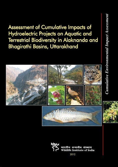
<strong>Assessment</strong> of <strong>Cumulative</strong> <strong>Impact</strong>s of Hydroelectric<br />
Projects on Aquatic and Terrestrial Biodiversity in<br />
Alaknanda and Bhagirathi Basins, Uttarakhand<br />
The Team<br />
Project Coordinator<br />
Dr. V.B. Mathur, Dean<br />
Project Advisors<br />
Mr. B.C. Choudhury<br />
Dr. V.K. Melkani<br />
Mr. V.K. Uniyal<br />
Component Investigator Research Personnel<br />
Vegetation Ecology Dr. G.S. Rawat Ajay Maletha<br />
Dr. Manish Khandwal<br />
Mammals and Birds Dr. S. Sathyakumar<br />
Dr. K. Ramesh<br />
River Ecology and<br />
Fishes<br />
<strong>Cumulative</strong><br />
<strong>Environmental</strong> <strong>Impact</strong><br />
<strong>Assessment</strong><br />
Dr. K. Sivakumar<br />
Dr. J.A. Johnson<br />
Dr. Asha Rajvanshi<br />
Dr. Vinod B. Mathur<br />
Nand K. Dimri<br />
P. Gangaiamaran<br />
Roshni Arora
Credits:<br />
Cover : Rajeev Thapa<br />
Desktop Publishing : Narinder Bist<br />
Maps : Dr. Panna Lal<br />
Citation: Rajvanshi, Asha; Roshni Arora; Vinod B. Mathur; K. Sivakumar; S. Sathyakumar; G.S.<br />
Rawat; J.A. Johnson; K. Ramesh; NandKishor Dimri and Ajay Maletha (2012) <strong>Assessment</strong> of<br />
<strong>Cumulative</strong> <strong>Impact</strong>s of Hydroelectric Projects on Aquatic and Terrestrial Biodiversity in<br />
Alaknanda and Bhagirathi Basins, Uttarakhand. Wildlife Institute of India, Technical Report. Pp<br />
203 plus Appendices.
List of Boxes, Figures and Plates<br />
Contents<br />
Chapter 1 – Introduction 1<br />
1.1 Hydropower potential of Uttarakhand 2<br />
1.2 Biodiversity profile of Uttarakhand 2<br />
1.3 Conservation - Development dilemma 3<br />
1.4 <strong>Cumulative</strong> <strong>Environmental</strong> <strong>Impact</strong> <strong>Assessment</strong> 4<br />
1.4.1 The conceptual basis 4<br />
1.4.2 Merits of adopting <strong>Cumulative</strong> <strong>Environmental</strong><br />
<strong>Impact</strong> <strong>Assessment</strong> (CEIA) 5<br />
1.5 Application of <strong>Cumulative</strong> <strong>Environmental</strong> <strong>Impact</strong> <strong>Assessment</strong> (CEIA)<br />
in the context of Hydropower Planning 6<br />
1.6 Relevance of CEA in the context of hydropower planning<br />
in Uttarakhand 7<br />
1.6.1 CEIA of aquatic biodiversity 8<br />
1.6.2 CEIA of terrestrial biodiversity 9<br />
1.6.3 Minimum environmental flows 10<br />
1.6.4 Social/Cultural issues 10<br />
1.7 Expected outputs from this study 11<br />
Chapter 2 – <strong>Environmental</strong> and Technical Considerations 12<br />
2.1 Project background 12<br />
2.2 Objectives of the WII study 12<br />
2.3 Study tasks and implementation schedule 13<br />
Chapter 3 – The Study Area and Project Profiles 16<br />
3.1 The study area 16<br />
3.1.1 Bhagirathi basin 16<br />
3.1.2 Alaknanda basin 17<br />
3.2 Profile of the projects 18<br />
3.3 Delineation of sub-basins for CEIA 25
Chapter 4 – Approach and Methodology 32<br />
4.1 Framework for <strong>Cumulative</strong> <strong>Environmental</strong> <strong>Impact</strong> <strong>Assessment</strong> (CEIA) 32<br />
4.1.1 Scoping 33<br />
4.1.1.1 Desk studies 34<br />
4.1.1.2 Reconnaissance 34<br />
4.1.1.3 Determining the study boundary and the Zone of Influence 34<br />
4.1.1.4 Defining sub-basins for CEIA 34<br />
4.1.2 Establishing biodiversity baseline 35<br />
4.1.2.1 Flora 35<br />
4.1.2.2 Fauna 36<br />
4.1.2.3 Assessing site-specific biodiversity values: Use of criteria 37<br />
4.1.3 <strong>Impact</strong> prediction 40<br />
4.1.3.1 Identification of impact indicators (impact stressors)<br />
4.1.3.2 An overview of impacts of HEP on aquatic<br />
40<br />
and terrestrial biodiversity 41<br />
4.1.4 <strong>Impact</strong> evaluation 44<br />
4.1.4.1 Development of impact evaluation matrix 45<br />
4.1.4.2 Scoring and weighting of impacts 46<br />
Chapter 5 – Biodiversity Baseline 48<br />
5.1 Overview of biodiversity values in Alaknanda and Bhagirathi river basins 48<br />
5.2 Biodiversity values based on fish fauna 77<br />
5.3 Biodiversity value based on terrestrial flora and fauna 82<br />
5.3.1 Mammals 82<br />
5.3.2 Birds 87<br />
5.3.3 Plants 89<br />
5.4 Areas representing critically imporant habitats 95<br />
5.4.1 Critically important habitats for aquatic species within the<br />
Alaknanda and Bhagirathi basins 96<br />
5.4.2 Terrestrial components of conservation significance 99<br />
5.4.2.1 Critically important habitats for animals 101<br />
5.4.2.2 Critically important habitats of plants 103<br />
Chapter 6 – <strong>Impact</strong> Prediction and Evaluation 105<br />
6.1 Introduction 105<br />
6.1.1 Valued environmental/ecological components of the<br />
Alaknanda and Bhagirathi basins 105<br />
6.2 Perceived environmental dimensions of ‘good and bad’ projects 106<br />
6.3 Ecological consequences of Hydro Electric Projects in Alaknanda<br />
and Bhagirathi basins 107
6.3.1 Prediction of impacts on aquatic ecology and fish diversity<br />
at the sub-basin levels 107<br />
6.3.1.1 Habitat loss 107<br />
6.3.1.2 Barrier effect 107<br />
6.3.1.3 Changes in sedimentation flows 108<br />
6.3.1.4 Changes in environmental flows 109<br />
6.3.1.5 Changes in nutrient flow 110<br />
6.3.2 Prediction of impacts on terrestrial fauna and flora<br />
at the sub-basin levels 110<br />
6.3.2.1 Habitat loss 110<br />
6.3.2.2 Habitat degradation and disturbances due to HEPs 111<br />
6.4 Scenario assessment 112<br />
6.4.1 Scenario assessment for aquatic biodiversity 113<br />
6.4.2 Scenario assessment for terrestrial biodiversity 123<br />
6.4.3 Final analysis 134<br />
Chapter 7 – <strong>Environmental</strong> Flow 136<br />
7.1 Introduction 136<br />
7.2 Methods 136<br />
7.3.1 Minimum <strong>Environmental</strong> Flows based on ecological<br />
status of river (EMC) 137<br />
7.3.2 <strong>Assessment</strong> of ecological status of Alaknanda and<br />
Bhagirathi basin 139<br />
7.3.3 <strong>Environmental</strong> Water Requirement as per EMC 142<br />
7.4. <strong>Environmental</strong> Water Requirement as per ecology of fishes 146<br />
7.4.1. Estimation of Minimum Environment Flow based on<br />
requirements of aquatic biodiversity especially fishes 163<br />
7.5 Major findings 170<br />
Chapter 8 – Conclusions and Recommendations<br />
8.1 Aquatic component 173<br />
8.1.1 Aquatic biodiversity profile 173<br />
8.1.2 Critically important fish habitats 174<br />
8.1.3 <strong>Impact</strong>s on aquatic biodiversity and their habitats 175<br />
8.1.3.1 Habitat modification/loss 175<br />
8.1.3.2 Barrier effect 175<br />
8.1.3.3 Changes in sedimentation flows 176<br />
8.1.3.4 Changes in environmental flows 176<br />
8.1.3.5 Changes in nutrient flow 177
8.2 Terrestrial component 177<br />
8.2.1 Biodiversity profile and critically imporant habitats 177<br />
8.2.2 <strong>Impact</strong>s on terrestrial biodiversity and habitats 178<br />
8.3 Recommendations 180<br />
8.3.1 <strong>Environmental</strong> flows 180<br />
8.3.2 Present and future scenario 181<br />
8.3.3 Conservation reserve 181<br />
8.3.4 Strategic options for regulating impacts of Hydro Electric Projects 181
List of Figures<br />
Fig.1.1 Forest cover map of Uttarakahand.<br />
Fig.1.2 Hydro Electric Projects on river Ganga.<br />
Fig.3.1 Study area showing Alaknanda and Bhagirathi basins and the locations of Hydro Electric<br />
Projects in different stages of planning and implementation.<br />
Fig.4.1 The CEIA framework adopted in the study.<br />
Fig.4.2 Flowchart of methodological framework adopted to undertake the CEIA.<br />
Fig.5.1 View of Bhagirathi sub-basin I.<br />
Fig.5.2 View of Bhagirathi sub-basin II.<br />
Fig.5.3 View of Asiganga sub-basin.<br />
Fig.5.4 View of Bhagirathi sub-basin III.<br />
Fig.5.5 View of Bhagirathi sub-basin IV.<br />
Fig.5.6 View of Bhilanganga sub-basin.<br />
Fig.5.7 View of Balganga sub-basin.<br />
Fig.5.8 View of Alaknanda sub-basin I.<br />
Fig.5.9 View of Mandakini sub-basin.<br />
Fig.5.10 View of Alaknanda sub-basin II.<br />
Fig.5.11 View of Pindar sub-basin.<br />
Fig.5.12 View of Nandakini sub-basin.<br />
Fig.5.13 View of Birahi ganga sub-basin.<br />
Fig.5.14 View of Rishi ganga sub-basin.<br />
Fig.5.15 View of Dhauli ganga sub-basin.<br />
Fig.5.19 Fish biodiversity values in Alaknanda and Bhagirathi basins.<br />
Fig.5.16 View of Bhyundar ganga sub-basin.<br />
Fig.5.17 View of Alaknanda sub-basin III.<br />
Fig.5.18 View of Ganges sub-basin (Devprayag to Rishikesh).<br />
Fig. 5.19 Relative fish biodiversity values in sub-basins of Alaknanda and Bhagirathi.<br />
Fig.5.20 Mammalian biodiversity value.<br />
Fig.5.21 Avifaunal biodiversity value of bird.<br />
Fig.5.22 Plant biodiversity value map.<br />
Fig.5.23 Very high terrestrial bioidiversity value.<br />
Fig.5.24 Nayar River, a critical fish habitat in Uttarkhand.<br />
Fig.5.25 A view of Balganga River, another important breeding ground of fishes.<br />
i
Fig.5.26 Map showing the location of critically important fish habitats in Nayar River and Balganga<br />
and their tributaries.<br />
Fig.5.27 Map showing the location of PAs within the Alaknanda and Bhagirathi basins.<br />
Fig.5.28 Map showing habitats utilised by snow leopard and brown bear for movement within the<br />
altitudinal ranges in Alaknanda and Bhagirathi basins.<br />
Fig.5.29 Map showing critical habitats identified for plants within the Alaknanda and Bhagirathi basins.<br />
Fig.5.30 Critical habitats of valued biodiversity components significantly overlap with locations of<br />
Hydro Electric Projects in the Alaknanda and Bhagirathi basins.<br />
Fig. 6.1 Predicted significance of impacts of all projects on aquatic biodiversity values.<br />
Fig. 6.2 Predicted significance of impacts of commissioned projects on aquatic values.<br />
Fig. 6.3 Predicted significance of impacts of commissioned projects and those under construction on<br />
aquatic values.<br />
Fig. 6.4 Predicted impact significance on aquatic biodiversity based on inclusion of projects with low<br />
impact potential.<br />
Fig. 6.5 Predicted significance of impacts based on exclusion approach to avoid impacts on critically<br />
important aquatic habitats.<br />
Fig. 6.6 Predicted significance of impacts of all projects on terrestrial biodiversity values.<br />
Fig. 6.7 Predicted significance of impacts of commissioned projects on terrestrial biodiversity values.<br />
Fig. 6.8 Predicted significance of impacts of commissioned projects and those under different stages<br />
of construction on terrestrial biodiversity vlaues.<br />
Fig. 6.9 Predicted impact significance on terrestrial biodiversity based on inclusion of projects with<br />
low impact potential.<br />
Fig. 6.10 Predicted significance of impacts based on exclusion approach to avoid impacts on critically<br />
important habitats for terrestrial biodiversity.<br />
Fig. 6.11 Critically important habitats of valued biodiversity components significantly overlap with<br />
locations of hydropower projects in the Alaknanda and Bhagirathi basins<br />
Fig.7.1 Line diagram of Ganga and its major tributaries (Numbers are average flows in MCM-million<br />
cubic meters.<br />
Fig.7.2 Relationship between the river flow and species richness in the Alaknanda and Bhagirathi<br />
Basins.<br />
Fig.7.3 Calculated Minimum <strong>Environmental</strong> Flow (MEF) with reference to Mean Annual Flow (i.e.<br />
20% of MAF) at Kotlibhel IA.<br />
Fig.7.4 Calculated Minimum <strong>Environmental</strong> Flow (MEF) with reference to Mean Monthly Flow (i.e.<br />
20%, 25% and 30% of MMF depending upon season) at Kotlibhel IA.<br />
Fig.7.5 Observed mean monthly flows during past few years at Kotibhel IA.<br />
ii
List of Boxes<br />
Box 1.1: Generic principles of <strong>Cumulative</strong> <strong>Environmental</strong> <strong>Impact</strong> <strong>Assessment</strong> (CEIA)<br />
Box 1.2: Regional EIA, SEA and CEIA linkages<br />
Box 1.3: <strong>Impact</strong> scenarios arising out of multiple projects<br />
Box 3.1: Type of Hydro Electric Projects<br />
Box 4.1: Criterion used for evaluation of natural areas.<br />
Box 4.2: Examples of relevant questions for guiding the evaluation of impact significance.<br />
Box 8.1: Ramsar Convention: Guidelines for contracting parties relating to reducing the impact of<br />
water development projects on wetlands.<br />
List of Plates<br />
Plate 5.1 Sub-basins within Alaknanda and Bhagirathi basins.<br />
Plate 5.2 RET Fishes of Alaknanda-Bhagirathi basin, Uttarakhand.<br />
Plate 5.3 Some common fishes of Alaknanda-Bhagirathi basin, Uttarakhand.<br />
Plate 5.4 Important mammals in the two basins.<br />
Plate 5.5 Important Galliformes in the two basins.<br />
Plate 5.6 Some RET plant species found in Alaknanda and Bhagirathi basins.<br />
Plate 5.7 Some RET plant species found in Alaknanda and Bhagirathi basins.<br />
iii
iv<br />
List of Appendices<br />
Appendix–2.1 The MoEF vide letter No. F 8-9/2008-FC dated 23rd July, 2010<br />
Appendix–2.2 The Terms of Reference (ToR) for the AHEC study<br />
Appendix–2.3 The broad objectives of WII study as agreed under Terms of reference<br />
Appendix–2.4 The proposal for the study was approved by MoEF vide letter No. 8-9/2008-FC dated<br />
16/11/2010<br />
Appendix – 3.1 Profile of 70 HEPs in Alaknanda and Bhagirathi basins<br />
Appendix–4.1 Criteria adopted for developing impact matrix.<br />
Appendix–5.1 Checklist of plant species found in the Alaknand and Bhagirathi basins<br />
Appendix–5.2 RET/Endemic species of plants recorded in the Bhagirathi and Alaknanda basins.<br />
Appendix–5.3 Description of RET plant species found in the two basins.<br />
Appendix–5.4 Checklist of fishes found in the ZoIs of hydroelectric projects in Alaknanda and<br />
Bhagirathi basins<br />
Appendix–5.5 Distribution of birds in the sub-basins of Alaknanda and Bhagirathi basins<br />
Appendix–5.6 Distribution of mammals in the sub-basins of Alaknanda and Bhagirathi basins<br />
Appendix–5.7 Distribution of mammals in the zones of influence of hydroelectric projects of<br />
Alaknanda and Bhagirathi basins<br />
Appendix–5.8 Floristic composition of all HEP sites in the Alaknanda & Bhagirathi basins.<br />
Appendix–6.1 Statement of Outstanding Universal Value of Nanda Devi and Valley of Flowers World<br />
Heritage Sites,Uttarakhand , India.<br />
Appendix–6.2 Project wise derivation of impact potential values for different sub-basin<br />
Appendix–8.1 Freshwater fish biodiversity in the River Ganga (India): changing pattern, threats and<br />
conservation perspectives
Chapter I – Introduction<br />
The State of Uttarakhand came into existence on 9th November 2000 as 27 th State of Indian<br />
Republic. It lies between 28 o 44’ to 31 o 28’ N Latitudes and 77 o 35’ to 81 o 01 E Longitudes. It was carved<br />
out from the State of Uttar Pradesh by separating the hill region with a geographical area of 53,483 km 2<br />
constituting 1.63% of the land area of the country (FSI, 1999). The State has 13 districts sub divided<br />
into 49 tehsils and 95 development blocks. The State is well known for its rich natural resources and<br />
varied ecosystems both terrestrial and aquatic. Four major rivers flowing through north India originate<br />
from the State, viz., Ganga, Yamuna, Ramganga and Sharada.<br />
The State is endowed with a rich array of forest types from tropical to alpine. The recorded<br />
forest area of the State is 3.47 m ha which constitutes about 65% of the State’s geographic area. These<br />
forests can be further categorized into Reserved Forests (68.74%), Protected Forests (0.36%) and<br />
Unclassed Forest (30.9%). The recorded forest cover (Fig. 1.1) of the State is 34,651 km 2 , which<br />
constitutes 64.79% of its geographic area (FSI, 2009).<br />
Figure 1.1 Forest cover map of Uttarakahand (Source: FSI, 2009).<br />
1
1.1 Hydropower potential of Uttarakhand<br />
The Indian Himalayan Region (IHR) spanning from Arunachal Pradesh in the east to Jammu<br />
and Kashmir in the west and covering 530,795 km2 has irreplaceable values as one of the important<br />
mountain ecosystems of the world (Singh, 2006). These young and fragile mountains of the Himalaya<br />
command high conservation significance due to their floral, faunal, geo-hydrological, ecological, sociocultural<br />
and aesthetic values. Also known as the water tower of the Earth (Valdiya, 1997), the<br />
Himalaya provides water to a larger part of the Indian subcontinent.<br />
The State of Uttarakhand, which is carved out of the upper reaches of Uttar Pradesh, is one of<br />
the many States that form a part of the IHR. The hilly tracts of the State namely Foothills, Lesser<br />
Himalaya, Greater Himalaya and Trans-Himalaya form the eastern most part of the western Himalaya<br />
(Negi, 1995). This State uniquely endowed with glaciers and rain fed monsoonal rivers following the<br />
natural incline/gradient has good hydro power potential and is thus recognized as a future Energy State<br />
(Joshi, 2007). Uttarakhand has a hydropower potential of the order of 20,000 MW against which only<br />
about 3,164 MW (16% approx.) has been harnessed so far through 45 Hydro Electric Projects (HEPs)<br />
of varying capacities being implemented by State and Central Government agencies and public and<br />
private sectors (IIT, 2011). Hydropower potential is one of the most important strategic assets of the<br />
State for the development of the economy (World Bank, 2011). With little or no fossil fuel resources, it<br />
is currently a net importer of power, but generates a seasonal surplus power. Since its creation, the<br />
new State, has been witnessing a sharp increase in energy demand. As the power consumption of the<br />
State has grown more than five times in the last eight years (2002-10), only 52 percent of its power<br />
needs are met from its natural resources. The State therefore plans to expand its hydropower<br />
generation capacity to become self reliant and a net exporter of surplus power (IIT, 2011). To meet this<br />
objective, a large number of Hydro Electric Projects are already in the advanced stages of<br />
planning/execution and many more projects are being proposed in the important river basins viz., the<br />
Alaknanda and Bhagirathi basins, of the State. Among the various allotted Hydro Electric Projects in<br />
these two basins, 17 are commissioned Hydro Electric Projects with total installed capacity of 1851<br />
MW; 14 projects of 2538 MW capacity are in the advanced stage of construction and 39 projects with<br />
installed capacity of 4644 MW are in different stages of planning.<br />
1.2 Biodiversity profile of Uttarakhand<br />
The State is well known for its rich natural resources and varied ecosystems, both terrestrial<br />
and aquatic. Four major rivers flowing through north India originate from the State, viz., Ganga,<br />
Yamuna, Ramganga and Sharada. The State is endowed with a rich and diverse array of forest types<br />
from tropical to alpine types. The recorded forest area of the State is 3.47 m ha which constitutes<br />
about 65% of the State’s geographic area. These forests can be further categorized into Reserved<br />
Forests (68.74%), Protected Forests (0.36%) and Unclassed Forest (30.9%). The forest cover of the<br />
State is estimated to be about 44%, two third of which is dense and the rest is open forest (FSI, 2007).<br />
The major categories of forests in the State are: (i) Tropical Moist Deciduous Forests in the<br />
Terai and Bhabar tracts dominated by Sal (Shorea robusta) and associates viz., Adina cardifolia,<br />
Anogeissus latifolia, Terminalia tomentosa and a rich assemblage of shrubs interspersed with patches<br />
of bamboo, climbers and grasses; (ii) Subtropical Pine Forests with Chir Pine (Pinus roxburghii) as the<br />
dominant species are primarily found in the lower regions of the Himalaya (iii) Himalayan Moist<br />
2
Temperate Forests occurring between 1600-2900 m altitude in the Himalaya are further divisible into<br />
temperate broad leaved and conifer forests. Broad leaved forests are dominated by one or other<br />
species of oak (Quercus spp.) while the coniferous species are Cedrus deodara, Picea smithiana,<br />
Abies pindrow, and Pinus wallichiana; (iv) Sub-alpine and Alpine Forests exist at altitudes of 2,900 m to<br />
3,500 m above sea level in the middle and upper Himalaya and is characterized by stunted birchrhododendron<br />
forests, alpine scrub and meadows locally called “Bugyals”. In addition, a considerable<br />
area of the State is under tropical and temperate grasslands. The grasslands or the chaurs of Rajaji<br />
and Corbett National Parks that can grow up to 2m, form as an ideal habitat as ambush cover for<br />
predators and also provide forage and fawning cover for herbivores. The major species of grasses in<br />
the area include Arundo donax, Phragmites karka, Apluda mutica (Bassi), Themeda arundinacea (Ulla),<br />
Cymbopogon spp. (Jarakush), Bothriochloa bladhii (Sindhur), Imperata cylindrica, Sachharum<br />
spontaneum, S. benghalense and S. narenga among others.<br />
The State has considerable area (13.68% of its geographic area) under protected area network<br />
as compared to the national average of 4.8%. There are six National Parks, six Wildlife Sanctuaries,<br />
one Biosphere Reserve, and two Conservation Reserves. The Nanda Devi NP and Valley of Flowers<br />
NP have been inscribed on the UNESCO World Heritage List. In terms of floral wealth, the State<br />
harbours about 4500 species of vascular plants, of which 29 species are endemic.<br />
The mammalian diversity of Uttarakhand represented by more than 75 species is one of the<br />
richest in the country (Paramanand et al. 2000; Uniyal & Ramesh 2004; Chandola et al. 2008; Bhardwaj<br />
& Uniyal 2009 and Bhardwaj et al. 2010, Maheshwari & Sharma 2010). Species falling under lower risk<br />
category represent a little more than 50% indicating that the species with threatened status represent<br />
nearly half of the total species found in the State. Some of the threatened/vulnerable mammals in the<br />
State include Musk deer (Moschus chryogaster), Snow leopard (Panthera uncia), Himalayan brown<br />
bear (Ursus arctos isabellinus) and Asiatic black bear (Ursus thibentanus). A detailed analysis of the<br />
data shows that 37.80% of species fall under lower risk least concern category and 19.51% under lower<br />
risk not threatened status. It is estimated that about 650 species of birds (51% of India’s avifauna)<br />
occur within the State (Vasudevan & Sondhi, 2010). Some of the threatened birds in the State include<br />
Western Tragopan (Tragopan melanocephalus), Cheer Pheasant (Catreus wallichi) and Sarus Crane<br />
(Grus antigone).<br />
The reptile diversity in Uttarakhand encompasses over 60 species including crocodiles, turtles,<br />
tortoises, snakes and lizards. One of the endangered reptiles of the State is the Gangetic Gharial<br />
(Gavialis gangeticus).<br />
The State of Uttarakhand which is a home for many perennial rivers of the country also has a<br />
good fish diversity represented by about 125 species (Badola, 2001). The Bhagirathi and Alaknanda<br />
river basins represent two important riparian ecosystems that have significantly contributed to the<br />
richness of the biodiversity of the State.<br />
1.3 Conservation - Development dilemma<br />
Among all types of development projects, hydroelectric dams are often seen as the most<br />
controversial. Issues linked to dams and especially to the “large dams” are often highly polarized.<br />
3
Critics of Hydro Electric Projects express their concerns about the wide range of negative<br />
environmental and related social impacts, from the destruction of unique biodiversity to the<br />
displacement of vulnerable human populations. Defenders of dams emphasize that these are often the<br />
economically least-cost source of electric power available from renewable source. However, like most<br />
other power generation technologies hydropower development also has adverse environmental impacts<br />
(Ledec and Quintero, 2003).<br />
Diversion of rivers from their channels has enabled the expansion of human civilization to<br />
inland areas that were otherwise unproductive (from the economic standpoint) or too remote to provide<br />
adequate water for essential life processes. Opponents of water resource developments charge that<br />
dams cause significant damage to human and natural resources resulting in the impoverishment of<br />
human populations and loss of plant and animal species and their habitats. Available worldwide<br />
literature on consequences of dam development (Goldsmith and Hildyard, 1984; Graf, 1999; Adams,<br />
2000; Berkamp et al., 2000;) reveals that the impacts of dams on ecosystems are profound, complex,<br />
varied, multiple and mostly negative. By storing or diverting water, dams alter the natural distribution<br />
and timing of stream flows. This in turn, changes sediment and nutrient regimes and alters water<br />
temperature and chemistry resulting to impacts on ecosystems and biodiversity elements that these<br />
streams support and on their attendant socio-economic aspects. These ecosystem impacts may result<br />
in consequent changes in freshwater biodiversity which is already threatened on account of several<br />
other factors (Berkamp et al., 2000).<br />
1.4 <strong>Cumulative</strong> <strong>Environmental</strong> <strong>Impact</strong> <strong>Assessment</strong><br />
1.4.1 The conceptual basis<br />
Concerns are often raised about the long term changes in the environmental quality, not only<br />
as result of a single action or development, but as the combined effects of many actions over time.<br />
<strong>Environmental</strong> <strong>Impact</strong> <strong>Assessment</strong> (EIA) has traditionally focused primarily on examining the direct<br />
environmental effects of a single development. Each individual development, when assessed for its<br />
potential to impact, may produce impacts that are ecologically and socially acceptable. However, when<br />
the effects of the numerous individual developments are combined, impacts may become larger,<br />
additive, or even new and therefore significant.<br />
In recent years, there has been a growing realisation that the EIA process essentially adopted<br />
to portend the impacts of each development initiative on its individual standing may not be the best<br />
approach to assess the combined impacts of several projects (Court et al., 1994). This has led to the<br />
development of procedures, known as <strong>Cumulative</strong> Effects <strong>Assessment</strong> (CEA) or <strong>Cumulative</strong><br />
<strong>Environmental</strong> <strong>Impact</strong> <strong>Assessment</strong> (CEIA), for evaluating the consequences, sources and pathways of<br />
cumulative impacts of multiple activities (Canter, 1999). Instead of focusing on the effects of a given<br />
action – a project, plan, or individuals' behaviour – this approach focuses on the assessment of<br />
changes on different components of the receiving environment and considers all of the effects on a<br />
given receptor (Therivel and Ross, 2007).<br />
Although the terms ‘cumulative impacts’ and ‘cumulative effects’ were introduced as early as<br />
the 1970s in several countries’ EIA legislation and practice guidelines, it was not until the mid-to-late<br />
4
1980s that these terms began to be incorporated in impact assessment practice. The terms 'cumulative<br />
impacts, cumulative effects and cumulative environmental changes’ are often used interchangeably.<br />
Several definitions of ‘cumulative impacts’ or ‘cumulative effects’ are available in the literature (e.g.<br />
Horak et al., 1983; Dickert and Tuttle, 1985; Sonntag et al., 1986; Hegmann et al.,1999). <strong>Cumulative</strong><br />
effects assessment has been broadly defined by Smit and Spaling (1995) as the practice of<br />
systematically analyzing cumulative environmental change. The Council on <strong>Environmental</strong> Quality<br />
(CEQ) regulations defines cumulative impacts aptly as: “<strong>Impact</strong> on the environment which results<br />
from the incremental impact of the action when added to other past, present, and reasonably<br />
foreseeable future actions regardless of what [government] agency or person undertakes such<br />
other actions.”<br />
Although there may be variations and refinements in the definitions associated with cumulative<br />
impacts, most efforts to incorporate CEIA within the EIA or SEA process have concentrated on<br />
addressing combined effects from the proposed actions on the environmental systems subsequent to<br />
appropriately defining baseline conditions and considering proposed actions in relation to surrounding<br />
projects (Canter, 1999). The principles of cumulative impact assessment have been derived from the<br />
definition of ‘cumulative effects’ in the CEQ regulations, from surveys of EIA practitioners and from a<br />
review of published literature. These principles are summarized (Box 1.1) and are meant to be<br />
considered in the planning and conduct of CEA within EIA process.<br />
Box 1.1: Generic principles of <strong>Cumulative</strong> <strong>Environmental</strong> <strong>Impact</strong> <strong>Assessment</strong> (CEIA)<br />
• <strong>Cumulative</strong> effects are caused by the aggregate of past, present, and reasonably<br />
foreseeable future actions;<br />
• They include both direct and indirect effects, on a given resource, ecosystem, and human<br />
community of all actions taken;<br />
• They are analyzed in terms of the specific resource, ecosystem, and human community<br />
being affected, rather than from the perspective of the proposed action;<br />
• <strong>Cumulative</strong> effects on a given resource, ecosystem, and human community are rarely<br />
aligned with political or administrative boundaries;<br />
• They may result from the accumulation of similar effects or the synergistic interaction of<br />
different effects;<br />
• They may last for many years beyond the life of the action that caused them; and<br />
• Each affected resource, ecosystem, and human community must be analyzed in terms of its<br />
carrying capacity or threshold for environmental stress.<br />
1.4.2 Merits of adopting <strong>Cumulative</strong> <strong>Environmental</strong> <strong>Impact</strong> <strong>Assessment</strong><br />
Source: Canter, 1999<br />
Because of the narrow focus of EIA and its inability to provide clarity on the criteria for<br />
identifying and assessing cumulative effects (DEAT, 2004), it is desirable to assess cumulative effects<br />
within the EIA. It is through cumulative assessment, project specific EIAs can be placed into a broader<br />
spatial and temporal perspective to aid in the assessment of “the net result of environmental impact<br />
from a number of projects and activities”.<br />
5
<strong>Cumulative</strong> impact assessment provides valuable and important inputs as an element of<br />
Strategic <strong>Environmental</strong> <strong>Assessment</strong> (SEA). SEA has been labeled as being a relatively efficient<br />
planning and decision support tool than EIA as this evaluation approach allows consideration of<br />
cumulative effects of the series of projects. Lawrence (1994), Sadler and Verheem (1996), Habib<br />
(2005), believe that the scope of SEA is more appropriate to the time and space scales at which<br />
cumulative effects are expressed.<br />
Depending on whether the assessment of cumulative effects is built upon environmental<br />
assessments (e.g. as part of the EIA) or will feed into Strategic decisions, the CEIA is an ideal, regional<br />
based approach which is closely linked to concepts of ‘limits of acceptable change’ and ‘thresholds of<br />
significance’, which appear to be strongly emerging tools in SEA. Addressing cumulative effects in<br />
SEA can provide early warning system, sign-post specific requirements for project specific EIA and<br />
highlight the relevance or futility of mitigation measures based on pre and post project environmental<br />
reviews (Box 1.2).<br />
6<br />
Box 1.2: Regional EIA, SEA and CEIA linkages<br />
Region<br />
Based EIA<br />
SEA as a part of region based EIA<br />
SEA CEIA<br />
CEIA as a part of SEA<br />
1.5 Application of <strong>Cumulative</strong> <strong>Environmental</strong> <strong>Impact</strong> <strong>Assessment</strong> in the context of<br />
hydropower planning<br />
Conflicts over dams have heightened in the last two decades largely due to the social,<br />
ecological and environmental impacts of dams that were either ignored in the planning process or were<br />
not adequately evaluated (WCD, 2000). Development outcomes require a substantially expanded and<br />
reliable basis for decision making, a basis that reflects a full knowledge and understanding of<br />
environmental consequences and their spatial and temporal dimensions.<br />
A range of planning tools for example, sectoral environmental assessments (EA), basin-wide<br />
EAs, regional EAs, and cumulative EA can be used to innovate and improve impact assessment<br />
outcomes for aiding decision support to provide a new direction to hydropower planning processes.<br />
<strong>Assessment</strong> of cumulative effects is being increasingly seen as representing best practice in<br />
conducting environmental assessments. As cumulative impacts can result from individually minor, but<br />
collectively significant actions taking place over different temporal and spatial scales, their overall effect
often exceeds the simple sum of previous effects (Cada and Hunsaker, 1990; DEAT, 2004). In the<br />
context of hydropower development, cumulative impacts can result from (i) multiple actions at a given<br />
site associated with a single project, or (ii) can be additive or synergistic in nature when potential<br />
impacts of multiple dams are taken into account and are concentrated in time or space, for example,<br />
the impacts of series of small dams constructed on a single stream or on streams within a single river<br />
basin (Ortolano and Shepherd, 1995). Such impacts may occur when the affected system is being<br />
perturbed repeatedly and increasingly by the same local agent with sufficient frequency so that it does<br />
not have time to recover between events (time-crowding), or the affected system is being perturbed by<br />
several similar activities or different activities having similar effects, in an area too small to assimilate<br />
the combined impacts (space-crowding) (Canter, 1999).<br />
Synergistic or interactive effects are generally the result of interactions between effects of two<br />
or more projects that result in combined effects that are greater than the sum of the individual project’s<br />
effects and typically more complex and difficult to assess than additive effects (Box 1.3).<br />
Energy<br />
Project 1<br />
Project 2<br />
Project 3<br />
Box 1.3: <strong>Impact</strong> scenarios arising out of multiple projects<br />
Multiple<br />
Hydro-<br />
Projects in<br />
Project 1<br />
Project 2<br />
<strong>Impact</strong><br />
1.6 Relevance of CEIA in the context of hydropower planning in Uttarakhand<br />
The State of Uttarakhand has an estimated hydropower potential of 20,236 MW against which<br />
only about 1,850.8 MW has been harnessed so far. The hydropower development in State is being<br />
recognised to have critical significance in meeting the State's energy demand for economic implications<br />
for sustainable development. Over the next decade a major expansion in hydropower generating<br />
capacity is therefore planned to meet this demand (Fig. 1.2).<br />
A<br />
<strong>Impact</strong><br />
A<br />
<strong>Impact</strong><br />
A<br />
<strong>Impact</strong><br />
D<br />
7
The developments in the hydropower sector in the State of Uttarakhand are therefore in a very<br />
expansive phase (particulars are described in Chapter 2). From the energy plans prepared to date, it is<br />
evident that as many as 70 Hydro Electric Projects are largely concentrated in two river basins viz.<br />
Alaknanda and Bhagirathi.<br />
It is well understood that land clearing, anthropogenic disturbances in the landscape, combined<br />
with increasing water withdrawals and alterations of river systems can result in adverse effects to the<br />
sustainability of natural resources (Schindler, 2001; Gleick et al., 2007). <strong>Environmental</strong> effects on river<br />
systems are largely cumulative in nature, caused by individually minor but collectively significant actions<br />
that accumulate over space and time. Within a basin, the greater number of dams leads to greater<br />
fragmentation of river ecosystems (Berkamp et al., 2000). Hence, there is a growing recognition of the<br />
need to assess the cumulative effects of river development (Reid, 1998; Brismar, 2004; Schindler and<br />
Donahue, 2006). On the same premise, it becomes relevant to adopt cumulative impact assessment<br />
approaches in assessment of the impacts of hydropower development on the ecology of the two major<br />
river basins.<br />
1.6.1 CEIA of aquatic biodiversity<br />
Hydro Electric Projects often have major effects on fish and other aquatic life. Reservoirs<br />
positively affect certain fish species (and fisheries) by increasing the area of available aquatic habitat.<br />
However, the net impacts are often negative because the dam blocks upriver fish migrations and the<br />
downriver passage through turbines or over spillways is often unsuccessful (Ledec and Quintero,<br />
2003).<br />
8<br />
Source:www.sandrp.in
Dams serve as a physical barrier to movement of migratory species, notably fish. This<br />
prevents brood-stock from reaching their spawning grounds during the breeding season, resulting in<br />
massive failure of recruitment and eventual extinction of the stock above the dam (Berkamp et al.,<br />
2000). Many river adapted fish and other aquatic species cannot survive in artificial lakes; changes in<br />
downriver flow patterns adversely affect many species and water quality deterioration in or below<br />
reservoirs can kill fish and damage aquatic habitats. Freshwater molluscs, crustaceans, and other<br />
benthic organisms are even more sensitive to these changes than most fish species, due to their limited<br />
mobility.<br />
The other important environmental impacts of dams are changes in sediment transport and<br />
water quality. Reduction in sediment transport in rivers downstream of dams which influences channel,<br />
floodplain and coastal delta morphology, alters habitat for fish and other groups of plants and animals<br />
and through changes in river water turbidity may affect populations of biota directly (Berkamp et al.,<br />
2000). Water quality deterioration in reservoirs or in river stretches downstream kills fish and damages<br />
aquatic habitats. As multiple dams on a river significantly aggravate the impact on ecosystems and<br />
biodiversity, assessing impacts on aquatic biodiversity is a vital component of the CEIA.<br />
Riparian vegetation is also an important component of the aquatic ecosystem. Riparian<br />
vegetation in the project area is very important for providing shelter and cover for the fish. It also<br />
provides shade to regulate the temperature. There are some specific pockets in the Alaknanda river<br />
and its tributaries especially the Birahi River in which a considerable riparian vegetation cover is<br />
present and which provides conducive habitat for fish.<br />
1.6.2 CEIA of terrestrial biodiversity<br />
Filling of the dam/ reservoir results in permanent flooding of riverine and terrestrial habitat, and<br />
depending upon the topography and habitats of the river valley upstream from the site of the dam,<br />
these impacts can vary greatly in extent and severity. The effects of inundation are especially severe<br />
when the reservoirs are situated close to mountains, in dry areas, or at higher latitudes where the river<br />
valleys are usually the most productive landscape elements. Due to impoundment, all terrestrial<br />
animals disappear from the submerged areas and populations decrease within a few years in<br />
proportion to the habitat area that is lost (Dynesius and Nilsson, 1994). Flooding can result in both<br />
local and global extinctions of animal and plant species. Particularly hard hit are the species dependent<br />
upon riverine forests, and other riparian ecosystems, and those adapted to the fast-flowing conditions<br />
of the main river course. From a biodiversity conservation standpoint, the terrestrial natural habitats<br />
lost to flooding are usually much more valuable than the aquatic habitats created by the reservoir<br />
(McAllister et al., 1999).<br />
Dams can have significant and complex impacts on downstream riparian plant communities.<br />
An important downstream manifestation of river impoundment is the loss of pulse-stimulated responses<br />
at the water-land interface of the riverine system. High discharges can retard the encroachment of true<br />
terrestrial species, but many riparian plants have evolved with, and have become adapted to the natural<br />
flood regimes. Species adapted to pulse-stimulated habitats are often adversely affected by flowregulation<br />
and invasion of these habitats by terrestrial weeds is frequently observed (Malanson, 1993).<br />
Typically riparian forest tree species are dependent on river flows and shallow aquifers.<br />
9
When dams are constructed the variability in water discharge over the year is reduced; high<br />
flows are decreased and low flows may be increased. Reduction of flood peaks reduces the frequency,<br />
extent and duration of floodplain inundation. Reduction of channel-forming flows reduces channel<br />
migration. Truncated sediment transport (i.e. sedimentation within the reservoir) results in complex<br />
changes in degradation and aggregation below the dam. These changes and others directly and<br />
indirectly influence a myriad of dynamic factors that affect the diversity and abundance of invertebrates,<br />
fish, birds and mammals downstream of dams (Berkamp et al., 2000). Moreover, human disturbances<br />
during construction and operational phases of hydro projects would keep away several shy wild animals<br />
from the vicinity.<br />
1.6.3 Minimum environmental flows<br />
<strong>Rivers</strong> are part of the hydrological cycle and it is the variable nature of runoff processes that<br />
give rivers their dynamic characteristics. The ecological integrity of river ecosystems is dependent on<br />
the variation in flow regime to which they are adapted. Floods cause hydraulic disturbance that<br />
determines the composition of biotic communities within the channel, the riparian zone and the<br />
floodplain (Junk et al., 1989; Webb et al., 1999). The spatio-temporal heterogeneity of river systems is<br />
responsible for a diverse array of dynamic aquatic habitats and hence ecological diversity, all of which<br />
is maintained by the natural flow regimes (Berkamp et al., 2000).<br />
Flow regimes, including volume, duration, timing, frequency and lapse time since last flooding,<br />
are the key driving variables for downstream aquatic ecosystems and are critical for the survival of<br />
communities of plants and animals living downstream. Small flood events may act as biological triggers<br />
for fish and invertebrate migration, major events create and maintain habitats, and the natural variability<br />
of most river systems sustains complex biological communities that may be very different from those<br />
adapted to the stable flows and conditions of a regulated river (Berkamp et al., 2000). Therefore,<br />
minimum environmental flows can be defined as: “<strong>Environmental</strong> flows describe the quantity, quality<br />
and timing of water flows required to sustain freshwater and estuarine ecosystems and the human<br />
livelihoods and well-being that depend on these ecosystems” (Brisbane declaration 2007).<br />
.<br />
Hence, it is essential to incorporate assessment of environmental flow requirements to ensure<br />
the amount, timing, and conditions under which water should be released by dams, to enable<br />
downstream river ecosystems to retain their natural integrity and optimum productivity. It is important to<br />
recognize that these assessments focus on evaluating impacts on releases are specifically from<br />
environmental standpoint and not for assessing minimum flows necessary for supporting downstream<br />
commercial activities and water supply (Acreman and Dunbar, 2004; Petts, 1996). A large number of<br />
river flow diversion type Hydro Electric Projects in Himalayan region are in different stages of planning<br />
and implementation. <strong>Assessment</strong> of impact of changed flow regime on river bed and river bank<br />
ecology and provision of environmental flows has therefore become a critical requirement in<br />
development of Hydro Electric Projects.<br />
1.6.4 Social/cultural issues<br />
People living in the region depend on the agriculture that provides major support to the<br />
population and with the rise in population; individual landholdings have significantly shrunk over the<br />
10
years (Rana et al., 2007). In addition to the expansion of urban areas, road building activities and in<br />
recent times the Hydro Electric Projects have further marginalized the individual landholding in<br />
Uttarakhand (Rana et al., 2007; Gaur, 2007). These projects are certainly going to engulf the already<br />
marginalized productive agricultural fields, thus implying more hardship to the local population in times<br />
to come (Bhatt, 1997).<br />
Natural ecosystems (including riverine ecosystems) and their biological components provide a<br />
range of services that are of substantial ecological, economic and cultural values to society. The<br />
changes in the riverine ecosystem due to impairment of its provisioning, regulating, cultural and<br />
supporting functions that are linked to the dam construction often lead to substantial economic and<br />
social impacts (Berkamp et al., 2000). Apart from providing life's basic needs, changes in river flows<br />
influence livelihoods, income, and local migration, which in turn may sometimes lead to unrest and<br />
even political conflicts (McCully, 1996). The consequent impacts on economy and physical security,<br />
freedom, choice and social relations have wide-ranging impacts on well-being and health (WHO, 2005).<br />
1.7 Expected outputs from this study<br />
While it is acknowledged that energy is essential for economic progress and well-being of the<br />
people of the State, the loss of biodiversity cannot be compensated by economic growth. It is essential<br />
to ensure that water demands for energy and irrigation do not become a cause of the decimation of<br />
forested areas, receding wildlife habitats and loss of biodiversity resources that may ultimately become<br />
compounding factors for accelerated impoverishment of natural resource dependent people.<br />
Development of water resources in a sustainable manner is therefore essential for the continued<br />
improvement in the quality of life for humans throughout the world.<br />
This cumulative impact study encompasses the combined effects of multiple developments or<br />
activities on a range of receptors. These include landscape, habitats and species. The objective of the<br />
study is to contribute in strategic assessments to achieve 'green decisions' which according to Fischer<br />
(http://www.twoeam-eu.net/role.pdf accessed on 21 st January 2012) is 'one that is more<br />
environmentally sustainable, in terms of leading to greater conservation of biodiversity'.<br />
In sync with this, the study aims to generate 'alerts' for safeguarding priority areas for<br />
conservation from impacts of hydropower schemes (existing, underway and proposed) in the two<br />
basins; provide a 'risk forecast' for specific biodiversity values (Rare, Endangered and Threatened<br />
(RET) Species and critical habitats) in the event of developments proceeding as planned and finally<br />
present a menu of scenarios for decision makers to approve options that best help in aligning energy<br />
planning with biodiversity conservation for sustainable developments in energy sector.<br />
11
12<br />
Chapter 2 – <strong>Environmental</strong> and Technical Considerations<br />
2.1 Project background<br />
The Government of Uttarakhand had submitted proposals to the Ministry of Environment &<br />
Forests, (MoEF), Government of India to grant environmental and forestry clearances for construction<br />
of Kotlibhel Stage IA, Kotlibhel Stage IB and Kotlibhel Stage-II Hydro Electric Projects on river<br />
Bhagirathi and Alaknanda in the State of Uttarakhand.<br />
The MoEF vide letter No. F 8-9/2008-FC dated 23rd July, 2010 (Appendix–2.1) requested the<br />
Wildlife Institute of India (WII) to conduct a study on the cumulative environmental/ecological impacts of<br />
Hydro Electric Projects in the Bhagirathi and Alaknanda river basins on the riverine ecosystem including<br />
terrestrial and aquatic biodiversity in collaboration with specialized institutions.<br />
The MoEF also entrusted the Alternate Hydro Energy Centre (AHEC), IIT Roorkee to study the<br />
cumulative impacts on the environmental side of the projects in Bhagirathi and Alaknanda river basins<br />
in Uttarakhand. Th broad objectives of the study conducted by AHEC were:<br />
a. To assess the cumulative impact of commissioned, under construction and proposed<br />
Hydro Electric Projects in Alaknanda and Bhagirathi basins.<br />
b. To estimate the extent to which hydropower potential identified in the basins should be<br />
developed without risking stability of landforms and environment. At the same time<br />
ensuring that the quality, quantity, and timing of water flows required to maintain functions,<br />
assimilative capacity and aquatic ecosystems that provide goods and services to people<br />
are maintained.<br />
c. Restrictions, if any, that need to be placed in the development of hydropower in the two<br />
basins.<br />
The Terms of Reference (ToR) for the AHEC study are given in Appendix–2.2.<br />
2.2 Objectives of the WII study<br />
In response to this directive, the Wildlife Institute of India submitted its technical and financial<br />
proposal to MoEF for undertaking the desired study. The broad objectives of WII study as agreed<br />
under Terms of Reference (Appendix–2.3) are:<br />
a) To assess the baseline status of rare, endangered and threatened (RET) species of flora<br />
and fauna dependent on riverine habitats and floodplains of Alaknanda and Bhagirathi river<br />
basins.<br />
b) To identify the critically important habitats along the existing and planned Hydro Electric<br />
Projects located on rivers Alaknanda and Bhagirathi upto Devaprayag.<br />
c) Delineate river stretches critical for conservation of rare, endangered and threatened (RET)<br />
aquatic species.<br />
d) To assess the key habitat variables for RET species, including minimum flows and volume<br />
of water for ecological sustainability of the two rivers.
The proposal for the study was approved by MoEF vide letter No. 8-9/2008-FC dated<br />
16/11/2010 (Appendix–2.4) and it was indicated that the cost of the study would be borne by the<br />
concerned User Agencies whose proposals seeking diversion of forest land for construction of Hydro<br />
Electric Projects in Ganga river basin were presently pending before the MoEF. These costs for the<br />
study were determined by MoEF based on the proportion to the area of forest land applied for forest<br />
diversion by the different project proponent and are presented in Table 2.1.<br />
Table 2.1 Details of contribution of cost to be recovered from five Hydro Electric Projects in<br />
Uttarakhand State.<br />
S. No. Name of the Project Developer Capacity Forest Area<br />
Proposed to be<br />
Diverted<br />
1.<br />
2.<br />
3.<br />
4.<br />
5.<br />
Kotlibhel Hydro Electric<br />
Project - (Stage-IA)<br />
Kotlibhel Hydro Electric<br />
Project - (Stage-IB)<br />
Kotlibhel Hydro Electric<br />
Project - (Stage-II)<br />
Vishnugad-Pipalkoti Hydro<br />
Electric Project<br />
Alaknanda-Badrinath Hydro<br />
Electric Project<br />
Amount to be<br />
recovered (Rs.)<br />
NHPC 195 MW 258.737 ha 5,26,316.00<br />
NHPC 530 MW 496.793 ha 10,10,562.00<br />
NHPC 530 MW 658.252 ha 13,39,059.00<br />
THDC 444 MW 80.607 ha 1,63,969.00<br />
GMR 300 MW 60.513 ha 1,23,094.00<br />
Total 1554.932 ha 31,63,000.00<br />
Accordingly, the Government of Uttarakhand received funds amounting to Rs. 31.63 lakhs from<br />
the 3 User Agencies viz. NHPC, THDC and GMR and provided these funds to the WII for carrying out<br />
this study vide letters issued by Watershed Directorate (Nos. 1528/IG-1131 () dated 14.12.2010 and<br />
1805/IG-1131 dated 19.01.2011).<br />
2.3 Study tasks and implementation schedule<br />
Based on the objectives of the study, an elaborate scope of work was developed to generate<br />
information relevant for developing information and knowledge base with reference to the different<br />
biological components included within the purview of consideration for this study. Table 2.2 provides an<br />
overview of the specific thrust areas and the tasks envisaged.<br />
13
Table 2.2 Details of scope of work under various components of the study.<br />
S.No. Study Components Scope of Work<br />
14<br />
1. Vegetation Science • Generation of baseline data and characterization of the river basins on the<br />
basis of floral attributes, plant association and community structure;<br />
2. Terrestrial Ecology<br />
(Mammals and avifauna<br />
and their habitats )<br />
3. Aquatic/River Ecology<br />
Aquatic mammals and<br />
fishes and their habitats<br />
4. <strong>Cumulative</strong> <strong>Impact</strong><br />
<strong>Assessment</strong><br />
Focus: upstreaming<br />
biodiversity<br />
considerations in<br />
hydropower planning.<br />
• <strong>Assessment</strong> of likely impacts of hydropower development on vegetation,<br />
composition and habitat quality due to anticipated changes in hydrology and<br />
river flows, alteration in land use, creation of impoundments and rehabilitation<br />
of human population;<br />
• Defining conservation priorities for addressing threats to RET taxa, important<br />
plant communities and forest based resources in the two river basins in the<br />
State of Uttarakhand.<br />
• Generation of baseline data and characterisation of the forest areas within the<br />
two river basins on the basis of faunal richness and delineation of suitable<br />
habitats, migratory/dispersal corridors in the context of RET species of aquatic<br />
and terrestrial birds and mammals known to occur in the Alaknanda and<br />
Bhagirathi river basins of Uttarakhand;<br />
• <strong>Assessment</strong> of impacts on species distribution and integrity of habitats of RET<br />
species as a result of changes in hydrology and land use and submergence of<br />
natural habitats under existing and proposed hydropower development<br />
schemes in Uttarakhand;<br />
• Defining conservation priorities and propose mitigation oriented plans for<br />
addressing threats to conservation of RET species.<br />
• Generation of baseline data through survey of the river stretches for delineating<br />
zones of high fish diversity and abundance and characterising special habitats<br />
commanding importance as wetland conservation areas in Alaknanda and<br />
Bhagirathi river basins of Uttarakhand;<br />
• Development of inventories and evaluate production potential of streams and<br />
rivers.<br />
• <strong>Assessment</strong> of cumulative impacts of changes in hydrology and river flow on<br />
stream characteristics; habitat quality and contiguity; upstream and<br />
downstream migration of RET fish species such as golden mahseer and snow<br />
trout; spawning and breeding success;<br />
• Determining conservation priorities and proposing species/habitat conservation<br />
and/recovery/reintroduction plans to avoid and address hydropower<br />
development induced threats to conservation of RET species, particularly the<br />
golden mahseer.<br />
• Collate information from project profiles to assess the impact potential of<br />
individual projects<br />
• Integrate information on all biophysical aspects of the study area for<br />
generating biodiversity values, spatial data at sub-basin. Weight scaling and<br />
ranking of key impacts of hydropower development on biodiversity values<br />
using sub-basins as the smallest landscape unit in the two river basin<br />
• Determine risks associated with changes in habitat size and quality, impacts of<br />
river flows on aquatic and terrestrial biodiversity.<br />
• Generate alternate scenarios using inclusion and exclusion approaches to<br />
profile impacts on biodiversity in different scenarios of hydropower planning.
Table 2.3 Task completion.<br />
Date of Commencement: 14 th December, 2010<br />
Inception meeting 14 th Jan, 2011<br />
Complete transfer of funds to WII 19 th January 2011<br />
Site visit 06 th to 12 th Jan, 2011<br />
Site visit 07 th to 12 th Feb, 2011<br />
Joint WII-IIT meeting 06 th March,2011<br />
Internal review meeting 08 th March, 2011<br />
Internal review meeting 09 th March, 2011<br />
Internal review meeting 11 th March, 2011<br />
Internal review meeting 23 th March, 2011<br />
Presentation on the study before the committee<br />
chaired by Hon’ble Minister of Environment &<br />
Forests (Independent Charge).<br />
13 th April, 2011<br />
Internal review meeting 14 th April, 2011<br />
Site visit 17 th to 22 th April, 2011<br />
Internal review meeting 27 th April, 2011<br />
Meeting of EAC (Hyropower) at MoEF 29 th April, 2011<br />
Interim report submission to MoEF based on part<br />
study<br />
28 th May, 2011<br />
Site visit 15 th May to 06 th June<br />
2011<br />
Internal review meeting 11 thJuly, 2011<br />
Internal review meeting 14 thJuly, 2011<br />
Meeting of EAC (Hydropower) at MoEF 15 th July, 2011<br />
Site visit 23 rd July to 04 th Aug,<br />
2011<br />
Internal review meeting 11 thAugust,2011<br />
Internal review meeting 08 thSep, 2011<br />
Internal review meeting 26 thSep, 2011<br />
Site visit 04 th to 08 th Oct, 2011<br />
Data analysis and report writing Oct, 2011 to Feb 2012<br />
Draft final report 5 th March, 2012<br />
Internal review meeting 29 th February, 2012<br />
Internal review meeting 1 st March, 2012<br />
Internal review meeting 3 rd March, 2012<br />
15
16<br />
Chapter 3 – The Study Area and Project Profiles<br />
3.1 The study area<br />
The study area for this assessment encompasses the Alaknanda and Bhagirathi river basins<br />
containing the 70 commissioned, under-construction and proposed Hydro Electric Projects (Fig. 3.1).<br />
The lower limit of the study area is Kaudiyala on river Ganga and upper limits are Gangotri on river<br />
Bhagirathi and Badrinath on river Alaknanda.<br />
Fig. 3.1 Study area showing Alaknanda and Bhagirathi basins and the locations of Hydro<br />
Electric Projects in different stages of planning and implementation.<br />
The Alaknanda and Bhagirathi basins fall in the north-western part of Uttarakhand. The terrain<br />
in these two basins is predominantly hilly. The total catchment of these basins upto Devparayag is<br />
19,600 km 2 . Both the basins are characterized with rather rugged river drainage, with deep, steep river<br />
valleys separated by linear narrow ridges. The slopes are steep and quite unstable in certain regions.<br />
The climatic zones vary from tropical zone to perpetually frozen zone according to the altitude, falling in<br />
7 different categories.<br />
3.1.1 Bhagirathi basin<br />
The river Bhagirathi originates from the Gomukh (3900 m) in the Gangotri glaciers and western<br />
face of the Chaukamba peaks (within the physical boundaries of district Uttarkashi). The valley has a<br />
broad U-shape at higher elevations, characteristic of glacial origin, but at lower elevations the river has
cut a narrow V-shaped fluvial valley. Along the 217 km long river, the elevation ranges from 480 m to<br />
3200 m and has an average gradient of 1.25%. The total catchment area of Bhagirathi River is 8846.64<br />
km 2 and the catchment can be further divided into the watershed of Bhagirathi, Bhilangana and Asi<br />
Ganga rivers.<br />
Before coming down to Uttarkashi town (1,158m) Bhagirathi receives the Jadganga and<br />
Asiganga, other glacial and non-glacial fed streams. During its further course, the Bhilangana (glacial<br />
fed originating from the Khatling glaciers-3950m in Tehri district) merges with it at Tehri (630m), goes<br />
further downwards at Devprayag (472m), and meets with equally important sister tributary of the<br />
Ganga- the Alaknanda. Asiganga and Bhilangana are the major tributaries, among which Bhilangana<br />
has its own tributary, Balganga. The Bhagirathi basin is confined within Tehri Garhwal, Pauri Garhwal<br />
and Uttarkashi districts (IIT, 2011).<br />
A total of 32 hydropower projects both large (>25 MW) and small (1MW) with a<br />
total installed capacity 4871 MW are being planned within this basin (IIT, 2011). There are 9<br />
commissioned projects, 4 projects are under-construction and 19 are proposed projects.<br />
3.1.2 Alaknanda basin<br />
The Alaknanda River originates from Satopanth and Bhagirath Kharak glaciers and runs a<br />
distance of 224 km till its confluence with Bhagirathi at Devprayag (472m). The basin is extended<br />
between 30 o 0’ N - 31 o 0’ N and 78 o 45’ E - 80 o 0’ E, covering a total catchment area of about 12587.23<br />
Km 2 , representing the eastern part of the Garhwal Himalaya. The Alaknanda catchment can be subdivided<br />
into Alaknanda, Mandakini, Nandakini, Pindar, Dhauliganga and Birahi Ganga sub-catchments.<br />
Table 3.1 Physiographic characteristics of Bhagirathi and Alaknanda rivers and their tributaries.<br />
S.No. River<br />
Total<br />
length*<br />
(m)<br />
Elevation Range<br />
Highest<br />
Point<br />
Confluence<br />
Point<br />
Confluence<br />
Confluence Location<br />
Bhagirathi River<br />
1. Bhagirathi 217000 3200 480 1.25%<br />
Confluences with<br />
Alaknanda at<br />
Devprayag<br />
1(a).<br />
Bhagirathi-<br />
Asiganga<br />
83500 3200 1120 2.49%<br />
1(b).<br />
Bhagirathi-<br />
Bhilangana<br />
91000 1120 610 0.56%<br />
1(c).<br />
Bhagirathi-<br />
Devprayag<br />
42500 610 480 0.31%<br />
2. Asi ganga 20500 2440 1120 6.44%<br />
Confluences at<br />
Ganganani Uttarkashi<br />
3. Bhilangana 109000 3000 670 2.14% Confluences at Tehri<br />
4. Bal ganga 37000 1730 814 2.48%<br />
Confluences<br />
Bhilangana at Ghansali<br />
17
Alaknanda River<br />
18<br />
5. Alaknanda 224000 4016 480 1.58%<br />
5(a).<br />
5(b).<br />
5(c).<br />
6.<br />
Alaknanda-<br />
Dhauli<br />
ganga<br />
Alaknanda-<br />
Pindar<br />
Alaknanda-<br />
Devprayag<br />
Dhauli<br />
ganga<br />
47000 4016 1446 5.47%<br />
60000 1446 795 1.09%<br />
109000 795 480 0.29%<br />
50000 2880 1446 2.87%<br />
7. Rishi ganga 38500 4000 1900 5.45%<br />
8. Birahi ganga 29500 2160 994 3.95%<br />
9. Nandakini 44500 2200 880 2.97%<br />
10. Pindar 114000 2200 775 1.25%<br />
11. Mandakini 81000 3562 640 3.61%<br />
*Upper reaches of river have not been accounted<br />
Joins Bhagirathi at<br />
Devprayag<br />
Confluences at<br />
Vishnuprayag<br />
Confluences at<br />
Karanprayag<br />
Confluences at<br />
Vishnuprayag<br />
Confluences Dhauli<br />
ganga at Tapovan<br />
Confluences at Birahi<br />
village<br />
Confluences<br />
Alaknanda at<br />
Nandprayag<br />
Confluences at<br />
Karnprayag<br />
Confluences at<br />
Rudraprayag<br />
Approximately 5.9% of the total geographical area is under agriculture while only 0.6% of the<br />
land is under the horticultural crops. Forest covers about of 65% land area. The basin comprises<br />
eighteen development blocks in Bageshwar, Chamoli, Rudraprayag, Tehri and Pauri Districts. Like the<br />
Bhagirathi valley, the Alaknanda valley is U-shaped in its upper reaches and becomes V-shaped in its<br />
lower reaches. It is characterised by difficult terrain, wide variation in slopes, high rainfall and high<br />
humidity, low solar radiation and extreme low (highly elevated regions) to very high temperatures<br />
(valley regions during the summer). Thus, the climate ranges from sub tropical to alpine (Sati, 2008).<br />
A total of 38 Hydro Electric Projects both large (>25 MW) and small (1MW) with a total<br />
installed capacity 4163 MW are being planned within this basin. There are eight commissioned<br />
projects, 10 projects are under-construction and 20 are proposed projects.<br />
3.2 Profile of the projects<br />
A total of 70 Hydro Electric Projects both large (>25 MW) and small (1MW) with<br />
a total installed capacity 9563 MW are being planned within this basin (Table 3.2 & Appendix 3.1).<br />
There are 17 commissioned projects, 14 projects are under-construction and 39 are proposed projects.
Table 3.2 List of 70 Hydro Electric Projects on Alaknanda and Bhagirathi river basins.<br />
S.No. Project Name River Capacity (MW)<br />
River<br />
length<br />
affected<br />
(m)<br />
Forest<br />
land take<br />
(ha)<br />
Forest area<br />
submerged<br />
(ha)<br />
1. Agunda Thati Dharam ganga 3.00 2000 NA NA<br />
2. Alaknanda Alaknanda 300.00 7000 49.648 NA<br />
3. Asiganga I Asiganga 4.50 3000 NA NA<br />
4. Asiganga II Asiganga 4.50 2000 NA NA<br />
5. Asiganga III Asiganga 9.00 4500 NA NA<br />
6. Badrinath II Rishi ganga 1.25 1500 NA NA<br />
7. Bal ganga II Bal ganga 7.00 3250 NA NA<br />
8. Bharon Ghati Bhagirathi 381.00 18500 0 NA<br />
9. Bhilangana Bhilangana 22.50 2700 4.949 NA<br />
10. Bhilangana IIA Bhilangana 24.00 5000 NA NA<br />
11. Bhilangana IIB Bhilangana 24.00 4500 NA NA<br />
12. Bhilangana IIC Bhilangana 21.00 6500 NA NA<br />
13. Bhilangana III Bhilangana 24.00 6500 82.84 NA<br />
14. Bhyundar ganga Bhyundar ganga 24.30 3250 NA NA<br />
15. Birahi ganga Birahi ganga 7.30 2500 NA NA<br />
16. Birahi ganga I Birahi ganga 24.00 6500 NA NA<br />
17. Birahi ganga II Birahi ganga 24.00 4000 NA NA<br />
18. Bowla Nandprayag Alaknanda 300.00 16000 9.09 NA<br />
19. Debal Kail ganga 5.00 3500 NA NA<br />
20. Devsari Pinder 252.00 26305 18.658 60<br />
21. Dewali Nandakini 13.00 10500 0 NA<br />
22. Gohana Tal Birahi ganga 50.00 12000 NA NA<br />
23. Jadh ganga Jadhganga 50.00 2100 NA 8.35<br />
24. Jalandharigad Jalandharigad 24.00 3500 12.11 NA<br />
25. Jelam Tamak Dhauli ganga 126.00 8500 70 NA<br />
19
S.No. Project Name River Capacity (MW)<br />
20<br />
River<br />
length<br />
affected<br />
(m)<br />
Forest<br />
land take<br />
(ha)<br />
Forest area<br />
submerged<br />
(ha)<br />
26. Jhala koti Bal ganga 12.50 4750 NA NA<br />
27. Jummagad Jummagad 1.20 2000 NA NA<br />
28. Kail ganga Kail ganga 5.00 3000 NA NA<br />
29. Kakoragad Kakoragad 12.50 3500 4.98 NA<br />
30. Kaldigad Kaldigad 9.00 4000 NA NA<br />
31. Kali ganga I Kaliganga 4.00 1500 NA NA<br />
32. Kaliganga II Kaliganga 6.00 3000 NA NA<br />
33. Karmoli Jadhganga 140.00 10500 NA 9.94<br />
34. Khirao ganga Khirao ganga 4.00 2750 NA NA<br />
35. Kot Budha Kedar Bal ganga 6.00 4750 NA NA<br />
36. Koteshwar Bhagirathi 400.00 20700 2 220<br />
37. Kotlibhel IA Bhagirathi 195.00 18400 46.339 211.7<br />
38. Kotlibhel IB Alaknanda 320.00 27500 146.05 453.7<br />
39. Kotlibhel II Ganga 530.00 28000 57.45 590<br />
40. Lata Tapovan Dhauli ganga 170.00 8500 0 NA<br />
41. Limcha Gad Limcha gad 3.50 1500 NA NA<br />
42. Lohari Nagpala Bhagirathi 600.00 15000 0 NA<br />
43. Madhmaheshwar Mandakini 10.00 5500 NA NA<br />
44. Malari Jelam Dhauli ganga 114.00 6500 NA NA<br />
45. Maneri Bhali I Bhagirathi 90.00 18000 NA 1.42<br />
46. Maneri Bhali II Bhagirathi 304.00 22000 NA NA<br />
47. Melkhet Pinder 15.00 8500 NA NA<br />
48.<br />
Nandprayag<br />
langasu<br />
Alaknanda 100.00 8000 NA NA<br />
49. Pala Maneri Bhagirathi 480.00 18642 21.883 19.24<br />
50. Phata Byung Mandakini 76.00 13000 2.97 4<br />
51. Pilangad Pilangad 2.25 3000 NA NA
S.No. Project Name River Capacity (MW)<br />
River<br />
length<br />
affected<br />
(m)<br />
Forest<br />
land take<br />
(ha)<br />
Forest area<br />
submerged<br />
(ha)<br />
52. Pilangad II Pilangad 4.00 2300 NA NA<br />
53. Rajwakti Nandakini 3.60 2500 NA NA<br />
54. Ram bara Mandakini 24.00 8000 NA NA<br />
55. Rishi ganga Rishi ganga 13.20 1000 NA NA<br />
56. Rishi ganga I Rishi ganga 70.00 6025 1.86 6.2<br />
57. Rishi ganga II Rishi ganga 35.00 5397 0.83 1.65<br />
58. Singoli Bhatwari Mandakini 99.00 14500 NA NA<br />
59. Siyangad Siyangad 11.50 4500 4.96 NA<br />
60. Srinagar Alaknanda 330.00 4500 339 68.73<br />
61. Suwari Gad Suwari gad 2.00 2000 NA NA<br />
62. Tamak Lata Dhauli ganga 250.00 10500 24 NA<br />
63. Tapovan Vishnugad Dhauli ganga 520.00 15500 0 NA<br />
64. Tehri Stage 1 Bhagirathi 1000.00 44000 2582 4200<br />
65. Tehri Stage II Bhagirathi 1000.00 44000 2582 4200<br />
66. Urgam Kalpganga 3.00 2500 NA NA<br />
67. Urgam II Kalpganga 3.80 1750 NA NA<br />
68. Vanala Nandakini 15.00 6500 0 NA<br />
69. Vishnugad Pipalkoti Alaknanda 444.00 17243 100.39 24.5<br />
70. Vishnuprayag Alaknanda 400.00 19400 33.248 NA<br />
Table 3.3 Status of individual projects based on the stages of development.<br />
Commissioned Under construction Proposed<br />
ALAKNANDA BASIN<br />
Badrinath II Kail ganga Alaknanda<br />
Birahi ganga Kali ganga I Bhyundar ganga<br />
Debal Kaliganga II Birahi ganga I<br />
Jummagad Madhmaheshwar Birahi ganga II<br />
Urgam Phata Byung Bowla Nandprayag<br />
Vanala Rishi ganga Dewali<br />
21
22<br />
Vishnuprayag Singoli Bhatwari Gohana Tal<br />
Rajwakti Srinagar Jelam Tamak<br />
Commissioned Under construction Proposed<br />
BHAGIRATHI BASIN<br />
Tapovan Vishnugad Devsari<br />
Vishnugad Pipalkoti Khirao ganga<br />
Kotlibhel IB<br />
Lata Tapovan<br />
Malari Jelam<br />
Melkhet<br />
Nandprayag langasu<br />
Ram bara<br />
Rishi ganga I<br />
Rishi ganga II<br />
Tamak Lata<br />
Urgam II<br />
Agunda Thati Lohari Nagpala Bal ganga II<br />
Bhilangana Asiganga I Bharon Ghati<br />
Bhilangana III Asiganga II Bhilangana IIA<br />
Kot Budha Kedar Asiganga III Bhilangana IIB<br />
Koteshwar Bhilangana IIC<br />
Maneri Bhali I Jadh ganga<br />
Maneri Bhali II Jalandharigad<br />
Pilangad Jhala koti<br />
Tehri Stage 1 Kakoragad<br />
Kaldigad<br />
Karmoli<br />
Kotlibhel IA<br />
Limcha Gad<br />
Pala Maneri<br />
Pilangad II<br />
Siyangad<br />
Suwari Gad<br />
Tehri Stage II<br />
Kotlibhel II<br />
Hydro Electric Projects do impact river ecosystems directly. They also affect terrestrial<br />
ecosystems in their zones of influence due to impoundment created for storage of water or because of<br />
land take for construction related activities from natural habitats. The degree of impact to which any one<br />
project affects a river, varies widely. One of the most important variables is the type of the dam that<br />
would be constructed (Box 3.1). Other variables include the size and flow rate of the river or tributary
where the project is located; the existing habitat and climatic conditions; the type, size, and design of a<br />
project; and whether a project is located upstream or downstream of other projects.<br />
Box-3.1: Type of Hydro Electric Projects.<br />
Diversion (Run-off) the River<br />
A diversion, sometimes called runof-river,<br />
facility channels a portion of<br />
a river through a canal or penstock.<br />
It may not require the use of a dam.<br />
Pump-storage<br />
When the demand for electricity is<br />
low, pumped storage facility stores<br />
energy by pumping water from a<br />
lower reservoir to an upper<br />
reservoir. During periods of high<br />
electrical demand, the water is<br />
released back to the lower reservoir<br />
to generate electricity.<br />
Reservoir (Impoundment)<br />
The most common type of<br />
hydroelectric power plant is an<br />
impoundment facility. An<br />
impoundment facility, typically a<br />
large hydropower system, uses a<br />
dam to store river water in a<br />
reservoir. Water released from the<br />
reservoir flows through a turbine,<br />
spinning it, which in turn activates a<br />
generator to produce electricity. The<br />
water may be released either to<br />
meet changing electricity needs or<br />
to maintain a constant reservoir<br />
level.<br />
(http://www.poweredbymothernature.com)<br />
In view of the above design considerations in assessing impacts of the Hydro Electric Projects<br />
in Alaknanda and Bhagirathi basins, the details of types of schemes proposed is presented in Table<br />
3.4.<br />
23
24<br />
Table 3.4 Types of HEPs in different sub-basins.<br />
Sub-basins<br />
Types of Scheme<br />
Bhagirathi I 01 02<br />
Bhagirathi II 10 01<br />
Asiganga 04<br />
RoR Storage Reservoir<br />
Bhagirathi III 01 01<br />
Bhagirathi IV 02<br />
Bhilangana 05<br />
Balganga 04<br />
Alaknanda Sub-basin I 02<br />
Mandakini Sub-basin 05 01<br />
Alaknanda Sub-basin 2 04 01<br />
Pindar Sub-basin 03 01<br />
Nandakini Sub-basin 03<br />
Birahi ganga 04<br />
Rishi ganga 01 02<br />
Dhauli ganga 06<br />
Bhyundar ganga 01<br />
Alaknanda Sub-basin 3 04<br />
Ganga Basin 01<br />
Run-of-river power projects require diversion of water into penstocks (pipes) that bring water to<br />
turbines in a power plant at lower elevation. The elevation difference between the intake and the<br />
powerhouse provides the kinetic energy that powers turbines that produce electricity. Such projects<br />
require that water be diverted from a section (‘reach’) of the river, which may vary in length from few to<br />
several kilometres in length. This water is finally returned into the stream below the powerhouse<br />
through a short channel ‘tailrace’. These various physical aspects of the project that are sometimes<br />
referred to as the project ‘footprint’ vary with length of river affected by diversions, submergence and<br />
downstream releases. The details of affected lengths of Bhagirathi and Alaknanda river are provided in<br />
Table 3.5.
Table 3.5 Affected lengths of Bhagirathi and Alaknanda river and its tributaries due to allotted<br />
hydropower development.<br />
S.No. River<br />
Total<br />
river<br />
stretch<br />
(m)<br />
River<br />
stretch<br />
diverted<br />
River<br />
stretch<br />
submerged<br />
Affected<br />
length<br />
% of river<br />
length<br />
diverted<br />
% of river<br />
length<br />
submerged<br />
% of river<br />
length<br />
affected<br />
Bhagirathi Basin<br />
1. Bhagirathi 217000 68031 85400 153431 31% 39% 70.71%<br />
2. Asiganga 20500 10945 0 10945 53% 0% 53.39%<br />
3. Bhilangana 109000 20369 19000 39369 19% 17% 36.12%<br />
4. Bal ganga 37000 14721 0 14721 40% 0% 39.79%<br />
5.<br />
Small<br />
tributaries<br />
73000 16401 0 16401 22% 0% 22.47%<br />
Alaknanda Basin<br />
6. Alaknanda 224000 60412 47100 107512 27% 21% 48.00%<br />
7. Dhauliganga 50000 46794 0 46794 94% 0% 93.59%<br />
8. Rishiganga 38500 10426 600 11026 27% 2% 28.64%<br />
9. Birahi ganga 29500 21926 0 21926 74% 0% 74.32%<br />
10. Nandakini 44500 15507 0 15507 35% 0% 34.85%<br />
11. Mandakini 81000 34875 500 35375 43% 1% 43.67%<br />
12. Pindar 114000 24974 10000 34974 22% 9% 30.68%<br />
13.<br />
Small<br />
tributaries<br />
83000 18780 0 18780 23% 0% 22.63%<br />
* Upper reaches of river have not been accounted<br />
3.3 Delineation of sub-basins for CEIA<br />
A total of 18 sub-basins were delineated within the study area. These sub-basins provide for<br />
unique ecogeographic character and therefore, reflect biodiversity values accordingly. In the study<br />
area, the Alaknanda Basin is comprised of 10 sub-basins that are as follows:<br />
A) Alaknanda basin<br />
The Alaknanda Basin is comprised of 10 sub-basins. These are:<br />
1. Alaknanda I sub-basin<br />
The Alaknanda I spans along the stretch of mainstream River Alaknanda between Devprayag<br />
and Karanprayag. This sub-basin is drained mainly by Alaknanda River and its major tributary<br />
Mandakini that joins Alaknanda at Rudraprayag. This sub-basin mainly falls under lower to<br />
middle Himalayan range and has high ridge mountains and a number of side valleys. The<br />
variable topography of the area supports wide range of vegetation from subtropical to<br />
temperate types. Area has subtropical mixed forests, pine in the lower elevations and<br />
temperate forests in the higher elevations. Anthropogenic pressures and developmental<br />
activities along this stretch of Alaknanda are high as the main routes to Kedarnath and<br />
Badrinath is along this river which includes the major towns such as Srinagar, Rudraprayag<br />
and Devprayag.<br />
25
26<br />
This sub-basin harbours 2 Hydro Electric Projects Kotlibhel IB (storage), and Srinagar<br />
(storage). Among these, Srinagar HEP is under-construction and the Kotlibhel IB is a proposed<br />
project. All the projects are planned on the mainstream River Alaknanda.<br />
2. Alaknanda II sub-basin<br />
The Alakananda II sub-basin covers the stretch of mainstream River Alaknanda between<br />
Karanprayag to Vishnuprayag. In this sub-basin, tributaries such as the Urgam, Birahi ganga,<br />
Mandal river, Nandakini and Pindar drain into the main Alaknanda River. The sub-basin falls<br />
within the middle and lower Himalayan regions and encompasses subtropical mixed and chir<br />
pine forests at the lower elevations, temperate forests and scattered tree and scrub in the<br />
middle elevations (near Vishnuprayag) and oak & coniferous mixed sub alpine forests, alpine<br />
scrub and meadows in the higher elevations (Tungnath, Rudranath regions). Patches of<br />
riverine forest and scrub occur along the main river.<br />
There are 5 Hydro Electric Projects within the limits of this sub-basin namely Bowla<br />
Nandprayag (RoR), Vishnugad Pipalkoti (storage), Nandprayag langasu (RoR), Urgam (RoR)<br />
and Urgam II (RoR). Urgam HEP is a commissioned project, Vishnugad- Pipalkoti is underconstruction<br />
and Bowla Nandprayag, Nandprayag Langasu and Urgam II projects are<br />
proposed. The Urgam and Urgam II projects are planned on River Kalpganga, a tributary of<br />
River Alaknanda. The other projects are planned on the mainstream River Alaknanda.<br />
3. Alaknanda III sub-basin<br />
The stretch of Alaknanda from its origin up to its confluence with Dhauli Ganga falls in this subbasin.<br />
The River Alaknanda originates from the high peaks near the northern boundary of<br />
District Chamoli (also international border), flows along Badrinath and south towards<br />
Joshimath. Tributaries such as Khiron ganga and Bhyundar ganga drain into Alaknanda. This<br />
sub-basin encompasses the Greater and Trans-Himalayan zones and the transition zones as<br />
well. The entire sub-basin is very narrow with steep slopes and rugged terrain in the lower and<br />
middle elevations, but opens up into wider valleys in the north towards the Trans-Himalayan<br />
regions. The uniqueness of this sub-basin is the gradual transition from Greater Himalayan<br />
elements (near Joshimath) to Trans-Himalayan elements (at the border). The famous<br />
Badrinath shrine is located in this sub-basin. Major proportion of this sub-basin was included<br />
into the buffer zone of Nanda Devi BR.<br />
A total of 4 Hydro Electric Projects at different stages of construction are situated within the<br />
sub-basin viz., Vishnuprayag (RoR), Khirao ganga (RoR), Alaknanda (RoR) and Badrinath II<br />
(RoR). Of these, Badrinath II and Vishnuprayag are commissioned projects whereas the others<br />
are proposed projects. All the projects are planned on River Alaknanda except Khirao ganga<br />
project which is planned on River Khirao ganga.<br />
4. Bhyundar ganga sub-basin<br />
The main river of the Bhyundar sub-basin is the Bhyundar River that is recognized by this<br />
name from the point where Paspawati River that originates in the Valley of Flowers NP and
Lakshman ganga that originates in the Lokpal Lake meet and later flow down through the<br />
Bhyundar Valley for about 15 km to join Alaknanda at Govindghat. This sub-basin is a small<br />
narrow Valley with steep terrain. This sub-basin located in the Greater Himalayan and the<br />
transition zone between the Greater and Trans-Himalaya. Only one project is planned in this<br />
sub-basin the Bhyundar ganga project (RoR). It is a proposed project and is planned on the<br />
River Bhyundar ganga.<br />
5. Nandakini sub-basin<br />
The Nandakini sub-basin covers the catchment of River Nandakini. The River Nandakini<br />
originates near the high peaks of Nandaghunti and Trishul and as like the Pinder runs eastwest<br />
to join the Alaknanda at Nandprayag. It is a very narrow sub-basin and similar to Pindar<br />
sub-basin in terms of its location, topography, forest types, flora & fauna. Some high altitude<br />
areas of this sub-basin fall within the buffer zone of Nanda Devi BR.<br />
This sub-basin has 3 Hydro Electric Projects which are Dewali (RoR), Rajwakti (RoR) and<br />
Vanala (RoR) projects. These projects are at different stages of construction with Vanala and<br />
Rajwakti being commissioned projects and Dewali project being proposed. All the projects are<br />
planned on River Nandakini.<br />
6. Mandakini sub-basin<br />
The catchment of River Mandakini falls under Mandakini sub-basin. The River Mandakini is one<br />
of the main tributaries of Alaknanda. <strong>Rivers</strong> such as Sone ganga, Kali ganga, Mandani ganga,<br />
and Madh Maheshwar ganga drain into Mandakini River. The sub-basin extends from middle<br />
to the high Himalayan ranges and encompasses subtropical mixed and chir pine forests at the<br />
lower elevations (Rudraprayag), temperate forests and scattered tree and scrub in the middle<br />
elevations, oak & coniferous mixed sub alpine forests, alpine scrub and meadows, moraines,<br />
glaciers and high altitude lakes in the higher elevations. The upper catchment of Mandakini<br />
forms the part of the Kedarnath Musk Deer Sanctuary.<br />
A total of 6 Hydro Electric Projects are planned within this sub-basin viz., Singoli Bhatwari<br />
(RoR), Madhmaheshwar (RoR), Kaliganga II (RoR), Phata Byung (storage), Kali ganga I<br />
(RoR), and Ram bara (RoR). Among these, Ram bara is a proposed project while the others<br />
are under-construction. The Kali ganga I and II projects are planned on River Kali ganga<br />
(tributary of Mandakini) while the other 4 projects are planned on River Mandakini.<br />
7. Birahi ganga sub-basin<br />
As like Nandakini, the River Birahi ganga originate from the high group of peaks of Trishul and<br />
Nandaghunti flows east-west to join Alaknanda near Pipalkoti. Located in the middle and<br />
Greater Himalayan ranges, this sub-basin encompasses subtropical mixed and chir pine<br />
forests at the lower elevations, temperate forests and scattered tree and scrub in the middle<br />
elevations, and oak & coniferous mixed sub alpine forests, alpine scrub and meadows in the<br />
higher elevations.<br />
27
28<br />
The catchment of River Birahi ganga forms the Birahi ganga sub- basin. This sub-basin<br />
contains Birahi ganga (RoR), Birahi ganga I (RoR), Birahi ganga II (RoR) and Gohana Tal<br />
(RoR) Hydro Electric Projects. The Birahi ganga project is under construction whereas Birahi<br />
ganga I, Birahi ganga II and Gohana Tal are proposed projects. All the projects are planned on<br />
River Birahi ganga.<br />
8. Pinder sub-basin<br />
The River Pinder catchment is covered under Pinder sub-basin. The River Pindar originates<br />
from the Pindari glacier in Bageshwar District and flows east-west to join the River Alaknanda<br />
at Karnaprayag in Chamoli District. The Pindar catchment falls within the middle and greater<br />
Himalayan regions and encompasses subtropical mixed and chir pine forests at the lower<br />
elevations (Karnaprayag), temperate forests and scattered tree and scrub in the middle<br />
elevations, and oak & coniferous mixed sub alpine forests, alpine scrub and meadows in the<br />
higher elevations (near Pindari). Patches of riverine forest and scrub occur along the main<br />
river. Some high altitude areas of this sub-basin fall within the buffer and transistion zones of<br />
Nanda Devi BR.<br />
There are 4 Hydro Electric Projects planned in the sub-basin namely Devsari (storage), Debal<br />
(RoR), Kail ganga (RoR) and Melkhet (RoR) projects. The Devsari and Melkhet projects are<br />
planned on the River Pinder and the Debal and Kail ganga projects are planned on River Kail<br />
ganga, a tributary of Pinder. The Devsari and Melkhet projects are proposed to be built, Kail<br />
ganga project is under-construction whereas Debal is a commissioned project.<br />
9. Dhauliganga sub-basin<br />
The catchment of River Dhauliganga falls within the Dhauliganga sub-basin. The River Dhauli<br />
ganga originates from the high peaks along the eastern border of District Chamoli (also the<br />
international border) and runs south west to join Alaknanda near Joshimath. The sub-basin<br />
encompasses Greater and Trans-Himalayan regions and has high habitat diversity ranging<br />
from temperate forests, scattered tree and scrub in lower elevations to subalpine forests, alpine<br />
scrub and meadows, glacier moraines, trans-Himalayan scrub and grasslands in the higher<br />
elevations. The uniqueness of this sub-basin is the gradual transition from Greater Himalayan<br />
elements (near Joshimath) to Trans-Himalayan elements (at the international border).<br />
A total of 6 Hydro Electric Projects are planned within the sub-basin viz., Jummagad (RoR),<br />
Tapovan Vishnugad (RoR), Lata Tapovan (RoR), Tamak Lata (RoR), Jelam Tamak (RoR) and<br />
Malari Jelam (RoR). Lata Tapovan, Tamak Lata, Jelam Tamak and Malari Jelam are among<br />
the proposed projects, Tapovan Vishnugad is under-construction and Jummagad is a<br />
commissioned project. All projects are planned on River Dhauliganga except Jummagad which<br />
is planned on River Jummagad, a tributary of Dhauliganga.<br />
10. Rishi ganga sub-basin<br />
The Rishi ganga basin covers the catchment of River Rishi ganga. The River Rishi ganga<br />
originates at the base of Nanda Devi west peak (7817m) and flows northwest to join Dhauli<br />
ganga at Reni village. The Nanda Devi Sanctuary was declared as Nanda Devi National Park
in 1982 and closed for all human activities in 1983. In 1988, the Nanda Devi NP was inscribed<br />
as UNESCO World Heritage Site. In order to protect the integrity of this site and the sustainable<br />
development of the local communities, the Nanda Devi Biosphere Reserve was created in 1988<br />
with a buffer zone surrounding this NP. The Nanda Devi NP is located in the Greater<br />
Himalayan region and encompasses the temperate, subalpine, alpine, moraine habitats and<br />
many glaciers.<br />
This sub-basin harbours 3 projects which are Rishi ganga (RoR), Rishi ganga I (storage) and<br />
Rishi ganga II (storage). All the projects are planned on River Rishi ganga. Rishi ganga I and II<br />
are proposed projects whereas Rishi ganga project is under-construction.<br />
B) Bhagirathi basin<br />
The Bhagirathi basin is comprised of 7 sub-basins which are:<br />
1. Bhagirathi I sub-basin<br />
This sub-basin that is drained by Bhagirathi and its main tributary, Jadh ganga fall in the<br />
Greater and Trans-Himalayan regions. It encompasses the temperate forests, temperate<br />
scattered tree and scrub, subalpine forests and scrub, alpine scrub and meadows, moraines<br />
and glaciers. The entire catchment of Bhagirathi forms the Gangotri National Park including a<br />
considerable stretch of snow-clad mountains and glaciers. The Gangotri, after which the<br />
National Park has been named, is one of the holy shrines of Hindus and located inside the<br />
Park. The National Park area forms a viable continuity between Govind National Park and<br />
Kedarnath Wildlife Sanctuary of Uttarakhand state. High ridges, deep gorges and precipitous<br />
cliffs, rocky craggy glaciers and narrow valleys characterize the area.<br />
There are 2 Hydro Electric Projects located within this sub-basin namely, Karmoli (storage) and<br />
Jadhganga (storage). Both these projects are proposed projects and are situated on River<br />
Jadhganga.<br />
2. Bhagirathi II sub-basin<br />
The stretch of Bhagirathi from its confluence with Jadh ganga to the location of its confluence<br />
with Asi ganga has been categorised as Bhagirathi II sub-basin. This sub-basin falls in the<br />
middle and high Himalayan ranges and much of the sub-basin has been degraded due to<br />
development and anthropogenic pressures consequently there are no PAs.<br />
A total of 11 Hydro Electric Projects are planned within this sub-basin viz., Lohari Nagpala<br />
(RoR), Limcha Gad (RoR), Bharon Ghati (RoR), Kakoragad (RoR), Siyangad (RoR),<br />
Jalandharigad (RoR), Maneri Bhali I (RoR), Pala Maneri (storage), Suwari Gad (RoR), Pilangad<br />
(RoR) and Pilangad II (RoR). The Pilangad and Maneri Bhali I projects are commissioned,<br />
Lohari Nagpala project is under-construction whereas all the other projects are proposed. The<br />
Maneri Bhali, Lohari Nagpala, Bharon Ghati and Pala Maneri projects are planned on River<br />
Bhagirathi, the Pilangad and Pilangad II projects are planned on River Pilangad and the other<br />
projects are planned on smaller tributaries of River Bhagirathi.<br />
29
30<br />
3. Bhagirathi III sub-basin<br />
The length of River Bhagirathi between point of confluence of River Bhilangana with River<br />
Bhagirathi to that of River Asiganga is covered within the Bhagirathi III sub-basin. This subbasin<br />
falls in lower and middle Himalayan range and has high ridge mountains. The Tehri Dam<br />
located at the confluence of Bhagirathi and Bhilangana and its Reservoir extends up to 44 km<br />
up stream fall within this sub-basin. The land on both the sides of the river is primarily<br />
agriculture land and the vegetation is mostly degraded scattered pine and mixed forests and<br />
xerophytic shrubs. Area above the submergence zone is very close to Uttarkashi town and<br />
most of it is human settlements.<br />
Only one project, Maneri Bhali II (RoR), is situated in the sub-basin. This project is located on<br />
mainstream Bhagirathi and is a commissioned project.<br />
4. Bhagirathi IV sub-basin<br />
This sub-basin includes the area from Bhagirathi-Bhilangana confluence to Devprayag where<br />
Bhagirathi joins Alaknanda. It falls in the lower Himalaya and has patches of riverine habitats<br />
along the river and mixed sub-tropical forests in the middle and higher slopes. Anthropogenic<br />
pressures and developmental activities in whole sub-basin have resulted in degradation of<br />
forested habitats.<br />
The section of river Bhagirathi between Devprayag and the point of confluence of River<br />
Bhilangana falls within the Bhagirathi IV sub-basin. There are 4 projects are planned in the subbasin<br />
namely, Kotlibhel IA (storage), Koteshwar (storage), Tehri Stage 1 (storage) and Tehri<br />
Stage II (storage) among which Tehri stage 1 and Koteshwar are commissioned and Kotlibhel<br />
IA and Tehri stage projects are proposed.<br />
5. Asiganga sub-basin<br />
The catchment of River Asiganga lies within the Asiganga sub-basin. The river Asiganga is one<br />
of the major tributaries of Bhagirathi. It originates from Dodital lake (2240m) and joins<br />
Bhagirathi near Uttarkashi. The sub-basin falls in the middle and high Himalayan ranges and<br />
encompasses subtropical pine mixed forests, temperate oak and conifer forests, subalpine<br />
forests and scrub, and alpine scrub and meadows. The valley is marked by undulating and<br />
rugged terrain and steep slopes with highly mountainous, precipitous ridges interspaced by<br />
deep gorges. The valley is seemingly narrow through which the fast flowing Asiganga passes.<br />
A total of 4 Hydro Electric Projects lie within the sub-basin which are Asiganga III (RoR),<br />
Asiganga II (RoR), Asiganga I (RoR) and Kaldigad (RoR). The Asiganga I, II and III projects are<br />
planned on River Asiganga and the Kaldigad project is planned River Kaldigad, a tributary of<br />
Asiganga. All the projects are under-construction except Asiganga III which is proposed to be<br />
built.<br />
6. Bhilangana sub-basin<br />
The Bhilangana sub-basin covers the catchment of River Bhilangana. The Bhilangana River<br />
originates from Khatling glacier and joined by Balganga at Ghansali. It falls in the middle and
greater Himalayan regions and encompasses subtropical mixed and chir pine forests at the<br />
lower elevations (Ghansali), temperate forests and scattered tree and scrub in the middle<br />
elevations (Ghutu), and coniferous mixed sub alpine forests, alpine scrub and meadows in the<br />
higher elevations (below Khatling).<br />
The sub-basin constitutes of 5 projects viz., Bhilangana (RoR), Bhilangana III (RoR),<br />
Bhilangana IIC (RoR), Bhilangana IIB (RoR), and Bhilangana IIA (RoR). The Bhilangana and<br />
Bhilangana III projects are commissioned, whereas the other 3 projects are proposed. All the<br />
projects are planned on River Bhilangana.<br />
7. Balganga sub-basin<br />
The Balganga sub-basin is drained by Balganga and its tributary Dharamganga that joins<br />
Balganga at Budhakedar. This sub-basin falls in the middle and greater Himalayan ranges and<br />
is a broad valley with many lakes and glaciers in the higher altitudes. Habitats such as<br />
temperate mixed forests, temperate scattered tree and scrub with open grassy slopes, pine<br />
forests are present in this sub-basin including patches of riverine forests along Balganga. A<br />
total of 4 projects are planned in this sub-basin namely, Balganga II (RoR), Agunda Thati<br />
(RoR), Kot Budha Kedar (RoR) and Jhala koti (RoR). All projects are planned in River<br />
Balganga except Agunda thati which is situated on River Dharamganga, a tributary of<br />
Balganga. The Agunda thati and Kot Budha Kedar are commissioned projects where as the<br />
Balganga II, and Jhala Koti projects are proposed.<br />
8. Ganga sub-basin<br />
The stretch of River ganga between Devprayag and Rishikesh is covered under Ganga subbasin.<br />
The stretch of Ganga from Devprayag to Rishikesh falls in the lower Himalayan range<br />
and encompasses the subtropical sal and mixed forests, open grassy slopes and scrub, and<br />
patches of riverine forests along the river. One major tributary, the Nayar joins Ganga near<br />
Byasi. This stretch of the Ganga is heavily used for adventure activities such as river rafting,<br />
camping, rock climbing and also for religious/spiritual purposes. This basin harbours one<br />
project which is the Kotlibhel II (storage) project. It is a proposed project which is planned on<br />
River Ganga.<br />
31
32<br />
Chapter 4 – Approach and Methodology<br />
4.1 Framework for <strong>Cumulative</strong> <strong>Environmental</strong> <strong>Impact</strong> <strong>Assessment</strong> (CEIA)<br />
The study was designed to assess the cumulative impacts of the Hydro Electric Projects<br />
(commissioned, under-construction and proposed) on the biodiversity values of Alaknanda and<br />
Bhagirathi basins, in the State of Uttarakhand. The overall goal of CEIA was to assess the impacts of<br />
past, present and future hydropower developments on biodiversity values. The major challenge to this<br />
kind of assessment is the lack of tailor made methodologies for scoping of cumulative effects and<br />
consideration of past or likely future human activities beyond the plan or project in question (Therivel<br />
and Ross, 2007). Development of an appropriate methodological framework for conducting CEIA in the<br />
context of hydropower development was the foremost requirement. The methodological framework for<br />
this study was adopted from standard practices followed globally in the evaluation of cumulative effects<br />
(Council on <strong>Environmental</strong> Quality, 1997; Canter and Sadler, 1997; CEAA,1999; Dube, 2003; Caltran<br />
2005). The specific process of CEIA involved (a) Scoping, (b) Establishing Biodiversity Baselines, (c)<br />
<strong>Impact</strong> Prediction and Evaluation and (d) Decision Support (Fig 4.1). The CEIA was designed to be<br />
executed over a nine month period from January to September 2011, but additional time frame upto<br />
February 2012 was actually used for analysis and report writing.<br />
Scoping<br />
Defining the boundary of the study area and Zone of Influence of projects<br />
Development of evaluation criteria and knowledge base<br />
Baseline Generation<br />
Development of baseline of terrestrial and aquatic biodiversity,<br />
including RET species and medicinal plants<br />
<strong>Impact</strong> Evaluation<br />
<strong>Assessment</strong> of cumulative impacts based on weight scoring of<br />
biodiversity values and impact potential of the projects<br />
Decision support<br />
Scenario Fig 4.1 modeling The Framework for projecting of CEIA present adopted and in futuristic the study. trends of<br />
impact significance on biodiversity values<br />
Fig. 4.1 The CEIA framework adopted in the study.
4.1.1 Scoping<br />
Fig 4.2 Flowchart of methodological framework adopted to undertake the CEIA.<br />
Scoping is the most important step in the impact assessment process as it is essentially aimed<br />
at identifying the sources of the impacts or “impact stressors” and those receptors that are likely to be<br />
subjected to significant cumulative effects and defining the boundary of the study.<br />
In this assessment, scoping effort included (a) desk reviews, (b) preliminary field surveys<br />
(reconnaissance) for determining scope of assessment and determining the larger boundary of the<br />
study and the Zone of Influence within this boundary, based on the available knowledge, field<br />
assessment and impact analysis. The Zone of Influence for each of these projects was defined as an<br />
area which will be influenced by the activity centers where all associated infrastructure development is<br />
planned and where all physical actions onsite will take place. The Zone of Influence varies thus vary for<br />
each project, based on disturbances caused by the size of scheme, submergence zone, diversion of<br />
river, area of powerhouse and key construction activities, such as dam, headrace/tailrace tunnels, muck<br />
disposal area and infrastructure developments. Therefore, the Zone of Influence is nonlinear, variable<br />
in size and shape, depending on the location, length and area of various project activities.<br />
33
4.1.1.1 Desk Studies<br />
Desk studies involved review and gleaning of information from the detailed project reports<br />
(DPRs), EIA reports, the report by IIT, Roorkee for improving the understanding of the project profile<br />
and the nature and extent of activities envisaged to visualize the range of impacts. An extensive and<br />
elaborate literature survey was undertaken to collect secondary information on floral and faunal<br />
(terrestrial and aquatic) values within the study area. Various institutions and organizations working on<br />
these aspects were also contacted to supplement information on key study parameters. Literature on<br />
CEIA studies conducted globally was consulted.<br />
4.1.1.2 Reconnaissance<br />
The Institute’s multidisciplinary team undertook series of surveys in the selected project sites<br />
and gathered information on different terrestrial and aquatic biodiversity components. As Hydro Electric<br />
Projects have a direct bearing on the habitats of both terrestrial and aquatic species dependent on<br />
environmental flows, specific taxa were targeted for conducting impact assessment. Taxonomic groups<br />
that have flagship values and keystone effects, and are highly sensitive to changes in the habitat and<br />
intensity of disturbance in their habitats were selected for the assessment. In this study, mammals,<br />
birds and plants were considered to represent the terrestrial system and fishes were included to<br />
represent the aquatic system. During the study period, the biodiversity values of the area within the<br />
Zone of Influence were assessed based on qualitative criteria such as cover, habitat diversity and<br />
species presence/ absence.<br />
4.1.1.3 Determining the study boundary and the Zone of Influence<br />
As cumulative impacts are considered within spatial (geographic) and temporal boundaries, the<br />
boundaries of study area for cumulative impacts analysis are often broader than the boundaries used<br />
for the project-specific analysis, which focuses on the immediate project area. These boundaries were<br />
identified based on working knowledge of resources, development actions proposed and regulatory<br />
mandates. Within these study boundaries, Zones of Influence (ZoI) were identified.<br />
The Zone of Influence is defined as the farthest possible distance of influence of the<br />
development project, emanating from various impact sources. Identification of impact sources took into<br />
consideration the activities, location and extent of (a) Dam, (b) Barrage, (c) Submergence, (d) Tailrace<br />
tunnel, (e) Diversion zone, (f) Muck deposits, and (g) Built-up areas for establishing various<br />
infrastructures including road network. These features joined together formed the threshold distance of<br />
Zone of Influence and the extent of area was determined based on 500m polygons drawn around the<br />
fused features.<br />
4.1.1.4 Defining sub-basins for CEIA<br />
It is known from experience that project-based assessments do not befit the conceptual and<br />
operational basis of CEIA (Kennett, 2002; Antoniuk, 2000; Dubé, 2003; Duinker and Greig, 2006). CEIA<br />
at the project level remains constrictive, reactive and divorced from broader planning and decisionmaking<br />
contexts (Harriman and Noble, 2008). In other words, it becomes imperative to conduct CEIAs<br />
at a larger landscape level. In this study, the two basins Alaknanda and Bhagirathi were the large<br />
landscape units within which the sub-basin landscape unit formed the smallest unit for assessing the<br />
34
iodiversity values and the development induced impacts on these. The site level information gathered<br />
from the project ZoIs was taken to be useful source of information to collate data at the sub-basin level,<br />
specifically for the impact sources.<br />
A total of 18 sub-basins were delineated within the study area (Table 4.1.), based on the extent<br />
of the major tributaries of Bhagirathi and Alaknanda basins and also the single stretch of the main<br />
streams. Similar classification was also used by IIT Roorkee in their study.<br />
Table 4.1. List of sub-basins in the study area.<br />
Major Basin Sub-basin Number of Hydro Electric<br />
Projects<br />
Alaknanda I Sub-basin 2<br />
Alaknanda II Sub-basin 5<br />
Alaknanda III Sub-basin 4<br />
Bhyundar ganga sub-basin 1<br />
Nandakini Sub-basin 3<br />
Alaknanda Mandakini Sub-basin 6<br />
Birahi ganga Sub-basin 4<br />
Pinder Sub-basin 4<br />
Dhauliganga Sub-basin 6<br />
Rishi ganga Sub-basin 3<br />
Sub-total 38<br />
Bhagirathi I Sub-basin 2<br />
Bhagirathi II Sub-basin 11<br />
Bhilangana III Sub-basin 1<br />
Bhilangana IV Sub-basin 4<br />
Bhagirathi Asiganga Sub-basin 4<br />
Bhilangana Sub-basin 5<br />
Balganga Sub-basin 4<br />
Ganga Sub-basin 1<br />
Sub-total 32<br />
Total 70<br />
4.1.2 Establishing biodiversity baseline<br />
4.1.2.1 Flora<br />
The broad physiognomic classes of vegetation in the area i.e., forests, scrub (primary or<br />
secondary), grasslands and herbaceous meadows (alpine) were characterized in terms of species<br />
composition and structure. Remote sensing data (LISS – IV) was interpreted to assess the overall<br />
vegetation cover and other land use / land cover (LULC) categories in both the basins. Prior to field<br />
surveys, collation of secondary literature, maps, working plans of various forest divisions was done.<br />
35
Stratified random sampling of vegetation communities was used following standard<br />
phytosociological approach (Mueller-Dombois & Ellenberg 1974; Kent & Coker 1992),The following<br />
categories of land forms and vegetation (physiognomic classes) occur in the study area:<br />
Land forms: Rocky slope, Gentle slope, Flat alluvial banks, Gorge, Upland Valley, Terminal and lateral<br />
moraines, Terraces (old and new), Landslides, Landslips and Debris.<br />
Physiognomic classes of vegetation: Dense Forest, Open Forest, Secondary scrub, Grassy slopes,<br />
Alpine scrub, Alpine meadow, Sparse vegetation cover and major communities within each category.<br />
Table 4.2. <strong>Environmental</strong> and vegetation parameters observed during sampling.<br />
36<br />
<strong>Environmental</strong> / Habitat Parameters Vegetation Parameters<br />
Geographical coordinate /GPS reading<br />
Altitude<br />
Soil Type<br />
Canopy Cover<br />
Shrub Cover<br />
Ground Cover<br />
Moss Cover<br />
Lichen Cover<br />
Weed Cover<br />
Rock Cover (%)<br />
Slope<br />
Aspect<br />
Human Pressure (0,1,2,3)<br />
Tree Species & Number<br />
Tree GBH<br />
Shrub Species & Number<br />
Shrub Height<br />
Herb Species & Number<br />
NTFP Species and their abundance<br />
RET Species and their abundance, if any<br />
4.1.2.2 Fauna<br />
Mammals<br />
Information on mammal distribution and abundance in the study area was collected from<br />
various sources such as publications, reports and databases (Bhattacharya et al. 2006, Bhattacharya<br />
and Sathyakumar 2008, Kala 2004, Maheshwari and Sharma 2010, PSL 2006, Schaller 1977, Prater<br />
1980, Sathyakumar 1994, 2001, 2006a, 2006b, Sathyakumar and Bhatnagar 2002, Sathyakumar et al.<br />
1992, ZSI 1995). Field surveys in the project influence zones and informal interviews with local<br />
villagers in the project area were carried out in the different project sites to ascertain the<br />
presence/absence of mammals, particularly RET species. Status of mammals in the project area was<br />
assessed based on visual encounters and indirect evidences (tracks, scats, pellet groups and other<br />
signs) following standard methods (Sathyakumar 1993, 1994, WII 1998) and also based on secondary<br />
sources including expert knowledge.<br />
Birds<br />
Data on bird distribution and abundance in the study area was collected from different sources<br />
(Ali and Ripley 1983, Bhattacharya and Sathyakumar 2007, Sathyakumar and Sivakumar 2007, ZSI<br />
1995). Field surveys in the Zone of Influence and also in other parts of sub-basins were carried out in<br />
the different project sites to ascertain the presence/absence of birds particularly RET species. Bird field<br />
guides (Ali and Ripley 1983, Grimmette et al 2003) were used for bird identification.
Fishes<br />
For generating baseline of biodiversity resources, the primary data on fish distribution and<br />
abundance was collected during field visits spread over a period of six months. This information was<br />
adequately supplemented by the the secondary data from different publications and the data sources<br />
(Badola 2001, Payne et al. 2004, Sinha 2007) to understand the current distribution pattern of fishes in<br />
the basin, especially in the Zone of Influence of project sites. Apart from main streams of the rivers<br />
Ganga, viz., Alaknanda and Bhagirathi, major tributaries of the river were also sampled for fishes. The<br />
location of Zone of Influence was also seen in the context of proximity to Protected Areas while<br />
assessing the impact.<br />
Samples were collected at all sites during daytime (07:00 – 17:00 hrs). Experimental fishing<br />
was carried out in all sampling points by the project team members and locally hired professional<br />
fishermen. Fishes were collected with cast nets (mesh 0.6 x 0.6 cm.), drag nets or locally called<br />
mahajal (mesh 0.7 x 0. 7 mm., L x B = 80 m. x 2.5 m. with varying mesh sizes) and fly collecting nets<br />
(indigenous nets using nylon mosquito nets tied with the bamboo in both ends). At each sampling site,<br />
all gears were used at least ten times during each sampling occasion.<br />
All specimens were identified based on the classification system of Nelson (2006) and scientific<br />
names were verified using www.fishbase.org. The color, spots if any, maximum size and other<br />
characters of the fishes caught were recorded in a format developed for this purpose. Fishes not<br />
collected during experimental sampling were collected from nearby fish market and landing centre<br />
associated with the river system. Taxonomic discrepancies were resolved using the latest database.<br />
4.1.2.3 Assessing site-specific biodiversity values: Use of criteria<br />
I. Rationale for using criteria<br />
The goal of systematic conservation planning is to provide a structured, scientifically defensible<br />
and effective framework for protecting biodiversity. The assignment of biodiversity value to land units is<br />
a key component of this process. Assessing and assigning biodiversity values to the sites aid in<br />
prioritizing sites for conservation. Such assessments can be made using different criteria and<br />
thresholds that not only focuses on a single biodiversity component but are also related to ecosystem<br />
and environmental diversity (Regan et.al. 2007). <strong>Environmental</strong> or ecological criteria can be useful for<br />
describing baseline environmental conditions and considering potential cumulative effects (Canter<br />
1999).<br />
Criteria (which explicitly and consistently differentiate the factors contributing to significance<br />
determination judgments) and thresholds (a clearly defined performance level that explicitly establishes<br />
significance) are a crucial component of impact significance determination procedures within the<br />
environmental assessment process (Gartner Lee Limited (GLL), 2001; Sippe, 1999). Threshold and<br />
criteria application can occur before and after considering mitigation potential (Lawrence 2007). A<br />
criterion is a comparative mechanism that facilitates assessment and judgment. There are both generic<br />
(e.g., positive/negative, degree of intensity, spatial extent, frequency, duration, reversibility, likelihood,<br />
direct/indirect, cumulative effects potential) and feature-specific (e.g., linked to specific setting types,<br />
locations, limits and impacts) criteria (Vanclay, 1999). Thresholds refer to the point at which additional<br />
37
system perturbations, no matter how little, will culminate in major system degradation or collapse<br />
(Contant and Wiggins 1993). A threshold value can be either a maximum or minimum number or a<br />
related qualitative measure, which, if exceeded or not met, causes the predicted effect (Witmer et al.,<br />
1987).<br />
Most ecological assessments use a series of criteria to evaluate impact significance and<br />
importance either quantitatively or qualitatively. No standard set of criteria has emerged and multitudes<br />
have been used in practice (Treweek, 1999). Names used for similar criteria vary from system to<br />
system. The idea of evaluating the significance of natural areas for conservation has found wide<br />
application and such evaluations are bring used for environmental assessments, planning systems and<br />
individual protected areas (Smith and Theberge 1986).<br />
The criteria used in 22 systems for evaluation of natural areas summarized by Smith and<br />
Theberge (1986) are given in Box 4.1.<br />
Treweek (1999) generated a set of questions (see Box 4.2) based on some of the criteria given<br />
in Box 4.1. These questions help in guiding the derivation of criteria relevant for application in impact<br />
assessment.<br />
It should be noted that identification of criteria is somewhat subjective, value driven and<br />
dependent on the experience and background of the group (Regan et al., 2007).<br />
38<br />
Box 4.1: Criterion used for evaluation of natural areas.<br />
Source: Smith and Theberge, 1986
Box 4.2: Examples of relevant questions for guiding the evaluation of impact significance.<br />
• Will the loss or redistribution of habitat affect the long term viability of associated species?<br />
• Will carrying capacity, stress thresholds of assimilative capacity be exceeded?<br />
• If this habitat is destroyed, will the associated species find an alternative habitat?<br />
• If this habitat is destroyed, will the remaining habitat be adequate to support associated species?<br />
• If this habitat is destroyed, can it be replaced using current technology and within a reasonable<br />
timeframe?<br />
• Will the ecosystem resilience or stability breakdown?<br />
• Will the predicted population reductions for a species result in loss of long-term population viability?<br />
• Will significant, irreversible loss of biodiversity occur?<br />
• Will the reduced generic diversity result in reduced ability to withstand environmental change on future?<br />
• Will the loss of one habitat type be more damaging than the loss of another?<br />
• Will the post-development state of an ecosystem be significantly different from its pre-impacted<br />
condition?<br />
• Should any losses of the ecosystem components or functions be mitigated or compensated for and if so,<br />
which ones?<br />
• Will proposed mitigation measures guarantee the maintenance of natural resources within acceptable<br />
limits, i.e. will the residual condition of ecosystems (post-impact and taking account of mitigation) be<br />
acceptable?<br />
(Source: Treweek, 1999 In Rajvanshi et al., 2007)<br />
II. Determination of criteria for the present study<br />
For this study, a set of criteria were identified to assess the biodiversity values of the impacted<br />
area at the sub-basin levels. These criteria capture the importance of the ecological/biological<br />
characteristics of these areas, especially in terms rarity, vulnerability or irreplaceability of their values.<br />
Different set of criteria were evolved for assessing aquatic and terrestrial biodiversity (Table 4.3. and<br />
Table 4.4.).<br />
Table. 4.3. Criteria for assessing terrestrial biodiversity values.<br />
S.No. Criteria Description Applicable Taxa<br />
RET (Rare,<br />
Endangered and<br />
Mammals/Birds/Plants<br />
1.<br />
Threatened)<br />
Species, as per<br />
IUCN and other<br />
Global Criteria<br />
Number of RET species present in the sub-basin.<br />
2. Schedule Species<br />
Number of species that are listed in the Schedule-I Mammals/Birds<br />
of Indian Wildlife Protection Act (IWPA), 1972,<br />
reflecting legal provisions.<br />
3. Species Richness<br />
Number of different species represented in a set<br />
or collection of individuals.<br />
Mammals/Birds/Plants<br />
4. Medicinal Species<br />
Number of species having medicinal properties<br />
hence valuable ecologically and economically.<br />
Plants<br />
39
Table. 4.4. Criteria for assessing aquatic biodiversity values.<br />
S.No. Criteria Description<br />
1.<br />
40<br />
RET (Rare, Endangered<br />
and Threatened) Species,<br />
as per IUCN and other<br />
Global Criteria<br />
2. Endemic Species<br />
3. Habitat Diversity<br />
Number of RET species present in the sub-basin.<br />
Number of endemic species present in the sub-basin,<br />
reflecting the irreplaceability, and national importance that the<br />
species command<br />
Number of habitat types available. This is a surrogate for<br />
habitat heterogeneity and biodiversity richness<br />
4. Species Richness Number of different species present in a given land units<br />
5. Breeding/Congregation<br />
6.<br />
Migratory<br />
Pathways/Corridor<br />
Presence/ absence of breeding sites and congregation<br />
opportunities for the target taxonomic group in a sub-basin.<br />
Presence/ absence of migratory pathways/corridor for aquatic<br />
biodiversity in the sub-basins<br />
4.1.3 <strong>Impact</strong> prediction<br />
Ecological assessments rely crucially on outcomes of impact prediction. It involves relating the<br />
project induced activities with ecosystem characteristics to determine the changes that may result in<br />
these charactersitics due to interactions (DEAT 2004).<br />
The evaluation of impacts involves assessing the severity and extent of impacts on ecosystem<br />
components relative to the baseline (Treweek 1999).<br />
Information about predicted changes is needed for assigning impact significance, prescribing<br />
mitigation measures, and designing and developing environmental management plans and monitoring<br />
programme (ADB 1997). This stage in a cumulative environmental process generally involves scenario<br />
building to project existing and futuristic trends of impacts and their significance for biodiversity values.<br />
This stage thus provides alternative scenarios for decision makers to promote least impacting option (of<br />
discouraging or relocating sites) and technology alternative.<br />
4.1.3.1 Identification of impact indicators (impact stressors)<br />
In the current study, the specific impact indicators were used (Table 4.4) based on their<br />
potential to cause definite changes in characteristics of receptors. The report by IIT Roorkee formed the<br />
basis for obtaining values for specific indicators.
Table 4.5. Criteria for impact indicators (reflecting the disturbance regimes).<br />
S.No. Indicator Description<br />
1.<br />
River Length Affected<br />
(River dryness and<br />
submergence)<br />
2. Forest Area Loss<br />
The length of river which would be deprived of water by water<br />
diversion through head/tailrace tunnel, and the area lost to<br />
submergence.<br />
The location, extent and nature of forest area cleared and<br />
submerged due to Hydro Electric Projects construction and<br />
operation.<br />
4.1.3.2 An overview of impacts of HEP on aquatic and terrestrial biodiversity<br />
This section provides an overview of the major impacts associated with hydropower<br />
development. While some impacts occur only during construction stage, most important impacts usually<br />
are linked to operation of the dam and reservoir. Other significant impacts can result from<br />
complementary civil works such as access roads, power transmission lines, and quarries and borrow<br />
pits (modified from Ledec and Quintero 2003). The specific impacts that are significant from the<br />
standpoint of this study are:<br />
a) Altered flow regime (volume of diverted water)<br />
There is a growing awareness of the essential role of flow regimes as a key factor shaping the<br />
ecology of rivers (Bunn and Arthington 2002). Distribution, abundance, and diversity of stream and river<br />
organisms are all determined by the complex interaction between flows and physical habitat (Schlosser<br />
1982, Poff and Allan 1995, Ward and others 1999, Nilsson and Svedmark 2002). Not only on a larger<br />
scale, the subtle variations in flow and near-bed velocities can govern the distribution and abundance of<br />
particular species of plants and animals at even the smallest spatial scales (e.g., Wetmore and others<br />
1990). Close associations with physical habitat can be found in many stream organisms ranging from<br />
algae and aquatic plants to invertebrates and fish. Alteration of flow regimes is therefore affirmed to be<br />
the most serious and continuing threat to ecological sustainability of rivers (Naiman and others 1995,<br />
Sparks 1995, Lundqvist 1998, Ward and others 1999).<br />
<strong>Impact</strong>s on aquatic biodiversity: Alteration of river flow affects habitat quality in a detrimental<br />
manner. A certain level of downstream flow is needed to maintain a minimum volume and area of<br />
habitat, and ‘desirable’ in-stream conditions (McAllister et.al. 2001). The altered seasonal pattern can<br />
influence oxygen levels, temperature, suspended solids, drift of organisms, and cycling of organic<br />
matter and other nutrients, as well as having direct impacts on biota (Batalla, et al. 2004). Complex<br />
interaction between flows and physical habitat is a major determinant of the distribution, abundance,<br />
and diversity of stream and river organisms (Schlosser 1982, Poff and Allan 1995, Ward and others<br />
1999, Nilsson and Svedmark 2002). Normal seasonal flow patterns are a key to maintaining river<br />
biodiversity.<br />
Flow alteration affects all the trophic levels of the aquatic food chain. The influence of river<br />
flows on recruitment and growth of aquatic plants is well established. Spatial and temporal variation in<br />
plant assemblage structure is influenced by flooding and scouring, desiccation, substrate stability and<br />
localized variations in water velocity, turbulence and shear stress (Chambers and others 1991, Biggs<br />
41
1996, French and Chambers 1996). Seedling survival, as well as plant growth rates are affected by<br />
changes in rates of water level fluctuation and disturbance frequency (floods and spates) and intensity<br />
(velocity and shear stress) (Blanch and others 1999, 2000, Froend and McComb 1994, Rea and Ganf<br />
1994, Sand-Jensen and Madsen 1992).<br />
Spatial and temporal dynamics of benthic communities in streams is also majorly dependent on<br />
the physical disturbance from floods and droughts (Resh and others 1988). As the macro-invertebrates<br />
are vulnerable to rapid diurnal changes in flow, the erratic flow of regulated river downstream,<br />
hydroelectric dams can results in the formation of species-poor macro-invertebrate communities in<br />
these stretches (Munn and Brusven 1991). In some cases, flow regulation may favour the proliferation<br />
of specific taxa (e.g., orthoclad chironomids) (Munn and Brusven 1991).<br />
As with the aquatic flora and invertebrates, the fish faunal composition in the rivers is<br />
maintained by the river flow cycle. The richness of the fish fauna often increases as habitat complexity<br />
increases, with depth, velocity, and cover being the most important variables governing this relationship<br />
(Gorman and Karr 1978, Schlosser 1982, Felley and Felley 1987, Pusey and others 1995). Fish<br />
assemblage structure (i.e., taxonomic composition and relative abundance pattern) is also strongly<br />
related to habitat structure (Meffe and Sheldon 1988, Pusey and others 1993, 1998, 2000).<br />
Associations between fish and their habitat are influenced by flow variability at a range of spatial scales.<br />
Poff and Allan (1995) demonstrated regional differences in fish assemblage structure and functional<br />
organization in streams of differing flow variability in the northern mid-western United States.<br />
Hydrologically variable streams (i.e., those with a high coefficient of variation of daily flows, moderate<br />
frequency of spates) were characterized by species with generalized feeding strategies and preference<br />
for low water velocity, silt, and general substrata. Modifications to flow regimes affect fish diversity and<br />
the functional organization of fish communities in regulated rivers. Flow plays a profound role in the<br />
lives of fish with critical life events linked to flow regime (e.g., phenology of reproduction, spawning<br />
behavior, larval survival, growth patterns and recruitment) (Welcomme 1985, Junk and others 1989,<br />
Copp 1989, 1990, Sparks 1995, Humphries and others 1999). Many of these life events are<br />
synchronized with temperature and day length, such that changes in flow regime that are not in natural<br />
harmony with these seasonal cycles may have a negative impact on aquatic biota.<br />
<strong>Impact</strong>s on terrestrial biodiversity: Typically, riparian forest tree species are dependent on river flows<br />
and a shallow aquifer, and the community and population structure of riparian forests is related to the<br />
spatial and temporal patterns of flooding at a site (McCartney et.al. 1999). Water release protocols can<br />
lower water tables lateral to the rivers which may affect vegetation there (McAllister et.al. 2001). This<br />
might consequently affect the faunal species dependent on this forest type.<br />
b) Disturbed continuity of the river (diverted river length)<br />
River continuity is essential for the overall functioning of the system. There is ample available<br />
evidence indicating the overall importance of connectivity and continuity in the river corridor for regional<br />
biodiversity by maintaining the river corridor functioning for meta-populations, gene flow and species<br />
dispersal (Gouyon et al., 1987; Johansson et al., 1996; Henry et al., 1996; Andersson et al., 2000;<br />
Imbert & Lefèvre, 2003).<br />
42
<strong>Impact</strong>s on aquatic biodiversity: As a result of water diversion, the flow of the river below the dam<br />
reaches very low levels or becomes nil especially during lean season leaving that stretch deprived of<br />
water. Induced desiccation of rivers causes mortality of aquatic flora and fauna thriving in these river<br />
stretches. The process also hampers the dispersal of species present upstream or downstream as a<br />
result of habitat fragmentation.<br />
<strong>Impact</strong>s on terrestrial biodiversity: Drying of river stretches also has negative impacts on terrestrial<br />
biodiversity. <strong>Rivers</strong> are the major source of drinking water for the regional terrestrial fauna. Drying of<br />
long river stretches might affect the occupancy of the nearby areas by the terrestrial species due to<br />
water scarcity leading to degradation of habitat quality, and affects on dispersal of migratory avifauna.<br />
The riparian vegetation habitat in these stretches will also get degraded due to water deprivation in turn<br />
affecting the dependent floral and faunal species.<br />
c) Submergence (Reservoir Area)<br />
One of the largest upstream impacts of dam construction (both storage and Run of the river<br />
type) is submergence. The area flooded by the reservoir is a strong proxy variable for many<br />
environmental and social impacts (Goodland, 1997).<br />
<strong>Impact</strong>s on aquatic biodiversity: The argument that the loss of riverine habitat associated with<br />
impoundments is balanced by the creation of lake-habitat is somewhat deceptive as natural lakes and<br />
wetlands often function in very different ways. The water levels maintained in large impoundments are<br />
generally not constant as a result of which the productive littoral areas are rarely sustained. Moreover,<br />
as compared to natural stream levels, water levels in these impoundments are usually significantly<br />
elevated, flooding part of the terrestrial–aquatic interface and creating a new littoral zone with steeper<br />
banks, less complex aquatic habitat, and different physicochemical conditions for aquatic plants and<br />
animals (Walker and others 1992).<br />
Conversion of one quarter of the river to lentic habitat results in the loss of fishes adapted to turbid<br />
riverine habitats (Stanford and Ward 1986). Also, introductions of highly competitive exotic fishes that<br />
can thrive in impoundments and regulated river reaches contribute to the extirpation of native fishes,<br />
posing as a significant threat.<br />
<strong>Impact</strong>s on terrestrial biodiversity: The most obvious effect of storage reservoirs on terrestrial<br />
ecosystems is the permanent destruction through inundation. Terrestrial biotopes are completely<br />
destroyed. All terrestrial plants and animals contained previously in the submerged areas completely<br />
disappear from the submerged areas. Many animals are caught and drowned during the filling of new<br />
reservoirs. Large scale impoundments may eliminate unique wildlife habitats and extinguish entire<br />
populations of endangered species especially those preferring valley bottoms (Bardach and Dussart,<br />
1973; Nilsson and Dynesius, 1994). Large reservoirs may also disrupt natural migration corridors.<br />
Upstream impoundment not only affects the river banks and areas in vicinity but its impacts radiate till<br />
the farther reaches of the floodplains<br />
43
d) Barrier influence of dam<br />
The most immediate and obvious impact of dam development is its physical presence as a<br />
barrier. Dams pose as a barrier leading to a plethora of impacts on the local biodiversity thereby<br />
disrupting the continuity of the riparian ecosystem.<br />
<strong>Impact</strong>s on aquatic biodiversity: The viability of populations of many species that are strictly aquatic<br />
depends on their ability to move freely through the stream network. Anadromous fishes which migrate<br />
long distances within the main channels and larger tributaries of rivers are particularly sensitive to<br />
barriers to fish passages, which in turn may obstruct their migratory pathways and interfere with the<br />
completion of their life cycles. The disappearance or decline of the major migratory fish species often<br />
follows river impoundment and the blocking of passage in the system (Bonetto and others 1989;<br />
Cadwallader 1986; Harris 1984a,b; Joy and Death 2001; Welcomme 1985, 1992).<br />
<strong>Impact</strong>s on terrestrial biodiversity: <strong>Rivers</strong> and their adjoining riparian zones are considered to be the<br />
most important corridors for movements of animals in natural landscapes (Forman and Godron 1986;<br />
Malanson 1993). Natural riparian zones are also effective pathways for plant dispersal (Jansson et.al.,<br />
2000). Dam acts as a barrier to terrestrial animal movement and plant dispersal, particularly reduction<br />
of riparian zone as a migration corridor (Deall 2010).<br />
e) Clear felling (forest area diverted/cleared)<br />
One of the primary impacts of dam development in such areas is deforestation or clear felling.<br />
Such an activity itself has multitude of impacts on terrestrial species and also on aquatic species.<br />
<strong>Impact</strong>s on aquatic biodiversity: Following deforestation, the soil in the area becomes loose leading<br />
to greater levels of soil erosion. The soil which is being washed away gets deposited in the river which<br />
leads to increased siltation of the river. Excess amounts of silt and sediments can deteriorate water<br />
quality, an essential component of fish habitat. Moreover, increased silt levels and turbidity might also<br />
leads to clogging and abrasion of the gills of fish and other aquatic organisms and behavioural<br />
changes, including movement and migration of aquatic fauna especially fishes (Birtwell, 1999). Such<br />
impacts have already been noticed in the case of Mekong river system.<br />
<strong>Impact</strong>s on terrestrial biodiversity: Deforestation leads to direct elimination of crucial habitats for<br />
terrestrial species. Several important tree, shrub and herb species are removed from these areas and<br />
might lead to extinction of certain endemic species. It also adversely affects the faunal species residing<br />
in these areas and which are dependent on these floral species. On a landscape level, deforestation<br />
leads to habitat fragmentation and degradation of habitat quality. It also leads to destruction of vital<br />
animal/plant corridors which ultimately effects migration and gene dispersal.<br />
4.1.4 <strong>Impact</strong> evaluation<br />
The significance of an impact is widely accepted to be a function of the magnitude of the impact<br />
(i.e. aspects of development likely to bring change) and the sensitivity of the receptor (i.e. components<br />
of the site sensitive to such change).<br />
44
The determination and interpretation of impact significance in cumulative assessments are<br />
influenced by many variables, hence demanding greater precision. A cumulative effect on a Valued<br />
Ecosystem Component (VEC) may be significant even though each individual project-specific<br />
assessment of that same component concludes that the effects are insignificant. This is a fundamental<br />
principle in the understanding of cumulative effects. Project-specific assessments that focus on the<br />
incremental contribution of the project being assessed can assist in making such conclusions as they<br />
must consider the implications of other actions also affecting the VECs. However, this inclusion (and<br />
sometimes the analytical approach used) requires the consideration of additional factors influencing<br />
determination of significance in (cumulative effects component (Hegmann et. al. 1999)<br />
These are:<br />
• exceeding of a threshold;<br />
• effectiveness of mitigation;<br />
• size of study area;<br />
• incremental contribution of effects from action under review;<br />
• relative contribution of effects of other actions;<br />
• relative rarity of species;<br />
• significance of local effects;<br />
• magnitude of change relative to natural background variability;<br />
• creation of induced actions; and<br />
• degree of existing disturbance<br />
The procedures of assigning impact significance are heavily reliant on expert judgment and<br />
technical data, analyses and knowledge (Cloquell-Ballester et al., 2007; Kirk, 2001).<br />
4.1.4.1 Development of impact evaluation matrix<br />
The earliest use of the matrices by Leopold et al. (1971), for assessing the impact significance<br />
led to subsequent innovation in the use and design of matrices that occured over the four decades of<br />
EIA practice (Canter, 2008).<br />
The Argonne Multiple Matrix (AMM) method represents advancement over traditional<br />
interactive matrices such as the Leopold Matrix (Leopold et al. 1971, cited in Lane et al. 1988 for<br />
analyzing the cumulative effect of multiple projects. This type of matrix can differentiate additive from<br />
interactive processes of cumulative environmental change, and can account for multiple projects of the<br />
same type (e.g. hydroelectric dams). Expert opinion is used to establish three types of data: scores that<br />
define the level of effect of each project on selected environmental components, weighting coefficients<br />
that reflect the relative value of each component, and interaction coefficients that measure the effect of<br />
each pair of projects on each component (Smit and Spaling 1995).<br />
AMM.<br />
The matrix used in this assessment (Appendix 4.1) was adapted based on the concept of<br />
45
4.1.4.2 Scoring and weighting of impacts<br />
I. Rationale<br />
Systems of scoring and weighting are used frequently in ecological assessments to measure<br />
and adjust criteria and impacts. Scoring enables evaluation criteria to be expressed numerically and<br />
used more readily in decision making. Without some form of scoring, measurement endpoints cannot<br />
be identified. It also becomes difficult to link assessment and measurement endpoints. Systems of<br />
weighting are based on the premise that criteria such as species richness, habitat diversity, stability and<br />
naturalness have relative importance that can be quantified. Although weighting generally involves<br />
some element of subjectivity (Treweek, 1999), weight scoring for determining impact potential of<br />
projects and risks to biodiversity have been extensively used in CEIA (ICEM, 2007, SEIA 2008).<br />
II. Scoring/weighting methodology adopted in present study<br />
i) For impact sources<br />
Scores ranging from 1 to 5 were assigned to <strong>Impact</strong> Sources with 1 representing the lowest<br />
value and the 5 representing the highest value in both the criterion. The scores were given for each of<br />
the two criteria. The values obtained for each projects were converted into a cumulative score for the<br />
sub-basins, with the maximum attainable score for each sub-basin being 10. The rationale for adding<br />
the project-wise values for a sub-basin was in lines with the concept of CEIA which states that the<br />
cumulative impacts are generally additive in nature.<br />
After obtaining scores for sub-basins, these scores were classified as low (L), medium (M),<br />
high (H) and very high (VH), which take percentage value of 0-25, 26-50, 51-75 and 76-100<br />
respectively. Such categorization was inevitable for score and percentage data and such approach is<br />
practiced widely in impact studies, including CEIA.<br />
ii) For impact receptors<br />
Scores ranging from 1 to 5 were assigned to <strong>Impact</strong> Receptors with 1 representing the lowest<br />
value and the 5 representing the highest value in both the criterion. In situation where binary responses<br />
were obtained (e.g. whether or not Zone of Influence contains breeding/congregation sites), the site<br />
with 'no such value; received a score of 1, while the site with 'such value' received a score of 5. This<br />
scoring system allowed for standardization of the values generated for individual indicators, and<br />
therefore, it became discernable while arriving at cumulative scores.<br />
As the assessment is based on a sub-basin scale, the biodiversity values were evaluated subbasin<br />
wise directly as opposed to project-wise. However, the raw values were obtained from data<br />
collected from the project ZoIs which were pooled for each sub-basin.<br />
The scores obtained for each criteria within a sub-basin were then added to give a total score,<br />
the maximum being 30 (6 criteria) for aquatic biodiversity and 15 (3 criteria) for terrestrial biodiversity.<br />
These scores were then converted into percentages of the maximum following which they were<br />
classified as low (L), medium (M), high (H) and very high (VH) using the same rationale as for impact<br />
sources.<br />
46
iii) <strong>Impact</strong> significance<br />
As mentioned in a previous section, determination of impact significance is the most important<br />
step of the impact evaluation process. The significance of an impact is widely accepted to be a function<br />
of the magnitude of the impact and the sensitivity of the receptor (given by biodiversity value here).<br />
Sub-basins identified in the two basins were assigned a score based on the biodiversity value (rated as<br />
Very High, High, Medium or Low) and the impact potential of Hydro Electric Projects (rated as Very<br />
High, High, Medium or Low).These scores determine the classification of each project into one of four<br />
impact significance categories, according to biodiversity values of the affected area(s) and impact<br />
potential of Hydro Electric Projects.<br />
For this study, the quantitative scores were ultimately converted into qualitative score (L,M,H,<br />
VH) for both impacts sources and receptors. These impact sources scores were then interacted with<br />
the terrestrial biodiversity scores and aquatic biodiversity scores in the form of a matrix to give the<br />
significance of impacts hence an impact significance statement. The key followed for arriving at<br />
interaction values (ICEM, 2007) is given in the table below:<br />
Table 4.6. Matrix showing impact significance based on interaction between biodiversity values<br />
and impact potential.<br />
Biodiversity<br />
values<br />
<strong>Impact</strong> Potential<br />
Very high High Moderate Low<br />
Very high Very high Very high High Low<br />
High Very high High Moderate Low<br />
Moderate High Moderate Moderate Low<br />
Low Low Low Low Low<br />
47
48<br />
Chapter 5 – Biodiversity Baseline<br />
An important first stage in gaining an understanding of how the system might be changed by<br />
the proposed Hydropwer development project is to take a “snap-shot” of the existing conditions – the<br />
baseline environment. The profiling of biodiversity is important in the later stages in impact assessment<br />
for comparing the baseline scenario with project alternative scenarios that involve changing land and<br />
resource use in a given ecosystem, and attempts to establish how these will impact on ecosystem<br />
services.<br />
The biodiversity baseline for this study was developed based on expert knowledge of<br />
professionals working on different taxa and ecosystems, national and global database, published<br />
species records, researched information. Information collected from all of the above sources was<br />
assessed for its adequacy and relevance and information gaps where observed were overcome by<br />
supplementing specific information through primary data collection efforts during the field visits<br />
undertaken during this study.<br />
5.1 Overview of biodiversity values in Alaknanda and Bhagirathi river basins<br />
Riverine habitats generally occupy a small proportion in the total landscape yet play a critical<br />
role as corridors and migration pathways for several faunal and floral species. They also serve as<br />
‘edge’ habitats, facilitate river courses and also assist in prevention of soil erosion. They are often<br />
designated as ‘sensitive habitats’. The courses of Bhagirathi and Alaknanda support a number of forest<br />
formations which are typically riverine in nature such as Khair – sissoo (Acacia catechu – Dalbergia<br />
sissoo) and Jamun – Putranjiva (Syzygium cuminii – Putranjiva roxburghii) in the lower areas, alder<br />
(Alnus nepalensis), Hippophae – Myricaria and Willow (Salix) communities at higher altitudes. The<br />
riverine forests support a large number of rare, threatened and endangered (RET) species of flora and<br />
fauna. Among fishes, there are several threatened species including golden mahseer, snow trout etc<br />
that breed in this landscape. Many species of fish require the riverine habitats as well as the floodplains<br />
for their breeding. Some of the threatened taxa of flora typically found along the riverine forests and<br />
stream courses of Bhagirathi and Alaknanda include Datisca cannabina, Itea nutans, Eriocaulon<br />
pumilio, Eria occidentalis, Flickingeria hesperis, Nervilia mackinnonii and Cautleya petiolaris, among<br />
others. Several species of medicinal and aromatic plants are also confined to riverine areas. Within the<br />
basin, out of a total of over 1000 species of plants (G.S. Rawat pers. comm.; 461 species were<br />
recorded during the survey; Appendix 5.1) found 55 are RET/endemic species (Appendix 5.2 & 5.3).<br />
Among mammals, out of 85 species 6 are RET species, 6 out of over 500 species of birds and 16 out of<br />
76 species of fishes are in the RET category. For all 18 sub-basins, fact sheets giving summary of<br />
biodiversity profiles were developed and are presented below, and shown in Plate 5.1.
Plate 5.1 Sub-basins within Alaknanda and Bhagirathi basins.<br />
49
50<br />
Bhagirathi I (Areas above Bhagirathi- Jadh ganga confluence)<br />
This sub-basin is drained by Bhagirathi River with its<br />
main tributary, Jadhganga, Jalandhari gad, Kakara gad<br />
and Siyan gad. The head waters of Bhagirathi river takes<br />
origin form Gangotri glaciers and the important shrine<br />
Gangotri is located along the bank of river. The entire<br />
catchment of this sub-basin forms the Gangotri National<br />
Park. It falls in the Greater and Trans-Himalayan regions,<br />
which encompasses the temperate forests, scattered<br />
trees and scrubs, sub-alpine oak forests, alpine scrub<br />
meadows, moraines and glaciers.<br />
Sub‐basins – Fact Sheet‐I<br />
Fish diversity: Considered as a ‘no fish’ zone, as no fish species were reported from this region,<br />
this oligotrophic basin has perennial, cooler, cleaner water with low primary producers and aquatic<br />
meiofauna.<br />
Mammals and Birds: Over 200 birds species are reported, including a critically endangered Indian<br />
white-backed vulture; 3 Schedule-I species of IWPA (Indian white-backed vulture, Cinereous<br />
vulture and Himalayan monal). This basin also has 29 species of mammal which include 5 RET<br />
species (Himalayan brown bear, Asiatic black bear, snow leopard, common leopard and Himalayan<br />
musk deer) and 8 IWPA Schedule-I species (Himalayan brown bear, Asiatic black bear, snow<br />
leopard, common leopard, Himalayan musk deer, Himalayan tahr, blue sheep and serow). This<br />
sub-basin represents a unique cold, arid ecosystem in Nilang valley which is one of the best<br />
habitats for snow leopard and its prey blue sheep (Paramanand et al. 2000; Uniyal & Ramesh<br />
2004; Rasmussen & Anderton, 2005; Chandola et al. 2008; Bhardwaj & Uniyal 2009 and Bhardwaj<br />
et al. 2010, Maheshwari & Sharma 2010).<br />
Floristic diversity: Bearing mixed conifer and Himalayan moist forests of temperate environment,<br />
the area is floristically diverse. 130 species of flowering plants were recorded during the study. Of<br />
these, 74 were herbs, 28 shrub, 16 trees and 12 climbers, 56 species of medicinal value. The<br />
common species of the sub-basin are Picea smithiana, Cedrus deodara, Pinus wallichiana,<br />
Euonymus fimbriatus, Populus ciliata, Prunus cornuta, and Acer caesium. Important species of<br />
medicinal value are Aconitum hetrophyllum, Allium stacheyi, Arnebia benthamii, Lilium polyphyllum,<br />
Ephedra gerardiana, Nardostachys jatamansi, and Picrorhiza kurrooa.<br />
The RET species recorded from this sub-basin are Acer caesium, Aconitum hetrophyllum, Allium<br />
stacheyi, Arnebia benthami, Epipogium aphyllum, Lilium polyphyllum, Nardostachys jatamansi and<br />
Picrorhiza kurrooa.
Bhagirathi II (From Bharongati to Asi ganga Confluence)<br />
The stretch of Bhagirathi from its confluence with<br />
Jadhganga to the location of its confluence with Asi<br />
Ganga has been categorised as Bhagirathi II sub-basin.<br />
This sub-basin falls in the middle and high Himalayan<br />
ranges and encompasses wildlife habitats such as<br />
Himalayan moist temperate forests, coniferous and moist<br />
mixed forests and scrub habitat, alpine scrub and<br />
meadows. Much of the sub-basin has been degraded due<br />
to development and anthropogenic pressures.<br />
Sub‐basins – Fact Sheet‐2<br />
Fish diversity: Ecologically the sub-basin is mesotrophic to oligotrophic in nature, in which 19<br />
species of fishes were recorded. It included 11 species of habitat specialists and 4 threatened<br />
species. State Fisheries Department has been maintaining a fish farm here.<br />
The threatened species of fishes recorded from this basin are golden mahseer (Tor putitora), snow<br />
trout (Schizothorax richardsonii), and stone suckers (Garra gotyla gotyla and Gara lamta). The river<br />
basin serves as migrated route for golden mahseer and snow trout, whose abundance has now<br />
become very low. This sub-basin is also infested with invasive brown trout, which appears to be<br />
expanding its range in this sub-basin due to barriers downstream. On account of the presence of<br />
existing dam across Bhagirathi River near Uttarkashi, the upward movements of mahseer and snow<br />
trout species have also been reduced or stopped.<br />
Mammals and Birds: About 320 birds species have been reported in this sub-basin, out of which 4<br />
are RET species (white-backed vulture, Egyptian vulture, cheer pheasant and western tragopan)<br />
and 5 are IWPA schedule-I (white-backed vulture, Egyptian vulture, cinereous vulture, cheer<br />
pheasant and western tragopan). This sub-basin encompasses 24 species of mammals, out of<br />
which 2 are RET species (i.e. Asiatic black bear and common leopard) and 4 are mentioned in<br />
IWPA schedule-I list (i.e. Asiatic black bear, common leopard, Himalayan Tahr and serow).<br />
(Paramanand et al. 2000; Uniyal & Ramesh 2004; Rasmussen & Anderton, 2005; Chandola et al.<br />
2008; Bhardwaj & Uniyal 2009 and Bhardwaj et al. 2010, Maheshwari & Sharma 2010).<br />
Floristic diversity: The sub-basin’s catchments have dry temperate conifer, moist deodar and<br />
mixed forests. 184 species were recorded during the study, of which 94 species were herbs, 41<br />
shrubs, 33 trees and 16 climbers. Among these, 78 species have medicinal values. Prominent<br />
species were Abies pindrow, Alnus nepalensis, Aesculus indica, Populus ciliata, Cedrus deodara,<br />
Celtis australis, Pinus wallichiana, P. roxburghii, Picea smithiana, Prunus cornuta, Pyrus malus.<br />
Hippophae salicifolia, Aspargus filicinus, Berberis asiatica, Centella asiatica, Prinsepia utilis,<br />
Juglans regia, Swertia chirayita, Viola biflora, Zanthoxylum armatum, Datisca cannabina, and Lilium<br />
polyphyllum are the important high value medicinal plants.<br />
RET species in this sub-basin are Acer caesium, Aconitum hetrophyllum, Allium stacheyi, Arnebia<br />
benthamii and Caragana sukiensis.<br />
51
52<br />
Fig. 5.1 View of Bhagirathi sub-basin I.<br />
Fig. 5.2 View of Bhagirathi sub-basin II.
Asiganga (Asiganga valley)<br />
The river Asiganga is one of the major tributaries of<br />
Bhagirathi. It originates from Dodital lake at an altitude of<br />
2240m and joins Bhagirathi near Uttarkashi. The sub-basin<br />
falls in the middle and high Himalayan ranges. The Asi<br />
Ganga Valley is marked by undulating and rugged terrain<br />
and steep slopes with highly mountainous, precipitous<br />
ridges interspaced by deep gorges. The valley is seemingly<br />
narrow and either slopes are covered with very dense<br />
forests falling in the category of Himalayan moist temperate<br />
forest, secondary scrub, alpine scrub and meadows.<br />
Sub‐basins – Fact Sheet‐3<br />
Fish diversity: Three species of fishes were recorded from this river basin, including a threatened<br />
species of snow trout (Schizothorax richardsonii) and an invasive brown trout (Salmo trutta fario). These<br />
two species migrate from downstream to upstream for breeding. This basin seems to be the major<br />
breeding ground of brown trout and distributed upto Dodital lake and from here this species expands its<br />
range to upstream of the Bhagirathi River. Ecological condition of this basin is oligotrophic to<br />
mesotrophic with clean and cooler water.<br />
Mammals and Birds: This sub-basin have about 250 birds species, including 2 RET species (Indian<br />
white-backed and Egyptian vulture); 4 Schedule-I species of IWPA (Indian white-backed vulture,<br />
Egyptian vulture, cinereous vulture, Himalayan monal). This sub-basin also provides habitat for 32<br />
mammal species which includes 3 RET species (Asiatic black bear, common leopard and Himalayan<br />
musk deer) and 4 IWPA Schedule-I species (Asiatic black bear, common leopard, Himalayan musk deer<br />
and serow). Upper reaches of sub-basin (>2000m) are recognized as high biodiversity area and it is a<br />
transition zone between Govind NP and Gangotri NP and therefore facilitates the movement of large<br />
mammals. (Paramanand et al. 2000; Uniyal & Ramesh 2004; Rasmussen & Anderton, 2005; Chandola<br />
et al. 2008; Bhardwaj & Uniyal 2009 and Bhardwaj et al. 2010, Maheshwari & Sharma 2010).<br />
Floristic diversity: The sub-basin encompasses subtropical pine mixed, temperate oak and conifer and<br />
sub alpine forests, alpine scrub and meadows. Lower stretches of riverine forests in this area are rich in<br />
orchids. The tract beyond Aghora village is dominated by various species of oak, rhododendron, maples<br />
and Carpinus viminea, and at higher altitudes temperate oak-conifer mixed forests. Other prominent<br />
species on way to Dodital are Pinus roxburghii, Pyrus pashia, Quercus leocotrichophora, Rhododendron<br />
arboreum, Toona ciliata, Juglans regia, Hippophae salicifolia, Prinsepia utilis, Prunus cerasoides,<br />
Prunus cornuta, Debregeasia salicifolia, Cedrus deodara and Taxus baccata.<br />
A total of 188 species of vascular plants were recorded from the study sites, of which, 94 are herbs, 46<br />
shrubs, 38 trees and 10 climbers. These also include 54 species of medicinal value. Some important<br />
medicinal plants recorded from the area include Anagallis arvensis, Saponaria vaccaria, Vernonia<br />
anthelmintica, Prinsipia utilis, Aspargus filicinus, Barleria cristata, Berberis aristata, Berberis asiatica,<br />
Berginia ciliata, Centella asiatica, Dactylorhiza hatagirea, Picrorhiza kurrooa, Swertia chirayata,<br />
Thalictrum foliolosum, and Aconitum hetrophyllum.<br />
RET species recorded from this basin are Acer caesium, Aconitum hetrophyllum, Allium stacheyi,<br />
Nardostachys jatamansi and Picrorhiza kurrooa.<br />
53
54<br />
Bhagirathi III (Uttarkashi to confluence of Bhilangana with Bhaghirathi):<br />
This sub-basin lies in main Bhagirathi between Uttarkashi<br />
and confluence of Bhilangana river, which falls in lower<br />
and middle Himalayan ranges. The Tehri Dam located at<br />
the confluence of Bhagirathi and Bhilangana and the<br />
reservoir extends up to 44 km upstream within this subbasin.<br />
The land on both the sides of the river is primarily<br />
agriculture land and the vegetation is mostly degraded<br />
scattered pine and mixed forests and xerophytic shrubs.<br />
Area above the submergence zone is very close to<br />
Uttarkashi town and most of it is human settlements.<br />
Sub‐basins – Fact Sheet‐4<br />
Fish diversity: This sub-basin has 43 species of fishes, which includes several threatened species.<br />
The threatened species include golden mahseer (Tor putitora), snow trout (Schizothorax<br />
richardsonii), stone suckers (Garra gotyla gotyla, Garra lamda) and hill stream catfish Glyptothorax<br />
telchitta. The isolated population of Golden mahseer T. putitora in the upstream of Tehri Dam use<br />
the Bhilangana river as the major breeding ground. Ecological conditon of this basin is mesotrophic<br />
to eutrophic with medium to rich nutrients presence. Exotic carbs such as Common carp, Silver<br />
carbs, Mirror carbs have been introduced in Tehri Dam and they are abundant in the reservoir and<br />
the downstream areas.<br />
Mammals and Birds: Bhagirathi-III sub-basin shows comparatively moderate faunal biodiversity<br />
with about 220 birds species including 2 RET species (Indian White-backed Vulture and Egyptian<br />
vulture) and 3 IWPA Schedule-I species (i.e. Indian white-backed vulture, Egyptian vulture and<br />
Cinereous vulture). This sub-basin encompasses 17 species of mammals, out of which 2 are RET<br />
(Asiatic black bear and common leopard) and 2 are mentioned in IWPA Schedule-I list (Asiatic<br />
black bear and common leopard) (Grimmet et al., 1998; Menon, 2003 and Rasmussen & Anderton,<br />
2005 ).<br />
Floristic diversity: A relatively drier and disturbed sub-basin, it reported 142 species of vascular<br />
plants. Of these, 68 were herbs, 43 shrubs and 31 trees. Among these, 28 species were of<br />
medicinal values. Some of the prominent species include Alnus nepalensis, Pinus roxburghii Acacia<br />
catechu, Bauhinia variegata, Celtis australis, Emblica officinalis, Ficus religiosa, Grewia<br />
oppositifolia, Mallotus philipinensis, Moringa oleifera, Populus ciliata, Pyrus pashia, Salix<br />
wallichiana, Syzium cuminii, and Toona serata.<br />
Medicinal species include Berberis chitria, Berberis aristata, Cassia fistula, Calotropis procera,<br />
Carrisa opaca, Centella asiatica, Cissampelos pareira, Diospyros montana, Hippophae salicifolia,<br />
Juglanse regia, Litsea chinensis, Ricinus communis, and Zanthoxylum armatum among others. The<br />
RET species reported form this sub-basin is Datisca cannabina.
Fig. 5.3 View of Asiganga sub-basin.<br />
Fig. 5.4 View of Bhagirathi sub-basin III.<br />
55
56<br />
Bhagirathi IV (From Bhagirathi-Bhilangana confluence to Devprayag):<br />
This sub-basin includes the area from Bhagirathi-<br />
Bhilangana confluence to Devprayag where Bhagirathi<br />
joins Alaknanda. This sub-basin falls in the lower<br />
Himalaya with deep escarbment and has patches of<br />
riverine habitats along the river. There are mixed subtropical<br />
forests in the middle and higher slopes, subtropical<br />
mixed broadleaf forests and patches of chir pine<br />
forests at higher reaches with secondary scrub on either<br />
slopes. Anthropogenic pressures and many<br />
developmental activities in this sub-basin are high.<br />
Sub‐basins – Fact Sheet‐5<br />
Fish diversity: Of oligotrophic nature, this sub-basin in quite rich in fish diversity, due to variety of<br />
habitats and confluence of another major river Alaknanda. A total of 48 species of fishes were<br />
reported from this sub-basin, including 29 habitat specialist and 12 threatened species. It also<br />
inhabits an endemic hill stream catfish, Glyptothorax alaknandi, which has a narrow distribution<br />
range within upper reaches of the Ganges. Exotic carps such as common carp and mirror carp have<br />
also been found in this sub-basin. The important threatened species reported from this region are<br />
golden mahseer (Tor putitora), Black mahseer (Tor chilinoides), snow trout (Schizothorax<br />
richardsonii), stone suckers (Garra gotyla gotyla, Garra lamda), hillstream catfish (Glyptothorax<br />
telchitta, Glyptothorax caviai), barbs (Chagunius chagunio), hillstream loaches (Botia dario,<br />
Nemacheilus multifasciatus and Pseudecheneius sulcatus). Population of migratory species is<br />
fragmented due to existing power projects in the area.<br />
Mammals and Birds: Bhagirathi-IV sub-basin also shows moderate faunal biodiversity with about<br />
220 birds species including 2 RET species (Indian White-backed Vulture and Egyptian vulture) and<br />
3 IWPA Schedule-I species (Indian white-backed vulture, Egyptian vulture and cinereous vulture).<br />
This sub-basin encompasses 16 species out of which 2 are RET (. Asiatic black bear and common<br />
leopard) and 2 are mentioned in IWPA Schedule-I list (i.e. Asiatic black bear and common leopard)<br />
(Grimmet et al., 1998; Menon, 2003 and Rasmussen & Anderton, 2005 ).<br />
Floristic diversity: This area has patches of riverine forests along the rivers and mixed sub<br />
tropical forests in the upper slopes. A total of 252 species of higher plants were recorded along the<br />
survey routes in this sub-basin. Of these 133 were herbs, 60 shrubs, 40 trees and 16 grasses.<br />
Notable species in the area were Acacia catechu, Aegle marmelos, Celtis australis, Delbergia<br />
sissoo, Emblica officinalis, Ficus religiosa, F. palmata, Grevellia robusta (planted), Grewia<br />
oppositifolia, Lannea coromandelica, Mallotus philippensis, Melia azedarach, Moringa oleifera,<br />
Pinus roxburghii, Salix acmophylla, Sapium insigne, Syzium cumini.<br />
As many as 129 species are of medicinal values represented by Abrus precatorius, Berberis chitria,<br />
Berberis asiatica, Centella asiatica, Calotropis procera, Cissampelos pareira, Litsea chinensis,<br />
Ricinus communis, and Zanthoxylum armatum. No RET species was recorded from this sub-basin.
Bhilangana (Bhilangana valley)<br />
The Bhilangana River originates from Khatling glacier<br />
and is joined by the Balganga River at Ghansali. This<br />
sub-basin falls in the middle and greater Himalayan<br />
regions and encompasses subtropical mixed and chir<br />
pine forests at the lower elevations (Ghansali), temperate<br />
forests and scattered tree and scrub in the middle<br />
elevations (Ghutu), and coniferous mixed sub alpine<br />
forests, alpine scrub and meadows in the higher<br />
elevations (below Khatling).<br />
Sub‐basins – Fact Sheet‐6<br />
Fish diversity: This sub-basin is quite rich in fish diversity, and provides habitats for 43 species of<br />
fishes, including 20 restricted range species and 11 threatened species.<br />
The important threatened species reported from this region are golden mahseer (Tor putitora),<br />
Black mahseer (Tor chilinoides), snow trout (Schizothorax richardsonii), stone suckers (Garra gotyla<br />
gotyla, Garra lamda), hillstream catfish (Glyptothorax telchitta, Glyptothorax caviai), barbs<br />
(Chagunius chagunio), hillstream loaches (Nemacheilus multifasciatus and Pseudecheneius<br />
sulcatus). Population of migratory species is fragmented due to existing power project in the area.<br />
Most importantly, the lower stretch of this river basin is one of the important breeding habitats for<br />
migratory species such as Tor putitora and Schizothroax spp.<br />
Mammals and Birds: Bhilangana sub-basin encompasses high avifaunal biodiversity which<br />
includes around 350 species, out of which 4 species are in RET (Indian white-backed vulture,<br />
Egyptian vulture, western tragopan and cheer pheasant) and 6 species are listed in IWPA<br />
Schedule-I (Indian white-backed vulture, egyptian vulture, cinereous vulture, western tragopan,<br />
cheer pheasant and Himalayan monal). This sub-basin encompasses 32 mammal species which<br />
includes 3 RET species (Asiatic black bear, common leopard and Himalayan musk deer) and 4<br />
Schedule-I species of IWPA (Asiatic black bear, common leopard, Himalayan musk deer and<br />
Himalayan tahr) (Grimmet et al., 1998; Menon, 2003 and Rasmussen & Anderton, 2005).<br />
Floristic diversity: 106 angiosperm species were recorded from the project sites, of which 33 are<br />
trees, 36 shrubs, and 37 herbs including 29 species having one or other kind of medicinal use.<br />
Species frequently seen in the lower parts of Bhilangana are Acacia catechu, Aegle marmelos,<br />
Bombax ceiba, Dalbergia sissoo, Ficus palmata, Grewia optiva, Pinus roxburghii. Medicinal plants<br />
recorded in the sub-basin were Aconitum heterophylllum, Picrorhiza kurrooa, Nardostachys<br />
grandiflora, Swertia chirayita, Angelica glauca at higher altitudes and Litsea chinensis, Berberis<br />
asiatica, B. aristata, Zanthoxylum armatum, Emblica officinalis, Calotropis procera, Juglans regia,<br />
Artemisia nilagarica, Bergenia ciliata, Rubus ellipticus, Colebrookia oppositifolia, and Adhatoda<br />
zeylanica at lower altitude. The RET species Anemone raui, Trachyspermum falconeri was reported<br />
from this sub-basin.<br />
57
58<br />
Fig. 5.5 View of Bhagirathi sub-basin IV.<br />
Fig. 5.6 View of Bhilanganga sub-basin.
Balganga sub-basin (Balganga valley)<br />
The Balganga sub-basin is drained by the Balganga<br />
River and its tributary Dharamganga that joins Balganga<br />
at Budhakedar. This sub-basin falls in the middle and<br />
greater Himalayan ranges and is a broad valley with<br />
many lakes and glaciers in the higher altitudes. Habitats<br />
such as temperate mixed forests, temperate scattered<br />
tree and scrub with open grassy slopes, pine forests are<br />
present in this sub-basin including patches of riverine<br />
forests along Balganga.<br />
Sub‐basins – Fact Sheet‐7<br />
Fish diversity: Fish faunal assemblage is more or less similar to that of Bhilangana sub-basin. A<br />
total of 38 species of fishes, which include 24 restricted range species and 11 threatened species<br />
were recorded. The following are the threatened species recorded from this basin: golden mahseer<br />
(Tor putitora), Black mahseer (Tor chilinoides), snow trout (Schizothorax richardsonii), stone<br />
suckers (Garra gotyla gotyla, Garra lamda), hillstream catfish (Glyptothorax telchitta, Glyptothorax<br />
caviai), barbs (Chagunius chagunio), hillstream loaches (Nemacheilus multifasciatus and<br />
Pseudecheneius sulcatus). This river is one of the critically important habitats for mahseers and<br />
snow trouts which occurs in Tehri Dam and associated rivers. Many migratory species congregate<br />
along the rivers for breeding especially after the monsoon.<br />
Mammals and Birds: The faunal diversity is similar to that of Bhilangana sub-basin and it has over<br />
350 species of birds, out of these 4 species are in RET (Indian white-backed vulture, Egyptian<br />
vulture, western tragopan and cheer pheasant) and 6 species are mentioned in IWPA schedule-I list<br />
(Indian white-backed vulture, Egyptian vulture, cinereous vulture, western tragopan, cheer pheasant<br />
and Himalayan monal). This sub-basin encompasses 32 mammal species which includes 3 RET<br />
species (Asiatic black bear, common leopard and Himalayan musk deer) and 4 IWPA Schedule-I<br />
species (Asiatic black bear, common leopard, Himalayan musk deer and Himalayan tahr) (Grimmet<br />
et al., 1998; Menon, 2003 and Rasmussen & Anderton, 2005 ).<br />
Floristic diversity: The sub-basin has trees and scrub with open grassy slopes, pine forests and<br />
patches of riverine forests along Balganga. 106 species were recorded from the project sites in the<br />
valley, of which 33 are trees, 36 shrubs, and 37 herbs. Of the total plants identified, 29 species<br />
were of medicinal values. Common species found at lower parts of sub-basin were Ficus palmata<br />
,Grewia optiva, Pinus roxburghii, Sapium insigne, while at higher elevations common temperate<br />
species such as oaks, Rhododendrons, maples, wild cherry, birch, fir, and a variety of understory<br />
shrubs were seen. Important medicinal plants of the sub-basin are Berberis aristata, Zanthoxylum<br />
armatum, Juglans regia, Bergenia ciliata, Rubus ellipticus, Coleus barbata, Paeonia emodi,<br />
Podophyllum hexandrum, Rheum austral, Angelica glauca and Aconitum heterophyllum.<br />
Some RET species Aconitum heterophyllum, Rheum austral, Angelica glauca, Coleus barbata,<br />
Podophyllum was reported from this sub-basin.<br />
59
60<br />
Alaknanda Sub-basin 1 (Devprayag to Karnaprayag)<br />
This sub-basin is drained mainly by Alaknanda River and<br />
its major tributary Mandakini that joins Alaknanda at<br />
Rudraprayag. This sub-basin mainly falls under lower to<br />
middle Himalayan range and has high ridge mountains<br />
and a number of side valleys in its catchment. Area has<br />
subtropical mixed forests, pine in the lower elevations<br />
and temperate forests in the higher elevations.<br />
Anthropogenic pressures and developmental activities<br />
along this stretch of Alaknanda are high as the main<br />
routes to Kedarnath and Badrinath is along this river.<br />
Sub‐basins – Fact Sheet‐8<br />
Fish diversity: In terms of fish diversity and aquatic habitat, this sub-basin is one of the richest<br />
regions due to oligotrophic condition. It supports about 49 species of fishes, including 2 endemic<br />
species namely Glyptothorax alaknandi and Glyptothorax garhwali. These two species occur only in<br />
the upper reaches of Ganga. This sub-basin also has 12 threatened species viz. golden mahseer<br />
(Tor putitora), Black mahseer (Tor chilinoides), snow trout (Schizothorax richardsonii), stone<br />
suckers (Garra gotyla gotyla, Garra lamda), hillstream catfish (Glyptothorax telchitta, Glyptothorax<br />
caviai), barbs (Chagunius chagunio), hillstream loaches (Botia dario, Nemacheilus multifasciatus<br />
and Pseudecheneius sulcatus). It also has 31 restricted range species. This sector of river is the<br />
major migratory route for golden mahseers and other migrants.<br />
Mammals and Birds: It encompasses about 250 birds species including 2 RET species (Indian<br />
White-backed Vulture and Egyptian vulture) and 3 IWPA Schedule-I species (Indian white-backed<br />
vulture, Egyptian vulture and cinereous vulture). This sub-basin encompasses 18 species of<br />
mammals out of which 2 are RET (Asiatic black bear and common leopard) and 2 are mentioned in<br />
IWPA Schedule-I list (Asiatic black bear and common leopard). Presence of otter has been reported<br />
from Malyasu and Papdasu based on signs (Dimri 2010). However, there are no confirmed reports<br />
on the presence of otters based on visual encounters or photographic records in this sub-basin<br />
(Grimmet et al., 1998; Menon, 2003 and Rasmussen & Anderton, 2005 ).<br />
Floristic diversity: A total of about 361 species of higher plants were recorded from the sub-basin<br />
during field survey. Of these, 126 were herbs, 88 shrubs, 76 trees and 35 grasses. Of these, 155<br />
species have medicinal values. The important high value medicinal plant of the sub-basin is Coleus<br />
barbatus, which can be seen around Kirtinagar in Tehri Garhwal, which is also listed as RET<br />
species. The dominant species among angiosperms are Anogeisus latifolia, Adina cordifolia Acacia<br />
catechu, Aesculus indica, Bombax ceiba, Celtis australis, Lannea coromandelica, Ficus palmata,<br />
Grewia optiva, Lyonia ovalifolia, Mallotus phillippensis, Pinus roxburghii, and Quercus<br />
leucotrichophora. Plants with medicinal uses recorded in the valley are Acacia catechu, Mallotus<br />
phillippensis, Syzygium cumini, Diospyros montana, Aegle marmelos, Adhatoda zeylanica,<br />
Asparagus adscendens, Cannabis sativa, Colebrookia oppositifolia, Murraya koenigii, Woodfordia<br />
fruticosa, Cassia fistula, Sapindus mukorossi, Terminalia bellirica, Terminalia alata, Terminalia<br />
chebula, Artemisia roxburghiana and Asparagus filicinus.
Fig. 5.7 View of Balganga sub-basin.<br />
Fig. 5.8 View of Alaknanda sub-basin I.<br />
61
62<br />
Mandakini sub-basin<br />
A collection of waters from Sone Ganga, Kali Ganga,<br />
Mandani Ganga, and Madh Maheshwar Ganga, the River<br />
Mandakini is one of the main tributaries of Alaknanda. The<br />
sub-basin extends from middle to the high Himalayan<br />
ranges and encompasses subtropical mixed and chir pine<br />
forests at the lower elevations (Rudraprayag), temperate<br />
forests with and scrub in the middle elevations,<br />
progressively rising to oak and coniferous mixed sub alpine<br />
forests, alpine scrub and meadows, moraines, glaciers and<br />
high altitude lakes in the higher elevations.<br />
Sub‐basins – Fact Sheet‐9<br />
Fish diversity: A rich fish area, it supports about 38 species of fishes, including 19 restricted range<br />
species and several threatened species. The threatened species reported from this sub-basin include<br />
golden mahseer (Tor putitora), Black mahseer (Tor chilinoides), snow trout (Schizothorax richardsonii),<br />
stone suckers (Garra gotyla gotyla, Garra lamda, Crossocheilus latius latius), hillstream catfish<br />
(Glyptothorax telchitta, Glyptothorax caviai, Pseudecheneius sulcatus). This sub-basin serves as a<br />
breeding habitat for mahseers and it is reported that during monsoons mahseers from Alaknanda<br />
migrate up to Mandakini river for breeding.<br />
Mammals and Birds: In this sub-basin more than 350 birds species are present, of which 4 species are<br />
RET (Indian white-backed vulture, Egyptian vulture, western tragopan and cheer pheasant) and 6 species<br />
are mentioned in IWPA Schedule-I list (Indian white-backed vulture, Egyptian vulture, cinereous vulture,<br />
western tragopan, cheer pheasant and Himalayan monal). This sub-basin has 32 mammal species which<br />
includes 5 RET and also listed IWPA Schedule-I species (Himalayan brown bear, Asiatic black bear, snow<br />
leopard, common leopard and musk deer) (Green, 1985; Sathyakumar, 1994; Grimmet et al., 1998; Menon,<br />
2003 and Rasmussen & Anderton, 2005 ).<br />
Floristic diversity: A total of 400 species of higher plants belonging to 230 genera and 89 families<br />
including 126 medicinal plants were found in the sub-basin, with many RET species like Aconitum<br />
hetrophyllum, Aconitum balfourii, Acorus calamus, Allium stacheyi, Allium humile, Cyananthus integer,<br />
Dactylorrhiza hatagirea, Dioscorea deltoidea, Nardostachys jatamansi, Podophyllum hexandrum,<br />
Picrorhiza kurrooa, and Trillidium govanianum (Semwal et al. 2007 ).<br />
The dominant species found in the sub-basin were Alnus nepalensis, Quercus leucotrichophora,<br />
Carpinus viminea, Ilex dipyrena, Litsea monopetala, Neolitsea pallens, Lyonia ovalifolia, Myrica<br />
esculenta, Pyrus pashia, Berberis aristata. were Aconitum heterophyllum, Aconitum violaceum,<br />
Anemone rivularis, Delphinium vestitum, Thalictrum foliolosum, Paeonia emodi, Berberis aristata,<br />
Berberis asiatica, Viola bifora, Viola canescens, Malva verticillata, Geranium nepalense, Geranium<br />
wallichianum, Geranium polyanthes, Oxalis corniculata, Skimmia anquetilia, Rosa sericea, Bergenia<br />
ciliata, Parnassia nubicola, Selinum vaginatum, Galium aparine, Rubia cordifolia, Valeriana hardwickii,<br />
Valeriana jatamansi, Morina longifolia, Anaphalis triplinervis, Artemisia nilagirica, Jurinea dolomiaea,<br />
Taraxacum officinale, Gaultheria trichophylla, Swertia ciliata, Maharanga emodi, Verbascum thapsus,<br />
Ajuga brachystemon, Lamium album, Micromeria biflora, Origanum vulgare, Prunella vulgaris, Salvia<br />
hians, Plantago himalaica, Bistorta affinis, Rumex nepalensis, Euphorbia pilosa, Sarcococca saligna,<br />
Carpinus viminea, Hedychium spicatum, Dioscorea deltoidea, Paris polyphylla and Arisaema<br />
jacquemontii.
Alaknanda Sub-basin II (Karnaprayag to Vishnuprayag):<br />
In this sub-basin, tributaries such as the Urgam, Birahi<br />
Ganga, Mandal, Nandakini and Pindar rivers drain into<br />
the main Alaknanda River. The sub-basin encompasses<br />
subtropical mixed and chir pine forests at the lower<br />
elevations, temperate forests and scrub in the middle<br />
elevations (near Vishnuprayag) and oak and coniferous<br />
mixed sub alpine forests, alpine scrub and meadows in<br />
the higher elevations (Tungnath, Rudranath regions).<br />
Some high altitude areas of this sub-basin fall within the<br />
Kedarnath Musk Deer Sanctuary.<br />
Sub‐basins – Fact Sheet‐10<br />
Fish diversity: 26 species of fishes were reported from this sub-basin. It includes 19 restricted<br />
range species and 5 threatened species namely, golden mahseer (Tor putitora), snow trout<br />
(Schizothorax richardsonii) hillstream catfish (Glyptothorax telchitta, Glyptothorax caviai), and<br />
Pseudecheneius sulcatus. This basin is the uppermost limit of mahseer distribution in main Ganga<br />
river. There are steep water-falls and narrow cascades between Pipalkoti and Vishnuprayag. These<br />
factors could be a major reason for absence of mahseer above Vishnuprayag.<br />
Mammals and Birds: Over 300 birds species including 3 RET species (Indian White-backed<br />
vulture, Egyptian vulture and cheer pheasant) and 4 IWPA Schedule-I species (Indian white-backed<br />
vulture, Egyptian vulture, cinereous vulture and cheer pheasant). The important mammals including<br />
RET and IWPA species that are reported in the sub-basin are snow leopard, common Leopard,<br />
brown bear, black bear, musk deer, Himalayan tahr and serow (Green 1985, 1986; Sathyakumar<br />
1994, Sathyakumar et al. 1992; Grimmet et al., 1998; Menon, 2003 and Rasmussen & Anderton,<br />
2005; Bhattacharya & Sathyakumar 2007).<br />
Floristic diversity: A total 177 species (173 Angiosperms and 4 Gymnosperms) have been<br />
recorded in the sub-basin. Of these, herbs, shrubs, trees and climbers represent 100, 47, 20 and 10<br />
species respectively (Bhatt, 2009). Some important RET species reported from the sub-basin are<br />
Cyananthus integer, Nardostachys jatamansi and Picrorhiza kurrooa.<br />
The dominant species of the basin was Aesculus indica, Celtis australis, Cinnamomum tamala,<br />
Cupressus torulosa, Lyonia ovalifolia, Populus ciliata, Pyrus pashia, Quercus semecarpifolia, Pinus<br />
roxburghii, Alnus nepalensis, Juglans regia, Mallotus philippensis, Rhus wallichii, Toona serrata,<br />
Rhododendron arboreum, and Myrica esculenta.<br />
About 82 species of medicinal plants are found in the sub-basin, notable among them were Alpuda<br />
mutica, Anaphalis adnata, Artemisia capillaries, Asparagus adscendens, Barleria cristata, Canabis<br />
sativa, Delphinium danudatum, Adhatoda zeylanica, Bergenia ciliata, Hedychium spicatum, Centella<br />
asiatica, Verbascum thapus, Berberis asiatica, Rumex hastatus, Swertia chirayita, and Zanthoxylum<br />
armatum.<br />
63
64<br />
Fig. 5.9 View of Mandakini sub-basin.<br />
Fig. 5.10 View of Alaknanda sub-basin II.
Pindar Sub-basin<br />
The River Pindar originates from the Pindari glacier in<br />
Bageshwar District and flows east-west to join the River<br />
Alaknanda at Karnaprayag in Chamoli District. The<br />
Pindar catchment falls within the middle and greater<br />
Himalayan regions and encompasses subtropical mixed<br />
and chir pine forests at the lower elevations<br />
(Karnaprayag), temperate forests and scattered tree and<br />
scrub in the middle elevations, and oak and coniferous<br />
mixed sub alpine forests, alpine scrub and meadows in<br />
the higher elevations (near Pindari).This sub-basin is one<br />
of the rich riverine habitats with good natural riparian<br />
forests. Much of the sub-basin is relatively well protected<br />
and attracts trekkers for its scenic beauty and wilderness.<br />
Sub‐basins – Fact Sheet‐11<br />
Fish diversity: It supports about 38 species of fishes, comprising 13 restricted range species and<br />
several threatened species including golden mahseer (Tor putitora), snow trout (Schizothorax<br />
richardsonii), Garra gotyla gotyla, Glyptothorax telchitta, Glyptothorax cavia, Puntius sarana and<br />
Pseudecheneius sulcatus. This sub-basin is one of the important migratory and breeding habitats<br />
for mahseers, which inhabits the lower Alaknanda basin. Invasive brown trout was also found in this<br />
sub-basin. The ecological condition of this basin is from oligotrophic at higher altitude to eutrophic at<br />
downstream.<br />
Mammals and Birds: More than 350 birds species are present, out of all these 3 species are RET<br />
(Indian white-backed vulture, Egyptian vulture and cheer pheasant) and 5 species are mentioned in<br />
IWPA Schedule-I list (Indian white-backed vulture, Egyptian vulture, cinereous vulture, cheer<br />
pheasant and Himalayan monal). It also has 34 species of mammals including RET and Schedule –<br />
I species of IWPA, they are: snow leopard, common Leopard, brown bear, black bear, Tibetan wolf,<br />
musk deer, blue sheep, Himalayan tahr, serow (ZSI 1995, Grimmet et al., 1998; Menon, 2003 and<br />
Rasmussen & Anderton, 2005; Bhattacharya et al. 2007, 2009, 2011; Bhattacharya & Sathyakumar<br />
2010; Kandpal & Sathyakumar 2010).<br />
Floristic diversity: Over 500 species of vascular plants were recorded in the area, of which herbs,<br />
shrubs, climbers, and trees represent 48, 32, 5 and 15% respectively. The common species<br />
recorded in the sub-basin were Pinus roxburghii, Albizia julibrissin, Alnus nepalensis, Ficus<br />
roxburghii, Dalbergia sericea, Juglans regia, Litsea chinensis, Lyonia ovalifolia, Quercus<br />
leuchotricophora, Quercus semecarpifolia, Quercus dilatata, Quercus floribunda, Quercus glauca,<br />
Rhus wallichii, Toona ciliata, Pyrus pashia, and Ilex dipyrena.<br />
Over 50 species of medicinal and aromatic plants were also seen in the area notably, Asparagus<br />
adscendens, Berberis asiatica, Terminalia chebula, T. bellirica, Aconitum heterophyllum, Rubia<br />
cordifolia, Prinsepia utilis, Cinnamomum tamala, Rosa macrophylla, Xanthoxylum armatum,<br />
Micromeria biflora, and Verbascum thapus.<br />
RET species recorded from this sub-basin are Berberis osmastonii, Onosma pyramidale,<br />
Cypripedium elegans and Dactylorhiza hatagirea.<br />
65
66<br />
Nandakini Sub-basin:<br />
Originating near the high peaks of Nandaghunti and<br />
Trishul, the river Nandakini, runs east-west to join the<br />
Alaknanda at Nandprayag. Some high altitude areas of<br />
this sub-basin fall within the buffer zone of Nanda Devi<br />
Biosphere Reserve. The major vegetation types of the<br />
Nandakini sub-basin are temperate chir pine forest,<br />
temperate broadleaf forests, moist deodar forest, oakconifer<br />
(mixed) forests, sub-alpine birch-rhododendron<br />
forests, alpine scrub and meadows.<br />
Sub‐basins – Fact Sheet‐12<br />
Fish diversity: It supports about 38 species of fishes, comprising 13 restricted range species and<br />
seven threatened species such as golden mahseers Tor putitora, snow trout (Schizothorax<br />
richardsonii), stone sucker (Garra gotyla gotyla), hillstream catfishes (Glyptothorax telchitta,<br />
Glyptothorax cavia), Olive barbs (Puntius sarana) and Pseudecheneius sulcatus. This sub-basin is<br />
one of the important migratory and breeding habitats for mahseers, which inhabits lower Alaknanda<br />
basin. Invasive brown trout was found in this sub-basin. The ecological condition of this basin is<br />
from oligotrophic at higher altitude to eutrophic at downstream.<br />
Mammals and Birds: Over 350 birds species are present, out of all these 3 species are listed in<br />
RET (Indian white-backed vulture, Egyptian vulture and cheer pheasant) and 5 species are<br />
mentioned in IWPA Schedule-I list (Indian white-backed vulture, Egyptian vulture, cinereous vulture,<br />
cheer pheasant and Himalayan monal). Pindar sub-basin encompasses 34 mammal species which<br />
includes 5 RET species (Himalayan brown bear, Asiatic black bear, snow leopard, common leopard<br />
and Himalayan musk deer) and 8 IWPA Schedule-I species (Himalayan brown bear, Asiatic black<br />
bear, snow leopard, common leopard, Himalayan musk deer, Himalayan tahr, blue sheep and<br />
serow) (ZSI 1995; Grimmet et al., 1998; Menon, 2003 and Rasmussen & Anderton, 2005).<br />
Floristic diversity: A total of 116 species were recorded in the proposed HEP sites grouped into<br />
herbs (56), shrubs (32) and trees (28). Of these, 36 species have medicinal values.<br />
The common species found in the project area are Pinus roxburghii, Toona ciliata, Celtis australis,<br />
Grewia optiva, Bombax ceiba, Delbergia sissoo, Bauhinia variegata, Sapium insigne, and Syzygium<br />
cumini. Important medicinal plant species include Swertia chirayita, Berginia ciliata, Berberis<br />
asiatica, Cinnamomum tamala, Picrorhiza kurrooa, Asparagus adscendens, Woodfordia fruticosa<br />
and Zanthoxylum armatum.<br />
The RET species of plants recorded from this sub-basin are: Acorus calamus, Allium stacheyi,<br />
Datisca cannabina, Berberis osmastonii.
Fig. 5.11 View of Pindar sub-basin.<br />
Fig. 5.12 View of Nandakini sub-basin.<br />
67
68<br />
Birahi ganga Sub-basin:<br />
The sub-basin consists of Trishul and Nandaghunti rivers,<br />
flowing east-west to form the Birahi Ganga, which finally<br />
joins with Alaknanda near Pipalkoti. This area<br />
encompasses subtropical mixed and chir pine forests at<br />
the lower elevations (
Rishi ganga Sub-basin:<br />
The River Rishi Ganga originates at the base of Nanda<br />
Devi west peak (7817m) and flows northwest to join<br />
Dhauli Ganga at Reni village. This area lies within the<br />
Nanda Devi NP and its buffer zone, which was inscribed<br />
as UNESCO World Heritage Site due to its ‘Outstanding<br />
Universal Values’. This region encompasses the<br />
temperate, subalpine, alpine habitats and many<br />
glaciers. This sub-basin is very rich in flora and fauna<br />
particularly RET species (Lamba 1987, Tak and Kumar<br />
1987) and many of the RET species occur in high<br />
densities in this NP when compared to other PAs in the<br />
Western Himalaya (Sathyakumar 1993, Sankaran 1993,<br />
Sathyakumar 2004).<br />
Sub‐basins – Fact Sheet‐14<br />
Fish diversity: It falls within ‘no fish zone’, as no fish species were reported from this region. This<br />
oligotrophic basin has cooler, clean water with low primary producers. Evidence for the presence of<br />
aquatic meiofauna have been recorded in this sub-basin.<br />
Mammals and Birds: Over 250 birds species are present, out of these 2 species are in RET<br />
species list (Indian white-backed vulture and cheer pheasant) and 4 species are listed in Schedule-I<br />
of IWPA (Indian white-backed vulture, cinereous vulture, cheer pheasant and Himalayan monal). It<br />
also has 33 mammal species which includes 4 RET species (Asiatic black bear, snow leopard,<br />
common leopard and Himalayan musk deer) and 8 IWPA Schedule-I species (Himalayan brown<br />
bear, Asiatic black bear, snow leopard, common leopard, Himalayan musk deer, Himalayan tahr,<br />
blue sheep and serow) (Grimmet et al., 1998; Menon, 2003 and Rasmussen & Anderton, 2005 ).<br />
Floristic diversity: A total of 98 species of flowering plants were recorded in Rishi Ganga subbasin.<br />
Of these, 64 species were herbs, 18 shrubs and 16 trees. Also, 28 species were of medicinal<br />
value. Common medicinal plants found in the area include Achyranthes aspera, Aconitum balfourii,<br />
Aconitum heterophyllum, Allium humile, Angelica glauca, Arisaema tortuosum, Berberis aristata,<br />
Berberis lycium, Bergenia ciliata, Carum carvi, Centella asiatica, Delphinium denudatum, Hippophae<br />
salicifolia Picrorhiza kurrooa, Rheum australe, Podophyllum hexandrum, and Zanthoxylum<br />
armatum.<br />
The common and dominant tree species observed in the sub-basin were Abies pindrow, Quercus<br />
semecarpifolica, Aesculus indica, Cedrus deodara, Juglans regia, Pinus wallichiana, Picea<br />
smithiana, Cupressus torulosa, Carpinus viminea.<br />
RET species reported from this sub- basin are Aconitum heterophyllum, Nardostachys grandiflora,<br />
Allium humile, Arnebia benthamii, Aconitum falconeri, Angelica glauca, Dactylorhiza hatagirea,<br />
Dioscorea deltoidea, Picrorhiza kurrooa, Podophyllum hexandrum, Saussurea obvallata (Hajra,<br />
1983)<br />
69
70<br />
Fig. 5.13 View of Bhirai ganga sub-basin.<br />
Fig. 5.14 View of Rishi ganga sub-basin.
Dhauli ganga Sub-basin:<br />
The River Dhauli Ganga originates from the high peaks<br />
along the eastern border of District Chamoli (also the<br />
international border) and runs south west to join<br />
Alaknanda near Joshimath. The sub-basin encompasses<br />
Greater and Trans-Himalayan regions and has high<br />
habitat diversity ranging from temperate forests,<br />
scattered tree and scrub in lower elevations to subalpine<br />
forests, alpine scrub and meadows, glacier moraines,<br />
trans-Himalayan scrub and grasslands in the higher<br />
elevations. The uniqueness of this sub-basin is the<br />
gradual transition from Greater Himalayan elements<br />
(near Joshimath) to Trans-Himalayan elements (at the<br />
international border).<br />
Sub‐basins – Fact Sheet‐15<br />
Fish diversity: It falls within ‘no fish zone’, as no fish species were reported from this region. This<br />
oligotrophic basin has cool and clean water with low primary producers.<br />
Mammals and Birds: Over 250 species of birds are reported, out of these 2 species are in RET<br />
(Indian white-backed vulture and cheer pheasant) and 4 species are listed in IWPA Schedule – I<br />
(Indian white-backed vulture, cinereous vulture, cheer pheasant and Himalayan monal). The<br />
important mammals and birds that are reported to occur in the sub-basin are snow leopard,<br />
common Leopard, brown bear, black bear, Tibetan wolf, musk deer, blue sheep, Himalayan tahr,<br />
serow, Himalayan monal and raptors (ZSI 1995). Typical Trans-Himalayan fauna that occur in this<br />
sub-basin include the snow leopard, Tibetan wolf, Tibetan woolly hare and Himalayan marmot. A<br />
Snow leopard was photo-captured at Malari during April 2011. The entire sub-basin forms the buffer<br />
zone of Nanda Devi BR and contains habitats and corridors for RET and other species that are of<br />
high conservation significance (Grimmet et al., 1998; Menon, 2003 and Rasmussen & Anderton,<br />
Floristic diversity: A total of 128 species were recorded in the survey localities, many of them are<br />
RET species. Of these, 88 species were herbs, 21 shrubs and 19 trees. Phondani (2010) has<br />
reported 86 species of medicinal value in this valley.<br />
RET species reported from this sub-basin are Acer caesium, Aconitum balfourii, Aconitum<br />
heterophyllum, Allium stracheyi, Arenaria curvifolia, Saussurea costus, Taxus baccata, Arenaria<br />
ferruginea, Berberis petioleris, Calamagrostis garhwalensis, Carex nandadeviensis, Dactylorhiza<br />
hatagirea, and Picrorhiza kurrooa.<br />
Important tree species in Dhauli Ganga Valley are Abies pindrow, Fraxinus zanthoxyloides,<br />
Hippophae salicifolia, Pinus wallichiana, Populus ciliata, Cedrus deodara, Rhododendron arboreum<br />
and Taxus baccata. Common shrubs include Berberis petiolaris, Cotoneaster acuminata,<br />
Cotoneaster microphyllus, Ephedra gerardiana, Prinsepia utilis, Sorbaria tomentosa, Spiraea<br />
arcuata, Lonicera spp., Ribes glaciale, Rosa sericea and Rubus niveus. The predominating herbs<br />
and grass species are Aconitum atrox, Agropyron longearistatum, Arctium lappa, Artemisia gmelinii,<br />
Danthonia cachymeriana, Geranium wallichianum, Hieracium umbellatum, Melica persica,<br />
Pedicularis hoffmeisterii, Poa spp., Potentilla cuneata, and Taraxacum officinale.<br />
71
72<br />
Bhyundar Sub-basin<br />
The main river of the Bhyundar sub-basin is the Bhyundar<br />
River that is recognized by this name from the point where<br />
Paspawati River originating in the Valley of Flowers NP and<br />
Lakshman Ganga originating in the Lokpal Lake meet and<br />
later flow down through the Bhyundar Valley for about 15<br />
km to join Alaknanda at Govindghat. This sub-basin is a<br />
small narrow valley with steep terrain. The World Heritage<br />
Site, Valley of Flowers NP and Hemkunad Saheb, a<br />
famous Sikh shrine are located in this sub-basin.<br />
Sub‐basins – Fact Sheet‐16<br />
Fish diversity: It falls within ‘no fish zone’, as no fish species was reported from this region. This<br />
oligotrophic basin has cooler, clean water with low primary producers.<br />
Mammals and Birds: More than 250 bird species including one RET, (Indian white-backed vulture) was<br />
reported and 3 species are listed in schedule-I of IWPA (Indian white-backed vulture, cinereous vulture<br />
and Himalayan monal). This sub-basin encompasses 33 mammal species which includes 5 RET<br />
species (i.e. Himalayan brown bear, Asiatic black bear, snow leopard, common leopard and Himalayan<br />
musk deer) and 8 IWPA Schedule-I species (Himalayan brown bear, Asiatic black bear, snow leopard,<br />
common leopard, Himalayan musk deer, Himalayan tahr, blue sheep and serow) (Grimmet et al., 1998;<br />
Menon, 2003 and Rasmussen & Anderton, 2005 ).<br />
Floristic diversity: The sub-basin encompasses temperate and sub alpine forests, alpine scrub,<br />
meadows and glaciers. 521 species of vascular plants were reported from the Valley of Flowers NP,<br />
including 17 RET species.<br />
The sub-basin has several species of threatened medicinal plants as well such as Aconitum balfourii,<br />
Aconitum falconeri, Angelica glauca, Arnebia benthamii, Delphinium brunonianum, Nardostachys<br />
grandiflora, Rheum australe, Rheum webbianum, Dactylorhiza hatagirea, Picrorhiza kurrooa, Aconitum<br />
violaceum, Meconopsis aculeata, Polygonatum multiflorum, Fritillaria roylei, Podophyllum hexandrum,<br />
Saussurea obvallata, and Taxus baccata (Kala et al., 1998; Kala, 2005). Dominant species of plants in<br />
the cool temperate belt are Acer caesium, Abies pindrow, Betula utilis, Rhododendron campanulatum,<br />
Taxus wallichiana, Syringa emodi and Sorbus lanata. Some of the common herbs are Arisaema<br />
jacquemontii, Boschniakia himalaica, Corydalis cashmeriana, Polemonium caeruleum, Polygonum<br />
polystachyum (a rampant tall weed), Impatiens sulcata, Geranium wallichianum, Helinia elliptica, Galium<br />
aparine, Morina longifolia, Inula grandiflora, Nomochoris oxypetala, Anemone rivularis, Pedicularis<br />
pectinata, P. bicornuta, Primula denticulata and Trillidium govanianum.<br />
The higher alpine zone (>4000m) in Bhyundar sub-basin is an area of pioneer species dispersed among<br />
moraines, boulders, and rocky slopes, dominated by scattered and stunted herbs, extensive shrubby<br />
patches of Rhododendron lepidotum, Cassiope fastigiata and Juniperus communis. The sub-basin’s<br />
dominant species are Kobresia royleana, Trachydium roylei and Danthonia cachemyriana. There are<br />
also several colourful herbs like Saussurea simpsoniana, Potentilla argyrophylla, Geum elatum, Senecio<br />
spp., Bistorta affinis, Bergenia stracheyi and Himalayan blue poppy (Mecanopsis aculeata).
Fig. 5.15 View of Dhauli ganga sub-basin.<br />
Fig. 5.16 View of Bhyundar ganga sub-basin.<br />
73
74<br />
Alaknanda Sub-basin III (Vishnuprayag to Badrinath):<br />
The stretch of Alaknanda from its origin up to its<br />
confluence with Dhauli Ganga falls in this sub-basin. The<br />
River Alaknanda originates from the high peaks near the<br />
northern boundary of District Chamoli (also international<br />
border), flows along Badrinath and south towards<br />
Joshimath. Tributaries such as Khiron Ganga and<br />
Bhyundar Ganga drain into Alaknanda. Major proportion<br />
of this sub-basin was included into the buffer zone of<br />
Nanda Devi Biosphere Reserve and includes habitat for<br />
several RET and other species of high conservation<br />
significance.<br />
Sub‐basins – Fact Sheet‐17<br />
Fish diversity: It falls within ‘no fish zone’, as no fish species was reported from this region. The<br />
basin is oligotrophic with low primary producers.<br />
Mammals and Birds: More than 250 birds species are reported, out of these 1 species is listed in<br />
RET (Indian white-backed vulture) and 3 species are listed in Schedule-I of IWPA (Indian whitebacked<br />
vulture, cinereous vulture and Himalayan monal) and there are 33 mammal species<br />
including RET and scheduled species such as snow leopard, common Leopard, brown bear, black<br />
bear, Tibetan wolf, musk deer, blue sheep, Himalayan tahr, serow, Himalayan monal and raptors<br />
(ZSI 1995, Kala 1998,2004, 2005). This sub-basin connects the Kedarnath WS and Khiron Valley in<br />
the west to the Nanda Devi Biosphere Reserve and therefore facilitates the movements of large<br />
mammals, particularly snow leopard and brown bear (Grimmet et al., 1998; Menon, 2003 and<br />
Rasmussen & Anderton, 2005 ).<br />
Floristic diversity: Diverse habitats ranging from temperate forests, scattered tree and scrub,<br />
subalpine oak-conifer forests, alpine scrub, meadows, moraines and glaciers are present in this<br />
sub-basin. Patches of riverine forest and scrub occur along the main river. Major proportion of this<br />
sub-basin forms the buffer zone of Nanda Devi BR. The major forest type of the sub-basin are Banj<br />
oak forest and Western mixed conifer forest.<br />
243 species were recorded from the Alaknanda III sub-basin. Of these 164 were herbs, 51 shrubs<br />
and 28 trees. Among them all species 38 species have medicinal values. The prominent species of<br />
plants in the sub-basin include Abies pindrow, Asculus indica, Alnus nepalensis, Celtis australis,<br />
Hippophae salicifolia, Lyonia ovalifolia, Populus ciliata, Pinus wallichiana, Pyrus pashia, Pyrus<br />
malus, Salix wallichiana, Betula alnoides, and Taxus baccata. Notable, high value medicinal plants<br />
in this area include Arnebia benthamii, Aconitum heterophyllum, Ajuga bracteosa, Allium humile,<br />
Artemesia vestita, Angelica glauca, Berberis asiatica, Bergenia ciliata,Carum carvi, Dactylorhiza<br />
hatagirea, Hippophae salicifolia, Prinsepia utilis, Rheum webbianum, Swertia chirayita, Thalictrum<br />
foliolosum, Taraxcum officinale and Zanthoxylum armatum.<br />
RET species in the sub-basin are Allium humile, Allium stracheyi, Aconitum heterophyllum, Carum<br />
carvi, Dactylorhiza hatagirea, Hedysarum microcalyx, and Picrorhiza kurrooa.
The Ganga (Devprayag to Rishikesh)<br />
The stretch of Ganga from Devprayag to Rishikesh falls in<br />
the lower Himalayan range. A major spring fed perennial<br />
river Nayar joins Ganga near Byasi and several small<br />
streams also drain between this basin. This area<br />
encompasses the subtropical sal and mixed forests, open<br />
grassy slopes and scrub, and patches of riverine forests<br />
along the river. This sector of river has many deep pools<br />
and rapids, which are most preferable habitat for large size<br />
fishes like mahseers and barbs. This stretch of the Ganga is<br />
heavily used for adventure activities such as river rafting,<br />
camping, rock climbing and also for religious/spiritual<br />
purposes.<br />
Sub‐basins – Fact Sheet‐18<br />
Fish diversity: This is the richest sector of entire Ganga river basin in terms of fish diversity and<br />
abundance in the State of Uttarakhand. A total of 56 species of fishes, including 30 restricted range<br />
fishes, 16 threatened fishes and 2 endemic fishes namely Glyptothorax alaknandi and Glyptothorax<br />
garhwali. These two species are endemic to the upper reaches of Ganga.<br />
The threatened species of this basin are: Tor putitora, Tor chelinoides, Schizothorax richardsonii,<br />
Bagarius bagarius, Garra gotyla gotyla, Garra lamda, Chagunius chagunio, Nemacheilus multifasciatus,<br />
Pseudecheneius sulcatus, Puntius arana, Puntius chola, Botia dario, Amblyceps mangois,<br />
Crossocheillus latius latius, Glyptothorax cavia and Glyptothorax telchitta. In the entire Ganges, this is<br />
the only sector with viable population of golden mahseer T. putitora. This population moves along the<br />
Nayar river during monsoon for breeding. Based on the present survey, the Nayar river is recognised as<br />
one of the critical habitat for mahseer and its associated species.<br />
Mammals and Birds: More than 225 birds species including 2 RET species (Indian White-backed<br />
Vulture and Egyptian vulture) and 4 IWPA Schedule-I species (Indian white-backed vulture, Egyptian<br />
vulture, cinereous vulture and Indian peafowl). This sub-basin encompasses 17 species of mammals, of<br />
which 2 are RET (Asiatic black bear and common leopard) and 2 species are listed in IWPA Schedule-I<br />
list (Asiatic black bear and common leopard). Species such as goral, sambar, barking deer are also<br />
present. There were no confirmed reports on the presence of otters, but potential otter habitats are<br />
present in some stretches along this basin. The only recent visual encounters of otters recorded by the<br />
WII team were near Bhimgoda Barrage, Haridwar on 18 November 2011 and on 3 December 2011<br />
(Grimmet et al., 1998; Menon, 2003 and Rasmussen & Anderton, 2005 ).<br />
Floristic diversity: A total of 272 species were recorded from the survey area. Of these, 140 species<br />
were herbs, 62 shrubs, 69 trees and 2 climbers. About 86 species of medicinal plants were recorded in<br />
the area, notably, Adhatoda zeylanica, Tinospora cordifolia, Aegle marmelos, Premna latifolia,<br />
Terminalia chebula, T. bellirica, Emplica officinalis and Woodfordia fruticosa.<br />
Among the RET species, one population of Catamixis baccharoides, was recorded close to Saknidhar<br />
near Devprayag. Prominent species in the area were Adina cordifolia, Aegle marmelos, Shorea robusta,<br />
Tectona grandis, Holoptelea integrifolia, Lannea coromandelica, Mallotus phillippensis, Pinus roxburghii,<br />
Acacia catechu, Rhus parviflora, Ficus glomerata, Lantana camara, Syzygium cumini.<br />
75
76<br />
Fig. 5.17 View of Alaknanda sub-basin III.<br />
Fig. 5.18 View of Ganges sub-basin (Devprayag to Rishikesh).
Table 5.1 RET species in different sub-basins of Alaknanda and Bhagirathi basins at a glance.<br />
Sub-basins<br />
No. of terrestrial RET species<br />
No. of aquatic<br />
RET species<br />
Mammals Birds Plants Fish<br />
Total RET<br />
species<br />
Bhagirathi I 5 1 8 0 14<br />
Bhagirathi II 3 4 10 4 21<br />
Asiganga 3 4 6 1 14<br />
Bhagirathi III 2 3 1 5 11<br />
Bhagirathi IV 2 3 0 12 17<br />
Bhilangana 3 4 2 11 20<br />
Balganga 3 4 5 11 23<br />
Alaknanda I 2 4 1 12 19<br />
Mandakini 5 5 10 8 28<br />
Alaknanda II 2 4 6 5 17<br />
Pindar 4 4 8 7 23<br />
Nandakini 4 4 1 5 14<br />
Birahi ganga 3 5 0 4 12<br />
Rishi ganga 4 5 15 0 24<br />
Dhauli ganga 5 5 14 0 24<br />
Bhyundar ganga 5 4 21 0 30<br />
Alaknanda III 5 1 8 0 14<br />
Ganga Basin 2 3 1 16 22<br />
5.2 Biodiversity values based on fish fauna<br />
A total of 76 fish species belonging to 32 genera and 13 families were recorded from the<br />
Alaknanda and Bhagirathi basin, of these, 66 species have been reported in the zone of influence of<br />
Hydro Electric Projects (Appendix 5.4). Estimates of catches at four points along the Alaknanda in the<br />
Garhwal Himalaya showed a range between 1035 to 2475 kg km-1 year-1 with an average of 1650 kg<br />
km-1 year-1 while a lower tributary, the Nayar river, an important fish breeding habitat in the region,<br />
produced 621 kg km-1 year-1 (Payne and Temple 1996). The cyprinidae was the major dominant family<br />
along with presence of other families like, Balitoridae and Sisoridae. Overall, the community structure<br />
in the basin was characterized by a few specialized cyprinid types, specifically the snow trouts<br />
(Schizothorax spp.), the mahseers (Tor spp.) and the lesser barils (Barilius spp.), the hillstream loaches<br />
(Nemacheilus spp.) and the sisorid torrent cat fishes (Glyptothorax spp.). There was no record of fish<br />
above 2400- 3000 masl elevation. The relative abundance of important fish species in this river stretch<br />
was dominated by B. bendelisis (18.64%) followed by S. richardsonii (16.21%), T. putitora (8.51%), S.<br />
montana (5.49%), T. tor (4.5%), G. gotyla (1.49%) and G. pectinopeterus (0.77%).<br />
77
Although much research has focussed on various ecological aspects (Nautiyal and Lal 1984,<br />
1985; Nautiyal et al. 1998; Singh 1988; Sharma 2003) of the species like golden mahseer (T. putitora,<br />
T. tor) and snow trouts (Schizothorax spp.) from some tributaries in the basin, however, detailed<br />
ecological information is still lacking for several cold water species in the region.<br />
As explained in the methodology chapter, the fish biodiversity value was assessed on the basis<br />
of 6 criteria which include species richness value, value based on RET species, value based on<br />
endemic species, value based on breeding/congregation habitats, value based on migratory habitats<br />
and value based on habitat biodiversity value.<br />
As is inferred from the data on fish species from all the sub-basins (Table 5.2), the three subbasins<br />
namely Ganga sub-basin, Alaknanda I sub-basin and Bhagirathi IV sub-basin have "very high"<br />
fish biodiversity value (Fig. 5.19). The Ganga sub-basin harbours 56 fish species of the 76 species,<br />
including all16 threatened species and both the endemic species, recorded from the Alaknanda and<br />
Bhagirathi basins. The fish biodiversity value of this sub-basin is the highest among all the 18 subbasins<br />
in the study area. The Alaknanda I sub-basin harbours 64% of the total fish species in the study<br />
area. Out of the 16 threatened species in the study area, 12 species occur in this sub-basin and it is<br />
home to both the endemic species found in the study area. The Bhagirathi IV sub-basin harbours 63%<br />
of the total fish species in the study area and 12 species out of the 16 threatened species in the two<br />
major basins. It is also home for two endemic species such as Glyptothorax garhwali and Glyptothorax<br />
alaknandi. In terms of habitat diversity, the three sub-basins have representative of all the five types of<br />
aquatic habitats are present in the area and also contain breeding/congregational sites and migratory<br />
pathways for golden mahseers, black mahseers and snow trouts.<br />
The Bhilangana, Balganga, Mandakini, Pindar, Nandakini, Bhagirathi II, Bhagirathi III,<br />
Alaknanda II, Birahi ganga and Asiganga sub-basins harbour "high" fish biodiversity value largely due<br />
to the presence of breeding/congregational sites and migratory pathways for species such as golden<br />
mahseers and snow trouts which have great conservation value.<br />
78<br />
Fig. 5.19 Relative fish biodiversity values in sub-basins of Alaknanda and Bhagirathi.
Table 5.2. Criteria for assessing aquatic biodiversity values.<br />
S.No. Name of sub-basin<br />
Species<br />
richness<br />
value<br />
L: Low; M: Medium; H: High; VH: Very High<br />
Criteria for assessing aquatic biodiversity values<br />
Value based<br />
on RET<br />
species<br />
Value<br />
based on<br />
endemic<br />
species<br />
Value based on<br />
breeding/<br />
congregation<br />
habitats<br />
Value based<br />
on migratory<br />
habitats<br />
Value<br />
based on<br />
habitat<br />
diversity<br />
Aquatic<br />
biodiversity<br />
value<br />
Relative<br />
ranking of<br />
sub-basins<br />
1. Bhagirathi I 1 1 1 1 1 3 8 27 M<br />
2. Bhagirathi II 2 2 1 5 5 3 18 60 H<br />
3. Asiganga 1 1 1 5 5 4 17 57 H<br />
4. Bhagirathi III 2 2 1 5 5 3 18 60 H<br />
Category<br />
5. Bhagirathi IV 4 4 3 5 5 5 26 87 VH<br />
6. Bhilangana 3 4 1 5 5 4 22 73 H<br />
7. Balganga 3 4 1 5 5 4 22 73 H<br />
8. Alaknanda I 4 4 5 5 5 5 28 93 VH<br />
9. Mandakini 2 3 1 5 5 5 21 70 H<br />
10. Alaknanda II 2 2 1 5 5 3 18 60 H<br />
11. Pindar 2 3 1 5 5 5 21 70 H<br />
12. Nandakini 2 2 1 5 5 4 19 63 H<br />
13. Birahi ganga 1 2 1 5 5 4 18 60 H<br />
14. Rishi ganga 1 1 1 1 1 3 8 27 M<br />
15. Dhauli ganga 1 1 1 1 1 3 8 27 M<br />
16. Bhyundar ganga 1 1 1 1 1 2 7 23 L<br />
17. Alaknanda III 1 1 1 1 1 3 8 27 M<br />
18. Ganga Basin 4 5 5 5 5 5 29 97 VH<br />
79
80<br />
Plate 5.2 RET fishes of Alaknanda-Bhagirathi basin, Uttarakhand.
Plate 5.3 Some common fishes of Alaknanda-Bhagirathi basin, Uttarakhand.<br />
81
5.3 Biodiversity value based on terrestrial flora and fauna<br />
The Alaknanda and Bhagirathi basins have high floral and faunal diversities and some valleys<br />
have unique biodiversity values and high densities of species particularly, RET species (Table 5.1 and<br />
5.2). Major habitats of Bhagirathi basin includes sub tropical pine mixed forests, temperate broad<br />
leaved and coniferous forests, subalpine forests and scrub, alpine scrub and meadows, moraines and<br />
perpetual snow areas. The Gangotri National Park is located in the upper catchment of Bhagirathi.<br />
About 15 species of mammals and 150 bird species have been documented in this NP. This includes<br />
some of the rare and charismatic species such as snow leopard, black bear, brown bear, musk deer,<br />
blue sheep or bharal, Himalayan tahr, Himalayan monal, Koklass, and Himalayan snowcock<br />
(Paramanand et al. 2000; Uniyal & Ramesh 2004; Chandola et al. 2008; Bhardwaj & Uniyal 2009 and<br />
Bhardwaj et al. 2010, Maheshwari & Sharma 2010).<br />
Within the Alaknanada basin, the Nanda Devi NP and Valley of Flowers NP are two areas with<br />
rich biodiversity values that have also been designated as UNESCO World Heritage site. These two<br />
NPs form the core zone of the Nanda Devi Biosphere Reserve that spreads across most of the upper<br />
catchment of Alaknanda and the entire catchment of Dhauliganga. The upper catchments of<br />
Alaknanda and Mandakini also form part of the Kedarnath WLS. Over 43 mammals and 250 bird<br />
species have been recorded from this basin (Reed 1979; Green 1985, 1986; Lamba 1987; Tak and<br />
Kumar 1987; Sathyakumar 1992, 1993, 1994, 2001, 2004, 2006; ZSI 1995; Sathyakumar & Kalsi 2007;<br />
Sathyakumar & Kaul 2007; Sathyakumar et al. 1992 1993; Bhattacharya & Sathyakumar, 2007a, 2008,<br />
2010, 2011; Bhattacharya et al. 2007, 2009). There were no confirmed recent reports on the presence<br />
of otters in both the basins with the exception of otter signs recorded at a few places downstream of<br />
Alaknanda (Table 5.1 and 5.2). However, potential otter habitats occur in some parts of the Alaknanda<br />
basin.<br />
These basins have high floral and faunal diversities and some valleys have unique biodiversity<br />
values and high densities of species particularly, Rare, Endangered & Threatened (RET) species. The<br />
forest types of the Alaknanda basin range from the Himalayan subtropical scrub at lower elevations,<br />
temperate broad leaved forests in the middle elevations to subalpine oak and conifer forests at ‘tree<br />
line’ at the higher elevations (Champion & Seth, 1968). The forest types of the Bhagirathi basin range<br />
from the Himalayan subtropical scrub at lower elevations to subalpine birch-rhododendron forests at<br />
‘tree line’ (Champion & Seth, 1968). Major habitats of Bhagirathi basin includes sub tropical pine mixed<br />
forests, temperate broad leaved and coniferous forests, subalpine forests and scrub, alpine scrub and<br />
meadows, moraines and perpetual snow areas.<br />
5.3.1 Mammals<br />
The mammalian biodiversity value reflects species richness value, relative richness of RET<br />
species and IWPA protected species in different sub-basins. An overview of biodiversity values in the<br />
sub-basins is presented in Table 5.3 & Plate 5.4 & 5.5.<br />
According to the Table 5.3, 12 sub-basins have ‘very high’ mammalian biodiversity values<br />
which are attributable largely to presence of relatively high proportion of RET species richness. These<br />
RET species are represented by Snow leopard, Brown bear and Himalayan musk deer which are also<br />
82
IWPA species and are restricted to high altitude Himalayan ecosystem. Some of the sub-basins like<br />
Bhagirathi-I, Dhauliganga, Rishiganga, Mandakini encompass Protected Areas which are critical<br />
habitats for species mentioned above.<br />
Table 5.3 Distribution of birds & mammals in all sub-basins of Alaknanda & Bhagirathi*.<br />
Basins Sub-basins<br />
Bhagirathi<br />
Alaknanda<br />
Ganga<br />
Birds<br />
Total<br />
Birds<br />
RET<br />
Birds<br />
IWPA<br />
Mammals<br />
Total<br />
Mammals<br />
RET<br />
Mammals<br />
IWPA<br />
Bhagirathi I 219 1 3 29 5 8<br />
Bhagirathi II 320 4 5 24 3 5<br />
Asiganga 262 4 5 32 3 5<br />
Bhagirathi III 238 3 4 17 2 2<br />
Bhagirathi<br />
IV<br />
239 3 4 16 2 2<br />
Bhilangana 359 4 6 32 3 5<br />
Balganga 358 4 6 32 3 5<br />
Alaknanda<br />
Sub-basin I<br />
Mandakini<br />
Sub-basin<br />
Alaknanda<br />
Sub-basin 2<br />
Pindar Subbasin<br />
Nandakini<br />
Sub-basin<br />
253 4 5 18 2 2<br />
361 5 6 33 5 7<br />
318 4 5 23 2 2<br />
357 4 5 34 4 7<br />
354 4 5 34 4 7<br />
Birahi ganga 345 5 6 34 3 5<br />
Rishi ganga 270 5 6 33 4 7<br />
Dhauli<br />
ganga<br />
Bhyundar<br />
ganga<br />
Alaknanda<br />
Sub-basin 3<br />
Ganga<br />
Basin<br />
271 5 6 33 5 8<br />
270 4 5 33 5 8<br />
271 1 2 33 5 8<br />
227 3 5 17 2 2<br />
Total numbers of Birds in Alaknanda and Bhagirathi basins- 364 (RET = 5; IWPA= 8)<br />
Total numbers of Mammals in Alaknanda and Bhagirathi basins (excluding Chiropterans and small rodents) – 35 (RET = 5;<br />
IWPA = 8) * for detailed information refer Appendix 5.5, 5.6 & 5.7.<br />
83
Plate 5.4: Important mammals in the two basins.<br />
(a) The Snow Leopard Camera trap image taken at Malari, Dhauliganga sub-basin<br />
(Photo credit: WII-UNESCO Project)<br />
(b) Asiatic Black bear (Photo credit: WII- Khangchendzonga Project);<br />
(c) Common leopard (Photo credit: WII- Uttarakhand Leopard Project – Dr. S.P. Goyal);<br />
(d) Himalayan musk deer (Photo credit: S.Sathyakumar);<br />
(e) Himalayan Brown bear (Photo credit: Aishwarya Maheshear, WWF-India).<br />
84
Plate 5.5: Important Galliformes in the two basins.<br />
(a) Western Tragopan (b) Himalayan monal (C) Cheer Pheasant (D) Indian Peafowl<br />
Photos credit: World Pheasant Association (a; b & c) and N K Dimri (d)<br />
85
Of the 12 sub-basins, Bhagirathi I, Mandakini, Dhauli ganga, Bhyundar ganga, Alaknanda III<br />
sub-basins have relatively the highest RET mammalian biodiversity value.<br />
Table 5.4 Criteria for assessing mammal biodiversity values.<br />
S.No. Sub-basin<br />
86<br />
Criteria for assessing mammal<br />
biodiversity<br />
Species<br />
richness<br />
value<br />
Value<br />
based on<br />
RET<br />
species<br />
Value<br />
based on<br />
species in<br />
IWPA<br />
Mammal<br />
biodiversity<br />
value<br />
Relative<br />
ranking Category<br />
1. Bhagirathi I 4 5 5 14 93 VH<br />
2. Bhagirathi II 4 3 4 11 73 H<br />
3. Asiganga 5 3 4 12 80 VH<br />
4. Bhagirathi III 3 2 2 7 47 M<br />
5. Bhagirathi IV 3 2 2 7 47 M<br />
6. Bhilangana 5 3 4 12 80 VH<br />
7. Balganga 5 3 4 12 80 VH<br />
8. Alaknanda I 3 2 2 7 47 M<br />
9. Mandakini 5 5 5 15 100 VH<br />
10. Alaknanda II 4 2 2 8 53 H<br />
11. Pindar 5 4 5 14 93 VH<br />
12. Nandakini 5 4 5 14 93 VH<br />
13. Birahi ganga 5 3 4 12 80 VH<br />
14. Rishi ganga 5 4 5 14 93 VH<br />
15. Dhauli ganga 5 5 5 15 100 VH<br />
16. Bhyundar<br />
ganga<br />
5 5 5 15 100 VH<br />
17. Alaknanda III 5 5 5 15 100 VH<br />
18. Ganga Basin 3 2 2 7 47 M<br />
M: Medium; H: High; VH: Very High
5.3.2 Birds<br />
Fig. 5.20 Mammalian biodiversity value.<br />
As with mammalian biodiversity value, the bird biodiversity value reflected in Table 5.5 are<br />
based on considerations on species richness, relative richness of RET species and IWPA protected<br />
species in different sub-basins. An overview of bird biodiversity values (Fig. 5.21) in the sub-basins<br />
highlights that as many as 13 sub-basins out of 18 sub-basins rank "very high" in relative bird<br />
biodiversity values. Factors that strongly contribute in the ranking of these basins as areas supporting<br />
high bird biodiversity are total species richness, presence of high number of RET and IWPA protected<br />
species such as Cheer Pheasant.The sub-basins supporting the highest species richness including<br />
those of RET and IWPA species are Mandakini and Birahi ganga sub-basins.<br />
The Cheer pheasant is an endangered pheasant that inhabits subtropical and temperate<br />
habitats (1,500-3,000m) of the Greater Himalaya and is reported in Bhyundar Dhauli ganga, Rishi<br />
ganga, Birahi, Pindar, Bhilangana Mandakini Bhagirathi II, Asiganga, Nandakini and Balganga subbasins.<br />
Sub-basins with moderate ranking for bird biodiversity such as Bhagirathi I, Alaknanda III are<br />
however are important habitats for cheer pheasant.<br />
The western tragopan is a vulnerable pheasant that inhibits forested habitats of the Greater<br />
Himalaya and its global distribution is limited to India and Pakistan only. In India, it is distributed in a<br />
narrow stretch (2,500-3,500m) from western Uttarakhand to Jammu & Kashmir State. It is a rare bird<br />
that occurs singly or pairs in undisturbed upper temperate and sub-alpine habitats. In the Alaknanda<br />
and Bhagirathi basins, it is reported to be present in Bhagirathi II, Asiganga, Bhilangana, Balganga and<br />
Mandakini sub-basins.<br />
87
Table 5.5 Criteria for assessing bird biodiversity values.<br />
S.No. Sub-basin<br />
88<br />
Species<br />
richness<br />
value<br />
Criteria for assessing Bird<br />
biodiversity Bird<br />
Value based<br />
on RET<br />
species<br />
Value based<br />
on species in<br />
IWPA<br />
biodiversity<br />
value<br />
Relative<br />
ranking<br />
Category<br />
1. Bhagirathi I 4 1 2 7 47 M<br />
2. Bhagirathi II 5 4 4 13 87 VH<br />
3. Asiganga 4 4 4 12 80 VH<br />
4. Bhagirathi III 4 3 3 10 67 H<br />
5. Bhagirathi IV 4 3 3 10 67 H<br />
6. Bhilangana 5 4 4 13 87 VH<br />
7. Balganga 5 4 4 13 87 VH<br />
8. Alaknanda I 4 4 4 12 80 VH<br />
9. Mandakini 5 5 4 14 93 VH<br />
10. Alaknanda II 5 4 4 13 87 VH<br />
11. Pindar 5 4 4 13 87 VH<br />
12. Nandakini 5 4 4 13 87 VH<br />
13. Birahi ganga 5 5 4 14 93 VH<br />
14. Rishi ganga 4 5 4 13 87 VH<br />
15. Dhauli ganga 4 5 4 13 87 VH<br />
16. Bhyundar ganga 4 4 4 12 80 VH<br />
17. Alaknanda III 4 1 2 7 47 M<br />
18. Ganga Basin 4 3 4 11 73 H<br />
M: Medium; H: High; VH: Very High<br />
Fig. 5.21 Avifaunal biodiversity value.
5.3.3 Plants<br />
The plant biodiversity value was assessed on the basis of species richness, RET species<br />
richness and medicinal value (Table 5.6). The biodiversity value based on the floral components in all<br />
the sub-basins is not as high as the value based on the faunal components including both terrestrial<br />
and aquatic. Most of the sub-basins have a moderate ranking for floral values with the only exceptions<br />
being Alaknanda I and Bhyundar ganga sub-basins (Fig. 5.22).<br />
Table 5.6 Criteria for assessing plant biodiversity value.<br />
S.No. Sub-basin<br />
Criteria for assessing Plant<br />
biodiversity<br />
Species<br />
richness<br />
value<br />
Value<br />
based<br />
on RET<br />
species<br />
Value<br />
based on<br />
medicinal<br />
species<br />
Plant<br />
biodiversity<br />
value<br />
Relative<br />
ranking<br />
of subbasins<br />
Category<br />
1. Bhagirathi I 2 2 1 5 33 M<br />
2. Bhagirathi II 2 2 2 6 40 M<br />
3. Asiganga 3 1 1 5 33 M<br />
4. Bhagirathi III 2 1 1 4 27 M<br />
5. Bhagirathi IV 3 1 3 7 47 M<br />
6. Bhilangana 2 1 1 4 27 M<br />
7. Balganga 2 1 1 4 27 M<br />
8. Alaknanda I 4 1 3 8 53 H<br />
9. Mandakini 2 2 3 7 47 M<br />
10. Alaknanda II 2 1 2 5 33 M<br />
11. Pindar 2 1 1 4 27 M<br />
12. Nandakini 2 1 1 4 27 M<br />
13. Birahi ganga 2 1 1 4 27 M<br />
14. Rishi ganga 2 2 1 5 33 M<br />
15. Dhauli ganga 2 3 2 7 47 M<br />
16. Bhyundar<br />
ganga<br />
5 3 1 9 60 H<br />
17. Alaknanda III 3 2 1 6 40 M<br />
18. Ganga Basin 3 1 2 6 40 M<br />
M: Medium; H: High<br />
89
Although the overall floral biodiversity values in the two basins are relatively low, it is<br />
noteworthy that some of these sub-basins harbour Locally Endemic, near Endemic and Threatened<br />
plant species (Table 5.7). Many of these endemic species are restricted to a single sub-basin of<br />
Alaknanda or Bhagirathi basins.<br />
90<br />
Fig. 5.22 Plant biodiversity value.
Table 5.7 Distribution / location of Endemic and Near Endemic, Threatened plant species in<br />
Alaknanda and Bhagirathi basins.<br />
S.No. Name of the species Family Distribution<br />
1. Aconitum falconeri Stapf var. falconeri Ranunculaceae<br />
2. Carex nandadeviensis Ghildyal, et al. Cyperaceae<br />
3. Festuca nandadevica Hajra Poaceae<br />
4. Listera nandadeviensis Hajra Orchidaceae<br />
5. Saussurea sudhanshui Hajra Asteraceae<br />
6. Arenaria curvifolia Majumdar Caryophyllaceae<br />
7. Arenaria ferruginea Duthie ex F.<br />
Williams<br />
Caryophyllaceae<br />
8. Calamogrostis garhwalensis Asteraceae<br />
9. Viola kunawarensis Royle Violaceae<br />
10. Ranunculus uttaranchalensis Pusalkar<br />
& Singh<br />
Ranunculaceae<br />
11. Silene gangotriana Pusalkar et al. Caryophyllaceae<br />
12. Microschoenus duthiei Clarke Cyperaceae<br />
13. Caragana sukiensis Nakao Fabaceae<br />
14. Agrostis tungnathii Bhattach. & Jain Poaceae<br />
15. Cyananthus integer Wall. ex Benth. Campanulaceae<br />
16. Anemone raui Goel & Bhattach. Ranunculaceae<br />
17. Trachyspermum falconeri (Clarke) H.<br />
Wolff<br />
18. Dilophia purii Rawat, Dangwal & R.D.<br />
Gaur<br />
Apiaceae<br />
Brassicaceae<br />
19. Cyathea spinulosa Cyatheaceae<br />
20. Euphorbia sharmae U.C. Bhattach Euphorbiaceae<br />
21. Gentiana saginoides Burkill Gentianaceae<br />
22. Gentiana tetrasepala Biswas Gentianaceae<br />
23. Androsace garhwalicum Balodi & Singh Primulaceae<br />
Rishiganga<br />
Dhauli ganga<br />
Bhagirathi II<br />
Mandakini<br />
Bhilangana<br />
Alaknanda II<br />
Bhyundar ganga<br />
24. Berberis osmastonii Dunn Berberidaceae Pindar<br />
25. Catamixis baccharoides Thomson Asteraceae Ganga-Basin<br />
Based on the primary and secondary information, floral composition within the ZoI of the<br />
different Hydro Electric Projects was also assessed and is presented in Appendix–5.8 & Plate 5.6 &<br />
5.7.<br />
91
1. Acer caesium Wall. ex Brandis. 2. Aconitum heterophyllum 3. Acorus calamus L.<br />
92<br />
4. Allium stracheyi Baker 5. Allium humile kunth<br />
6. Arnebia benthamii (Wall. Ex<br />
D. Don) Johnston<br />
7. Berberis osmastonii Dunn. 8. Caragana sukiensis Schn. 9. Catamixis baccharoides Thoms.<br />
Plate 5.6 Some RET plant species found in Alaknanda and Bhagirathi basins.<br />
Photocredits: 1.Tabish; 2. C.S Rana; 3.<br />
Thingnam Girija; 4. Ishwari Dutt Rai; 5.<br />
Guojun Hua; 6. Ajay Maletha; 7. Ishwari<br />
Dutt Rai; 8. H.B. Naithani; 9. G.S. Rawat
10. Coleus barbatus (Andr.) Benth.<br />
13. Dioscorea deltoidea Wall.<br />
ex Griseb.<br />
11. Cyananthus integer Wall. ex Benth.<br />
14. Epipogium aphyllum (Schmm.)<br />
Swartz<br />
16. Nardostachys grandiflora DC. 17. Picrorhiza kurrooa Royle ex Benth.,<br />
12. Datisca cannabina L.<br />
15. Lilium polyphyllum D. Don<br />
ex Royle<br />
18. Trillidium govanianum (D. Don)<br />
Kunth<br />
Plate 5.7 Some RET plant species found in Alaknanda and Bhagirathi basins.<br />
Photocredits: 10. Ninad Raut; 11. G.S. Rawat; 12. Ninad<br />
Raut; 13. Ninad Raut; 14. Skoppelo; 15. G.S. Rawat; 16.<br />
Ninad Raut; 17. C.S.Rana; 18. Narayan singh chauhan<br />
93
Presented below is a composite assessment of terrestrial biodiversity (Table 5.8) values in the<br />
two basins after combining the biodiversity values based on individual biodiversity components.<br />
94<br />
Table 5.8 Relative ranking of terrestrial biodiversity value.<br />
S.No. Sub-basin Relative ranking of<br />
terrestrial biodiversity<br />
value<br />
Category<br />
1. Bhagirathi I 53 H<br />
2. Bhagirathi II 62 H<br />
3. Asiganga 60 H<br />
4. Bhagirathi III 44 M<br />
5. Bhagirathi IV 51 H<br />
6. Bhilangana 62 H<br />
7. Balganga 62 H<br />
8. Alaknanda I 56 H<br />
9. Mandakini 76 VH<br />
10. Alaknanda II 56 H<br />
11. Pindar 67 H<br />
12. Nandakini 67 H<br />
13. Birahi ganga 64 H<br />
14. Rishi ganga 69 H<br />
15. Dhauli ganga 73 VH<br />
16. Bhyundar ganga 73 VH<br />
17. Alaknanda III 58 H<br />
18. Ganga Basin 51 H<br />
H: High; M: Medium; VH: Very High<br />
The three sub-basins namely Mandakini, Dhauliganga and Bhyundar ganga have "very high"<br />
ranking (Fig. 5.23) for terrestrial biodiversity values for the reasons explained below.<br />
The Bhyundar ganga sub-basin has very high (VH) terrestrial biodiversity value especially due<br />
to very high richness of mammalian species and plant species. It harbours all the RET mammal species<br />
and IWPA mammal species found in the study area. Among avifaunal species, 4 out of 5 RET species<br />
and 5 out of 8 IWPA species found in the area occur in this sub-basin. In addition, 53% of RET plant<br />
species and 15% of medicinal plants contribute to the overall high biodiversity value of this basin.
The Mandakini sub-basin has very high (VH) terrestrial biodiversity value because of very high<br />
mammal and bird species richness. The sub-basin harbours all of the mammal and birds RET species<br />
reported from the two basins. In terms of protected species the sub-basin has 7 out of the 8 mammals<br />
and 6 out of 8 I bird species listed under IWPA. Additionally, the sub-basin also supports 42% of the<br />
medicinal plants reported from the two basins.<br />
The very high terrestrial bioidiversity value of the Dhauli ganga sub-basin can be attributed to<br />
the very high species richness of mammals followed by that of bird species richness. The sub-basin is<br />
home to all of the (5) RET and (8) IWPA mammal species. Among avifaunal species, all of the RET<br />
species and 6 out of 8 IWPA species occur in the sub-basin.<br />
Fig. 5.23 Terrestrial bioidiversity values in Alakananda and Bhagirathi basins.<br />
5.4 Areas representing critically important habitats<br />
Based on the simplest of notions, 'critical natural habitats' are existing and officially proposed<br />
protected areas, as well as unprotected areas of known high importance for biodiversity conservation<br />
(Ledec and Quintero, 2003). Precise definitions explain “critical habitat' as a specific geographic area(s)<br />
that is essential for the conservation of a threatened or endangered species and that may require<br />
special management and protection (USFWS, 2002); habitats that are not currently occupied by the<br />
species but that will be needed for its recovery; areas within or outside the geographic range of a<br />
species (Schreiner 1976, USFWS 1988).<br />
95
Delineation of critically important habitats in this study has followed the rationale supported by<br />
most biologists (U.S. Fish & Wildlife Service, 2002) and has involved identifying all physical and<br />
biological habitat features needed for life and successful reproduction of the species. These habitat<br />
features essentially included the following:<br />
• Space for individual and population growth and for normal behaviour;<br />
96<br />
• Cover or shelter;<br />
• Food, water, air, light, minerals, or other nutritional or physiological requirements;<br />
• Migratory routes/corridors<br />
• Sites for breeding and rearing offspring; and<br />
• Habitats protected from disturbances or are representative of historic, geographical and<br />
ecological distributions of a species. (modified from U.S. Fish & Wildlife Service, 2002)<br />
Conceptually, these critically important habitats are distinguishable from high-quality habitats<br />
which equate to an area's ability to provide resources for population’s persistence (Hall et.al., 1997).<br />
Species diversity of fishes in the Alaknanda and Bhagirathi basin was observed to be<br />
increasing with increase in flow i.e. more diversity of fishes in the downstream than the upstreams of<br />
Alaknanda and Bhagirathi <strong>Rivers</strong> and their tributaries (R 2 = 0.5002, p
fishes to breed in the region. Therefore, this river has been identified as the critical fish habitat in these<br />
basins.<br />
II. Balganga River – Tehri reservoir complex<br />
An important tributary of Bhagirathi River with respect to fishes is Balganga River, which<br />
confluence with Bhilangna River and later join with Tehri Reservoir. This eutrophic Balganga River and<br />
Tehri Reservoir complex is reported with minimum of 40 species of fishes, highest in the Bhagirathi<br />
Basin. Balganga River is the only longest spring/rain fed tributary available in Bhagirathi basin. Many<br />
cold water fishes including snow trout and fragmented population of mahseer were observed to be<br />
breeding in this river. Heterogeneity in the habitats, gradual sloping throughout the river, excellent<br />
growth of algae on the substratum provide better food sources for fish and other microbes in the river.<br />
Moreover, relatively warm water and eutrophic condition of the river is more conducive for fishes to<br />
breed in this river. Therefore, this river has been identified as the critical fish habitat in these basins.<br />
97
98<br />
Fig. 5.24 Nayar River, a critical fish habitat in Uttarkhand.<br />
Fig. 5.25 A view of Balganga River, another important breeding ground of fishes.
Fig. 5.26. Map showing the location of critically important fish habitats in Nayar River and<br />
Balganga and their tributaries.<br />
5.4.2 Terrestrial components of conservation significance<br />
Habitats of snow leopard, Himalayan brown bear, musk deer and cheer pheasant that fall in the<br />
altitude above 2500 msl are herewith considered as important biodiversity areas in the basin with<br />
respect to terrestrial fauna (Green, 1985; Sathyakumar, 1994, 2006; PSL, 2006; Sathyakumar and<br />
Sivakumar, 2007). Of these important biodiversity areas, certain part of landscape that connects<br />
existing wildlife protected areas in the basin are important wildlife corridors used by snow leopard and<br />
brown bear. Therefore, the potential corridor habitats of long ranging species such as snow leopard<br />
and Himalayan brown bear are considered as important biodiversity areas in the basin. Moreover,<br />
areas with high concentration of endemic and threatened plants were also taken into consideration<br />
while identifying important biodiversity areas in the basin.<br />
Mammals and birds<br />
Highly threatened species that require landscape level conservation plan such as snow leopard<br />
and Himalayan brown bear have been taken into consideration while identifying important biodiversity<br />
areas. Moreover, habitats of certain other threatened species such as musk deer and cheer pheasant<br />
have also been considered while finalizing the important habitats in the basin.<br />
99
Snow leopard and himalayan brown bear<br />
The Snow leopard and brown bear are distributed in the high altitudes of the Greater and Trans<br />
Himalayan regions of Uttarakhand State. Their major habitats fall within the Bhagirathi I, Mandakini,<br />
Alaknanda III, Bhyundar, Dhauli ganga, Rishi ganga, Pindar and Nandakini sub-basins of the<br />
Alaknanda and Bhagirathi Basins. Most importantly, the distribution of brown bear in India ends in<br />
Chamoli district. Both snow leopard and brown bear are solitary, elusive and shy large mammals. The<br />
snow leopard preys majorly on blue sheep, musk deer, tahr, serow, galliformes, rodents and domestic<br />
livestock whereas the brown bear depends on alpine vegetation, preys on domestic livestock and also<br />
occasionally scavenges dead wild animals for its food requirements.<br />
The snow leopards occupy habitat types such as alpine scrub, meadows, moraines and open<br />
rocks/cliffs and comes down to valleys in subalpine or upper temperate regions to prey on domestic<br />
livestock or for movement between different areas in different seasons. As a large carnivore, the snow<br />
leopard requires large contiguous habitats for survival which includes habitats in corridors that connect,<br />
larger and more integrated habitats within protected areas such as Nanda Devi and Valley of Flower<br />
World Heritage Sites. These corridors outside PAs are also critical habitats to help it move along or<br />
across elevation gradients and for long term conservation of the species restricted to specific altitudinal<br />
ranges. As the brown bear shares its habitat with the snow leopard, their critical habitats also overlap.<br />
Himalayan musk deer<br />
The Himalayan musk deer is a small, shy, solitary forest ruminant that is distributed in isolated<br />
pockets all along the southern side of the Greater Himalaya between 2,500m and 4,500m. Within the<br />
Alaknanda and Bhagirathi Basins, it is reported to be present in Bhagirathi I, Mandakini, Alaknanda III,<br />
Bhyundar, Dhauli ganga, Rishi ganga, Pindar and Nandakini Sub-basins. It inhabits upper temperate<br />
forests, subalpine forests, alpine scrub, and meadows. Habitats such as interspersion of alpine scrub<br />
and meadows (krumholtz) and the vulnerable tree line are critical habitats for musk deer. It is a<br />
selective feeder that feeds on a variety of plants such as leaves of trees and shrubs, grasses, herbs,<br />
sedges, moss and lichen. During winter, some musk deer use sub-optimal habitats as low as 2,500m,<br />
but not habitats lower than this elevation range. Such sub-optimal habitats are also critical for this<br />
species.<br />
Cheer pheasant<br />
The Cheer pheasant is an endangered pheasant that inhabits subtropical and temperate<br />
habitats (1,500-3,000m) of the Greater Himalaya. It is a rare bird that inhabits open habitats with low<br />
tree cover, moderate scrub cover and high grass and rock cover. Habitats such as scattered tree and<br />
scrub with open grassy slopes including those that are along the river stretches are potential cheer<br />
habitats. In the Alaknanda and Bhagirathi Basins, cheer pheasant is reported to be present in<br />
Bhagirathi I, II, Asiganga, Bhilangana, Balganga, Mandakini, Alaknanda III, Bhyundar, Dhauli ganga,<br />
Rishi ganga, Birahi, Nandakini and Pindar Sub-basins. It is a very sensitive species that is highly<br />
vulnerable to habitat loss, degradation or disturbances. Most of the cheer habitats are already under<br />
threat due to over exploitation of resources by local communities, livestock grazing, and disturbances<br />
due to large-scale pilgrimage/tourism and development. They also form important prey for mammalian<br />
100
carnivores and raptors. They are threatened due to poaching for meat and habitat loss or degradation<br />
due to developmental projects and anthropogenic pressures. Therefore, the remaining stretches of<br />
cheer habitats are of very high significance and are required to be protected for long-term conservation<br />
of this species.<br />
5.4.2.1 Critically important habitats for animals<br />
The following areas have been identified as critical habitats for species of mammals and birds<br />
described above:<br />
A) Areas of sub-basins overlapping with PAs<br />
The Gangotri NP which is characterized by high ridges, deep gorges and precipitous cliffs,<br />
rocky craggy glaciers and narrow valleys falls within the Bhagirathi-I sub-basin (Fig. 5.27). This area is<br />
an ideal habitat for snow leopard, brown bear and musk deer. It holds good populations of blue sheep,<br />
the main prey of snow leopard. The Bhagirathi I sub-basin supports large alpine grasslands with more<br />
than 170 species of flowering plants which provide an excellent habitat for Himalayan brown bear and<br />
Himalayan musk deer.<br />
Fig 5.27 Map showing the location of PAs within the Alaknanda and Bhagirathi basins.<br />
The upper reaches of the Kedarnath WLS within the Mandakini sub-basin is also recognised as<br />
a high biodiversity area. Area ranging between 2500-5000m within Kedarnath WLS is categorised as<br />
critical habitat for snow leopard, Himalayan brown bear and Himalayan musk deer. The Mandakini also<br />
101
constitutes the catchments of Kaliganga and Madhmeshwar rivers which form a major part of the critical<br />
habitat of snow leopard, Himalayan brown bear and Himalayan musk deer.<br />
The entire Rishiganga sub-basin falls inside the Nanda Devi NP which is inscribed as UNESCO<br />
World Heritage Site for its exceptional beauty and high unique biodiversity. The habitat within the subbasin<br />
is unique as it includes temperate and subalpine forest, alpine scrubs and steep slopes and cliffs,<br />
moraine, plateaus and marshes, all of which makes it a critical habitat for species like snow leopard,<br />
Himalayan brown bear and Himalayan musk deer. Within Nanda Devi Biosphere, also lies the Western<br />
Himalaya Endemic Bird Area, which include habitat of cheer pheasant.<br />
B) Corridors connecting PAs (between 2500-4500 m)<br />
Upper reaches of the Dhauliganga sub-basin mainly Mallari and Tamak form an extremely<br />
rugged, wind-swept and frost bitten cold desert habitat presenting a unique ecosystem. Snow leopard 1<br />
and Himalayan brown bear are heavily reliant on such marginal habitats making these as critical<br />
habitats. Additionally, the brown bear's eastern most distribution ends in this region (Fig 5.28).<br />
Some regions of the Alaknanda-III sub-basin also serve as corridors for snow leopard, brown<br />
bear and black bear, and are therefore functionally critical habitats for these species. This sub-basin<br />
connects the Kedarnath WS and Khiron Valley in the west to the Nanda Devi Biosphere Reserve.<br />
Narrow strips of land within Khiron valley are critical as movement corridors for these large mammals<br />
between their isolated habitats. In addition, Khiron valley is also a critical habitat for musk deer.<br />
102<br />
Fig. 5.28 Map showing habitats utilised by snow leopard and brown bear for<br />
movement within the altitudinal ranges in Alaknanda and Bhagirathi basins.
5.4.2.2 Critically important habitats of plants<br />
Based on the primary and secondary information, following inferences on critical habitats (Fig.<br />
5.29) for floral species can be drawn:<br />
Bhyundarganga, Dhauliganga, Bhagirathi, Rishiganga, and Mandakini sub-basins are the most<br />
important areas for conservation of overall floral diversity, endemic and RET species. In some basins,<br />
the project zones of influence are important localities of RET and endemic species. As Catamixis<br />
baccharoides is endemic to Uttarakhand and has a few populations in Shivaliks, and a few individuals<br />
close to Kotlibhel II, the ZoI of Kotlibhel II these areas are a critical habitat for this species. Similarly,<br />
Berberis osmastonii is also endemic to Uttarakhand – having one of the populations in the ZoI of<br />
Melkhet Hydro Electric Project. Caragana sukiensis is Near Endemic with one population found area<br />
between ZoI of Pala maneri and Bharonghati HEPs in Bhagirathi II sub-basin. Thus, the zones of<br />
influence of different projects supporting habitats for all the three species are critical for long term<br />
conservation of these species in the two basins.<br />
Although, some of the RET species and their critical habitats are protected in the PAs within<br />
the two basins, the critical habitats for species such as Anemone raui Goel & Bhattach,<br />
Trachyspermum falconeri (Clarke) H. Wolff Trachyspermum falconeri (Clarke) H. Wolff, Arenaria<br />
curvifolia Majumdar, Arenaria ferruginea Duthie ex F. Williams, Calamogrostis garhwalensis, Viola<br />
kunawarensis Royle, Ranunculus uttaranchalensis Pusalkar & Singh, Silene gangotriana Pusalkar et<br />
al., Microschoenus duthiei Clarke and Caragana sukiensis Nakao need to be protected. These habitats<br />
occupy some parts of Dhauliganga, Bhilangana and Bhagirathi I sub-basins.<br />
Fig. 5.29 Map showing critically important habitats identified for plants within the Alaknanda and<br />
Bhagirathi basins.<br />
103
It is amply evident (Fig. 5.30) that there is a significant overlap in the spatial expanse of the<br />
critically important habitats of all valued components of terrestrial and aquatic biodiversity with<br />
locations of existing and proposed Hydro Electric Projects in Alaknanda and Bhagirathi Basins<br />
Fig. 5.30 Critically important habitats of valued biodiversity components significantly overlap<br />
with locations of Hydro Electric Projects in the Alaknanda and Bhagirathi basins.<br />
104
6.1 Introduction<br />
Chapter 6 – <strong>Impact</strong> Prediction and Evaluation<br />
The benefits of energy planning are often more immediate, important and obvious to society to<br />
satisfy many of the priority needs and reap economic benefits. The benefits of biodiversity conservation<br />
are often less evident and immediate, but are nonetheless important as biodiversity values continue to<br />
decline and threats associated with this loss to human well-being become ever-increasing.<br />
This section of the report is aimed at underlining the existing cumulative and potential impacts<br />
on biodiversity values of 70 Hydro Electric Projects that are under different stages of implementation in<br />
Alaknanda and Bhagirathi basins.<br />
This assessment takes into consideration the existing biodiversity values of the basins/subbasins,<br />
identifies development trends and predicts the cumulative impacts of these developments on<br />
the specific ecosystems and their biodiversity values. These impacts would represent the aggregate<br />
footprint of all existing and proposed Hydro Electric Projects spatially concentrated within 18 sub-basins<br />
in the two major basins. Such an evaluation should not only enable the understanding of incremental<br />
and interactive impacts on biodiversity values of the sub-basins but should also aid in the evaluation of<br />
the environmental soundness of the energy plan based on all ‘commissioned’, ‘under construction’ and<br />
‘proposed’ projects.<br />
This <strong>Cumulative</strong> <strong>Environmental</strong> <strong>Impact</strong> <strong>Assessment</strong> (CEIA) is intended to assist in defining the<br />
range of impact significance (very high, high, medium and low) associated with Hydro Electric Projects<br />
to aid in presenting the ‘acceptable trade-offs’. This is needed for selecting the optimum combination of<br />
projects and sites for the greater benefit with least impact and for facilitating the preparation of the<br />
basin level energy development strategy for the State of Uttarakhand.<br />
As the framework for predicting the cumulative environmental assessment involves the<br />
recognition of valued components of environment that are likely to be the receptors of impacts from<br />
different sources, this assessment takes into account the baseline information to identify the valued<br />
ecological/ biological components considered in this CEIA.<br />
6.1.1 Valued environmental/ecological components of the Alaknanda and Bhagirathi basins<br />
This assessment is premised on evaluation of the significance of the impacts of hydropower<br />
development in the two basins. The significance of the impacts has been perceived based on the<br />
threats/risks to valued biodiversity components (species and habitats).<br />
105
Table 6.1 Conservation importance of ecosystems/taxonomic groups included in the study.<br />
Ecosystems/<br />
Taxonomic Group<br />
Aquatic<br />
Fishes<br />
Aquatic mammal<br />
(Otters)<br />
Terrestrial<br />
Mammals<br />
Pheasant (Cheer<br />
Pheasant)<br />
Plant species<br />
106<br />
Conservation<br />
importance<br />
√ - Yes; X – No; ? – Unknown<br />
RET Endemic IWPA Species<br />
specific<br />
habitats<br />
Breeding/<br />
congregation<br />
sites<br />
Habitats<br />
Migratory<br />
sites<br />
Movement<br />
corridors<br />
Critical<br />
habitats<br />
Protected<br />
areas<br />
√ √ X √ √ √ √ √ X<br />
√ X √ ? ? X X ? X<br />
√ X √ √ √ √ √ √ √<br />
√ X √ √ √ √ √ √ √<br />
√ √ √ √ √ X X √ √<br />
6.2 Perceived environmental dimensions of ‘good and bad’ projects<br />
All Hydro Electric Projects are not alike from the environmental standpoint (WCD,2000; Ledec<br />
and Quintro 2003) . These have been typified as 'good' and 'bad' projects first primarily on the basis of<br />
the type of a structure (impoundments, pumped storage and run of the river schemes). The qualifiers<br />
for bad dams include ( a ) a large reservoir surface area; (b) larger areas of natural habitats under<br />
flooding and consequent loss of wildlife; (c) a large river with much aquatic biodiversity damaged; (d) a<br />
relatively shallow reservoir (sometimes with a fairly short useful life); (e) few or no downriver tributaries;<br />
(f) water quality problems due to the decay of submerged forests; (g) location in the lowland tropics or<br />
subtropics, conducive to the spread of vector-borne diseases; and (h) serious problems with floating<br />
aquatic weeds.<br />
On the contrary, an environmentally benign dam is typified by (a) a relatively small reservoir<br />
surface area (often in a narrow gorge with a high head and even a tunnel); (b) little loss of natural<br />
habitats and wildlife; (c) a relatively small (often highland) river with little aquatic biodiversity at risk; (d)<br />
a deep reservoir which silts up very slowly; (e) many downriver tributaries; (f) little or no flooding of<br />
forests; (g) no tropical diseases (often due to high elevations or temperate latitudes); and (h) no aquatic<br />
weed problems (i) and low number or no oustees. Generalizing from these findings, a useful rule of<br />
thumb is that usually the most environmentally benign hydroelectric dam sites are on upper tributaries,<br />
while the most problematic ones are on the large main stems of rivers.
6.3 Ecological consequences of Hydro Electric Projects in Alaknanda and Bhagirathi basins<br />
Given the above backdrop of generic impacts of hydropower generation and the context of<br />
developments in the energy sector in Uttarakhand, it is seemingly easy to visualize both from the<br />
location of existing and proposed Hydro Electric Projects planned in various sub-basins of Alaknanda<br />
and Bhagirathi and from the technical profile of such projects, that they are likely to deliver a mixed bag<br />
of consequence for State’s economy and prospects of biodiversity conservation.<br />
An attempt is made here to first assess the significance of the potential impacts of the<br />
hydropower development projects on aquatic and terrestrial biodiversity at the sub-basin level in the<br />
two basins.<br />
The biodiversity values and the ratings for impact potential were combined to give a score<br />
reflecting the relative significance/importance of cumulative impacts on each of the sub-basins. These<br />
assessments of impacts were separately undertaken for aquatic and terrestrial biodiversity.<br />
6.3.1 Prediction of impacts on aquatic ecology and fish diversity at the sub-basin levels<br />
6.3.1.1 Habitat loss<br />
Changes in flow volume and patterns can adversely impact the structure, distribution and<br />
composition of fish communities in the region (Emy et al, 2003). Of the 1121 km long stretch of rivers<br />
that flow in the entire Alaknanda and Bhagirathi basins, a minimum of 526.8 km long river stretch is<br />
expected to be affected, if all proposed HEP are implemented. This is 47% of total river stretche in the<br />
entire basin. Therefore, significant area of the fish habitat would either be modified or lost due to<br />
proposed hydro projects in the basin. Out of 76 species of fish reported in the entire basin, a total of 66<br />
species have been reported from the areas which would potentially be affected by the hydro projects.<br />
That is about 87% of fish species would be affected, if all proposed hydro projects get implemented in<br />
the basin.<br />
Among 18 sub-basins in the region, the most affected sub-basins with respect to fish habitat<br />
modification would be Bhagirathi II, III and IV (71%*), Bhirai ganga (74%*), Alaknanda I & II (48%*),<br />
Mandakini (44%*), Balganga (40%*) and Nandakini (35%*). Although, fish was not found in<br />
Dhauliganga but 94% of stretch of this river would be affected that would have adverse impacts on the<br />
downstream fishes in the main Alaknanda River. Alaknanda I and Ganges sub-basins are known to be<br />
potential habitats of otter although there was no direct evidence found here during this study. The<br />
decline in fish abundance due to HEPs in these basins is likely to affect otters where they exists.<br />
*Data based on report by AHEC IIT Roorkee, 2011<br />
6.3.1.2 Barrier effect<br />
Dam or any construction across rivers is always a barrier for fish which move from one part of<br />
stream/ river to another as part of its life cycle processes. These structures are always detrimental to<br />
the survival of fishes especially on migrants which use different habitats for different life history<br />
requirements. There are a minimum of 17 species of migrant fishes (either long distance or local<br />
migrants) found in the Alaknanda and Bhagirathi basins, which include three species of mahseer that<br />
are long distance migrants. Mahseer migrate from main river to smaller streams for spawning, or<br />
107
downstream of river to upstream for the same. Any obstacle such as dam/barrage across river will<br />
break this normal migratory behaviour which would ultimately affect the breeding cycle. Therefore, there<br />
would be decline in population that has already been observed due to Tehri Dam, which has prevented<br />
migration of mahseer upstream. Based on literature and observations made in various studies, it has<br />
been established that there has been a decline in the populations of mahseer in the upstream of<br />
Bhagirathi River due to barrier effect caused by Tehri Dam (Sharma 2003).<br />
Fish passes are often believed to be an engineering mitigation measure for reducing impacts<br />
on fish, especially migrants. In general, the efficiency of fish passes is considered low and fish<br />
migrations are severely affected (World Commission on Dams, 2000). Even where fish passes have<br />
been installed successfully, migrations can be delayed by the absence of better navigational cues, such<br />
as strong currents etc. In the salmon (known for anadromous migration) countries the fish passes have<br />
been observed to be inefficient, if the dam height is more than 16 m. Compared to salmon, mahseer<br />
and snow trouts are poor jumpers/climbers. Based on the study is was observed that snow trout<br />
jumping upto 1.5 m height and mahseer upto 2.0 m height above the water surface. If larger volume of<br />
water flows down, these fishes may move further upstream using flowing water column as a support.<br />
However, the efficiency of fish pass in Himalayan <strong>Rivers</strong> would be highly doubtful if the dam height is<br />
more than 16 m. No comprehensive study has been carried out on the basis of which better fish passes<br />
for Himalayan fishes can be prescribed. It is reported that upward movement of Schizothorax has been<br />
successfully facilitated at Uri HEP (dam height is 43 m) through fish pass. This needs to be however<br />
verified by a professional tracking system. Fish lift that may work better in facilitating movements of fish<br />
in the Himalayan rivers needs to be designed and monitored.<br />
Any kind of ex-situ conservation programme (as an alternate conservation strategy) to<br />
artificially restock (through ranching) the fish populations of species that would be threatened due to<br />
dams or any other kinds of barrier construction across rivers or streams may not fully compensate the<br />
natural breeding phenomenon of migration. Moreover, species that are non-migratory and less<br />
significant to fisheries are largely ignored in the ex-situ (fish ranching) conservation programme.<br />
Migratory fishes in the region would be therefore affected adversely due to HEPs. As per the barrier<br />
effect, all sub-basins falling in the fish zone will be impacted. However, HEPs in the downstream subbasins<br />
would be impacted more in respect to migratory fishes.<br />
6.3.1.3 Changes in sedimentation flows<br />
Changes in the sedimentation flows due to dam/barrier construction especially in Himalayan<br />
rivers are expected to have an adverse impact on fish habitats. Most of the fishes in the Alaknanda and<br />
Bhagirathi <strong>Rivers</strong> prefer substratum that are pebble, cobble, boulders, gravel, sand and occasionally<br />
loamy soil. These substratums are common in most stretches. These substratums were also observed<br />
to be ideal grounds for foraging and spawning of snow-trouts and many more Himalayan fishes.<br />
However, due to dam construction there would be changes in the sedimentation flow. Sediments would<br />
be accumulated in the upstream of dam upto the tail end of submersible zone even though there is a<br />
provision of silt channel to remove the silt from the upstream of dam.<br />
Submersible zones of Hydro power projects of existing, under construction or proposed dams<br />
vary from project to project. In some cases, the submersible stretch of river is more than 5 km. Even a<br />
108
few centimeters of sediment layer over the natural substrata is enough to effect the foraging and<br />
spawning fishes negatively. In this context, it is expected that submersible zones of HEPs would be<br />
unsuitable for several fishes especially snow trouts and Himalayan loaches. The HEPs with longer<br />
stretch of submersible zone but without proper silt removal plan would be therefore detrimental to<br />
populations of several Himalayan fishes such as snow trouts and Himalayan loaches.<br />
Sub-basins such as Bhagirathi III & IV, Bhilanganga, Alaknanda I, Pindar and Mandakini would<br />
be affected mostly due to changes in the sedimentation flow. A minimum 162 km long fish habitat would<br />
be modified due to precipitation of sediments on their substratum.<br />
6.3.1.4 Changes in environmental flows<br />
It is increasingly recognized that the distribution and abundance of riverine species are limited<br />
by the effects of flow regulation (Sivakumar & Choudhury, 2008, Sivakumar, 2008 and Sarkar et al.,<br />
2011). A strong correlation exists between stream flow and a river’s physico-chemical characteristics<br />
such as water temperature and habitat diversity. Research on the distributional ecology of fishes<br />
suggests that fish assemblages form in response to the physio-chemical factors of the environment.<br />
Change in the assemblage structure of stream fishes or species composition is imposed by temporal<br />
variation in stream flow, which ultimately affects the entire biodiversity of the river ecosystem. However,<br />
ever increasing human population requires water for drinking, agriculture etc, which affects the river<br />
health. Therefore, it becomes necessary to estimate the Minimum <strong>Environmental</strong> Water Flow and<br />
Minimum <strong>Environmental</strong> Water Level for rivers with reference to their biodiversity and the hydrological<br />
regimes.<br />
Three kinds of adverse impacts on the aquatic biodiversity are expected because of changes in<br />
the natural flow due to HEPs in the Alaknanda and Bhagirathi Basin: (a) Stagnated water in the<br />
submersible zones of HEPs which are not conducive for torrent hill stream/river fishes such as snow<br />
trouts and Himalayan loaches, (b) Less or no water flow in the dry zones of HEPs which is also<br />
expected to adversely affect the aquatic biodiversity but it may be mitigated by maintaining minimum<br />
environment flow and (c) changes in the natural flow may also fail to provide the natural environmental<br />
cues to the aquatic biodiversity to breed or maintain annual life histories, but this can again be mitigated<br />
by following minimum environmental flows even though it would help partially to maintain the current<br />
status of aquatic ecosystem and its biodiversity (see Chapter 7).<br />
Of the 1121 km long stretch of river that flows in the entire Alaknanda-Bhagirathi basin, a<br />
minimum of 526.8 km long river stretch is expected to be affected due to changes in the flows, if all<br />
HEP projects are implemented. This is 47% of total rivers stretches of the entire basin. Therefore,<br />
significant area of the fish habitat would either be modified or lost due to proposed hydro projects in the<br />
basin. A total of 364 km long stretch of river in the basin (32% of total river stretch) would get dry, if<br />
minimum flows are not recommended.<br />
Among 18 sub-basins in the region, the most affected sub-basins with respect to flow<br />
modification would be Dhauliganga, Asiganga, Balganga, Birahi ganga, Mandakini, Alaknanda. As far<br />
Otter is concerned, sub-basin Alaknanda I and Ganges are potential habitat of Otter, although their<br />
109
presence was not reported during this study. Changes in the flow may not directly affect the habitat of<br />
Otter but it would affect their prey abundance.<br />
6.3.1.5 Changes in nutrient flow<br />
Although majority of proposed HEPs are run-of-river projects 15 HEPs, which would have dam,<br />
would stop the nutrient flow either for longer or for a shorter period depending upon presence of dam or<br />
barrage. As per the IIT-Roorkee report, minimum 162.6 km long river stretch in the entire basin would<br />
be submerged due to various HEPs. These submerged rivers would act as nutrient traps. Changes in<br />
the nutrient flow would adversely affect the downstream fishes and other aquatic biodiversity.<br />
Moreover, few species may get benefitted due to reservoir water, which would again affect the fish<br />
composition in the region. Nutrient availability is the major environment factor that determine the fish<br />
species composition in Himalayan rivers (Sivakumar 2008). Therefore, any changes in the nutrient flow<br />
would affect the overall composition of the fish community.<br />
Sub-basins such as Bhagirathi III & IV, Bhilanganga, Alaknanda I, Pindar and Mandakini would<br />
be affected most due to changes in the nutrient flow. A reservoir like situation would be created in these<br />
sub-basins due to HEPs. Although these habitats may be useful for promoting fisheries but they would<br />
be detrimental to the native fish diversity in the region.<br />
Dams are environmentally less objectionable if they affect rivers with a naturally low diversity<br />
and endemism of native fish species. River segments with threatened fish species and critical habitats<br />
found nowhere else in the basin should be protected from dams or other potentially damaging civil<br />
works.<br />
6.3.2 Prediction of impacts on terrestrial fauna and flora at the sub-basin levels<br />
6.3.2.1 Habitat loss<br />
Habitat loss to terrestrial wildlife species are largely due to developmental projects where in<br />
original habitats are completely replaced with land unlike the original. In case of HEPs, the habitat loss<br />
is in the form of forest land take for the project infrastructure and areas submerged under water in the<br />
reservoir. Of the 70 HEPs, 17 are commissioned projects which have resulted in the total loss of about<br />
7126.46 ha of land that includes 2705.04 ha as forest land take and 4421.42 ha under submergence.<br />
Similarly, the 14 HEPs that are under construction have resulted in the total loss of about 539.59 ha of<br />
land that includes 442.36 ha as forest land take and 97.23 ha under submergence. The remaining 39<br />
HEPs that have been proposed would result in an additional loss of about 1828.64 ha of land that<br />
includes 467.86 ha as forest land take and 1360.78 ha under submergence.<br />
Of the 39 HEPs that have been proposed, 16 would lead to loss of forest land either for land<br />
intake or will be under submergence. Of the 16 HEPs, seven are located in areas that are >2.500m<br />
which are wildlife habitats for many RET species and also includes critically important areas for these<br />
species. These seven HEPs that have been proposed would result in a loss of about 172.48 ha of land<br />
that includes 146.34 ha as forest land take and 26.14 ha under submergence. These habitats are<br />
extremely important for RET species such as the snow leopard, common leopard, brown bear, black<br />
bear, musk deer, cheer and Himalayan monal. The remaining nine HEPs are located in areas that are<br />
6.3.2.2 Habitat degradation and disturbances due to HEPs<br />
Pilang valley and Dayara bhugyal in Bhagirathi II sub-basin have been identified as the key<br />
sites for long-term conservation of Galliformes, including a number of RET species. Therefore,<br />
proposed development projects (Pilangad II and Siyangad) on the side streams would severely impair<br />
the biodiversity values of these areas.<br />
The ZoI of the proposed Rambara and that of projects already under advanced stages of<br />
construction (Madmaheswar, Kali ganga I and Kali ganga II) fall in the critically important habitats of<br />
snow leopard, brown bear, black bear and musk deer. These HEPs would directly as well as indirectly<br />
impact upon the remnant wildlife habitats and consequently the species, particularly the snow leopard,<br />
brown bear and musk deer.<br />
The Dhauli ganga sub-basin encompasses critical habitats and corridors for large mammals<br />
such as snow leopard, brown bear and Tibetan wolf. ZoI of the proposed HEPs (Tamak-Lata, Malari-<br />
Jelam, and Jelam-Tamak) fall in these critically important habitats. Considering that snow leopard and<br />
brown bear are very rare with a restricted distribution in Uttarakhand State and the eastern most<br />
distribution limits of brown bear ends in this region, hydropower development in these basins will<br />
significantly alter the habitats of these species of very high conservation importance.<br />
Bhilangana and Balganga sub-basins form the eastern most distribution limits for western<br />
tragopan in India, which is a species with restricted distribution. The ZoI of proposed HEPs (Bhilangana<br />
II, A, B & C) in Bhilangana basin and the proposed HEPs (Balganga-II and Jhala koti) in Balganga subbasin<br />
and their associated activities would impact the western tragopan by reducing its distribution<br />
range. There are two existing projects in this Bhilangana sub-basin which together with several<br />
proposed projects will cumulatively impact upon the western tragopan habitat within the sub-basin.<br />
Similarly, Cheer pheasant, which has already become confined to isolated pockets in this region would<br />
further become restricted due to likely habitat losses associated with HEPs in this basin.<br />
In the Alaknanda-II sub-basin, the ZoI of the proposed Bowla Nandprayag, and Nandprayag<br />
Langasun HEPs and that of Vishnugad-Pipalkoti HEP which is under-construction fall within the<br />
distribution range of Cheer pheasant that has restricted distribution in the State and overlaps with the<br />
habitats of leopard, black bear and tahr which are species that command high conservation priority<br />
globally. The proposed HEP Urgam-II would severely impair the biodiversity values of the Urgam<br />
valley, which is one of the key sites for long-term conservation of ungulates species.<br />
Although much of the Pindar sub-basin is relatively well protected and attracts trekkers for its<br />
scenic beauty and wilderness areas, the Devsari proposed project may have an important bearing on<br />
the distribution range of common leopard and black bear falling within the ZoI of Devasari project.<br />
The two proposed HEPs i.e., Rishi ganga I and Rishi ganga II are both located in the areas with<br />
high biodiversity including critically important wildlife habitats for RET species. These areas are also<br />
recognised for theirinside ‘Outstanding Universal Values’ by UNESCO and hence listed as “World<br />
Heritage Site’ (Appendix 6.1).<br />
111
The ZoI of the proposed HEPs (Alaknanda and Khirao ganga ) in Alaknanda -III Sub-basin<br />
would fall within the critically important habitats of large mammals such as snow leopard, brown bear<br />
and black bear. These proposed HEPs and their associated disturbances is likely to impact the<br />
movement of snow leopard, brown bear, black bear and also the critically important habitats of musk<br />
deer, Himalayan tahr and monal pheasant. This sub-basin connects the Kedarnath Wildlife Sanctuary<br />
and Khirao Valley in the west to the Nanda Devi Biosphere Reserve Hydropower developments in this<br />
sub-basin would have irreversible impacts on biodiversity values of this basin.<br />
The proposed HEPs (Jadganaga and Karmoli) in Bhagirathi sub-basin and their associated<br />
disturbances are likely to cause severe degradation of habitats for snow leopard and Himalayan brown<br />
bear and may also adversely impact the movement of snow leopard, brown bear and black bear.<br />
Bhyundar sub-basin contains the most important and significant natural habitats for in situ<br />
conservation of biological diversity. Any developmental project in this sub-basin would adversely impact<br />
the critical habitats, and may also impact the ‘Outstanding Universal Value’ of this sub-basin (Refer<br />
Appendix 6.1)<br />
6.4 Scenario assessment<br />
In view of the various impacts on many of the candidate biodiversity receptors commanding<br />
high conservation priority, many Hydro Electric Projects should be reviewed, as developing them would<br />
cause unacceptably high environmental damage, whereas in other situations, assessment of thresholds<br />
of development are needed for arriving at permissible limits of developments based on exclusion<br />
approach applied to proposed projects.<br />
An important tradeoff between conservation benefits and economic objectives in hydropower<br />
planning in the two basins can emerge by either choosing to allow (i) projects come in areas with<br />
relatively low biodiversity values or (ii) projects that have low impact potential. Selecting both the<br />
options would be perfect for achieving a winning ground from biodiversity conservation standpoint but<br />
this may be unacceptable from the perspectives of economic progress and societal benefits.<br />
An approach is required to provide the decision maker with choices to consider the option of<br />
exclusion or inclusion of specific projects, based on assessment of values that may be jeopardized in<br />
the event of proceeding with different scenarios of hydropower generation. The development of<br />
scenarios that investigate the impacts of the proposed developments, with and without various<br />
combinations of Hydro Electric Projects with different potentials of impacts can be a useful planning<br />
approach to arrive at thresholds for sustainable energy development options.<br />
Scenario planning is becoming increasingly useful in studies of environmental change, natural<br />
resource management and development to understand dynamic vulnerabilities and explore alternative,<br />
long-term, policy responses (Gallopin et al. 1997, Wollenberg et al. 2000, Peterson et al. 2003, Swart et<br />
al. 2004, Millennium Ecosystem <strong>Assessment</strong> 2005). Recent literature (Greig et al., 2004; Duinker and<br />
Greig, 2007) suggests that scenario-based approaches are most appropriate in cumulative effects<br />
assessments (CEAs) as they are 'futuring' approaches to improve the information and advice they can<br />
bring to decision-makers.<br />
112
Although scenarios may refer to informal imaginative exercise, a visioning game or conjectures<br />
about what might happen in the future (Cornish 2004), they provide a variety of approaches to deliver<br />
well-grounded options for future by reviewing alternative possibilities and can be an important tool for<br />
planning and policy.<br />
In the cumulative effects context of hydropower development in Alaknanda and Bhagirathi<br />
basins, the scenario exercise has focused on exploring various trajectories of change that may lead to<br />
a broadening range of plausible alternatives for securing and safeguarding priority biodiversity values.<br />
The steps included:<br />
I. Evaluating the cumulative impact significance of all projects including those that are<br />
commissioned, are under different stages of construction and those are proposed through<br />
projected change in the overall biodiversity value of the two basins.<br />
II. Presenting the exclusive impacts of commissioned projects influencing the true baseline<br />
biodiversity value of the basins. This provides a starting point for reviewing impacts of projects<br />
under different stages. This scenario essentially conveys the message that the decline in<br />
biodiversity value has already occurred in some sub-basins on account of the commissioned<br />
projects as is reflected in the relatively lower overall biodiversity ranking of those sub-basins.<br />
III. Assessing the combined impacts of all commissioned projects and those under construction on<br />
biodiversity values.<br />
IV. Presenting a scenario for projecting the alternatives to lower at the sub-basin levels for aquatic<br />
and terrestrial receptors by applying exclusion approach targeting only the proposed projects.<br />
V. Presenting alternative scenario to address the significant impacts on aquatic and terrestrial<br />
biodiversity species and their critically important habitats by exclusion approach.<br />
113
Table 6.2 Interaction matrix for Scenario Ia.<br />
Name of sub-basin <strong>Impact</strong> potential based on project profile* Aquatic biodiversity value <strong>Impact</strong>s significance<br />
Bhagirathi I M M M<br />
Bhagirathi II M H M<br />
Asiganga M H M<br />
Bhagirathi III VH H VH<br />
Bhagirathi IV H VH VH<br />
Bhilangana M H M<br />
Balganga M H M<br />
Alaknanda I M VH H<br />
Mandakini M H M<br />
Alaknanda II M H M<br />
Pindar M H M<br />
Nandakini M H M<br />
Birahi ganga H H H<br />
Rishi ganga M M M<br />
Dhauli ganga H M M<br />
Bhyundar ganga L L L<br />
Alaknanda III M M M<br />
Ganga Basin H VH VH<br />
*Refer to Appendix 6.2 for detailed information on impact potential<br />
6.4.1 Scenario assessment for aquatic biodiversity<br />
Scenario Ia- <strong>Cumulative</strong> impacts of all projects<br />
114<br />
Fig. 6.1 Predicted significance of impacts of all projects on aquatic biodiversity values.
This scenario indicates relative ranking of impact significance on biodiversity in the two basins<br />
taking into consideration the biodiversity values of the sub-basins and the impact potential of all<br />
projects planned in the basins. The scenario clearly outlines that most of the areas in the sub-basin will<br />
be affected with varying levels of impacts if the current hydropower plan is implemented. In the two<br />
basins, 5 sub-basins will be adversely impacted by Hydro Electric Projects. Among these sub-basins,<br />
Bhagirathi III, Bhagirathi IV and Ganga sub-basin will be the most impacted as represented by the red<br />
shade in Fig. 6.2. The aquatic biodiversity values of Bhagirathi III sub-basin have already been<br />
compromised due to the construction and operation of two projects namely Tehri HEP and Maneri Bhali<br />
II HEP. Tehri HEP, being a reservoir based project which has a huge area under submergence has<br />
impacted the biodiversity values both in terms of quality of habitat and the spatial loss.<br />
The aquatic biodiversity values of Bhagirathi IV sub-basin are being negatively influenced by<br />
the existing Koteshwar HEP and would be further compounded in the event of the operation of Kotlibhel<br />
IA HEP.<br />
The proposed Kotlibhel II HEP in the Ganga sub-basin would cause irreversible damage to the<br />
aquatic species and its habitats including Nayar River, which is the only available undisturbed habitat<br />
for several threatened fishes, especially mahseer and snow trout in the Garhwal Himalaya<br />
High significance of impact indicated in Alaknanda I sub-basin is predicted considering that the<br />
migration of species such as mahaseer and snow trout would be impaired by the Kotlibhel IB proposed<br />
project. Similarly, the Birahi ganga sub-basin would receive significant impacts from four projects that<br />
includes one commissioned (Birahi ganga) and 3 proposed (Birahi ganga I, Birahi ganga II and Gohana<br />
Tal) projects.<br />
115
Table 6.3 Interaction matrix for Scenario 2a.<br />
Name of sub-basin <strong>Impact</strong> potential based on project profile* Aquatic biodiversity value <strong>Impact</strong>s significance<br />
Bhagirathi I L M L<br />
Bhagirathi II L H L<br />
Asiganga L H L<br />
Bhagirathi III VH H VH<br />
Bhagirathi IV M VH H<br />
Bhilangana L H L<br />
Balganga L H L<br />
Alaknanda I L VH L<br />
Mandakini L H L<br />
Alaknanda II L H L<br />
Pindar L H L<br />
Nandakini M H M<br />
Birahi ganga L H L<br />
Rishi ganga L M L<br />
Dhauli ganga L M L<br />
Bhyundar ganga L L L<br />
Alaknanda III M M M<br />
Ganga Basin L VH L<br />
*Refer to Appendix 6.2 for detailed information on impact potential<br />
116<br />
Scenario 2a – Exclusive impacts of commissioned projects<br />
Fig. 6.2 Predicted significance of impacts of commissioned projects on aquatic values.
This scenario portrays the impacts of all the 17 commissioned projects on the aquatic<br />
biodiversity values of the two basins. It becomes evident that the impacts of already commissioned<br />
projects are spatially concentrated in the two sub-basins as a result of which very high and high<br />
significance of impacts (shown in shades of red and orange) are received by Bhagirathi II and<br />
Bhagirathi IV sub-basins. These impacts are largely significant owing to large footprints of Tehri HEP<br />
and Koteshwar HEP respectively. Careful review of scenarios 1 and 2 clearly demonstrate that all<br />
projects under progress and those proposed and widely spread across all sub-basins would have<br />
greater impact of reducing biodiversity values as can be seen from the transformation (refer green<br />
areas in scenario 2 and yellow areas in scenario 1).<br />
117
Table 6.4 Interaction matrix for Scenario 3a.<br />
Name of sub-basin <strong>Impact</strong> potential based on project profile* Aquatic biodiversity value <strong>Impact</strong>s significance<br />
Bhagirathi I L M L<br />
Bhagirathi II M H M<br />
Asiganga M H M<br />
Bhagirathi III VH H VH<br />
Bhagirathi IV M VH H<br />
Bhilangana L H L<br />
Balganga L H L<br />
Alaknanda I L VH L<br />
Mandakini M H M<br />
Alaknanda II M H M<br />
Pindar L H L<br />
Nandakini M H M<br />
Birahi ganga L H L<br />
Rishi ganga L M L<br />
Dhauli ganga M M M<br />
Bhyundar ganga L L L<br />
Alaknanda III M M M<br />
Ganga Basin L VH L<br />
*Refer to Appendix 6.2 for detailed information on impact potential<br />
Scenario 3a – Combined impacts of all commissioned projects and projects under-construction<br />
Fig. 6.3 Predicted significance of impacts of commissioned projects and those under construction on aquatic<br />
values.<br />
118
A comparative review of the scenario 1a (which include all projects) with this scenario (which<br />
includes only commissioned and projects under-construction) allows visualizing the contribution of all<br />
proposed projects in altering the aquatic biodiversity values of the two basins. This scenario provide a<br />
useful insight by visioning the future of hydropower development to ensure reduction in impacst by<br />
exercising choices of regulated develoments. It allows a starting point for forward thinking on planning<br />
actions to promote the projects that are least impacting and to contain the development proposals that<br />
are most impacting on aquatic biodiversity values of the sub-basins.<br />
In this present scenario, exclusion of proposed projects in Bhagirathi I, Bal ganga, Bhilangana,<br />
Ganga, Alaknanda I, Alaknanda II, Bhyundar ganga, Birahi ganga, Rishi ganga and Pindar sub-basin<br />
would be effective in lowering the intensity of impacts on aquatic biodiversity values as compared to the<br />
rest of the sub-basins within the two basins.<br />
119
Table 6.5 Interaction matrix for Scenario 4a.<br />
Name of sub-basin <strong>Impact</strong> potential based on project profile* Aquatic biodiversity value <strong>Impact</strong>s significance<br />
Bhagirathi I M M M<br />
Bhagirathi II M H M<br />
Asiganga M H M<br />
Bhagirathi III VH H VH<br />
Bhagirathi IV M VH H<br />
Bhilangana M H M<br />
Balganga M H M<br />
Alaknanda I L VH L<br />
Mandakini M H M<br />
Alaknanda II M H M<br />
Pindar M H M<br />
Nandakini M H M<br />
Birahi ganga M H M<br />
Rishi ganga M M M<br />
Dhauli ganga H M M<br />
Bhyundar ganga L L L<br />
Alaknanda III M M M<br />
Ganga Basin L VH L<br />
*Refer to Appendix 6.2 for detailed information on impact potential<br />
Scenario 4a – Alternatives for lowering the overall impacts on aquatic biodiversity in the subbasins<br />
Fig. 6.4 Predicted impact significance on aquatic biodiversity based on inclusion of projects with low<br />
impact potential.<br />
120
In this scenario, an attempt has been made to secure the twin benefits of conservation and<br />
economic objectives of harnessing hydropower in the two basins by choosing projects that have low<br />
impact potential and excluding those with a higher potential only in sub-basins which could have been a<br />
recipient of impacts of very high and high significance.<br />
Table 6.6 List of proposed projects with high impact potential considered for exclusion in<br />
Scenario 4a.<br />
S.No. Sub-basin Projects excluded<br />
1. Alaknanda I Kotlibhel IB<br />
2. Birahi ganga Birahi ganga I<br />
Gohana Tal<br />
3. Bhagirathi IV Kotlibhel IA<br />
4. Ganga Kotlibhel II<br />
TOTAL 5<br />
121
Table 6.7 Interaction matrix for Scenario 5a.<br />
Name of sub-basin <strong>Impact</strong> potential based on project profile* Aquatic biodiversity value <strong>Impact</strong>s significance<br />
Bhagirathi I M M M<br />
Bhagirathi II M H M<br />
Asiganga M H M<br />
Bhagirathi III VH H VH<br />
Bhagirathi IV M VH H<br />
Bhilangana M H M<br />
Balganga L H L<br />
Alaknanda I L VH L<br />
Mandakini M H M<br />
Alaknanda II M H M<br />
Pindar M H M<br />
Nandakini M H M<br />
Birahi ganga M H M<br />
Rishi ganga M M M<br />
Dhauli ganga H M M<br />
Bhyundar ganga L L L<br />
Alaknanda III M M M<br />
Ganga Basin L VH L<br />
*Refer to Appendix 6.2 for detailed information on impact potential<br />
Scenario 5a – Alternatives to reduce significant impacts on critically important habitats for<br />
aquatic biodiversity<br />
Fig. 6.5 Predicted significance of impacts based on exclusion approach to avoid impacts on critically<br />
important aquatic habitats.<br />
122
This is a resultant scenario based on exclusion of all such projects that have contributed to the<br />
decline of biodiversity values of the aquatic species in specific sub-basins and biodiversity value of the<br />
habitats (Table 6.8). This is a compounding exercise to exclude some additional projects that remained<br />
in the inclusion list in earlier scenario to further reduce impacts.<br />
Table 6.8 List of proposed Hydro Electric Projects to be excluded exclusively for safeguarding<br />
aquatic biodiversity.<br />
S.No. Sub-basin Projects excluded Reason for exclusion<br />
1. Alaknanda I Kotlibhel IB<br />
2. Birahi ganga<br />
Birahi ganga I<br />
Gohana Tal<br />
3. Bhagirathi IV Kotlibhel IA<br />
4.<br />
Bal ganga<br />
Bal ganga II<br />
Jhala koti<br />
5. Ganga Kotlibhel II<br />
High impact potential<br />
TOTAL 7<br />
Within critically important habitat<br />
High impact potential and within critically important<br />
habitat<br />
Section 5.4.1 in - chapter 5, has highlighted Nayar River in the Ganga sub-basin and River<br />
Balganga in the Bal ganga sub-basin as critically important habitats for cold water fishes including<br />
mahseer and snow trouts. The Balganga river is additionally an important habitat for fragmented<br />
populations of mahseer, which is a IUCN listed RET species.<br />
The proposed projects Bal Ganga II and Jhala koti in the Bal ganga sub-basin have been<br />
additionally incorporated in the list of excluded projects for scenario 4a. Kotlibhel II falling within the<br />
Ganga sub-basin which would affect the Nayar river was included in the exclusion list even in<br />
Scenarion 4a due to its high impact potential.<br />
123
Table 6.9 Interaction matrix for Scenario 1b.<br />
Name of sub-basin <strong>Impact</strong> potential based on project profile* Terrestrial biodiversity value <strong>Impact</strong>s significance<br />
Bhagirathi I M H M<br />
Bhagirathi II M H M<br />
Asiganga M H M<br />
Bhagirathi III VH M H<br />
Bhagirathi IV H H H<br />
Bhilangana M H M<br />
Balganga M H M<br />
Alaknanda I M H M<br />
Mandakini M VH H<br />
Alaknanda II M H M<br />
Pindar M H M<br />
Nandakini M H M<br />
Birahi ganga H H H<br />
Rishi ganga M H M<br />
Dhauli ganga H VH VH<br />
Bhyundar ganga L VH L<br />
Alaknanda III M H M<br />
Ganga Basin H H H<br />
*Refer to Appendix 6.2 for detailed information on impact potential<br />
6.4.2 Scenario assessment for Terrestrial Biodiversity<br />
Scenario Ib – <strong>Cumulative</strong> impacts of all projects<br />
124<br />
Fig. 6.6 Predicted significance of impacts of all projects on terrestrial biodiversity values.
This scenario indicates relative ranking of impact significance on biodiversity in the two basins<br />
taking into consideration the biodiversity values of the sub-basins and the impact potential of all<br />
projects planned in the two basins. Most of the terrestrial biodiversity areas in the sub-basins will be<br />
affected with varying levels of impacts if the current hydropower plan is implemented with total<br />
disregard to the need for ensuring ecological viability of energy projects.<br />
In the two basins, 6 sub-basins will be significantly impacted by Hydro Electric Projects (refer to<br />
red and orange areas in Fig. 6.7). Amongst these sub-basins, Dhauliganga sub-basin would be most<br />
affected in the event of all six projects becoming operational. Of these the two projects,Tapovan<br />
Vishnugad is under advanced stages of construction and Jummagad HEPs is an already commissioned<br />
project. Dhauliganga sub-basin has very high richness of RET species and also holds suitable habitats<br />
for supporting species such as snow leopard and Himalayan brown bear.<br />
High significance of impact is predicted in Mandakini sub-basin on account of four projects<br />
already being in advanced stages of construction. Considering that this sub-basin harbours high<br />
proportion of RET species of mammals, birds and plants, impacts of such high significance are likely to<br />
jeopardize the habitats of these species and the long term conservation of RET species in this subbasin.<br />
The impacts of high significance in Bhagirathi IV, Birahi ganga and Ganga sub-basins (Table<br />
6.9) can be attributed to the fact that these areas contain high terrestrial biodiversity values and the<br />
projects with high potential to impact these values are also located here.<br />
The terrestrial biodiversity value of Bhagirathi II sub-basin has already been compromised on<br />
account of the existing Tehri HEP and in the futuristic scenario this basin would continue to be<br />
subjected to incremental impacts on remnant terrestrial biodiversity over a period of time.<br />
125
Table 6.10 Interaction matrix for Scenario 2b.<br />
Name of sub-basin <strong>Impact</strong> potential based on project profile* Terrestrial biodiversity value <strong>Impact</strong>s significance<br />
Bhagirathi I L H L<br />
Bhagirathi II L H L<br />
Asiganga L H L<br />
Bhagirathi III VH M H<br />
Bhagirathi IV M H M<br />
Bhilangana L H L<br />
Balganga L H L<br />
Alaknanda I L H L<br />
Mandakini L VH L<br />
Alaknanda II L H L<br />
Pindar L H L<br />
Nandakini M H M<br />
Birahi ganga L H L<br />
Rishi ganga L H L<br />
Dhauli ganga L VH L<br />
Bhyundar ganga L VH L<br />
Alaknanda III M H M<br />
Ganga Basin L H L<br />
*Refer to Appendix 6.2 for detailed information on impact potential<br />
Scenario 2b – Exclusive impacts of commissioned projects<br />
Fig. 6.7 Predicted significance of impacts of commissioned projects on terrestrial biodiversity values.<br />
126
This scenario portrays the impacts of all the 17 commissioned projects on the terrestrial<br />
biodiversity values of the two basins. It becomes evident that the impacts of already commissioned<br />
projects are spatially concentrated in only one sub-basin as a result of which high significance of<br />
impacts (shown in shades of orange) are received by Bhagirathi III sub-basin (Table 6.10). These<br />
impacts are largely significant owing to large footprints of Tehri HEP. Scenarios 1b and 2b clearly<br />
demonstrate that all projects under construction and all proposed projects that are widely spread across<br />
all sub-basins would have greater impact influence in increasing significance of impacts on biodiversity<br />
values. This transformation in impact significance category can be visualized at the sub-basin level<br />
where increasing areas under green shade portray the scenario in which incremental impacts on the<br />
terrestrial biodiversity would not be significant in the two basins in future.<br />
127
Table 6.11 Interaction matrix for Scenario 3b.<br />
Name of sub-basin <strong>Impact</strong> potential based on project profile* Terrestrial biodiversity value <strong>Impact</strong>s significance<br />
Bhagirathi I L H L<br />
Bhagirathi II M H M<br />
Asiganga M H M<br />
Bhagirathi III VH M H<br />
Bhagirathi IV M H M<br />
Bhilangana L H L<br />
Balganga L H L<br />
Alaknanda I L H L<br />
Mandakini M VH H<br />
Alaknanda II M H M<br />
Pindar L H L<br />
Nandakini M H M<br />
Birahi ganga L H L<br />
Rishi ganga L H L<br />
Dhauli ganga M VH H<br />
Bhyundar ganga L VH L<br />
Alaknanda III M H M<br />
Ganga Basin L H L<br />
*Refer to Appendix 6.2 for detailed information on impact potential<br />
Scenario 3b – Combined impacts of all commissioned projects and projects under-construction<br />
Fig. 6.8 Predicted significance of impacts of commissioned projects and those under different stages of<br />
construction on terrestrial biodiversity values.<br />
128
A comparative review of the scenario 1 (which includes all projects) with this scenario (which<br />
includes only commissioned and projects under-construction) allows visualizing the contribution of all<br />
proposed projects in altering the terrestrial biodiversity values of the two basins especially in sub-basins<br />
seen in green (Fig. 6.8). This scenario provides a reference point to gain a useful insight for futuristic<br />
planning of hydropower development which to some extent can integrate the biodiversity conservation<br />
concerns specific to sub-basins and larger landscape unit in the two basins.<br />
This scenario however fails to reduce the impacts of developments on Dhauliganga basin to an<br />
acceptable level despite this sub-basin being a cradle for many RET species. It only allows moderation<br />
of impacts to reduce them to the next lower level (refer to the change from red to orange in this<br />
scenario).<br />
129
Table 6.12 Interaction matrix for Scenario 4b.<br />
Name of sub-basin <strong>Impact</strong> potential based on project profile* Terrestrial biodiversity value <strong>Impact</strong>s significance<br />
Bhagirathi I M H M<br />
Bhagirathi II M H M<br />
Asiganga M H M<br />
Bhagirathi III VH M H<br />
Bhagirathi IV M H M<br />
Bhilangana M H M<br />
Balganga M H M<br />
Alaknanda I M H M<br />
Mandakini M VH H<br />
Alaknanda II M H M<br />
Pindar M H M<br />
Nandakini M H M<br />
Birahi ganga M H M<br />
Rishi ganga M H M<br />
Dhauli ganga M VH H<br />
Bhyundar ganga L VH L<br />
Alaknanda III M H M<br />
Ganga Basin L H L<br />
*Refer to Appendix 6.2 for detailed information on impact potential<br />
Scenario 4b – Alternatives for lowering the overall impacts on terrestrial biodiversity in the subbasins<br />
Fig. 6.9 Predicted impact significance on terrestrial biodiversity based on inclusion of projects with low<br />
impact potential.<br />
130
This scenario presents an alternative to secure the twin benefits of conservation and economic<br />
objectives of harnessing hydropower in the two basins by choosing 7 projects that have low impact<br />
potential and excluding those with a higher potential only in sub-basins which could have been a<br />
recipient of impacts of very high and high significance.<br />
Table 6.13 List of proposed projects with high impact potential<br />
considered for exclusion in Scenario 4b.<br />
S.No. Sub-basin Projects to be excluded<br />
1. Dhauliganga Tamak Lata<br />
Lata Tapovan<br />
Malari Jhelam<br />
Jhelam Tamak<br />
2. Birahi ganga Birahi ganga I<br />
Gohana Tal<br />
3. Mandakini Rambara<br />
Bhagirathi IV Kotlibhel IA<br />
4. Ganga Kotlibhel II<br />
TOTAL 9<br />
131
Table 6.14 Interaction matrix for Scenario 5b.<br />
Name of sub-basin <strong>Impact</strong> potential based on project profile* Terrestrial biodiversity value <strong>Impact</strong>s significance<br />
Bhagirathi I L H L<br />
Bhagirathi II M H M<br />
Asiganga M H M<br />
Bhagirathi III VH M H<br />
Bhagirathi IV M H M<br />
Bhilangana M H M<br />
Balganga M H M<br />
Alaknanda I M H M<br />
Mandakini M VH H<br />
Alaknanda II M H M<br />
Pindar M H M<br />
Nandakini M H M<br />
Birahi ganga M H M<br />
Rishi ganga L H L<br />
Dhauli ganga M VH H<br />
Bhyundar ganga L VH L<br />
Alaknanda III M H M<br />
Ganga Basin L H L<br />
*Refer to Appendix 6.2 for detailed information on impact potential<br />
Scenario 5b – Alternatives to reduce significant impacts on critically important habitats for<br />
terrestrial biodiversity<br />
Fig. 6.10 Predicted significance of impacts based on exclusion approach to avoid impacts on critically<br />
important habitats for terrestrial biodiversity.<br />
132
This is a resultant scenario based on exclusion of all such projects that can contribute to the<br />
decline of biodiversity values of the terrestrial species in specific sub-basins and biodiversity value of<br />
the critically important habitats (Table 6.14). This is a compounding exercise after including additional<br />
projects in the exclusion list used in Scenario 4b.<br />
The scenario has been developed to ensure that biodiversity values of critically important<br />
habitats both within and outside PAs are not compromised as a consequence of hydropower<br />
development. This exclusion exercise is intended to reappraise projects whose zones of influence<br />
overlap with critically important habitats for all terrestrial components including mammals, birds and<br />
plants.<br />
The benefits of applying this exclusion approach may only yield limited benefits of reducing<br />
significant impacts of proposed developments on critically important habitats within PAs and those<br />
providing connectivity between PAs (Table 6.15).<br />
Table 6.15 List of proposed Hydro Electric Projects to be excluded exclusively for safeguarding<br />
terrestrial biodiversity.<br />
S.No. Sub-basin Projects to be excluded Reason for exclusion<br />
Bharon ghati ZoI overlapping with the boundary of Gangotri NP<br />
1. Bhagirathi II<br />
Jalandrigad<br />
Siyangad<br />
Kakoragad<br />
ZoIs falling within important habitats connecting PAs<br />
2. Bhagirathi I<br />
Karmoli<br />
Jadhganga<br />
ZoI falling within Gangotri NP<br />
3. Mandakini Rambara<br />
ZoI falling within Kedarnath WLS<br />
and High impact potential<br />
4. Alaknanda III<br />
Alaknanda<br />
Khirao ganga<br />
ZoI is overlapping with the buffer zone of Valley of<br />
Flowers NP<br />
5. Alaknanda II Urgam II<br />
Lata tapovan<br />
ZoI falling within important habitats connecting PAs<br />
6. Dhauliganga<br />
Malari jhelam<br />
Jhelam tamak<br />
Tamak lata<br />
ZoIs falling within important habitats connecting PAs<br />
and High impact potential<br />
ZoI falling within critically important habitat (buffer<br />
7. Bhyundar ganga Bhyundar ganga<br />
zone of Nanda Devi Biosphere Reserve)<br />
8.<br />
Rishi ganga I ZoIs falling within important habitats connecting PAs<br />
9.<br />
Rishi ganga<br />
Rishi ganga<br />
and High impact potential<br />
10.<br />
11.<br />
Birahi ganga<br />
Birahi ganga I<br />
Gohana Tal<br />
12. Bhagirathi IV Kotlibhel IA<br />
13. Ganga Kotlibhel II<br />
High impact potential<br />
TOTAL 21<br />
High impact potential and ZoI overalapping with<br />
important habitat for plants species (Catamixis<br />
baccharoides)<br />
133
It becomes apparent that with the situation of many projects already in stages of operation and<br />
construction, the reversibility of impacts from significant to moderate is not possible in sub-basins<br />
(Dhauliganga, Mandakini and Bhagirathi III) that are supporting many species of high conservation<br />
values.<br />
It is further highlighted the zone of influence of Melkhet HEP located in Pindar basin overlaps<br />
with the area that commands high conservation priority for long term security of the habitat for highly<br />
endangered species of plant (refer appendix of plants RET profile).<br />
6.4.3 Final analysis<br />
These five scenarios can be used to improve upfront the process of decision making and<br />
forward planning of the hydropower sector. These scenarios distinctly present options to decision<br />
makers in respect of approval or relocation of Hydroelectric project(s) based on potential risk to<br />
biodiversity values and reflection, if required.<br />
The scenarios also provide adequate basis to make decisions with respect to applying<br />
‘exclusion approach’ across the two basins for securing key biodiversity values in key biodiversity sites,<br />
critically important habitats and designated protected areas (Refer Fig 6.11).<br />
For acceptable outcomes from hydropower development for biodiversity conservation and<br />
societal well-being, Table 6.17 provides a list of proposed projects that may be reviewed for combined<br />
benefits of reducing impacts on both, aquatic and terrestrial biodiversity.<br />
Fig. 6.11 Critically important habitats of valued biodiversity components significantly overlap<br />
with locations of hydropower projects in the Alaknanda and Bhagirathi basins.<br />
134
Table 6.16 List of proposed Hydro Electric Projects to be excluded for safeguarding aquatic and<br />
terrestrial biodiversity.<br />
Sub-basin<br />
Bal ganga<br />
Bhagirathi II<br />
Projects to be<br />
excluded<br />
River Capacity<br />
(MW)<br />
Bal ganga II Bal ganga 7.00 √<br />
Jhala koti Bal ganga 12.50 √<br />
Aquatic Terrestrial<br />
Bharon ghati Bhagirathi 381.00 √<br />
Jalandrigad Jalandharigad 24.00 √<br />
Siyangad Siyangad 11.50 √<br />
Kakoragad Kakoragad 12.50 √<br />
Bhagirathi IV Kotlibhel IA Bhagirathi 195.00 √ √<br />
Bhagirathi I<br />
Karmoli Jadhganga 140.00 √<br />
Jadhganga Jadhganga 50.00 √<br />
Mandakini Rambara Mandakini 24.00 √<br />
Alaknanda I Kotlibhel IB Alaknanda 320.00 √<br />
Alaknanda III<br />
Alaknanda Alaknanda 30.00 √<br />
Khirao ganga Khirao ganga 4.00 √<br />
Alaknanda II Urgam II Kalpganga 3.80 √<br />
Dhauliganga<br />
Bhyundar<br />
ganga<br />
Rishi ganga<br />
Birahi ganga<br />
Lata tapovan Dhauli ganga 170.00 √<br />
Malari jhelam Dhauli ganga 114.00 √<br />
Jhelam tamak Dhauli ganga 126.00 √<br />
Tamak lata Dhauli ganga 250.00 √<br />
Bhyundar ganga Bhyundar ganga 24.30 √<br />
Rishi ganga I Rishi ganga 70.00 √<br />
Rishi ganga II Rishi ganga 35.00 √<br />
Birahi ganga I Birahi ganga 24.00 √ √<br />
Gohana Tal Birahi ganga 50.00 √ √<br />
Ganga Kotlibhel II Ganga 530.00 √ √<br />
135
7.1 Introduction<br />
136<br />
Chapter 7 – <strong>Environmental</strong> Flow<br />
<strong>Environmental</strong> flows are flows that are essential to maintain the normal ecological services of a<br />
river. Their purpose could be as general as maintenance of a ‘healthy’ riverine ecosystem, or as<br />
specific as enhancing the survival chances of a threatened species and other associated fauna<br />
(Smakhtin, et al, 2007). The flow regime is one of the important components of the river ecosystem,<br />
which can reflect its health and geography, and also influence the socio-economic status of the region.<br />
Ecosystem components such as channel morphology and patterns; water chemistry and temperature;<br />
and the biota of channel, bank and associated wetlands reflect the nature of the flow patterns of the<br />
river. In this study, the environmental flow has been defined in the context of maintaining the health of<br />
river stretches in the dry zones of the Hydro Electric Projects in the Alaknanda and Bhagirathi basins.<br />
7.2 Methods<br />
A global review of the present status of environmental flow methodologies revealed the<br />
existence of more than 200 individual methodologies, recorded from 44 countries covering all realms of<br />
the world (Tharme, 1996; Stalnaker and Arnette, 1976; Wesche and Rechard, 1980; Morhardt, 1986;<br />
Estes and Orsborn, 1986; Stewardson and Gippel, 1997)). These methods could be categorized into<br />
hydrological, hydraulic rating, habitat simulation and holistic methodologies. In an international context,<br />
the development and application of methodologies for prescribing <strong>Environmental</strong> Flow Requirements<br />
(EFRs), began as early as the 1950s, in the western U.S.A, with marked progress during the 1970s,<br />
primarily as a result of new environmental legislation (Stalnaker, 1982; Trihey and Stalnaker, 1985).<br />
Outside the U.S.A., the process by which environmental flow methodologies evolved and became<br />
established for use is less apparent, as there is little published information on environmental flow<br />
(Tharme, 1996). In Asia, environmental flow assessment appears to be less advanced in the field, with<br />
little published literature that deals specifically with environmental flows. This suggests that many<br />
countries in Asia have not yet recognized the importance of <strong>Environmental</strong> Flow <strong>Assessment</strong>s in the<br />
long-term maintenance and sustainability of freshwater systems (Tharme, 1996).<br />
There are also a number of hybrid approaches which comprise elements of one or more of<br />
these main types of methodology to assess the <strong>Environmental</strong> Flows. They are: Flow Stressor-<br />
Response (FSR) approach, Downstream Response to imposed Flow transformations (DRIFT)<br />
approach and Instream Flow Incremental Methodology (IFIM) approach. However, there is no single<br />
method for flow assessment that can be used at universal level without any modification(s). This is<br />
largely due to variations in the topography, climate and other environmental settings across the globe.<br />
Moreover, requirement of flow varies with different needs of the region.<br />
<strong>Environmental</strong> Flows should also provide the required environmental cues for the various life<br />
history traits of a species such as breeding, growth, metamorphosis and migration which are dependent<br />
on the seasonal variations in natural flows pattern. Moreover, the flow requirements for the life history<br />
stages of many fishes are dependent on the seasonal flow. Taking this into account, the environmental
flow required for different sector of the river was calculated from Mean Seasonal Flow (MSF) during this<br />
study.<br />
In the recent past, most of the environmental flow estimators have used the hydrological<br />
indices for hydrological impact assessment due to water associated developments. However, in the<br />
building block and holistic method like DRIFT, habitat rating curve is generally used for the ecological<br />
flow estimation since water abstraction from the Bhagirathi/Alakananda rivers for agriculture, drinking,<br />
pollution assimilation, etc. is very less as compared to the other rivers of Ganges basin. Ecological flow<br />
is a major concern in Alaknanda/Bhagirathi river systems and for these rivers the ecological flow has<br />
been considered equivalent to the environmental flow. In the present study, a combination of modified<br />
Building Block (King et al., 2000), Habitat Rating (Loar et al., 1986; Dunbar, 1998), and DRIFT (Brown<br />
et al., 2000) methods has been used. Moreover, suggested alternate flows based on <strong>Environmental</strong><br />
Management Class of the Alaknanda and Bhagirathi basins (Smakhtin, et al, 2007) have also been<br />
suggested.<br />
7.3.1 Minimum <strong>Environmental</strong> Flows based on ecological status of River (EMC)<br />
In rivers where natural river flow pattern has been altered by humans, all of ecological<br />
components are likely to change compared to their historical conditions. The degree to which this<br />
happens reflects the severity of the flow manipulation. As far as fishes are concerned, water flow is<br />
one of the important limiting factors for their distribution and abundance. Most of the riverine fishes are<br />
attracted towards flow for two important reasons, i) to get more dissolved oxygen and ii) flowing water<br />
carries lot of nutrients from upstream, which provides food for many fishes. Natural flow during different<br />
seasons stimulates the reproductive system of aquatic organisms and facilitates spawning related<br />
activities. A modified flow pattern in stream and river brings about adverse effects on water quality,<br />
species diversity, distribution, migration, spawning and survival of many aquatic organisms.<br />
Suitable river flow is necessary for maintaining the health, function and integrity of the river<br />
ecosystems. Moreover, seasonal variations in the flow are equally important to maintain the life history<br />
cycle of aquatic biodiversity that exists in any river ecosystem. The major aquatic components of<br />
Alaknanda-Bhagirathi basin up to Rishikesh are periphyton, phytoplankton, macrophytes, zooplankton,<br />
benthic macroinvertebrates, fish, and birds. The only aquatic mammal reported in the basin was the<br />
otter but its current distribution needs further validation.<br />
Several studies have been conducted on the water quality and aquatic biodiversity of<br />
Bhagirathi (Sharma, 1983; 1984; 1985; 1986), Bhilangana (Sharma et al. 1990, Sarkar et al. 2011),<br />
Alaknanda (Singh and Sharma, 1998), Dahuliganga (Sharma et al., 2004), Tons (Sharma et al., 2008)<br />
and Asan (Sharma and Rawat, 2009, Sarkar et al. 2011). There is no information available on the<br />
precise hydrological requirements of the organisms living in the upper Ganga. It is possible to provide<br />
minimum environmental flow required for different fish communities which occur in different fish zones<br />
by studying their spatial distributions with supporting data on immediate habitats. Fig. 7.1 shows the<br />
flows estimated for the entire Ganga basins and its tributaries.<br />
137
Fig. 7.1. Line diagram of Ganga and its major tributaries (Numbers are average flows in MCM-million<br />
cubic meters (Source: IIT-Roorkee, 2011).<br />
Smakhtin and Anputhas (2006) defined six EMCs corresponding to the default levels of<br />
environmental flows (Table 7.1). A river which falls into classes C to F would normally be present in<br />
densely populated areas with multiple human induced impacts. Poor ecosystem conditions (Class E<br />
and F) are sometimes not considered or acceptable from the management perspective and the<br />
management intention is always to ‘move’ such rivers up to the least acceptable class D through<br />
rehabilitation measures. It can be noted that the ecosystems in class F are likely to be those which<br />
have been modified beyond rehabilitation to anything resembling a natural condition.<br />
Table 7.1 Environnemental Management Classes (EMCs) (modified from Smakhtin, et al., 2007).<br />
EMC Status Ecological description Management perspective Default FDC shift limit<br />
A Natural Pristine condition or minor<br />
modification of in-stream and<br />
riparian habitat<br />
B Slightly<br />
modified<br />
138<br />
Largely intact biodiversity and<br />
habitats despite water resources<br />
development and/or basin<br />
modifications<br />
C Moderately The habitat and dynamics of the<br />
biota have been disturbed, but<br />
• Protected river and<br />
basins<br />
• Reserves and<br />
national parks<br />
• No new water<br />
projects (dam,<br />
diversions, etc.)<br />
allowed<br />
Water supply schemes or<br />
irrigation development<br />
present and/or allowed<br />
Multiple disturbances<br />
associated with the need<br />
Lateral shift of<br />
reference FDC one<br />
percentage point to the<br />
left along the time axis<br />
from the original FDC<br />
position<br />
Lateral shift of<br />
reference FDC one<br />
percentage point to the<br />
left along the time axis<br />
from the position of the<br />
FDC for A class<br />
Lateral shift of<br />
reference FDC one
EMC Status Ecological description Management perspective Default FDC shift limit<br />
modified basic ecosystem functions are still<br />
intact. Some sensitive species are<br />
lost and/or reduced in extent. Alien<br />
species present.<br />
D Largely<br />
modified<br />
E Seriously<br />
modified<br />
F Critically<br />
modified<br />
• Large changes in natural<br />
habitat, biota and basic<br />
ecosystem functions have<br />
occurred.<br />
• A clearly lower than expected<br />
species richness.<br />
• Much lowered presence of<br />
intolerant species.<br />
• Alien species prevail<br />
• Habitat diversity and<br />
availability have declined.<br />
• A strikingly lower than<br />
expected species richness.<br />
• Only tolerant species remain.<br />
• Indigenous species can no<br />
longer breed.<br />
• Alien species.<br />
• Modifications have reached a<br />
critical level and ecosystem<br />
has been completely modified<br />
with almost total loss of<br />
natural habitat and biota.<br />
• In the worst case, the basic<br />
ecosystem functions have<br />
been destroyed and the<br />
changes are irreversible.<br />
for socio-economic<br />
development, e.g., dams,<br />
diversion, habitat<br />
modification and reduced<br />
water supply<br />
Significant and clearly<br />
visible disturbances<br />
associated with basin and<br />
water resources<br />
development, including<br />
dams, diversions,<br />
transfers, habitat<br />
modification and water<br />
quality degradation<br />
High human population<br />
density and extensive<br />
water resources<br />
exploitation<br />
This status is not<br />
acceptable from the<br />
management perspective.<br />
Management interventions<br />
are necessary to restore<br />
flow pattern, river habitats,<br />
etc. (if still<br />
possible/feasible) – to<br />
‘move’ a river to a higher<br />
management category.<br />
7.3.2 <strong>Assessment</strong> of ecological status of Alaknanda and Bhagirathi basin<br />
more percentage point<br />
to the left along the<br />
time axis from the<br />
position of the FDC for<br />
B class<br />
Lateral shift of<br />
reference FDC one<br />
more percentage point<br />
to the left along the<br />
time axis from the<br />
position of the FDC for<br />
C class<br />
Lateral shift of<br />
reference FDC one<br />
more percentage point<br />
to the left along the<br />
time axis from the<br />
position of the FDC for<br />
D class<br />
Lateral shift of<br />
reference FDC one<br />
more percentage point<br />
to the left along the<br />
time axis from the<br />
position of the FDC for<br />
E class<br />
Normally, the ecological status of a river is assessed based on the <strong>Environmental</strong> Management<br />
Class of that river. The definition of EMC should be based on existing empirical relationships between<br />
flow changes and ecological status/conditions, which are associated with clearly identifiable thresholds<br />
(Smakhtin et al., 2007). Limited evidence or knowledge is available of such thresholds (e.g., Beecher,<br />
1990). In this connection, EMC is a management concept that has been developed and used globally<br />
because of a need to make decisions regardless of the limited hydro-ecological knowledge available<br />
(Smakhtin et al., 2007). In these conditions of uncertainty with regard to which EMC is required for a<br />
139
particular river, the EMCs may be used as default ‘scenarios’ of environmental protection and<br />
associated environmental flows as ‘scenarios’ of environmental water demand (Smakhtin and<br />
Anputhas, 2006). It is possible to estimate environmental demand corresponding to all or any of such<br />
default EMCs and then consider which one is the most feasible for a river in question, given the existing<br />
and future basin developments. We followed the methodology prescribed by the <strong>International</strong> Water<br />
Management Institute (Smakhtin et al., 2007) to assess the environmental management class of the<br />
Alaknanda and Bhagirathi <strong>Rivers</strong> basins (Table 7.2).<br />
Table 7.2 Ecological status of Alaknanda and Bhagirathi basins using fish as major taxa.<br />
Indicator Value Alaknanda Bhagirathi<br />
Rare and<br />
endangered<br />
aquatic biota<br />
Unique aquatic<br />
biota<br />
Diversity of<br />
Aquatic Habitats<br />
Presence of<br />
protected or<br />
pristine areas<br />
140<br />
Moderate<br />
High<br />
Moderate<br />
to High<br />
Entire<br />
Study<br />
Area<br />
3 3 3<br />
4 4 4<br />
3 3 4<br />
Moderate 2 2 2<br />
Remarks<br />
There are at least 16 threatened<br />
fish species in the reach which<br />
form about 20% of total fish<br />
diversity of the reach. Moreover,<br />
this is 13% of total threatened<br />
species of fish in the country<br />
(NBFGR, 1999). However, among<br />
Himalayan species, moderate<br />
numbers of threatened species<br />
occur in this reach. Presence of<br />
otter in the reach was reported<br />
earlier but there was no authentic<br />
report of their sighting in the recent<br />
past.<br />
Although this reach has at least 2<br />
endemic species, but many<br />
species are Himalayan element<br />
and have adapted to live in<br />
torrential river that too in cold<br />
water.<br />
Presence of sandy banks, slow and<br />
fast flowing reaches, rafts, lagoons,<br />
confluences of different rivers,<br />
streams, diversity of substratum,<br />
formation of islands during summer<br />
and winter offers relatively diverse<br />
habitats for fish and other wildlife.<br />
Although small portions of reaches<br />
are inside the Protected Areas,<br />
majority of reaches are outside and<br />
are relatively disturbed due to<br />
Hydro Electric Projects such as<br />
Tehri Dam, Vishnuprayag project
Sensitivity of<br />
aquatic<br />
ecosystems to flow<br />
reduction<br />
Percentage of<br />
watershed<br />
remaining under<br />
natural vegetation<br />
Percentage of<br />
floodplains<br />
remaining<br />
Degree of flow<br />
regulation<br />
Percentage of<br />
watershed closed<br />
to movement of<br />
aquatic biota by<br />
structures<br />
or degree of flow<br />
fragmentation<br />
Percentage of<br />
aquatic biota that<br />
are exotic<br />
High<br />
4 4 4<br />
High 4 4 4<br />
>75 % 4 4 4<br />
High<br />
(reverse<br />
value)<br />
Moderate<br />
(reverse<br />
value)<br />
Moderate<br />
(reverse<br />
value)<br />
2 4 3<br />
2 4 3<br />
2 4 3<br />
etc., Nayar and Balganga rivers<br />
are identified as important fish<br />
habitats, where several threatened<br />
species congregate to breed.<br />
There are at least 37 species<br />
largely restricted to Himalaya that<br />
occur in this reach which have<br />
evolved to live in fast flowing water.<br />
Moreover, at least 17 species that<br />
occur here are migrants in nature.<br />
Therefore, any change in the flow<br />
reduction will be detrimental to the<br />
populations of several Himalayan<br />
species.<br />
Larger portion of catchment of<br />
Alaknanda and Bhagirathi are<br />
relatively undisturbed and with<br />
natural vegetation<br />
There is not much reduction in the<br />
floodplains area within study area,<br />
but degradation of floodplains was<br />
observed.<br />
Because of presence of Tehri Dam<br />
and several other Hydro Electric<br />
Projects the reach has already<br />
been fragmented and water flow is<br />
highly regulated at least in summer<br />
and winter.<br />
Movement of Tor spp.and other<br />
migrants have already been<br />
blocked by Tehri Dam. There is no<br />
provision of successful fish paths in<br />
the existing Hydro Electric Projects<br />
which has drastically reduced the<br />
populations of migrants in upper<br />
reaches (e.g. mahseer)<br />
At least 3 exotic species are<br />
present in the reach. One of 100<br />
worst invasive species of world<br />
‘brown trout’ occurs in the upper<br />
reaches and seems to be<br />
expanding its range at a faster rate.<br />
Exotic carps have been introduced<br />
in the Tehri Dam which are posing<br />
141
Aquatic species’<br />
relative richness<br />
Human population<br />
density as % of<br />
that in the main<br />
floodplains<br />
Overall water<br />
quality<br />
Sum of Indicator<br />
Scores<br />
Maximum Possible<br />
Sum of Scores<br />
Maximum Possible<br />
Sum of Scores<br />
Probable<br />
Environment<br />
Management<br />
Class<br />
142<br />
Very High 4 5 5<br />
Moderate 2 2 2<br />
Very High<br />
5 5 5<br />
43 48 46<br />
65 65 65<br />
63 74 71<br />
C C C<br />
threat to several native species.<br />
Compared to availability of area, 76<br />
species of fish is very high species<br />
richness. Of the available species,<br />
about 50% are Himalayan species.<br />
Compared to other parts of<br />
Ganges, this stretch has moderate<br />
population.<br />
The quality of water is still very<br />
high.<br />
The habitats and dynamics of the<br />
biota of these rivers have been<br />
disturbed, but basic ecosystem<br />
functions are still intact. Some<br />
sensitive species are lost and/or<br />
reduced in extent. Alien species<br />
present. ( as per Smakhtin et al.,<br />
2007)<br />
7.3.3 <strong>Environmental</strong> Water Requirement as per EMC<br />
The mountainous lotic aquatic environment of the Alaknanda and Bhagirathi Basins constitute<br />
the major river system of the Ganges. Alaknanda and Bhagirathi Basins exhibit many limnological<br />
extremes. Tributaries of these basins have low water temperatures, highly turbulent water current and<br />
low primary and secondary producers. These tributaries are also exposed to frequent flash floods,<br />
heavy soil erosion and sedimentation, high turbidity during heavy precipitation, and many<br />
anthropogenic disturbances such as Hydro Electric Projects (Tehri, Vishnuprayag, Srinagar, etc.) and<br />
the removal of boulders, stones, pebbles and sand from the river bed. These manifestations of<br />
environmental degradation are responsible for the destruction of natural feeding and spawning grounds<br />
of the fish inhabiting different rivers of the basin. In general, the habitats and dynamics of the biota of<br />
rivers in this basin have been observed as disturbed, but basic ecosystem functions are apparently<br />
intact. Some sensitive species are lost and/or reduced in the extent and some alien species are
present. Therefore, the <strong>Environmental</strong> Management Category (EMC) of the Alaknanda and Bhagirathi<br />
Basins was assessed as ‘C’ Class (as per Smakhtin et al., 2007).<br />
Smakhtin and Anputhas (2006) suggested that 28.9% of Mean Annual Runoff (MAR) as<br />
<strong>Environmental</strong> Water Required (EWR) for Ganga River to retain the similar status of the EMC of stretch<br />
if it is assessed as ‘C’ Class. However, Smakhtin and Anputhas (2006) have proposed this EWR for<br />
Ganges based on analysis downstream of Ganges that starts from Rishkesh. This downstream stretch<br />
of Ganges is considered to have more than 140 species of fishes, of which about 19 species are in<br />
threatened categories (Sarkar et al. 2011). Moreover, in the same stretch, two species of crocodile<br />
Crocodylus palustris and the Gavialis gangeticus are found. Both are considered endangered (IUCN,<br />
1994). The Common Indian Otter (Lutra lutra), and Smooth Indian Otter (Lutra perspicillata), have also<br />
been sighted in this stretch of the river. In addition, endangered Gangetic dolphin, 12 species of<br />
freshwater turtles have also been reported in this stretch apart from hundreds of species of aquatic<br />
insects. Several thousands of people are also directly dependent on the fisheries resources on this<br />
stretch of Ganges. It is not prudent to recommend the same EWR i.e. 28.9% of MAR as suggested by<br />
Smakhtin and Anputhas (2006) to Alaknanda and Bhagirathi Basins. Alaknanda and Bhagirathi basins<br />
are observed to be having less than half of the aquatic biodiversity when compared to other parts of<br />
Ganges. In the absence of larger animals such as dolphin, crocodiles, etc and with 76 species of fishes<br />
(in comparison to 143 species reported in the entire Ganges), it has been estimated that 14.5% to<br />
21.8% of MAR may be the Minimum EWR for the aquatic biodiversity of Alaknanda and Bhagirathi<br />
basins as a conservative estimate during the lean season.<br />
Moreover, calculation of Minimum <strong>Environmental</strong> Flow (MEF) should also recognize that these<br />
releases are ensured specifically for environmental purposes especially to meet te requirements of<br />
different life history events of the aquatic biota. They should not include flows necessary for<br />
downstream commercial activities or for water supply purposes (Acreman and Dunbar, 2004; Petts,<br />
1996).Therefore, this study has calculated that Minimum EWR for a river stretch that falls in the<br />
Mahseer zone and Snow-trout zone should be 21.8% of Mean Seasonal Runoff (MSR). The stretch<br />
that falls in the ‘No fish zone’ may be equal to 14.5 % of MSR as this stretch is devoid of fishes but has<br />
other aquatic biota.<br />
143
Table 7.3 Mean Monthly Flows (MMF) for various sites in Alaknanda and Bhagirathi Basins (Monthly flow in Cumec/day) observed during past few<br />
decades (Source : IIT-R Report, 2011).<br />
MAF<br />
(cumec/<br />
HEP Site day) Jan Feb Mar Apr May June July Aug Sept Oct Nov Dec<br />
A Bhagirathi River<br />
1 Asiganga-III 5.29 0.3 0.3 0.3 0.7 3.3 8.5 17.1 19.1 10 1.9 0.6 0.4<br />
2 Agunda thati 5.48 4.2 4.3 4.2 3.7 4.2 5.4 8.1 10.6 8.1 5.1 3.8 4.3<br />
3 Bhilangana-III 13.74 5.6 5.7 5.7 5.5 9.3 17.8 32.7 38.4 23 8.8 5.5 5.9<br />
4 Bhilangana 52.01 39.6 40.6 40.2 35 39.4 51.3 77 100.8 76.5 48 36.5 41.1<br />
5 Lohari Nagpala 92.27 5.9 4.9 5.9 12.2 57.5 148.5 299 332.9 174.5 33.5 9.8 7<br />
6 Maneri bhali I 114.22 7.3 6.1 7.3 15.1 71.2 183.8 370.1 412.1 216 41.5 12.2 8.7<br />
7 Maneri bhali II 122.87 7.9 6.6 7.9 16.3 76.5 197.7 398.2 443.3 232.4 44.6 13.1 9.3<br />
8 Tehri stage-I 243.41 99.7 100.6 101 97.6 163.8 315.5 579.2 679.3 408.2 156 97.3 104.1<br />
9 Koteshwar 259.73 106.3 107.4 107.7 104.2 174.8 336.6 618 724.8 435.5 166.4 103.8 111.1<br />
10 Kotlibhel I A 266.34 109 110.1 110.5 106.8 179.3 345.2 633.8 743.3 446.6 170.7 106.4 113.9<br />
B Alaknanda River<br />
1 Badrinath 39.69 7.6 6.6 8.1 14.2 35.2 70.5 106 95.8 64.8 34.7 21.7 14.8<br />
2 Birahi ganga II 8.18 2.4 2.2 2.5 3 4.1 6.8 16.8 23.6 19.3 8.9 4.7 3.5<br />
3 Bhyunder ganga 9.41 1.8 1.6 1.9 3.4 8.3 16.7 25.1 22.7 15.4 8.2 5.1 3.5<br />
4 Phata Byung 16.82 5.5 6.1 6.6 6.8 9 15.8 39.7 53 31.8 12.8 7.5 8<br />
5 Rajwakti 19.82 5.8 5.4 6 7.2 10 16.4 40.6 57.2 46.8 21.5 11.3 8.5<br />
6 Rishiganga-II 24.51 4.7 4.1 5 8.8 21.7 43.6 65.5 59.1 40 21.5 13.4 9.1<br />
7 Singoli Bhatwari 53.57 13.1 13.9 17.1 22.1 29.9 48 125.2 176.7 108.8 41.7 23 19.2<br />
8 Alaknanda 41.33 8 6.9 8.4 14.8 36.7 73.4 110.4 99.7 67.5 36.2 22.6 15.4<br />
9 Devsari 19.71 5.8 5.5 6 7.2 9.9 17.5 42.2 57.7 45.5 19.7 10.7 7.5<br />
10 Vishnuprayag 46.24 13.2 11.4 14 24.6 60.9 122 183.4 165.7 112.1 60.1 37.5 25.6<br />
11 Tapovan Vishnugad 126.85 24.4 21.1 25.8 45.4 112.5 225.4 338.9 306 207.2 111 69.3 47.3<br />
12 Vishnugad Pipalkoti 191.18 36.8 31.8 38.9 68.4 169.5 339.7 510.7 461.2 312.2 167.3 104.4 71.3<br />
13 Nandaprayag Langrasu 255.06 49.1 42.4 52 91.3 226.2 453.2 681.3 615.4 416.6 223.3 139.3 95.1<br />
144
Four main seasons occur annually in this region. These are: (a) Season I: It is considered as<br />
high flow season influenced by monsoon. It covers the months from May to September. (b) Season<br />
II: This season is considered as average flow period, covers the month of October. (c) Season III: This<br />
season is considered as low or lean or dry flow season which covers the months from November to<br />
March. (d) Season IV: This season is considered as average flow period and is same as that of<br />
season II, it covers the month of April. Based on this classification of seasons, Mean Seasonal Flow<br />
(MSF) was estimated to be 21.8% of MSF for a stretch that falls in the Mahseer and Trout zones.<br />
Similarly, 14.5% of MSF is suggested for the stretch that falls in the ‘No fish zone’. Final Minimum<br />
<strong>Environmental</strong> Flow based on EMC of stretch and seasonal cues was then calculated and is presented<br />
in Tables 7.4 & 7.5.<br />
Table 7.4 Observed Mean Seasonal Flows (MSF) of various sites in Alaknanda and Bhagirathi<br />
basins (Seasonal flow in Cumec/day) during past few decades (Data Source IIT-R Report, 2011).<br />
Season I<br />
(High Flow)<br />
Season II<br />
(Average Flow)<br />
Season III<br />
(Low Flow)<br />
Season IV<br />
(Average Flow)<br />
A Bhagirathi River<br />
1 Asiganga-III 11.6 1.9 0.38 0.7<br />
2 Agunda thati 7.28 5.1 4.16 3.7<br />
3 Bhilangana-III 24.24 8.8 5.68 5.5<br />
4 Bhilangana 69 48 39.6 35<br />
5 Lohari Nagpala 202.48 33.5 6.7 12.2<br />
6 Maneri bhali I 250.64 41.5 8.32 15.1<br />
7 Maneri bhali II 269.62 44.6 8.96 16.3<br />
8 Tehri stage-I 429.2 156 100.54 97.6<br />
9 Koteshwar 457.94 166.4 107.26 104.2<br />
10 Kotlibhel I A 469.64 170.7 109.98 106.8<br />
B Alaknanda River<br />
2 Birahi ganga II 14.12 8.9 3.06 3<br />
3 Bhyunder ganga 17.64 8.2 2.78 3.4<br />
4 Phata Byung 29.86 12.8 6.74 6.8<br />
5 Rajwakti 34.2 21.5 7.4 7.2<br />
7 Singoli Bhatwari 97.72 41.7 17.26 22.1<br />
8 Alaknanda 77.54 36.2 12.26 14.8<br />
9 Devsari 34.56 19.7 7.1 7.2<br />
10 Vishnuprayag 128.82 60.1 20.34 24.6<br />
12 Vishnugad Pipalkoti 358.66 167.3 56.64 68.4<br />
13 Nandaprayag Langrasu 478.54 223.3 75.58 91.3<br />
145
Table 7.5 Suggested Minimum <strong>Environmental</strong> Flow (MEF) required based on EMC of River, for<br />
various sites in the Mahseer and Trouts zones of the Alaknanda and Bhagirathi Basins (Mean<br />
Seasonal Flow in Cumec/Day). MEFs only for the dry zones of the HEPs.<br />
146<br />
Season I<br />
(High Flow)<br />
Season II<br />
(Average Flow)<br />
Season III<br />
(Low Flow)<br />
Season IV<br />
(Average Flow)<br />
A Bhagirathi River<br />
1. Asiganga-III 2.53 0.41 0.08 0.15<br />
2. Agunda thati 1.59 1.11 0.91 0.81<br />
3. Bhilangana-III 5.28 1.92 1.24 1.20<br />
4. Bhilangana 15.04 10.46 8.63 7.63<br />
5. Lohari Nagpala 44.14 7.30 1.46 2.66<br />
6. Maneri bhali I 54.64 9.05 1.81 3.29<br />
7. Maneri bhali II 58.78 9.72 1.95 3.55<br />
8. Tehri stage-I 93.57 34.01 21.92 21.28<br />
9. Koteshwar 99.83 36.28 23.38 22.72<br />
10. Kotlibhel I A 102.38 37.21 23.98 23.28<br />
B Alaknanda River<br />
1 Birahi ganga II 3.08 1.94 0.67 0.65<br />
2 Bhyunder ganga 3.85 1.79 0.61 0.74<br />
3 Phata Byung 6.51 2.79 1.47 1.48<br />
4 Rajwakti 7.46 4.69 1.61 1.57<br />
5 Singoli Bhatwari 21.30 9.09 3.76 4.82<br />
6 Alaknanda 16.90 7.89 2.67 3.23<br />
7 Devsari 7.53 4.29 1.55 1.57<br />
8 Vishnuprayag 28.08 13.10 4.43 5.36<br />
9 Vishnugad Pipalkoti 78.19 36.47 12.35 14.91<br />
10<br />
Nandaprayag<br />
Langrasu<br />
104.32 48.68 16.48 19.90<br />
7.4 <strong>Environmental</strong> Water Requirement as per ecological requirement of fishes<br />
The objective of <strong>Environmental</strong> Flow <strong>Assessment</strong> for the Alaknanda and Bhagirathi Basin of<br />
this study was to sustain the aquatic biodiversity and provide minimum flow in the dry zones of Hydro<br />
Electric Projects. In this connection, we largely used the habitat requirements of certain fishes that<br />
have been observed in this study and literature survey (Badola, 2001; Atkore et al 2011; Sivakumar,<br />
2008; Nautiyal and Lal, 1984; Nautiyal and Lal, 1985; Sharma 2003).<br />
The ecological structure of fish communities largely depends on the kind of aquatic habitat and<br />
environment in which they move around and survive. In Alaknanda and Bhagirathi Basins, two distinct<br />
fish communities occur such as golden mahseer (Tor putitora) and its associated species, and snow-
trout (Schizothorax richardsonii) and its associated species. The Schizothorax richardsonii is the most<br />
dominant species in the basin and it lives with and without mahseer species. Therefore, we classified<br />
the entire basin into three categories such as mahseer zone, snow trout zone and ‘no-fish zone’. Nofish<br />
zone are in the higher altitudes i.e. 1600 MSL and above. No fish was found during this study in<br />
this zone and moreover, there was no report of fish occurring in this zone in literature. Below the ‘nofish<br />
zone’, is the snow trout zone where water temperature is always low but in the mahseer zone,<br />
which falls in the lower altitude rivers and streams, water is relatively warm.<br />
Since fish occur in most of the basin area and occupy all kind of trophic levels, this study<br />
considered the fish as flagship fauna to estimate the Minimum <strong>Environmental</strong> Water Flow required in<br />
the different stretches of Alaknanda and Bhagirathi Basins for maintanance of fish diversity in particular<br />
and well being of entire ecosystem in general. Studying the habitat requirement of all fish species in a<br />
short duration is a difficult task and therefore threatened species of the basins have been studied to<br />
assess their habitat requirements, based on primary as well as secondary data. Minimum<br />
<strong>Environmental</strong> Flow required for different stretches of rivers and streams in the basin was then<br />
calculated based on the habiat requirement as well as availability of water. There are 16 threatened fish<br />
species that occur in the two basins and their habitat requirements are follows;<br />
1. Golden Mahseer (Tor putitora) – IUCN status: Endangered.<br />
This species is considered as one of the mighty game fishes in India. It is a migratory species that<br />
attains a total length of 2.7 m (Talwar and Jhingran, 1991) and is well known for its utility in angling<br />
sports. It inhabits the montane and sub-montane regions, in streams and rivers. This species is native<br />
to Himalayan river system and is distributed in mid-hill stretches of Himalayan region. It occurs in rapid<br />
streams with rocky bottom and riverine pools. It neither inhabits in the warm ‘Terai’ climate nor streams<br />
of very cold climate; but in natural conditions it inhabits moderately cold and tropical highlands. The fish<br />
is a column feeder in freshwater found in subtropical condition 13°C - 30°C. It is omnivorous in nature<br />
during their adult stage it feeds on periphytic algae and on diatoms in juvenile stage (IUCN, 2011). It<br />
migrates from the foot hills to upper reaches of the river and tributaries for breeding and needs suitable<br />
habitats such as clean, stable, well-oxygenated, gravel habitats to spawn (Sharma, 1984).<br />
The feeding and breeding habitats have been almost lost throughout their distributional<br />
range. The population is fast depleting and at present are chiefly localised to certain major river<br />
systems and is fast approaching extinction in the streams and lakes of northern India. Large fishes are<br />
only found in some of the perennial pools. This species is declining in its natural habitat due to<br />
urbanization, illegal encroachment, over fishing and chemical and physical alterations of their natural<br />
habitats. Annual productivity of the species has declined from 0.198 gm 2 per year to 0.054 gm 2 per year<br />
(about 73% decline/ year) in the Tehri Dam in the Garhwal Himalaya, India (Sharma et.al., 2004). The<br />
stress on the population is not only due to its over exploitation, but also due to the rise in developmental<br />
activities, especially the growing number of hydroelectric and irrigation projects which have fragmented<br />
and deteriorated its natural habitat (IUCN, 2011).<br />
147
Table 7.6 Summary of the biology and flow-related ecological requirements of Golden Mahseer<br />
(Tor putitora) in Alaknanda and Bhagirathi river basins.<br />
Observed<br />
Requirements<br />
Depth<br />
Velocity<br />
Habitat<br />
Substratum<br />
148<br />
Adults Juveniles Spawning<br />
Deep (>1 m)<br />
Medium to high<br />
(0.5 - 1.5 m/s)<br />
Riffles, pools,<br />
glides<br />
Bed rock,<br />
Boulders,<br />
Cobbles, gravel to<br />
sandy bottom<br />
Shallow (
food and sport and declines have been reported from several parts of its range. Sharma (2004)<br />
reported that the environmental degradation, brought about by intensified road construction activities at<br />
Tehri, and other construction activities along the Bhagirathi and Bhilangana river has adversely<br />
obstructed the movement of Tor tor from the foot hills to upper reaches of the river and tributaries for<br />
breeding purposes.<br />
Table 7.7 Summary of the biology and flow-related ecological requirements of Silver Mahseer<br />
(Tor tor) in Alaknanda and Bhagirathi river basin.<br />
Observed<br />
requirements<br />
Depth<br />
Velocity<br />
Habitat<br />
Substratum<br />
Deep (>1 m)<br />
Adults Juveniles Spawning<br />
Medium to high<br />
(0.5 - 1.5 m/s)<br />
Riffles, pools,<br />
glides<br />
Bed rock, boulders,<br />
cobbles, gravel to<br />
sandy bottom<br />
Shallow (
3. Snow Trout (Schizothorax richardsonii) – IUCN status: Vulnerable<br />
This native species commonly occurs in the western Himalayas and Trans-Himalayan region especially<br />
upstream of Indus, Ganges and Bhramaputra rivers (Talwar and Jhingran, 1991) and it is rare in<br />
Ladakh (Sivakumar, 2008). Schizothorax richardsonii gains weight up to 1 kg and attains a length up to<br />
40 cm in length. The female fishes spawn in natural as well as in artificial environment in two seasons<br />
viz. April to September. Sexually matured S. richardsonii (when they reach 18-24 cm length) spawn<br />
naturally in clear water on gravelly / stony ground or on fine pebbles at 10-30 cm depth. Water current<br />
of 0.5-1.5 m/sec, pH 7.5, dissolved oxygen concentration of 8-12 mg/L and gravel size of 50-60 mm are<br />
the optimum conditions for spawning. Adults feed on periphytic algae, diadems, detritus and rarely<br />
feed on aquatic insects. Juveniles feed on peripytons and diatoms. Although Schizothorax richardsonii<br />
is widely distributed along the Himalayan foothills and previous studies have indicated that it is<br />
abundant and commonly found, recent observations over the last 5 to 10 years indicate drastic declines<br />
in many areas of its range due to introduction of exotics (especially brown trout), damming and<br />
overfishing. In some areas, declines are more than 90% (IUCN, 2011).<br />
Table 7.8 Summary of the biology and flow-related ecological requirements of snow trout<br />
(Schizothorax richardsonii) in Alaknanda and Bhagirathi river basins.<br />
Depth<br />
Velocity<br />
Habitat<br />
Substratum<br />
150<br />
>0.5 m<br />
Adults Juveniles Spawning<br />
Low to high<br />
(0.5-1.5 m/s)<br />
Riffles, pools,<br />
glides,<br />
Boulders, Cobbles,<br />
Pebbles,<br />
Gravel<br />
Incubation and<br />
larval<br />
development<br />
0.1 - 1 m 0.5 - 1.00 m 0.1 - 1.00 m<br />
Low to medium<br />
(0.5-1.0 m/s)<br />
Riffles, glides, closer to<br />
the banks<br />
Cobbles, boulders,<br />
pebbles, gravel<br />
Low to medium<br />
(0.5 -1.0 m/s)<br />
Low gradient riffle<br />
Glides<br />
Cobbles, pebbles,<br />
gravel<br />
Low<br />
(0.1-0.5 m/s)<br />
Back water pools<br />
and bank<br />
undercuts<br />
Cobbles, gravel<br />
Temperature 4-20 °C 4-20 °C
3. Chaguni carp (Chagunius chagunio) IUCN status: Endangered.<br />
Chagunius chagunio is a minor carb, distributed in the Ganga and Brahmaputra drainages of northern<br />
and northeastern India, Nepal and Bangladesh. C. chagunio is generally found in large rivers<br />
characterised by rocky bottom, clear and fast flowing water, with little or no vegetation and temperature<br />
ranges between 22°C and 27°C (Edds, 2007). Adults are found in habitats with swift flowing water and<br />
juveniles prefer moderate flow. It is a bottom feeder and attains a total length of 45 cm (Menon, 1999).<br />
Omnivorous in feeding habits, its diet largely consists of aquatic insects, crustaceans and detritus. It is<br />
a migratory species, migrates upstream for spawning during April to June (Shrestha, 1999). Habitat of<br />
this species is being degraded in its native ranges due to deforestation and illegal fishing techniques,<br />
dams, sand quarry and mining (IUCN, 2011).<br />
Table 7.9 Summary of the biology and flow-related ecological requirements of chaguni carp<br />
(Chagunius chagunio) in Alaknanda and Bhagirathi river basins.<br />
Adults Juveniles Spawning<br />
Incubation<br />
and larval<br />
development<br />
Depth >1.0 m 0.5 - 1 m 0.4 - 1.00 m 0.4 - 1.00 m<br />
Velocity<br />
Medium<br />
(0.1-0.5 m/s)<br />
Habitat Pools, riffles<br />
Substratum<br />
Boulders, cobbles,<br />
pebbles,<br />
gravel,<br />
sand<br />
Low to medium<br />
(0.05-0.2 m/s)<br />
Pools, closer to the<br />
banks<br />
Cobbles, boulders,<br />
pebbles, gravel,<br />
sand, leaf litter<br />
Low to medium<br />
(0.05-0.2 m/s)<br />
Back water pools<br />
and bank undercuts<br />
Boulders undercut,<br />
cobbles, pebbles<br />
Low<br />
(0.05- 0.1 m/s)<br />
Back water<br />
pools and bank<br />
undercuts<br />
Boulders<br />
undercut,<br />
cobbles,<br />
pebbles<br />
Temperature 22 - 27 °C 22 - 27 °C < 20 °C < 20 °C<br />
Dissolved O2 8-10 mg/l<br />
Large portion of<br />
8-10 mg/l 8-12 mg/l 8-12 mg/l<br />
Food<br />
benthic<br />
invertebrates,<br />
crustaceans,<br />
detritus<br />
benthic invertebrates,<br />
Not applicable<br />
detritus<br />
Diatoms<br />
Breeding period April to June<br />
Passage<br />
This species is a migrant species, moves from river to upstreams and adjoin<br />
requirement streams for spawning.<br />
Migration timings April to June<br />
Migration cues<br />
Other flow-<br />
Movement is believed to be triggered by the variation in water temperature and<br />
flow.<br />
related<br />
needs<br />
Flow may be a crucial factor for the migration of this species.<br />
151
4. Indian torrent cat fish (Amblyceps mangois) – IUCN status: Endangered.<br />
Amblyceps mangois is a small cat fish belonging to the family Amblyceipitidae. It was described from<br />
the Kosi River, a tributary of the Ganges river (Hamilton, 1822). This species was previously thought to<br />
be very widespread and variable in form, ranging from the Indus river eastwards to the northern part of<br />
the Malayan Peninsula (Hora, 1933). However, Ng and Kottelat (2000) restrict A. mangois to the<br />
northern part of the Indian subcontinent. A. mangois is generally found in fast flowing upland streams<br />
with rocky bottom, clear and fast flowing water. It is a bottom dwelling cat fish, feeds largely on aquatic<br />
insects and attains a total length of 12.5 cm (Talwar and Jhingran, 1991). The major threats to this<br />
species are habitat modification via the removal of river bed materials substrate (for construction) and<br />
over fishing as incidental bycatch (Prasad et al. 1997; IUCN, 2011).<br />
Table 7.10 Summary of the biology and flow-related ecological requirements of Indian torrent<br />
cat fish (Amblyceps mangois) in Alaknanda and Bhagirathi river basins.<br />
152<br />
Adults Juveniles Spawning<br />
Incubation and<br />
larval<br />
development<br />
Depth 0.5 - 1.5 m 0.2 – 1.0 m >0.5 m 0.2 – 0.10 m<br />
Velocity<br />
Habitat<br />
Substratum<br />
Medium<br />
(0.1-1.0 m/s)<br />
Run, Pools,<br />
backwater pools<br />
Cobbles,<br />
pebbles, gravels<br />
Low<br />
(0.05 - 0.1 m/s)<br />
Pools, backwater<br />
pools<br />
Cobbles, pebbles,<br />
gravels, sand<br />
Medium<br />
(0.1-1.0 m/s)<br />
Run, backwater<br />
pools<br />
Cobbles,<br />
pebbles, gravels<br />
Low<br />
(0.05 - 0.1 m/s)<br />
Run, backwater<br />
pools<br />
Cobbles,<br />
pebbles,<br />
gravels, sand<br />
Temperature 20-25 °C 20-25 °C
5. Sucker throat cat fish (Pseudecheneis sulcatus) - IUCN status: Vulnerable.<br />
Pseudecheneis sulcatus is distributed in the Himalayan foothills of the Ganges and Brahmaputra River<br />
drainage in India. This species is found in swift hillstream, typically with torrential areas and riffles and a<br />
substrate of coarse gravel and fine sand. It is a carnivore and predates mostly on benthic aquatic<br />
insects. This species attains a total length of 20 cm (Menon, 1999). Construction of dams, shifting<br />
cultivation and destructive fishing are the major threats to this species.<br />
Table 7.11 Summary of the biology and flow-related ecological requirements of Sucker throat<br />
cat fish (Pseudecheneis sulcatus) in Alaknanda and Bhagirathi river basins.<br />
Adults Juveniles Spawning<br />
Incubation<br />
and larval<br />
development<br />
Depth 0.5 – 1.5 m 0.5 – 1.0 m 0.5 – 1.0 m 0.5 – 1.0 m<br />
Velocity<br />
Habitat<br />
Substratum<br />
low to high<br />
(0.1-1.5 m/s)<br />
Riffles, cascades,<br />
glides<br />
Cobbles, pebbles,<br />
gravely<br />
beds<br />
Low to medium<br />
(0.1-1.0 m/s)<br />
Riffles, cascades,<br />
glides<br />
Cobbles, pebbles,<br />
gravely<br />
beds<br />
Low to medium<br />
(0.1 -1 m/s)<br />
Riffles, run Run<br />
Pebbles and<br />
gravels<br />
Low to medium<br />
(>0.1 m/s)<br />
Pebbles and<br />
gravels<br />
Temperature 4-18 °C 4-18 °C
survey report indicates that this species is suffering declines in parts of its range. A considerable<br />
decline in the population in southern West Bengal of 29.2% over four decades from 1960 to 2000 has<br />
been reported (Mishra et al. 2009).<br />
Table 7.12 Summary of the biology and flow-related ecological requirements of Goonch<br />
(Bagarius bagarius) in Alaknanda and Bhagirathi river basin.<br />
Depth<br />
Velocity<br />
Habitat<br />
Substratum<br />
154<br />
Adults Juveniles Spawning<br />
Incubation and<br />
larval<br />
development<br />
> 1.0 m<br />
1.0 – 1.5 m 0.25 – 0.5 m 0.25 – 0.5 m<br />
low to high<br />
(0.1-1.5 m/s)<br />
Low to medium<br />
(0.1-1 m/s)<br />
Low to medium<br />
(0.1 -1 m/s)<br />
Low to medium<br />
(0.1-1 m/s)<br />
Riffles, pools Riffles, pools, glides pools, riffle Pools and bank<br />
undercuts<br />
Cobbles,<br />
boulders,<br />
pebbles, also<br />
stony to gravely<br />
beds<br />
Cobbles, boulders,<br />
pebbles, also stony<br />
to gravely<br />
beds<br />
Fine gravel Cobbles,<br />
boulders,<br />
pebbles, also<br />
stony to gravely<br />
beds<br />
fine gravel<br />
Temperature 18°C - 25°C 18°C - 25°C 18 - 20 °C 18 - 20 °C<br />
Dissolved O2 6-10 mg/l 6-10 mg/l 8-12 mg/l 8-12 mg/l<br />
Benthic insects, Benthic invertebrate Not applicable Not known<br />
Food<br />
fishes, frog, larvae, worms, fish<br />
crustaceans fry<br />
Breeding period July to August<br />
Passage<br />
requirement<br />
Migratory fish, requires very strong current and turbid water.<br />
Migration timings Upstream migration begins close to the peak of flood<br />
Migration cues Monsoon flow<br />
Other flow- They are specialized in torrential flow; it may be a crucial factor for spawning of<br />
related<br />
needs<br />
this species.<br />
7. Hillstream cat fish (Glyptothorax cavia) – IUCN status: Endangered.<br />
This catfish inhabits montane regions under stones and rocks. It is distributed in the headwaters of<br />
Himalaya. It is a specialized hillstream cat fish and prefers riffles and cascade habitats with torrential<br />
flows. It is carnivorous and predates mostly on benthic aquatic insects. It attains a total length of 16.5<br />
cm (Menon, 1999). Main threats to this species are siltation, boulders and gravel extraction, sand<br />
mining etc.
Table 7.13 Summary of the biology and flow-related ecological requirements of hillstream cat<br />
fish (Glyptothorax cavia) in Alaknanda and Bhagirathi river basins.<br />
Adults Juveniles Spawning<br />
Incubation<br />
and larval<br />
development<br />
Depth 0.2 - 0.5 m 0.2 – 0.5 m 0.2 – 0.5 m 0.1 – 0.20 m<br />
Velocity<br />
Habitat<br />
Substratum<br />
low to high<br />
(0.1-1.5 m/s)<br />
Riffles,<br />
cascades, glides<br />
Cobbles,<br />
pebbles, gravely<br />
beds<br />
Low to medium<br />
(0.1-1.0 m/s)<br />
Riffles, cascades,<br />
glides<br />
Cobbles, pebbles,<br />
gravely<br />
beds<br />
Low to medium<br />
(0.1 -1 m/s)<br />
Riffles, Run Run<br />
Low to<br />
medium<br />
(>0.1 m/s)<br />
Pebbles and gravels Pebbles and<br />
gravels<br />
Temperature 4-18 °C 4-18 °C
Table 7.14 Summary of the biology and flow-related ecological requirements of hillstream cat<br />
fish (Glyptothorax telchitta) in Alaknanda and Bhagirathi river basins.<br />
156<br />
Adults Juveniles Spawning<br />
Incubation<br />
and larval<br />
development<br />
Depth 0.2 - 0.5 m 0.2 – 0.5 m 0.2 – 0.5 m 0.1 – 0.20 m<br />
Velocity<br />
Habitat<br />
Substratum<br />
low to high<br />
(0.1-1.5 m/s)<br />
Riffles, cascades,<br />
glides<br />
Cobbles,<br />
pebbles, gravely<br />
beds<br />
Low to medium<br />
(0.1-1.0 m/s)<br />
Riffles, cascades,<br />
glides<br />
Cobbles, pebbles,<br />
gravely<br />
beds<br />
Low to medium<br />
(0.1 -1 m/s)<br />
Riffles, Run Run<br />
Pebbles and gravels<br />
Low to medium<br />
(>0.1 m/s)<br />
Pebbles and<br />
gravels<br />
Temperature 4-18 °C 4-18 °C
Table 7.15 Summary of the biology and flow-related ecological requirements of Chola barb<br />
(Puntius chola) in Alaknanda and Bhagirathi river basins.<br />
Depth<br />
Velocity<br />
Habitat<br />
Substratum<br />
Adults Juveniles Spawning<br />
0.5 - 1.0 m<br />
Low to medium<br />
(0.05-0.2 m/s)<br />
0.5 – 1.0 m 0.5 - 1.0 m >0.5 m<br />
Low to medium<br />
(0.05-0.2 m/s)<br />
pools, Runs, Pools, closer to the<br />
banks<br />
Cobbles,<br />
Pebbles,<br />
Gravel,<br />
Sand<br />
Cobbles, boulders,<br />
pebbles, gravel,<br />
sand, leaf litter<br />
Low to medium<br />
Back water pools<br />
and bank undercuts<br />
Boulders undercut,<br />
Cobbles, pebbles<br />
Incubation<br />
and larval<br />
development<br />
Low<br />
>0.05 m/s)<br />
Back water<br />
pools and<br />
bank<br />
undercuts<br />
Boulders<br />
undercut,<br />
Cobbles,<br />
pebbles<br />
Temperature 22 - 28 °C 22 - 28 °C < 20 °C < 20 °C<br />
Dissolved O2 6-8 mg/l 6-8 mg/l 8 mg/l 8 mg/l<br />
Food<br />
Large portion of<br />
benthic<br />
invertebrates and<br />
detritus<br />
Breeding period Not known<br />
Passage<br />
requirement<br />
Migration<br />
timings<br />
Non migrant<br />
benthic<br />
invertebrates,<br />
detritus<br />
Migration cues -<br />
Other flowrelated<br />
needs<br />
-<br />
-<br />
Not applicable Diatoms<br />
10. Olive barb (Puntius sarana) – IUCN status: Vulnerable.<br />
This barb is distributed in all northern and northeast Indian rivers and tanks. It attains a length of 31 cm.<br />
It breeds during monsoon in running waters amongst submerged boulders and vegetation (Talwar and<br />
Jhingran, 1991). Spawning occurs in two stages once between May to mid September but prominent in<br />
June and the second spawning time is the months of August and September (Chakraborty et al., 2007).<br />
It forms schools in groups of four or five to several dozens (Pethiyagoda, 1991). P. sarana feeds on<br />
aquatic insects, fish, algae and shrimps. It spawns in running waters among submerged boulders and<br />
157
vegetation and spawns in running waters among submerged boulders and vegetation (Talwar and<br />
Jhingran, 1991).<br />
Table 7.16 Summary of the biology and flow-related ecological requirements of Olive barb<br />
(Puntius sarana) in Alaknanda and Bhagirathi river basin.<br />
158<br />
Adults Juveniles Spawning<br />
Incubation<br />
and larval<br />
development<br />
Depth >1.0 m 0.5 - 1 m 0.4 - 1.00 m 0.4 - 1.00 m<br />
Velocity<br />
Habitat<br />
Substratum<br />
Medium<br />
(0.1-0.5 m/s)<br />
Low to medium<br />
(0.05-0.2 m/s)<br />
pools, Riffles, Pools, closer to the<br />
banks<br />
Boulders,<br />
Cobbles,<br />
Pebbles,<br />
Gravel,<br />
Sand<br />
Cobbles, boulders,<br />
pebbles, gravel,<br />
sand, leaf litter<br />
Low to medium<br />
(0.05-0.2 m/s)<br />
Back water pools<br />
and bank undercuts<br />
Boulders undercut,<br />
Cobbles, pebbles<br />
Low<br />
(0.05- 0.1<br />
m/s)<br />
Back water<br />
pools and<br />
bank<br />
undercuts<br />
Boulders<br />
undercut,<br />
Cobbles,<br />
pebbles<br />
Temperature 22 - 27 °C 22 - 27 °C < 20 °C < 20 °C<br />
Dissolved O2 8-10 mg/l 8-10 mg/l 8-12 mg/l 8-12 mg/l<br />
Food<br />
Large portion of<br />
benthic<br />
invertebrates,<br />
crustaceans,<br />
detritus, plant<br />
matters<br />
benthic<br />
invertebrates,<br />
detritus<br />
Breeding period May to June; August - September<br />
Passage<br />
requirement<br />
Migration<br />
timings<br />
Non migrant<br />
Migration cues -<br />
Other flowrelated<br />
needs<br />
-<br />
-<br />
Not applicable Diatoms
11. Gotyla garra (Garra gotyla gotyla) – IUCN status: Vulnerable.<br />
Garra gotyla gotyla is a small sucker fish and it has a wide distribution all along the Himalaya, Chota-<br />
Nagpur plateau and the Vindhaya-Satpura mountains of the Indian Peninsula, Uttarakhand (Dehra Dun,<br />
Tehri, Pauri, Uttarkashi, Chamoli, Nainital, Almora, Pithoragarh), Arunachal Pradesh, Assam, Bihar,<br />
Chattisgarh and Jharkand (Talwar and Jhingran, 1991). This species attains a length of 14 cm. This<br />
species inhabits swift flowing streams with bedrock and boulders and they are substrate specialist. It is<br />
herbivorous, bottom feeder and feeds largely on algae and detritus (Sharma, 1990). Though it is wildly<br />
distributed, removal of boulders, sand mining, siltation and damming are the major threat to this<br />
species.<br />
Table 7.17 Summary of the biology and flow-related ecological requirements of Gotyla garra<br />
(Garra gotyla gotyla) in Alaknanda and Bhagirathi river basins.<br />
Adults Juveniles Spawning<br />
Incubation<br />
and larval<br />
development<br />
Depth 0.5 - 1.0 m 0.5 - 1 m 0.4 - 1.00 m 0.4 - 1.00 m<br />
Velocity<br />
Habitat<br />
Substratum<br />
Low to high<br />
(0.5-1.5 m/s)<br />
Riffles, pools,<br />
glides,<br />
Boulders,<br />
Cobbles,<br />
Pebbles,<br />
Gravel<br />
Low to medium<br />
(0.5-1.0 m/s)<br />
Riffles, glides, closer<br />
to the banks<br />
Cobbles, boulders,<br />
pebbles, gravel<br />
Low to medium<br />
(0.5 -1.0 m/s)<br />
Low gradient riffle<br />
Glides<br />
Cobbles, pebbles,<br />
gravel<br />
Low<br />
(0.1-0.5 m/s)<br />
Back water<br />
pools and bank<br />
undercuts<br />
Cobbles, gravel<br />
Temperature 18 - 24 °C 18 - 24 °C 18- 20 °C 18- 20 °Cs<br />
Dissolved O2 8-12 mg/l 8-12 mg/l 8-12 mg/l 8-12 mg/l<br />
Food<br />
Large portion of<br />
periphytic algae<br />
and diatoms.<br />
Breeding period April to September<br />
Passage<br />
requirement<br />
Migration<br />
timings<br />
Migration cues -<br />
Other flowrelated<br />
needs<br />
Non migrant<br />
-<br />
Periphytic algae and<br />
diatoms.<br />
Not applicable Diatoms<br />
They require torrential flows; it may be a crucial factor for survival of this species.<br />
159
11. Lamta Garra (Garra lamta) – IUCN status: Vulnerable.<br />
Garra lamta is a small sucker fish and it has a restricted distribution in northern and north eastern<br />
Himalaya and is reported from Assam, Bihar, Darjeeling, Kumaon Himalaya (IUCN, 2011). This species<br />
attains a total length of 13.4 cm. Like Gotyla stone sucker, this species is also a habitat specialist and<br />
inhabits swift flowing streams with bedrock and boulders. It is found in tropical temperature (24°C -<br />
27°C). It is herbivorous and feeds largely on algae and detritus. Removal of boulders, sand mining,<br />
siltation and damming are the major threats to this species.<br />
Table 7.18 Summary of the biology and flow-related ecological requirements of Lamta garra<br />
(Garra lamta) in Alaknanda and Bhagirathi river basins.<br />
160<br />
Adults Juveniles Spawning<br />
Incubation<br />
and larval<br />
development<br />
Depth 0.5 - 1.0 m 0.5 - 1 m 0.4 - 1.00 m 0.4 - 1.00 m<br />
Velocity<br />
Habitat<br />
Substratum<br />
Low to high<br />
(0.5-1.5 m/s)<br />
Riffles, pools,<br />
glides,<br />
Boulders,<br />
Cobbles,<br />
Pebbles,<br />
Gravel<br />
Low to medium<br />
(0.5-1.0 m/s)<br />
Riffles, glides, closer<br />
to the banks<br />
Cobbles, boulders,<br />
pebbles, gravel<br />
Low to medium<br />
(0.5 -1.0 m/s)<br />
Low gradient riffle<br />
Glides<br />
Cobbles, pebbles,<br />
gravel<br />
Low<br />
(0.1-0.5 m/s)<br />
Back water<br />
pools and<br />
bank<br />
undercuts<br />
Cobbles,<br />
gravel<br />
Temperature 24 - 27 °C 24 - 27 °C 20 - 24 °C 20 - 24 °C<br />
Dissolved O2 8-12 mg/l 8-12 mg/l 8-12 mg/l 8-12 mg/l<br />
Food<br />
Large portion of<br />
periphytic algae<br />
and diatoms.<br />
Breeding period April to September<br />
Passage<br />
requirement<br />
Non migrant<br />
Periphytic algae and<br />
diatoms.<br />
Migration timings -<br />
Migration cues -<br />
Other flowrelated<br />
needs<br />
Not applicable Diatoms<br />
They require torrential flows; it may be a crucial factor for survival of this species.
12. Gangetic latia (Crossocheilus latius) – IUCN status: Vulnerable.<br />
In India, Crossochilus latius is reported from drainages of the Ganga and Brahmaputra in northern<br />
India; Mahanadi River drainage, Arunachal Pradesh, Manipur, Mizoram, Meghalaya, Tripura, India. It is<br />
a bottom dowelling small cyprinids, mostly found in flowing streams with gravel bed. They are<br />
herbivorous and largely feed on periphytic algae and diatoms. This species attains a total length of 12.5<br />
cm and it is highly sought after aquarium trade. They are found in tropical temperature (22°C - 27°C).<br />
Removal of boulders, sand mining, siltation and damming are the major threats to this species.<br />
Table 7.19 Summary of the biology and flow-related ecological requirements of Gangetic latia<br />
(Crossocheilus latius) in Alaknanda and Bhagirathi river basins.<br />
Adults Juveniles Spawning<br />
Incubation and<br />
larval<br />
development<br />
Depth 0.5 - 1.0 m 0.5 - 1 m 0.4 - 1.00 m 0.4 - 1.00 m<br />
Velocity Low to high<br />
(0.5-1.5 m/s)<br />
Habitat Riffles, pools,<br />
glides,<br />
Substratum Boulders,<br />
Cobbles,<br />
Pebbles,<br />
Gravel<br />
Low to medium<br />
(0.5-1.0 m/s)<br />
Riffles, glides, closer<br />
to the banks<br />
Cobbles, boulders,<br />
pebbles, gravel<br />
Low to medium<br />
(0.5 -1.0 m/s)<br />
Low gradient riffle<br />
Glides<br />
Cobbles, pebbles,<br />
gravel<br />
Low<br />
(0.1-0.5 m/s)<br />
Back water<br />
pools and bank<br />
undercuts<br />
Cobbles, gravel<br />
Temperature 22 - 27 °C 22 - 27 °C 18- 22 °C 18- 22 °Cs<br />
Dissolved O2 8-12 mg/l 8-12 mg/l 8-12 mg/l 8-12 mg/l<br />
Food Large portion of Periphytic algae and Not applicable Diatoms<br />
periphytic algae<br />
and diatoms.<br />
diatoms.<br />
Breeding period April to September<br />
Passage<br />
requirement<br />
Non migrant<br />
Migration timings -<br />
Migration cues -<br />
Other flow- They are specialized in torrential flow; it may be a crucial factor for survival of this<br />
related<br />
needs<br />
species.<br />
13. Necktie loach (Botia dario) – IUCN status: Vulnerable.<br />
Botia dario is a popular aquarium in the ornamental trade. The body is marked with seven to eight<br />
attractive oblique vertical bands, descending from back to abdomen. It is distributed in the Ganga and<br />
Brahmaputra drainages in India. It is a bottom dowelling species, mostly found in clear mountain<br />
streams with gravel bed. It is omnivorous in feeding habits and it feeds on aquatic insects larvae,<br />
161
worms, detritus etc. This species attains a total length of 9 cm and prefer temperature 23°C - 26°C.<br />
Major threats to this species are overexploitation for international ornamental fish trade, habitat<br />
modifications due to sand mining and gravel extractions.<br />
Table 7.20 Summary of the biology and flow-related ecological requirements of Necktie loach<br />
(Botia dario) in Alaknanda and Bhagirathi river basins.<br />
162<br />
Adults Juveniles Spawning<br />
Incubation and<br />
larval<br />
development<br />
Depth 0.5 – 1.0 m 0.25 – 0.5 m 0.25 – 0.5 m 0.25 – 0.5 m<br />
Velocity low to high<br />
(0.1-1.5 m/s)<br />
Habitat Riffles, pools,<br />
glides<br />
Substratum Cobbles,<br />
boulders,<br />
pebbles, also<br />
stony to gravely<br />
beds<br />
Low to medium<br />
(0.1-1 m/s)<br />
Riffles, pools,<br />
glides<br />
Cobbles, boulders,<br />
pebbles, also stony<br />
to gravely<br />
beds<br />
Low to medium<br />
(0.1 -1 m/s)<br />
Low to medium<br />
(0.1-1 m/s)<br />
pools, glides Pools and bank<br />
undercuts<br />
Fine gravel Cobbles, boulders,<br />
pebbles, also stony<br />
to gravely<br />
beds<br />
fine gravel<br />
Temperature 23- 26 °C 23- 26 °C 18 - 20 °C 18 - 20 °C<br />
Dissolved O2 8-12 mg/l 8-12 mg/l 8-12 mg/l 8-12 mg/l<br />
Food Benthic<br />
invertebrate<br />
larvea, worms,<br />
algae etc.<br />
Benthic<br />
invertebrate larvae,<br />
worms<br />
Not applicable Not known<br />
Breeding period Probably May to September. Gravid females were found during July and August<br />
Passage<br />
requirement<br />
Migration<br />
timings<br />
Non migrant species.<br />
Migration cues -<br />
Other flowrelated<br />
needs<br />
-<br />
They require torrential flows; it may be a crucial factor for survival of this<br />
species.
14. Multi-banded loach (Schistura multifasciatus) – IUCN status: Vulnerable.<br />
Schistura multifasciata is disturbed in the Himalayan foothills of the Ganges River drainage in India and<br />
Nepal. Found in shallow, gently flowing clear streams/creeks and riffles, over gravel or pebbles. It is a<br />
bottom dweller and feeds mostly on worms and detritus. It is threatened by ornamental fish trade and<br />
from declining habitat quality. This species attains a total length of 12 cm and prefers temperature 18°C<br />
- 25°C. Major threats to this species are overexploitation for international ornamental fish trade, habitat<br />
modification due to sand mining and gravel extractions.<br />
Table 7.21 Summary of the biology and flow-related ecological requirements of multibanded<br />
loach (Schistura multifasciata) in Alaknanda and Bhagirathi river basins.<br />
Adults Juveniles Spawning<br />
Incubation and<br />
larval<br />
development<br />
Depth 0.5 – 1.0 m 0.25 – 0.5 m 0.25 – 0.5 m 0.25 – 0.5 m<br />
Velocity low to high<br />
(0.1-1.5 m/s)<br />
Habitat Riffles, pools,<br />
glides<br />
Substratum Cobbles, boulders,<br />
pebbles, also stony<br />
to gravely<br />
beds<br />
Low to medium<br />
(0.1-1 m/s)<br />
Low to medium<br />
(0.1 -1 m/s)<br />
Low to medium<br />
(0.1-1 m/s)<br />
Riffles, pools, glides Pools, glides Pools and bank<br />
undercuts<br />
Cobbles, boulders,<br />
pebbles, also stony to<br />
gravely<br />
beds<br />
Fine gravel Cobbles,<br />
boulders,<br />
pebbles, also<br />
stony to gravely<br />
beds<br />
fine gravel<br />
Temperature 18°C - 25°C 18°C - 25°C 18 - 20 °C 18 - 20 °C<br />
Dissolved O2 8-12 mg/l 8-12 mg/l 8-12 mg/l 8-12 mg/l<br />
Food Benthic<br />
Benthic invertebrate Not applicable Not known<br />
invertebrate larvea,<br />
worms, algae etc.<br />
larvae, worms<br />
Breeding period Gravid females were found during July and August<br />
Passage<br />
requirement<br />
Non migrant species.<br />
Migration timings -<br />
Migration cues -<br />
Other flow-related<br />
needs<br />
They require torrential flows; it may be a crucial factor for survival of this species.<br />
7.4.1. Estimation of Minimum Environment Flow based on requirements of aquatic biodiversity<br />
especially fishes<br />
A total of 66 species have been reported from the habitat of golden mahseer (Tor putitora) in<br />
the Alaknanda and Bhagirathi Basins. <strong>Environmental</strong> water requirement of golden mahseer was<br />
observed to be greater than any other fish species that occurs in the mahseer zone. Moreover,<br />
maximum 11 species were found at a sampling point in the mahseer zone with an average of seven<br />
species per sampling station.<br />
163
There are 28 Hydro Electric Projects that either exist or are under construction or proposed in<br />
the exclusive mahseer zone of the Alaknanda and Bhagirathi basins. The mahseer zone is already<br />
fragmented and is likely to fragment further due to proposed or under construction HEPs.<br />
Table 7.22 Details of Hydro Electric Projects existing/under construction/proposed in the<br />
exclusive Mahseer Zone.<br />
164<br />
S.No. Projects site Name River/Stream/Tributary Name<br />
1. Bhilangana Bhilangana<br />
2. Dewal Kail ganga<br />
3. Maneri bhali I Bhagirathi<br />
4. Maneri bhali II Bhagirathi<br />
5. Rajwakti Nandakini<br />
6. Tehri stage-I Bhagirathi<br />
7. Vanala Nandakini<br />
8. Bhilangana-III Bhilangana<br />
9. Kail ganga Kail ganga<br />
10. Koteshwar Alaknanda<br />
11. Lohari Nagpala Bhagirathi<br />
12. Singoli Bhatwari Mandakini<br />
13. Srinagar Alaknanda<br />
14. Balganga-II Balganga<br />
15. Bhilangana-IIA Bhilangana<br />
16. Bhilangana-IIB Bhilangana<br />
17. Bhilangana-IIC Bhilangana<br />
18. Bowla Nandprayag Alaknanda<br />
19. Devsari Pinder<br />
20. Devali Nandakini<br />
21. Kotbudhakedar Balganga<br />
22. Kotlibhel IA(Bhagirathi) Bhagirathi<br />
23. Kotlibhel IB (Alaknanda) Alaknanda<br />
24. Kotlibhel II Ganga<br />
25. Melkhet Pinder<br />
26. Nandprayag Langasu Alaknanda<br />
27. Tehri stage-II Bhagirathi<br />
28. Vishnugad Pipalkoti Alaknanda
A total of 27 species have been reported from the exclusive habitat of snow trout (Schizothorax<br />
richardsonii) in the Alaknanda and Bhagirathi basins. <strong>Environmental</strong> water requirement of snow trout<br />
was observed to be either equal or greater than any other fish species that occurs in the exclusive<br />
snow trout zone. Moreover, maximum 6 species were found at a sampling point in the exclusive snow<br />
trout zone with an average of four species per sampling station. There are 18 Hydro Electric Projects<br />
that either exist or under construction or proposed in the exclusive snow trout zone of the Alaknanda<br />
and Bhagirathi basins. Some of the snow trout habitats in the basin have already been fragmented by<br />
HEPs. Invasive brown trout was also found to be expanding its range in the exclusive snow trout zone,<br />
possibly due to climate change or changes in the environmental flow or barrier effect caused by existing<br />
HEPs.<br />
Table 7.23 Details of Hydro Electric Projects existing / under construction / proposed in the<br />
exclusive snow trout zone.<br />
Sl.No Projects site Name River/Stream/Tributary Name<br />
1 Agunda thati Dharam ganga<br />
2 Pilangad Pilangad<br />
3 Birahi ganga Birahi ganga<br />
4 Asiganga-I Asiganga<br />
5 Asiganga-II Asiganga<br />
6 Asiganga-III Asiganga<br />
7 Bharon Ghati(I,II) including Harsil Bhagirathi<br />
8 Birahi ganga-I Birahi ganga<br />
9 Birahi ganga-II Birahi ganga<br />
10 Gohana Tal Birahi ganga<br />
11 Jalandharigad Jalandhari<br />
12 Jhala koti Balganga<br />
13 Pala Maneri Bhagirathi<br />
14 Pilangad-II Pilangad<br />
15 Suwarigad Suwarigad<br />
16 Urgam-II Kalpganga<br />
17 Kaliganga-II Kaliganga<br />
18 Madhmesheshwar Madhmesheshwar<br />
Minimum environmental flow required in the dry zones of the various Hydro Electric Projects of<br />
the Alaknanda and Bhagirathi Basin was calculated after fulfilling the observed habitat requirements of<br />
certain fishes mentioned above in this report. The habitat rating method has been combined with<br />
165
Building Block Method for estimating the minimum ecological flow for the river. In habitat rating method,<br />
the final outputs, usually in the form of habitat-discharge curves for the target biota, have been used to<br />
predict optimum discharges as environmental flow recommendations. The suggested minimum<br />
environmental flow have been given Table 7.24 & 7.25. As expected, there is a strong correlation<br />
between the flow and species richness (Fig. 7.2, R 2 =0.5007, p
Table 7.24 Minimum flow required to sustain riverine ecology with special reference to fishes in<br />
the dry zones of HEPs in the Alaknanda and Bhagirathi basins.<br />
Month Percentage of Mean Seasonal<br />
Flow suggested (%) (Cumec/day)<br />
June 30<br />
July 30<br />
August 30<br />
September 30<br />
October 25<br />
November 20<br />
December 20<br />
January 20<br />
February 20<br />
March 20<br />
April 25<br />
May 30<br />
Daily requirements of minimum environmental flow (MEF) has been calculated using Mean<br />
Annual Flow (Fig. 7.3) and also using mean monthly flows (Fig. 7.4) at Kotli Bhel IA. Both these flows<br />
were checked to determine whether the calculated flows provided the similar environmental and<br />
seasonal cues (Fig. 7.5) to fishes to maintain their normal breeding and migratory behavior or not.<br />
Similar analysis were also carried out for all sites of HEPs in the basin. It was found that calculated<br />
flows with respect to Mean Monthly Flows are better than flows calculated using Mean Annual Flows.<br />
Therefore, flows calculated with reference to Mean Monthly Flow have been suggested as the Minimum<br />
<strong>Environmental</strong> Flows required to fulfill the ecological requirements of dry zones.<br />
Fig. 7.3 Calculated Minimum <strong>Environmental</strong> Flow (MEF) with reference to Mean Annual Flow (i.e.<br />
20% of MAF) at Kotlibhel IA.<br />
Calculated MEF (Cumec/day)<br />
60<br />
50<br />
40<br />
30<br />
20<br />
10<br />
0<br />
Feb Mar Apr May June July Aug Sept Oct Nov Dec<br />
167
Fig. 7.4 Calculated Minimum <strong>Environmental</strong> Flow (MEF) with reference to Mean Monthly Flow<br />
(i.e. 20%, 25% and 30% of MMF depending upon season) at Kotlibhel IA.<br />
Fig. 7.5 Observed Mean Monthly Flows during past few years at Kotibhel IA (IIT-R Report, 2011).<br />
168<br />
Suggested Minimum <strong>Environmental</strong><br />
Flow (Cumec/day)<br />
Observed Flow (cumec/day)<br />
800<br />
700<br />
600<br />
500<br />
400<br />
300<br />
200<br />
100<br />
250.00<br />
200.00<br />
150.00<br />
100.00<br />
0<br />
50.00<br />
0.00<br />
Jan Feb Mar Apr May June July Aug Sept Oct Nov Dec<br />
Jan Feb Mar Apr May June July Aug Sept Oct Nov Dec
Table 7.25 Suggested <strong>Environmental</strong> Minimum Flow required to sustain riverine ecology with<br />
special reference to fishes in the dry zones of HEPs in the Alaknanda and Bhagirathi Basin<br />
(cumec/day, Data source: IIT-R Report, 2011).<br />
A Bhagirathi River<br />
Jan Feb Mar Apr May June July Aug Sept Oct Nov Dec<br />
1 Asiganga-III 0.06 0.06 0.06 0.18 0.99 2.55 5.13 5.73 3.00 0.48 0.12 0.08<br />
2 Agunda thati 0.84 0.86 0.84 0.93 1.26 1.62 2.43 3.18 2.43 1.28 0.76 0.86<br />
3 Bhilangana-III 1.12 1.14 1.14 1.38 2.79 5.34 9.81 11.52 6.90 2.20 1.10 1.18<br />
4 Bhilangana 7.92 8.12 8.04 8.75 11.82 15.39 23.10 30.24 22.95 12.00 7.30 8.22<br />
5 Lohari Nagpala 1.18 0.98 1.18 3.05 17.25 44.55 89.70 99.87 52.35 8.38 1.96 1.40<br />
6 Maneri bhali I 1.46 1.22 1.46 3.78 21.36 55.14 111.03 123.63 64.80 10.38 2.44 1.74<br />
7 Maneri bhali II 1.58 1.32 1.58 4.08 22.95 59.31 119.46 132.99 69.72 11.15 2.62 1.86<br />
8 Tehri stage-I 19.94 20.12 20.20 24.40 49.14 94.65 173.76 203.79 122.46 39.00 19.46 20.82<br />
9 Koteshwar 21.26 21.48 21.54 26.05 52.44 100.98 185.40 217.44 130.65 41.60 20.76 22.22<br />
10 Kotlibhel I A 21.80 22.02 22.10 26.70 53.79 103.56 190.14 222.99 133.98 42.68 21.28 22.78<br />
B Alaknanda River<br />
2 Birahi ganga II 0.48 0.44 0.50 0.75 1.23 2.04 5.04 7.08 5.79 2.23 0.94 0.70<br />
3 Bhyunder ganga 0.36 0.32 0.38 0.85 2.49 5.01 7.53 6.81 4.62 2.05 1.02 0.70<br />
4 Phata Byung 1.10 1.22 1.32 1.70 2.70 4.74 11.91 15.90 9.54 3.20 1.50 1.60<br />
5 Rajwakti 1.16 1.08 1.20 1.80 3.00 4.92 12.18 17.16 14.04 5.38 2.26 1.70<br />
7 Singoli Bhatwari 2.62 2.78 3.42 5.53 8.97 14.40 37.56 53.01 32.64 10.43 4.60 3.84<br />
8 Alaknanda 1.60 1.38 1.68 3.70 11.01 22.02 33.12 29.91 20.25 9.05 4.52 3.08<br />
9 Devsari 1.16 1.10 1.20 1.80 2.97 5.25 12.66 17.31 13.65 4.93 2.14 1.50<br />
10 Vishnuprayag 2.64 2.28 2.80 6.15 18.27 36.60 55.02 49.71 33.63 15.03 7.50 5.12<br />
12 Vishnugad Pipalkoti 7.36 6.36 7.78 17.10 50.85 101.91 153.21 138.36 93.66 41.83 20.88 14.26<br />
13<br />
Nandaprayag<br />
Langrasu<br />
9.82 8.48 10.40 22.83 67.86 135.96 204.39 184.62 124.98 55.83 27.86 19.02<br />
169
7.5 Major findings<br />
170<br />
1. Minimum <strong>Environmental</strong> Flow Required (cumec/day) based on EMC of <strong>Rivers</strong>, for various<br />
sites in the Mahseer and Snow Trout zones of the Alaknanda and Bhagirathi Basins based<br />
on <strong>Environmental</strong> Management Class of the basins is given below.<br />
A Bhagirathi River<br />
Season I<br />
(High Flow)<br />
Season II<br />
(Average Flow)<br />
Season III<br />
(Low Flow)<br />
Season IV<br />
(Average Flow)<br />
1 Asiganga-III 2.53 0.41 0.08 0.15<br />
2 Agunda thati 1.59 1.11 0.91 0.81<br />
3 Bhilangana-III 5.28 1.92 1.24 1.20<br />
4 Bhilangana 15.04 10.46 8.63 7.63<br />
5 Lohari Nagpala 44.14 7.30 1.46 2.66<br />
6 Maneri bhali I 54.64 9.05 1.81 3.29<br />
7 Maneri bhali II 58.78 9.72 1.95 3.55<br />
8 Tehri stage-I 93.57 34.01 21.92 21.28<br />
9 Koteshwar 99.83 36.28 23.38 22.72<br />
10 Kotlibhel I A 102.38 37.21 23.98 23.28<br />
B Alaknanda River<br />
2 Birahi ganga II 3.08 1.94 0.67 0.65<br />
3 Bhyunder ganga 3.85 1.79 0.61 0.74<br />
4 Phata Byung 6.51 2.79 1.47 1.48<br />
5 Rajwakti 7.46 4.69 1.61 1.57<br />
7 Singoli Bhatwari 21.30 9.09 3.76 4.82<br />
8 Alaknanda 16.90 7.89 2.67 3.23<br />
9 Devsari 7.53 4.29 1.55 1.57<br />
10 Vishnuprayag 28.08 13.10 4.43 5.36<br />
12 Vishnugad Pipalkoti 78.19 36.47 12.35 14.91<br />
13<br />
Nandaprayag<br />
Langrasu<br />
104.32 48.68 16.48 19.90
2. Minimum <strong>Environmental</strong> Flow Required (MEFR) to sustain riverine ecology with special<br />
reference to fishes in the dry zones of HEPs in the Alaknanda and Bhagirathi Basin<br />
(cumec/day) based on ecological requirements of fishes.<br />
A Bhagirathi River<br />
Jan Feb Mar Apr May June July Aug Sept Oct Nov Dec<br />
1 Asiganga-III 0.06 0.06 0.06 0.18 0.99 2.55 5.13 5.73 3.00 0.48 0.12 0.08<br />
2 Agunda thati 0.84 0.86 0.84 0.93 1.26 1.62 2.43 3.18 2.43 1.28 0.76 0.86<br />
3 Bhilangana-III 1.12 1.14 1.14 1.38 2.79 5.34 9.81 11.52 6.90 2.20 1.10 1.18<br />
4 Bhilangana 7.92 8.12 8.04 8.75 11.82 15.39 23.10 30.24 22.95 12.00 7.30 8.22<br />
5 Lohari Nagpala 1.18 0.98 1.18 3.05 17.25 44.55 89.70 99.87 52.35 8.38 1.96 1.40<br />
6 Maneri bhali I 1.46 1.22 1.46 3.78 21.36 55.14 111.03 123.63 64.80 10.38 2.44 1.74<br />
7 Maneri bhali II 1.58 1.32 1.58 4.08 22.95 59.31 119.46 132.99 69.72 11.15 2.62 1.86<br />
8 Tehri stage-I 19.94 20.12 20.20 24.40 49.14 94.65 173.76 203.79 122.46 39.00 19.46 20.82<br />
9 Koteshwar 21.26 21.48 21.54 26.05 52.44 100.98 185.40 217.44 130.65 41.60 20.76 22.22<br />
10 Kotlibhel I A 21.80 22.02 22.10 26.70 53.79 103.56 190.14 222.99 133.98 42.68 21.28 22.78<br />
B Alaknanda River<br />
2 Birahi ganga II 0.48 0.44 0.50 0.75 1.23 2.04 5.04 7.08 5.79 2.23 0.94 0.70<br />
3 Bhyunder ganga 0.36 0.32 0.38 0.85 2.49 5.01 7.53 6.81 4.62 2.05 1.02 0.70<br />
4 Phata Byung 1.10 1.22 1.32 1.70 2.70 4.74 11.91 15.90 9.54 3.20 1.50 1.60<br />
5 Rajwakti 1.16 1.08 1.20 1.80 3.00 4.92 12.18 17.16 14.04 5.38 2.26 1.70<br />
7 Singoli Bhatwari 2.62 2.78 3.42 5.53 8.97 14.40 37.56 53.01 32.64 10.43 4.60 3.84<br />
8 Alaknanda 1.60 1.38 1.68 3.70 11.01 22.02 33.12 29.91 20.25 9.05 4.52 3.08<br />
9 Devsari 1.16 1.10 1.20 1.80 2.97 5.25 12.66 17.31 13.65 4.93 2.14 1.50<br />
10 Vishnuprayag 2.64 2.28 2.80 6.15 18.27 36.60 55.02 49.71 33.63 15.03 7.50 5.12<br />
12 Vishnugad Pipalkoti 7.36 6.36 7.78 17.10 50.85 101.91 153.21 138.36 93.66 41.83 20.88 14.26<br />
13<br />
Nandaprayag<br />
Langrasu<br />
9.82 8.48 10.40 22.83 67.86 135.96 204.39 184.62 124.98 55.83 27.86 19.02<br />
171
172<br />
3. It is suggested to use the flows, whichever is maximum from the above suggested flows (Point<br />
No. 1 & 2).<br />
4. Minimum <strong>Environmental</strong> Flow Required (MEFR) at the dry zones of HEPs were calculated only<br />
for those river stretches where flow data was available. However, the same flow is suggested<br />
for all other river stretches which are having similar flow/biodiversity values or else follow the<br />
methodological approach similar to Point No.1. In that case, MEFR should be 21.5% of Mean<br />
Seasonal Flow of river if it falls in the mahseer or trout zones. MEFR should be 14.5% of Mean<br />
Seasonal Flow if the river stretch falls in the ‘no fish zone’.<br />
5. The suggested minimum environmental flows in the Point No.1 & 2, would provide the<br />
necessary environmental cues to trigger the breeding and migration behavior of Himalayan<br />
fishes. Most importantly, the suggested Minimum <strong>Environmental</strong> Flows are only for the dry<br />
zones of the HEPs and not for the entire stretch of the rivers.<br />
6. Minimum environmental flows suggested above need to be reviewed periodically in relation to<br />
changes in the population status of fishes that occur in the stretch. Periodic review may be<br />
carried out once in every five years with inputs from professional institutions such as National<br />
Institute of Hydrology, IIT-Roorkee, National Bureau of Fish Genetic Resources, Directorate of<br />
Cold Water Fisheries Research, Local Universities etc.
Chapter 8 – Conclusions and Recommendations<br />
This report is an outcome of the study conducted in response to the directives of the Ministry of<br />
Environment and Forests (MoEF) vide letter no. F 8/9/2008-FC dated 23 rd July 2010 (Annexure---) on<br />
cumulative impacts of Hydro Electric Projects in Alaknanda and Bhagirathi river basins in Uttarakhand.<br />
Aims and methodology<br />
• The focus of the study included assessment of the baseline status of rare, endangered and<br />
threatened (RET) species of flora and fauna; identification of the critically important habitats for<br />
RET species in the two basins; delineation of river stretches critical for conservation of RET<br />
aquatic species; and assessment of the minimum flows for ecological sustainability of the two<br />
rivers.<br />
• The study adapted the globally applied cumulative environmental impact assessment (CEIA)<br />
approach for assessing impacts of existing and proposed Hydro Electric Projects within<br />
Alaknanda and Bhagirathi basins on aquatic and terrestrial biodiversity values. This<br />
assessment has led to the evaluation of the cumulative impacts of Hydro Electric Projects at<br />
the landscape level using the sub-basin as a smallest landscape unit.<br />
• The entire Alaknanda and Bhagirathi basins have been categorised into 18 sub-basins based<br />
on drainage profile of rivers. There are 10 sub-basins within the Alaknanda basin, seven within<br />
Bhagirathi basin and one in Ganga basin.<br />
• This assessment takes into account the cumulative impact of 70 Hydro Electric Projects of<br />
which 17 are existing, 14 are under-construction and 39 are proposed.<br />
8.1 Aquatic component<br />
8.1.1 Aquatic biodiversity profile<br />
a) Of the 76 fish species found in the Alaknanda-Bhagirathi basins, a total of 66 species of<br />
fishes have been reported from the study area based on the data collected from the zones<br />
of influence of 70 Hydro Electric Projects. Sixteen species are globally threatened and 17<br />
species are either long distance or local migrants.<br />
b) The Cyprinidae is the major dominant family along with presence of other families like,<br />
Balitoridae and Sisoridae. Overall, the community structure in the basin is characterized by<br />
a few specialized cyprinid types, specifically the snow trouts (Schizothorax spp.), the<br />
mahseers (Tor spp.) the lesser barils (Barilius spp.), the hillstream loaches (Nemacheilus<br />
spp.) and the sisorid torrent cat fishes (Glyptothorax spp.).<br />
c) The three sub-basins viz. Ganga, Alaknanda I and Bhagirathi IV sub-basin have "very high"<br />
fish biodiversity values (Fig. 5.1). The Ganga sub-basin harbours 56 fish species of the 76<br />
species, including all16 threatened species and the two endemic species, recorded from<br />
the Alaknanda and Bhagirathi basins. The fish biodiversity value of this sub-basin is the<br />
highest among all the 18 sub-basins in the study area.<br />
173
174<br />
d) The Alaknanda I sub-basin harbours 64% of the total fish species in the study area. Out of<br />
the 16 threatened species in the study area, 12 species occur in this sub-basin and it is<br />
home to both the endemic species found in the study area. The Bhagirathi IV sub-basin<br />
harbours 63% of the total fish species in the study area and 12 species out of the 16<br />
threatened species in the two major basins.<br />
e) The Bhilangana, Balganga, Mandakini, Pindar, Nandakini, Bhagirathi II, Bhagirathi III,<br />
Alaknanda II, Birahi ganga and Asiganga sub-basins harbour "high" fish biodiversity values<br />
largely due to the presence of breeding/congregational sites and migratory pathways for<br />
species such as golden mahseers and snow trouts.<br />
f) At least four exotic fish species have been found in the two basins. There is no record of<br />
fish presence above 2400 masl elevation.<br />
g) Diverse habitats conducive for breeding and nursery grounds of mahseer, snow trouts etc<br />
were observed within the Balganga and the Ganga (Nayar) sub-basins.<br />
h) High diversity of fishes was reported in the Mahseer zone. Sixty-six species were recorded<br />
in this zone including exotic carps (common, silver and mirror carps), mahseer (golden and<br />
silver mahseers) snow trouts (Schizothorax sp), Indian barils (Barilius spp.) and hill stream<br />
loaches (Nemacheilus spp.).<br />
i) Twenty-seven species were reported from the exclusive trout zone including an exotic<br />
invasive species, the brown trout.<br />
j) No fishes were reported from the zone of influence of 24 HEPs located within the high<br />
altitude ranges.<br />
k) There was no observation on the presence of otters in the Alaknanda and Bhagirathi<br />
basins during this study. However, potential otter habitats occur in sub-basin Alaknanda I<br />
and Ganges.<br />
8.1.2 Critically important fish habitats<br />
a. Species diversity of fishes in the Alaknanda and Bhagirathi basin was observed to be<br />
increasing with increase in flow. It was found that there are two important rivers which are<br />
rain fed and relatively less disturbed such as Balganga (tributary of Bhagirathi) and Nayar<br />
(tributary of Ganga). These are important breeding grounds of mahseer and snow trout.<br />
Both these rivers are rain fed. As the temperature of their water is always relatively warmer<br />
than of other rivers in the basin, this may be conducive for mahseer and snow trout to<br />
spawn and rear. Based on this study these two small rivers are recognised as Important<br />
Aquatic Habitats in the basin, that should not be disturbed by any kinds of developmental<br />
activity including HEP. These identified critical fish habitats may be considered for<br />
declaring as ‘Conservation Reserve’. The conservation value of the two critically important<br />
habitats is reiterated here.<br />
b. Nayar – Ganges complex: Among all tributaries in the basin, the Nayar River was<br />
reported to have the highest number of 57 species. The Nayar river is the spring/rain fed<br />
tributary of the main Ganges adjoining the Alaknanda basin. Many cold water fishes
including mahseer and snow trout were observed breeding in this river at least twice in a<br />
year especially during March and August. Heterogeneity in the habitats, gradual sloping<br />
throughout the river, excellent growth of algae on the substratum provide better food<br />
sources for fish and other microbes in the river, eutrophic condition, etc make this river<br />
more conducive for fishes to breed in the region. Therefore, this river has been identified as<br />
the critical fish habitat in these basins.<br />
c. Balganga river – Tehri reservoir complex: An important tributary of Bhagirathi River with<br />
respect to fishes is Balganga River, which confluence with Bhilangna River and later join<br />
Tehri Reservoir. This eutrophic Balganga River and Tehri Reservoir complex is reported<br />
with minimum of 40 species of fishes, highest in the Bhagirathi Basin. Balganga River is<br />
the only longest spring/rain fed tributary available in Bhagirathi basin. Many cold water<br />
fishes including snow trout and fragmented population of mahseer were observed to be<br />
breeding in this river. Heterogeneity in the habitats, relatively warm water and eutrophic<br />
condition of this river is more conducive for fishes to breed in this river. Therefore, this river<br />
has also been identified as the critical fish habitat in these basins.<br />
8.1.3 <strong>Impact</strong>s on aquatic biodiversity and their habitats<br />
8.1.3.1 Habitat modification/loss:<br />
a) Of the 1121 km long stretch of rivers that flow in the entire Alaknanda-Bhagirathi basins, a<br />
minimum of 526.8 km long river stretch is expected to be affected, if all proposed HEP are<br />
implemented. This is 47% of total rivers stretch in the entire basin. Therefore, significant<br />
area of the fish habitat would either be modified or lost due to proposed Hydro Electric<br />
Projects in the basin. Out of 76 species of fish reported in the entire basin, a total of 66<br />
species have been reported in the influence zones of HEP. This means that about 87% of<br />
fish species would be affected, if all proposed Hydro Electric Projects get implemented in<br />
the basin.<br />
b) Among 18 sub-basins in the region, the most affected sub-basins with respect to fish<br />
habitat modification/loss would be Bhagirathi III and IV (71%), Birahi ganga (74%),<br />
Alaknanda I & II (48%), Mandakini (44%), Balganga (40%) and Nandakini (35%). Although,<br />
fish was not found in Dhauliganga, nearly 94% of stretch of this river would be affected<br />
which in turn would adversely impact the downstream fishes in the main Alaknanda River.<br />
8.1.3.2 Barrier effect<br />
a) Dam or any construction across rivers is always detrimental to the survival of fishes<br />
especially of migrants, which use different habitats for completing life history requirements.<br />
There are a minimum of 17 species of migrant fishes found in the Alaknanda and<br />
Bhagirathi basins, which include three species of mahseer that are long distance migrants.<br />
Any obstacle such as dam/barrage across river will hamper normal migratory behaviour of<br />
these fishes and consequently affect their breeding cycle. Their migration has already been<br />
obstructed by Tehri dam. Based on literature and observations made in various studies it is<br />
confirmed that there has been a general decline in the populations of mahseer in the<br />
upstream of Bhagirathi River due to barrier effect caused by Tehri Dam.<br />
175
176<br />
b) Fish passes are often believed to be an appropriate mitigation measure for reducing<br />
impacts on fish (WCD, 2000), especially migrants. In general, the efficiency of fish passes<br />
is considered low and fish migrations are severely affected (WCD, 2000). Even when fish<br />
passes have been installed successfully, migrations can be delayed by the absence of<br />
better navigational cues, such as strong currents etc. Moreover, the efficiency of fish pass<br />
in Himalayan <strong>Rivers</strong> would be highly doubtful if the dam height is more than 16 m.<br />
8.1.3.3 Changes in sedimentation flows<br />
a) Changes in the sedimentation flows due to dam/barrier construction especially in<br />
Himalayan rivers are expected to have an adverse impact on fish habitats.<br />
b) Most of the fishes in the Alaknanda and Bhagirathi <strong>Rivers</strong> prefer substratum that are<br />
pebble, cobble, boulders, gravel, sand and occasionally loamy soil. These substrata are<br />
common in most stretches. These substrata were also observed to be ideal grounds for<br />
foraging and spawning of snow trout and many more Himalayan fishes. However, due to<br />
dam construction there would be changes in the sedimentation flow. Sediments would be<br />
accumulated in the upstream of dam up to the tail end of submersible zone even though<br />
there is a provision of silt channel to remove the silt from the upstream of dam.<br />
c) Submersible zones of Hydro Electric Projects of existing, under construction or proposed<br />
dams vary from project to project. In some cases, the submersible stretch of river is more<br />
than 5 km. Just few centimetres of sediment over the natural substratum is more than<br />
enough to negatively influence the foraging and spawning fishes. It is expected that<br />
submersible zones of HEPs would be unsuitable for several fishes especially snow trout<br />
and Himalayan loaches. Therefore, the HEPs with longer stretch of submersible zone but<br />
without proper silt removal plan would be detrimental to populations of several Himalayan<br />
fishes such as snow trout and Himalayan loaches.<br />
d) Sub-basins such as Bhagirathi III & IV, Bhilanganga, Alaknanda I, Pindar and Mandakini<br />
would be affected mostly due to changes in the sedimentation flow. A minimum 162 km<br />
long river stretch of fish habitat would be modified due to precipitation of sediments on their<br />
substratum.<br />
8.1.3.4 Changes in environmental flows<br />
a) It is increasingly recognized that the distribution and abundance of riverine species are<br />
limited by the effects of flow regulation. Three kinds of adverse impacts on the aquatic<br />
biodiversity are expected because of changes in the natural flow due to HEPs in the<br />
Alaknanda and Bhagirathi Basin: (i) Stagnated water in the submersible zones of HEPs<br />
which are not conducive for torrent hill stream/river fishes such as snow trout and<br />
Himalayan loaches, (ii) Less or no water flow in the dry zones of HEPs which is also<br />
expected to adversely affect the aquatic biodiversity although it may be mitigated by<br />
maintaining minimum environment flow and (iii) Changes in the natural flow may also fail to<br />
provide the natural environmental cues to the aquatic biodiversity to breed or maintain<br />
annual life histories, but this can again be mitigated by following minimum environmental
flows even though it would help partially to maintain the current status of aquatic<br />
ecosystem and its biodiversity.<br />
b) Of the 1121 km long stretch of rivers that flows in the entire Alaknanda-Bhagirathi basin, a<br />
minimum of 526.8 km long river stretch is expected to be affected due to changes in the<br />
flows, if all HEP projects are implemented. This is 47% of total river stretches of the entire<br />
basin. A total of 364 km long stretch of river in the basin (32% of total river stretch) would<br />
get dry, if minimum flows are not implemented.<br />
c) Among 18 sub-basins in the region, the most affected sub-basins with respect to flow<br />
modification would be Dhauliganga, Asiganga, Alaknanda, Balganga, Birahi ganga and<br />
Mandakini. As far as the otter is concerned, sub-basin Alaknanda I and Ganges are<br />
potential habitats of otter, although their presence was not reported during this study.<br />
Changes in the flow may not directly affect the habitat of otter but it would affect their prey<br />
abundance.<br />
8.1.3.5 Changes in nutrient flow<br />
a) Although majority of proposed HEPs are run-of-river projects but 15 HEPs, which would<br />
have dam, would stop the nutrient flow either for longer period or for a shorter depending<br />
upon presence of dam or barrage. As per the IIT-Roorkee report (2011), minimum 162.6<br />
km long stretch of river in the entire basin would be submerged due to various HEPs.<br />
These submerged rivers would act as nutrient traps.<br />
b) Nutrient availability is the major environment factor that determines the fish species<br />
composition in Himalayan rivers. Changes in the nutrient flow would adversely affect the<br />
downstream fishes and other aquatic biodiversity. Although few species may get<br />
benefitted due to reservoir water but overall the fish composition in the region would be<br />
affected. Therefore, changes in the nutrient flow due to HEP would affect the overall<br />
composition of the fish community in the Alaknanda and Bhagirathi basins.<br />
8.2 Terrestrial component<br />
8.2.1 Biodiversity profile and critical habitats<br />
a) Over 35 mammals, 350 birds and 1000 plants have been reported in these sub-basins. Of<br />
these, five each of mammals and birds, and 55 plant species are rare, endangered or<br />
threatened.<br />
b) Bhagirathi-I, Mandakini, Alaknanda-III, Dhauli ganga, Rishi and Bhyundar ganga subbasins<br />
have very high terrestrial biodiversity values, particularly due to the presence of<br />
RET species. Substantial portions of these sub-basins are critically important habitats and<br />
most of these are encompassed by Protected Areas. RET species such as snow leopard,<br />
brown bear, musk deer, cheer pheasant and three species of vultures occur in these subbasins.<br />
c) Snow leopard is extremely rare and occurs only in Bhagirathi-I, Mandakini, Alaknanda –III,<br />
Bhyundar, Dhauliganga, Rishi ganga, Pindar,and Nandakini sub-basins . Similarly, the<br />
177
178<br />
brown bear also occurs in these sub-basins and the eastern most distribution range of<br />
brown bear in India ends in Alaknanda basin.<br />
d) The forest types of the Alaknanda basin range from the Himalayan subtropical scrub at<br />
lower elevations, temperate broad leaved forests in the middle elevations to Subalpine oak<br />
and conifer forests at ‘tree line’ at the higher elevations whereas that of Bhagirathi basin<br />
ranges from the Himalayan subtropical scrub at lower elevations to subalpine birchrhododendron<br />
forests at ‘tree line’.<br />
e) Bhyundar ganga, Dhauliganga and Rishi ganga sub-basins have the maximum number of<br />
plant RET species as compared to the rest of sub-basins.<br />
f) The two basins support over 300 medicinal plants within which highest number (over 150)<br />
occur in Alaknanda I sub-basin.<br />
g) Protected Areas such as Gangotri NP, Nanda Devi NP, Valley of Flowers NP, Kedarnath<br />
WLS and buffer zones of Nanda Devi BR are located in one or more sub-basins and serve<br />
as critically important habitats for floral and faunal RET species. Sub-basins such as Rishi<br />
ganga and Bhyundar encompass the Nanda Devi NP and Valley of Flowers NP<br />
respectively that are globally recognized for their Outstanding Universal Values and hence<br />
listed as UNESCO World Heritage Sites. These two NPs are well recognised for their<br />
exceptional natural beauty and for encompassing critically important habitats that maintain<br />
ecological processes (Appendix 8). Nanda Devi NP is the only PA in India to hold the<br />
single wild population of Saussurea costus – a Red listed plant species.<br />
h) Habitats found within the elevation range of 2500-4500 m which connect these PAs are<br />
also identified as critically important habitats for species such as snow leopard, brown<br />
bear, musk deer, Asiatic black bear, Himalayan tahr, serow, common leopard, blue sheep,<br />
as they serve as movement corridors between two important habitats.<br />
i) The Alaknanda and Bhagirathi sub-basins also harbour certain plant species which are<br />
endemic to Uttarakhand. Out of the two populations of Catamixis baccharoides found in<br />
Uttarakhand, one is found within the zone of influence of Kotlibhel II. One of the<br />
populations of Berberis osmastonii, another endemic species, is found in the ZoI of Melkhet<br />
Hydro Electric Projects. Caragana sukiensis is Near Endemic with one population found<br />
area between ZoI of Pala maneri and Bharonghati HEPs in Bhagirathi II sub-basin. These<br />
areas are critical for the long term conservation of the species mentioned above in the two<br />
basins.<br />
8.2.2 <strong>Impact</strong>s on terrestrial biodiversity and habitats<br />
a) Of the 70 HEPs, 17 are commissioned projects which have resulted in the total loss of<br />
about 7126.46 ha of land that includes 2705.04 ha as forest land take and 4421.42 ha<br />
under submergence. Similarly, the 14 HEPs that are under construction have resulted in<br />
the total loss of about 539.59 ha of land that includes 442.36 ha as forest land take and<br />
97.23 ha under submergence. The remaining 39 HEPs that have been proposed would<br />
result in an additional loss of about 1828.64 ha of land that includes 467.86 ha as forest<br />
land take and 1360.78 ha under submergence.
) Of the 39 HEPs that have been proposed, 16 would lead to loss of forest land either for<br />
land intake or will be under submergence. Of the 16 HEPs, seven are located in areas<br />
that are >2.500m which are wildlife habitats for many RET species and also includes<br />
critically important areas for these species. These seven HEPs that have been<br />
proposed would result in a loss of about 172.48 ha of land that includes 146.34 ha as<br />
forest land take and 26.14 ha under submergence.<br />
c) Pilang valley and Dayara bhugyal in Bhagirathi II sub-basin have been identified as the<br />
key sites for long-term conservation of Galliformes, including a number of RET<br />
species. Therefore, proposed development projects (Pilangad II and Siyangad) on the<br />
side streams would severely impair the biodiversity values of these areas.<br />
d) The ZoI of the proposed Rambara and that of projects already under advanced stages<br />
of construction (Madmaheswar, Kali ganga I and Kali ganga II) fall in the critically<br />
important habitats of snow leopard, brown bear, black bear and musk deer and would<br />
impact the remnant wildlife habitats of these species.<br />
e) The Dhauli ganga sub-basin encompasses critical habitats and corridors for large<br />
mammals such as snow leopard, brown bear and Tibetan wolf. ZoI of the proposed<br />
HEPs (Tamak-Lata, Malari-Jelam, and Jelam-Tamak) fall in these critically important<br />
habitats. Considering that snow leopard and brown bear are very rare with a restricted<br />
distribution in Uttarakhand State and the eastern most distribution limits of brown bear<br />
ends in this region, hydropower development in these basins will significantly alter the<br />
habitats of these species of very high conservation importance.<br />
f) Bhilangana and Balganga sub-basins form the eastern most distribution limits for<br />
western tragopan in India, which is a species with restricted distribution. The ZoI of<br />
proposed HEPs (Bhilangana II, A, B & C) in Bhilangana basin and the proposed HEPs<br />
(Balganga-II and Jhala koti) in Balganga sub-basin and their associated activities<br />
would impact the western tragopan by reducing its distribution range. There are two<br />
existing projects in this Bhilangana sub-basin which together with several proposed<br />
projects will cumulatively impact upon the western tragopan habitat within the subbasin.<br />
g) Cheer pheasant, which has already become confined to isolated pockets in this region<br />
would further become restricted due to likely habitat losses associated with HEPs in<br />
this basin.<br />
h) In the Alaknanda-II sub-basin, the ZoI of the proposed Bowla Nandprayag, and<br />
Nandprayag Langasun HEPs and that of Vishnugad-Pipalkoti HEP which is underconstruction<br />
fall within the distribution range of Cheer pheasant that has restricted<br />
distribution in the State and overlaps with the habitats of leopard, black bear and tahr,<br />
which are species that command high conservation priority globally. The proposed<br />
HEP Urgam-II would severely impair the biodiversity values of the Urgam valley, which<br />
is one of the key sites for long-term conservation of ungulates species.<br />
179
180<br />
i) The two proposed HEPs i.e., Rishi ganga I and Rishi ganga II are both located inside<br />
the Nanda Devi NP. HEP developmental project in this sub-basin would adversely<br />
impact the ‘Outstanding Universal Values’ of the Nanda Devi World Heritage Site.<br />
j) The ZoI of the proposed HEPs (Alaknanda and Khirao ganga ) in Alaknanda -III Subbasin<br />
would fall within the critically important habitats of large mammals such as snow<br />
leopard, brown bear and black bear. These proposed HEPs and their associated<br />
disturbances is likely to impact the movement of snow leopard, brown bear, black bear<br />
and also the critically important habitats of musk deer, Himalayan tahr and monal<br />
pheasant. This sub-basin connects the Kedarnath Wildlife Sanctuary and Khirao<br />
Valley in the west to the Nanda Devi Biosphere Reserve. Hydropower developments in<br />
this sub-basin would have adverse impacts on biodiversity values of this basin.<br />
k) The ZoI of the proposed HEPs (Jadganaga and Karmoli) in Bhagirathi sub-basin fall<br />
within the Gangotri NP and therefore these projects are likely to adversely impact the<br />
habitats of snow leopard and Himalayan brown bear.<br />
l) Bhyundar sub-basin contains the most important and significant natural habitats for in<br />
situ conservation of biological diversity. Any developmental project in this sub-basin<br />
would adversely impact the critical habitats, and may also impact the ‘Outstanding<br />
Universal Value’ of this sub-basin.<br />
8.3 Recommendations<br />
8.3.1 <strong>Environmental</strong> flows<br />
a) Minimum <strong>Environmental</strong> Flows required in the Alaknanda and Bhagirathi basins only for<br />
the dry zone of HEP has been estimated based on (i) <strong>Environmental</strong> Management Class of<br />
the rivers and (ii) Ecological requirement of fishes.<br />
b) <strong>Environmental</strong> Management Class (EMC) of the Alaknanda and Bhagirathi basins was<br />
assessed as ‘C’ Class. Minimum <strong>Environmental</strong> Water Requirement for a river stretch that<br />
falls in the Mahseer and Snow trout zones of study area should be 21.8% of Mean<br />
Seasonal Runoff (MSR) and for river stretches that falls in the ‘No fish zone’ should be 14.5<br />
% of MSR (Table 7.5).<br />
c) Minimum <strong>Environmental</strong> Flow Required (MEFR) (cumec/day) to sustain riverine ecology<br />
with special reference to fishes in the dry zones of HEPs in the Alaknanda and Bhagirathi<br />
basins based on ecological requirements of fishes was calculated as 20% of monthly<br />
average of flow during dry season (November to March), 25% of monthly average of flow<br />
from October and April, and 30% of monthly average of high flow season from May to<br />
September (Table 7.5).<br />
d) Minimum <strong>Environmental</strong> Flow Required (MEFR) in the dry zones of HEPs was calculated<br />
only for those river stretches where flow data was available (section 7.4).<br />
e) The suggested minimum environmental flows would provide the necessary environmental<br />
cues to trigger the breeding and migration behavior of Himalayan fishes.
f) Minimum environmental flows that have been suggested need to be reviewed periodically<br />
in relation with changes in the population status of fishes. This review may be carried out<br />
once in every five years with inputs from professional institutions such as National Institute<br />
of Hydrology, IIT-Roorkee, National Bureau of Fish Genetic Resources, Directorate of Cold<br />
Water Fisheries Research, Local Universities etc.<br />
8.3.2 Present and future scenario<br />
The scenario building for assessing impacts on biodiversity values portrays very distinctively<br />
the present and futuristic trends of the impact significance of hydropower developments in all the subbasins<br />
in the larger landscape represented by the Alaknanda and Bhagirathi basins.<br />
It becomes apparent that because of the fact that many of the projects are already in stages<br />
of operation and construction, the reversibility in significance of impacts on terrestrial biodiversity is not<br />
possible in sub-basins - Dhauliganga, Mandakini and Bhagirathi III which harbour many species of high<br />
conservation values.<br />
The implementation of the current hydropower power plan which envisages the operation of 70<br />
Hydro Electric Projects is likely to significantly impact the aquatic biodiversity of Bhagirathi IV and<br />
Ganga sub-basins. Decline in biodiversity values of Bhagirathi III sub-basin have significantly been<br />
compounded by Tehri dam.<br />
The scenarios provide adequate understanding to make decisions with respect to applying<br />
exclusion approach across the two basins for securing key biodiversity sites (such as critically important<br />
habitats) and prevent adverse impacts on designated protected areas.<br />
Based on five different scenarios that have been presented the most acceptable option<br />
suggests that the decision with respect to 24 proposed Hydro Electric Projects may be reviewed.<br />
8.3.3 Conservation reserve<br />
It is proposed that (a) Nayar River and the Ganges stretch between Devprayag and Rishikesh, and<br />
(b) Balganga – Tehri Reservoir complex may be declared as Fish Conservation Reserve as these two<br />
stretches are comparatively less disturbed and have critically important habitats for long term survival of<br />
Himalayan fishes (Refer Appendix 8.1) basin.<br />
8.3.4 Strategic options for regulating impacts of Hydro Electric Projects<br />
At the global level there is an increasing consensus on the need to manage water, waterrelated<br />
processes and biodiversity in a sustainable manner. However, at the local level, water related<br />
developments are still taken for granted often without due regards to biodiversity conservation. A key<br />
challenge for decision makers is how to balance energy and human demands with conservation<br />
imperatives. Broad guidelines on reducing the impact of development projects (e.g. dams) on wetlands<br />
(Box 8.1) can guide the regulatory principles in the context of water resource planning in Uttarakhand<br />
State, depending on the stages in which the development of hydropower project has progressed.<br />
181
Box 8.1 Ramsar convention: Guidelines for contracting parties relating to reducing the impact of water<br />
development projects on wetlands.<br />
182<br />
I. Ensure that proposals for water development projects are carefully reviewed at their initial<br />
stages to determine whether non-structural alternatives may be feasible<br />
II. Take all necessary actions in order to minimise the impact of water development projects on<br />
biodiversity and socio-economic benefits during the construction phase and longer term<br />
operation<br />
III. Ensure that project design/planning processes includes a step by step process to integrate<br />
environmental issues, especially initial biodiversity/resource surveys, and post project<br />
evaluation and monitoring.<br />
IV. Incorporate long-term social benefit and cost considerations into the process from the very<br />
initial stages of project preparation.<br />
Source: IUCN 2001<br />
The Energy Plan of Uttarakhand State encompasses projects in three stages of development<br />
(i) that are in operation, (ii) under construction and (iii) proposed. A range of corrective, restorative or<br />
preventive actions can be taken to regulate hydropower developments. A suite of options that are<br />
specific to each category of projects based on the stages of their development are given below:<br />
Category I Projects: Already commissioned – As a consequence of commissioned projects in<br />
Alaknanda and Bhagirathi basins, biodiversity values have been greatly compromised both on account<br />
of direct and indirect impacts induced by these projects on size and quality of terrestrial wildlife habitats.<br />
The altered land use regimes and disturbance factors have further compounded the impacts. The<br />
changes in stream quality and ecological flows subsequent to the development of hydropower<br />
project(s) that together alter the river ecology cause significant impacts on the aquatic biodiversity<br />
values.<br />
Regulating options<br />
• Options to compensate or mitigate direct impacts and indirect impacts discussed above become<br />
almost impossible or greatly limited when development projects have progressed past the stage of<br />
construction and have become fully operational and are delivering the economic benefits from<br />
power generation. The aggregated footprint of the project associated infrastructure in a basin could<br />
be a function of many projects with relatively similar impact potentials or could be a result of a<br />
single project that is a major contributor to the degradation of biodiversity values of the specific<br />
landscape. In this category, the cumulative impact assessment of 17 projects (9 in Bhagirathi basin<br />
and 8 in Alaknanda basin) has highlighted varying levels of detrimental changes in biodiversity<br />
values in the different sub-basins. The specifics step that can be taken for regulating the impacts<br />
are:<br />
i. Ensure revised environmental flows are implemented as indicated in section 8.3.1;<br />
ii. Monitoring for compliance of clearance conditions and conducting environmental audits to<br />
identify areas of negligence in environmental management so that regulatory frameworks can<br />
be better tailored for ensuring the reduction in the combined footprint of all projects operating<br />
in the sub-basins;
iii. Identifying biodiversity offsets and compensatory opportunities for areas of high biodiversity<br />
values. The nearest parallel of such an offset scheme is the proposal to set up two<br />
Conservation Reserves (refer section 8.3.3);<br />
iv. Review the sustainability of livelihoods that are dependent on bio-resources and promote<br />
alternatives to protect remnant biodiversity in areas of use;<br />
v. Treatment of released water (to ensure a natural range of salinity, turbidity, temperature,<br />
oxygenation, etc) and restoration of river bed substratum for making them suitable habitats of<br />
fishes;<br />
vi. Controls on access, and low impact siting of resettlement areas, workforce camps, sites and<br />
stockyards.<br />
Category-II: Projects under-construction- In this category, 14 projects that are in various stages of<br />
construction have to be regulated.<br />
Regulating options<br />
• In case of projects where the work on site has advanced to a stage of accepting the project as<br />
'nearly complete', all of the measures proposed for Category I projects must apply. In addition,<br />
conditions for site specific measures must be additionally stipulated at all project sites to ensure<br />
that the zone of project influence is substantially reduced. Measures that must be essentially<br />
incorporated in regulatory framework for individual projects are:<br />
i. Ensure revised environmental flows are implemented as indicated in section 8.3.1<br />
ii. Material and waste management to reduce impacts on natural habitats of animals and<br />
plants in the sub-basins(s).<br />
iii. Location of temporary and permanent structures (muck disposal sites, resettlement areas,<br />
workforce camps, workshops and stockyards) to reduce the zone of project influence to<br />
avoid their impacts on wildlife areas.<br />
iv. Prevention of physical disturbances along river courses, to maintain unhindered flow and<br />
stream quality during construction.<br />
v. Appropriately plan operation of the dam/barrage to maintain continuous natural flow in post<br />
construction and inundation stages;<br />
vi. Rescheduling construction activities where necessary to avoid prolonging the duration of<br />
impacts linked to construction phase. This would specially apply to activities causing<br />
physical disturbance at sites that can affect habitat utilisation, impair movement of animals<br />
and destruction of sites that harbour important plant species.<br />
• In case of projects where preparatory work on site and construction has been initiated, all of the<br />
strategic and project specific regulatory measures indicated above must apply. Assuming that<br />
there is still time for modifications, design specification(s) must be reviewed to ensure (i) continuous<br />
natural flow during construction and inundation stages; (ii) reduce impacts on riverine habitats for<br />
183
184<br />
aquatic species, reduce flooding of riparian habitats and (iii) prevent requirements of land take from<br />
forest areas.<br />
Category-III: Proposed projects<br />
Regulating options<br />
Out of the total of 39 proposed projects considered in the CEIA, 24 projects have been found to<br />
be significantly impacting the biodiversity values in the two sub-basins. The relevant details of these 24<br />
projects is given in Table 8.1.<br />
Table 8.1. List of Hydro Electric Projects to be re-appraised.<br />
Sub-basin Name of the<br />
project<br />
Bal ganga<br />
Bhagirathi II<br />
River River length<br />
Affected (m)<br />
Forest<br />
Area<br />
Loss<br />
(ha)<br />
Power<br />
generation<br />
Capacity<br />
(MW)<br />
Aquatic<br />
Biodiversity<br />
Values<br />
Terrestrial<br />
Biodiversity<br />
Values<br />
Bal ganga II Bal ganga 3250 NA 7.00<br />
-<br />
VH<br />
Jhala koti Bal ganga 4750 NA 12.50 -<br />
Bharon ghati Bhagirathi 18500 381.00 -<br />
Jalandrigad Jalandharigad 3500 12.11 24.00 -<br />
Siyangad Siyangad 4500 4.96 11.50 -<br />
Kakoragad Kakoragad 3500 4.98 12.50 -<br />
Bhagirathi IV Kotlibhel IA Bhagirathi 18400 258.04 195.00 VH H<br />
Bhagirathi I<br />
Karmoli Jadhganga 11300 9.94 140.00 -<br />
Jadhganga Jadhganga 2900 8.35 50.00 -<br />
Mandakini Rambara Mandakini 8000 NA 24.00 - VH<br />
Alaknanda I Kotlibhel IB Alaknanda 27500 599.75 320.00 VH -<br />
Alaknanda III<br />
Alaknanda Alaknanda 7000 49.648 30.00 -<br />
Khirao ganga Khirao ganga 2750 NA 4.00 -<br />
Alaknanda II Urgam II Kalpganga 1750 NA 3.80 - H<br />
Dhauliganga<br />
Bhyundar<br />
ganga<br />
Rishi ganga<br />
Lata tapovan Dhauli ganga 8500 NA 170.00 -<br />
Malari jhelam Dhauli ganga 6500 NA 114.00 -<br />
Jelam tamak Dhauli ganga 8500 70 126.00 -<br />
Tamak lata Dhauli ganga 10500 24 250.00 -<br />
Bhyundar<br />
ganga<br />
Bhyundar<br />
ganga<br />
H<br />
H<br />
H<br />
VH<br />
3250 NA 24.30 - VH<br />
Rishi ganga I Rishi ganga 6525 8.06 70.00 -<br />
Rishi ganga II Rishi ganga 5497 2.48 35.00 -<br />
H
Sub-basin Name of the<br />
project<br />
Birahi ganga<br />
River River length<br />
Affected (m)<br />
Forest<br />
Area<br />
Loss<br />
(ha)<br />
Power<br />
generation<br />
Capacity<br />
(MW)<br />
Birahi ganga I Birahi ganga 6500 NA 24.00<br />
Gohana Tal Birahi ganga 12000 NA 50.00<br />
Aquatic<br />
Biodiversity<br />
Values<br />
Terrestrial<br />
Biodiversity<br />
Values<br />
H H<br />
Ganga Kotlibhel II Ganga 59200 647.45 530.00 VH H<br />
TOTAL 24 244572 1699.77 2608.6 - -<br />
H: High; VH: Very High<br />
The rationale for recommending these 24 projects for re-appraisal has been amply elaborated<br />
in chapter 6 where the scenario 5A and B distinctly capture the potential of these proposed projects to<br />
significantly and cumulatively reduce the aquatic and terrestrial biodiversity values of the sub-basins.<br />
In the final analysis, the combined footprint of all 24 projects have been considered for their<br />
potential to impact areas with biodiversity values (both aquatic and terrestrial), critically important<br />
habitats for RET and IWPA protected species in different sub-basins in the two larger landscape units,<br />
the Alaknanda and Bhagirathi basins. Some of these sub-basins harbour areas of Outstanding<br />
Universal Values. Ecological prudence therefore requires that securing long term biodiversity<br />
conservation should get precedence over economic considerations visualized in commissioning these<br />
24 projects.<br />
As may be seen from the figures given in Table 8.1 above, these 24 hydroelectric projects<br />
would cumulatively adversely affect a river length of 244572 m. The total river length affected by all 70<br />
projects is 655512 m. This means that the overall river length that would be affected will get reduced<br />
from 655512 m to 410940 m, which is 37.31% reduction, in event of these 24 projects not being<br />
commissioned. This would be of significant value for conservation of aquatic biodiversity.<br />
The total requirement of forest area for 70 hydropower projects is 9494.68 ha. These 24<br />
hydropower project require 1699.77 ha of forest land. Thus the total requirement of forest land would<br />
decrease from 9494.68 ha to 7794.91 ha, which is 21.71% reduction, in event of these 24 projects not<br />
being commissioned. This would be a positive gain for forest biodiversity conservation.<br />
The current power generation visualized from commissioning of all 70 projects is 9563 MW, of<br />
which these 24 projects contribute 2608.6 MW. Thus there would be a reduction in power generation<br />
capacity of 27%. In this context it is stated that India has one of the world’s highest power transmission<br />
losses of about 30-40% against global average of 15% (OECD/IEA, http://www.iea.org/stats/index.asp<br />
and http://www.indexmundi.com/facts/india/electric-power-transmission-and-distribution-losses). Better<br />
and effective power transmission management system can to a large extent offset this loss in power<br />
generation.<br />
185
186<br />
References<br />
Acreman, M. & Dunbar, M.J. (2004) Defining environmental flow requirements- a review. Hydrology<br />
and Earth system sciences, 8(5): 861-876.<br />
Adams, W. (2000) Downstream impacts of dams. World Commission on Dams. Available from<br />
http://www.dams.org/docs/kbase/contrib/soc195.pdf .<br />
ADB. (1997) Chapter 4-Approaches to <strong>Impact</strong> Prediction.EIA for Developing Countries. Downloaded<br />
from http://www.adb.org/documents/books/environment_impact/chap4.pdf<br />
Adhikari, B.S., Uniyal S.K. & Rawat, G.S. (2009) Vegetation structure and community patterns of Tehri<br />
Dam Submergence Zone, Uttarakhand, India. EurAsia J BioSci 3, 40-49.<br />
Ali, S., & Ripley, S.D. (1983) Handbook of the birds of India and Pakistan. Compact Edition. Oxford<br />
University Press, Bombay.<br />
Andersson, E., Nilsson, C., & Johansson, M.E. (2000a) Effects of river fragmentation on plant dispersal<br />
and riparian flora. Reg. Riv. Res. Manage. 16:83-89<br />
Antoniuk, T. (2000) <strong>Cumulative</strong> effects assessment of pipeline projects. In: Kennedy A, editor.<br />
<strong>Cumulative</strong> environmental effects management: tools and approaches. Calgary, Canada: Alberta<br />
Society of Professional Biologists;<br />
Atkore V.M., Sivakumar, K., Johnsingh, A.J.T. (2011) Patterns of diversity and conservation status of<br />
freshwater fishes in the tributaries of Ramganga river, in the Shiwaliks of the Western Himalaya.<br />
Current science 100(4).<br />
Badola, S.P. (2001) Ichthyology of Central Himalaya. Transmedia Publisher, Srinagar, India.<br />
Bardach, J.E. & Dussart, B. (1973) Effects of man-made lakes on ecosystems. Geophys. Monogr.,<br />
17:811-817.<br />
Batalla, R.J., Gomez C.M., & Kondolf G.M. (2004) River impoundment and changes in flow<br />
regime, Ebro River basin, northeastern Spain. Journal of Hydrology 290: 117-136.<br />
Beecher, H. A. (1990) Standards for instream flows. <strong>Rivers</strong> 1: 97–109<br />
Berkamp, G., McCartney, M., Dugan, P., McNeely, J., Acreman, M. (2000) Dams, Ecosystem<br />
Functions and <strong>Environmental</strong> Restoration. Thematic Review II.1 prepared as an input to the World<br />
Commission on Dams, Cape Town, www.dams.org<br />
Berkamp, G., McCartney, M., Dugan, P., McNeely, J., Acreman, M. (2000) Dams, Ecosystem<br />
Functions and <strong>Environmental</strong> Restoration. Thematic Review II.1 prepared as an input to the World<br />
Commission on Dams, Cape Town, www.dams.org<br />
Bhardwaj, M. & Uniyal, V.P. (2009) Wildlife survey in Nilang valley of the Gangotri National Park.<br />
Wildlife Survey Report. Wildlife Institute of India. 23 pp.
Bhardwaj, M., Uniyal, V.P. & Sanyal, A. K. (2010) Estimating relative abundance and habitat use of<br />
Himalayan blue sheep Pseudois nayaur in Gangotri National Park, Western Himalaya, India.<br />
Galemys 22 (nº especial):545-560.<br />
Bhatt, C.P. (1997) “Future of large projects in the Himalaya”, PAHAR, Nainital, pp 46.<br />
Bhatt, V. & Purohit, V.K. (2009) Floristic structure and phytodiversity along an elevational gradient in<br />
Peepalkoti-Joshimath area of Garhwal Himalaya, India. Nature and Science 7(9) 63-74<br />
Bhattacharya, T. & Sathyakuma,r S. (2011) Natural Resource Use by Humans and Response of Wild<br />
Ungulates - A Case Study from Bedini-Ali, Nanda Devi Biosphere Reserve, India. Mountain<br />
Research and Development 31(3):209-219.<br />
Bhattacharya, T. & Sathyakumar S. (2008) Abundance, Group Sizes and Habitat Use Patterns of<br />
Himalayan tahr (Hemitragus jemlahicus) and Goral (Nemorhaedus goral) in Chenab Valley,<br />
Chamoli District (Uttarakhand). The Indian Forester 134(10):1359-1370.<br />
Bhattacharya, T. & Sathyakumar, S. (2007) An ornithological survey of Chenab Valley, Chamoli district,<br />
Uttaranchal, including notes on pheasants. Indian Birds 3(4):138-145.<br />
Bhattacharya, T. & Sathyakumar, S. (2010) Sighting of Tibetan Wolf Canis lupus chanko in the Greater<br />
Himalayan range of Nanda Devi Biosphere Reserve, Uttarakhand, India: a new record. Journal of<br />
Threatened Taxa 2(12):1345-1348<br />
Bhattacharya, T., Sathyakumar, S. & Rawat, G. S. (2009) Distribution and abundance of Galliformes in<br />
response to anthropogenic pressures in the buffer zone of Nanda Devi Biosphere Reserve.<br />
<strong>International</strong> Journal of Galliformes Conservation 1:78-84.<br />
Bhattacharya, T., Sathyakumar, S. & Rawat, G.S. (2006) Studies on the Animal – Habitat interactions in<br />
the buffer zone of Nanda Devi Biosphere Reserve. Final Report to the Ministry of Environment and<br />
Forests, Govt. of India. New Delhi. 103 pp.<br />
Bhattacharya, T., Sathyakumar, S. & Rawat, G.S. (2007) Studies on Animal-Habitat Interactions in the<br />
Buffer Zone of the Nanda Devi Biosphere Reserve. Final Report. Submitted to the Ministry of<br />
Environment & Forests, Government of India. Wildlife Institute of India, Dehradun. 103 pp<br />
Biggs, B.J.F. (1996) Hydraulic habitat of plants in streams. Regulated <strong>Rivers</strong>: Research and<br />
Management 12:131–144.<br />
Birtwell, I. K. (1999) The effects of sediment on fish and their habitat. Fisheries and Ocean Canada,<br />
Science branch, Marine Environment and Habitat Science Division, Fresh Environment and Habitat<br />
science Section, West Vancouver Laboratory, West Vancouver, B.C.<br />
Blanch, S. J., Ganf, G. G. and Walker, K. F. (1999) Tolerance of riverine plants to flooding and<br />
exposure indicated by water regime. Regulated <strong>Rivers</strong>: Research and Management 15:43– 62.<br />
Blanch, S. J., Walker, K. F. & Ganf, G. G. (2000) Water regimes and littoral plants in four weir pools of<br />
the River Murray, Australia. Regulated <strong>Rivers</strong>: Research and Management 16:445– 456.<br />
Brisbane Declaration (2007) Available at http://www.nature.org /<br />
initiatives/freshwater/files/brisbane_declaration_with_organizations_final.pdf.<br />
187
Bonetto, A. A., Wais, J. R., & Castello, H. P. (1989) The increasing damming of the Parana´ Basin and<br />
its effect on the lower reaches. Regulated <strong>Rivers</strong>: Research and Management 4:333–346<br />
Brismar, A. (2004) Attention to impact pathways in EISs of large dam projects. Environ <strong>Impact</strong> Assess<br />
Rev, 24: 59–87.<br />
Bunn, S. E. & Arthington, A. H. (2002) Basic principles and ecological consequences of altered flow<br />
regimes for aquatic biodiversity. <strong>Environmental</strong> Management 30(4): 492-507.<br />
Cada, G.F. & Hunsaker, C.T. (1990) <strong>Cumulative</strong> impacts of hydropower development: reaching a<br />
watershed impact assessment. The <strong>Environmental</strong> Professional, 12 :2–8.<br />
Cadwallader, P. (1986) Fish of the Murray-Darling system. In: B. R. Davies and K. F. Walker (eds.), The<br />
ecology of river systems. Pp 679 – 694 Dr W. Junk, Publishers, Dordrecht.<br />
Caltrans (with FHWA and EPA), (2005) “Guidance for Preparers of <strong>Cumulative</strong> <strong>Impact</strong> Analysis”, June<br />
30, 2005, Sacramento, California. http://www.dot.ca.gov/ser/cumulative_guidance/purpose.htm<br />
Canadian <strong>Environmental</strong> <strong>Assessment</strong> Agency (1999). <strong>Cumulative</strong> Effects <strong>Assessment</strong> Practitioners<br />
Guide.<br />
Canter, L. (1999) <strong>Cumulative</strong> Effects <strong>Assessment</strong>, In: Petts, J. (ed.) Handbook of <strong>Environmental</strong><br />
<strong>Impact</strong> <strong>Assessment</strong>, Volume 1, <strong>Environmental</strong> <strong>Impact</strong> <strong>Assessment</strong>: Process, Methods and<br />
Potential, Blackwell Science, Oxford, 405– 440.<br />
Canter, L.W. & Sadler, B. (1997) A Toolkit for Effective EIA Practice – Review of Methods and<br />
Perspectives on their Application. A Supplementary Report of the <strong>International</strong> Study of<br />
Effectiveness of <strong>Environmental</strong> <strong>Assessment</strong>. <strong>International</strong> Association of <strong>Impact</strong> <strong>Assessment</strong>.<br />
Chakraborty, B.K., Mirza, Z.A., Miah, M.I., Habib, M.A.B. & Chakraborty, A. (2007) Reproductive cycle<br />
of the endangered sarpunti, Puntius sarana (Hamilton, 1822) in Bangladesh. Asian Fisheries<br />
Science 20: 145-164.<br />
Chambers, P. A., Prepas, E. E., Hamilton, H. R. & Bothwell, M. L. (1991) Current velocity and its effects<br />
on aquatic macrophytes in flowing waters. Ecological Applications 1:249–257.<br />
Champion, G. &. Seth, S.K. (1968) A revised survey of forest types of the India. Manager of<br />
publications, Government of India Press, New Delhi.<br />
Chandola, S., H.B. Naithanai & Rawat, G.S. (2008) Nilang: A little known Transhimalayan valley in<br />
Uttarakhand and its floral wealth. In: Special habitats and threatened plants of India. ENVIS<br />
bulletin: Wildlife and protected areas Ed. Rawat, G.S., Vol. II (1). Wildlife Institute of India,<br />
Dehradun, India, 239 pp.<br />
Cloquell-Ballester, V., Monterde-Díaz, R., Cloquell-Ballester, V., Santamarima-Siurana, M. (2007)<br />
Systematic comparative and sensitivity analyses of additive and outranking techniques for<br />
supporting impact significance assessments. <strong>Environmental</strong> <strong>Impact</strong> <strong>Assessment</strong> Review 27:62–83.<br />
Contant, C.K. & Wiggins, L.L. (1993) Toward Defining and Assessing <strong>Cumulative</strong> <strong>Impact</strong>s: Practical<br />
and Theoretical Considerations. In <strong>Environmental</strong> Analysis: The NEPA Experience, S.G.<br />
Hildebrand and J.B.Cannon (eds). Boca Raton, Florida:Lewis Publishers.<br />
188
Copp, G. H. (1989) The habitat diversity and fish reproductive function of floodplain ecosystems.<br />
<strong>Environmental</strong> Biology of Fishes 26:1–26.<br />
Copp, G. H. (1990) Effect of regulation on fish recruitment in the Great Ouse, a lowland river.<br />
Regulated <strong>Rivers</strong>: Research and Management 5:251–163.<br />
Council on <strong>Environmental</strong> Quality. (1997) Considering <strong>Cumulative</strong> Effects under the National<br />
<strong>Environmental</strong> Policy Act. Executive office of the President of the United States, Washington DC<br />
Court, J.D., Wright, C.J. & Guthrie, A.C. (1994) <strong>Assessment</strong> of <strong>Cumulative</strong> <strong>Impact</strong>s and Strategic<br />
<strong>Assessment</strong> in <strong>Environmental</strong> <strong>Impact</strong> <strong>Assessment</strong>. Document prepared for Commonwealth<br />
<strong>Environmental</strong> Protection Agency by J D Court and Associates Pty Ltd and Guthrie Consulting,<br />
Commonwealth of Australia. Day 1875-1878; 1889.<br />
Curtis, J.T. & Cottam, G.(1956) Plant Ecology Work Book. Laboratory Field Reference Manual. Burges<br />
Publishing Co. Minnesota.<br />
Deall, G., McCleland, W. & Hawkes, P. (2010) <strong>Environmental</strong> <strong>Impact</strong> <strong>Assessment</strong> Appendix B:<br />
Terrestrial Ecology Specialist study. Groot Letaba River Water Development Project.<br />
DEAT. (2004) <strong>Cumulative</strong> Effects <strong>Assessment</strong>, Integrated <strong>Environmental</strong> Management, Information<br />
Series 7. Department of <strong>Environmental</strong>Affairs and Tourism (DEAT), Pretoria.<br />
Department of <strong>Environmental</strong> Affairs & Tourism, DEAT. (2004) <strong>Cumulative</strong> Effects <strong>Assessment</strong>,<br />
Integrated <strong>Environmental</strong> Management, Information Series 7, Department of <strong>Environmental</strong> Affairs<br />
and Tourism (DEAT), Pretoria.<br />
Dickert, T.G. & Tuttle, A.E. (1985) <strong>Cumulative</strong> <strong>Impact</strong> <strong>Assessment</strong> in <strong>Environmental</strong> Planning – A<br />
Coastal Wetland Watershed Example. <strong>Environmental</strong> <strong>Impact</strong> <strong>Assessment</strong> Review, 5: 37-6<br />
Dimri, N. K. (2010) Aspects of habitat use and conservation status of Otters in Alaknanda-Ganga basin,<br />
Uttarakhand. M.Sc. dissertation. HNB Garhwal Central University.<br />
Dubé, M. (2003) <strong>Cumulative</strong> effect assessment in Canada: a regional framework for aquatic<br />
ecosystems. <strong>Environmental</strong> <strong>Impact</strong> <strong>Assessment</strong> Review 23:723–45.<br />
Dubé, M.G. (2003) '<strong>Cumulative</strong> effects assessment in Canada: a regional framework for aquatic<br />
ecosystems, <strong>Environmental</strong> <strong>Impact</strong> <strong>Assessment</strong> Review, 23, 723-745.<br />
Duinker, P. & Greig, L. (2006) The impotence of cumulative effects assessment in Canada: ailments<br />
and ideas for redeployment. <strong>Environmental</strong> Management 37(2):153–61.<br />
Duinker, Peter N. & Greig, Lorne A. (2007) Scenario analysis in environmental impact assessment:<br />
Improving explorations of the future. <strong>Environmental</strong> <strong>Impact</strong> <strong>Assessment</strong> Review 27, 206–219<br />
Dunbar, M.J., Gustard, A., Acreman, M.C. & Elliott, C.R.N. (1998) Review of overseas approaches to<br />
setting river flow objectives. Environment Agency R&D Technical Report W6B(96)4. Institute of<br />
Hydrology, Wallingford, United Kingdom.61 pp.<br />
Dynesius, M. & Nilsson, C. (1994) Fragmentation and Flow Regulation of River Systems in the<br />
Northern Third of the World. Science, 266:753-762.<br />
189
Edds, D.R. (2007) Fishes in Nepal: ichthyofaunal surveys in seven nature reserves. Ichthyol. Explor.<br />
Freshwat. 18(3):277-287.<br />
Estes, C.C., & Orsborn, J.F. (1986) Review and analysis of methods for quantifying instream flow<br />
requirements. Water Resources Bulletin 22(3): 389–398<br />
Felley, J. D., & Felley S. M. (1987) Relationships between habitat selection by individuals of a species<br />
and patterns of habitat segregation among species: fishes of the Calcasieu drainage. Pp. 61–68 in<br />
D. C. Matthews and W. J. Heins (eds.), Community ecology of North American stream fishes.<br />
University of Oklahoma Press, Norman.<br />
Fischer,Thomas B. (2012) On the role(s) of (strategic) environmental assessment in ‘greening’ decision<br />
making. http://www.twoeam-eu.net/role.pdf accessed on 21 st January 2012.<br />
Forest Survey of India (2009) India State of Forest Report, 2009. Forest Survey of India, Dehradun.<br />
199 pp.<br />
Forman, R. T. T., & Godron M. (1986) Landscape ecology. John Wiley & Sons, New York, New York,<br />
USA.<br />
French, T. D., & Chambers, P.A. (1996) Habitat partitioning in riverine macrophyte communities.<br />
Freshwater Biology 36:509–520.<br />
Froend, R. H., & McComb, A. J. (1994) Distribution, productivity and reproductive phenology of<br />
emergent macrophytes in relation to water regimes at wetlands of South-western Australia.<br />
Australian Journal of Marine and Freshwater Research 45:1491–1508.<br />
FSI (1999) State of Forest Report, 1999. Forest Survey of India, Ministry of Environment and Forests,<br />
Government of India.<br />
FSI (2007) State of Forest Report, 2007. Forest Survey of India, Ministry of Environment and Forests,<br />
Government of India.<br />
FSI, (2009) State of Forest Report, 2009. Forest Survey of India, Ministry of Environment and Forests,<br />
Government of India.<br />
Futuring, Cornish E. (2004) The exploration of the future. Bethesda, MD: World Future Society. 313 pp.<br />
Gallopin, G., Hammond, A., Raskin, P. & Swart, R. (1997) Branch Points: Global Scenarios and<br />
Human Choice. PoleStar Series Report No. 7, Global Scenarios Group, Stockholm Environment<br />
Institute, Stockholm.<br />
Gartner Lee Limited (GLL). (2001) Evaluating significance: an initial scan of relevant literature and<br />
guidance materials. Markham: Gartner Lee Limited.<br />
Gaur, R.D. (1999) Flora of the district Garhwal North West Himalaya (with ethnobotanical notes) :752<br />
Gaur, R.D. (2007) “Biodiversity and river valley projects in Uttarakhand”, Proceedings of National<br />
Academy of Sciences India, 77 (BIII), pp 253-262.<br />
190
Gleick, P.H., Cooley, H., Katz, D., Lee, E., Morrison, J., Palaniyappan, M., et al., (2007) The World's<br />
Water 2006–2007: The Biennial Report on Freshwater Resources. Pacific institution for studies in<br />
development, environment and security.<br />
Goldsmith, E. & Hildyard, N. (1984) The Social and <strong>Environmental</strong> Effects of Large Dams.<br />
SanFrancisco, CA, USA:A Sierra Club Book. 404 pp.<br />
Goodland, R., Juras, A., & Pachauri, R.. (1993) Can Hydro-Reservoirs in Tropical Moist Forests Be<br />
<strong>Environmental</strong>ly Sustainable?. <strong>Environmental</strong> Conservation 20: 122–130.<br />
Gorman, O. T., & Karr, J. R. (1978) Habitat structure and stream fish communities. Ecology 59:507–<br />
515.<br />
Gouyon, P.H., King, E.B., Bonnet, J.M., Valdyron, G. & Vernet, P. (1987) Seed migration and the<br />
structure of plant populations. An experimental study on Thymus vulgaris L. Oecologia 72:92-94<br />
Graf, W.L. (1999) Dam Nation: A geographic census of American dams and their large-scale<br />
hydrologic impacts. Water Resources Research, 35(4): 1305-1311.<br />
Green, M.J.B. (1985) Aspects of the ecology of the Himalayan musk deer. Ph. D. Dissertation,<br />
Cambridge Univ. 292 pp.<br />
Green, M.J.B. (1986) The birds of the Kedarnath Sanctuary, Chamoli district, Uttar Pradesh: Status and<br />
distribution. J. Bombay Nat. Hist. Soc. 63:603-617.<br />
Greig, L., Pawley, K., Duinker, P. (2004) Alternative scenarios of future development: an aid to<br />
cumulative effects assessment. Gatineau, QC: Canadian <strong>Environmental</strong> <strong>Assessment</strong> Agency. 35<br />
pp.<br />
Grimmet, R., Inskipp, C. & Inskipp, T. (1998) Birds of Indian subcontinent. Oxford university press,<br />
Delhi. 888 pp.<br />
Habib, M. A., (2005) Strategic environmental assessment can help solve environmental impact<br />
assessment failures in developing countries. Environ. <strong>Impact</strong> Assess. Rev., 25, 307–317.<br />
Hajra, P.K. (1983) A Contribution to the Botany of Nanda Devi National Park. Botanical Survey of India,<br />
Calcutta.<br />
Hall L. S., Krausman P.R. & Morrison M. L. (1997) The habitat concept and a plea for standard<br />
terminology. Wildlife Society Bulletin 25(1):173-182<br />
Hamilton, F. (1822) An account of the fishes found in the river Ganges and its branches. Constable and<br />
Co, Edinburgh, UK.<br />
Harriman, J. & Noble, B. (2008) Characterizing project and strategic approaches to regional cumulative<br />
effects assessment in Canada. Journal of <strong>Environmental</strong> <strong>Assessment</strong> Policy & Management<br />
10(1):25–50.<br />
Harris, J. H. (1984a) A survey of fishways in streams of coastal south-eastern Australia. Australian<br />
Zoologist 21:219 –233.<br />
191
Harris, J. H. (1984b) Impoundment of coastal south-eastern Australia, and a review of its relevance to<br />
fish migrations. Australian Zoologist 21:235–250<br />
Hegmann, G., Cocklin, C., Creasey, R., Dupuis, S., Kennedy, A., Kingsley, L., Ross, W., Spaling, H. &<br />
Stalker, D. (1999) <strong>Cumulative</strong> Effects <strong>Assessment</strong> Practitioners Guide, Prepared by AXYS<br />
<strong>Environmental</strong> Consulting Ltd. and the CEA Working Group for the Canadian <strong>Environmental</strong><br />
<strong>Assessment</strong> Agency, Hull, Quebec.<br />
Henry, C.P., Amoros, C. & Bornette, G. (1996) Species traits and recolonization processes after flood<br />
disturbances in riverine macrophytes. Vegetatio 122:13-27<br />
Hora, S. L. (1933) Siluroid fishes of India, Burma and Ceylon. 1. Loach-like fishes of the genus<br />
Amblyceps Blyth. Records of the Indian Museum 35: 607–621.<br />
Horak, G.C., Vlachos, E.C. & Cline, E.W. (1983) Methodological Guidance for Assessing <strong>Cumulative</strong><br />
<strong>Impact</strong>s on Fish and Wildlife. Prepared for the U.S. Department of the Interior, Eastern Energy and<br />
Land Use Team, Kearneysville, West Virginia. 102 pp.<br />
Horne, B.V. (1983) Density is a misleading indicator of habitat quality. Journal of Wildlife Management<br />
47(4):893-901<br />
Humphries, P., King, A. J., & Koehn, J. D. (1999) Fish, flows and floodplains: Links between freshwater<br />
fishes and their environment in the Murray-Darling River system, Australia. <strong>Environmental</strong> Biology<br />
of Fishes 56:129 –151.<br />
ICEM. (2007) Pilot Strategic <strong>Environmental</strong> <strong>Assessment</strong> in the Hydropower Sub-sector, Vietnam. Final<br />
Report: Biodiversity <strong>Impact</strong>s of the hydropower components of the 6th Power Development Plan.<br />
Prepare for The World Bank, MONRE, MOI & EVN, Hanoi, Vietnam.<br />
Imbert, E. & Lefèvre, F. (2003) Dispersal and gene flow of Populus nigra (Salicaceae) along a dynamic<br />
river system. Journal of ecology 91, 447-456.<br />
Indian Institute of Techology, IIT Roorkee. (2011) <strong>Assessment</strong> of <strong>Cumulative</strong> <strong>Impact</strong>s of Hydroelectric<br />
projects in Alaknanda-Bhagirathi basins. Report prepared by AHEC, IIT, Roorkee. Submitted to the<br />
Ministry of Environment and Forests, Govt. of India.<br />
IUCN. (2011) IUCN Red List of Threatened Species. Version 2011.2. <br />
Jansson , R., Nilsson, C., & Renofalt, B. (2000) Fragmentation of riparian floras in rivers with multiple<br />
dams. Ecology 81:899-903<br />
Johansson, M.E., Nilsson, C. & Nilsson, E. (1996) Do rivers function as corridors for plant dispersal?<br />
Journal of Vegetation Science 593-598<br />
Joshi, M.C. (2007) Hydro Power Potential in Uttarakhand. <strong>International</strong> Conference on Small<br />
Hydropower - Hydro Sri Lank a, 22-24 October 2007. Available at<br />
<br />
downloaded on 15th May 2011.<br />
Joy, M. K., & Death, R. G. (2001) Control of fish and crayfish community structure in Taranaki, New<br />
Zealand: Dams, diadromy or habitat structure. Freshwater Biology 46:417– 429.<br />
192
Junk, W. J., Bayley, P. B. & Sparks, R. E. (1989) The flood pulse concept in river-floodplain systems.<br />
Pages 110–127 in D. P. Dodge (ed.), Proceedings of the international large river symposium<br />
(LARS). Canadian Journal of Fisheries and Aquatic Sciences Special Publication 106.<br />
Junk, W.J., Bayley, P.B. & Sparks, R.E. (1989) The Flood Pulse Concept in River-Floodplain Systems<br />
in Doge, D.P. (ed) Proceedings of the <strong>International</strong> Large River Symposium (LARS). Can. J. Fish.<br />
Aquat. Sci., 106: 110-127.<br />
Kala, C. P. (2004) The Valley of Flowers: Myth and Reality. <strong>International</strong> Book Distributors, Dehradun,<br />
Kala, C.P. (1998) Ecology and conservation of alpine meadows in the Valley of flower National Park,<br />
Garhwal Himalaya. PhD. Thesis Forest Research Insititute of India, Dehradun.<br />
Kala, C.P. (2004) The Valley of Flowers; Myth and Reality. <strong>International</strong> Book Distributors, Dehradun,<br />
India.<br />
Kala, C.P. (2005) Indigenous uses, population density and conservation of threatened medicinal plants<br />
in Protected Areas of the Indian Himalayas. Conservation Biology, 19 (2): 368-378.<br />
Kala, C.P. (2005) The Valley of Flowers; A newly declared World Heritage Site. Current Science, 89 (6):<br />
919-920.<br />
Kandpal, V. & Sathyakumar, S. (2010) Distribution and Relative Abundance of Mountain<br />
Ungulates in Pindari Valley, Nanda Devi Biosphere Reserve, Uttarakhand, India Galemys 22 (nº<br />
especial): 277-294.<br />
Kennett, S. (2002) Lessons from Cheviot: Redefining government's role in cumulative effects<br />
assessment. In: Kennedy A, editor. <strong>Cumulative</strong> Effects <strong>Assessment</strong> in Canada: From Concept to<br />
Practice. Calgary, AB: Alberta Society of Professional Biologists; 2002<br />
Kent, M. & Coker, P. (1992) Vegetation Description and Analysis. John Wiley & Sons.<br />
King, J.M., Tharme, R.E., & De Villiers, M. (2000) <strong>Environmental</strong> Flow <strong>Assessment</strong>s for <strong>Rivers</strong>: Manual<br />
for the Building Block Methodology. Water Research Commission Technology Transfer Report No.<br />
TT131/00. Water Research Commission: Pretoria, South Africa.<br />
Kirk, D. (2001) Using science to assess the adverse effects of impacts of migratory birds. In: EA. Hull,<br />
Quebec: Canadian <strong>Environmental</strong> <strong>Assessment</strong> Agency.<br />
Lawrence, D. P. (2007) <strong>Impact</strong> significance determination--Designing an approach. <strong>Environmental</strong><br />
<strong>Impact</strong> <strong>Assessment</strong> Review 27(8): 730-754.<br />
Lawrence, D.P. (1994) <strong>Cumulative</strong> effects assessment at the project level. <strong>Impact</strong> <strong>Assessment</strong>, 12:<br />
253-273.<br />
Ledec, G. & Quintero, J. D. (2003) Good Dams and Bad Dams: <strong>Environmental</strong> Criteria for Site<br />
Selection of Hydroelectric Projects. Sustainable Development Working Paper No. 16. The World<br />
Bank Latin America and the Caribbean Region; <strong>Environmental</strong>ly and Socially Sustainable<br />
Development Sector Management Unit.<br />
193
Ledec, George & Quintero, Juan David (2003) Sustainable Development Working Paper No. 16.<br />
Good Dams and Bad Dams: The World Bank Latin America and the Caribbean Region.<br />
<strong>Environmental</strong>ly and Socially Sustainable Development Sector Management Unit.<br />
Leopold, L.B., Clarke, F.E., Hanshaw, B.B., & Balsley, J.R. (1971) A Procedure for Evaluating<br />
<strong>Environmental</strong> <strong>Impact</strong>. Geological Survey Circular No. 645. Washington D.C., United States<br />
Geological Survey<br />
Loar, J.M., Sale, M.J. & Cada, G.F. (1986) Instream flow needs to protect fishery resources. Water<br />
Forum '86: World water issues in evolution. Proceedings of A.S.C.E. conference/HY. IR, EE, WR,<br />
WW Divs. Long Beach, California, August 4-6, 1986.<br />
Lundqvist, J. (1998) Avert looming hydrocide. Ambio 27:428–433.<br />
Maheshwari, A. & Sharma, D. (2010) Snow leopard conservation in Uttarakhand and Himachal<br />
Pradesh. WWF-India, pp: 1-67.<br />
Malanson, G.P. (1993) Riparian Landscapes. Cambridge: Cambridge University Press.<br />
McAllister, D.E., Hamilton, A.L., & Harvey, B. (1999) Global Freshwater Biodiversity: Striving for the<br />
Integrity of Freshwater Ecosystemsî, in Special Edition of Sea Wind-Bulletin of Ocean Voice<br />
<strong>International</strong>,11(3): 1-140.<br />
McCartney, M.P., Sullivan, C.A. & Acreman, M.C. (1999) Ecosystem impacts of large dams, a review<br />
for <strong>International</strong> Union for Conservation of Nature, Gland, Switzerland, Centre for Ecology and<br />
Hydrology, Wallingford, UK.<br />
McCully, P. (1996) Silenced <strong>Rivers</strong>: the ecology and politics of large dams. Zed Books, London. 350<br />
pp.<br />
Meffe, G. K., & Sheldon, A. L. (1988) The influence of habitat structure on fish assemblage composition<br />
in southeastern blackwater streams. The American Midland Naturalist 120:225–240.<br />
Menon, A.G.K. (1999) Check list - fresh water fishes of India. Rec. Zool. Surv. India, Misc. Publ.,<br />
Occas. Pap. No. 175, 366 p.<br />
Menon, V. (2003) A field guide to Indian mammals. Handbook, dorling Kindersley, India pvt. Ltd. 201<br />
pp.<br />
Mishra, S. S., Acherjee, S. K. & Chakraborty, S. K. (2009) Development of tools for assessing<br />
conservation categories of siluroid fishes of fresh water and brackish water wetlands of South West<br />
Bengal, India. <strong>Environmental</strong> Biology of Fishes 84(4): 395-407.<br />
Morhardt, 1986;<br />
MRC (2005) Scenarios for strategic planning. BDP Library Volume 4. March 2005. Revised November<br />
2005. Mekong River Commission.<br />
Mueller-Dombois, D. & Ellenberg, H. (1974) Aims and Methods of Vegetation Ecology. John Wiley &<br />
Sons.<br />
194
Munn, M. D., & Brusven, M. A. (1991) Benthic invertebrate communities in non-regulated and regulated<br />
waters of the Clearwater River, Idaho, USA. Regulated <strong>Rivers</strong>: Research and Management 6:1–11.<br />
Naiman, R. J., Magnuson, J. J., McKnight, D. M. & Stanford, J. A. (1995) The freshwater imperative: A<br />
research agenda. Island Press, Washington, DC, 165 pp.<br />
Naithani, B.D. ( 1985) Flora of Chamoli Volume I & II, Botanical survey of India.<br />
Nanda Devi & Valley of Flowers National Parks Uttaranchal, India (2011) United Nation Environment<br />
Programme & World Conservation Monitoring Centre.<br />
Nautiyal P, & Lal, M.S.. (1984) Food and feeding habit of fingerlings and juveniles of mahseer Tor<br />
putitora (Ham.) in Nayar River. J Bombay Nat Hist Soc 81:642–646<br />
Nautiyal P,& Lal, M.S.. (1985) Fecundity of golden Himalayan mahseer Tor putitora. J Bombay Nat Hist<br />
Soc 82(2):253–257<br />
Nautiyal, P., & Lal, M.S. (1985) Fecundity of golden Himalayan mahseer Tor putitora. Journal of<br />
Bombay Natural History Society, 82(2): 253-257<br />
Nautiyal, P., & Lal, M.S. (1984) Food and feeding habit of fingerlings and juveniles of mahseer Tor<br />
putitora (Ham.) in Nayar River. Journal of Bombay Natural History Society , 81: 642-646<br />
Nautiyal, P., Bhatt, J.P., Rawat, V.S., Kishor, B., Nautiyal, R., & Singh, H.R. (1998) Himalayan<br />
Mahseer: Magnitude of commercial fishery in Garhwal hills. Fish Genetics and Biodiversity<br />
Conservation 5: 107-114<br />
Nayar, M. P. & Sastry, A.R.K. (1990) Red Data Book of Indian Plants – III. B.S.I. Howrah.<br />
Nayar, M. P. & Sastry, A.R.K. (1987) Red Data Book of Indian Plants – I. B.S.I. Howrah.<br />
Nayar, M. P. & Sastry, A.R.K. (1988) Red Data Book of Indian Plants – II. B.S.I. Howrah.<br />
Negi, S. S. (1995) Uttarakhand: land and people. M D Publications Pvt. Ltd New Delhi. 49 pp.<br />
Ng, H. H. & Kottelat, M. (2000) A review of the genus Amblyceps (Osteichthyes: Amblycipitidae) in<br />
Indochina, with descriptions of five new species. Ichthyological Exploration of Freshwaters 11(4):<br />
335–348.<br />
Nilsson, C. & Dynesius, M. (1994) Ecological effects of river regulation on mammals and birds: a<br />
review. Regul. <strong>Rivers</strong>: Res. Manage. 9:45-53.<br />
Nilsson, C., & Svedmark, M. (2002) Basic principles and ecological consequences of changing water<br />
regimes: riparian plant communities. <strong>Environmental</strong> Management 30:468–480.<br />
Ortolano, L. & Shepherd, A. (1995) "<strong>Environmental</strong> <strong>Impact</strong> <strong>Assessment</strong>: Challenges and Opportunities,"<br />
<strong>Impact</strong> <strong>Assessment</strong>, Vol.13, No.1 (Spring, 1995), pp. 3-30.<br />
Parmanand, G.C.P. & Singh R.L. (2000) Management Plan of Gangotri National Park. Wildlife<br />
Preservation Organisation, Forest Department Uttar Pradesh.<br />
195
Payne, A.I., Sinha, R.K., Singh, H.R., & Haq, S. (2004) A review of the Ganges Basin: its fish and<br />
fisheries. In: Welcomme RL, Peter T (eds.), Proceedings of the Second <strong>International</strong> Symposium<br />
on the Management of Large <strong>Rivers</strong> for Fisheries, Vol. 1, FAO Regional Office for Asia and the<br />
Pacific, Bangkok, Thailand, pp 229-251<br />
Peterson, G. D., Cumming, G. S. & Carpenter, S. R. (2003) Scenario planning: a Tool for conservation<br />
in an uncertain world. Conservation Biology 17:358-366.<br />
Pethiyagoda, R. (1991) Freshwater fishes of Sri Lanka. The Wildlife Heritage Trust of Sri Lanka,<br />
Colombo. 362 .<br />
Phondani, P.C., Maikhuri, R. K., & Bisht, N.S. (2009) Medicinal Plants Used in the Health Care System<br />
Practiced by Traditional Vaidyas in Alaknanda Catchment of Uttarakhand, India. Ethnobotanical<br />
Leaflets 13:1453-67.<br />
Phondani, P.C., Maikhuri, R. K., Rawat, L. S., Farooquee, N. A., Kala, C.P., Vishvakarma, S.C.R., Rao,<br />
K.S & Saxena, K.G (2010) Ethnobotanical Uses of Plants among the Bhotiya Tribal Communities of<br />
Niti Valley in Central Himalaya, India. A journal of Plant, People and Applied Research 8 (2547-<br />
3465) : 8-233.<br />
Poff, N. L., & Allan, J. D. (1995) Functional organization of stream fish assemblages in relation to<br />
hydrological variability. Ecology 76:606–627.<br />
Prasad, M.S., Yadav, A.N. & Singh, B. (1997) Threatened fishes of the world: Amblyceps mangois<br />
Hamilton, 1822 (Amblycipitidae). Environemntal Biology of Fishes 49(1): 62.<br />
Prater, S.H. (1980) The Book of Indian Animals. Bombay Natural History Society. Pp 324<br />
PSL. (2006) Towards Project Snow Leopard; report of the National Workshop on Project Snow<br />
Leopard. 10–11 July 2006, Leh, Ladakh, Ministry of Environment and Forests, Government of<br />
India, Department of Wildlife Protection, Jammu and Kashmir, Nature Conservation Foundation and<br />
<strong>International</strong> Snow Leopard Trust, Mysore, India. Pp93<br />
Pusey, B. J., Arthington, A. H. & Read, M. G. (1993) Spatial and temporal variation in fish assemblage<br />
structure in the Mary River, south-east Queensland: the influence of habitat structure.<br />
<strong>Environmental</strong> Biology of Fishes 37:355–380.<br />
Pusey, B. J., Arthington, A. H. & Read, M. G. (1995) Species richness and spatial variation in fish<br />
assemblage structure in two rivers of the Wet Tropics of Northern Queensland, Australia.<br />
<strong>Environmental</strong> Biology of Fishes 42:181–199.<br />
Pusey, B. J., Arthington, A. H. & Read, M. G. (1998) Freshwater fishes of the Burdekin River, Australia:<br />
Biogeography, history and spatial variation in assemblage structure. <strong>Environmental</strong> Biology of<br />
Fishes 53:303–318.<br />
Pusey, B. J., Kennard, M. J. & Arthington, A. H. 2000. Discharge variability and the development of<br />
predictive models relating stream fish assemblage structure to habitat in north-eastern Australia.<br />
Ecology of Freshwater Fishes 9:30–50.<br />
Rana, N. (2007) “Socioeconomic and <strong>Environmental</strong> Implications of the Hydroelectric projects in<br />
Uttarakhand Himalaya, India”, Journal of Mountain Science, 4(4), 344353 pp.<br />
196
Rea, N., & Ganf, G. G. (1994) The role of sexual reproduction and water regime in shaping the<br />
distribution patterns of clonal emergent aquatic plants. Australian Journal of Marine and Freshwater<br />
Research 45:1469–1479,<br />
Reed, T.M. (1979) A contribution to the ornithology of the Rishi Ganga valley and the Nanda Devi<br />
Sanctuary. J. Bombay Nat. Hist. Soc. 76(2): 270-82.<br />
Regan H. M., Davis F. W., Andelman S. J., Widyanata A., & Freese M. (2007) Comprehensive criteria<br />
for biodiversity evaluation in conservation planning. Biodiversity and Conservation 16(9): 2715-<br />
2728.<br />
Reid, L.M. (1998) <strong>Cumulative</strong> watershed effects and watershed analysis. In: Naiman R, Bilby R, editors.<br />
River ecology and management: lessons from the pacific coastal ecoregion. NY: Springer-Verlag,<br />
476–501.<br />
Resh, V. H., Brown, A. V., Covich, A. P., Gurtz, M. E., Li H. W., Minshall, G. W.,. Reice, S. R, Sheldon,<br />
A. L, Wallace, J. B. and Wismaar, R. C. (1988) The role of disturbance in stream ecology. Journal<br />
of the North American Benthological Society 7:433– 455.<br />
Sadler, B & Verheem, R. (1996) Strategic <strong>Environmental</strong> <strong>Assessment</strong>: Status, Challenges and Future<br />
Directions. Ministry of Housing, Spatial Planning and the Environment, Publication No. 53, The<br />
Hague, The Netherlands, and the <strong>International</strong> Study of Effectiveness of <strong>Environmental</strong><br />
<strong>Assessment</strong>.<br />
Sand-Jensen, K., & Madsen, T. V. (1992) Patch dynamics of the stream macrophyte, Callitriche<br />
cophocarpa. Freshwater Biology 27:277–282.<br />
Sankaran, R. (1993) An ornithological survey of Nanda Devi National Park. Scientific and Ecological<br />
Expedition to Nanda Devi. A report. pp. 16-34.<br />
Sarkar, U. K., Pathak, A. K., Sinha, R. K., Sivakumar, K., Pandian, A. K., Pandey, A., Dubey, V. K.,<br />
Lakra, W. S. (2011) Freshwater fish biodiversity in the River Ganga (India): changing pattern,<br />
threats and conservation perspectives. Rev Fish Biol Fisheries, DOI 10.1007/s11160-011-9218-6.<br />
Sathyakumar, S & Bhatnagar, Y.V. (2002) Mountain Ungulates. ENVIS Bulletin: Wildlife and Protected<br />
Areas, 1(1):130.<br />
Sathyakumar, S & Kalsi, R.S. (2007) Partridges, Quails, Francolins and Snowcocks. Galliformes of<br />
India. ENVIS Bulletin. Wildlife and Protected Areas: Vol.10 (1). Wildlife Institute of India, Dehradun.<br />
Pp. 3-32.<br />
Sathyakumar, S & Kaul, R. (2007) Pheasants. Galliformes of India. ENVIS Bulletin. Wildlife and<br />
Protected Areas: Vol.10 (1). Wildlife Institute of India, Dehradun. Pp. 33-52Sathyakumar 1992,<br />
2006;<br />
Sathyakumar, S. (1993) Status of mammals in Nanda Devi National Park. In: Scientific and Ecological<br />
Expedition to Nanda Devi. A report. Pp 5-15.<br />
Sathyakumar, S. (1994) Habitat Ecology of Major ungulates in Kedarnath Musk deer Sanctuary. Ph.D<br />
Dissertation. Saurashtra Univ., Rajkot. 244 pp.<br />
Sathyakumar, S. (2001) Musk Deer. An Encyclopaedia of the Mammals of the World. Second Edition.<br />
197
198<br />
Oxford University Press, Oxford. Pp. 502-503<br />
Sathyakumar, S. (2004) Conservation status of Mammals and Birds in Nanda Devi National Park – An<br />
assessment of changes over two decades. Biodiversity Monitoring Expedition Nanda Devi 2003. A<br />
Report to the Ministry of Environment & Forests, Govt. of India. Uttaranchal State Forest<br />
Department, Dehradun. pp.1-14.<br />
Sathyakumar, S. (2006a) Status and Distribution of Himalayan Brown Bear (Ursus arctos isabellinus)<br />
in India: An assessment of changes over ten years. The Indian Forester 132(12(a)): 89-96.<br />
Sathyakumar, S. (2006b) Martens, Weasels and Civets of North-western and Western Himalayas. The<br />
The Indian Forester 132(12(a)):132-139<br />
Sathyakumar, S., Kaul, R., Kalsi, R.S., & Sivakumar, K . (2007) Techniques for Monitoring Galliformes.<br />
In: Sathyakumar, S and Sivakumar, K. (Eds.) Galliformes of India. ENVIS Bulletin. Wildlife and<br />
Protected Areas, 10(1). Wildlife Institute of India, Dehradun. Pp. 177-182.<br />
Sathyakumar, S., Prasad, S.N., Rawat, G.S. & Johnsingh, A.J.T. (1993) Conservation status of<br />
Himalayan musk deer and livestock impacts in Kedarnath Wildlife Santuary, Western Himalaya.<br />
High Altitudes of the Himalaya: Biogeography, Ecology and Conservation. Gyanodaya Prakashan,<br />
Nainital. Pp. 240-245.Schreiner 1976,<br />
Sathyakumar, S., R.M Athreya & Athreya, V.R. (1992) The Cheer Pheasant - A new recording. WPA<br />
News 37:28.<br />
Sati, V.P. (2008) Natural Resource Management and Food Security in the Alaknanda Basin of Garhwal<br />
Himalaya. Presented in Conference on <strong>International</strong> Research on Food Security, Natural Resource<br />
Management and Rural Development, University of Hohenheim, October 7-9, 2008.<br />
Schaller, G.B. (1977) Mountain monarchs: wild sheep and goat of the Himalayas. The University of<br />
Chicago Press, Chicago, Illinois, USA, 425p.<br />
Schindler, D.W. & Donahue, W.F. (2006) An impending water crisis in Canada's Western prairie<br />
provinces. Proc Nat Acad Sci, 103(19):7210–6.<br />
Schindler, D.W. (2001)The cumulative effects of climate warming and other human stresses on<br />
Canadian freshwaters in the new millennium. Can J Fish Aquat Sci, 58:18–29.<br />
Schlosser, I. J. (1982) Fish community structure and function along two habitat gradients in a<br />
headwater stream. Ecological Monographs 52:395– 414.<br />
Schreiner, K. M. (1976) Critical habitat: what it is and is not. Endangered Species Tech. Bull. 1:1-4<br />
Semwal, D.P., Saradhi P. Pardha, Nautiyal, B.P., & Bhatt, A.B. (2007) Current status, distribution and<br />
conservation of rare and endangered medicinal plants of Kedarnath Wildlife Sanctuary, Central<br />
Himalayas, India. Current Science, 92 (12) : 1733-1738.<br />
Sharma, R. (2003) Protection of an endangered fish Tor tor and Tor putitora population impacted by<br />
transportation network in the area of Tehri Dam project, Garhwal Himalaya, India. ICOET<br />
Proceedings
Sharma, R. (2003) Protection of an endangered fish Tor tor and Tor putitora population impacted by<br />
transportation network in the area of Tehri Dam project, Garhwal Himalaya, India. ICOET<br />
Proceedings.<br />
Sharma, R.C. (1983) Sustainable utilization and preservation of living aquatic resources of Garhwal<br />
Himalaya with special reference to coldwater fisheries. Himalayan Research and Development.<br />
2(1):15-18.<br />
Sharma, R.C. (1984) Potamological studies on lotic environment of the upland river Bhagirathi of<br />
Garhwal Himalaya. .Environment and Ecology 2:239-242<br />
Sharma, R.C. (1985-86) Ecology and problem of survival of Mahaseer in Garwhal Himalayas. Johsard<br />
9 and 10:57-61.<br />
Shrestha, J. 1999 Coldwater fish and fisheries in Nepal. FAO Fish. Tech. Pap. 385:13-40.<br />
Sing, G. & Rawat, G.S. (2011) Ethnomedicinal Survey of Kedarnath Wildlife Sanctuary in Western<br />
Himalaya, India. Indian Journal of Fundamental and Applied Life Sciences 1 (1) 35-46.<br />
Singh, D., & Sharma, R.C. (1998) Biodiversity, ecological status and conservation priority of the fish of<br />
the River Alaknanda, a parent stream of the River Ganges (India). Aquatic Conservation: Marine<br />
and Freshwater Ecosystems, 8: 761-772<br />
Singh, H.R. (1988) Bio ecological studies on the mahseer and snow trout of Garhwal Himalaya. Final<br />
Technical Report, ICAR<br />
Singh, J. S., (2006) Sustainable development of the Indian Himalayan region: linking ecological and<br />
economic concerns. Curr. Sci, 90:784–788.<br />
Sinha, R.K. (2007) <strong>Impact</strong> of Man-Made and Natural Hazards on Fisheries of the River Ganga in India.<br />
In: Goswami UC (eds.), Natural and Anthropogenic Hazards on Fish and Fisheries. Inland Fisheries<br />
Society of India, Barrackpore, India pp 245-261<br />
Sippe, R. (1999) Criteria and standards for assessing significant impacts. In: Petts J, editor. Handbook<br />
of environmental impact assessment. Malden, MA: Blackwell Science, p. 74–92.<br />
Sivakumar, K & Choudhury, B. C. (2008) Chambal River, Rajasthan:Importance of water flow and<br />
minimum water level in conservation of all tropic levels in different habitats and biodiversity. J.<br />
Landscape Architecture 19: 52-57.<br />
Sivakumar, K. (2008) Species richness, distribution pattern and habitat use of fishes in the Trans-<br />
Himalayas, India. Elc. J. Ichthyology 1:31-42<br />
Smit, B. & Spaling, H. (1994) Methods for cumulative impact assessment. Environ <strong>Impact</strong> Assess<br />
Rev,15: 81-106.<br />
Smith, P. G. R. & Theberge, J. B. (1986) A review of criteria for evaluating natural areas. <strong>Environmental</strong><br />
Management 10(6): 715-734.<br />
Sonntag, N.C., Everitt, R.R., Rattie, L.P., Colnett, D.L.,. Wolf, C.P, Truett, J., Dorecy, A., & Holling, C.S.<br />
(1986) <strong>Cumulative</strong> Effects <strong>Assessment</strong>: A Context for Further Research and Development. A<br />
Report to the Canadian <strong>Environmental</strong> <strong>Assessment</strong> Research Council (CEARC), Hull, Quebec.<br />
199
200<br />
Prepared by ESSA <strong>Environmental</strong> and Social Systems Analysts Ltd., Vancouver, B.C. 99 pp. +<br />
appendix.<br />
Sparks, R. E. (1995) Need for ecosystem management of large rivers and floodplains. BioScience<br />
45:168 –182.<br />
Stanford, J. A., & Ward, J. V. (1986a) Reservoirs of the Colorado River system. Pp 375–383 in B. R.<br />
Davies and K. F. Walker (eds.), The ecology of river systems. Dr W. Junk, Publishers, Dordrecht.<br />
Stockholm Environment Institute, SEI. (2008) Strategic environmental assessment of the hydropower<br />
master plan in the context of the power development plan VI. Final report.<br />
Swart, R., Raskin, P. & Robinson, J. (2004) The problem of the future: sustainability science and<br />
scenario analysis. Global <strong>Environmental</strong> Change 14:137-146.<br />
Tak, P.C. and G. Kumar. (1987) Wildlife of Nanda Devi National Park – an update. Ind. J. For. 10:184-<br />
190.<br />
Therivel, R., & Ross, B. (2007) <strong>Cumulative</strong> effects assessment: Does scale matter? <strong>Environmental</strong><br />
<strong>Impact</strong> <strong>Assessment</strong> Review (Special Issue on Data and Scale Issues for SEA), 27:365–385.<br />
Tiwari, J.K., Ballabha, R. & Tiwari, P. (2010) Diversity and Present Status of Medicinal Plants in and<br />
around Srinagar Hydroelectric Power Project in Garhwal Himalaya, India: Needs for Conservation.<br />
Researcher 2(2) 50-60.<br />
Treweek, J. (1999) Ecological impact assessment. Wiley-Blackwell.<br />
U.S. Fish & Wildlife Service. (1988) Endangered species act of 1973, as amended through the 100th<br />
Congress. U.S. Dep. Inter., Washington, D.C.<br />
U.S. Fish & Wildlife Service. (2002) Critical Habitat: What is it? Downloaded on 11 January 2012<br />
http://www.fs.fed.us/r9/wildlife/tes/docs/esa_references/critical_habitat.pdf<br />
Uniyal, B. ( 2006) Traditional Knowledge and conservation of medicinal plants for sustainable<br />
livelihoods in the Garhwal Himalayan region of Uttaranchal, India. <strong>International</strong> Symposium towards<br />
Sustainable Livelihoods and Ecosystems in Mountainous Regions, 7-9 March, Chang Mai,<br />
Thailand.<br />
Uniyal, S., Awasth,i A. & Rawat, G.S. (2002) Traditional and ethnobotanical uses of plants in Bhagirathi<br />
Valley, Western Himalaya. Indian J. of Traditional Knowledge 1 (1): 7-19.<br />
Uniyal, V.P. & Ramesh K.. (2004) Wildlife survey in Gangotri National Park. Wildlife Institute of India<br />
and Uttarakhand Forest Department, Dehradun, India, pp.10.<br />
Valdiya, K. S. (1997) Developing a paradise in peril. Proceedings of 7 th Pandit Govind Ballabh Pant<br />
Memorial Lecture, G.B. Pant Institute of Himalayan Environment and Development, Kosi- Katarmal,<br />
Almora, 1997.<br />
Vanclay, F. (1999) Social impact assessment. In: Petts J, editor. Handbook of environmental impact<br />
assessment, vol. 1. Oxford: Blackwell Science; 1999. p. 301–26.
Vasudevan, K. & Sondhi, S. (2010) Amphibians and Reptiles of Uttarakhand, India. Wildlife Institute of<br />
India, Dehradun. 94 pp.<br />
Walker, K. F., Thoms, M. C. & Sheldon, M. C. (1992) Effects of weirs on the littoral environment of the<br />
River Murray, South Australia. Pages 271–292 in P. J. Boon, P. Calow and G. E. Petts (eds.), River<br />
conservation and management. John Wiley & Sons, Chichester, UK.<br />
Ward, J. V., Tockner, K. and Schiemer, F. (1999) Biodiversity of floodplain ecosystems: Ecotones and<br />
connectivity. Regulated <strong>Rivers</strong>: Research and Management 15:125–139.<br />
Webb, R.H., Schmidt, J.C., Marzolf, G.R. & Valdez, R.A. (1999) The Controlled Flood in Grand Canyon.<br />
Geophysical Monograph Series, 110, Geological Survey 368 pp.<br />
Welcomme, R. L. (1985) River Fisheries. FAO Fisheries Technical Paper 262. Food and Agriculture<br />
Organisation of the United Nations, Rome, 330 pp,<br />
Welcomme, R. L. (1992) River conservation—future prospects. Pages 454 – 462 in P. J. Boon, P.<br />
Calow and G. E. Petts (eds.), River conservation and management. John Wiley & Sons,<br />
Chichester, UK<br />
Wetmore, S. H., Mackay, R. J. & Newbury, R. W. (1990) Characterisation of the hydraulic habitat of<br />
Brachycentrus occidentalis, a filter feeding caddisfly. Journal of the North American Benthological<br />
Society 9:157–169.<br />
Wildlife Institute of India, WII. (1998) <strong>Assessment</strong> of ecological values of proposed Chamera Stage II<br />
Hydroelectric Power Project area in Chamba, Himachal Pradesh. WII-EIA Technical Report Wildlife<br />
Institute of India, Dehra Dun. 51 pp. (Unpublished).<br />
Wollenberg, E., Edmunds, D. & Buck, L. (2000) Using scenarios to make decisions about the future:<br />
anticipatory learning for the adaptive co-management of community forests. Landscape and Urban<br />
Planning 47:65-77.<br />
World Bank, (2011) Uttarakhand. Available at http://go.worldbank.org/FE04IF2IP0. Downloaded on 16 th<br />
May 2011.<br />
World Commission on Dams (WCD) (2000) Dams and Development: A New Framework for Decision-<br />
Making the Report of The Earthscan Publications Ltd., London and Sterling, VA.<br />
World Health Organization, WHO. (2005) Ecosystems and human well-being: health synthesis. A<br />
Report of the Millennium Ecosystem <strong>Assessment</strong>. Available at<br />
http://www.who.int/globalchange/ecosystems/ecosys.pdf.<br />
World Wildlife Fund, WWF-India. (2011) <strong>Assessment</strong> of <strong>Environmental</strong> Flows for the Upper Ganga<br />
Basin. WWF-Report.<br />
Zoological Survey of India, ZSI. (1995) Fauna of Nanda Devi Biosphere Reserve. Zoological Survey of<br />
India, Northern Regional Station, Dehra Dun.<br />
Smakhtin, V. & Anputhas, M. (2006) An assessment of environmental flow requirements of Indian river<br />
basins. Colombo, Sri Lanka: <strong>International</strong> Water Management Institute. 42p. IWMI Research<br />
Report 107.<br />
201
Smakhtin, V., Arunachalam, M., Behera, S., Chatterjee, A., Das, S., Gautam, P., Joshi, G. D.,<br />
Sivaramakrishnan, K. G., & Unni, K. S. (2007) Developing procedures for assessment of ecological<br />
status of Indian river basins in the context of environmental water requirements. Colombo, Sri<br />
Lanka: <strong>International</strong> Water Management Institute. 40p. IWMI Research Report 114.<br />
Stalnaker, C.B. & Arnette, S.C. (1976) Methodologies for the Determination of Stream Resource Flow<br />
Requirements: An <strong>Assessment</strong>. US Fish and Wildlife Services, Office of Biological Services<br />
Western Water Association<br />
Stalnaker, C.B. (1982) Instream flow assessments come of age in the decade of the 1970’s. In<br />
Research on Fish and Wildlife Habitat, Mason WT, Iker S (eds). EPA-600/8-82-022. Office of<br />
Research and Development. US <strong>Environmental</strong> Protection Agency: Washington, DC; 119–142.<br />
Stewardson ,M., & Gippel, C. (1997) In-stream <strong>Environmental</strong> Flow Design: A Review. Draft Report.<br />
Cooperative Research Centre for Catchment Hydrology, Department of Civil and <strong>Environmental</strong><br />
Engineering, University of Melbourne: Victoria, Australia.<br />
Talwar, P. K. & Jhingran, A.G. (1991) Inland Fishes of India and Adjacent Countries - Vol. I. Oxford &<br />
IBH Publishing Co. Pvt. Ltd, New Delhi, 541 pp.<br />
Tharme, R. E. (2003) A global perspective on environmental flow assessment: emerging trends in the<br />
development and application of environmental flow methodologies for rivers. River res. Applic. 19:<br />
397– 441<br />
Wesche, T.A., & Rechard, P.A. (1980) A Summary of Instream Flow Methods for Fisheries and Related<br />
Needs. Eisenhower Consortium Bulletin No. 9. Water Resources Research Institute, University of<br />
Wyoming, for the USDA Forest Service.<br />
Rajvanshi, A., Mathur, V.B., Iftikhar, U.A. (2007) Best practice guidance for biodiversity-inclusive impact<br />
assessment:a manual for practitioners and reviewers in South Asia. CBBIA-IAIA Guidance Series.<br />
Capacity Building for Good practice in Biodiversity and <strong>Impact</strong> <strong>Assessment</strong> (CBBIA) Project,<br />
<strong>International</strong> Association of <strong>Impact</strong> <strong>Assessment</strong> (IAIA), North Dakota, USA.<br />
<strong>International</strong> Union for Conservation of Nature and Natural Resources and the United Nations<br />
<strong>Environmental</strong> Programme. (2001) Ecosystem <strong>Impact</strong>s of Large Dams. Background Paper Nr. 2,<br />
Prepared for IUCN / UNEP / WCD by M.P. McCartney, C. Sullivan and M.C. Acreman<br />
Lane, P.A., Wallace, R.R., Johnson, R.J., & Bernard, D. (1988) A Reference Guide to <strong>Cumulative</strong><br />
Efsects <strong>Assessment</strong> in Canada. Volume 1, Hull, Quebec: Canadian <strong>Environmental</strong> <strong>Assessment</strong><br />
Research Council.<br />
Witmer, G.W., Bain, M.B. & Irving, J.S. (1987) <strong>Cumulative</strong> impact assessment: application of a<br />
methodology. CONF-8708124-1, presented at Waterpower 1987 Conference, American Society of<br />
Civil Engineers, 19-21 August 1987, Portland, OR, USA.<br />
Lamba, B. S. (1987) Status survey of fauna. Nanda Devi National Park. Occasional Paper No. 103.<br />
Zoological Survey of India, Dehradun.<br />
Rasmussen, P. C. & Anderton, J. C. (2005) Birds of South Asia. The Ripley Guide. ISBN 84-87334-67-<br />
9<br />
202
Sharma, R.C., Gusain, O.P. and Juyal, C.P., 1990. Ecology of high altitude river Builangana of Garhwal<br />
Himalaya. In. Trivedy, R.K. (ed) River Pollution in India. Ashish Publ. House, New Delhi: 11-30<br />
Sharma, R.C., Bhanot, G. and Singh, D., 2004. Aquatic macro invertebrate diversity in Nanda Devi<br />
Biosphere Reserve, India. The <strong>Environmental</strong>ist. 24:211-221.Sharma et al., 2008<br />
Sharma, R.C., and Rawat, J.S., 2009. Monitoring of aquatic macroinvertebrates as bioindicator for<br />
accessing the health of Asan Conservation Reserve, India: A case study. Ecological Indicators,<br />
9:118-128.<br />
Payne, A.I., & Temple, S.A., 1996. River and floodplain fisheries in the Ganges basin. Final Report.<br />
Marine Resources <strong>Assessment</strong> Group Ltd. London.<br />
Trihey, E. W., & Stalnaker, C. B. (1985) Evolution and application of instream flow methodologies to<br />
small hydropower development: an overview of the issues. In: F. W. Olson, R. G. White, and R.<br />
H. Hamre, eds. Proceedings of the symposium on small hydropower and fisheries. American<br />
Fisheries Society, Bethesda, 176-183.<br />
203
i<br />
Appendix – 2.1
iii
1.1. Assignment<br />
CHAPTER -1<br />
INTRODUCTION<br />
The National River Conservation Directorate (NRCD), Ministry of Environment<br />
and Forests (MoEF), Government of India (GoI), vide letter no. J11022/1/2010-NRCD-<br />
II dated July 15, 2010 assigned a study to Alternate Hydro Energy Centre (AHEC), IIT<br />
Roorkee, for “<strong>Assessment</strong> of <strong>Cumulative</strong> <strong>Impact</strong> of Hydroelectric Projects in<br />
Alaknanda- Bhagirathi Basins”. The Terms of Reference of the study are given as<br />
Annexure 1.1.<br />
1.2. Geographical Area of Study<br />
The study area, comprising of Alakananda and Bhagirathi Basins, is shown in the<br />
index map (Fig. 1.1). Ganga Basin is the largest river basin in India with an area of<br />
8,61,404 sq.km and home to for nearly 43% of India’s population (448.3 million as per<br />
2001 census) (Fig. 1.2, Anon, 2009). The Alaknanda and Bhagirathi rivers are in the<br />
North Western part of the State of Uttarakhand, which is cradled in the Himalayas.<br />
These rivers have their confluence at Devprayag and lose their names to acquire a new<br />
one “Ganga”.<br />
Fig. 1.1 Index Map of Alaknanda and Bhagirathi Basins<br />
AHEC/2011: <strong>Assessment</strong> of <strong>Cumulative</strong> <strong>Impact</strong> of Hydropower Projects in Alaknanda and Bhagirathi Basins<br />
1-1
Fig. 1.2 Map of Ganga Basin (from National River Conservation Directorate,<br />
Ministry of Environment and Forests, “Status paper on River Ganga” 2009.)<br />
As a result of a combination of various factors Alaknanda and Bhagirathi basins<br />
are rich in water resources. Additionally the topography provides a large number of sites<br />
for setting up hydropower projects to generate large quantity of electricity with relatively<br />
low investments. Some hydropower projects have already been commissioned and many<br />
more are either under construction or are planned. For this study hydropower projects<br />
with installed capacity exceeding 1 MW have been considered as the smaller ones will<br />
have much smaller impact.<br />
The present generation capacity of the commissioned hydropower projects is<br />
1,850.8 MW. Hydropower projects under construction and development will add another<br />
7,712.5 MW of power to the existing capacity and if all the identified sites are made<br />
operational 9,563.3 MW of additional power will be added. (Annexure 1.2).<br />
1.3. Components of the Ecosystem for <strong>Cumulative</strong> <strong>Impact</strong> <strong>Assessment</strong><br />
There is an apprehension that if hydropower potential of the study area is<br />
developed without a study of their impact on various components of the ecosystem<br />
(response components), then cumulative impact of these projects on various components<br />
of the ecosystem of the basin could be significantly adverse and would therefore be<br />
unacceptable. The components on which the impact of development of hydropower<br />
projects needs to be assessed, identified by NRCD, MoEF are as follows:<br />
a) geological (tectonic) stability,<br />
b) stability of glaciers resulting in more frequent avalanches,<br />
AHEC/2011: <strong>Assessment</strong> of <strong>Cumulative</strong> <strong>Impact</strong> of Hydropower Projects in Alaknanda and Bhagirathi Basins<br />
1-2
c) stability of slopes resulting in landslides,<br />
d) soil erosion reducing productivity of land and producing frequent floods,<br />
e) requirement of environmental flow,<br />
f) altered surface and ground water regime affecting drinking and irrigation<br />
water sources and their potential to provide water,<br />
g) flows in streams, tributaries and rivers and, above all, environmental flows<br />
necessary for sustaining biotic life and observing religious practices,<br />
h) impact on places of cultural and religious importance and<br />
i) details of submergence area under protected area network,<br />
1.4. Objectives of the Study<br />
Objectives of this study are the following<br />
a. To assess the cumulative impact of commissioned, under construction and<br />
proposed hydro power projects in Alaknanda and Bhagirathi basins. The<br />
assessment would consider, interalia, factors mentioned in paragraph 1.2 of<br />
ToR, and mentioned in Section 1.3 from a) to i) above.<br />
b. To estimate the extent to which hydropower potential identified in the basins<br />
should be developed without risking stability of landforms and environment.<br />
At the same time ensuring that the quality, quantity, and timing of water flows<br />
required to maintain functions, assimilative capacity and aquatic ecosystems<br />
that provide goods and services to people are maintained.<br />
c. Restrictions, if any, that need to be placed in the development of hydropower<br />
in the two basins.<br />
1.5. Other Requirements of the Study<br />
1.5.1. Collection of Maps<br />
The following maps were collected<br />
a) topographical maps of the two basins,<br />
b) satellite imageries and geological maps of the basins.<br />
c) satellite imageries of large completed projects to detect any discernible change<br />
between preconstruction period and post construction period.<br />
1.5.2. Collection of Reports<br />
The following reports were collected<br />
a) Detailed Project Reports and Prefeasibility reports (DPRs/PFRs) of all<br />
commissioned / proposed Hydropower Projects and<br />
b) EIA studies and <strong>Environmental</strong> Management Plans (EMPs) of all<br />
commissioned/ proposed HPs.<br />
c) Clearances accorded to all HPs.<br />
d) Monitored observations and activities under taken post clearances as per<br />
requirement<br />
e) Meteorological data<br />
f) Surface and ground water hydrology<br />
AHEC/2011: <strong>Assessment</strong> of <strong>Cumulative</strong> <strong>Impact</strong> of Hydropower Projects in Alaknanda and Bhagirathi Basins<br />
1-3
i. discharge upstream of hydropower sites.<br />
ii. discharge downstream of the hydropower sites.<br />
g) Available ground water levels in affected areas.<br />
h) Available socio-economic data of affected areas.<br />
i) Water quality data at each potential site.<br />
1.5.3. Collection of Data Relating to Completed Projects With Capacity Above 25 MW<br />
This study includes an assessment of impact of large hydropower projects on<br />
environment and other factors mentioned in paragraph 1.2. In particular the following<br />
data was gathered:<br />
a) landslides<br />
b) loss of irrigation potential, if any<br />
c) Health hazards<br />
d) Socio-economic survey of the area to assess the socio-economic impact of<br />
completed projects.<br />
e) Water quality and discharge studies in the immediate vicinity and d/s of the<br />
project<br />
f) Study the impact on springs.<br />
1.5.4. Deliverables<br />
Based on this study the following reports are to be delivered<br />
a) The impact of large completed hydropower projects in the basin of rivers<br />
Alaknanda and Bhagirathi, up to Devprayag.<br />
b) Based on the above study, drawing empirical inferences in assessing impact of<br />
hydropower projects under implementation / proposed.<br />
c) <strong>Cumulative</strong> impact of<br />
i. All projects on a stream on the tributary.<br />
ii. All projects located on a tributary at its confluence with river<br />
Alaknanda.<br />
iii. All projects located on a tributary at its confluence with river<br />
Bhagirathi.<br />
iv. All hydropower projects proposed / established on river Alaknanda and<br />
Bhagirathi upto Devprayag.<br />
d) This report addresses the following issues<br />
i. Whether acceptable limits of geomorphologic stability or of<br />
environmental sustainability, particularly of environmental flows, are<br />
likely to exceed at any small or large hydropower project site(s).<br />
ii. Whether there will be a depletion of irrigation potential or availability<br />
of drinking water in habitations as a result of any project.<br />
iii. <strong>Impact</strong> on ground water and springs in the basin.<br />
iv. <strong>Impact</strong> of these projects on places of cultural, religious or of tourism<br />
importance.<br />
v. Whether any restrictions should be placed on development of<br />
hydropower in the basin.<br />
vi. The impacts should be expressed qualitatively and quantitatively.<br />
The Terms of Reference (ToR) of the assignment are given at Annexure 1.2.<br />
AHEC/2011: <strong>Assessment</strong> of <strong>Cumulative</strong> <strong>Impact</strong> of Hydropower Projects in Alaknanda and Bhagirathi Basins<br />
1-4
1.6. Background of the Problem<br />
As is well known, the state of Uttarakhand and the country are acutely short<br />
of electricity, a prerequisite for development. In view of rapid economic growth the<br />
gap between demand and supply of electricity has been increasing. In this context all<br />
sources of power generation need to be harnessed. In the last 50 years, although the<br />
role of hydropower in meeting the power requirement of the country has increased in<br />
terms of output, its share in the mix of power has significantly reduced and is far<br />
below the desirable level.<br />
Any form of power generation affects the environment. Hydrocarbons and<br />
coal release a large amount of green house gases and particulate matter which pollutes<br />
the atmosphere and may also contribute to global warming. Wind, tidal and<br />
geothermal related power plants can be located only in very specific and limited areas<br />
where suitable conditions exists, moreover, cost of power production by these plants<br />
is invariably high. Solar energy requires panels which are made from rare earth<br />
elements. The rare earth elements are expensive and available at the moment only in<br />
very limited regions of the world and hence have to be imported. Moreover, cost of<br />
production of solar panels by the present known technology is high and large scale<br />
use of solar energy in the next few decades seems unlikely. Material required to<br />
generate nuclear energy (nuclear fuel) is available only with large constraints and<br />
serious environmental hazards are associated with this form of electrical energy<br />
generation in case of an accident. The occurrence of such accidents, however few, are<br />
serious environmental hazards.<br />
Considering the above, hydropower generation appears to be a viable<br />
alternative to meet the ever increasing power demand. Before a decision is taken to<br />
harness this considerable hydropower potential in the basin under study it is necessary<br />
to understand the cumulative impact of development of this hydropower potential on<br />
the response components of the ecosystem. In view of the above an attempt is made in<br />
this study to assess the cumulative impact of hydropower projects in Alaknanda and<br />
Bhagirathi Basins.<br />
1.6.1 <strong>Cumulative</strong> <strong>Impact</strong> <strong>Assessment</strong><br />
1.6.1.1 Concept<br />
The impact of human activity or a project on an environmental resource or<br />
eco-system may be considered insignificant when assessed in isolation, but may<br />
become significant when evaluated in the context of the combined effect of all the<br />
past, present, and reasonably foreseeable future activities that may have or have had<br />
an impact on the resources in question. The Council for <strong>Environmental</strong> Quality<br />
established under the US National <strong>Environmental</strong> Policy Act of 1969 (NEPA) came to<br />
the view that a conventional project and site-specific approach to environmental<br />
assessment has its limitations when it comes to assessing potential cumulative effects<br />
on environmental resources.<br />
AHEC/2011: <strong>Assessment</strong> of <strong>Cumulative</strong> <strong>Impact</strong> of Hydropower Projects in Alaknanda and Bhagirathi Basins<br />
1-5
1.6.1.2 Definition of <strong>Cumulative</strong> <strong>Impact</strong><br />
<strong>Cumulative</strong> impact is defined by the US Council on <strong>Environmental</strong> Quality as<br />
"the impacts on the environment that result from the incremental impact of the action<br />
when added to other past, present, and reasonably foreseeable future actions (RFFA)<br />
regardless of what agency undertakes such other actions." Thus the practice of<br />
<strong>Cumulative</strong> Effects <strong>Assessment</strong> (CEA) of projects in a region began. Various aspects<br />
of CEA began to be studied.<br />
There are several reasons why <strong>Cumulative</strong> <strong>Impact</strong> <strong>Assessment</strong>s should be carried out<br />
i.e.,<br />
i. Conceptual reasons – For a group of projects, the environmental effects of<br />
primary concern tend to be cumulative and it will not be advisable to consider<br />
simply the effects of individual projects<br />
ii. Pragmatic reasons – CEA guidance and other EIA legislation of the 1990s<br />
requires that CEs be assessed<br />
iii. Regulatory reasons – make “room” for future developments<br />
iv. Idealistic reasons – minimize negative CEs, promote resource sustainability<br />
In India, so far, there is no law requiring the conduct of <strong>Cumulative</strong><br />
<strong>Environmental</strong> <strong>Impact</strong> <strong>Assessment</strong> before a development project is given<br />
<strong>Environmental</strong> Clearance.<br />
During 1980s and 1990s, it became the practice in many countries to include<br />
<strong>Cumulative</strong> Effects in <strong>Environmental</strong> <strong>Impact</strong> Statements. CEA processes were also<br />
developed. Litigation in courts also clarified some of the concepts. With the dawn of<br />
the present millennium i.e., 2000s practice for project CEAs was improved; methods<br />
of analysis developed and existing methods expanded.<br />
In view of the above the present study attempts to deal with the issue of<br />
cumulative impact assessment of hydropower projects in Alaknanda and Bhagirathi<br />
basins in light of the prevailing concepts of cumulative impact assessment of<br />
hydropower projects.<br />
1.7. Description of Area<br />
1.7.1. Uttarakhand State<br />
Uttarakhand (formerly known as Uttaranchal) was carved out of Uttar Pradesh<br />
as the 27 th state of India on 9 th November 2000. The state lies between latitudes<br />
28°43 N to 31°27 N and longitudes 77°34 E to 81°02 E, with a total geographical area<br />
53,484 sq km (1.6% of total area of the country). Forest area of 34,651 sq km, is<br />
63.99% of the total area of the state (Kumar, 2010).<br />
This state is predominantly mountainous, with hilly area covering 46035 sq<br />
km (86.07%) and the plains having an area of 7448 sq km (13.93%). The state is<br />
divided into two divisions Kumaon and Garhwal, and has 13 districts, with 78 Tehsils,<br />
95 Development Blocks, 670 Nyaya Panchayats, 7541 Gram Panchayats and 16826<br />
villages, excluding forest settlements, of which 15761 are inhabited. Total population<br />
of the state, as per 2001 census, was 84,89,000. Bulk of the population, 46.24%, lives<br />
AHEC/2011: <strong>Assessment</strong> of <strong>Cumulative</strong> <strong>Impact</strong> of Hydropower Projects in Alaknanda and Bhagirathi Basins<br />
1-6
in the three plain districts of Hardwar, Dehradun and Udham Singh Nagar. Population<br />
density of the state is 159 persons/ sq km as against 324 at the national level. Urban<br />
component of population is 25.59 per cent, slightly lower than the national average of<br />
27.78 per cent. The female population is 962 per thousand males, a little higher than<br />
the national average of 933 recorded by the last census. However, rural areas have a<br />
better sex ratio with 1007 females per thousand males.<br />
In the overall ranking of different states in the country, the state ranks 20 th in<br />
terms of population, 18 th in terms of area, 25 th in terms of population density and 14 th<br />
in terms of literacy. District wise data for the state is given in Table 1.1.<br />
Table 1.1 Statistical Data on Uttarakhand as per 2001 Census<br />
District Headquarter Area<br />
(sq<br />
km)<br />
Population Male Female Populati<br />
on<br />
Density<br />
(persons<br />
/sq km)<br />
AHEC/2011: <strong>Assessment</strong> of <strong>Cumulative</strong> <strong>Impact</strong> of Hydropower Projects in Alaknanda and Bhagirathi Basins<br />
Literacy<br />
rate<br />
(%)<br />
Uttarkashi Uttarkashi 8016 295013 152016 142997 37 65.71<br />
Tehri<br />
Garhwal<br />
New Tehri 3796 604747 295168 309579 166 66.73<br />
Pauri<br />
Garhwal<br />
Pauri 5230 697078 331061 366017 124 77.49<br />
Rudraprayag Rudraprayag 2439 227439 107535 119904 115 73.65<br />
Chamoli Gopeshwar 7520 370359 183746 186614 43 75.43<br />
Pithoragarh Pithoragarh 7169 462289 227615 234674 65 75.95<br />
Bageshwar Bageshwar 2246 249462 118510 130952 111 70.42<br />
Champawat Champawat 1766 224542 111084 113458 126 71.29<br />
Udham<br />
Singh Nagar<br />
Rudrapur 3055 1235614 649484 586130 486 64.96<br />
Nainital Nainital 4251 762909 400254 362655 179 78.36<br />
Almora Almora 3689 630567 293848 336719 201 73.64<br />
Hardwar Hardwar 2360 1447187 776021 671168 613 63.75<br />
Dehra Dun Dehra Dun 3088 1282143 679583 602560 415 78.99<br />
Total Uttarakhand 53,484 8489349 4325925 4163427 159 71.6<br />
The state is also known as Dev Bhumi (“Abode of Gods) and tourism plays an<br />
important role in the economy of the state. It has the famous pilgrim centers: four<br />
dhams (Badrinath, Kedarnath, Gangotri and Yamnotri), five prayags (Vishnuprayag,<br />
Nandprayag, Karnprayag, Rudraprayag and Devprayag), besides Hardwar and<br />
Rishikesh which are prominent religious centres for Hindus. The famous “Kumbh<br />
Mela” is held every twelve years at Hardwar. Hemkund Sahib, a prominent pilgrim<br />
centre for Sikhs is also situated in Uttarakhand. Besides centres of religious<br />
importance, many hill stations are very popular tourist destinations like Nainital,<br />
Mussorie, Kausani, Ranikhet, Almora and Lansdown. These places are famous for<br />
their natural beauty. The state also has several sites for winter, river and adventure<br />
sports at Auli, Dayara Bugyal, Tehri Dam, Kodiyala etc.<br />
The Alaknanda basin lies mainly in Chamoli, Rudraprayag, Tehri Garhwal and<br />
Pauri Garhwal districts with small areas of Pithoragarh and Bageshwar districts also<br />
included in it. The Bhagirathi basin is confined within Uttarkashi, Tehri Garhwal and<br />
Pauri Garhwal districts. After the confluence of Alaknanda and Bhagirathi <strong>Rivers</strong>, at<br />
Devprayag, the river is called Ganga. Fig. 1.3, shows districts and towns of the state,<br />
1-7
Fig. 1.4 shows villages in Alaknanda and Bhagirathi basins and Fig. 1.5 shows the<br />
location of commissioned and under development power projects along with protected<br />
areas.<br />
Uttarakhand has consistently recorded a high rate of economic growth even<br />
though more than 61 per cent of the area is covered by forests which contributes very<br />
little directly to the State Domestic Product, and only a little over 13 per cent of the<br />
area is available for any meaningful agriculture. Per capita income has been slightly<br />
higher than the national average. Level of literacy recorded in the last census was 71.6<br />
percent, with 83.3 percent for males and 59.6 per cent for females, much higher than<br />
the national average.<br />
Since the formation of the State its GDP has generally been higher than the<br />
national GDP, except for a few years.<br />
A decade has passed since the formation of this State. In this period<br />
contribution of primary sector to the State GDP, which was 31%, has declined to 18%<br />
and that secondary sector increased from 18% to 35%. Thus, roles of the two sectors<br />
have been reversed. The share of tertiary sector has marginally declined. The<br />
secondary sector comprises of manufacturing, organized and unorganized;<br />
construction; and electricity, gas and water supply. Trade, hotels and restaurants, as a<br />
sub-sector, had the largest share in the tertiary sector followed by public<br />
administration and transport in most districts.<br />
Contribution of Alaknanda and Bhagirathi Basins to the state GDP is low,<br />
being only 400 million against the state GDP of 207 million, as is to be expected<br />
because of the rugged terrain. The districts constituting the basin under had in 2008-<br />
09 per capita NDDP about half of that of Hardwar the district with the highest per<br />
capita NDDP.<br />
1.7.2. Climatic Conditions<br />
The state has two distinct climate regions (a) the predominant hilly terrain and<br />
(b) the plain region. Alaknanda and Bhagirathi Basins fall under the first category.<br />
The mountain regions do not have a uniform type of climate and variations are due to<br />
location, altitude, aspect and morphology. Places situated on southern slopes of the<br />
Himalaya receive more sunshine and a larger amount of rainfall. But due to a high<br />
rate of evaporation and transpiration, these slopes remain generally dry. The duration<br />
of sunshine is shorter on northern slopes, with the result that the moisture retaining<br />
capacity of the soil is higher, even though these slopes receive less rainfall.<br />
Uttarakhand has been divided into seven broad climatic zones based primarily on<br />
altitude as given in Table 1.2.<br />
AHEC/2011: <strong>Assessment</strong> of <strong>Cumulative</strong> <strong>Impact</strong> of Hydropower Projects in Alaknanda and Bhagirathi Basins<br />
1-8
AHEC/2011: <strong>Assessment</strong> of <strong>Cumulative</strong> <strong>Impact</strong> of Hydropower Projects in Alaknanda and Bhagirathi Basins<br />
1-9
AHEC/2011: <strong>Assessment</strong> of <strong>Cumulative</strong> <strong>Impact</strong> of Hydropower Projects in Alaknanda and Bhagirathi Basins<br />
1-10
AHEC/2011: <strong>Assessment</strong> of <strong>Cumulative</strong> <strong>Impact</strong> of Hydropower Projects in Alaknanda and Bhagirathi Basins<br />
1-11
Table 1.2 Climatic Zones in Uttarakhand<br />
Climatic Zone Altitude (m) Average Temperature Range (°C)<br />
Annual June January<br />
Tropical Zone 300–900 18.9–21.1 27.2 – 29.4 11.1–13.3<br />
Warm<br />
Temperature<br />
(Sub-Tropical)<br />
900–1800 13.9–18.9 21.1–27.2 6.1–11.1<br />
Cool Temperature 1800–2400 10.3–13.9 17.2–21.1 2.8–6.1<br />
Cold Zone 2400–3000 4.5–10.3 13.3–17.2 1.7–2.8<br />
Alpine Zone 3000–4000 3.0–4.5 5.6–13.3 Below<br />
Zero<br />
Glacial Zone 4000–4800 For ten months,<br />
Perpetually Above 4800 below zero, and<br />
Frozen Zone<br />
(Cold desert, No<br />
vegetation)<br />
in July and<br />
August between<br />
2.2°C and 3.9°C<br />
1.7.3. General Geological Setup<br />
Uttarakhand is located in the central part of the Himalayan mountain chain, in<br />
the northern part of the Indian subcontinent. The Himalaya in the Uttarakhand is<br />
subdivided into east-west trending linear belts with their specific physiographic<br />
features. These belts are, from north to south, Tethys Himalaya, Great Himalaya<br />
(Higher Himalaya), Lesser Himalaya and Sub-Himalaya (Himalayan Foot hills i.e.,<br />
Siwalik hills). In the south of the Himalayan belt, the Ganga alluvial plain is located.<br />
These physiographic belts of the Himalaya also show specific geological and<br />
rock characteristics. The Tethys Himalaya is made of sedimentary rocks (Tethys<br />
zone), the Great Himalaya is made up of metamorphic rocks (central crystalline zone),<br />
the Lesser Himalaya is made up of Precambrian sedimentary rocks and some<br />
metamorphic rocks (Krol belt, Inner Sedimentary belt) and the Sub-Himalaya is made<br />
up of young friable sedimentary rocks (Siwalik zone). These belts are also separated<br />
by regional tectonic lineaments, namely Basement Thrust Front (BTF) between<br />
Tethys and Central Crystalline zone, Main Central Thrust between Central Crystalline<br />
zone and Inner Sedimentary belt, Main Boundary Thrust between Krol belt and<br />
Siwalik belt and Himalayan Frontal Thrust between Siwalik belt and Ganga Alluvial<br />
Plain. These thrusts and faults are the main deep-seated weak zones. Additionally,<br />
there are a large number of small faults crisscrossing the entire area.<br />
The study area is a part of the seismically active regions of the world.<br />
According to seismic zoning map of India it falls in seismic zones IV and V. The area<br />
has witnessed many earthquakes of medium to large size in the recent past. These<br />
earthquakes are related to two major tectonic features, namely Main Central Thrust<br />
(MCT) and Main Boundary Thrust (MBT). The study area is part of local seismicity<br />
zone extending from Barkot to Chamoli towns. The study area has the Main Central<br />
Thrust (MCT) in the central part of the Bhagirathi and Alaknanda river basins.<br />
Geology in detail is discussed in Chapter 4 and seismicity is discussed in Chapter 5.<br />
1.7.4. Alaknanda – Bhagirathi Basins<br />
Both Bhagirathi and Alaknanda rivers originate from glaciers, namely<br />
Gangotri glacier and Satopanth and Bhagirathi Kharak, respectively. Several<br />
AHEC/2011: <strong>Assessment</strong> of <strong>Cumulative</strong> <strong>Impact</strong> of Hydropower Projects in Alaknanda and Bhagirathi Basins<br />
1-12
tributaries also originate from glaciers and snow fields. However, contribution of<br />
snow melt in the river system is rather limited. <strong>Rivers</strong> of the region show strong<br />
fluctuation in discharge depending upon the season of the year. Total catchment of<br />
Alaknanda and Bhagirathi basins up to Devprayag is 19,600 sq. km. Alaknanda and<br />
Bhagirathi rivers meet at Devprayag and downstream, the river acquires the name<br />
Ganga.<br />
The area occupied by river drainage is rather rugged with deep, steep river<br />
valleys separated by linear narrow ridges in between. In general the pattern of<br />
drainage is dendritic. In several segments the tributaries show preferred parallelism<br />
and other preferred orientation indicating a tectonic or lithological control on the<br />
drainage development.<br />
An important feature of rivers of the area is that these are deeply incised and<br />
possess steep valley slopes. Many minor tributaries meet the trunk river with steep<br />
slopes and often bring large quantities of debris. The Himalaya is undergoing fast<br />
erosion and large quantities of sediment are generated due to intense physical<br />
weathering. This sediment is quickly moved along steep slopes and downstream by<br />
rivers.<br />
In some segments of river valleys, particularly in the upper reaches, valley<br />
slopes are very steep and unstable. These segments regularly witness landslides and<br />
sediment movement as debris flow. Landslides are very intense and cause destruction<br />
of forest cover on hill slopes. Due to this phenomena large parts of valley slopes are<br />
barren, without any vegetation cover.<br />
A regular feature of the river system of the area is that it receives<br />
intermittently huge amount of sediment from valley slopes; but most commonly from<br />
steep gradient minor tributaries. Often this sediment transfer takes place as a quick<br />
single event of few hours. The amount of sediment is so large that it blocks flow in<br />
the channel by making a temporary dam, and converting the river upstream into a<br />
temporary lake. This natural damming may exist for a few hours, days, weeks or in<br />
exceptional cases several decades. The breaking of these natural dams releases large<br />
amount of water and sediment debris. It may cause local flooding in downstream<br />
areas and also huge amount of sediment can be deposited on fertile agricultural land.<br />
Some important such lakes are Barital in Rishiganga, Chinatal in Patalganga, and<br />
Gauna lake in Alaknanda.<br />
In higher reaches, particularly during winter, snow avalanches take place<br />
which may temporarily block flow in the river. Breaking and melting of snow<br />
avalanches causes flash flood in downstream areas locally.<br />
In monsoon season the main source of water discharge is surface runoff of<br />
rainwater, along with some contribution from snow melt water and groundwater. In<br />
the post-monsoon season discharge is essentially from groundwater. In summer<br />
season discharge is from melt water and groundwater.<br />
These rivers, along with their catchment, are depicted in Fig 3.6. Other<br />
hydrological details of the basin may be seen in Chapter 7 on Hydrological Studies.<br />
In the study area several high altitude protected areas (national parks) are<br />
present, namely Govinda National Park, Gangotri National Park, Kedarnath Wild Life<br />
AHEC/2011: <strong>Assessment</strong> of <strong>Cumulative</strong> <strong>Impact</strong> of Hydropower Projects in Alaknanda and Bhagirathi Basins<br />
1-13
Sanctuary, Valley of Flowers National Park, and Nanda Devi National Park. These<br />
areas are partly located above the snowline and partly incorporate drainage basins of<br />
tributaries of Bhagirathi and Alakhnanda rivers in their upper reaches. The study<br />
shows a rich biodiversity. The flora shows a wide range from low altitude to high<br />
altitude alpine flora. This region is well-known for growth of a wide variety of<br />
medicinal and aromatic plants.<br />
In the last few decades changes in Himalayan landforms and ecosystem have<br />
been observed. One important factor for changes has been population growth and<br />
haphazard developmental activities, namely, unplanned construction of residential and<br />
commercial buildings. Road construction and mining activity has not been properly<br />
planned. In some areas unplanned construction activity has caused land subsidence<br />
and increased landslides. Improper building design and construction has been<br />
responsible for large-scale damage of humans and buildings in case of recent<br />
Uttarkashi and Chamoli earthquakes.<br />
This study does not include socio-economic survey of the area, the effect of<br />
Hydropower Projects on landscape, livelihood of people living in the area around<br />
hydropower projects, development of transportation and other infra structural<br />
facilities due to coming up of hydropower projects in the region, effect of hydropower<br />
projects on fauna in the region and health of people living in the region. This is<br />
because these aspects were not covered in the terms of reference of the study and<br />
because of time constraints. It may, however, be added that it is felt that major<br />
conclusions and recommendations of the study would not change even if these were<br />
included.<br />
References:<br />
Anon ((2009): Status Paper on Ganga, National River Conservation Directorate,<br />
Ministry of Environment and Forest 31p.<br />
Sanjay Kumar (2010): Know Your State Uttarakhand, Arihant Publications (i) Pvt.<br />
Ltd., Meerut 208p.<br />
AHEC/2011: <strong>Assessment</strong> of <strong>Cumulative</strong> <strong>Impact</strong> of Hydropower Projects in Alaknanda and Bhagirathi Basins<br />
1-14
AHEC/2011: <strong>Assessment</strong> of <strong>Cumulative</strong> <strong>Impact</strong> of Hydropower Projects in Alaknanda and Bhagirathi Basins<br />
ANNEXURE 1.1<br />
Terms of Reference to undertake study for the <strong>Assessment</strong> of <strong>Cumulative</strong><br />
<strong>Impact</strong> of Hydropower Projects in Alaknanda and Bhagirathi Basins as per The<br />
National River Conservation Directorate (NRCD), Ministry of Environment and<br />
Forests (MoEF), Government of India (GoI), letter no. J11022/1/2010-NRCD-II<br />
dated July 15, 2010.<br />
Terms of Reference<br />
1. Background<br />
1.1. Alaknanda and Bhagirathi Basins<br />
The rivers Alaknanda and Bhagirathi, which have their confluence at<br />
Devprayag, give birth to the holy river Ganga. Their basins comprise glaciers in the<br />
higher reaches of the mighty Himalayas, which feed the rivers. The entire region has<br />
enormous social and cultural significance.<br />
Both these rivers, along with their tributaries, are rich in water resources.<br />
Because of the hilly terrain huge falls are available and the identified potential for<br />
hydropower in the area is large. There are a number of identified sites for large and<br />
small hydropower projects.<br />
Hydroelectric projects in the area may have major implications for the<br />
environment, for flow in stream/rivers, ground water etc. The risks in many cases may<br />
not be obvious but could be latent. Among the environmental conditions the quantity<br />
and quality of water during different parts of the year (environmental flow) is very<br />
important.<br />
1.2. Probable <strong>Impact</strong> of Hydropower Projects<br />
Before taking up any hydropower project of more than 25 MW capacity an<br />
EIA is mandatory and the project can be implemented only if the environmental<br />
clearance is accorded and the environmental safeguards prescribed are complied with.<br />
However, environmental impact assessment of isolated projects, on a case to case<br />
basis, may not present the true picture of the cumulative impact of all the projects that<br />
are proposed/ under implementation in due course. Against a large number of sites<br />
with potential to develop large/medium/small hydro power projects in the basin, only<br />
few projects have so far been set up or are under execution. With the projects<br />
proposed / being developed, it is important to ensure that their cumulative impact does<br />
not exceed the limits in terms of the following parameters:-<br />
a) geological (tectonic) stability,<br />
b) stability of glaciers resulting in more frequent avalanches,<br />
c) stability of slopes resulting in landslides,<br />
d) soil erosion reducing productivity of land and producing frequent floods,<br />
e) requirement of environmental flow,<br />
f) altered surface and ground water regime affecting drinking and irrigation<br />
water sources and their potential to provide water,<br />
g) flows in the streams, tributaries and rivers and, above all, environmental flows<br />
necessary for observing religious practices and sustaining biotic life,<br />
1-15
h) impact on the places of cultural and religious importance,<br />
i) details of submergence area under protected area network,<br />
2. Objective of the Study<br />
2.1. To assess the cumulative impact of existing/ proposed/ under construction<br />
hydro power projects in the Alaknanda and Bhagirathi basins. The<br />
assessment should consider, inter alia, the factors mentioned in paragraph<br />
1.2.<br />
2.2. To assess the extent to which the hydropower potential identified in the<br />
basins should be developed without risking stability and environment and at<br />
the same time ensuring that the quality, quantity, and timing of water flows<br />
required to maintain the functions and assimilative capacity that provide<br />
goods and services to people are maintained.<br />
2.3. Restrictions, if any, that needs to be placed in the development of<br />
hydropower in the two basins.<br />
3. Approach<br />
There are three kinds of hydropower project sites. One where hydropower<br />
projects are operational. The second which are under implementation and the third<br />
those sites where work is yet to commence.<br />
Study of the impact of projects that have already been implemented will give<br />
empirical evidence of the consequences of activities whose impact otherwise is<br />
difficult to precisely predict. This will help in drawing suitable inferences of the<br />
impact of activities w.r.t. the projects which are under implementation or where<br />
implementation has not begun.<br />
The impact of the hydropower projects may be studied stream, tributary and<br />
river wise in series moving from upstream to downstream. The project most u/s on<br />
the uppermost stream may be taken first and its impact should be taken in to account<br />
while assessing the impact on the next d/s project. Tributaries and streams should<br />
also be studied in the same sequence. This approach will ensure that at any particular<br />
site the impact of all the u/s sites is reflected.<br />
There are already a few projects which have been set up and are operational.<br />
The projected impact of u/s identified projects that may come up in the future needs<br />
to be superimposed on the impact of the existing Hydropower Project. The<br />
cumulative impact of the project should then be superimposed on the assessed<br />
impact of the identified d/s projects that have not been set up so far upto Devprayag.<br />
The available EIA reports of all existing/proposed projects in the two river<br />
basins may be used. Prudence will require that impacts of these projects when<br />
implemented do not exceed the limits of safety or sustainability.<br />
4. Methodology<br />
4.1. Identification of Stakeholders<br />
AHEC/2011: <strong>Assessment</strong> of <strong>Cumulative</strong> <strong>Impact</strong> of Hydropower Projects in Alaknanda and Bhagirathi Basins<br />
1-16
The stake holders shall be identified and they be taken in to confidence in the<br />
process of impact assessment at various stages.<br />
4.2. <strong>Assessment</strong> of the requirement of data<br />
The impact assessments that need to be made will have their own requirements<br />
of data. This requirement shall be identified. Whatever data is available shall be<br />
collected. This will enable identification of the gaps in the data which will be filled up<br />
through primary collection of data.<br />
4.3. The hydropower projects may have implications on geologic stability, stability of<br />
slopes, landslides and erosion of soil in the catchment. Geological information will,<br />
therefore, need to be gathered.<br />
4.4. Maps, Reports & Data<br />
The following data shall be collected:<br />
a) Topographical maps, satellite imageries and geological maps of the basins. For<br />
completed projects, three satellite imageries, one pertaining to pre-project<br />
period, second pertaining to the period immediately after completion and the<br />
third pertaining to the latest period. These can be used to:<br />
i. Mark the streams, tributaries and the completed projects, projects<br />
under implementation, Sites with potential for the development of<br />
hydropower, both large and small.<br />
ii. Identify the area upstream and downstream likely to be affected by the<br />
hydro-power potential sites and mark the villages.<br />
iii. Natural features – glaciers, tributaries, streams, other drainage lines.<br />
iv. Geological Features in the affected areas.<br />
v. Present land use<br />
vi. Subsidence Erosion Intensity Maps, Relief and Aspect Maps should be<br />
prepared.<br />
vii. Changes that have taken place over the time – since the establishment<br />
of hydropower projects in the basin<br />
viii. Sites from where building material was either extracted or material is<br />
proposed to be extracted.<br />
b) Reports<br />
j) DPRs I PFRs of all commissioned I proposed Hydropower Projects and<br />
k) EIA studies and <strong>Environmental</strong> Management Plans (EMPs) of all<br />
commissioned/ proposed HEPs.<br />
l) Clearances accorded to all HEPs.<br />
m) Monitored observations and activities under taken post clearances as per<br />
requirement<br />
n) Meteorological<br />
o) Surface and ground water hydrology<br />
discharge upstream of the hydropower sites.<br />
discharge downstream of the hydropower sites.<br />
p) Ground water levels in the affected areas.<br />
q) Socio-economic data of the affected areas.<br />
AHEC/2011: <strong>Assessment</strong> of <strong>Cumulative</strong> <strong>Impact</strong> of Hydropower Projects in Alaknanda and Bhagirathi Basins<br />
1-17
) Water quality data at each potential site.<br />
4.5. Completed Projects -Data Collection for <strong>Impact</strong> <strong>Assessment</strong><br />
The projects with capacity 25 MW and above which have been completed and<br />
are operational would have made an <strong>Impact</strong>. The study should include an assessment<br />
of their impact on environment and other factors mentioned in paragraph 1.2 in<br />
particular the following data should be gathered:<br />
a) landslides<br />
b) loss of irrigation potential, if any<br />
c) Health hazards<br />
d) Socio-economic Survey of the area to assess the socio-economic impact of the<br />
completed projects.<br />
e) Water quality and discharge studies in the immediate vicinity and d/s of the<br />
project<br />
f) Study the impact on springs<br />
4.6. This data should be compared with the base line data as available in the EIA<br />
report of the project.<br />
4.7. Use of the above data to generate further outputs such as<br />
i. Develop Digital Elevation Models (DEM), wherever needed.<br />
ii. Mark existing and new transmission lines that will need to be erected.<br />
iii. Mark villages which get their drinking water and or irrigation water from<br />
streams likely to be affected by hydropower plants<br />
iv. Mark areas which are prone to land slides<br />
v. Mark areas which are prone to soil erosion.<br />
4.8. Analysis of Data and Recommendations:<br />
The data will be analysed to assess the impact of each activity necessary to<br />
implement the hydropower projects. The safe limits of parameters for geological and<br />
slope stability, environmental flows, availability of water for various traditional uses<br />
and other natural resources and environmental sustainability should be determined<br />
based on the standard methodologies. It should be examined if any of these limits will<br />
exceed at any site or sites and if so what measures need to be taken to take care of<br />
safety and sustainability norms.<br />
5. Deliverables<br />
a) Study the impact of large completed hydro-electric projects in the basin of the<br />
rivers Alaknanda and Bhagirathi up to Devprayag. It will include all factors<br />
mentioned in paragraph 1.2.<br />
b) Based on the above study, drawing empirical inferences in assessing impact of<br />
hydroelectric projects under implementation / proposed.<br />
c) A report, on the cumulative impact of<br />
i. all projects on a stream on the tributary.<br />
ii. all projects located on a tributary at its confluence with the river<br />
Alaknanda.<br />
iii. all projects located on a tributary at its confluence with the river<br />
AHEC/2011: <strong>Assessment</strong> of <strong>Cumulative</strong> <strong>Impact</strong> of Hydropower Projects in Alaknanda and Bhagirathi Basins<br />
1-18
Bhagirathi.<br />
iv. all hydroelectric projects proposed / established on river Alaknanda and<br />
Bhagirathi up to Devprayag.<br />
(i). The report should, inter-alia, address whether the acceptable<br />
limits of geomorphologic stability or of environment al<br />
sustainability, particularly of environmental flows, are likely to<br />
exceed at any small or large hydropower project site(s).<br />
(ii). Whether there will be a depletion of irrigation potential or<br />
availability of drinking water in habitations as a result of any<br />
project.<br />
(iii). <strong>Impact</strong> on ground water and springs in the basin.<br />
(iv). <strong>Impact</strong> of these projects on places of cultural, religious or<br />
tourism importance.<br />
(v). Whether any restrictions should be placed on the development<br />
of hydropower in the basin.<br />
d) The impacts should be expressed qualitatively and quantitatively.<br />
6. Time to Cary out the Assignment<br />
Six months<br />
AHEC/2011: <strong>Assessment</strong> of <strong>Cumulative</strong> <strong>Impact</strong> of Hydropower Projects in Alaknanda and Bhagirathi Basins<br />
1-19
AHEC/2011: <strong>Assessment</strong> of <strong>Cumulative</strong> <strong>Impact</strong> of Hydropower Projects in Alaknanda and Bhagirathi Basins<br />
ANNEXURE 1.2<br />
Table Showing Operational, Under Construction and Under Development Hydropower<br />
Projects in Alaknanda and Bhagirathi Basins<br />
S.<br />
No.<br />
Project Name Basin Name of River/<br />
Tributary<br />
Installed<br />
Capacity<br />
(MW)<br />
In Operation<br />
1 Agunda thati Bhagirathi Dharamganga 3<br />
2 Badrinath II Alaknanda Rishi ganga 1.25<br />
3 Bhilangana Bhagirathi Bhilangana 22.5<br />
4 Debal Alaknanda Kailganga 5<br />
5 Jummagad Alaknanda Jummagad 1.2<br />
6 Maneri bhali I Bhagirathi Bhagirathi 90<br />
7 Manaeri bhali-II Bhagirathi Bhagirathi 304<br />
8 Pilangad Bhagirathi Pilangad 2.25<br />
9 Rajwakti Alaknanda Nandakini 3.6<br />
10 Tehri stage-I Bhagirathi Bhagirathi 1000<br />
11 Urgam Alaknanda Kalpganga 3<br />
12 Vanala Alaknanda Nandakini 15<br />
13 Vishnuprayag Alaknanda Alaknanda 400<br />
Total Capacity 1850.8<br />
Under Development – At Construction Stage<br />
1 Bhilangana-III Bhagirathi Bhilangana 24<br />
2 Birahi Ganga Alaknanda Birahi Ganga 7.2<br />
3 Kail ganga Alaknanda Kailganga 5<br />
4 Kaliganga-I Alaknanda Kaliganga 4<br />
5 Kaliganga-II Alaknanda Kaliganga 6<br />
6 Koteshwar Bhagirathi Bhagirathi 400<br />
7 Lohari Nagpala Bhagirathi Bhagirathi 600<br />
8 Madhmaheshwar Alaknanda Mandakini 10<br />
9 Phata Byung Alaknanda Mandakini 76<br />
10 Rishi Ganga Alaknanda Rishi ganga 13.2<br />
11 Singoli Bhatwari Alaknanda Mandakini 99<br />
12 Srinagar Alaknanda Alaknanda 330<br />
13 Tapowan Vishnugad Alaknanda Dhauliganga 520<br />
14 Vishnugad Pipalkoti Alaknanda Alaknanda 444<br />
Total Capacity 2538.4<br />
Under Development – At Other Stages<br />
1 Alaknanda Alaknanda Alaknanda 300<br />
2 Asiganga-I Bhagirathi Asiganga 4.5<br />
3 Asiganga-II Bhagirathi Asiganga 4.5<br />
4 Asiganga-III Bhagirathi Asiganga 9<br />
5 Balganga-II Bhagirathi Balganga 7<br />
6 Bharon Ghati Bhagirathi Bhagirthi 381<br />
7 Bhilangna-II A Bhagirathi Bhilangana 24<br />
8 Bhilangna-II B Bhagirathi Bhilangana 24<br />
9 Bhilangna-II C Bhagirathi Bhilangana 21<br />
1-20
S.<br />
No.<br />
Project Name Basin Name of River/<br />
Tributary<br />
Installed<br />
Capacity<br />
(MW)<br />
10 Bhyundar ganga Alaknanda Bhyundar ganga 24.3<br />
11 Birahi Ganga-I Alaknanda Birahi ganga 24<br />
12 Birahi Ganga-II Alaknanda Birahi ganga 24<br />
13 Bowla Nandprayag Alaknanda Alaknanda 300<br />
14 Devsari Alaknanda Pinder 252<br />
15 Dewali Alaknanda Nandakini 13<br />
16 Gohana Tal Alaknanda Birahi ganga 50<br />
17 Jadh Ganga Bhagirathi Jadhganga 50<br />
18 Jalandharigad Bhagirathi Jalandhari 24<br />
19 Jelam Tamak Alaknanda Dhauliganga 126<br />
20 Jhala koti Bhagirathi Balganga 12.5<br />
21 Kakoragad Bhagirathi Kakoragad 12.5<br />
22 Kaldigad Bhagirathi Kaldigad 9<br />
23 Karmoli Bhagirathi Jadhganga 140<br />
24 Khirao ganga Bhagirathi Khaiaoganga 4<br />
25 Kot Budha Kedar Bhagirathi Balganga 6<br />
26 Kotli Bhel-I A Bhagirathi Bhagirathi 195<br />
27 Kotli Bhel-I B Alaknanda Alaknanda 320<br />
28 Kotli Bhel-II Ganga Ganga 530<br />
29 Lata Tapovan Alaknanda Dhauliganga 170<br />
30 Limcha Gad Bhagirathi Limcha Gad 3.5<br />
31 Malari Jelam Alaknanda Dhauliganga 114<br />
32 Melkhet Alaknanda Pinder 15<br />
33 Nandprayag Langrasu Alaknanda Alaknanda 100<br />
34 Pala Maneri Bhagirathi Bhagirthi 480<br />
35 Pilangad- II Bhagirathi Pilangad 4<br />
36 Ram Bara Alaknanda Mandakini 24<br />
37 Rishi Ganga-I Alaknanda Rishi ganga 70<br />
38 Rishiganga II Alaknanda Rishi ganga 35<br />
39 Siyangad Bhagirathi Siyangad 11.5<br />
40 Suwari Gad Bhagirathi Suwari Gad 2<br />
41 Tamak Lata Alaknanda Dauliganga 250<br />
42 Tehri Stage-II Bhagirathi Bhagirathi 1000<br />
43 Urgam-II Alaknanda Kalpganga 3.8<br />
Total Capacity 5174.1<br />
AHEC/2011: <strong>Assessment</strong> of <strong>Cumulative</strong> <strong>Impact</strong> of Hydropower Projects in Alaknanda and Bhagirathi Basins<br />
1-21
Terms of Reference for a study on the “<strong>Assessment</strong> of <strong>Cumulative</strong><br />
<strong>Impact</strong>s of Hydroelectric Projects on aquatic and terrestrial<br />
biodiversity in Alaknanda and Bhagirathi Basins, Uttarakhand”<br />
1. BACKGROUND<br />
The Government of Uttarakhand has submitted proposals to the Ministry of<br />
Environment & Forests, (MoEF), Government of India to grant environmental and<br />
forestry clearances for construction of Kothibhel Stage 1A, Kothibhel Stage IB and<br />
Kothibhel Stage-II hydroelectric projects on river Bhagirathi and Alaknanda in the<br />
State of Uttarakhand.<br />
The MoEF vide letter No. F 8-9/2008-FC dated 23 rd July, 2010 (Annexure-I) has<br />
requested the Wildlife Institute of India to conduct a study on the cumulative<br />
environmental/ecological impacts of hydroelectric projects in the Bhagirathi and<br />
Alaknanda river basins on the riverine ecosystem including terrestrial and aquatic<br />
biodiversity in collaboration with appropriate specialized institutions.<br />
The MoEF has also entrusted the Alternate Hydro Energy Centre (AHEC), IIT<br />
Roorkee to study the cumulative impacts on the environmental side of the projects in<br />
Bhagirathi and Alaknanda river basins in Uttarakhand. The Terms of Reference<br />
(ToR) for the AHEC study are enclosed in Annexure-II.<br />
Accordingly, the WII approached AHEC, Roorkee to work out the modalities for the<br />
study on cumulative environmental impacts of hydroelectric projects in Bhagirathi and<br />
Alaknanda river basins. In the meeting held with the Head, AHEC on 17 th August,<br />
2010 it was agreed that close cooperation in the conduct of study and sharing of<br />
data, information and products would be required for successful completion of the<br />
study in order to deliver outputs/outcomes requested by the MoEF.<br />
The existing and proposed hydroelectric projects in Bhagirathi and Alaknanda river<br />
basins are shown in Figure 1.<br />
- 1 -<br />
Appendix – 2.3
2. SCOPE OF STUDY<br />
Figure 1. Existing and proposed hydroelectric projects in<br />
Bhagirathi and Alaknanda river basins<br />
The broad scope of the study will be as follows:<br />
- 2 -<br />
Source: AHEC, 2010<br />
a) <strong>Assessment</strong> of ecological flows required for conservation of rare, endangered<br />
and threatened (RET) floral and faunal species.<br />
b) <strong>Assessment</strong> of the cumulative impacts of hydropower projects in the two<br />
basins on the riverine ecosystem in general and terrestrial and aquatic<br />
biodiversity in particular<br />
Considering the interdisciplinary nature of the work, the AHEC will provide the<br />
necessary data, information and products relating to environmental flows and water<br />
budget. The WII will provide AHEC data, information and products relating to<br />
protected area network and ecological requirements of RET species.
3. CONTEXT<br />
Riverine habitats generally occupy a small proportion in the total landscape yet play a<br />
critical role as corridors and migration pathways for several faunal and floral species.<br />
They also serve as ‘edge’ habitats, facilitate river courses and also assist in<br />
prevention of soil erosion. They are often designated as ‘sensitive habitats’. The<br />
courses of Bhagirathi and Alaknanda support a number of forest formations which<br />
are typically riverine in nature such as Khair – sissoo (Acacia catechu – Dalbergia<br />
sissoo) and Jamun – Putranjiva (Syzygium cuminii – Putranjiva roxburghii) in the<br />
lower areas, alder (Alnus nepalensis), Hippophae – Myricaria and Willow (Salix)<br />
communities at higher altitudes. The riverine forests support a large number of rare,<br />
threatened and endangered (RET) species of flora and fauna. Among the faunal<br />
groups several species of herpetofauna, riverine birds such as laughing thrushes, red<br />
starts, forktails, whistling thrush and mammals especially otters, weasels and fishing<br />
cats are of high conservation significance. Among fishes, there are several<br />
threatened species including golden mahseer, snow trout etc that breed in this<br />
landscape. Many species of fish require the riverine habitats as well as the<br />
floodplains for their breeding. Some of the threatened taxa of flora typically found<br />
along the riverine forests and stream courses of Bhaigrathi and Alaknanda include<br />
Datisca cannabina, Itea nutans, Eriocaulon pumilio, Eria occidentalis, Flickingeria<br />
hesperis, Nervilia mackinnonii and Cautleya petiolaris, among others. Several<br />
species of medicinal and aromatic plants are also confined to riverine areas.<br />
Status and distribution of the above mentioned taxa and several faunal species which<br />
might use riverine forests as dispersal corridors needs to be assessed on a priority<br />
basis so as to determine the cumulative impacts of hydropower projects and to<br />
develop/evolve appropriate mitigation / conservation plans.<br />
4. APPROACH<br />
The study merits inter-institutional cooperation for achieving all the study objectives.<br />
While the WII will contribute towards generating ecological baseline for evaluating the<br />
impacts on aquatic and terrestrial ecology, AHEC will provide the major data inputs for<br />
evaluating cumulative environmental impacts. WII will collect the data on status and<br />
distribution of rare, threatened and endangered species both aquatic and terrestrial,<br />
using standard methods. Similarly, ecological requirements of select individual species<br />
that command conservation significance will be collected observing their habitat use<br />
and behavior. Secondary data wherever available will be utilized for this study.<br />
- 3 -
Based on the locations of the proposed and existing projects an assessment of<br />
quantum of change on the loss and gain of seasonal flow regimes in the two river<br />
basins also needs to be calculated, so that appropriate measures for a critical<br />
minimum flow for maintenance of riverine ecology for RET species can be worked out.<br />
Implications on environmental flow with special reference to water flow impacts on<br />
aquatic and associated terrestrial species would be subsequently determined using<br />
outputs generated by AHEC. These are seen as critical inputs to the outputs to be<br />
ultimately generated by the WII.<br />
5. OBJECTIVES OF THE STUDY<br />
5.1. To assess the baseline status of rare, endangered and threatened (RET)<br />
species of flora and fauna dependent on riverine habitats and floodplains of<br />
Alaknanda and Bhagirathi river basins.<br />
5.2. To identify the critical wildlife habitats along the existing and planned<br />
hydroelectric projects located on rivers Alaknanda and Bhagirathi upto<br />
Devaprayag.<br />
5.3. Delineate river stretches critical for conservation of rare, endangered and<br />
threatened (RET) aquatic species.<br />
5.4. To assess the key habitat variables for RET species, including minimum flows<br />
6. DELIVERABLES<br />
and volume of water for ecological sustainability of the two rivers.<br />
1. Baseline status of RET species in the Alaknanda and Bhagirathi river basin.<br />
2. Report on critical wildlife habitats along the existing and planned hydroelectric<br />
projects on rivers Alaknanda and Bhagirathi upto Devaprayag.<br />
3. Report on cumulative impacts on the RET flora and fauna.<br />
7. REPORTING<br />
1. Inception report within one month of the receipt of 1 st installment of funds.<br />
2. Interim report after four months of the receipt of 1 st installment of funds.<br />
3. Draft final report after 8 months of the receipt of 1 st installment of funds.<br />
4. Final report on the completion of the study period.<br />
- 4 -
8. RELEASE OF FUNDS<br />
1. 50% of the total amount with the approval of ToR.<br />
2. 40% of the total amount upon submission of the interim report.<br />
3. 10% of the total amount upon submission of final report.<br />
9. TIME TO CARRY OUT THE ASSIGNMENT<br />
Nine months from the receipt of first installment of funds.<br />
10. PROJECT TEAM<br />
Project Coordinator<br />
Dr. V.B. Mathur<br />
Dean, WII<br />
Principal Scientists<br />
Dr. G.S. Rawat<br />
Scientist-G<br />
Shri B.C. Choudhury<br />
Scientist-G<br />
Dr. V.K. Melkani<br />
Scientist-F<br />
Shri V.K. Uniyal<br />
Scientist-F<br />
Dr. Asha Rajvanshi<br />
Scientist-F & Nodal Officer, EIA Cell<br />
Dr. S. Sathyakumar<br />
Scientist-F<br />
Dr. K. Sivakumar<br />
Scientist-E<br />
Dr. K. Ramesh<br />
Scientist-C<br />
Project Associate/ Assistants<br />
To be engaged<br />
- 5 -
11. PROJECT BUDGET<br />
COMPONENT Nos. RATE (Rs.) DURATION<br />
1 MANPOWER<br />
- 6 -<br />
TOTAL<br />
(Rs.)<br />
Project Associate 01 25000/month 09 months 2,25,000<br />
Project Assistant – Level I 04 15000/month 09 months 5,40,000<br />
Project Assistant – Level II 04 8000/month 09 months 2,88,000<br />
2 TRAVEL<br />
Sub-Total 10,53,000<br />
Hiring of Vehicle 01 30000/month 09 months 2,70,000<br />
WII Faculty 06 -- -- 1,50,000<br />
3 PROCUREMENT OF<br />
Sub-Total 4,20,000<br />
SPECIALIZED SERVICES<br />
FROM EXPERT<br />
INSTITUTIONS 5,00,000<br />
Sub-Total 2,00,000<br />
4 DEVELOPMENT OF SPATIAL<br />
DATABASE -- -- LS 5,00,000<br />
Sub-Total 5,00,000<br />
5 ESTABLISHMENT AND<br />
OPERATION OF BASE-CAMP 02 30000/month 9 months 5,40,000<br />
Sub-Total 5,40,000<br />
6 FIELD EQUIPMENT LS 1,00,000<br />
Sub-Total 1,00,000<br />
7 MISCELLANEOUS LS 50,000<br />
Sub-Total 50,000<br />
GRAND TOTAL 31,63,000<br />
(Rupees Thirty-one lakhs sixty-three thousand only)<br />
***
i<br />
Appendix – 2.4
MANERI BHALI-I H.E.PROJECT<br />
Profile of 70 HEPs in Alaknanda and Bhagirathi Basins<br />
Location: Maneri<br />
Tehsil: Bhatwari<br />
District: Uttarkashi<br />
Catchment area: 4024 Km 2<br />
Longitude: 78°032’E<br />
Latitude: 30°044.5’N<br />
Developer: UJVNL<br />
River: Bhagirathi<br />
Tributary: Ganga<br />
Up stream \Downstream HEP projects : Kaldigad /Maneribhali II<br />
Diverted river length: 18000<br />
Type: Reservoir<br />
Height of the Dam: 39.00 m<br />
Volume content of Dam: 600000.00 cum<br />
Full Reservoir level (FRL): 1294.50 m<br />
Head race Tunnel Type: Length: 8.63 Km<br />
Tail Race-Length: 120.00 m<br />
Penstock- Nubmer and type: 415 m long<br />
Power House Size: Under ground<br />
Installed Capacity: 90 MW<br />
Firm Power Capacity: 33.23 MW at 90% Availability of Discharge.<br />
Annual Power generation: 545.829x10⁶ K.W.H.<br />
Status: Construction completed Power house under production.<br />
MANERI BHALI –II HYDRO-ELECTRIC PROJECT<br />
Location: Joshyara<br />
Tehsil: Uttarkashi<br />
District: Uttarkashi<br />
Longitude: 78°24’ 07’’E<br />
Latitude: 30°42’ 36’’N<br />
Developer: UJVNL<br />
River: Bhagirathi<br />
Tributary of: Ganga<br />
Up stream \Downstream HEP projects: Maneribhali I/ Tehri I<br />
Diverted river length: 22000 M<br />
Type: Run of River<br />
Height/ length of the Dam/Barrage: 81 meters long barrage<br />
FRL: 1108 m<br />
Volume content of Dam: 7.55 lac cum<br />
Head Race Tunnel: 16.8 km long<br />
Tail Race- Length:<br />
Power House: over ground located near Dharasu on left bank of river Bhagirathi.<br />
Installed Capacity: 304 mw<br />
Anuual generation: 1566 MU<br />
Status: Construction completed Power house under production.<br />
Source: http://hydropowerstation.com/?cat=1 - Archive for the ‘Uncategorized’<br />
Category . Maneri Bhali Stage-II (4×76 = 304) Head Race Tunnel and<br />
Appurtenant Civil Structures.<br />
i<br />
Appendix – 3.1
ASIGANGA –I HYDRO-ELECTRIC PROJECT<br />
Location: On the way Gangori to sangamchatti<br />
Tehsil: Bhatwari<br />
District: Uttarkashi<br />
Catchment area: 147 km 2<br />
Longitude: 78°27’12“ E<br />
Latitude: 30°46’56” N<br />
Developer: UJVNL<br />
River catchment : Asi ganga<br />
River: Assi Ganaga<br />
Tributary of: Bhagirathi<br />
Up stream \Downstream HEP projects: Kaldigad/ Assi ganga II<br />
Diverted river length: 3000 m<br />
Type: Run off (ROR)<br />
Height/ length of the Dam weir/ trench: 22 m long trench<br />
Full Reservoir level (FRL): 1491.05<br />
Head race Tunnel Type: 700 m Long<br />
Tail Race-Length: 90.00 m<br />
Power House: On surface<br />
Installed Capacity: 4.5 MW<br />
Annual generation: 19.11 MU<br />
Source: Summary provided by Maneri Bhali dam authority-SF1:<br />
ASIGANGA –III HYDRO-ELECTRIC PROJECT<br />
Location: Sangam chatti<br />
Tehsil: Bhatwari<br />
District: Uttarkashi<br />
Catchment area: 190.32 km 2<br />
Longitude: 78°27’05“ E<br />
Latitude: 30°48’05” N<br />
Developer: UJVNL<br />
River: Assi Ganga<br />
Tributary of: Bhagirathi<br />
Up stream \Downstream HEP projects: Assi Ganga I/ Maneri Bhali I<br />
Diverted river length: 4500 m<br />
Type: Run off river<br />
Height of the Dam: Ungated weir 20.7 m long.<br />
Full reservoir level: 1294.50 m<br />
Head race Tunnel: 700 m<br />
Tail Race-Length: 90.00 m<br />
Penstock- Number and type: Single underground Penstock pf 3.80 m Dia Length: 415 m<br />
Power House Size: Surface<br />
Installed Capacity: 9 mw<br />
Annual Power generation: 48.5 MU<br />
Project capital cost: 48.5 million Rs.<br />
Status: Under construction<br />
Source: Summary provided by Maneri Bhali dam authority-SF1<br />
ii
ASIGANGA –II HYDRO-ELECTRIC PROJECT<br />
Location: Sangam chatti<br />
Tehsil: Bhatwari<br />
District: Uttarkashi<br />
Longitude: 78 o26’40“ E<br />
Latitude: 30 o47’40” N<br />
Developer: UJVNL<br />
River: Assi Ganga<br />
Tributary of: Bhagirathi<br />
Up stream \Downstream HEP projects : Assi Ganga I/<br />
Assi Ganga II<br />
Diverted River length: 2000<br />
Type: Run off river.<br />
Height of the Dam:<br />
Full Reservoir level (FRL): 1376 m<br />
Head race Tunnel Type:<br />
Tail Race-Length: 90.00 m<br />
Power House: On surface<br />
Installed Capacity: 4.5 mw<br />
Annual generation: 22.76 MU<br />
Status: Under various stages of development.<br />
Source: Summary provided by Maneri Bhali dam authority-SF1<br />
SINGOLI BATWARI HYDRO-ELECTRIC PROJECT<br />
Location: Near Tilwara village.<br />
Tehsil: Ookhimath<br />
District: Rudraprayag<br />
Catchment area: 963.2 km 2<br />
Longitude: 79°05’22”<br />
Latitude: 30°30’70”<br />
Developer: L& T<br />
River: Mandakini<br />
Tributary: Alaknanda<br />
Up stream \Downstream HEP projects : Phata Bhyung/Srinagar<br />
Diverted river length: 14500 m<br />
Type: Reservoir<br />
Height of the Dam/ weir/trench: 22 m<br />
Volume content of Dam: 0.495mm 2<br />
Full Reservoir level (FRL): 1294.50 m<br />
Head race Tunnel: 11.87km<br />
Tail Race-Length: 90.00 m<br />
Penstock- Number and type: Single underground Penstock pf 3.80 m Dia Length: 415 m<br />
Power House: On surface<br />
Installed Capacity: 99 mw<br />
Annual Power generation: 28.0MU<br />
Status: Under construction<br />
Source: Summary provided by dam authority-<br />
iii
PALA MANERI HYDRO-ELECTRIC PROJECT<br />
Location: Between Pala and Maneri<br />
Tehsil: Bhatwari<br />
District: Uttarkashi<br />
Longitude: 78°35’ 15” E<br />
Latitude: 30°46’ 25” N<br />
Catchment area: 3667 KM 2<br />
Developer: UJVNL<br />
Project river: Bhagirathi<br />
Tributry of: Ganga<br />
Type: Reservoir type<br />
Height of the Dam: 78 m<br />
Full Reservoir level (FRL): 624.90m<br />
Head race Tunnel Type: 12.64 km<br />
Tail Race-Length: 1.37 km<br />
Power House: Under ground on the right bank of the river<br />
Installed Capacity: 480 mw<br />
Annual generation: 1993 MU<br />
Status: Work on halt due to environment clearance<br />
Source: Salient features as provided by dam authorities<br />
MALARI JHLEM HYDRO-ELECTRIC PROJECT<br />
Location: Malari to Jhlem<br />
Tehsil: Joshimath<br />
District: Chamoli<br />
Longitude: 79°53’ 4.5” E<br />
Latitude: 30°40’ 54.7” N<br />
Catchment area: 1504 km 2<br />
Developer: THDC<br />
Project river: Dhauliganga<br />
Tributry of: Alaknanda<br />
Type: Reservoir type<br />
Up stream \Downstream HEP projects: -----/Jhleum-Tamak<br />
Height of the Dam: 28.77 m<br />
Volume content of Dam<br />
Full Reservoir level (FRL): 2879<br />
Head race Tunnel Type: 4.04 km<br />
Tail Race-Length: 2.1 km<br />
Power House: Under ground on the right bank of the river<br />
Installed Capacity: 114 mw<br />
Annual generation: 466.7MU<br />
Status: Under various stages of development<br />
Source: Summary provided by dam authority-<br />
iv
JHLEM TAMAK HYDRO-ELECTRIC PROJECT<br />
Location: Between Jhlem<br />
and Tamak<br />
Tehsil: Joshi math<br />
District: Chamoli<br />
Longitude: 79°37’35.4” E<br />
Latitude: 30°37’35.4” N<br />
Catchment area: 1652 km 2<br />
Developer: THDC<br />
Project river: Dhauliganga<br />
Tributry of: Alaknanda<br />
Type: Reservoir type<br />
Height of the Dam: 28.0 m<br />
Full Reservoir level (FRL): 2648.5 m<br />
Head race Tunnel Type: 12.64 km<br />
Tail Race-Length: 1.37 km<br />
Power House: Under ground on the right bank of the river<br />
Installed Capacity: 480 mw<br />
Annual generation: 434.0 MU<br />
Status: Under various stages of construction<br />
Source: Salient features as provided by dam authorities<br />
TAMAK LATA HYDRO-ELECTRIC PROJECT<br />
Location: Lata village<br />
Tehsil: Joshi math<br />
District: Chamoli<br />
Catchment area: 2000 km 2<br />
Longitude: 79°47’13” E<br />
Latitude: 30°35’46” N<br />
Developer: UJVNL<br />
Project river: Dhauliganga<br />
Tributry: Alaknanda<br />
Up stream \Downstream HEP projects : Jhleum –tamak \<br />
Lata tapovan<br />
Diverted river length: 10500 m<br />
Type: Run off river (ROR)<br />
Height of the Barrage :<br />
Full Reservoir level (FRL): 2422<br />
Head race Tunnel Type: 12.0 Km<br />
Tail Race-Length :<br />
Power House: Under ground<br />
Installed Capacity: 250 mw<br />
Annual generation: 1041.5 MU<br />
Status: Under various stages of construction<br />
Source: NT website PC.co.in<br />
v
LATA TAPOVAN HYDRO-ELECTRIC PROJECT<br />
Location: Lata village<br />
Tehsil: Joshi math<br />
District: Chamoli<br />
Longitude: 79°45’ 5” E<br />
Latitude: 30°31’ 20” N<br />
Catchment area: 599 km 2<br />
Developer: NTPC<br />
Project river: Dhauliganga<br />
Tributry of: Alaknanda<br />
Up stream \Downstream HEP projects : Tamak Lata/<br />
Tapovan Vishnugad<br />
Diverted river length: 8500 m<br />
Type: Run off the river type<br />
Height of the Barrage: ????<br />
Full Reservoir level (FRL): 2103 m<br />
Head race Tunnel Type: 7.51 Km<br />
Tail Race-Length: 4.1 m<br />
Power House: Under ground<br />
Installed Capacity: 125 mw<br />
Annual generation: 221.6 MU<br />
Status: Under various stages of development<br />
Source: NT website PC.co.in<br />
TAPOVAN VISHNU GAD HYDRO-ELECTRIC PROJECT<br />
Location: Between Tapovan and Helang<br />
Tehsil: Joshi math<br />
District: Chamoli<br />
Longitude: 79°37’ 30” E<br />
Latitude: 30°44’ 30” N<br />
Catchment area: 3100 km 2<br />
Developer: NTPC<br />
Project river: Dhauliganga<br />
Tributry of: Alaknanda<br />
Up stream \Downstream HEP projects: Lata Tapovan/<br />
Tapovan- Vishnugad<br />
Diverted river length :<br />
Type: Reservoir type<br />
Height of the Dam: 22 m<br />
Full Reservoir level (FRL): 1794 m<br />
Head race Tunnel Type: 11.77 km<br />
Tail Race-Length: 439 m<br />
Power House: Under ground on the left bank of the river<br />
Installed Capacity: 520 mw<br />
Annual generation: 2486.41MU<br />
Status: Under construction<br />
Source: Summary as provided by dam authority-<br />
Anonymous. 2007. India: NTPC Capacity Expansion Financing II<br />
(Tapovan–Vishnugad Hydroelectric Project and Loharinag–Pala<br />
Hydroelectric Project) : Summary <strong>Environmental</strong> <strong>Impact</strong> <strong>Assessment</strong><br />
Asian Development Bank (ADB).<br />
vi
RISHI GANGA HYDRO-ELECTRIC PROJECT<br />
Location: Near Raini village<br />
Tehsil: Joshimath<br />
District: Chamoli<br />
Longitude: 79°41’ 59’’E<br />
Latitude: 30°28’ 59’’N.<br />
Catchment area: 545 km 2<br />
Developer: Rishiganga Power<br />
Corporation Ltd<br />
Project River: Rishiganga<br />
Tributary of: Dhauliganga<br />
Up stream/ Downstream HEP: Rishiganga II /<br />
Tapovan vishnugad<br />
Diverted river length :<br />
Type: Run off type<br />
Height of the Dam/ Barrage: diversion weir 5 m in height,<br />
Full Reservoir level (FRL): 2012 M<br />
Head raise Tunnel: 597 m<br />
Tail Race-Length : ??<br />
Power House: Over ground on the left bank of the river<br />
Installed Capacity: 13.2 mw<br />
Annual generation: 82.204 MU<br />
Status: Construction complet, power house under production<br />
Source:http://cdm.unfccc.int/filestorage/Y/U/S/YUSJCLMIK16F3ON2ZW4BXTHV9REAP8/RGHEP%20PDD.pdf?t=M218bHJ<br />
nN3R0fDDBE1q4SZEoBbEAaJWaM7de PROJECT DESIGN DOCUMENT FORM (CDM-SSC-PDD) - Version 03<br />
RISHI GANGA II HYDRO-ELECTRIC PROJECT<br />
Location: Down stream of Raunthi gad with Rishi ganga<br />
Tehsil: Joshimath<br />
District: Chamoli<br />
Longitude: 79°46 26<br />
Latitude: 30°27 37<br />
Catchment area: 680 km 2<br />
Developer: Uttarakhand Jal vidut<br />
Nigam limited (UJVNL)<br />
River: Rishiganga<br />
Tributary of: Dhauliganga<br />
Up stream \Downstream HEP projects: Rishi ganga I/Rishiganga<br />
Diverted river length :<br />
Type: Storage<br />
Height of the Dam/ Barrage: 29 m high dam<br />
Full Reservoir level (FRL): 2060 m<br />
Head race Tunnel: 3.24 km<br />
Tail Race-Length: 300 m<br />
Power House: Under ground<br />
Installed Capacity: 35 mw<br />
Annual generation: 164.6 MU<br />
Project Capital Cost (Million Rs.): 2129.8<br />
Source : http://hydropowerstation.com/?s=Rishiganga+II Salient features of RISHI GANGA-II Hydroelectric Project (35 MW)<br />
vii
RISHI GANGA I HEP<br />
Location: Raini<br />
Tehsil: Joshimath<br />
District: Chamoli<br />
Longitude: 79°46’ 26”<br />
Latitude: 30°27’ 37”<br />
Catchment area: 599 km 2<br />
Developer: Uttarakhand Jal vidut<br />
Nigam limited (UJVNL)<br />
Project River: Rishiganga<br />
Tributary of: Dhauliganga<br />
Up stream \Downstream HEP projects: No project/Rishiganga<br />
Diverted river length:<br />
Type: Storage<br />
Height of the Dam/ Barrage: 29 m high dam<br />
Full Reservoir level (FRL): 2306 m<br />
Volume content of Dam: 1.52 M cum<br />
Head race Tunnel : 3.24 km<br />
Tail Race-Length : 300 m<br />
Power House: Under ground<br />
Installed Capacity: 35 mw<br />
Annual generation: 327.3 MU<br />
Status: under various stages of development<br />
Source : http://hydropowerstation.com/?s=Rishiganga+II Salient features of RISHI GANGA-II Hydroelectric Project (35 MW)<br />
BHYUNDER GANGA<br />
Location: In Between Govindghat and ghangria near valley of flowers<br />
Tehsil: Joshimath<br />
District: Chamoli<br />
Longitude: 79°41’59’’E<br />
Latitude: 30°28’ 59’’N.<br />
Catchment area: 204.54 km 2<br />
Developer: SHEPL<br />
River: Bhyunder (Laxman)<br />
Ganga<br />
Tributary of: Alaknanda<br />
Up stream \Downstream HEP projects : JP HEP ?<br />
Diverted river length :<br />
Type: Run off type<br />
Height of the Dam/ Barrage: diversion weir 4 m in height,<br />
Full Reservoir level (FRL): 2204 m<br />
Head raise Tunnel: 597 m<br />
Tail Race-Length:<br />
Power House: over ground on the left bank of the river<br />
Installed Capacity: 13.2 mw<br />
Annual generation: 149.5 MU<br />
Status: under various stages of development<br />
Source : http://cdm.unfccc.int/filestorage/Y/U/S/YUSJCLMIK16F3ON2ZW4BXTHV9REAP8/RGHEP%20PDD.pdf?t=<br />
M218bHJnN3R0fDDBE1q4SZEoBbEAaJWaM7de PROJECT DESIGN DOCUMENT FORM (CDM-SSC-PDD) - Version 03<br />
viii
VISHNUGAD-PIPALKOTI HYDRO-ELECTRIC PROJECT<br />
Location: Helang<br />
Tehsil: Pipal koti<br />
District: Chamoli<br />
Longitude: 79°25’20” E.<br />
Latitude: 30°26’15” N;<br />
Catchment area: 4682.5 km 2<br />
Developer: THDC<br />
Project river: Alaknanda<br />
Tributary of: Ganga<br />
Up stream \Downstream HEP projects: Tapovan Vishnu gad /<br />
Bowla Nandprayag<br />
Diverted river length :<br />
Type: Run off type<br />
Height of the Dam: 62 m<br />
Full Reservoir level (FRL): 1267 m<br />
Head race Tunnel Type: 13.4 km<br />
Tail Race-Length: 3.7 km<br />
Power House: Under ground on the right bank of the river<br />
Installed Capacity: 444 mw<br />
Annual generation: 1813 MU<br />
Status: Under construction<br />
Source: http://www.uttarakhandjalvidyut.com<br />
DEVSARI HYDRO-ELECTRIC PROJECT<br />
Location: Devasari<br />
Tehsil: Thalisain<br />
District: Chamoli<br />
Longitude: 79°34’25” E.<br />
Latitude: 30°02’40” N;<br />
Catchment area: 1138 km 2<br />
Developer: SJVNL<br />
Project river: Pindar<br />
Tributary of: Alaknanda<br />
Up stream \Downstream HEP projects: Debal/ Srinagar<br />
Diverted river length:<br />
Type: Reservoir type<br />
Height of the Dam: 35.0 m<br />
Full Reservoir level (FRL): 1300 m<br />
Head race Tunnel Type: 7.37 km<br />
Tail Race-Length : 1.5 km.<br />
Power House: Under ground on the right bank of the river<br />
Installed Capacity: 200 mw<br />
Annual generation: 1036.8 MU<br />
Status: Under various stages of development<br />
Source: Summary provided by dam authority-<br />
ix
NANADPRAYAG LANGASU HYDRO-ELECTRIC PROJECT<br />
Location: Nanadprayag<br />
Tehsil: Nandprayag<br />
District: Chamoli<br />
Longitude: 79°18’ 55” E.<br />
Latitude: 30°19’ 55” N;<br />
Catchment area: 6233 km 2<br />
Developer: UJVNL<br />
Project river: Alaknanda<br />
Tributary of: Ganga<br />
Up stream \Downstream HEP projects : Vishnugad Pipalkoti/<br />
Bowla Nandprayag<br />
Type: Run off type<br />
Height/ length of the Dam/ Barrage: 141 m long weir along the river<br />
Full Reservoir level (FRL): 857 m<br />
Head race Tunnel Type: 5 km<br />
Tail Race-Length: ????<br />
Power House: Surface<br />
Installed Capacity: 100 mw<br />
Annual generation: 490.5 MU<br />
Status: Under various stages of development<br />
Source : http://hydropowerstation.com/?tag=bowala-nand-prayag-hydro-electric-project;<br />
http://www.uttarakhandjalvidyut.com/cms_ujvnl/Bowala_Nanda.php<br />
BOWLA NANDPRAYAG HYDRO-ELECTRIC PROJECT.<br />
Location: Bowla<br />
Tehsil: Nandprayag<br />
District: Chamoli<br />
Longitude: 79°22’ 00” E.<br />
Latitude: 30°24’ 00” N;<br />
Catchment area: 6233 km 2<br />
Developer: UJVNL<br />
Project river: Alaknanda<br />
Tributary of: Ganga<br />
Diverted river length:<br />
Up stream \Downstream HEP projects: Nandprayag Langasu/<br />
SrinagarHEP<br />
Type: Run off type<br />
Height of the Dam/ Barrage: 8 M<br />
Full Reservoir level (FRL): 1027<br />
Head race Tunnel Type: 10.5 km<br />
Tail Race-Length: ????<br />
Power House: Surface<br />
Installed Capacity: 300 mw<br />
Annual generation: 1102 MU<br />
Source : http://hydropowerstation.com/?tag=bowala-nand-prayag-hydro-electric-project;<br />
http://www.uttarakhandjalvidyut.com/cms_ujvnl/Bowala_Nanda.php<br />
x
SRINAGAR HYDRO-ELECTRIC PROJECT.<br />
Location: Srinagar<br />
Tehsil: Srinagar<br />
District: Pauri<br />
Longitude: 78°47’ 00” E.<br />
Latitude: 30°13’ 40” N;<br />
Catchment area: 11110 km 2<br />
Developer: GVK<br />
Project River: Alaknanda<br />
Tributary of: Ganga<br />
Up stream \Downstream HEP projects: Bowla Nandprayag /<br />
Kotlibhel II<br />
Diverted river length :<br />
Type: Storage<br />
Height of the Dam/ Barrage: 90 M<br />
Full Reservoir level (FRL): 605.5 m<br />
Head race Tunnel: 10.5 km<br />
Tail Race-Length: ?<br />
Power House: Surface on the right bank<br />
Installed Capacity: 320 mw<br />
Annual generation: 1515 MU<br />
Status: Under construction<br />
Source: http://hydropowerstation.com/?tag=bowala-nand-prayag-hydro-electric-project;<br />
http://www.uttarakhandjalvidyut.com/cms_ujvnl/Bowala_Nanda.php<br />
KOTLIBHEL IB HYDRO-ELECTRIC PROJECT.<br />
Location: Devprayag near Pali village<br />
Tehsil: Devprayag<br />
District: Tehri<br />
Longitude: 78°35’ 24” E.<br />
Latitude: 30°9’ 45” N;<br />
Catchment area: 11471 km 2<br />
Developer: NHPC<br />
Project river: Alaknanda<br />
Tributary of: Ganga<br />
Up stream \Downstream HEP projects: Srinagar HEP/<br />
Kotlibhel II<br />
Diverted river length :<br />
Type: Storage type<br />
Height of the Dam/ Barrage: 70.5 M<br />
Full Reservoir level (FRL): 521 m<br />
Head race Tunnel: 10.5 km<br />
Tail Race-Length: 230 M<br />
Power House: Under ground<br />
Installed Capacity: 300 mw<br />
Annual generation: 1268.5 MU<br />
Project Capital Cost (Million Rs.): 19113.3<br />
Source : Environment Management Plan<br />
xi
KOTLIBHEL II HYDRO-ELECTRIC PROJECT.<br />
Location: Kodiyala<br />
Tehsil: Devprayag<br />
District: Tehri<br />
Longitude: 78°30p’ 00” E.<br />
Latitude: 30°3’ 30” N;<br />
Catchment area: 21375 km 2<br />
Developer: NHPC<br />
Project river: Alaknanda<br />
Tributary of: Ganga<br />
Up stream \Downstream HEP projects: Kotlibhel IB (Up stream)<br />
Diverted river length :<br />
Type: Reservoir type<br />
Height of the Dam/ Barrage: 82.5 M<br />
Full Reservoir level (FRL): 458.5 m<br />
Head race Tunnel: 145 m<br />
Tail Race-Length: 50 M<br />
Power House: Under ground<br />
Installed Capacity: 195 mw<br />
Annual generation: 1993 MU<br />
Project Capital Cost (Million Rs.): 19228<br />
Status: under various stages of development<br />
Source: EIA Report<br />
KOTLIBHEL IA HYDRO-ELECTRIC PROJECT.<br />
Location: Muneth village<br />
Tehsil: Devprayag<br />
District: Tehri<br />
Longitude: 78°35p’ 24” E.<br />
Latitude: 30°09’45” N;<br />
Catchment area: 7887 km 2<br />
Developer: NHPC<br />
Project river: Bhagirathi<br />
Tributary of: Ganga<br />
Up stream \Downstream HEP projects: Koteshwar HEP/<br />
Kotlibhel II<br />
Diverted river length :<br />
Type: Reservoir type<br />
Height of the Dam/ Barrage: 58.6 M<br />
Full Reservoir level (FRL): 532 m<br />
Head race Tunnel Type: 40 m<br />
Tail Race-Length: 40 M<br />
Power House: Under ground<br />
Installed Capacity: 195 mw<br />
Annual generation: 973.1 MU<br />
Project Capital Cost (Million Rs.): 12984.9<br />
Source: EIA and EMP<br />
xii
KOTESHWAR HYDRO-ELECTRIC PROJECT.<br />
Location: Near Pendaras Village<br />
Tehsil: Devprayag<br />
District: Tehri<br />
Longitude: 78°33’39” E.<br />
Latitude: 30°45’ 02” N;<br />
Catchment area: 7691 km 2<br />
Developer: THDC<br />
Project river: Bhagirathi<br />
Tributary of: Ganga<br />
Up stream \Downstream HEP projects: Tehri HEP/Kotlibhel IA<br />
Diverted river length:<br />
Type: Reservoir type<br />
Height of the Dam/ Barrage: 97.5 M<br />
Full Reservoir level (FRL): 612 m<br />
Divergence Tunnel: 593 m<br />
Tail Race-Length:??<br />
Power House: Surface at toe of the dam on the right bank of the river<br />
Installed Capacity: 400 mw<br />
Annual generation: 1209 MU<br />
Status: Under construction<br />
Source: "Koteshwar Hydro Power Project". Tehri Hydro Development Corporation. http://thdc.gov.in/Projects/<br />
english/Scripts/Prj_Introduction.aspx?vid=134.<br />
"Features". Tehri Hydro Development Corporation. http://thdc.gov.in/Projects/english/Scripts/Prj_ Features.aspx?Vid=134.<br />
Koteshwar Dam http://en.wikipedia.org/wiki/Koteshwar_Dam.<br />
TEHRI I HYDRO-ELECTRIC PROJECT.<br />
Location: Tehri<br />
Tehsil: Tehri<br />
District: Tehri<br />
Longitude: 78°29’ 00” E.<br />
Latitude: 30°24’ 00” N;<br />
Catchment area: 7700 km 2<br />
Developer: THDC<br />
River: Bhagirathi<br />
Tributary of: Ganga<br />
Up stream \Downstream HEP projects: Maneri Bhali/Koteshwar<br />
Diverted river length: -<br />
Type: Reservoir type<br />
Height of the Dam/ Barrage: 260.5 M<br />
Full Reservoir level (FRL): 830<br />
Divergence Tunnel: 593 m<br />
Tail Race-Length:<br />
Power House: Surface at toe of the dam on the right bank of the river<br />
Installed Capacity: 1000 mw<br />
Annual generation: 3497 MU<br />
Status: construction completed , power house under production<br />
Source: "Koteshwar Hydro Power Project". Tehri Hydro Development Corporation. http://thdc.gov.in/Projects/<br />
english/Scripts/Prj_Introduction.aspx?vid=134.<br />
"Features". Tehri Hydro Development Corporation. http://thdc.gov.in/Projects/english/Scripts/Prj_ Features.aspx?Vid=134.<br />
Koteshwar Dam http://en.wikipedia.org/wiki/Koteshwar_Dam.<br />
xiii
TEHRI STAGE II HYDRO-ELECTRIC PROJECT.<br />
Location: Tehri<br />
Tehsil: Tehri<br />
District: Tehri<br />
Longitude: 78°28’ 51.6” E.<br />
Latitude: 30°23’ 20” N;<br />
Catchment area: 2000 km 2<br />
Developer: THDC<br />
River: Bhagirathi<br />
Tributary of: Ganga<br />
Up stream \Downstream HEP projects: Tehri I/Koteshwar<br />
Diverted river length: -<br />
Type: Reservoir type<br />
Height of the Dam/ Barrage: ???M<br />
Full Reservoir level (FRL): 830<br />
Divergence Tunnel: ???<br />
Tail Race-Length: ???<br />
Power House: Surface at toe of the dam on the right bank of the river<br />
Installed Capacity: 1000 mw<br />
Annual generation: 3497 MU<br />
Status: Under various stages of development<br />
ALAKNANDA HYDRO-ELECTRIC PROJECT.<br />
Location: Near 3 Km downstream of<br />
Badrianth<br />
Tehsil: Joshimath<br />
District: Chamoli<br />
Longitude: 79°29’42” E.<br />
Latitude: 30°43’24” N;<br />
Catchment area: 1010 km 2<br />
Developer: GMR<br />
Project River: Alaknanda<br />
Tributary of: Ganga<br />
Up stream \Downstream HEP projects: Badrinath II/<br />
Vishnuprayag<br />
Diverted river length: -<br />
Type: Run of the river<br />
Height of the Dam/ Barrage: ?<br />
Full Reservoir level (FRL): 2922 m<br />
Head Race Tunnel: 2886 m<br />
Tail Race-Length: 1780 m<br />
Power House: under ground on the right bank of the river<br />
Installed Capacity: 300 mw<br />
Annual generation: 1199 MU<br />
Project Capital Cost (Million Rs.): 14520.8<br />
Status: under various stages of development<br />
Source: EIA Reports<br />
xiv
VISHNUPRAYAG HYDRO-ELECTRIC PROJECT.<br />
Location: Near 15 Km downstream of Badrianth<br />
Tehsil: Joshimath<br />
District: Chamoli<br />
Longitude: 79°28’ 0” N;<br />
Latitude: 30°32’ 0” E.<br />
Catchment area: 1678 km 2<br />
Developer: JAYPEE<br />
Project river: Alaknanda<br />
Tributary of: Ganga<br />
Up stream\Downstream HEP projects: Alaknanda/<br />
Vishnugad Pipalkoti<br />
Diverted river length :<br />
Type: Run of the river<br />
Height of the Dam/ Barrage: Barrage across the river<br />
Full Reservoir level (FRL): 2276 m<br />
Head Race Tunnel: 11.334 m<br />
Tail Race-Length: 1920 m<br />
Power House: Under ground on the right bank of the river<br />
Installed Capacity: 400 mw<br />
Annual generation: 2060.5 MU<br />
Source: http://www.docstoc.com/docs/26098671/VISHNUPRAYAG-HYDRO-ELECTRIC-PROJECT-_4X100MW_<br />
BIRAHI GANGA HYDRO-ELECTRIC PROJECT.<br />
Location: Birahi village<br />
Tehsil: Pipalkoti<br />
District: Chamoli<br />
Longitude: 79°23’ 56” E.<br />
Latitude: 30°24’ 35” N;<br />
Catchment area: 3000km 2<br />
Developer: Birahi Ganga Hydro<br />
power Ltd.<br />
Project River: Birahi Ganga<br />
Tributary of: Alaknanda<br />
Up stream \Downstream HEP projects: Birahi Ganga II / Srinagar<br />
Diverted river length:<br />
Type: Run of the river<br />
Height/length of the Dam/ Barrage: 25 m long weir<br />
FRL: 1080 m<br />
Full Reservoir level (FRL): 1105<br />
Head Race Tunnel: 1648 m<br />
Tail Race- Length: 100 m<br />
Power House: Over ground on the right bank of the river<br />
Installed Capacity: 4.8 MW<br />
Annual generation: 42.25MU<br />
Status: Under operation<br />
Source: http://indscan.weblogs.us/archives/530.<br />
xv
KALDI GAD HYDRO-ELECTRIC PROJECT.<br />
Location: Near Sangam chatti<br />
Tehsil: Bhatwari<br />
District: Uttarkashi<br />
Longitude: 78°28’ 39” E.<br />
Latitude: 30°50’ 27” N;<br />
Developer: UJVNL<br />
Project river: Kaldi gad<br />
Tributary of: Asiganga<br />
Up stream \Downstream HEP projects: Assi Ganga I (Down<br />
stream)<br />
Diverted river length :<br />
Type: Run of the river<br />
Height/length of the Dam/ Barrage: 15 m long trench<br />
Full Reservoir level (FRL): 1783 m<br />
Head Race Tunnel: 2030 m<br />
Pen stock: 560 m<br />
Power House: Over ground on the left bank of the river<br />
Installed Capacity: 9 mw<br />
Annual generation: 63.5MU<br />
Status: under various stages of development<br />
Source : http://indscan.weblogs.us/archives/530; salient features provided by the authorities of HEP<br />
GOHNA TAL HYDRO-ELECTRIC PROJECT.<br />
Location: 1.7 km d/s of confluence of<br />
Pui Gadhera joining river<br />
Birahi Ganga from Right Bank<br />
Tehsil: Pipalkoti<br />
District: Chamoli<br />
Longitude: 79°30' 18"E<br />
Latitude: 30°22' 43" N<br />
Catchment area: 218 km 2<br />
Developer: THDC<br />
Project river: Birahi Ganga<br />
Tributary of: Alaknanda<br />
Up stream \Downstream HEP projects: --------/ Birahi II<br />
Diverted river length:<br />
Type: Run of the river<br />
Height/ length of the Dam/ Barrage: 84 m long<br />
Full Reservoir level (FRL): 1614 m<br />
Area under submergence: 24.64 ha<br />
Head Race Tunnel: 9 km<br />
Tail Race- Length: 940 m<br />
Power House: Under ground<br />
Installed Capacity: 60 mw<br />
Annual generation: 180.9MU<br />
Project Capital Cost (Million Rs.): 3538.7<br />
Status: Under various stages of development<br />
Source : http://thdc.gov.in/Projects/english/Scripts/Prj_Features.aspx?Vid=14<br />
3 Gohna Tal Features<br />
xvi
MADH MAHESHWAR HYDRO-ELECTRIC PROJECT.<br />
Location: Madmaheswar<br />
Tehsil: Okihmath<br />
District: Rudrya prayag<br />
Longitude: 79°30' 18"E<br />
Latitude: 30°22' 43" N<br />
Catchment area: 429.67 km 2<br />
Developer: THDC<br />
River: Birahi Ganga<br />
Tributary of: Alaknanda<br />
Up stream \Downstream HEP projects: --------/ Singoli Bhatwari<br />
Diverted river length:<br />
Type: Run of the river<br />
Height/ length of the Dam/ Barrage:<br />
Full Reservoir level (FRL): 1236 m<br />
Head Race Tunnel: …. km<br />
Tail Race- Length: ….m<br />
Power House: Under ground<br />
Installed Capacity: 10 mw<br />
Annual generation: 60.38 MU<br />
Status: Under various stages of development<br />
PHATA BHYUNG HYDRO-ELECTRIC PROJECT.<br />
Location: Near Sita pur village<br />
Tehsil: Okhimath<br />
District: Rudrya prayag<br />
Longitude: 79o 00’ 28’’E<br />
Latitude: 30o 37’ 35’’N<br />
Catchment area: 247.44 km 2<br />
Developer: LANCO<br />
Project river: Mandakini<br />
Tributary of: Alaknanda<br />
Up stream \Downstream HEP projects: Rambara /<br />
Singoli Bhatwari<br />
Diverted river length :<br />
Type: Storage<br />
Height/ length of the Dam/ Barrage: 26 m high<br />
Full Reservoir level (FRL): 1635 m<br />
Head Race Tunnel: 9.38 km<br />
Tail Race- Length: ? m<br />
Power House: Under ground on the right bank<br />
Installed Capacity: 76 mw<br />
Annual generation: 340.5 MU<br />
Project Capital Cost (Million Rs.): 4840<br />
Status: Under various stages of development<br />
Source: EMP report<br />
xvii
LOHARINAG PALA HYDROELECTRIC PROJECT.<br />
Location: Near loharinag Pala<br />
District: Uttarkashi<br />
Longitude: 78°42’ 00’’E<br />
Latitude: 30°58’ 16’’N<br />
Catchment area: 3316 km 2<br />
Developer: NTPC<br />
Project river: Bhagirathi<br />
Tributary of: Ganga<br />
Up stream \Downstream HEP projects: Bhairon ghati /<br />
Limcha gad<br />
Diverted river length :<br />
Type: Run of River<br />
Height/ length of the Dam/ Barrage: 13 m wide and 8.5 m high<br />
Full Reservoir level (FRL): 2140.50<br />
Head Race Tunnel: 13.5 km<br />
Tail Race - Length: 510 m<br />
Power House: Under ground on the right bank near Pala Village<br />
Installed Capacity: 600 mw<br />
Annual generation: 2436.9MU<br />
Status: Under various stages of development<br />
Source: <strong>Environmental</strong> <strong>Assessment</strong> Report (Anonymous 2007. India: NTPC Capacity Expansion Financing II (Tapovan–<br />
Vishnugad Hydroelectric Project and Loharinag–Pala Hydroelectric Project. NTPC)<br />
BHAIRON GHATI HYDROELECTRIC PROJECT.<br />
Location: Bhaironghati<br />
District: Uttarkashi<br />
Longitude: 78°42’ 52’’E<br />
Latitude: 31° 01’ 02’’N<br />
Catchment area: 3290 km 2<br />
Developer: UJVNL<br />
River: Bhagirathi<br />
Tributary of: Ganga<br />
Up stream \Downstream HEP projects: Jadh Ganga/<br />
Loharinag Pala<br />
Type: Run of River<br />
Height/ length of the Dam/ Barrage: 12×9.5 m of barrage<br />
Full Reservoir level (FRL): 3290 m<br />
Head Race Tunnel: 4.7 km<br />
Tail Race- Length : ??<br />
Power House: Under ground<br />
Installed Capacity: 381 mw<br />
Annual generation: 1462 MU<br />
Status: Work on hold due to environment issues in river Bhagirathi<br />
Source : http://hydropowerstation.com/?tag=bhairon-ghati-hydroelectric-project - Salient features of BhaironGhati<br />
Hydroelectric Project (381 MW).<br />
xviii
BIRAHI GANGA I SMALL HYDROELECTRIC PROJECT.<br />
Location: Birahi Ganga<br />
Tehsil: Pipalkoti<br />
District: Chamoli<br />
Longitude: 79°30’ 00’’E<br />
Latitude: 30°22’ 30’’N<br />
Catchment area: 278.66 km 2<br />
Developer: PES Engineers Pvt. Ltd<br />
Project River: Birahi Ganga<br />
Tributary of: Alaknanda<br />
Up stream \Downstream HEP projects: Birahi ganga II/<br />
Birahi ganga<br />
Type: Run of river<br />
Up stream \Downstream HEP projects: Birahi Ganga II/<br />
Birahi Ganga<br />
Diverted river length :<br />
Type: Run of River<br />
Height/ length of the Dam/ Barrage: 67 m long concrete weir<br />
Full Reservoir level (FRL): 1345 m<br />
Head Race Tunnel: 5.6 km<br />
Tail Race- Length:<br />
Power House: Surface<br />
Installed Capacity: 24 mw<br />
Annual generation: 96.8 MU<br />
Status: Work on hold due to environment issues<br />
Source: Silent features provided by HEP authorities.<br />
BIRAHI GANGA II SMALL HYDROELECTRIC PROJECT.<br />
Location: Birahi Ganga<br />
Tehsil: Pipalkoti<br />
District: Chamoli<br />
Longitude: 79°30’ 00’’E<br />
Latitude: 30°22’ 30’’N<br />
Catchment area: 217.44 km 2<br />
Developer: PES Engineers Pvt. Ltd.<br />
River: Birahi ganga<br />
Tributary of: Alaknanda<br />
Up stream \Downstream HEP projects: Gohna Tal /<br />
Birahi Ganga I<br />
Diverted river length :<br />
Type: Run of River<br />
Height/ length of the Dam/ Barrage: 46.5 m long concrete weir<br />
Full Reservoir level (FRL): 1610 m<br />
Head Race Tunnel: 2.76 km<br />
Power House: Surface<br />
Installed Capacity: 24 mw<br />
Annual generation: 96.8MU<br />
Status: Under various stages of development<br />
xix
BHILANGANA HYDROELECTRIC PROJECT<br />
Location: Ghansali<br />
Tehsil: Ghansali<br />
District: Tehri<br />
Longitude: 78°39’ 30’’E<br />
Latitude: 30°26’ 07’’N<br />
Catchment area: 1149 km 2<br />
Developer: Swasti Hydro power Ltd.<br />
River: Bhilangana<br />
Tributary of: Bhagirathi<br />
Up stream \Downstream HEP projects: Bhilangana IIC/<br />
Tehri Stage II<br />
Diverted river length :<br />
Type: Run of River<br />
Height/ length of the Dam/ Barrage : 30.0 m long weir<br />
FRL: 965 m<br />
Head Race Tunnel : 13.0km<br />
Power House: over ground<br />
Installed Capacity: 24 mw<br />
Annual generation: 121.956 MU<br />
Status: under operation<br />
Source: http://www.careratings.com/archive/9/5564.pdf;<br />
BHILANGANA III HYDROELECTRIC PROJECT.<br />
Location: Bhilangana valley<br />
Tehsil: Ghansali<br />
District: Tehri<br />
Longitude: 78°48’ 26’’E<br />
Latitude: 30°33’ 07’’N<br />
Catchment area: 407 km 2<br />
Developer: Bhilangana Hydro<br />
Power Limited (BHPL)<br />
Project river: Bhilangana<br />
Tributary of: Bhagirathi<br />
Up stream \Downstream HEP projects: …./B<br />
Diverted river length :<br />
Type: Run of River<br />
FRL: 1105 m<br />
Head Race Tunnel: 4.7 km<br />
Installed Capacity: 24 mw<br />
Annual generation: 170.83 MU<br />
Status: Under construction<br />
Source: http://www.careratings.com/archive/9/5564.pdf;<br />
xx
JADH GANGA HYDROELECTRIC PROJECT.<br />
Location: 100 m D/S of confluence<br />
of Gartang gad with<br />
Jadhganga river.<br />
District: Uttarkashi<br />
Longitude: 78°53’ 17’’E<br />
Latitude: 31° 2’ 18’’N<br />
Catchment area: 1679 km 2<br />
Developer: THDC<br />
River: Jadh Ganga<br />
Tributary of: Bhagirathi<br />
Up stream \Downstream HEP projects: Karmoli/Bhaironghati<br />
Diverted river length :<br />
Type: Storage<br />
Height/ length of the Dam/ Barrage: 45 m High 110 m long<br />
Full Reservoir level (FRL): 2802 m<br />
Head Race Tunnel: 1.1 km<br />
Tail Race- Length: 290 m<br />
Power House: Under ground<br />
Installed Capacity: 50 mw<br />
Annual generation: 220.9 MU<br />
Status: Under various stages of development<br />
Source: http://thdc.gov.in/Projects/english/Scripts/Prj_Features.aspx?Vid=165<br />
KARMOLI HYDROELECTRIC PROJECT.<br />
Location: 700 m D/S of confluence<br />
of Chorgad with<br />
Jadhganga river<br />
District: Uttarkashi<br />
Longitude: 78°58’ 5’’E<br />
Latitude: 31°6’ 4’’N<br />
Catchment area: 1605 km 2<br />
Developer: THDC<br />
Project river: Jadh Ganga<br />
Tributary of: Bhagirathi<br />
Up stream \Downstream HEP projects: ……/Jadh Ganga HEP<br />
Diverted river length :<br />
Type: Storage<br />
Height/ length of the Dam/ Barrage: 56 m High 128 m long<br />
Full Reservoir level (FRL): 3268.5 m<br />
Head Race Tunnel: 8.6 km<br />
Tail Race- Length: 600 m<br />
Power House: Under ground<br />
Installed Capacity: 140 mw<br />
Annual generation: 220.9 MU<br />
Status: Under various stages of development.<br />
Source: http://thdc.gov.in/Projects/english/Scripts/Prj_Introduction.aspx?Vid=141<br />
xxi
URGAM HYDRO-ELECTRIC PROJECT.<br />
Location: Near Helong<br />
Tehsil: Joshimath<br />
District: Chamoli<br />
Longitude: 78°58’ 5’’E<br />
Latitude: 31°6’ 4’’N<br />
Catchment area: 107 km 2<br />
Developer: UJVNL<br />
River: Kalpganga<br />
Tributary of: Alaknanda<br />
Up stream \Downstream HEP projects: Urgam I/<br />
Vishnuprayag<br />
pipaplkoti HEP<br />
Type: Run of the River<br />
Height/ length of the Dam/ Barrage: 25 m long concrete weir<br />
Full Reservoir level (FRL): 990<br />
Head Race Tunnel: 1700 m<br />
Power House: Surface<br />
Installed Capacity: 3 mw<br />
Annual generation: 10.66MU<br />
Status: Under various stages of development<br />
Source : http://hydropowerstation.com/?s=urgam<br />
RAMBARA HYDRO ELECTRIC PROJECT<br />
Location: Rambara<br />
Tehsil: Ookhimath<br />
District: Rudrya prayag<br />
Longitude: 79°03’ 20.01’’E<br />
Latitude: 30°41’ 42.3’’N<br />
Catchment area: 65 km 2<br />
Developer: Lancod. Mandikini<br />
hydro Energy Pvt. Ltd.<br />
Project River: Mandakini<br />
Tributary of: Alaknanda<br />
Up stream \Downstream HEP projects: ………..I/Phata bhyung<br />
Type: Run of the River<br />
Full Reservoir level (FRL): 2673<br />
Head Race Tunnel: 1700 m<br />
Power House: Surface<br />
Installed Capacity: 76 mw<br />
Annual generation: 121.6MU<br />
Status: Under various stages of development<br />
Source: http://hydropowerstation.com/?s=urgam<br />
xxii
KAIL GANGA HYDRO ELECTRIC PROJECT<br />
Location: Near Debal village<br />
Tehsil: Tharali<br />
District: Chamoli<br />
Longitude: 79°5’ 10’’E<br />
Latitude: 30°5’ 30’’N<br />
Catchment area: 342 km 2<br />
Developer: UJVNL<br />
River: Kail ganga<br />
Tributary of: Pinder<br />
Up stream \Downstream HEP projects: ..------/Debal<br />
Diverted river length:<br />
Type: Run of the River<br />
Height/ length of the Dam/ Barrage: 12 m long trench type Rcc<br />
Full Reservoir level (FRL): 1443<br />
Power House: Surface<br />
Installed Capacity: 5 mw<br />
Annual generation: 31.93MU<br />
Status: Under construction<br />
KALI GANGA I HYDRO ELECTRIC PROJECT<br />
Location: Jaitala village<br />
Tehsil: Okhimath<br />
District: Rudryaprayag<br />
Longitude: 79°5’ 10’’E<br />
Latitude: 30°36’ 40’’N<br />
Catchment area: 69.55km 2<br />
Developer: UJVNL<br />
River: Kali ganga<br />
Tributary of: Mandakini<br />
Up stream \Downstream HEP projects: ----/Kali ganga II<br />
Diverted river length :<br />
Type: Run of the River<br />
Height/ length of the Dam/ Barrage: 12 m long trench type weir<br />
Full Reservoir level (FRL): 69.55m<br />
Head Race Tunnel: 400 m<br />
Power House: Surface<br />
Installed Capacity: 4 mw<br />
Annual generation: 26.37MU<br />
Project Capital Cost (Million Rs.): 239.38<br />
Status: Under various stages of development<br />
Source: Salient features of the project<br />
xxiii
URGAM II HYDRO ELECTRIC PROJECT<br />
Location: Near Urgam village<br />
Tehsil: Joshimath<br />
District: Chamoli<br />
Longitude: 79°28’ 40’’E<br />
Latitude: 30°32’ 56’’N<br />
Catchment area: 89 km 2<br />
Developer: UJVNL<br />
River: Kalpganga<br />
Tributary of: Alaknanda<br />
Up stream \Downstream HEP projects: ---/Urgam<br />
Type: Run of the River<br />
Height/ length of the Dam/ Barrage: ?<br />
Full Reservoir level (FRL): 1785<br />
Head Race Tunnel: ?<br />
Power House: Surface<br />
Installed Capacity: 3.8mw<br />
Annual generation: 15.7 MU<br />
Status: Under various stages of development<br />
Source: http://hydropowerstation.com/?s=urgam<br />
BADRINATH II HYDRO ELECTRIC PROJECT<br />
Location: Badrinath<br />
Tehsil: Joshimath<br />
District: Chamoli<br />
Longitude: 79°29’ 48’’E<br />
Latitude: 30°43’ 9.1’’N<br />
Catchment area: 4024km 2<br />
Developer: UJVNL<br />
River: Risi Ganga<br />
Tributary of: Alaknanda<br />
Up stream \Downstream HEP projects: -----/Alaknanda HEP<br />
Type: Run of the River<br />
Height/ length of the Dam/ Barrage: ???<br />
Full Reservoir level (FRL): 3221.50<br />
Head Race Tunnel: ???<br />
Power House: Surface<br />
Installed Capacity: 1.25 mw<br />
Annual generation: 26.33 MU<br />
Status: under operation<br />
xxiv
JALANDHARIGAD HYDRO ELECTRIC PROJECT<br />
Location: Near Harsil<br />
Tehsil: Harsil<br />
District: Uttarkashi<br />
Longitude: 78°45’ 5’’E<br />
Latitude: 31°2’ 51’’N<br />
Catchment area: 107 km 2<br />
Developer: UJVNL<br />
River: Jalandharii gad<br />
Tributary of: Bhagirathi<br />
Up stream \Downstream HEP projects: ----/Lohari Nagpala HEP.<br />
Type: Run of the River<br />
Height/ length of the Dam/ Barrage: ???<br />
Full Reservoir level (FRL): 3108<br />
Head Race Tunnel: ??<br />
Power House: Surface<br />
Installed Capacity: 18.5 mw<br />
Annual generation: 117.9 MU<br />
Status: Under various stages of development<br />
LIMCHA GAD HYDRO ELECTRIC PROJECT<br />
Location: On way to Harsil<br />
District: Uttarkashi<br />
Longitude: 78°41’ 28’’E<br />
Latitude: 30°55’ 31’’N<br />
Catchment area: 14.75 km 2<br />
Developer: UJVNL<br />
River: Kalpganga<br />
Tributary of: Bhagirathi<br />
Up stream \Downstream HEP projects: Lohari nag pala/<br />
Palamaneri HEP<br />
Diverted river length:<br />
Type: Run of the River<br />
Height/ length of the Dam/ Barrage: ??<br />
Full Reservoir level (FRL): 2377<br />
Head Race Tunnel: ?<br />
Power House: Surface<br />
Installed Capacity: 3.5 mw<br />
Annual generation: 20.6MU<br />
Status: Under various stages of development<br />
xxv
SUWARI GAD HYDRO ELECTRIC PROJECT<br />
Location: On way to Harsil<br />
District: Uttarkashi<br />
Longitude: 78°37’ 0’’E<br />
Latitude: 30°51’ 0’’N<br />
Catchment area: 35.67 km 2<br />
Developer: UJVNL<br />
River: Suwari gad<br />
Tributary of: Alaknanda<br />
Up stream \Downstream HEP projects: Palamaneri /<br />
Maneri Bhali HEP<br />
Type: Run of the River<br />
Height/ length of the Dam/ Barrage :<br />
Full Reservoir level (FRL): 1827.563<br />
Head Race Tunnel: ?<br />
Power House: Surface<br />
Installed Capacity: 2 mw<br />
Annual generation: 11.1MU<br />
Status: Under various stages of development<br />
SIYANG GAD HYDRO ELECTRIC PROJECT<br />
Location: Near Harsil<br />
District: Uttarkashi<br />
Longitude: 78°41’ 50’’E<br />
Latitude: 31°30’ 10’’N<br />
Catchment area: 136 km 2<br />
Developer: UJVNL<br />
River: Siyan gad<br />
Tributary of: Alaknanda<br />
Up stream \Downstream HEP projects: ------/LohariNagpala HEP<br />
Type: Run of the River<br />
Height/ length of the Dam/ Barrage: ?<br />
Full Reservoir level (FRL): 2765<br />
Head Race Tunnel: ?<br />
Power House: Surface<br />
Installed Capacity: 11.5 mw<br />
Annual generation: 53.0 MU<br />
Status: Under various stages of development<br />
xxvi
KAKORA GAD HYDRO ELECTRIC PROJECT<br />
Location: Near Harsil<br />
District: Uttarkashi<br />
Longitude: 78°46’ 20’’E<br />
Latitude: 31°3’ 32’’N<br />
Catchment area: 86 km 2<br />
Developer: UJVNL<br />
River: Kakora gad<br />
Tributary of: Alaknanda<br />
Up stream \Downstream HEP projects: ------/LohariNagpala HEP<br />
Type: Run of the River<br />
Height/ length of the Dam/ Barrage :<br />
Full Reservoir level (FRL): 2442<br />
Head Race Tunnel : ?<br />
Power House: Surface<br />
Installed Capacity : 12.5 mw<br />
Annual generation: 56.5 MU<br />
Status: Under various stages of development<br />
PILANG GAD HYDRO ELECTRIC PROJECT<br />
Location: Near Bhatwari<br />
Teshil: Bhatwari<br />
District: Uttarkashi<br />
Longitude: 78°38’ 0’’E<br />
Latitude: 30°46’ 0’’N<br />
Catchment area: 252 km 2<br />
Developer: UJVNL<br />
River: Pilang gad<br />
Tributary of: Alaknanda<br />
Up stream \Downstream HEP projects: /Pilang gad II/<br />
Maneri Bhali.<br />
Type: Run of the River<br />
Height/ length of the Dam/ Barrage :<br />
Full Reservoir level (FRL): UA<br />
Head Race Tunnel:<br />
Power House: Surface<br />
Installed Capacity: 2.25 mw<br />
Annual generation: 2.75MU<br />
Status: Under various stages of development<br />
xxvii
PILANG GAD II HYDRO ELECTRIC PROJECT<br />
Location: Near Bhatwari<br />
Teshil: Bhatwari<br />
District: Uttarkashi<br />
Longitude: 78°39’ 55’’E<br />
Latitude: 30°45’ 55’’N<br />
Catchment area: 140 km 2<br />
Developer: UJVNL<br />
River: Pilang Gad<br />
Tributary of: Alaknanda<br />
Up stream \Downstream HEP projects: /------/Pilang gad<br />
Type: Run of the River<br />
Height/ length of the Dam/ Barrage :<br />
Full Reservoir level (FRL): 1985<br />
Head Race Tunnel:<br />
Power House: Surface<br />
Installed Capacity: 4mw<br />
Annual generation: 18.7MU<br />
Status: Under various stages of development<br />
DEBAL HYDRO ELECTRIC PROJECT<br />
Location: Debal village<br />
Tehsil: Tharali<br />
District: Chamoli<br />
Longitude: 79°33’ 10’’E<br />
Latitude: 30°3’ 0’’N<br />
Catchment area: 360 km 2<br />
Developer: Chamoli Hydro<br />
power Pvt. Ltd.<br />
River: Kail Ganga<br />
Tributary of: Pi nder<br />
Up stream \Downstream HEP projects: Melkhet /Devsari<br />
Type: Run of the River<br />
Height/ length of the Dam/ Barrage : ?<br />
Full Reservoir level (FRL): 360<br />
Head Race Tunnel:<br />
Power House: Surface<br />
Installed Capacity: 5<br />
Annual generation: 34.3 MU<br />
Status: Under operation Debal Hydro Electric Project<br />
xxviii
MELKHET HEP<br />
Location: Melkhet village<br />
Tehsil: Tharali<br />
District: Chamoli<br />
Longitude: 79°2’ 20’’E<br />
Latitude: 30°1’ 23’’N<br />
Catchment area: 644 km 2<br />
Developer: Melkhet Hydro<br />
power Pvt. Ltd.<br />
River: Pinder Ganga<br />
Tributary of: Alaknanda<br />
Up stream \Downstream HEP projects: -----/Devsari<br />
Diverted river length :<br />
Type: Run of the River<br />
Height/ length of the Dam/ Barrage: ?<br />
Full Reservoir level (FRL): 1452.55<br />
Head Race Tunnel: ?<br />
Power House: Surface<br />
Installed Capacity: 15<br />
Annual generation: 110.2 MU<br />
Status: under various stages of development<br />
AGUNDA THATI HYDRO-ELECTRIC PROJECT.<br />
Location: Bhudha Kedar<br />
Tehsil: Ghansali<br />
District: Tehri<br />
Developer: Gunsola Hydro Power<br />
Generation Pvt. Ltd.<br />
Catchment area: 121 Km 2<br />
Latitude: 30°36’6”<br />
Longitude: 78°37’22”<br />
River: Bhagirathi<br />
Tributary: Dharamganga<br />
Up stream \Downstream HEP projects: Jhala koti/ Kot Bhuda Kedar HEP<br />
Diverted river length (M): 2000<br />
Type: ROR<br />
Height of the Dam: 3.5<br />
Volume content of Dam:<br />
FRL: 1286.5<br />
Head race Tunnel Type: Length:<br />
Tail Race-Length:<br />
Penstock- Nubmer and type:<br />
Power House Size:<br />
Installed Capacity (MW): 3<br />
Firm Power Capacity:<br />
Annual Power generation (MU): 26.23<br />
Status: Commissioned<br />
xxix
JUMAGAD HYDRO-ELECTRIC PROJECT.<br />
Location: Jumagad<br />
Tehsil: Joshimath<br />
District: Chamoli<br />
Developer: UJVNL<br />
Catchment area: 27 Km 2<br />
Latitude: 30°40’0”<br />
Longitude: 79°50’0”<br />
River: Dhauliganga<br />
Tributary: Jummagad<br />
Up stream \Downstream HEP projects: None<br />
Diverted river length (M): 2000<br />
Type: ROR<br />
Height of the Dam: 3.49<br />
Volume content of Dam:<br />
FRL: 1143.9<br />
Head race Tunnel Type: Length<br />
Tail Race-Length:<br />
Penstock- Nubmer and type:<br />
Power House Size:<br />
Installed Capacity (MW): 1.2<br />
Firm Power Capacity:<br />
Annual Power generation (MU): 10.593<br />
Status: Commissioned<br />
RAJWAKTI HYDRO-ELECTRIC PROJECT.<br />
Location: Rajwakti village<br />
Tehsil: Ghat<br />
District: Chamoli<br />
Developer: Him Urja Private Limited<br />
Catchment area: 545 Km 2<br />
Latitude: 30°18’25”<br />
Longitude: 79°21’0”<br />
River: Alaknanda<br />
Tributary: Nandakini<br />
Up stream \Downstream HEP projects: Vanala / Devali HEP<br />
Diverted river length (M): 2500<br />
Type: ROR<br />
Height of the Dam: 6.5<br />
Volume content of Dam:<br />
FRL: 991<br />
Head race Tunnel Type: Length<br />
Tail Race-Length:<br />
Penstock- Nubmer and type:<br />
Power House Size:<br />
Installed Capacity (MW): 3.6<br />
Firm Power Capacity:<br />
Annual Power generation (MU): 27.68<br />
Status: Commissioned<br />
xxx
VANALA HYDRO-ELECTRIC PROJECT.<br />
Location: Vanala village<br />
Tehsil: Ghat<br />
District: Chamoli<br />
Developer: Him Urja Private Limited<br />
Catchment area: 418 Km 2<br />
Latitude: 30°16’0”<br />
Longitude: 79°25’0”<br />
River: Alaknanda<br />
Tributary: Nandakini<br />
Up stream \Downstream HEP projects: Rajwakti HEP (D)<br />
Diverted river length (M): 6500<br />
Type: ROR<br />
Height of the Dam: 6.2<br />
Volume content of Dam:<br />
FRL: 1202.5<br />
Head race Tunnel Type: Length<br />
Tail Race-Length:<br />
Penstock- Nubmer and type:<br />
Power House Size:<br />
Installed Capacity (MW): 15<br />
Firm Power Capacity:<br />
Annual Power generation (MU): 81.104<br />
Status: Commissioned<br />
DEVALI HYDRO-ELECTRIC PROJECT.<br />
Location: Vanala village<br />
Tehsil: Ghat<br />
District: Chamoli<br />
Developer: Him Urja Private Limited<br />
Catchment area: 497.5 Km 2<br />
Latitude: 30°18’0”<br />
Longitude: 79°20’0”<br />
River: Alaknanda<br />
Tributary: Nandakini<br />
Up stream \Downstream HEP projects: Rajwakti HEP (U)<br />
Diverted river length (M): 10500<br />
Type: ROR<br />
Height of the Dam: 6<br />
Volume content of Dam:<br />
FRL: 939<br />
Head race Tunnel Type Length:<br />
Tail Race-Length:<br />
Penstock- Nubmer and type:<br />
Power House Size:<br />
Installed Capacity (MW): 13<br />
Firm Power Capacity:<br />
Annual Power generation (MU): 69.9<br />
Status: Under the other stage of development.<br />
xxxi
KALIGANGA-II HYDRO-ELECTRIC PROJECT.<br />
Location: Near Jaitala village<br />
Tehsil: Okhimath<br />
District: Rudryaprayag<br />
Longitude: 79°5’ 10’’E<br />
Latitude: 30°36’ 40’’N<br />
Catchment area: 182 km 2<br />
Developer: UJVNL<br />
River: Kali ganga<br />
Tributary of: Mandakini<br />
Up stream \Downstream HEP projects: ----/Kali ganga II<br />
Diverted river length: 3000<br />
Type: Run of the River<br />
Height/ length of the Dam/ Barrage: 6.48<br />
Full Reservoir level (FRL): 1487<br />
Head Race Tunnel: 400 m<br />
Power House: Surface<br />
Installed Capacity: 6 mw<br />
Annual generation: 40 MU<br />
Status: Under various stages of development<br />
BALGANGA-II HYDRO-ELECTRIC PROJECT.<br />
Location: Vanala village<br />
Tehsil: Ghansali<br />
District: Tehri<br />
Developer: UJVNL<br />
Catchment area (Km 2): 395<br />
Latitude: 30°29’0”<br />
Longitude: 78°37’30”<br />
River: Bhagirathi<br />
Tributary: Balganga<br />
Up stream \Downstream HEP projects: Balganga HEP (U)<br />
Diverted river length (M): 3250<br />
Type: ROR<br />
Height of the Dam: 5<br />
Volume content of Dam:<br />
FRL: 1145<br />
Head race Tunnel Type: Length<br />
Tail Race-Length:<br />
Penstock- Nubmer and type:<br />
Power House Size:<br />
Installed Capacity (MW): 7<br />
Firm Power Capacity:<br />
Annual Power generation (MU): 29.98<br />
Status: Under the other stage of development.<br />
xxxii
BHILANGANA- II A HYDRO-ELECTRIC PROJECT.<br />
Location: On the way Budhakedar temple.<br />
Tehsil: Ghansali<br />
District: Tehri<br />
Developer: UJVNL<br />
Catchment area: 457 Km 2<br />
Latitude: 30°31’37”<br />
Longitude: 78°44’52”<br />
River: Bhagirathi<br />
Tributary: Bhilangana<br />
Up stream \Downstream HEP projects: Bhilangana III /<br />
Bhilangana II B<br />
Diverted river length (M): 5000<br />
Type: ROR<br />
Height of the Dam: 9<br />
Volume content of Dam:<br />
FRL: 1660<br />
Head race Tunnel Type: Length<br />
Tail Race-Length:<br />
Penstock- Nubmer and type:<br />
Power House Size:<br />
Installed Capacity (MW): 24<br />
Firm Power Capacity:<br />
Annual Power generation (MU): 149.56<br />
Status: Under the other stage of development.<br />
BHILANGANA- II B HEP<br />
Location: Near Bhilangana II A HEP.<br />
Tehsil: Ghansali<br />
District: Tehri<br />
Developer: UJVNL<br />
Catchment area: 562.3<br />
Latitude: 30°29’30”<br />
Longitude: 78°43’15”<br />
River: Bhagirathi<br />
Tributary: Bhilangana<br />
Up stream \Downstream HEP projects: Bhilangana II A /<br />
Bhilangana II C<br />
Diverted river length (M): 4500<br />
Type: ROR<br />
Height of the Dam: 5<br />
Volume content of Dam:<br />
FRL: 1410<br />
Head race Tunnel Type: Length<br />
Tail Race-Length:<br />
Penstock- Nubmer and type:<br />
Power House Size:<br />
Installed Capacity (MW): 24<br />
Firm Power Capacity:<br />
Annual Power generation (MU): 163.31<br />
Status: Under the other stage of development.<br />
xxxiii
BHILANGANA- II C HYDRO-ELECTRIC PROJECT<br />
Location: Near Bhilangana II B HEP<br />
Tehsil: Ghansali<br />
District: Tehri<br />
Developer: UJVNL<br />
Catchment area: 570 Km 2<br />
Latitude: 30°23’24”<br />
Longitude: 78°36’36”<br />
River: Bhagirathi<br />
Tributary: Bhilangana<br />
Up stream \Downstream HEP projects: Bhilangana II B /<br />
Bhilangana<br />
Diverted river length (M): 6500<br />
Type: ROR<br />
Height of the Dam: 3.5<br />
Volume content of Dam:<br />
FRL: 1248.5<br />
Head race Tunnel Type: Length<br />
Tail Race-Length:<br />
Penstock- Nubmer and type:<br />
Power House Size:<br />
Installed Capacity (MW): 21<br />
Firm Power Capacity:<br />
Annual Power generation (MU): 149.42<br />
Status: Under the other stage of development.<br />
JHALAKOTI HYDRO-ELECTRIC PROJECT.<br />
Location: Jhalakoti<br />
Tehsil: Ghansali<br />
District: Tehri<br />
Developer: Gunsola Hydro Power<br />
Generation Pvt. Ltd.<br />
Catchment area: 105 Km 2<br />
Latitude: 30°38’53”<br />
Longitude: 78°38’10”<br />
River: Bhagirathi<br />
Tributary: Balganga<br />
Up stream \Downstream HEP projects: Agunda Thati (D)<br />
Diverted river length (M): 4750<br />
Type: ROR<br />
Height of the Dam: 2.2<br />
Volume content of Dam:<br />
FRL: 1724.2<br />
Head race Tunnel Type: Length<br />
Tail Race-Length:<br />
Penstock: Number and type<br />
Power House Size:<br />
Installed Capacity (MW): 12.5<br />
Firm Power Capacity:<br />
Annual Power generation (MU): 59.8<br />
Status: Under the other stage of development.<br />
xxxiv
KOT BUDHA KEDAR HYDRO-ELECTRIC PROJECT.<br />
Location: Bhudha Kedar<br />
Tehsil: Ghansali<br />
District: Tehri<br />
Developer: Gunsola Hydro Power<br />
Generation Pvt. Ltd.<br />
Catchment area: 135 Km 2<br />
Latitude: 30°35’13”<br />
Longitude: 78°38’3”<br />
River: Bhagirathi<br />
Tributary: Balganga<br />
Up stream \Downstream HEP projects: Agunda Thati (U)<br />
Diverted river length (M): 4750<br />
Type: ROR<br />
Height of the Dam: 1<br />
Volume content of Dam:<br />
FRL: 1577<br />
Head race Tunnel Type: Length<br />
Tail Race-Length:<br />
Penstock- Number and type:<br />
Power House Size:<br />
Installed Capacity (MW): 6<br />
Firm Power Capacity:<br />
Annual Power generation (MU): 51.8<br />
Status: Under the other stage of development.<br />
KHIROGANGA HYDRO-ELECTRIC PROJECT.<br />
Location: Khiron valley<br />
Tehsil: Joshimath<br />
District: Chamoli<br />
Developer: Super Hydro Pvt. Ltd<br />
Catchment area: 145 Km 2<br />
Latitude: 30°41’2.5”<br />
Longitude: 79°29’27”<br />
River: Alaknanda<br />
Tributary: Khironganga<br />
Up stream \Downstream HEP projects: Alaknanda HEP ?<br />
Diverted river length (M): 2750<br />
Type: ROR<br />
Height of the Dam: 4<br />
Volume content of Dam<br />
FRL: 2451<br />
Head race Tunnel Type: Length<br />
Tail Race-Length:<br />
Penstock- Number and type:<br />
Power House Size:<br />
Installed Capacity (MW) - 4<br />
Firm Power Capacity:<br />
Annual Power generation (MU) - 19.4<br />
Status: Under the other stage of development.<br />
xxxv
Criteria adopted for developing impact matrix.<br />
<strong>Impact</strong> Sources<br />
River Length<br />
Affected<br />
Forest Area loss<br />
<strong>Impact</strong><br />
Receptors<br />
RET<br />
species<br />
Endemic<br />
species<br />
IWPA<br />
species<br />
Medicinal<br />
Species<br />
Habitat Diversity Breeding/<br />
Congregation sites<br />
Appendix – 4.1<br />
Migratory<br />
Sites
Checklist of plant species found in the Alaknand and Bhagirathi basins<br />
Trees Species recorded in the two basins<br />
S.No. Name of the Species Vernacular Name<br />
1. Abies pindrow Royle<br />
2.<br />
3.<br />
Acacia arabica (Lam).<br />
Willd.<br />
Acacia catechu (L.F.)<br />
Wild.<br />
i<br />
Ethnobotanical<br />
Notes<br />
Raga M,Ed, Tm, Fl<br />
Appendix 5.1<br />
References<br />
GMR HE Project<br />
Report<br />
Khair M , Fd Kotlibhel EIA Report<br />
Khair M,Fl<br />
Kotlibhel EIA Report,<br />
Gangwar et al.2011<br />
4. Acacia nilotica L. Babool Tm, Fl Gangwar et al. 2011<br />
5.<br />
6.<br />
Acacia farnesiana (L.)<br />
Willd.)<br />
Acer caesium Wall. ex<br />
Brandis<br />
Vilayati Kikar Fl, M, Api, Ag. Kotlibhel EIA Report<br />
Fd, Fl Uniyal et al. 2002<br />
7. Adina cordifolia Roxb. Haldu M Kotlibhel EIA Report<br />
8. Aegle marmelos L. Bel Ed, M , Api Kotlibhel EIA Report<br />
9.<br />
10.<br />
11.<br />
12.<br />
Albizia chinensis (Osb.)<br />
Merr.<br />
Albizia julibrissin<br />
Durazz.<br />
Albizia lebbek (L.)<br />
Benth.<br />
Albizia procera (Roxb.)<br />
Benth.<br />
Siris Ag. Gangwar et al.2011<br />
Bhondir Tm Gangwar et al.2011<br />
Siris M, Fl, Fd Kotlibhel EIA Report<br />
Safed siris Tm Gangwar et al.2011<br />
13. Alnus nepalensis D. Don Utis M, Fl Gangwar et al.2011<br />
14.<br />
Anogeisus latifolia<br />
(Roxb. ex DC.)<br />
Dhauda Tm, Ag. Kotlibhel EIA Report<br />
15. Aesculus indica L. Pangar M Phondani et al. 2009<br />
16.<br />
Azadirachta indica<br />
A.Juss.<br />
Neem M, Tm Gangwar et al.2011<br />
17. Bauhinia purpurea L. Guiral Ed, M , Dye Kotlibhel EIA Report<br />
18.<br />
Bauhinia racemosa<br />
Lam.<br />
Jhanjhora Fl Gangwar et al.2011<br />
19. Bauhinia variegata L. Kachnar M, Fd, Fl Kotlibhel EIA Report<br />
20. Betula utilis D.Don Bhojpatra M Phondani et al. 2009<br />
21. Boehmeria rugulosa Genthi Fd, M Kotlibhel EIA Report
Wedd.<br />
22. Bombex ceiba L. Semal M , Ed Kotlibhel EIA Report<br />
23.<br />
Butea monosperma<br />
(Lam.) Kuntze.<br />
Dhak Fd, M Kotlibhel EIA Report<br />
24. Carica papaya L. Papeeta M Phondani et al. 2009<br />
25. Cassia fistula L. Amaltas M, Fd, Fl Kotlibhel EIA Report<br />
26.<br />
Cedrus deodara<br />
(Roxb.ex D.Don) G.Don<br />
Deodar M, Tm Phondani et al. 2009<br />
27. Celtis australis L. Kharik Fl, Tm, Fd Kotlibhel EIA Report<br />
28.<br />
Citrus aurantifolia<br />
(Christm. & Panzer)<br />
Swingle<br />
Kagji Nimbu M Phondani et al. 2009<br />
29. Dalbergia sissoo L. Shisham M, Fd, Fl Kotlibhel EIA Report<br />
30. Delonix regia Boj. Gulmohar Fd, Fl Kotlibhel EIA Report<br />
31.<br />
Dyospyros montana<br />
Roxb.<br />
NA M, Ag. Kotlibhel EIA Report<br />
32. Erythrina variegata L. Dhaul Dhak M Kotlibhel EIA Report<br />
33. Eucalyptus<br />
camaldulensis Dehnh.<br />
34.<br />
Ougenia oojeinensis<br />
Benth.<br />
Safeda M, Fl, Fd Kotlibhel EIA Report<br />
Sandan M, Tm, Fl, Fd Kotlibhel EIA Report<br />
35. Ficus hispida L.f. Gobla Fd Gangwar et al.2011<br />
36. Ficus palmata Forsk. Bedu M, Fd,Ed Kotlibhel EIA Report<br />
37. Ficus racemosa L. Gular Fd Gangwar et al.2011<br />
38. Ficus religiosa L. Peepal M, Fd, Fl Kotlibhel EIA Report<br />
39. Ficus roxburgii Wall. Timal Tm Gangwar et al.2011<br />
40.<br />
Ficus semicordata Buch<br />
-Ham. ex Smith<br />
Khina M, Fd,Fb, Ed Kotlibhel EIA Report<br />
41. Ficus benghalensis L. Bargad M, Fd Kotlibhel EIA Report<br />
42.<br />
43.<br />
44.<br />
45.<br />
Grevillea robusta A.<br />
Cunn.<br />
Grewia optiva<br />
Drummond ex Burret<br />
Hippophae rhamnoides<br />
L.<br />
Hippophae salicifolia<br />
D.Don<br />
Silver aak Tm Gangwar et al.2011<br />
Bheemal M, Fb, Fd, Ed Kotlibhel EIA Report<br />
NA M<br />
ii<br />
GMR HE Project<br />
Report<br />
Amesh M Phondani et al. 2009
46.<br />
Jacaranda mimosifolia<br />
D.Don<br />
47. Juglans regia L.<br />
Padeli<br />
Akhrot M,Fd.<br />
iii<br />
Kotlibhel EIA Report<br />
Phondani et al. 2009,<br />
Uniyal et al. 2002<br />
48. Kydia calycina Roxb. Pula M, Fl, Fb Uniyal et al. 2002<br />
49.<br />
50.<br />
51.<br />
Lagerstroemia parviflora<br />
Rox.<br />
Lannea coromandelica<br />
(D.Don) Houttuym<br />
Leucaena leucocephala<br />
(Lam.) Wit.<br />
Dhaudi Tm Gangwar et al.2011<br />
Kalmina Tn,Fl,Fd Kotlibhel EIA Report<br />
Subabul Sc. Kotlibhel EIA Report<br />
52. Lyonia ovalifolia Wall. Anyar M Uniyal et al. 2002<br />
53.<br />
54.<br />
55.<br />
Mallotus phillipensis<br />
(Lam.) Muell-Arg.<br />
Mangifera indica L.<br />
Melia azedarach L.<br />
Ruina Ml, Fl, Api, Dy, Rit.<br />
Kotlibhel EIA Report,<br />
Uniyal et al. 2002<br />
Aam Ed, Tm, M Kotlibhel EIA Report<br />
Daikan Fd, Ag, M<br />
Kotlibhel EIA Report,<br />
Uniyal et al. 2002<br />
56. Moringa oleifera Lamk. Sunara Ed, M Kotlibhel EIA Report<br />
57.<br />
58.<br />
Morus alba L.<br />
Myrica esculenta Buch-<br />
Ham ex D.Don<br />
Tatri Ed, Fl Gangwar et al.2011<br />
Kafal M,Ed, Fd,<br />
Phondani et al. 2009,<br />
Uniyal et al. 2002<br />
59. Phoenix humilis Royle Khajoor Fb, Ed Kotlibhel EIA Report<br />
60. Phyllanthus emblica L. Anowla M,Ed, Fd, Phondani et al. 2009<br />
61.<br />
Picea smithiana (Wall.)<br />
Boiss.<br />
Roi Fl Gangwar et al.2011<br />
62. Pinus roxburghii Sargent Chir Tm, M, Fl.<br />
63. Pinus wallichiana Jacks. Kail M,Fl<br />
64.<br />
Pistacia integrerrima<br />
Stewart ex Brandis<br />
65. Populus ciliata Wall. ex<br />
Royle.<br />
66.<br />
Premna barbata Wall. ex<br />
Schauer<br />
Kotlibhel EIA Report,<br />
Uniyal et al. 2002<br />
Phondani et al. 2009,<br />
Uniyal et al. 2002<br />
Kaker singhee M Phondani et al. 2009<br />
Ban Pipal M,Fd.Tm<br />
GMR HE Project<br />
Report, Uniyal et al.<br />
2002<br />
NA Fd, M, Fl Kotlibhel EIA Report
67.<br />
68.<br />
Prunus cerasoides D<br />
Don<br />
Prunus persica (L.)<br />
Batsch<br />
Paiyan M, Rit. Kotlibhel EIA Report<br />
Aaru M, Ed, Fd Phondani et al. 2009<br />
69. Psidium guajava L. Amrood Ed Kotlibhel EIA Report<br />
70. Punica granatum L. Darim Ed, M Gangwar et al.2011<br />
71.<br />
72.<br />
73.<br />
Pyrus pashia Buch -<br />
Ham ex D.Don<br />
Quercus leucotricophora<br />
A.<br />
Quercus semecarpifolia<br />
Sm.<br />
Melu Fd, Sc, Ed, M, Api.<br />
Banj M<br />
iv<br />
Kotlibhel EIA Report,<br />
Uniyal et al. 2002<br />
Phondani et al. 2009,<br />
Uniyal et al. 2002<br />
Fd, Fl Uniyal et al. 2002<br />
74. Rhamnus virgatus Roxb. Cholu M Phondani et al. 2009<br />
75. Rhododendron<br />
arboreum Sm.<br />
76. Rhus wallichii Hook. f.<br />
77.<br />
78.<br />
79.<br />
80.<br />
Salix disperma Roxb. ex<br />
D.Don<br />
Sapindus mukorossi<br />
Gaertner<br />
Spondias pinnata (L.f.)<br />
Kurz.<br />
Syzygium cumini (L.)<br />
Skeels<br />
81. Taxus baccata (L.)<br />
82.<br />
83.<br />
84.<br />
85.<br />
86.<br />
87.<br />
Terminalia alata Heyne<br />
ex Roth<br />
Terminalia arjuna Roxb.<br />
Ex. Dc.<br />
Terminalia bellerica<br />
Roxb.<br />
Terminalia chebula<br />
Retzr.<br />
Toona ciliata (Wall. ex<br />
Roxb.) Rom.<br />
Wrightia tomentosa<br />
Roem.<br />
Burans M, Ed, Fl Uniyal et al. 2002<br />
Jalmala, laila M<br />
Fl Uniyal et al. 2002<br />
GMR HE Project<br />
Report<br />
Reetha M. Kotlibhel EIA Report<br />
Amra M, Ed,Fl. Phondani et al. 2009<br />
Jamun Ed, Tm, M, Dy, Tm Kotlibhel EIA Report<br />
Thuner M<br />
Phondani et al. 2009,<br />
Uniyal et al. 2002<br />
Sain Tm Gangwar et al. 2011<br />
Arjuna M Phondani et al. 2009<br />
Bahera M Phondani et al. 2009<br />
Haira M Phondani et al. 2009<br />
Pahari - Tun Tm, Dy, Api, Soc, Fl Kotlibhel EIA Report<br />
Dudhali Tm Gangwar et al. 2011
Shrub and undershrub species recorded in the two basins<br />
S.No. Name of the Species<br />
Vernacular<br />
Name<br />
v<br />
Ethnobotanical<br />
Notes<br />
References<br />
1. Abutilon indicum L Kanghi M, Fl Gangwar et al. 2011<br />
2. Adhatoda zeylanica Medikus Baisingu M, Ed<br />
Gangwar et al. 2011,<br />
Uniyal et al. 2002<br />
3. Aerva sanguinolenta (L.) Blume Safedphulia M, Ed Kotlibhel EIA Report.<br />
4. Agave americana L. Ram Baans Fb, M, Sc<br />
Kotlibhel EIA Report,<br />
Gangwar et al. 2011<br />
5. Ardisia solanacea Roxb. Bhatmal M Gangwar et al. 2011<br />
6.<br />
7.<br />
Artemisia nilagirica<br />
(C.B.Clarke) Pamp.<br />
Artemisia roxburghiana Wall.<br />
ex Besser<br />
8. Asparagus officinalis L. Satavar M<br />
9.<br />
Asparagus adscendens Buch -<br />
Ham. ex Roxb.<br />
10. Barleria cristata L. Saundi M, Sc.<br />
11. Berberis aristata DC. Chatru M<br />
12. Berberis asiatica DC. Kirmod M<br />
Kunja M Uniyal et al. 2002<br />
Kunja M, Rit Kotlibhel EIA Report<br />
NHPC Pipalkoti HE<br />
project, Uniyal et al.<br />
2002<br />
Jhimi Ed, M Kotlibhel EIA Report<br />
13. Berberis lycium Royle Kirmor M, Sc, Ed.<br />
14. Bergenia ciliata (Haw.) Strnb.<br />
15.<br />
Brugmansia suaveolens<br />
(Humb. & Bonpl. Ex Willd.)<br />
Berch. & Presl.<br />
Pathar chata,<br />
Pashan bhed<br />
16. Buddleja asiatica Lours. Bhati M.<br />
Kotlibhel EIA Report,<br />
Uniyal et al. 2002<br />
Phondani et al. 2009,<br />
Uniyal et al. 2002<br />
Kotlibhel EIA Report,<br />
Uniyal et al. 2002<br />
Kotlibhel EIA Report,<br />
Uniyal et al. 2002<br />
M Uniyal et al. 2002<br />
NA M. Kotlibhel EIA Report<br />
Kotlibhel EIA Report,<br />
Gangwar et al. 2011<br />
17. Buddleja paniculata Wall. Sendroi Fl Gangwar et al. 2011<br />
18. Cajanus mollis (Benth.) Maess. ban sem Fd,Sc Kotlibhel EIA Report<br />
19. Calicarpa macrophylla Vahl. Daya M<br />
NHPC Pipalkoti HE<br />
project, Uniyal et al.<br />
2002<br />
20. Calotropis procera (Air.) R.Br Aak M Gangwar et al. 2011
21.<br />
Calotropis gigantea (L.)<br />
Dryander<br />
Mudar M Gangwar et al. 2011<br />
22. Cannabis sativa L. Bhang M, Fb, Ed<br />
vi<br />
Kotlibhel EIA Report,<br />
Uniyal et al. 2002<br />
23. Carissa opaca Stapf. ex Haines Karonda Fd, Sc Kotlibhel EIA Report<br />
24.<br />
Caryopteris odorata (D.Don)<br />
Robinson<br />
NA<br />
Kotlibhel EIA Report<br />
25. Cassia tora L. Chakunda M. Kotlibhel EIA Report<br />
26. Cestrum nocturnum L. Rat ki rani M.Api Kotlibhel EIA Report<br />
27. Cinnamomum tamala Nees Tejpat M<br />
NHPC Pipalkoti HE<br />
project<br />
28. Clerodendrom viscosum Vent. Bhant M. Gangwar et al. 2011<br />
29. Clerodendrom serratum Spreng Banbahri M. Gangwar et al. 2011<br />
30.<br />
Clematis gouriana Roxb. ex<br />
DC.<br />
NA M, Api.<br />
Kotlibhel EIA Report,<br />
Uniyal et al. 2002<br />
31. Colebrookia oppositifolia Smith Binda M, Sc. Kotlibhel EIA Report<br />
32.<br />
33.<br />
34.<br />
35.<br />
Cotoneaster microphyllus Wall.<br />
ex Lindl.<br />
Debregeasia longifolia (Burm.<br />
f.) Wedd.<br />
Desmodium gangeticum (L.)<br />
DC.<br />
Desmodium velutinum (Willd.)<br />
DC.<br />
NA M<br />
36. Desmodium laxiflorum DC. NA M,Fd<br />
GMR HE Project<br />
Report<br />
Syanru Fd, Fb, M Kotlibhel EIA Report<br />
NA<br />
37. Dodonaea angustifolia L.f. Sinatha<br />
38.<br />
Elsholtzia fruticosa (D.Don)<br />
Rehder<br />
Kotlibhel EIA Report,<br />
Uniyal et al. 2002<br />
NA Fi, M, Sc Kotlibhel EIA Report<br />
Pothi M<br />
Kotlibhel EIA Report,<br />
Uniyal et al. 2002<br />
Kotlibhel EIA Report<br />
GMR HE Project<br />
Report<br />
39. Embelia robusta Roxb. Gaia M Gangwar et al. 2011<br />
40.<br />
Ephedra gerardiana Wall. ex<br />
Stapf.<br />
Som lata M GMR HE project Area<br />
41. Eupatorium perfoliatum L. Bashya M Phondani et al. 2009<br />
42.<br />
Eupatorium adenophorum<br />
Sprengel<br />
Kharnabakura Fd,M<br />
Kotlibhel EIA Report,<br />
Uniyal et al. 2002<br />
43. Euphorbia royleana Boissier Sulla M, Sc. Kotlibhel EIA Report<br />
44.<br />
Ficus sarmentosa Buch - Ham.<br />
ex Smith.<br />
NA Fd, Ed. Kotlibhel EIA Report
45.<br />
46.<br />
Flacourtia indica (Burm.f.)<br />
Merrill.<br />
Gerardinia diversifolia (Link)<br />
Friis<br />
NA Fd, Ed, M. Kotlibhel EIA Report<br />
Bichchhu M. Gangwar et al. 2011<br />
47. Helictreres isora L. Bhendu Fb, M Kotlibhel EIA Report<br />
48. Holmskioldia sanguinea Retz. NA M Kotlibhel EIA Report<br />
49. Indigofera astragalina DC. Sakina M, F. Kotlibhel EIA Report<br />
50. Jatropha curcas L. Pahari Arand Fl, M.<br />
51. Juniperus communis L. Junipers M<br />
vii<br />
Kotlibhel EIA Report,<br />
Gangwar et al. 2011<br />
GMR HE Project<br />
Report, Uniyal et al.<br />
2002<br />
52. Juniperus indica Bertol. Dhupi M GMR HE project Area<br />
53.<br />
Juniperus squamata Buch.-<br />
Ham. ex D. Don<br />
54. Lagerostroemia indica L. Dhatura<br />
Thelu Fl Gangwar et al. 2011<br />
Kotlibhel EIA Report<br />
55. Lantana camara L. Kuri - ghas Fl, M, Sc. Kotlibhel EIA Report<br />
56. Leea aspera M. Laws. Kunwai M. Gangwar et al. 2011<br />
57. Mimosa himalayana Gamble Alay M Gangwar et al. 2011<br />
58. Murraya koenigii. (L.) Sprengel. Kadi patta M Kotlibhel EIA Report<br />
59. Nerium oleander L. Kaner<br />
Kotlibhel EIA Report<br />
60. Opuntia elatior Miller Nagfani Ed Kotlibhel EIA Report<br />
61.<br />
Pelargonium graveolense<br />
L.Herit.<br />
Geranium M.<br />
NHPC Pipalkoti HE<br />
project<br />
62. Plumbago zeylanica L. Chitrak M. Kotlibhel EIA Report<br />
63. Phoenix sylvestris Roxb. Khajur M. Gangwar et al. 2011<br />
64.<br />
Pogostemon benghalense<br />
(Burm.f.) Kuntze<br />
65. Prinsepia utilis Royle. Bhekal M<br />
66.<br />
Pteracanthus angustifrons<br />
(Clarke) Bremek.<br />
NA Api Kotlibhel EIA Report<br />
Phondani et al. 2009,<br />
Uniyal et al. 2002<br />
Pathora M. Kotlibhel EIA Report<br />
67. Pupalia lappacea (L.) Juss. Nagdaminee M Kotlibhel EIA Report<br />
68.<br />
69.<br />
Rauwolfia serpentina (L.)<br />
Benth.<br />
Pyracantha crenulata (D. Don)<br />
M. Roemer<br />
Sarpgandha M Gangwar et al. 2011<br />
Ghangharu M Gangwar et al. 2011
70. Rhamnus virgatus Roxb. Chentuli<br />
71.<br />
72.<br />
Rhododendron anthopogon<br />
D.Don<br />
Rhododendron campanulatum<br />
D.Don<br />
viii<br />
Kotlibhel EIA Report<br />
Awon M Phondani et al. 2009<br />
Simru M<br />
73. Rhus parviflora Roxb. Tungla Ed, Fl, M.<br />
GMR HE Project<br />
Report<br />
Kotlibhel EIA Report,<br />
Uniyal et al. 2002<br />
74. Ricinus communis L. Arandi M, Sc. Kotlibhel EIA Report<br />
75. Rosa moschata Herm. Kunj pani M<br />
GMR HE Project<br />
Report<br />
76. Rosa sinensis L. Gulab M Phondani et al. 2009<br />
77.<br />
78. Roylea cinerea (D.Don) Baillon. Karui Ed Kotlibhel EIA Report<br />
79. Rubus ellipticus Smith. Hinsalu M, Sc. Kotlibhel EIA Report<br />
80. Rubus foliolosus D.Don Kala hisar Ed<br />
Kotlibhel EIA Report<br />
81. Rubus niveus Thunb. Bhera M Gangwar et al. 2011<br />
82. Salix denticulata Anderss.<br />
83.<br />
Scurrula cordifolia (Wallich)<br />
G.Don<br />
bashal,chhoti<br />
bashroi<br />
NA<br />
Fl,Fd<br />
GMR HE Project<br />
Report<br />
Kotlibhel EIA Report<br />
84. Sida cardifolia L. Balu Fb, M. Kotlibhel EIA Report<br />
85.<br />
Skimmia laureola (DC.) Seibold<br />
& Zucc. Ex walp.<br />
Nairpat Fd,Ed, M<br />
GMR HE Project<br />
Report, Uniyal et al.<br />
2002<br />
86. Solanum anguivi L. Barhanta M, Gangwar et al. 2011<br />
87. Solanum indicum L. Bhut-Kataia M. Gangwar et al. 2011<br />
88. Solanum surratense Burm. f. Kantakari M. Gangwar et al. 2011<br />
89. Solanum virginianum L.<br />
90.<br />
Sorbia tomentosa (Lindl.)<br />
Rehder.<br />
91. Tamarix dioica Roxb.ex Roth. NA<br />
Bakhree jhar M,Fd<br />
M. Gangwar et al. 2011<br />
GMR HE Project<br />
Report<br />
Kotlibhel EIA Report<br />
92. Tephrosia candida (Roxb.)DC. Ban tor Fd. Kotlibhel EIA Report<br />
93.<br />
Thespesia lampas Dalz. &<br />
Gibs.<br />
94. Thymus linearis Benth. Ban ajwain M<br />
Ban kapasi Fl Gangwar et al. 2011<br />
NHPC Pipalkoti HE<br />
project
95. Urtica dioica L. Kandali Fb, M. Kotlibhel EIA Report<br />
96. Viburnum cotonifolium D. Don Bhatyanu M. Gangwar et al. 2011<br />
97.<br />
Viburnum grandiflorum wall. ex<br />
DC.<br />
98. Vitex negundo L. NA<br />
Thallana Fl<br />
99. Woodfordia fruticosa (L.) Kurz Dhola M, Dy, Sc.<br />
100. Xanthium indicum Koening. Kuru<br />
101. Zanthoxylum armatum DC. Timru M, Rit.<br />
ix<br />
GMR HE Project<br />
Report<br />
Kotlibhel EIA Report<br />
Kotlibhel EIA Report,<br />
Uniyal et al. 2002<br />
Kotlibhel EIA Report<br />
Phondani et al. 2009,<br />
Uniyal et al. 2002<br />
102. Zizyphus oenoplia (Linn.)Mill Makoy M, Fl Gangwar et al. 2011<br />
103. Ziziphus mauritiana Lamk. Ber M, Ed.<br />
104.<br />
Zizyphus nummularia (Burm. f.)<br />
W. & A.<br />
105. Zizyphus oxyphylla Edgew.<br />
Kotlibhel EIA Report,<br />
Uniyal et al. 2002<br />
Jharber Fl, Fd Gangwar et al. 2011<br />
M.
Herbaceous plants and grasses recorded in the two basins<br />
S.No. Name of the Species<br />
Vernacular<br />
Name<br />
1. Aconitum heterophyllum Wall. Atis M<br />
2. Achyranthes aspera L. NA M.<br />
3. Aconitum balfourii Stapf. Mithabish M<br />
4. Acorus calamus L. Bach M<br />
5. Aerva lanata (L.) Juss. Ex Schult. Chaya Fd<br />
6. Ageratum conyzoides L. Kansura M<br />
7. Ageratum houstonianum Mill. Gundhry M<br />
8. Ajuga bracteosa Wall. ex Benth. Neelkanthi M<br />
9. Ajuga macrosperma Wall. ex Benth. NA M<br />
10. Allium ampeloprasum L. Lahsun jangli M<br />
11. Allium humile Kunth Jamu faran M<br />
12.<br />
Alternanthera sessilis (L.) R.Br. ex<br />
DC<br />
Gudrisag M.<br />
13. Aloe barbadensis Mill. Ghritkumari M<br />
14. Aloe vera (L.) Burm. f. NA M.<br />
15.<br />
Alternanthera pungens Homb,<br />
Bonpl & Kunth<br />
NA<br />
16. Alternanthera pungens Humb. NA<br />
17. Alysicarpus vaginalis (L.) DC. NA<br />
18. Amaranthus spinosus Linn. Kanta-Chaulai M.<br />
x<br />
Ethnobotanical<br />
Notes<br />
References<br />
Phondani et al.<br />
2009<br />
Kotlibhel EIA<br />
Report<br />
Phondani et al.<br />
2009<br />
Phondani et al.<br />
2009, Uniyal et al.<br />
2002<br />
Gangwar et al.<br />
2011<br />
Kotlibhel EIA<br />
Report<br />
Kotlibhel EIA<br />
Report<br />
Kotlibhel EIA<br />
Report, Uniyal et<br />
al. 2002<br />
Kotlibhel EIA<br />
Report<br />
NHPC Pipalkoti<br />
HE project<br />
Phondani et al.<br />
2009<br />
Gangwar et al.<br />
2011<br />
NHPC Pipalkoti<br />
HE project<br />
Kotlibhel EIA<br />
Report<br />
Kotlibhel EIA<br />
Report<br />
Kotlibhel EIA<br />
Report<br />
Kotlibhel EIA<br />
Report<br />
Gangwar et al.<br />
2011
19. Amaranthus viridis L. NA M.<br />
20. Ammi majus L. Visnasa M<br />
21. Anagallis arvensis L. NA<br />
22.<br />
Anaphalis triplinervis (Sims.)<br />
Clarke.<br />
23. Anaphalis adnata Wall. ex. DC. NA<br />
Bugla Sc.<br />
24. Androsace sarmentosa Wall. Rock jasmine M<br />
25. Androsace umbellata (Lour.) Merrill NA Api<br />
26. Angelica glauca Edgew. Choru M<br />
27. Anisomeles indica (L.) Kuntze Goplya M.<br />
28. Apluda mutica L. NA Fd.<br />
29. Arenaria serpyllifolia L. NA<br />
30. Argemone ochroleuca Sweet NA M<br />
31. Argemone mexicana L. Pili kateli M.<br />
32. Arisaema tortousom (Wall.) Schott NA<br />
33.<br />
Arnebia benthami (Wall ex D.Don)<br />
Jhonston.<br />
Balchari M<br />
34. Artemisia nilagarica (Clarke) Pamp. Pati M.<br />
35. Artemisia capillaris Thunb. Marwa jhirun M.<br />
36.<br />
Arthraxon hispidus (Thunb.)<br />
Makino.<br />
NA M<br />
xi<br />
Kotlibhel EIA<br />
Report, Uniyal et<br />
al. 2002<br />
NHPC Pipalkoti<br />
HE project<br />
Kotlibhel EIA<br />
Report<br />
GMR HE Project<br />
report, Uniyal et<br />
al. 2002<br />
Kotlibhel EIA<br />
Report<br />
GMR HE Project<br />
report.<br />
Kotlibhel EIA<br />
Report<br />
Phondani et al.<br />
2009, Uniyal et al.<br />
2002<br />
Gangwar et al.<br />
2011<br />
Kotlibhel EIA<br />
Report, Uniyal et<br />
al. 2002<br />
Kotlibhel EIA<br />
Report<br />
Kotlibhel EIA<br />
Report<br />
Kotlibhel EIA<br />
Report<br />
Kotlibhel EIA<br />
Report<br />
Phondani et al.<br />
2009<br />
NHPC Pipalkoti<br />
HE project, Uniyal<br />
et al. 2002<br />
Kotlibhel EIA<br />
Report<br />
GMR HE Project<br />
report.
37. Arundinella nepalensis Trinius NA Fd<br />
38. Aster peduncularis Wallich ex Nees Phulyan M<br />
39. Avena fatua L. Jawatu Fd.<br />
40.<br />
Baliospermum montanum (Wild.)<br />
Muell.-Arg.<br />
NA M<br />
41. Barleria prionitis L. Peela-bansa M.<br />
42. Bergenia ciliata (Haw.) Sternb. Silphori M.<br />
43. Bidens pilosa L. Kumur M.<br />
44.<br />
Bidens biternata (Lour.) Merrill &<br />
Sherff<br />
Kura M.<br />
45. Blumea lacera (Burm. F.) DC Kukronda M.<br />
46. Boerhavia diffusa L. NA M<br />
47. Brachiaria ramosa (L) NA Fd.<br />
48.<br />
Brachypodium sylvaticum (Huds.)<br />
P. Beaur.<br />
49. Brassica rapa L. NA<br />
NA Fd<br />
50. Bupleuram falcatum L. NA M.<br />
51. Calamagrostis emodensis Griseb. NA M<br />
52. Calendula arvensis L. Calendula M<br />
53. Callicarpa macrophylla Vahl. NA<br />
54.<br />
Campanula alsinoides Hook.f. &<br />
Thomsan<br />
Bell flower Ed.<br />
55. Canabis sativa L. Bhang M<br />
56.<br />
Capsella bursa-pastoris (L.)<br />
Medikus<br />
NA<br />
xii<br />
Kotlibhel EIA<br />
Report<br />
Kotlibhel EIA<br />
Report<br />
Kotlibhel EIA<br />
Report<br />
Kotlibhel EIA<br />
Report<br />
Gangwar et al.<br />
2011<br />
Phondani et al.<br />
2009<br />
Kotlibhel EIA<br />
Report, Uniyal et<br />
al. 2002<br />
Kotlibhel EIA<br />
Report<br />
Gangwar et al.<br />
2011<br />
Kotlibhel EIA<br />
Report<br />
Kotlibhel EIA<br />
Report<br />
GMR HE prject<br />
report<br />
Kotlibhel EIA<br />
Report<br />
Kotlibhel EIA<br />
Report<br />
GMR HE project<br />
Report.<br />
NHPC Pipalkoti<br />
HE project<br />
Kotlibhel EIA<br />
Report<br />
GMR HE Project<br />
report.<br />
Phondani et al.<br />
2009<br />
Kotlibhel EIA<br />
Report, Uniyal et
57. Capsicum annuum L. Mirch M<br />
58. Cardiospermum helicacabum L. NA M.<br />
59. Carex myosurus Nees. NA<br />
60. Carum carvi L. Kala jeera M<br />
61. Cassia absus L. NA<br />
62. Cassia mimosoides L. NA<br />
63. Celosia argentea L. Gadrya Ed; M<br />
64. Cassia occidentalis Linn. Chakunda Fl<br />
65. Centella asiatica L. NA<br />
66. Chenopodium ambrosioides Linn. Bathua Ed, M<br />
67. Chenopodium album L. Bhettu Ed, M<br />
68. Chloris dolichostachya Lagasca. NA Fl<br />
69.<br />
Chlorophytum tuberosum (Roxb.)<br />
Baker.<br />
Safed musli M.<br />
70. Cirsium arvense (L.) Scop. Kardra M.<br />
71. Cirsium wallichii DC NA M.<br />
72. Cleome viscosa Linn Hurhur M.<br />
73. Colocasia elculenta (L.) Schott. NA Ed.<br />
74. Commelina benghalensis L. Kansura M.<br />
75. Conyza stricta Willd. NA<br />
xiii<br />
al. 2002<br />
Phondani et al.<br />
2009<br />
Kotlibhel EIA<br />
Report<br />
Kotlibhel EIA<br />
Report<br />
Phondani et al.<br />
2009<br />
Kotlibhel EIA<br />
Report<br />
Kotlibhel EIA<br />
Report<br />
Kotlibhel EIA<br />
Report<br />
Gangwar et al.<br />
2011<br />
Kotlibhel EIA<br />
Report, Uniyal et<br />
al. 2002<br />
Gangwar et al.<br />
2011<br />
Kotlibhel EIA<br />
Report, Uniyal et<br />
al. 2002<br />
Kotlibhel EIA<br />
Report<br />
Phondani et al.<br />
2009<br />
Gangwar et al.<br />
2011<br />
GMR HE Project<br />
report.<br />
Gangwar et al.<br />
2011<br />
Kotlibhel EIA<br />
Report<br />
Kotlibhel EIA<br />
Report<br />
Kotlibhel EIA<br />
Report
76. Conyza japonica (Thumb.) Lessing NA Ed.<br />
77. Cotula anthemoides L. NA<br />
78. Crepis mulitcaulis Ledebour. NA M.<br />
79. Crotalaria medicaginea Lam. Van methi M.<br />
80. Cucumis hardwickii Royle. Elaroo M.<br />
81. Curculigo orchioides Gaertn. Kali musli M.<br />
82. Cyathocline purpurea (D.Don) NA<br />
83.<br />
Cymbopogon citratratus (D.C.)<br />
Stapf<br />
Lemon grass M.<br />
84. Cymbopogon winterianus Jowitt. Citronela grass M.<br />
85. Cymbopogon martini (Roxb.) Wat. Mirchya ghas M.<br />
86. Cynodon dactylon (L.) Persoon Doob<br />
87.<br />
Cynoglossum glochidiatum Wall. ex<br />
Benth<br />
NA<br />
88. Cyperus corymbosus Rottboell NA<br />
89. Cyperus niveus Retz. NA<br />
90. Cyperus rotundus Linn. Motha M<br />
91. Cyperus compressus L. NA<br />
92. Datura stramonium L. NA<br />
93. Dactylorhizia hatagirea D.Don Hatajari M.<br />
94.<br />
Delphinium denudatum Wall. ex<br />
Hook. F.<br />
Nirbisi M.<br />
xiv<br />
Kotlibhel EIA<br />
Report<br />
Kotlibhel EIA<br />
Report<br />
Kotlibhel EIA<br />
Report<br />
Kotlibhel EIA<br />
Report<br />
Phondani et al.<br />
2009<br />
NHPC Pipalkoti<br />
HE project<br />
Kotlibhel EIA<br />
Report<br />
NHPC Pipalkoti<br />
HE project<br />
NHPC Pipalkoti<br />
HE project<br />
Phondani et al.<br />
2009<br />
Kotlibhel EIA<br />
Report, Uniyal et<br />
al. 2002<br />
Kotlibhel EIA<br />
Report, Uniyal et<br />
al. 2002<br />
Kotlibhel EIA<br />
Report<br />
Kotlibhel EIA<br />
Report, Uniyal et<br />
al. 2002<br />
Gangwar et al.<br />
2011<br />
Kotlibhel EIA<br />
Report<br />
Kotlibhel EIA<br />
Report<br />
Phondani et al.<br />
2009<br />
GMR HE project<br />
Area, Uniyal et al.
95. Desmodium triflorum (L.) DC. Kudaliya Fd.<br />
96. Dicliptera bupleuroides Nees. NA<br />
97. Digitalis purpurea L. Digitalis M<br />
98. Digitaria ciliaris (Retz.) Koeler NA<br />
99.<br />
Drymaria cordata (L.) Wild ex<br />
Romer<br />
Pit papera M,. Fd<br />
100. Echinops cornigerus DC. Kantela Ed, M.<br />
101. Elettaria cardomomum (L.) Maton. Badi elachi M<br />
102. Eleusine coracona (L.) Gaertn. Koda<br />
103. Eclipta alba L. Bhangaru M.<br />
104. Eclipta prostrata (Linn.)Linn Keshraj M.<br />
105. Emilia sonchifolia (L.) DC. NA<br />
106. Epilobium latifolium L.<br />
107. Epilobium brevifolium D.Don NA<br />
108. Eragrostis minor Host. NA<br />
109.<br />
Eriophorum comosum (Wall.) Wall.<br />
ex Nees<br />
110. Euphorbia chamaesyce L. NA<br />
xv<br />
M<br />
NA Fb.<br />
111. Euphorbia hirta L. . Dudhi M.<br />
112. Evolvulus alsinoides (L.) Sankhpuspi M.<br />
113. Filago hurdwarica Wall. ex DC. NA<br />
2002<br />
Kotlibhel EIA<br />
Report<br />
Kotlibhel EIA<br />
Report<br />
NHPC Pipalkoti<br />
HE project<br />
Kotlibhel EIA<br />
Report<br />
Kotlibhel EIA<br />
Report<br />
Kotlibhel EIA<br />
Report<br />
Phondani et al.<br />
2009<br />
Kotlibhel EIA<br />
Report<br />
Gangwar et al.<br />
2011<br />
Gangwar et al.<br />
2011<br />
Kotlibhel EIA<br />
Report<br />
GMR HE project<br />
Area<br />
Kotlibhel EIA<br />
Report<br />
Kotlibhel EIA<br />
Report<br />
Kotlibhel EIA<br />
Report<br />
Kotlibhel EIA<br />
Report<br />
Kotlibhel EIA<br />
Report<br />
Kotlibhel EIA<br />
Report<br />
Kotlibhel EIA<br />
Report<br />
114. Fragaria indica Andrews Gand khaphal M. Ed Kotlibhel EIA
115. Fumaria indica (Haussk.) Pugsley Pit papera M<br />
116. Galinsoga parviflora Cav. NA<br />
117. Galium aparine L. Lesskuri M<br />
118. Gnaphalium leuto album L. Bal-raksha M<br />
119.<br />
Gentiana capitata. Buch. –Ham. ex<br />
D.Don<br />
Chiratu M<br />
120. Geranium nepalense Sw. Phori M.<br />
121. Geranium roberttianum L. NA Orn, M<br />
122. Geranium ocellatum Cambess. Kaphlya M<br />
123.<br />
124.<br />
Gerbera gossypina (Royle) G.<br />
Beauv.<br />
Hedychium spicatum<br />
Var.acuminatum (Rosc) Wall.<br />
Kapasi M<br />
Van Haldi M<br />
125. Heliotropium strigosum Willd. NA M<br />
126.<br />
Heteropogon contortus (L.) Beauv.<br />
ex Romer & Schultes<br />
127. Hypoxis aurea Lour. NA M<br />
NA<br />
128. Impatiens balsamina L. NA<br />
129.<br />
Kalanchoe integra (Medikus)<br />
Kuntze<br />
Bis kapra<br />
130. Lamium amplexicaulis L. NA Fd.<br />
131. Lathyrus sativus L. NA Fd.<br />
132. Lathyrus sphaericus Retz. NA Fd.<br />
xvi<br />
Report<br />
Kotlibhel EIA<br />
Report<br />
Kotlibhel EIA<br />
Report<br />
GMR HE project<br />
Area, Uniyal et al.<br />
2002<br />
Gangwar et al.<br />
2011<br />
Kotlibhel EIA<br />
Report<br />
Gangwar et al.<br />
2011<br />
GMR HE project<br />
Area<br />
Kotlibhel EIA<br />
Report, Uniyal et<br />
al. 2002<br />
Kotlibhel EIA<br />
Report<br />
Phondani et al.<br />
2009, Uniyal et al.<br />
2002<br />
Kotlibhel EIA<br />
Report<br />
Kotlibhel EIA<br />
Report<br />
Kotlibhel EIA<br />
Report<br />
Kotlibhel EIA<br />
Report<br />
Kotlibhel EIA<br />
Report<br />
Kotlibhel EIA<br />
Report<br />
Kotlibhel EIA<br />
Report<br />
Kotlibhel EIA<br />
Report
133. Lathyrus aphaca L. Kureheli Fd.<br />
134.<br />
Launaea asplenifolia (Willd.) Hook.<br />
F.<br />
135. Launnea procumbens Van-gobhi Fd.<br />
136. Lepidum sativum L. Chdrasur M, Ed, Fd<br />
NA<br />
137. Leucas cephalotus (Roth.) Sprengel Gumba<br />
138. Leucas lanata Benth. NA M<br />
139.<br />
Lobelia heyneana Roemer &<br />
Schultes<br />
NA<br />
140. Lotus corniculata L. NA<br />
141.<br />
Macrotyloma uniflorum (Lam.)<br />
Verdc.<br />
Cheerkaguli M<br />
142. Malva sylvestris L. Gurchanti M<br />
143.<br />
144.<br />
Malvastrum coromendalianum (L.)<br />
Garcke<br />
Mazus pumilus (Burm. f.) Van<br />
Steenis<br />
Suchi<br />
145. Medicago sativa L. NA<br />
Mastura M.<br />
146. Megacarpea polyandra Benth. Bermula M<br />
147. Merremia tridentata (Linn.)Hall. F. Prasarini M<br />
148.<br />
Micromeria biflora (Buch.-Ham.ex<br />
D.Don<br />
Gorakhopan M<br />
149. Microstylis muscifera (Lindl.) Ridl. Reebjak M<br />
150. Miscanthus nepalensis (Trin.) Hack. Feyari ghass Fd<br />
151. Morina longifolia Wall. Biskandru M<br />
152. Musa paradisiaca L. Kela Ed, Fb, M, Ri.<br />
xvii<br />
Kotlibhel EIA<br />
Report<br />
Kotlibhel EIA<br />
Report<br />
Gangwar et al.<br />
2011<br />
Kotlibhel EIA<br />
Report<br />
Kotlibhel EIA<br />
Report<br />
Kotlibhel EIA<br />
Report<br />
Kotlibhel EIA<br />
Report<br />
Kotlibhel EIA<br />
Report<br />
Phondani et al.<br />
2009<br />
Kotlibhel EIA<br />
Report<br />
Kotlibhel EIA<br />
Report<br />
Kotlibhel EIA<br />
Report<br />
Kotlibhel EIA<br />
Report<br />
Phondani et al.<br />
2009<br />
Gangwar et al.<br />
2011<br />
Kotlibhel EIA<br />
Report<br />
Phondani et al.<br />
2009<br />
GMR HE project<br />
Area<br />
GMR HE project<br />
Area<br />
Phondani et al.<br />
2009
153. Nardostachyas grandiflora DC. Jatamansi M<br />
154. Nepeta hindostana (Roth.) Haines. NA<br />
155.<br />
Notholirion thomsonianum (Royle)<br />
Stapf<br />
156. Ocimum basilicium L. Kali tulsi M<br />
157.<br />
Ocimum kilimandscharicum<br />
Guerke.<br />
NA<br />
Kapoor tulsi M<br />
158. Ocimum sanctum L. Tulsi M<br />
159. Origanum vulgare L. Ban Tulsi M, Rit.<br />
160. Oryza sativa L. NA Ed.<br />
161. Oxalis corniculata L. Chilmori M; Ed.<br />
162. Paeonia emodi Wall. ex Royle. Chandra M<br />
163. Panicum milialaceum L. Cheena M<br />
164. Perilla frutescens (L.) Britton Bhangjeera M.Ed. Api.<br />
165. Phragmitis karka Trin. Narkul M.<br />
166. Physalis divaricata D.Don. Damphu Ed; M.<br />
167. Picrorhiza kurrooa Royle ex Benth. Kutki M<br />
168. Pilea umbrosa wedd. NA M<br />
169. Plantago ovata Forsk. Isabgol M<br />
170. Podophyllum hexandrum Royle. Bankakri M<br />
xviii<br />
Phondani et al.<br />
2009, Uniyal et al.<br />
2002<br />
Kotlibhel EIA<br />
Report<br />
Kotlibhel EIA<br />
Report<br />
NHPC Pipalkoti<br />
HE project<br />
NHPC Pipalkoti<br />
HE project<br />
Kotlibhel EIA<br />
Report<br />
Kotlibhel EIA<br />
Report<br />
Kotlibhel EIA<br />
Report<br />
Kotlibhel EIA<br />
Report, Uniyal et<br />
al. 2002<br />
Phondani et al.<br />
2009, Uniyal et al.<br />
2002<br />
Phondani et al.<br />
2009<br />
Kotlibhel EIA<br />
Report<br />
Gangwar et al.<br />
2011<br />
Kotlibhel EIA<br />
Report<br />
Phondani et al.<br />
2009, Uniyal et al.<br />
2002<br />
GMR HE project<br />
Area<br />
Phondani et al.<br />
2009<br />
Phondani et al.<br />
2009, Uniyal et al.<br />
2002
171. Polygonum hydropiper L NA M<br />
172.<br />
Polygomum plebeium R. Br.<br />
Dondya<br />
Dondya M.<br />
173. Polygonatum verticillatum (L.) All. Salam misri M<br />
174. Portulaca oleracea Linn. Badinoni M<br />
175. Potentilla fulgens wall. ex Lehm. Bajaradanti M<br />
176. Potentilla supina L. NA<br />
177. Ranunculus muricatus L. NA M<br />
178. Ranunculus laetus Wall. ex D.Don NA M<br />
179.<br />
Rauwolfia serpentina (L.) Benth. ex<br />
Kurz.<br />
Sharpgandha M<br />
180. Reinwardtia indica Dumort. Phiunli M<br />
181. Rheum australe D.Don Dolu M<br />
182. Ribes orientale Desf. Darbag M.<br />
183.<br />
Rosularia adenotricha (Wallich ex<br />
Edgew.)<br />
Looniya M.<br />
184. Rosularia rosulata (Edgew.) Ohba NA M<br />
185. Rumex hastatus D. Don Almora M, Ed.<br />
186. Rungia pectinata (L.) Nees Pindikunda M.<br />
187. Saccharum spontaneum L. wild sugar cane Fodder<br />
188. Salvia plebeia R. Br.<br />
189.<br />
Salvia coccinia Buch’ hoz ex<br />
Etlinger<br />
Sathi,<br />
Samundarsok<br />
NA<br />
xix<br />
M<br />
Gangwar et al.<br />
2011<br />
Kotlibhel EIA<br />
Report<br />
Phondani et al.<br />
2009, Uniyal et al.<br />
2002<br />
Gangwar et al.<br />
2011<br />
Phondani et al.<br />
2009<br />
Kotlibhel EIA<br />
Report<br />
Kotlibhel EIA<br />
Report<br />
Kotlibhel EIA<br />
Report<br />
Phondani et al.<br />
2009<br />
Phondani et al.<br />
2009<br />
Phondani et al.<br />
2009, Uniyal et al.<br />
2002<br />
Gangwar et al.<br />
2011<br />
Gangwar et al.<br />
2011<br />
Kotlibhel EIA<br />
Report<br />
Kotlibhel EIA<br />
Report, Uniyal et<br />
al. 2002<br />
Gangwar et al.<br />
2011<br />
GMR HE project<br />
Area<br />
Gangwar et al.<br />
2011<br />
Kotlibhel EIA<br />
Report
190. Saussurea costus (Falc.) Lipsch. Kuth M<br />
191. Saussurea obvallata (DC) Edgew Brahm kamal M<br />
192.<br />
Saussurea heteromalla (D Don)<br />
Hand.<br />
193. Scutellaria linearis Benth. NA M.<br />
194.<br />
Scutellaria scandens Buch. –Ham.<br />
ex D.Don<br />
NA<br />
kutlaphul M. Api<br />
195. Sedum motanum Wall. ex Edgew. NA Ed,M.<br />
196.<br />
Sedum multicaule Wallich ex<br />
Lindley<br />
cane M<br />
197. Selinum tenuifolium wall. Bhutkeshi M<br />
198. Sesamum orientale L. Til M<br />
199. Sida rhombifolia L. NA<br />
200.<br />
Sida cordata (Burm. f.) Borss.<br />
Waalk.<br />
201. Solanum nigrum L. NA<br />
202. Solanum viarum Dunal. NA<br />
203. Solanum erianthum D.Don NA<br />
204. Sonchus asper (L.) Hill. NA<br />
Bhiyli M<br />
205. Sonchus oleraceus Dudhi M., Fd<br />
206. Stellaria media (L.)Villars. Badalau M, Ed.<br />
207.<br />
Swertia chirayita (Roxb. ex<br />
Fleming)<br />
208. Tagetes erecta L. NA<br />
Cheriata M<br />
xx<br />
Phondani et al.<br />
2009<br />
Phondani et al.<br />
2009, Uniyal et al.<br />
2002<br />
Kotlibhel EIA<br />
Report<br />
Kotlibhel EIA<br />
Report<br />
Kotlibhel EIA<br />
Report<br />
GMR HE project<br />
Area<br />
Kotlibhel EIA<br />
Report<br />
Phondani et al.<br />
2009<br />
Phondani et al.<br />
2009<br />
Kotlibhel EIA<br />
Report<br />
Kotlibhel EIA<br />
Report<br />
Kotlibhel EIA<br />
Report<br />
Kotlibhel EIA<br />
Report<br />
Kotlibhel EIA<br />
Report<br />
Kotlibhel EIA<br />
Report<br />
Gangwar et al.<br />
2011<br />
Kotlibhel EIA<br />
Report<br />
Phondani et al.<br />
2009, Uniyal et al.<br />
2002<br />
Kotlibhel EIA<br />
Report
209. Taraxacum officinale Weber. NA M<br />
210. Thalictrum foliolosum DC NA<br />
211. Thalictrum javanicum Blume. Peeli jari M<br />
212. Themeda triandra Forssk. Red grass Orn<br />
213. Tridax procumbens L. Keshraj M.<br />
214. Trigonella corniculata L. Van mathi<br />
215. Trigonella foenum-graecum L. Methi M<br />
216. Trigonella polycerata L. NA<br />
217. Triticum aestivum L. NA<br />
218. Urena lobata Linn. Ungoo M<br />
219. Urginea indica (Roxb.) Kunth NA M<br />
220. Valeriana hardwickii Wall. Tagar M<br />
221. Verbascum chinense (L.) Santapau. NA<br />
222. Verbascum thapsus L. NA<br />
223. Vicia sativa L. NA<br />
224. Vicia faba L. NA<br />
225. Vigna radiate (L.) R. Wilczek. Mung<br />
226. Vigna ungiculata (L.) Walp. Sunte<br />
227. Viola canescens Wall. NA<br />
xxi<br />
GMR and<br />
Kotlibhel HE.<br />
Project Report<br />
Kotlibhel EIA<br />
Report, Uniyal et<br />
al. 2002<br />
Phondani et al.<br />
2009<br />
GMR HE project<br />
Area<br />
Gangwar et al.<br />
2011<br />
Kotlibhel EIA<br />
Report<br />
Phondani et al.<br />
2009<br />
Kotlibhel EIA<br />
Report<br />
Kotlibhel EIA<br />
Report<br />
Gangwar et al.<br />
2011<br />
Gangwar et al.<br />
2011<br />
Phondani et al.<br />
2009<br />
Kotlibhel EIA<br />
Report<br />
Kotlibhel EIA<br />
Report, Uniyal et<br />
al. 2002<br />
Kotlibhel EIA<br />
Report<br />
Kotlibhel EIA<br />
Report<br />
Kotlibhel EIA<br />
Report<br />
Kotlibhel EIA<br />
Report<br />
Kotlibhel EIA<br />
Report
228. Withania somnifera (L.) Dunal. Ashwagandha M<br />
229. Xanthium strumarium L. Chota-dhatura M.<br />
Cultigens recorded in the two basins<br />
S.No. Name of the Species Vernacular Name Ethnobotanical<br />
Notes<br />
xxii<br />
Phondani et al.<br />
2009<br />
Gangwar et al.<br />
2011<br />
References<br />
1. Allium cepa L. Pyaz M Phondani et al. 2010<br />
2. Allium sativum L. Lashun M Phondani et al. 2010<br />
3.<br />
Amaranthus cruentus Sieber ex C.<br />
Presl.<br />
Marsu M Kala, 2005<br />
4. Arisaema tortuosum (Wall.) schott Bag-mungri. M Phondani et al. 2010<br />
5. Brassica campestris L. Sarso M Phondani et al. 2010<br />
6. Brassica juncea (L.) Czern. Rai M Phondani et al. 2010<br />
7. Capsicum annuum L. Mirch M Phondani et al. 2010<br />
8. Coriandrum sativum L. Dhaniya M. Phondani et al. 2010<br />
9. Cucumis sativus L. Kakree M Phondani et al. 2010<br />
10. Curcuma longa L. Haldi M Phondani et al. 2010<br />
11. Daucus carota L. Gajar M. Phondani et al. 2010<br />
12. Echinochloa frumentacea Link. Jhangora. M Phondani et al. 2010<br />
13. Glycine max ( L.) Merr. Kala bhat. M Phondani et al. 2010<br />
14. Hordeum vulgare L. Jau. M Phondani et al. 2010<br />
15.<br />
Macrotyloma uniflorum (Lam.)<br />
Verdc.<br />
Gaheth. M Phondani et al. 2010<br />
16. Mentha arvensis L. Podina M Phondani et al. 2010
17. Momordica charantia L.<br />
Karela M Tiwari et al. 2010<br />
18. Raphanus sativus L. Muli M Phondani et al. 2010<br />
19. Sesamum orientale wild. ex Roxb. Til M Kala, 2005<br />
20. Trigonella foenum-graecum L. Methi M Kala, 2005<br />
21. Vigna mungo (L.) Hepper. Kali dal M Phondani et al. 2010<br />
22. Zingiber officinale Roscoe Adrak M Phondani et al. 2010<br />
Climbers recorded in the two basins<br />
S.No. Name of the Species Vernacular Name Ethnobotanical Notes References<br />
1. Abrus pulchellus Wall. M. Kotlibhel EIA Report<br />
2.<br />
Argyreia nervosa<br />
(Burm.f.) Boj. Ghav bel M Gangwar et al. 2011<br />
3. Bauhinia vahlii W. & A. Maljhan Fd Gangwar et al. 2011<br />
4.<br />
Caesalpinia bonducella<br />
(L.) Roxb. Kath Karanj M Gangwar et al. 2011<br />
5. Capparis zeylanica Linn. Hins M Gangwar et al. 2011<br />
6.<br />
Clematis gouriana Roxb.<br />
ex DC. NA M, Api. Kotlibhel EIA Report<br />
7.<br />
Cryptolepis buchananii<br />
Roem. & Schult. Medha-singhi M Gangwar et al. 2011<br />
8. Ficus hederacea Roxb. Beduli Fd Kotlibhel EIA Report<br />
9. Ipomoea hederifolia L. NA Kotlibhel EIA Report<br />
10. Ipomoea nil L. Guj Fd Gangwar et al. 2011<br />
11. Ipomoea pes tigris L. Panch patri Fd Gangwar et al. 2011<br />
12. Millettia auriculata Baker Gauj Fd Gangwar et al. 2011<br />
13. Mucuna prurita Hook. Kaircha M Gangwar et al. 2011<br />
14.<br />
Pergularia daemia<br />
(Forsk) Chioaenda. Utraun Kotlibhel EIA Report<br />
xxiii
15. Rosa brunoii Lindley<br />
NA M, Sc, Api. Uniyal et al. 2002<br />
16. Smilax aspera L. NA Kotlibhel EIA Report<br />
17.<br />
Tinospora cordifolia<br />
(Willd.) Hook. f. &<br />
Thomson Giali M Phondani et al. 2009<br />
18. Vallaris heynei Spreng Dudhi-bel Fd Gangwar et al. 2011<br />
[M = Medicinal, Ed = Wild Edible; Fd =Fodder, Tm = Timber, Fl = Fuelwood, Fb = Fiber, Api =<br />
Apiculture, Ag = Agricultural Implements, Dy = Dye, Rit =Ritual, Sc. = Soil Conservation.]<br />
xxiv
Appendix 5.2<br />
RET/Endemic species of plants recorded in the Bhagirathi and Alaknanda basins.<br />
S.N RET species Family Basin<br />
1. Acer caesium Wall. ex Brandis Aceraceae. Alk & Bhag.<br />
2. Aconitum balfourii Stapf. Ranunculaceae Alk.<br />
3. Aconitum falconeri Stapf var. falconeri Ranunculaceae Alk.<br />
4. Aconitum hetrophyllum Wall. Ranunculaceae Alk & Bhag.<br />
5. Aconitum violaceum Jacquem. ex Stapf. Ranunculaceae Alk.<br />
6. Acorus calamus L. Araceae Alk.<br />
7. Agrostis tungnathii Bhattach. & Jain Poaceae Alk.<br />
8. Allium humile Kunth Alliaceae Alk.<br />
9. Allium stacheyi Baker Alliaceae Alk & Bhag.<br />
10. Androsace garhwalicum Balodi & Singh Primulaceae Alk.<br />
11. Anemone raui Goel & Bhattach. Ranunculaceae Bhag.<br />
12. Angelica glauca Edgrew. Apiaceae Alk & Bhag.<br />
13. Arenaria curvifolia Majumdar Caryophyllaceae Alk.<br />
14. Arenaria ferruginea Duthie ex F. Williams Caryophyllaceae Alk.<br />
15. Arnebia benthamii (Wall. ex D. Don) Johnston Boraginaceae Alk & Bhag.<br />
16. Berberis osmastonii Dunn. Berberidaceae Alk.<br />
17. Berberis petiolaris Wall. ex G.Don Berberidaceae Alk.<br />
18. Bergenia ligulata (Wall.) Engl. Saxifragaceae. Alk.<br />
19. Calamogrostis garhwalensis Asteraceae Alk.<br />
20. Caragana sukiensis Schn. Fabaceae Bhag.<br />
21. Carex nandadeviensis Ghildyal, et al. Cyperaceae Alk.<br />
22. Catamixis baccharoides Thoms. Asteraceae Alk.<br />
23. Coleus barbatus (Andr.) Benth. Lamiaceae Alk & Bhag.<br />
24. Cyananthus integer Wall. ex Benth. Campanulaceae Alk.<br />
25. Cyathea spinulosa Wall. Cyatheaceae Alk.<br />
26. Dactylorhiza hatagirea ( D.Don) Soo. Orchideaceae. Alk.<br />
27. Datisca cannabina L. Datiscaceae Alk & Bhag.<br />
28. Delphinium brunonianum Royle. Ranunculaceae Alk.<br />
29. Dilophia purii Rawat, Dangwal & R.D. Gaur Brassicaceae Alk.<br />
30. Dioscorea deltoidea Wall. ex Griseb. Dioscoreaceae Alk.<br />
31. Epilobium latifolium L. Onagraceae Alk.<br />
32. Epipogium aphyllum (Schm.) Swartz Orchideaceae. Bhag.<br />
33. Euphorbia sharmae U.C. Bhattach Euphorbiaceae Alk.<br />
34. Festuca nandadevica Hajra Poaceae Alk.<br />
35. Fritillaria roylei Hook. Liliaceae Alk.<br />
36. Gentiana saginoides Burkill Gentianaceae Alk.<br />
37. Gentiana tetrasepala Biswas Gentianaceae Alk.<br />
38. Hedychium spicatum Lodd. Zingiberaceae Alk.
39. Hedysarum microcalyx Baker Fabaceae Alk.<br />
40. Lilium polyphyllum D. Don ex Royle Liliaceae Bhag.<br />
41. Listera nandadeviensis Hajra Orchidaceae Alk.<br />
42. Meconopsis aculeate Royle. Papaveraceae Alk.<br />
43. Microschoenus duthiei Clarke Cyperaceae Bhag.<br />
44. Nardostachys grandiflora DC. Valerianaceae Alk & Bhag.<br />
45. Picrorhiza kurrooa Royle ex Benth. Scrophulariaceae Alk & Bhag.<br />
46. Podophyllum hexandrum Royle. Berberidaceae Alk & Bhag.<br />
47. Polygonatum multiflorum Kunth. Convallariaceae Alk.<br />
48. Ranunculus uttaranchalensis Pusalkar & Singh Ranunculaceae Bhag.<br />
49. Rheum austral D.Don Polygonaceae Alk & Bhag.<br />
50. Rheum webbianum Royle. Polygonaceae Alk.<br />
51. Saussurea sudhanshui Hajra Asteraceae Alk.<br />
52. Silene gangotriana Pusalkar et al. Caryophyllaceae Bhag.<br />
53. Trachyspermum falconeri (Clarke) H. Wolff Apiaceae Alk & Bhag.<br />
54. Trillidium govanianum (D. Don) Kunth. Liliaceae Alk.<br />
55. Viola kunawarensis Royle Violaceae Alk.<br />
Alk = Alaknanda basin, Bhag = Bhagirathi basin.
Description of RET plant species found in the two basins.<br />
Name: Acer caesium Wall. ex Brandis.<br />
Family: Aceraceae<br />
Vern/<br />
Kanchula<br />
Common name:<br />
Distribution: India, Western Himalaya from Kashmir to<br />
Kumaon.<br />
Appendix 5.3<br />
Description Large deciduous broad-leaved trees dormant flower buds large and prominent. Leaves<br />
8-18 x 10-20 cm, palmately 5-lobed, upper surface green, lower surface<br />
characteristically caesio-pruinose, base deeply cordate, 5-nerved, leaf lobes caudateacuminate,<br />
petioles 6-15 cm long, reddish. Inflorescence corymbose-panicle, erect,<br />
terminal, puberulous, appearing after the leaves. Flowers pale greenish-yellow to<br />
yellow. Sepals longer than petals. Stamens 8, inserted into the disc, exserted. Ovary<br />
pubescent , style 2, connate half way up. Fruit a two winged samara.<br />
Habitat and<br />
Ecology<br />
It is the largest maple in the western Himalayas between t 2130-3050 m asl. It is<br />
characteristic of the moist temperate deciduous forests, commonly associated with<br />
Corylus colurna, Aesculus indica, Prunus cornuta, Ulmus wallichiana, Carpinus viminea,<br />
Betula utilis and the lauraceous genera such as Lindera and Machilus. In Upper west<br />
Himalayan temperate forest the species is in association with Quercus semicarpifolia,<br />
Q. dilatata and Abies pindrow.<br />
Uses Wood is frequently used for making agricultural implements, wooden utensils and also<br />
as fuel wood. The knots on the stem are highly prized for making wooden bowels by<br />
certain ethnic communities in hills.<br />
Source : Nayar & Sastry 1987. Red Data Book of Indian Plants, Vol-I: 5<br />
Name: Aconitum heterophyllum Wall.<br />
Family: Ranunculaceae<br />
Vern/<br />
Common name:<br />
Atees<br />
Status: Threatened<br />
Distribution Temperate and Alpine zone of Western & Central Himalaya 2000-4000 m.<br />
Description An erect, leafy herb having biennial, paired, tuberous roots. Stem upto 1 m tall with<br />
broad, ovate or orbicular, cordate, lobed and toothed, shortly stalked or sessile,<br />
amplexicaule leaves. Flowers bright-blue to yellow greenish blue with purple veins in<br />
long, many flowered peduncles. Fruit, a 5 celled capsule.<br />
Habitat and An erect herb found in forested blanks and alpine meadows above 3000 m.<br />
Ecology<br />
Uses Used in Ayurvedic as a well as Unani system of medicine for the preparation of various<br />
formulations. It is also used locally as a popular household medicine for the treatment of<br />
fever and stomachache.<br />
Source: Nayar & Sastry 1987. Red Data Book of Indian Plants
Name: Acorus calamus L.<br />
Family: Araceae<br />
Vern/<br />
Common name:<br />
Baodh, Bauj, Baj, Bach,;<br />
Status: Threatened<br />
Distribution Widely distributed in temperate belt of northern Hemisphere including Himalaya.<br />
[Mondal, Pindar valley, Akash kamini, Phata].<br />
Description An erect, semi-aquatic herb. Root stock rhizomatous, creeping and aromatic. Leaves<br />
fascicled, 3-4 from a tiller, 35 – 50 cm long and 8 – 15 cm wide, shining green.<br />
Inflorescence compact spadix borne on basal parts of upper leaves. Flowers minute,<br />
yellowish green, inconspicuous.<br />
Habitat and A typical species of hill valley wetlands and marshes.<br />
Ecology<br />
Uses Sweet flag is used medicinally for a wide variety of ailments since centuries. The<br />
aromatic oil extracted from its rhizomes are valued in the perfume industry.<br />
Source: Pl. 324, 1753; Hook. f. Fl. Brit. India. 6: 555. 1893, Naithani, Fl. Chamoli – II, 150, 1984; Gaur, Fl. Garhwal 604,<br />
1999.<br />
Name: Allium stracheyi Baker<br />
Family: Alliaceae<br />
Vern/<br />
Common name:<br />
Faran, Jambu<br />
Status: Vulnerable<br />
Distribution Western Himalaya: From Pakistan to Uttrakhand , Nepal.Endemic to Himalaya.<br />
Description Small bulbous herb, 8-20 cm tall, bulbs 3.5-5 cm long, elongate-ovoid with parallel<br />
fibrous scales. Leaves 2-4, 11-30 cm X 1-2 mm, linear, longer than scapes. Flowers<br />
purple or pink in colour, 4-5 mm long, oblong-campanulate, on 3-7 mm long pedicel,<br />
many, heads sub- globose or hemispherical, 1.5-2.5 cm in diameter. Stamens and pistil<br />
longer and exserted. Capsules ca 4x3 mm, globose, oblong, thin papery, with 6 black<br />
seeds.<br />
Habitat and<br />
Ecology<br />
Found on open grassy slopes and alpine meadows between 2400-4000 m. Cultivated in<br />
some parts of Dhauliganga Valley.<br />
Uses Used for seasoning vegetables locally and also used to cure physical injuries and joint<br />
pains.<br />
Source: Nayar,M.P. & Sastry,A.R.K. 1987. Red Data Book of Indian Plants, vol-III: 9.
Name: Allium humile Kunth<br />
Family: Alliaceae<br />
Vern/<br />
Common name:<br />
Jimboo; Faran<br />
Status: Not assessed<br />
Distribution Sporadically distributed along the sub-alpine and alpine moist valleys mainly in Western<br />
Himalaya. In Uttarakhand the species is found in upper catchments of Yamuna,<br />
Bhagirathi and Alaknanda rivers.<br />
Description Perennial, tufted and bulbous herbs. Aerial parts withering during winter. Leaves<br />
strongly aromatic, 4-7, linear, 4-5 mm wide, flat, fleshy. Flowers white, star shaped, in a<br />
rather lax umbel 2.5-4 cm across, born on a leafy stem.<br />
Habitat and Alpine moist slopes at altitudes of 3000-4000 m.<br />
Ecology<br />
Uses Leaves are used in culinary purposes locally as in case of Allium stracheyi. It is also<br />
known to be used in the treatment of minor ailments such as stomach diseases,<br />
jaundice, cold and cough.<br />
Source: Kunth, Naithani, Fl. Chamoli – II, 647, 1984.<br />
Name: Arnebia benthamii (Wall. ex D. Don) Johnston<br />
Family: Boraginaceae<br />
Vern/<br />
Common name:<br />
Ratan Jot; Balchhad<br />
Status: Vulnerable<br />
Distribution Alpine moist pastures, especially in the Western Himalaya between 3000–3900 m asl.<br />
Description A perennial, erect, hoary herb. Stem stout up to 50 cm high. Leaves linear, alternate.<br />
Inflorescences a dense shaggy-haired cylindrical spike. Flowers reddish-purple.<br />
Habitat and Open slopes and shrubberies between 3500 - 4200 m asl.<br />
Ecology<br />
Uses The species is a major ingredient of the commercial drug available under the name<br />
Gaozaban, which has antibacterial, antifungal, anti-inflammatory and wound-healing<br />
properties. Roots yield purplish red dye when soaked in mustard oil and used locally as<br />
a hair tonic.<br />
Source: (Wall. ex G. Don) I.M. Johnson in Journ. Arn. Arb. 35:36, 1954; Raizada and Saxena, Fl. Mussoorie, 567, 1978.
Name: Berberis osmastonii Dunn.<br />
Family: Berberidaceae.<br />
Vern/<br />
Common name:<br />
NA<br />
Status: Rare<br />
Distribution Endemic to Uttarakhand in Pindar Valley and Pithoragarh District.<br />
Description Subprostrate shrubs. Stems terete or subterete, mature shoots purplish red. Spines 3fid,<br />
slender, 1-3 cm. leaves 10-20 x 2-3 mm, lonear-oblong or very narrowly elliptic,<br />
margins entire revolute. Flower solitary. Outer sepals 3.5 X 1mm, entire, glands<br />
orbicular, stamens 5 mm, produced, apiculate. Berries ovoid, stylose.<br />
Habitat and Patchily distributed on open dry, hill slopes at higher altitudes (1800 – 2200 m asl).<br />
Ecology<br />
Uses Not known.<br />
Source: Nayar,M.P. & Sastry,A.R.K. 1987. Red Data Book of Indian Plants, vol-I: 100.<br />
Name: Caragana sukiensis Schn.<br />
Family: Leguminosae<br />
Vern/<br />
Common name:<br />
NA<br />
Status: Not assessed<br />
Distribution Near Endemic. Known to occur in few patches of Western Uttarakhand and Western<br />
Nepal. In Uttarakhand few patches have been located near Sukhi and Harshi Villages.<br />
Description A spiny, tufted shrub up to 2 m tall. Leaves crowded, pinnate with<br />
8-10 leaflets. Stipule not connate behind. Flowers yellow,fading to orange or brown.<br />
Pods 4-6 cm long, turgid.<br />
Habitat and<br />
Ecology<br />
Sparsely distributed along dry, boulder slopes and sandy riverbanks. An excellent soil<br />
binder and helps in reclamation of soil owing to its nodular roots and nitrogen fixing<br />
properties.<br />
Uses Important fuel wood and valuable for soil reclamation.<br />
Source: C.K. Schneid in Bull. Herb. Boiss. Ser. 2, 7: 313. 1907; Naithani, Fl. Chamoli - I 150, 1984. C. hoplites I Dunn. In<br />
Kew Bull. 338.
Name: Catamixis baccharoides Thoms.<br />
Family: Asteraceae<br />
Vern/<br />
Common name:<br />
NA<br />
Status: Vulnerable<br />
Distribution Endemic to the Siwalik belt and outer Himalaya. Sporadically distributed along Dehra<br />
Dun Shiwaliks between Yamuna and Ganges. Few patches have been located in dry<br />
slopes near Kotlibhel in Tehri district.<br />
Description A low hanging shrub, 1.0-1.5 m high. Stems with silky pubescence. Leaves alternate,<br />
shortly petiolate, semi-amplexicaule, obovate or obovate-spathulate, 5.0-7.5 X 2.0-3.7<br />
cm, crenate or crenate serrate. Inflorescence in heads, ligulate, 7.5 mm long, in terminal<br />
corymbs. Involucral bracts few to many seriate, much shorter than flowers. Florets all<br />
ligulate, purplish white. Achenes silky-villous. Pappus hairy,white.<br />
Habitat and<br />
Ecology<br />
The species is found on steep calcareous and sand stone rocks between 500 – 1200 m<br />
asl.<br />
Uses Not known<br />
Source: Nayar,M.P. & Sastry,A.R.K. 1987. Red Data Book of Indian Plants, vol-1: 78.<br />
Name: Coleus barbatus (Andr.) Benth.<br />
Family: Lamiaceae or Labiatae<br />
Vern/<br />
Common name:<br />
Status: Not Assessed<br />
Patthar Chud, Fiwai. English : Indian coleus,<br />
False boldo.<br />
Distribution Sub-montane and warm temperate belt of Himalaya between 1000 – 2000 m. In<br />
Uttarakhand it can be seen sporadically distributed along lower parts of Bhagirathi and<br />
Alaknanda valleys. Also reported from hilly tracts of Central India and Western Ghats.<br />
Description Perennial herbs, 30- 60 cm high. Roots fleshy, fibrous. Stem decumbent, cylindrical<br />
and hairy. Leaves ovate to obovate, petiolated. Flowers in whorls of 6 -8, pale- blue.<br />
Calyx and corolla 2 lipped.<br />
Habitat and<br />
Ecology<br />
Coleus is a hardy plant species growing on the dry slopes of the lower Himalaya, often<br />
along the edges of fallow fields and pine forests.<br />
Uses An important source of Colenol, this species is exploited heavily by various Ayurvedic<br />
industries.<br />
Source: (Andr.) Benth. Hook. f Fl. Brit. India.4: 625.1885. Naithani, Fl. Chamoli -II. 504, 1984s.
Name: Cyananthus integer Wall. ex Benth.<br />
Family: Campanulaceae<br />
Vern/<br />
Common name:<br />
NA<br />
Status: Rare<br />
Distribution Endemic to Uttarakhand<br />
Description Dwarf, decumbent branched, glabrous to puberulous herbs. Leaves alternate or<br />
opposite, petiolate, ovate to ovate-lanceolate, dentate or sub-entire, pubescent on the<br />
upper surface and villous on the lower surface, 1.2-7.6 x 0.5-4.6 cm. Flowers purplish<br />
blue. Corolla broadly cylindric or campanulate, cleft for less than ½ the length, 9-11.5<br />
mm. Capsules subglobose, 8.5-11.5 mm long and 9-12 mm broad.<br />
Habitat and Moist alpine slopes and rocks in alpine areas between 3000-3800m.<br />
Ecology<br />
Uses Not known<br />
Source: Nayar,M.P. & Sastry,A.R.K. 1987. Red Data Book of Indian Plants, vol-II: 81.<br />
Name: Datisca cannabina L.<br />
Family: Datiscaceae<br />
Vern/<br />
Common name:<br />
Bajra Bhang<br />
Status: Not Assessed<br />
Distribution Sparsely and patchily distributed in dry temperate belt of Western Himalaya and<br />
extends up to Mediterranean zone. Garhwal Himalaya a few patches have been located<br />
near Harsil, Tharali, Khetaswami, Chirbatiya, and Narayan Bagarh.<br />
Description An erect shrub up to 2.5 m tall. Stem slender, cylindrical, branching only in the terminal<br />
parts. Leaves pinnate. Pinnae resemble the leaflets of hemp. Flowers small, greenish,<br />
unisexual, male and female plants borne on different plants, in terminal racemes.<br />
Habitat and<br />
Ecology<br />
The species is peculiar in its habitat, largely colonizing banks of seasonal streams<br />
especially on steep slopes.<br />
Uses Roots are known to be an importance source of dye.<br />
Source: Hook. f Fl. Brit. India.2: 656. 1879. Naithani, Fl. Chamoli -I. 249, 1984.
Name: Dioscorea deltoidea Wall. ex Kunth.<br />
Family: Dioscoreaceae<br />
Vern/<br />
Common name:<br />
Ghanjir<br />
Status: Vulnerable due to the over exploitation.<br />
Distribution Widely distributed in temperate and sub-alpine zone<br />
of Himalaya, from Kashmir to Arunachal Pradesh, South-West China.<br />
Description Glabrous, herbaceous climber with tuberous roots. Leaves alternate, 5-13 cm long,<br />
ovate, acuminate, base deeply cordate, lobes rounded, sometimes dilated outwards<br />
petiole as long as the blade. Male spikes solitary, rarely in pairs, 8-35 cm long, very<br />
slender, perianth segments broadly oblong, flower in small, distinct cluster, stamen 6.<br />
Female spikes 8-16 cm long, usually broader than long, solitary, flower few, distinct.<br />
Capsule 1.5-2.5 X 2.5-5 cm, variable in shape. Seeds round, winged.<br />
Habitat and Temperate belt in open areas and forest edges between 1000-3500 m altitudes.<br />
Ecology<br />
Uses Tuberous roots are used for extracting steroidal saponin, diosgenin. Diosgenin is a<br />
precursor of cortisone, hydro-cartisone, sex hormone & antifertility drug largely used in<br />
modern medicine.<br />
Source: Nayar,M.P. & Sastry,A.R.K. 1987. Red Data Book of Indian Plants, vol-II: 104.<br />
Name: Epipogium aphyllum (Schmidt) Sw.<br />
Family: Orchideaceae<br />
Vern/<br />
Common name:<br />
N.A.<br />
Status: Not Assessed<br />
Distribution Sparsely distributed in the temperate and sub-alpine<br />
zone of Western and Central Himalaya. Only two populations<br />
of this species were located in Garhwal – one in Bhyundar Valley and other near<br />
Gangotri (3200m).<br />
Description A slender, leafless ground orchid. Root stock creeping. Leaves reduced to scales.<br />
Flowering stem 10-20 cm long, pale brown, smooth. Lowers white to pale yellow, 4-5 in<br />
a simple raceme.<br />
Habitat and<br />
Ecology<br />
The species likes to grow in shady moist areas as an understory of forested habitats in<br />
especially along riverine areas between 2500 – 3000 m.<br />
Uses The species is of botanical interest. Local uses are not known.<br />
Source: Veget. Scand. 32. 1814. Orchis aphylla Schmidt in May Sammal. Phys. Aufs. 1:240. 1791. Non frossk. 1775;<br />
Hook. f. Fl. Brit Ind. 6: 124.1890; Naithani, Fl. Chamoli – II, 616, 1984.
Name: Lilium polyphyllum D.Don ex Royle<br />
Family: Liliaceae<br />
Vern/<br />
Common name:<br />
Kakoli, Kshir Kakoli<br />
Status: Vulnerable<br />
Distribution Sparsely distributed in the temperate belt of Western Himalaya between 2000 – 3300 m<br />
asl, from Kashmir to Garhwal. In the survey area a few populations were located near<br />
Kanol Sitale and Gangotri (3200m asl).<br />
Description Perennial, erect herbs upto 50 cm tall. Bulbs up to 5 cm across. Leaves sessile,<br />
alternate or nearly opposite or whorled, narrowly lanceolate or linear, 8-12 x 1- 2 cm.<br />
Bracts leaf-like, often whorled. Flowers whorled and with long stalk. Perianth 5- 8 cm<br />
long, greenish white with purple dots inside, segments obtuse, recurved when fully<br />
expanded.<br />
Habitat and<br />
Ecology<br />
This species is found primarily as and understory of deodar and fir between 2400 –<br />
3300 m asl.<br />
Uses The species has a great potential as horticultural crop. Its medicinal properties are yet<br />
to be explored.<br />
Source: Don in Royle, III. Bot. Himal. 388. 1840; Hook. f Fl. Brit. India. 6:351. 1892; Naithani, Fl. Chamoli – II, 652, 1984.<br />
Name: Nardostachys jatamansi DC.<br />
Family: Valerianaceae<br />
Vern/<br />
Common name:<br />
Mansi, Jatamansi<br />
Status: Vulnerable<br />
Distribution Sparsely distributed in the moist alpine areas of Greater Himalaya<br />
from Eastern Himachal Pradesh to Sikkim.<br />
Description An aromatic, decumbent herb, 10-30cm high. Basal parts of stem rhizomatous, fibrous<br />
covered with tail like brown fibers left over from the withered leaves towards the stem,<br />
while the root continuous to penetrate deep in the soil. Leaves are radical in nature<br />
long, narrow and the flower are creamy white, often rosy or pale pink in appearance<br />
arising in terminal corymbose cymes.<br />
Market drug consists of a short portion of rhizome, as thick as little finger, dark grey,<br />
covered by a tuft of fine, reddish brown fibers and gives an appearance of a tail. Fibers<br />
are malted together as a network. It has a heavy aromatic odour and tastes bitter.<br />
Habitat and Usually found on rocky slopes in the alpine areas above 3500 m.<br />
Ecology<br />
Uses It is used in Ayurvedic system of medicine and perfumery. Local people use as incense.<br />
Market drug consists of a short portion of rhizome.<br />
Source: Nayar & Sastry 1987. Red Data Book of Indian Plants.
Name: Picrorhiza kurrooa Royle ex Benth.<br />
Family: Scrophulariaceae<br />
Vern/<br />
Common name:<br />
Kutki, Karui<br />
Status: Vulnerable<br />
Distribution Himalaya: From Kashmir to Sikkim.<br />
Description A rhizomatous, perennial herb with bitter taste. Leaves 5-10 cm, coriaceous, trip<br />
rounded, base narrowed into a winged sheating petiole. Flowering stock ascending,<br />
longer than the leaves, with or without bracts below the inflorescence. Spike 5-10 cm<br />
long, obtuse, many flowered, sub- hirsute, bracts oblong or lanceolate, as long as calyx.<br />
Sepals 5, lanceolate, 4-5 mm long, ciliate. Corolla 5-8 mm long, lobes ovate, acuminate,<br />
ciliata. Capsule 1-1.5 cm long, ovoid, turgid, acute.<br />
Habitat and<br />
Ecology<br />
The species is found sporadically on moist skeletal alpine valleys and stream courses<br />
between 3300-4500 m altitudes.<br />
Uses Used locally to cure stomach ache. Commercially exploited across the Himalaya for<br />
preparation of various formulations especially to cure liver diseases.<br />
Source: Nayar,M.P. & Sastry,A.R.K. 1987. Red Data Book of Indian Plants, vol-I: 350.<br />
Name: Trillidium govanianum (D. Don) Kunth<br />
Family: Liliaceae<br />
Vern/<br />
Common name:<br />
Satwa<br />
Status: Not Assessed<br />
Distribution Sparsely but widely distributed throughout the Himalayan region between 3000 – 4000<br />
m asl. In the survey area this species was<br />
recorded in upper parts of Bhagirathi and Alaknanda valleys.<br />
Description A tuberous herb often up to 30 cm tall, growing frequently in forest shades with three<br />
leaves in one whorl at the summit of the stem and solitary, purple flower in the centre.<br />
Leaves are broadly ovate, ovate and conspicuously stalked, 3.5 – 10 cm long. Flowers<br />
brown purple with narrow, spreading petals, the outer three narrowly lanceolate, the<br />
inner 3, linear. Anthers large, yellow, style 3, long and conspicuous. Fruit is a red,<br />
globular berry, 1-2 cm in diameter.<br />
Habitat and Shady moist forests among boulders often under the birch-rhododendron forests.<br />
Ecology<br />
Uses The cortico-steroid hormone isolated from the plant is used in various preparations like<br />
sex hormones, cortisone and allied preparations used in the treatment of rheumatism,<br />
birth control, regulation of menstrual flow and the like. It is an important source of<br />
diosgenin.<br />
Source: Kunth. Nayar & Sastry 1987. Red Data Book of Indian Plants. Trillium govanianum Wall. Cat. 812,
Checklist of fishes found in the ZoIs of hydroelectric projects in Alaknanda and Bhagirathi basins<br />
SL.<br />
NO Name of the Fish Species<br />
Agunda<br />
thati Badrinath Bhilangana Dewal<br />
Jumma<br />
gad<br />
Maneri<br />
bhali I<br />
Maneri<br />
bhali II Pilangad Rajwakti<br />
Annexure 5.4<br />
1 Salmo trutta fario Linnaeus<br />
Salmo gairdnerii gairdnerii<br />
- - - + - + - + - -<br />
2 Richardson - - - - - - - - - -<br />
3 Tor tor (Ham.) - - + - - - - - + + EN<br />
4 Tor putitora (Ham.) - - + + - + + - + + EN<br />
5 Tor chelinoides (McClell.)<br />
Neolissochilus hexastrichus<br />
- - - - - - - - - +<br />
6 (McClell.) - - - - - - - - - +<br />
7 Labeo dyocheilus (McClell.) - - - + - - + - + +<br />
8 Labeo dero (Ham.) - - + + - + + - + +<br />
9 Labeo boga (Ham.) - - - - - - - - - -<br />
10 Labeo bata (Ham.) - - - - - - - - - -<br />
11 Chagunius chagunio (Ham.) - - + - - - - - - + EN<br />
12 Puntius ticto (Ham.) - - - - - - - - - -<br />
13 Puntius conchonius (Ham.) - - - - - - - - - -<br />
14 Puntius sophoue (Ham.) - - - - - - - - - -<br />
15 Puntius chola (Ham.) - - - - - - - - - - VU<br />
16 Puntius sarana (Ham.) - - - - - - - - - - VU<br />
17 Puntius phutunio (Ham.) - - - - - - - - - -<br />
18 Barilius bendelisis (Ham.) + - + + - + + + + +<br />
19 Barilius shacra (Ham.) - - + + - - + - + +<br />
20 Barilius barna (Ham.) + - + + - + + - + +<br />
21 Barilius barila (Ham.) + - + + - - + - + +<br />
22 Barilius vagra (Ham.) + - + + - + + - + +<br />
23 Raiamas bola (Ham.) - - - - - - - - - +<br />
Tehri<br />
stage-I<br />
NBFGR<br />
2009
24 Danio (Brachydanio) rerio (Ham.) - - - - - - - - - -<br />
25 Devario aequipinnatus (McClell.) - - - - - - - - - -<br />
26 Devario devario (McClell.) - - - - - - - - - -<br />
27 Esomus danricus (Ham.) - - - - - - - - - -<br />
28 Rasbora daniconius (Ham.) - - - - - - - - - -<br />
29 Schizothorax richardsonii (Gray)<br />
Schizothorax plagiostomus<br />
+ - + + - + + + + + VU<br />
30 Heckel - - + + - - - - + -<br />
31 Schizothorax progastus (McClell.) - - - + - - - - - -<br />
32 Schizothorax esocinus Heckel<br />
Schizothoraichthys micropogon<br />
- - - - - - - - - -<br />
33 (Heckel)<br />
Schizothoraichthys longipinnis<br />
- - + + - - - - + -<br />
34 (Heckel)<br />
Schizothoraichthys curvifrons<br />
- - + - - - - - + -<br />
35 (Heckel)<br />
Schizothoraichthys planifrons<br />
- - + + - - - - + -<br />
36 (Heckely) - - + + - - + - + +<br />
37 Garra gotyla gotyla (Gray) - - + - - + + + - + VU<br />
38 Garra lamta (Ham.) - - + - - - + - - + VU<br />
39 Crossocheilus latius latius (Ham.) - - + - - - - - - + VU<br />
40 Psilorhynchus balitora (Ham.) - - - - - - - - - +<br />
41 Balitora brucei Gray - - - - - - - - - -<br />
42 Lepidocephalus guntea (Ham.) - - - - - - - - - -<br />
43 Botia dario (Ham.) - - - - - - - - - + VU<br />
44 Botia almorhe Gray - - - - - - - - - +<br />
45 Acanthacobitis botia (Ham.) - - - - - - - - - -<br />
46 Schistura rupicola (McClell.)<br />
Paraschistura montanus<br />
- - + - - + + + - +<br />
47 (McClell.) - - + - - + + - - +<br />
48 Schistura beavani Gunther - - + - - + + - - +<br />
49 Schistura savona (Ham.) - - + - - - - - - +
50 Schistura denisonii (Jerdon.) - - + - - - - - - +<br />
51 Nemacheilus multifasciatus Day<br />
Nemacheilus scaturigina<br />
- - + - - - - - - + VU<br />
52 (McClell.) - - - - - - - - - -<br />
53 Schistura corica (Ham.) - - - - - - - - - -<br />
54 Mystus tengara (Ham.) - - - - - - - - - -<br />
55 Rita rita (Ham.) - - - - - - - - - -<br />
56 Clupisoma garua (Ham.) - - + - - - - - - +<br />
57 Amblyceps mangois (Ham.) - - - - - - - - - - EN<br />
58 Bagarius bagarius (Ham.) - - - - - - - - - - VU<br />
59 Parachiloganis hodgarti (Hora)<br />
Glyptothorax madraspatanum<br />
- - + - - - - - - +<br />
60 (Day)<br />
Glyptothorax pectinopterus<br />
- - - - - - - - - +<br />
61 (McClell.) - - + + - + + + + +<br />
62 Glyptothorax telchitta (Ham.) - - + + - - + - + + VU<br />
63 Glyptothorax conirostris (Steind.) - - + + - - - - + +<br />
64 Glyptothorax cavia (Ham.) - - + + - - - - + + EN<br />
65 Glyptothorax trilineatis Blyth - - + + - + + - + +<br />
66 Glyptothorax kashmirensis Hora - - - - - - - - - +<br />
67 Glyptothorax brevipinnis Hora<br />
Pseudecheneis sulcatus<br />
- - + + - - + - + +<br />
68 (McClell.) - - + + - - - - + + VU<br />
69 Xenetodon cancila (Ham.) - - - - - - - - - -<br />
70 Channa gachna (Ham.) - - - - - - - - - -<br />
71 Mastacembelus armatus (Lacep.) - - - - - - - - - -<br />
72 Trichogaster fasciatus (Schn.) - - - - - - - - - -<br />
73 Glyptothorax alaknandi - - - - - - - - - -<br />
74 Glyptothorax garhwali - - - - - - - - - -<br />
75 Cyprinus carpio carpio - - - - - - - - - +<br />
76 Ctenopharyngodon idella - - - - - - - - - +
SL.<br />
NO Name of the Fish Species Urgam Vanala<br />
Vishnu<br />
prayag<br />
Bhilangana<br />
-III<br />
Birahi<br />
Ganga<br />
Kail<br />
ganga<br />
Kaliganga<br />
-I<br />
Kaliganga<br />
-II Koteshwar<br />
Lohari<br />
Nagpala<br />
1 Salmo trutta fario Linnaeus - - - - - + - - - +<br />
2 Salmo gairdnerii gairdnerii Richardson - - - - - - - - - -<br />
3 Tor tor (Ham.) - - - - - - - - + - EN<br />
4 Tor putitora (Ham.) - + - + - + - - + + EN<br />
5 Tor chelinoides (McClell.) - - - - - - - - + -<br />
6 Neolissochilus hexastrichus (McClell.) - - - - - - - - - -<br />
7 Labeo dyocheilus (McClell.) - + - - - - - - - +<br />
8 Labeo dero (Ham.) - + - - - - - - + +<br />
9 Labeo boga (Ham.) - - - - - - - - - -<br />
10 Labeo bata (Ham.) - - - - - - - - - -<br />
11 Chagunius chagunio (Ham.) - - - - - - - - + - EN<br />
12 Puntius ticto (Ham.) - - - - - - - - - -<br />
13 Puntius conchonius (Ham.) - - - - - - - - - -<br />
14 Puntius sophoue (Ham.) - - - - - - - - - -<br />
15 Puntius chola (Ham.) - - - - - - - - - - VU<br />
16 Puntius sarana (Ham.) - - - - - - - - - - VU<br />
17 Puntius phutunio (Ham.) - - - - - - - - - -<br />
18 Barilius bendelisis (Ham.) - + - - - + - - + +<br />
19 Barilius shacra (Ham.) - + - - - - - - + -<br />
20 Barilius barna (Ham.) - + - - - + - - + -<br />
21 Barilius barila (Ham.) - + - - - + - - + -<br />
22 Barilius vagra (Ham.) - + - - - - - - + -<br />
23 Raiamas bola (Ham.) - - - - - - - - + -<br />
24 Danio (Brachydanio) rerio (Ham.) - - - - - - - - - -<br />
25 Devario aequipinnatus (McClell.) - - - - - - - - - -<br />
26 Devario devario (McClell.) - - - - - - - - - -<br />
NBFGR<br />
2009
27 Esomus danricus (Ham.) - - - - - - - - - -<br />
28 Rasbora daniconius (Ham.) - - - - - - - - - -<br />
29 Schizothorax richardsonii (Gray) - + - + + + - - + + VU<br />
30 Schizothorax plagiostomus Heckel - + - - + + - - - -<br />
31 Schizothorax progastus (McClell.) - + - - - + - - - +<br />
32 Schizothorax esocinus Heckel<br />
Schizothoraichthys micropogon<br />
- - - - - - - - - -<br />
33 (Heckel) - + - - - - - - - -<br />
34 Schizothoraichthys longipinnis (Heckel) - - - - - - - - - -<br />
35 Schizothoraichthys curvifrons (Heckel) - + - - - - - - - -<br />
36 Schizothoraichthys planifrons (Heckely) - + - - + - - - + -<br />
37 Garra gotyla gotyla (Gray) - - - - - + - - + + VU<br />
38 Garra lamta (Ham.) - - - + - - - - + - VU<br />
39 Crossocheilus latius latius (Ham.) - - - - - - - - + - VU<br />
40 Psilorhynchus balitora (Ham.) - - - - - - - - + -<br />
41 Balitora brucei Gray - - - - - - - - - -<br />
42 Lepidocephalus guntea (Ham.) - - - - - - - - - -<br />
43 Botia dario (Ham.) - - - - - - - - + - VU<br />
44 Botia almorhe Gray - - - - - - - - + -<br />
45 Acanthacobitis botia (Ham.) - - - - - - - - - -<br />
46 Schistura rupicola (McClell.) - - - - - + - - + -<br />
47 Paraschistura montanus (McClell.) - - - - - - - - + -<br />
48 Schistura beavani Gunther - - - - - - - - + -<br />
49 Schistura savona (Ham.) - - - - - + - - + -<br />
50 Schistura denisonii (Jerdon.) - - - + - - - - - -<br />
51 Nemacheilus multifasciatus Day - - - - - - - - + - VU<br />
52 Nemacheilus scaturigina (McClell.) - - - - - - - - - -<br />
53 Schistura corica (Ham.) - - - - - - - - - -<br />
54 Mystus tengara (Ham.) - - - - - - - - - -
55 Rita rita (Ham.) - - - - - - - - - -<br />
56 Clupisoma garua (Ham.) - - - - - - - - + -<br />
57 Amblyceps mangois (Ham.) - - - - - - - - - - EN<br />
58 Bagarius bagarius (Ham.) - - - - - - - - - - VU<br />
59 Parachiloganis hodgarti (Hora) - - - - - - - - + -<br />
60 Glyptothorax madraspatanum (Day) - + - + + - - - + -<br />
61 Glyptothorax pectinopterus (McClell.) - + - + + + - - - -<br />
62 Glyptothorax telchitta (Ham.) - + - - + - - - + - VU<br />
63 Glyptothorax conirostris (Steind.) - + - - + - - - - -<br />
64 Glyptothorax cavia (Ham.) - + - - + - - - + - EN<br />
65 Glyptothorax trilineatis Blyth - + - - + - - - + -<br />
66 Glyptothorax kashmirensis Hora - - - - - - - - + -<br />
67 Glyptothorax brevipinnis Hora - + - + + - - - + +<br />
68 Pseudecheneis sulcatus (McClell.) - + - - + - - - - - VU<br />
69 Xenetodon cancila (Ham.) - - - - - - - - - -<br />
70 Channa gachna (Ham.) - - - - - - - - - -<br />
71 Mastacembelus armatus (Lacep.) - - - - - - - - - -<br />
72 Trichogaster fasciatus (Schn.) - - - - - - - - - -<br />
73 Glyptothorax alaknandi - - - - - - - - - -<br />
74 Glyptothorax garhwali - - - - - - - - + -<br />
75 Cyprinus carpio carpio - - - - - - - - - -<br />
76 Ctenopharyngodon idella - - - - - - - - - -
SL.<br />
NO Name of the Fish Species<br />
Madh<br />
mesheshwar<br />
Phata<br />
Byung<br />
Rishi<br />
Ganga<br />
Singoli<br />
Bhatwari Srinagar<br />
Tapovan<br />
Vishnugad<br />
Vishnugad<br />
Pipalkoti<br />
Alaknanda<br />
-Badrinath<br />
Asiganga<br />
-I<br />
Asiganga<br />
-II<br />
1 Salmo trutta fario Linnaeus<br />
Salmo gairdnerii gairdnerii<br />
- - - - - - - - + +<br />
2 Richardson - - - - - - - - - -<br />
3 Tor tor (Ham.) - - - + + - - - - - EN<br />
4 Tor putitora (Ham.) + - - + + - - - - - EN<br />
5 Tor chelinoides (McClell.)<br />
Neolissochilus hexastrichus<br />
+ - - - + - + - - -<br />
6 (McClell.) - - - - + - + - - -<br />
7 Labeo dyocheilus (McClell.) - - - - + - - - - -<br />
8 Labeo dero (Ham.) + - - - + - - - - -<br />
9 Labeo boga (Ham.) - - - + - - - - - -<br />
10 Labeo bata (Ham.) - - - - - - - - - -<br />
11 Chagunius chagunio (Ham.) - - - - + - - - - - EN<br />
12 Puntius ticto (Ham.) - - - - - - - - - -<br />
13 Puntius conchonius (Ham.) - - - - - - - - - -<br />
14 Puntius sophoue (Ham.) - - - - - - - - - -<br />
15 Puntius chola (Ham.) - - - - - - - - - - VU<br />
16 Puntius sarana (Ham.) - - - - - - - - - - VU<br />
17 Puntius phutunio (Ham.) - - - - - - - - - -<br />
18 Barilius bendelisis (Ham.) + - - + + - - - - -<br />
19 Barilius shacra (Ham.) + - - - + - - - - -<br />
20 Barilius barna (Ham.) + - - + + - - - - -<br />
21 Barilius barila (Ham.) + - - + + - - - - -<br />
22 Barilius vagra (Ham.) + - - + + - - - - -<br />
23 Raiamas bola (Ham.) - - - - + - - - - -<br />
24 Danio (Brachydanio) rerio (Ham.) - - - - - - - - - -<br />
25 Devario aequipinnatus (McClell.) - - - - - - - - - -<br />
NBFGR<br />
2009
26 Devario devario (McClell.) - - - - - - - - - -<br />
27 Esomus danricus (Ham.) - - - - - - - - - -<br />
28 Rasbora daniconius (Ham.) - - - - - - - - - -<br />
29 Schizothorax richardsonii (Gray)<br />
Schizothorax plagiostomus<br />
+ - - + + - + - + + VU<br />
30 Heckel<br />
Schizothorax progastus<br />
- - - + - - + - - -<br />
31 (McClell.) + - - + - - + - - -<br />
32 Schizothorax esocinus Heckel<br />
Schizothoraichthys micropogon<br />
- - - - - - + - - -<br />
33 (Heckel)<br />
Schizothoraichthys longipinnis<br />
- - - + - - + - - -<br />
34 (Heckel)<br />
Schizothoraichthys curvifrons<br />
- - - - - - + - - -<br />
35 (Heckel)<br />
Schizothoraichthys planifrons<br />
+ - - - - - + - - -<br />
36 (Heckely) - - - - + - + - - -<br />
37 Garra gotyla gotyla (Gray) + - - + + - - - - - VU<br />
38 Garra lamta (Ham.)<br />
Crossocheilus latius latius<br />
+ - - + + - - - - - VU<br />
39 (Ham.) - - - + + - - - - - VU<br />
40 Psilorhynchus balitora (Ham.) - - - - + - - - - -<br />
41 Balitora brucei Gray - - - - - - - - - -<br />
42 Lepidocephalus guntea (Ham.) - - - - - - - - - -<br />
43 Botia dario (Ham.) - - - - + - - - - - VU<br />
44 Botia almorhe Gray - - - - + - - - - -<br />
45 Acanthacobitis botia (Ham.) - - - - - - - - - -<br />
46 Schistura rupicola (McClell.)<br />
Paraschistura montanus<br />
+ - - + + - - - - -<br />
47 (McClell.) - - - + + - - - - -<br />
48 Schistura beavani Gunther + - - + + - - - - -<br />
49 Schistura savona (Ham.) - - - + + - - - - -<br />
50 Schistura denisonii (Jerdon.) - - - - + - - - - -
51 Nemacheilus multifasciatus Day<br />
Nemacheilus scaturigina<br />
- - - - + - - - - - VU<br />
52 (McClell.) - - - - - - - - - -<br />
53 Schistura corica (Ham.) - - - - - - - - - -<br />
54 Mystus tengara (Ham.) - - - - - - - - - -<br />
55 Rita rita (Ham.) - - - - - - - - - -<br />
56 Clupisoma garua (Ham.) - - - - + - - - - -<br />
57 Amblyceps mangois (Ham.) - - - - - - - - - - EN<br />
58 Bagarius bagarius (Ham.) - - - - - - - - - - VU<br />
59 Parachiloganis hodgarti (Hora)<br />
Glyptothorax madraspatanum<br />
- - - - + - - - - -<br />
60 (Day)<br />
Glyptothorax pectinopterus<br />
- - - + + - + - - -<br />
61 (McClell.) + - - - + - + - - -<br />
62 Glyptothorax telchitta (Ham.) - - - - + - + - - - VU<br />
63 Glyptothorax conirostris (Steind.) - - - + + - + - + +<br />
64 Glyptothorax cavia (Ham.) - - - + + - + - - - EN<br />
65 Glyptothorax trilineatis Blyth + - - - + - + - - -<br />
66 Glyptothorax kashmirensis Hora - - - - + - + - - -<br />
67 Glyptothorax brevipinnis Hora<br />
Pseudecheneis sulcatus<br />
- - - - + - + - - -<br />
68 (McClell.) - - - + + - + - - - VU<br />
69 Xenetodon cancila (Ham.) - - - - - - - - - -<br />
70 Channa gachna (Ham.)<br />
Mastacembelus armatus<br />
- - - - - - - - - -<br />
71 (Lacep.) - - - - - - - - - -<br />
72 Trichogaster fasciatus (Schn.) - - - - - - - - - -<br />
73 Glyptothorax alaknandi - - - - + - - - - -<br />
74 Glyptothorax garhwali - - - - - - - - - -<br />
75 Cyprinus carpio carpio - - - - - - - - - -<br />
76 Ctenopharyngodon idella - - - - - - - - - -
SL.<br />
NO Name of the Fish Species<br />
Asiganga<br />
-III<br />
Balganga<br />
-II<br />
Bharon Ghati<br />
(I,II) including<br />
Harsil<br />
Bhilangana<br />
-IIA<br />
Bhilangana<br />
-IIB<br />
Bhilangana<br />
-IIC<br />
Bhyunder<br />
ganga<br />
1 Salmo trutta fario Linnaeus<br />
Salmo gairdnerii gairdnerii<br />
+ - + - - - - - - -<br />
2 Richardson - - - - - - - - - -<br />
3 Tor tor (Ham.) - + - - - - - - - - EN<br />
4 Tor putitora (Ham.) - + - + + + - - - + EN<br />
5 Tor chelinoides (McClell.)<br />
Neolissochilus hexastrichus<br />
- + - - - - - - - -<br />
6 (McClell.) - - - - - - - - - -<br />
7 Labeo dyocheilus (McClell.) - + - - - - - - - +<br />
8 Labeo dero (Ham.) - + - - - - - - - +<br />
9 Labeo boga (Ham.) - - - - - - - - - -<br />
10 Labeo bata (Ham.) - - - - - - - - - -<br />
11 Chagunius chagunio (Ham.) - + - - - - - - - - EN<br />
12 Puntius ticto (Ham.) - - - - - - - - - -<br />
13 Puntius conchonius (Ham.) - - - - - - - - - -<br />
14 Puntius sophoue (Ham.) - - - - - - - - - -<br />
15 Puntius chola (Ham.) - - - - - - - - - - VU<br />
16 Puntius sarana (Ham.) - - - - - - - - - - VU<br />
17 Puntius phutunio (Ham.) - - - - - - - - - -<br />
18 Barilius bendelisis (Ham.) - + - - - - - - - +<br />
19 Barilius shacra (Ham.) - + - - - - - - - -<br />
20 Barilius barna (Ham.) - + - - - - - - - +<br />
21 Barilius barila (Ham.) - + - - - - - - - +<br />
22 Barilius vagra (Ham.) - + - - - - - - - +<br />
23 Raiamas bola (Ham.) - - - - - - - - - -<br />
Birahi<br />
Ganga<br />
-I<br />
Birahi<br />
Ganga<br />
-II<br />
Bowla<br />
Nand<br />
prayag<br />
NBFGR<br />
2009
24 Danio (Brachydanio) rerio (Ham.) - - - - - - - - - -<br />
25 Devario aequipinnatus (McClell.) - - - - - - - - - -<br />
26 Devario devario (McClell.) - - - - - - - - - -<br />
27 Esomus danricus (Ham.) - - - - - - - - - -<br />
28 Rasbora daniconius (Ham.) - - - - - - - - - -<br />
29 Schizothorax richardsonii (Gray) + + + + + + - + + + VU<br />
30 Schizothorax plagiostomus Heckel - + - + + + - + + +<br />
31 Schizothorax progastus (McClell.) - + - - - - - - - +<br />
32 Schizothorax esocinus Heckel<br />
Schizothoraichthys micropogon<br />
- + - - - - - - - -<br />
33 (Heckel)<br />
Schizothoraichthys longipinnis<br />
- + - - - - - - - -<br />
34 (Heckel)<br />
Schizothoraichthys curvifrons<br />
- + - - - - - - - +<br />
35 (Heckel)<br />
Schizothoraichthys planifrons<br />
- + - - - - - - - +<br />
36 (Heckely) - + - - - - - + + -<br />
37 Garra gotyla gotyla (Gray) - + - - - - - - - - VU<br />
38 Garra lamta (Ham.) - + - + + + - - - - VU<br />
39 Crossocheilus latius latius (Ham.) - + - - - - - - - - VU<br />
40 Psilorhynchus balitora (Ham.) - - - - - - - - - -<br />
41 Balitora brucei Gray - - - - - - - - - -<br />
42 Lepidocephalus guntea (Ham.) - - - - - - - - - -<br />
43 Botia dario (Ham.) - - - - - - - - - - VU<br />
44 Botia almorhe Gray - - - - - - - - - -<br />
45 Acanthacobitis botia (Ham.) - - - - - - - - - -<br />
46 Schistura rupicola (McClell.) - + - + + + - - - -<br />
47 Paraschistura montanus (McClell.) - + - + + + - - - -<br />
48 Schistura beavani Gunther - + - - - - - - - -<br />
49 Schistura savona (Ham.) - + - + + + - - - -<br />
50 Schistura denisonii (Jerdon.) - + - + + + - - - -
51 Nemacheilus multifasciatus Day<br />
Nemacheilus scaturigina<br />
- + - - - - - - - - VU<br />
52 (McClell.) - - - - - - - - - -<br />
53 Schistura corica (Ham.) - - - - - - - - - -<br />
54 Mystus tengara (Ham.) - - - - - - - - - -<br />
55 Rita rita (Ham.) - - - - - - - - - -<br />
56 Clupisoma garua (Ham.) - + - - - - - - - -<br />
57 Amblyceps mangois (Ham.) - - - - - - - - - - EN<br />
58 Bagarius bagarius (Ham.) - - - - - - - - - - VU<br />
59 Parachiloganis hodgarti (Hora)<br />
Glyptothorax madraspatanum<br />
- + - - - - - - - -<br />
60 (Day)<br />
Glyptothorax pectinopterus<br />
- + - + + + - + + +<br />
61 (McClell.) - + - + + + - + + +<br />
62 Glyptothorax telchitta (Ham.) - + - - - - - + + - VU<br />
63 Glyptothorax conirostris (Steind.) + + - - - - - + + -<br />
64 Glyptothorax cavia (Ham.) - + - - - - - + + + EN<br />
65 Glyptothorax trilineatis Blyth - + - - - - - + + +<br />
66 Glyptothorax kashmirensis Hora - - - - - - - - - -<br />
67 Glyptothorax brevipinnis Hora - + - + + + - + + +<br />
68 Pseudecheneis sulcatus (McClell.) - + - - - - - + + + VU<br />
69 Xenetodon cancila (Ham.) - - - - - - - - - -<br />
70 Channa gachna (Ham.) - - - - - - - - - -<br />
71 Mastacembelus armatus (Lacep.) - - - - - - - - - -<br />
72 Trichogaster fasciatus (Schn.) - - - - - - - - - -<br />
73 Glyptothorax alaknandi - - - - - - - - - -<br />
74 Glyptothorax garhwali - - - - - - - - - -<br />
75 Cyprinus carpio carpio - - - - - - - - - -<br />
76 Ctenopharyngodon idella - - - - - - - - - -
SL.<br />
NO Name of the Fish Species Devsari Devali<br />
Gohana<br />
Tal<br />
Jadh<br />
Ganga Jalandharigad<br />
Jelam<br />
Tamak<br />
Jhala<br />
koti Kakoragad Kaldigad Karmoli<br />
1 Salmo trutta fario Linnaeus<br />
Salmo gairdnerii gairdnerii<br />
+ - - - + - - - + -<br />
2 Richardson - - - - - - - - - -<br />
3 Tor tor (Ham.) - - - - - - - - - - EN<br />
4 Tor putitora (Ham.) + + - - - - - - - - EN<br />
5 Tor chelinoides (McClell.) + - - - - - - - - -<br />
6 Neolissochilus hexastrichus (McClell.) - - - - - - - - - -<br />
7 Labeo dyocheilus (McClell.) - + - - - - - - - -<br />
8 Labeo dero (Ham.) - - - - - - - - - -<br />
9 Labeo boga (Ham.) - - - - - - - - - -<br />
10 Labeo bata (Ham.) - - - - - - - - - -<br />
11 Chagunius chagunio (Ham.) - - - - - - - - - - EN<br />
12 Puntius ticto (Ham.) - - - - - - - - - -<br />
13 Puntius conchonius (Ham.) - - - - - - - - - -<br />
14 Puntius sophoue (Ham.) - - - - - - - - - -<br />
15 Puntius chola (Ham.) - - - - - - - - - - VU<br />
16 Puntius sarana (Ham.) + - - - - - - - - - VU<br />
17 Puntius phutunio (Ham.) - - - - - - - - - -<br />
18 Barilius bendelisis (Ham.) + + - - - - - - - -<br />
19 Barilius shacra (Ham.) - - - - - - - - - -<br />
20 Barilius barna (Ham.) + + - - - - - - - -<br />
21 Barilius barila (Ham.) + - - - - - - - - -<br />
22 Barilius vagra (Ham.) + + - - + - - - - -<br />
23 Raiamas bola (Ham.) - - - - - - - - - -<br />
24 Danio (Brachydanio) rerio (Ham.) - - - - - - - - - -<br />
25 Devario aequipinnatus (McClell.) - - - - - - - - - -<br />
26 Devario devario (McClell.) - - - - - - - - - -<br />
27 Esomus danricus (Ham.) - - - - - - - - - -<br />
NBFGR<br />
2009
28 Rasbora daniconius (Ham.) - - - - - - - - - -<br />
29 Schizothorax richardsonii (Gray) + + + - + - + - - - VU<br />
30 Schizothorax plagiostomus Heckel + + + - - - + - - -<br />
31 Schizothorax progastus (McClell.) + + - - - - - - - -<br />
32 Schizothorax esocinus Heckel<br />
Schizothoraichthys micropogon<br />
- - - - - - - - - -<br />
33 (Heckel)<br />
Schizothoraichthys longipinnis<br />
- - - - - - - - - -<br />
34 (Heckel)<br />
Schizothoraichthys curvifrons<br />
- + - - - - - - - -<br />
35 (Heckel)<br />
Schizothoraichthys planifrons<br />
- + - - - - - - - -<br />
36 (Heckely) - - + - - - - - - -<br />
37 Garra gotyla gotyla (Gray) + - - - + - + - - - VU<br />
38 Garra lamta (Ham.) - - - - - - - - - - VU<br />
39 Crossocheilus latius latius (Ham.) - - - - - - - - - - VU<br />
40 Psilorhynchus balitora (Ham.) - - - - - - - - - -<br />
41 Balitora brucei Gray - - - - - - - - - -<br />
42 Lepidocephalus guntea (Ham.) - - - - - - - - - -<br />
43 Botia dario (Ham.) - - - - - - - - - - VU<br />
44 Botia almorhe Gray - - - - - - - - - -<br />
45 Acanthacobitis botia (Ham.) - - - - - - - - - -<br />
46 Schistura rupicola (McClell.) + - - - - - + - - -<br />
47 Paraschistura montanus (McClell.) - - - - - - + - - -<br />
48 Schistura beavani Gunther - - - - + - - - - -<br />
49 Schistura savona (Ham.) - - - - - - - - - -<br />
50 Schistura denisonii (Jerdon.) - - - - - - - - - -<br />
51 Nemacheilus multifasciatus Day - - - - - - - - - - VU<br />
52 Nemacheilus scaturigina (McClell.) - - - - - - - - - -<br />
53 Schistura corica (Ham.) - - - - - - - - - -<br />
54 Mystus tengara (Ham.) - - - - - - - - - -
55 Rita rita (Ham.) - - - - - - - - - -<br />
56 Clupisoma garua (Ham.) - - - - - - - - - -<br />
57 Amblyceps mangois (Ham.) - - - - - - - - - - EN<br />
58 Bagarius bagarius (Ham.) - - - - - - - - - - VU<br />
59 Parachiloganis hodgarti (Hora) - - - - - - - - - -<br />
60 Glyptothorax madraspatanum (Day) - - + - - - - - - -<br />
61 Glyptothorax pectinopterus (McClell.) + + + - - - + - - -<br />
62 Glyptothorax telchitta (Ham.) + - + - - - - - - - VU<br />
63 Glyptothorax conirostris (Steind.) - - + - - - - - - -<br />
64 Glyptothorax cavia (Ham.) + + + - - - - - - - EN<br />
65 Glyptothorax trilineatis Blyth - + + - - - - - - -<br />
66 Glyptothorax kashmirensis Hora - - - - - - - - - -<br />
67 Glyptothorax brevipinnis Hora - + + - - - - - - -<br />
68 Pseudecheneis sulcatus (McClell.) - + + - - - - - - - VU<br />
69 Xenetodon cancila (Ham.) - - - - - - - - - -<br />
70 Channa gachna (Ham.) - - - - - - - - - -<br />
71 Mastacembelus armatus (Lacep.) - - - - - - - - - -<br />
72 Trichogaster fasciatus (Schn.) - - - - - - - - - -<br />
73 Glyptothorax alaknandi - - - - - - - - - -<br />
74 Glyptothorax garhwali - - - - - - - - - -<br />
75 Cyprinus carpio carpio - - - - - - - - - -<br />
76 Ctenopharyngodon idella - - - - - - - - - -
SL.<br />
NO Name of the Fish Species<br />
Khirao<br />
ganga<br />
Kotbudha<br />
kedar<br />
Kotlibhel IA<br />
(Bhagirathi)<br />
Kotlibhel<br />
IB<br />
(Alaknanda)<br />
Kotlibhel<br />
II<br />
Lata<br />
Tapovan Limchagad<br />
Malari<br />
Jelam Melkhet<br />
Nandprayag<br />
Langasu<br />
1 Salmo trutta fario Linnaeus<br />
Salmo gairdnerii gairdnerii<br />
- - - - - - - - + -<br />
2 Richardson - - - - - - - - - -<br />
3 Tor tor (Ham.) - - + + + - - - - - EN<br />
4 Tor putitora (Ham.) - + + + + - - - + + EN<br />
5 Tor chelinoides (McClell.)<br />
Neolissochilus hexastrichus<br />
- - + + + - - - + -<br />
6 (McClell.) - - + + - - - - - -<br />
7 Labeo dyocheilus (McClell.) - - + + + - - - - +<br />
8 Labeo dero (Ham.) - - + + + - - - - +<br />
9 Labeo boga (Ham.) - - - + + - - - - -<br />
10 Labeo bata (Ham.) - - - + + - - - - -<br />
11 Chagunius chagunio (Ham.) - + + + + - - - - - EN<br />
12 Puntius ticto (Ham.) - - - - + - - - - -<br />
13 Puntius conchonius (Ham.) - - - - + - - - - -<br />
14 Puntius sophoue (Ham.) - - - - + - - - - -<br />
15 Puntius chola (Ham.) - - - - + - - - - - VU<br />
16 Puntius sarana (Ham.) - - - - + - - - + - VU<br />
17 Puntius phutunio (Ham.) - - - - - - - - - -<br />
18 Barilius bendelisis (Ham.) - + + + + - - - + +<br />
19 Barilius shacra (Ham.) - + + + - - - - - -<br />
20 Barilius barna (Ham.) - + + + + - - - + +<br />
21 Barilius barila (Ham.) - + + + + - - - + +<br />
22 Barilius vagra (Ham.) - + + + + - - - + +<br />
23 Raiamas bola (Ham.) - - + + - - - - - -<br />
24 Danio (Brachydanio) rerio - - - - + - - - - -<br />
NBFGR<br />
2009
25<br />
(Ham.)<br />
Devario aequipinnatus<br />
(McClell.) - - - - - - - - - -<br />
26 Devario devario (McClell.) - - - - + - - - - -<br />
27 Esomus danricus (Ham.) - - - - - - - - - -<br />
28 Rasbora daniconius (Ham.)<br />
Schizothorax richardsonii<br />
- - - - + - - - - -<br />
29 (Gray)<br />
Schizothorax plagiostomus<br />
- + + + + - - - + + VU<br />
30 Heckel<br />
Schizothorax progastus<br />
- + + + + - - - + +<br />
31 (McClell.) - - + + + - - - + +<br />
32 Schizothorax esocinus Heckel<br />
Schizothoraichthys micropogon<br />
- - + + - - - - - -<br />
33 (Heckel)<br />
Schizothoraichthys longipinnis<br />
- - + + - - - - - -<br />
34 (Heckel)<br />
Schizothoraichthys curvifrons<br />
- - + + + - - - - +<br />
35 (Heckel)<br />
Schizothoraichthys planifrons<br />
- - + + + - - - - +<br />
36 (Heckely) - + + + - - - - - -<br />
37 Garra gotyla gotyla (Gray) - + + + + - - - + - VU<br />
38 Garra lamta (Ham.)<br />
Crossocheilus latius latius<br />
- - + + + - - - - - VU<br />
39 (Ham.) - - + + + - - - - - VU<br />
40 Psilorhynchus balitora (Ham.) - - + + + - - - - -<br />
41 Balitora brucei Gray - - - - - - - - - -<br />
42 Lepidocephalus guntea (Ham.) - - - - + - - - - -<br />
43 Botia dario (Ham.) - - + + + - - - - - VU<br />
44 Botia almorhe Gray - - + + + - - - - -<br />
45 Acanthacobitis botia (Ham.) - - - - + - - - - -<br />
46 Schistura rupicola (McClell.) - + + + + - - - + -<br />
47 Paraschistura montanus - + + + + - - - - -
(McClell.)<br />
48 Schistura beavani Gunther - - + + + - - - - -<br />
49 Schistura savona (Ham.) - - + + + - - - - -<br />
50 Schistura denisonii (Jerdon.) - - + + + - - - - -<br />
51 Nemacheilus multifasciatus Day<br />
Nemacheilus scaturigina<br />
- + + + + - - - - - VU<br />
52 (McClell.) - - - - + - - - - -<br />
53 Schistura corica (Ham.) - - - - - - - - - -<br />
54 Mystus tengara (Ham.) - - - - - - - - - -<br />
55 Rita rita (Ham.) - - - - + - - - - -<br />
56 Clupisoma garua (Ham.) - + + + + - - - - -<br />
57 Amblyceps mangois (Ham.) - - - - + - - - - - EN<br />
58 Bagarius bagarius (Ham.) - - - - + - - - - - VU<br />
59 Parachiloganis hodgarti (Hora)<br />
Glyptothorax madraspatanum<br />
- + + + + - - - - -<br />
60 (Day)<br />
Glyptothorax pectinopterus<br />
- + + + + - - - - +<br />
61 (McClell.) - + + + + - - - + +<br />
62 Glyptothorax telchitta (Ham.)<br />
Glyptothorax conirostris<br />
- - + + + - - - + - VU<br />
63 (Steind.) - - + + + - - - - -<br />
64 Glyptothorax cavia (Ham.) - + + + + - - - + + EN<br />
65 Glyptothorax trilineatis Blyth - + + + + - - - - +<br />
66 Glyptothorax kashmirensis Hora - - - + + - - - - -<br />
67 Glyptothorax brevipinnis Hora<br />
Pseudecheneis sulcatus<br />
- - + + + - - - - +<br />
68 (McClell.) - + + + + - - - - + VU<br />
69 Xenetodon cancila (Ham.) - - - - - - - - - -<br />
70 Channa gachna (Ham.)<br />
Mastacembelus armatus<br />
- - - - - - - - - -<br />
71 (Lacep.) - - + + - - - - - -<br />
72 Trichogaster fasciatus (Schn.) - - - - - - - - - -
73 Glyptothorax alaknandi - - - + + - - - - -<br />
74 Glyptothorax garhwali - - - + + - - - - -<br />
75 Cyprinus carpio carpio - - - - - - - - - -<br />
76 Ctenopharyngodon idella - - - - - - - - - -<br />
SL.<br />
NO Name of the Fish Species<br />
Pala<br />
Maneri<br />
Pilangad<br />
-II<br />
Rama<br />
bara Rishiganga I<br />
Rishiganga<br />
II Siyangad Suwarigad Tamak Lata<br />
Tehri<br />
stage-<br />
II Urgam-II<br />
1 Salmo trutta fario Linnaeus<br />
Salmo gairdnerii gairdnerii<br />
+ + - - - - - - - -<br />
2 Richardson - - - - - - - - - -<br />
3 Tor tor (Ham.) - - - - - - - - + - EN<br />
4 Tor putitora (Ham.) - - - - - - - - + - EN<br />
5 Tor chelinoides (McClell.)<br />
Neolissochilus hexastrichus<br />
- - - - - - - - + -<br />
6 (McClell.) - - - - - - - - - -<br />
7 Labeo dyocheilus (McClell.) - - - - - - - - + -<br />
8 Labeo dero (Ham.) - - - - - - - - + -<br />
9 Labeo boga (Ham.) - - - - - - - - - -<br />
10 Labeo bata (Ham.) - - - - - - - - - -<br />
11 Chagunius chagunio (Ham.) - - - - - - - - + - EN<br />
12 Puntius ticto (Ham.) - - - - - - - - - -<br />
13 Puntius conchonius (Ham.) - - - - - - - - - -<br />
14 Puntius sophoue (Ham.) - - - - - - - - - -<br />
15 Puntius chola (Ham.) - - - - - - - - - - VU<br />
16 Puntius sarana (Ham.) - - - - - - - - - - VU<br />
17 Puntius phutunio (Ham.) - - - - - - - - - -<br />
18 Barilius bendelisis (Ham.) + + - - - - + - + -<br />
19 Barilius shacra (Ham.) - - - - - - - - + -<br />
20 Barilius barna (Ham.) - - - - - - - - + -<br />
NBFGR<br />
2009
21 Barilius barila (Ham.) - - - - - - - - + -<br />
22 Barilius vagra (Ham.) - - - - - - - - + -<br />
23 Raiamas bola (Ham.) - - - - - - - - + -<br />
24 Danio (Brachydanio) rerio (Ham.) - - - - - - - - - -<br />
25 Devario aequipinnatus (McClell.) - - - - - - - - - -<br />
26 Devario devario (McClell.) - - - - - - - - - -<br />
27 Esomus danricus (Ham.) - - - - - - - - - -<br />
28 Rasbora daniconius (Ham.) - - - - - - - - - -<br />
29 Schizothorax richardsonii (Gray)<br />
Schizothorax plagiostomus<br />
+ + - - - - + - + + VU<br />
30 Heckel<br />
Schizothorax progastus<br />
- - - - - - - - - -<br />
31 (McClell.) - - - - - - - - - -<br />
32 Schizothorax esocinus Heckel<br />
Schizothoraichthys micropogon<br />
- - - - - - - - - -<br />
33 (Heckel)<br />
Schizothoraichthys longipinnis<br />
- - - - - - - - - -<br />
34 (Heckel)<br />
Schizothoraichthys curvifrons<br />
- - - - - - - - - -<br />
35 (Heckel)<br />
Schizothoraichthys planifrons<br />
- - - - - - - - - -<br />
36 (Heckely) - - - - - - - - + -<br />
37 Garra gotyla gotyla (Gray) + + - - - - + - + - VU<br />
38 Garra lamta (Ham.)<br />
Crossocheilus latius latius<br />
- - - - - - - - + - VU<br />
39 (Ham.) - - - - - - - - + - VU<br />
40 Psilorhynchus balitora (Ham.) - - - - - - - - + -<br />
41 Balitora brucei Gray - - - - - - - - - -<br />
42 Lepidocephalus guntea (Ham.) - - - - - - - - - -<br />
43 Botia dario (Ham.) - - - - - - - - + - VU<br />
44 Botia almorhe Gray - - - - - - - - + -<br />
45 Acanthacobitis botia (Ham.) - - - - - - - - - -
46 Schistura rupicola (McClell.)<br />
Paraschistura montanus<br />
+ + - - - - - - + -<br />
47 (McClell.) - - - - - - - - + -<br />
48 Schistura beavani Gunther - - - - - - - - + -<br />
49 Schistura savona (Ham.) - - - - - - - - + -<br />
50 Schistura denisonii (Jerdon.) - - - - - - - - + -<br />
51 Nemacheilus multifasciatus Day<br />
Nemacheilus scaturigina<br />
- - - - - - - - + - VU<br />
52 (McClell.) - - - - - - - - - -<br />
53 Schistura corica (Ham.) - - - - - - - - - -<br />
54 Mystus tengara (Ham.) - - - - - - - - - -<br />
55 Rita rita (Ham.) - - - - - - - - - -<br />
56 Clupisoma garua (Ham.) - - - - - - - - + -<br />
57 Amblyceps mangois (Ham.) - - - - - - - - - - EN<br />
58 Bagarius bagarius (Ham.) - - - - - - - - - - VU<br />
59 Parachiloganis hodgarti (Hora)<br />
Glyptothorax madraspatanum<br />
- - - - - - - - + -<br />
60 (Day)<br />
Glyptothorax pectinopterus<br />
- - - - - - - - + -<br />
61 (McClell.) + + - - - - - - + -<br />
62 Glyptothorax telchitta (Ham.) - - - - - - - - + - VU<br />
63 Glyptothorax conirostris (Steind.) - - - - - - - - + -<br />
64 Glyptothorax cavia (Ham.) - - - - - - - - + - EN<br />
65 Glyptothorax trilineatis Blyth - - - - - - - - + -<br />
66 Glyptothorax kashmirensis Hora - - - - - - - - + -<br />
67 Glyptothorax brevipinnis Hora<br />
Pseudecheneis sulcatus<br />
- - - - - - - - + -<br />
68 (McClell.) - - - - - - - - + - VU<br />
69 Xenetodon cancila (Ham.) - - - - - - - - - -<br />
70 Channa gachna (Ham.)<br />
Mastacembelus armatus<br />
- - - - - - - - - -<br />
71 (Lacep.) - - - - - - - - - -
72 Trichogaster fasciatus (Schn.) - - - - - - - - - -<br />
73 Glyptothorax alaknandi - - - - - - - - - -<br />
74 Glyptothorax garhwali - - - - - - - - - -<br />
75 Cyprinus carpio carpio - - - - - - - - + -<br />
76 Ctenopharyngodon idella - - - - - - - - + -
Distribution of birds in the sub-basins of Alaknanda and Bhagirathi basins<br />
Appendix 5.5<br />
S.No. Common Name<br />
Sub‐basins<br />
Scientific Name<br />
B‐I B‐II ASI B‐III B‐IV BHI BAL A‐I MAN A‐II PIN NAN BG RG DG BYU A‐III GAN<br />
1 Black‐faced Warbler Abroscopus schisticeps 1 1 0 0 0 1 1 0 1 1 1 1 1 1 1 1 1 0<br />
2 Shikra Accipiter badius 0 1 1 1 1 1 1 1 1 1 1 1 1 0 0 0 0 1<br />
3 Goshawk Accipiter gentilis 1 1 0 0 0 1 1 0 1 0 1 1 1 1 1 1 1 0<br />
4 Eurasian Sparrowhawk Accipiter nisus 1 1 1 0 0 1 1 0 1 1 1 1 1 1 1 1 1 0<br />
5 Crested Goshawk Accipiter trivirgatus 0 1 1 1 1 1 1 1 1 1 1 1 1 1 1 1 1 1<br />
6 Jungle Myna Acridotheres fuscus 1 1 1 1 1 1 1 1 1 1 1 1 1 1 1 1 1 1<br />
7 Common Myna Acridotheres tristis 1 1 1 1 1 1 1 1 1 1 1 1 1 1 1 1 1 1<br />
8 Black‐throated Tit Aegithalos concinnus 1 1 1 1 1 1 1 1 1 1 1 1 1 1 1 1 1 1<br />
9 White‐throated Tit Aegithalos niveogularis 1 0 0 0 0 1 1 0 1 0 1 1 1 1 1 1 1 0<br />
10 Common iroa Aegithina tiphia 0 1 1 1 1 1 1 1 1 1 1 1 1 0 0 0 0 1<br />
11 Cinereous Vulture Aegypius monachus 1 1 1 1 1 1 1 1 1 1 1 1 1 1 1 1 1 1<br />
12 Mrs Gould Sunbird Aethopyga gouldiae 1 1 1 0 0 1 1 0 1 1 1 1 1 1 1 1 1 0<br />
13 Fire‐tailed Sunbird Aethopyga ignicauda 0 1 1 0 0 1 1 0 1 1 1 1 1 1 1 1 1 0<br />
14 Green‐tailed Sunbird Aethopyga nipalensis 1 1 1 1 1 1 1 1 1 1 1 1 1 1 1 1 1 1<br />
15 Black‐throated Sunbird Aethopyga saturata 0 1 1 1 1 1 1 1 1 1 1 1 1 0 0 0 0 1<br />
16 Crimson Sunbird Aethopyga siparaja 0 1 1 1 1 1 1 1 1 1 1 1 1 0 0 0 0 1<br />
17 Common Kingfisher Alcedo atthis 1 1 1 1 1 1 1 1 1 1 1 1 1 0 0 0 0 1<br />
18 White‐browed Fulvetta Alcippe vinipectus 1 1 0 0 0 1 1 0 1 1 1 1 1 1 1 1 1 0<br />
19 Northern Pintail Anas acuta 0 0 0 0 0 0 0 0 1 0 0 0 0 0 0 0 0 0<br />
20 Gadwall Anas strepera 0 0 0 0 0 0 0 0 1 0 0 0 0 0 0 0 0 0<br />
21 Tawny Pipit Anthus campestris 0 1 1 1 1 1 1 1 1 1 1 1 1 1 1 1 1 1<br />
22 Olive‐backed Pipit Anthus hodgsoni 1 1 1 1 1 1 1 1 1 1 1 1 1 1 1 1 1 1<br />
23 Rosy Pipit Anthus roseatus 1 1 0 0 0 1 1 0 1 0 1 1 1 1 1 1 1 0<br />
24 Upland Pipit Anthus sylvanus 1 1 1 0 0 1 1 0 1 1 1 1 1 1 1 1 1 0<br />
25 Tree Pipit Anthus trivialis 1 0 0 0 0 1 1 0 1 0 1 1 1 1 1 1 1 0<br />
26 House Swift Apus affinis 0 1 1 1 1 1 1 1 1 1 1 1 1 1 1 1 1 1<br />
27 Common Swift Apus apus 1 1 1 0 0 1 1 0 1 1 1 1 1 1 1 1 1 0<br />
28 Fork‐tailed Swift Apus pacificus 1 1 1 1 1 1 1 1 1 1 1 1 1 1 1 1 1 1<br />
29 Golden Eagle Aquila chrysaetos 0 1 1 1 1 1 1 1 1 1 1 1 1 0 0 0 0 1<br />
30 Steppe eagle Aquila nipalensis 1 1 1 1 1 1 1 1 1 1 1 1 1 1 1 1 1 1<br />
31 Hill Partridge Arborophila torqueola 1 1 0 0 0 1 1 0 1 1 1 1 1 1 1 1 1 0<br />
32 Eurasian Skylark Atauda aruensis 0 1 1 1 1 1 1 1 1 1 1 1 1 1 1 1 1 1<br />
33 Spotted Owlet Athene barma 0 1 1 1 1 1 1 1 1 1 1 1 1 0 0 0 0 1<br />
34 Spotted Bush Warbler Bradypterus thoracicus 1 0 0 0 0 1 1 0 1 0 1 1 1 1 1 1 1 0<br />
35 Eurasian Eagle Owl Bubo bubo 1 1 1 1 1 1 1 1 1 1 1 1 1 1 1 1 1 1<br />
36 Spot‐bellied eagle Owl Bubo nipalensis 1 1 1 1 1 1 1 1 1 1 1 1 1 0 0 0 0 1<br />
37 Great Hornbill Buceros bicornis 0 1 1 1 1 1 1 1 1 1 1 1 1 1 1 1 1 1
38 White‐eyed Buzzard Butastur teesa 0 1 1 1 1 1 1 1 1 1 1 1 1 0 0 0 0 1<br />
39 Upland Buzzard Buteo hemilasius 1 1 1 1 0 1 1 0 1 1 1 1 1 1 1 1 1 0<br />
40 Longlegged Buzzard Buteo rufinus 0 1 0 0 0 1 1 0 1 1 1 1 1 1 1 1 1 0<br />
41 Grey‐bellied Cuckoo Cacomantis passerinus 1 1 1 1 1 1 1 1 1 1 1 1 1 1 1 1 1 1<br />
42 Sand Lark Calandrella raytal 0 0 0 1 1 1 1 1 1 1 1 1 0 0 0 0 0 1<br />
43 Red‐brown Finch Callacanthis burtoni 1 1 0 0 0 1 1 0 1 0 1 1 1 1 1 1 1 0<br />
44 Indian Nightjar Caprimulgus asiaticus 0 1 1 1 1 1 1 1 1 1 1 1 1 0 0 0 0 1<br />
45 Large‐tailed Nightjar Caprimulgus macrurus 0 1 1 1 1 1 1 1 1 1 1 1 1 0 0 0 0 1<br />
46 Grey Nightjar Caprimulugus indicus 1 1 1 1 1 1 1 1 1 1 1 1 1 1 1 1 1 1<br />
47 European Goldfinch Carduelis carduelis 0 1 0 0 0 1 1 0 1 1 1 1 1 1 1 1 1 0<br />
48 Yellow‐breasted Greenfinch Carduelis spinoides 0 1 1 1 1 1 1 1 1 1 1 1 1 1 1 1 1 0<br />
49 Common Rose Finch Carpodacus erythrinus 1 1 1 1 1 1 1 1 1 1 1 1 1 1 1 1 1 1<br />
50 Dark‐breasted Rosefinch Carpodacus nipalensis 1 0 0 0 0 1 1 0 1 0 1 1 1 1 1 1 1 0<br />
51 Beautiful Rosefinch Carpodacus pulcherrimus 1 0 0 0 0 1 1 0 1 0 1 1 1 1 1 1 1 0<br />
52 Pink‐browed Rosefinch Carpodacus rhodochorus 1 0 0 0 0 1 1 0 1 0 1 1 1 1 1 1 1 0<br />
53 Spot‐winged Rosefinch Carpodacus rhodopeplus 1 0 0 0 0 1 1 0 1 0 1 1 1 1 1 1 1 0<br />
54 White‐browed Rosefinch Carpodacus thura 1 1 0 0 0 1 1 0 1 1 1 1 1 1 1 1 1 0<br />
55 Cheer Pheasant Catreus wallichii 0 1 0 0 0 1 1 0 1 1 1 1 1 1 1 0 0 0<br />
56 Rufous Woodpecker Celeus brachyurus 0 0 0 1 1 1 0 1 1 0 0 0 0 0 0 0 0 1<br />
57 Greater Coucal Centropus sinensis 0 1 1 1 1 1 1 1 1 1 1 1 1 1 1 1 1 1<br />
58 Fire‐capped Tit Cephalopyrus flammiceps 0 1 0 0 0 1 1 0 1 1 1 1 1 1 1 1 1 0<br />
59 Eurasian Treecreeper Certhia familiaris 0 1 0 0 0 1 1 0 1 1 1 1 1 1 1 1 1 0<br />
60 Bar‐tailed Treecreeper Certhia himalayana 0 1 0 0 0 1 1 0 1 1 1 1 1 1 1 1 1 0<br />
61 Rusty‐flanked Treecreeper Certhia nipalensis 0 0 0 0 0 1 1 0 1 0 1 1 1 1 1 1 1 0<br />
62 Pied Kingfisher Ceryle rudis 0 0 0 1 1 1 1 1 1 0 1 0 0 0 0 0 0 1<br />
63 Grey‐sided Bush Warbler Cettia brunnifrons 1 0 0 0 0 1 1 0 1 0 1 1 1 1 1 1 1 0<br />
64 Aberrant Bush Warbler Cettia flavolivacea 1 1 1 1 1 1 1 1 1 1 1 1 1 1 1 1 1 1<br />
65 Chestnut‐crowned Bush Warbler Cettia major 0 0 0 0 0 1 1 0 1 0 1 1 1 1 1 1 1 0<br />
66 White‐capped Redstart Chaimarrornis leucocephalus 1 1 0 0 0 1 1 0 1 1 1 1 1 1 1 1 1 0<br />
67 Emerald Dove Chalcophaps indica 0 1 0 1 1 1 1 1 1 1 1 1 0 0 0 0 0 1<br />
68 Orange‐bellied Leafbird Chloropsis hardwickii 0 1 1 1 1 1 1 1 1 1 1 1 1 1 1 1 1 1<br />
69 Yellow‐eyed Babbler Chrysomma sinense 1 1 1 1 1 1 1 1 1 1 1 1 1 0 0 0 0 1<br />
70 Brown Dipper Cinclus pallasii 1 1 1 1 1 1 1 1 1 1 1 1 1 1 1 1 1 1<br />
71 Hen Harrier Circus cyaneus 0 1 1 1 1 1 1 1 1 1 1 1 1 1 1 1 1 1<br />
72 Red‐Billed Blue Magpie Cissa erythrorhyncha 0 1 1 1 1 1 1 1 1 1 1 1 1 0 0 0 0 1<br />
73 Yellow‐billed Blue Magpie Cissa flavirostris 0 1 0 0 0 1 1 0 1 1 1 1 1 1 1 1 1 0<br />
74 Pied Cuckoo Clamator coromandus 1 1 1 1 1 1 1 1 1 1 1 1 1 1 1 1 1 1<br />
75 Himalayan Swiftlet Collocalia brevirostris 1 1 1 1 1 1 1 1 1 1 1 1 1 1 1 1 1 1<br />
76 Speckled Wood Pigeon Columba hodgsonii 1 1 0 0 0 1 1 0 1 1 1 1 1 1 1 1 1 0<br />
77 Snow Pigeon Columba leuconota 1 0 0 0 0 1 1 0 1 0 1 1 1 1 1 1 1 0<br />
78 Rock Pigeon Columba livia 1 1 1 1 1 1 1 1 1 1 1 1 1 1 1 1 1 1<br />
79 Hill Pigeon Columba rupestris 1 1 1 1 1 1 1 1 1 1 1 1 1 1 1 1 1 0
80 Oriental Magpie Robin Copsychus saularis 0 1 1 1 1 1 1 1 1 1 1 1 1 1 1 1 1 1<br />
81 Indian Roller Coracias benghalensis 0 1 1 1 1 1 1 1 1 1 1 1 1 0 0 0 0 1<br />
82 Large Cuckooshrike Coracina macei 0 1 1 1 1 1 1 1 1 1 1 1 1 0 1 0 1 1<br />
83 Black‐winged Cuckoo Shrike Coracina melaschistos 0 1 1 1 1 1 1 1 1 1 1 1 1 1 1 1 1 1<br />
84 Raven Corvus corax 1 0 0 0 0 1 1 0 1 0 1 1 1 1 1 1 1 0<br />
85 Large‐billed Crow Corvus macrorhynchos 1 1 0 0 0 1 1 0 1 1 1 1 1 1 1 1 1 0<br />
86 House Crow Corvus splendens 0 0 1 0 1 0 0 1 0 0 0 0 0 0 0 0 0 1<br />
87 Common Quail Coturnix coturnix 0 0 0 0 1 0 0 1 0 0 0 0 0 0 0 0 0 1<br />
88 Eurasian Cuckoo Cuculus canorus 1 1 1 1 1 1 1 1 1 1 1 1 1 1 1 1 1 1<br />
89 Indian Cuckoo Cuculus micropterus 0 1 1 1 1 1 1 1 1 1 1 1 1 1 1 1 1 1<br />
90 Lesser Cuckoo Cuculus poliocephalus 0 1 1 1 1 1 1 1 1 1 1 1 1 1 1 1 1 1<br />
91 Oriental Cuckoo Cuculus saturatos 0 1 1 1 1 1 1 1 1 1 1 1 1 1 1 1 1 1<br />
92 Large Hawk Cuckoo Cuculus sparveroides 0 1 1 1 1 1 1 1 1 1 1 1 1 1 1 1 1 0<br />
93 Grey‐headed Canary Flycatcher Culicicapa ceylonensis 1 1 1 0 0 1 1 0 1 1 1 1 1 1 1 1 1 0<br />
94 Blue Throated Flycatcher Cyornis rubeculoides 0 1 1 1 1 1 1 1 1 1 1 1 1 1 1 1 1 1<br />
95 Asian House Martin Delichon dasypus 1 1 1 1 1 1 1 1 1 1 1 1 1 1 1 1 1 1<br />
96 Nepal House Martin Delichon nipalensis 1 1 1 0 0 1 1 1 1 1 1 1 1 1 1 1 1 0<br />
97 Northern House Martin Delicon urbica 1 1 1 0 0 1 1 0 1 1 1 1 1 1 1 1 1 0<br />
98 Grey Treepie Dendrocitta formosae 0 1 1 1 1 1 1 1 1 1 1 1 1 1 1 1 1 1<br />
99 Indian Treepie Dendrocitta vagabunda 0 1 1 1 1 1 1 1 1 1 1 1 1 1 1 1 1 1<br />
100 Brown‐fronted Woodpecker Dendrocopos auriceps 0 1 1 0 0 1 1 1 1 1 1 1 1 1 1 1 1 0<br />
101 Grey Capped Woodpecker Dendrocopos canicapillus 0 1 1 1 1 1 1 1 1 1 1 1 1 0 0 0 0 1<br />
102 Fluvorus‐breasted Woodpecker Dendrocopos macei 0 1 1 1 1 1 1 1 1 1 1 1 1 1 1 1 1 1<br />
103 Yellow crowned Woodpecker Dendrocopos mahrattensis 0 0 0 1 1 1 1 1 1 1 1 1 0 0 0 0 0 1<br />
104 Himalyan Woodpecker Dendrocopus himalayensis 1 1 0 1 1 1 1 1 1 1 1 1 1 1 1 1 1 0<br />
105 Rufous‐bellied Woodpecker Dendrocopus hyperythrus 1 1 1 1 1 1 1 1 1 1 1 1 1 1 1 1 1 0<br />
106 Thick‐billed Flower pecker Dicaeum agile 0 1 1 1 1 1 1 1 1 1 1 1 1 1 1 1 1 1<br />
107 Pale‐billed Flower pecker Dicaeum erythrorhynchos 0 1 1 1 1 1 1 1 1 1 1 1 1 1 1 1 1 1<br />
108 Fire‐breasted Flowerpecker Dicaeum ignipectus 1 1 1 0 0 1 1 0 1 1 1 1 1 1 1 1 1 0<br />
109 Bronzed Drongo Dicrurus aeneus 0 1 1 1 1 1 1 1 1 1 1 1 1 0 0 0 0 1<br />
110 Spangled Drongo Dicrurus hottentottus 1 1 1 1 1 1 1 1 1 1 1 1 1 1 1 1 1 1<br />
111 Ashy Drongo Dicrurus leucophaeus 1 1 1 1 1 1 1 1 1 1 1 1 1 1 1 1 1 1<br />
112 Black Drongo Dicrurus macrocercus 0 1 1 1 1 1 1 1 1 1 1 1 1 1 1 1 1 1<br />
113 Lesser Racket‐tailed Drongo Dicrurus remifer 0 1 1 1 1 1 1 1 1 1 1 1 1 1 1 1 1 0<br />
114 Himalayan Flameback Dinopium shorii 0 1 1 1 1 1 1 1 1 1 1 1 1 0 0 0 0 1<br />
115 Tawny ‐bellied Babbler Dumetia hyperythra 0 1 1 1 1 1 1 1 1 1 1 1 1 1 1 1 1 1<br />
116 Rock Bunting Emberiza cia 0 1 1 1 1 1 1 1 1 1 1 1 1 1 1 1 1 1<br />
117 Pine Bunting Emberiza leucocephalus 0 1 1 1 1 1 1 1 1 1 1 1 1 1 1 1 1 1<br />
118 Little Bunting Emberiza pusilla 1 1 1 1 1 1 1 1 1 1 1 1 1 1 1 1 1 1<br />
119 Reed Bunting Emberiza schoeniclus 0 1 1 1 1 1 1 1 1 1 1 1 1 1 1 1 1 1<br />
120 White‐capped Bunting Emberiza stewarti 1 1 1 1 1 1 1 1 1 1 1 1 1 1 1 1 1 1<br />
121 Black‐backed Forktail Enicurus immaculatus 0 1 1 1 1 1 1 1 1 1 1 1 1 0 0 0 0 1
122 Spotted Forktail Enicurus maculatus 1 1 1 0 0 1 1 0 1 1 1 1 1 1 1 1 1 0<br />
123 Slaty‐backed Forktail Enicurus schistaceus 0 1 1 1 1 1 1 1 1 1 1 1 1 0 0 0 0 1<br />
124 Little Forktail Enicurus scouleri 1 1 0 0 0 1 1 0 1 1 1 1 1 1 1 1 1 0<br />
125 Ashy‐crowned Sparrow Lark Eremopterix grisea 0 0 0 1 1 1 1 1 1 1 1 1 0 0 0 0 0 1<br />
126 Asian Koel Eudynamys scolopacea 1 1 1 1 1 1 1 1 1 1 1 1 1 0 0 0 0 1<br />
127 Verditer Flycatcher Eumyias thalassina 1 1 1 0 0 1 1 0 1 1 1 1 1 1 1 1 1 0<br />
128 Peregrine Falcon Falco peregrinus calidus 1 1 1 1 1 1 1 1 1 1 1 1 1 1 1 1 1 1<br />
129 Common Kestrel Falco tinnunculus 1 1 1 1 1 1 1 1 1 1 1 1 1 1 1 1 1 1<br />
130 Red‐throated Flycatcher Ficedula (parva) parva 0 1 1 1 1 1 1 1 1 1 1 1 1 0 0 0 0 1<br />
131 Rufous‐gorgeted Flycatcher Ficedula strophiata 1 1 1 1 1 1 1 1 1 1 1 1 1 1 1 1 1 1<br />
132 Ultramarine Flycatcher Ficedula superciliaris 1 1 0 0 0 1 1 0 1 1 1 1 1 1 1 1 1 0<br />
133 Slaty‐blue Flycatcher Ficedula tricolor 1 1 0 0 0 1 1 0 1 1 1 1 1 1 1 1 1 0<br />
134 Black Francolin Francolinus francolinus 1 1 1 1 1 1 1 1 1 1 1 1 1 1 1 1 1 1<br />
135 Chaffinch Fringilla coelebs 1 1 1 1 1 1 1 1 1 1 1 1 1 1 1 1 1 1<br />
136 Red Spurfowl Galloperdix spadicea 0 1 1 1 1 1 1 1 1 1 1 1 1 0 0 0 0 1<br />
137 Red Junglefowl Gallus gallus 0 1 1 1 1 1 1 1 1 1 1 1 1 1 1 1 1 1<br />
138 White‐throated Laughingthrush Garrulax albogularis 1 1 0 0 0 1 1 0 1 1 1 1 1 1 1 1 1 0<br />
139 Chestnut‐crowned Laughingthrush Garrulax erythrocephalus 1 1 0 0 0 1 1 0 1 0 1 1 1 1 1 1 1 0<br />
140 White crested Laughing Thrush Garrulax leucolophus 0 1 1 1 1 1 1 1 1 1 1 1 1 0 0 0 0 1<br />
141 Streaked Laughingthrush Garrulax lineatus 1 1 0 0 0 1 1 0 1 1 1 1 1 1 1 1 1 0<br />
142 Spotted Laughingthrush Garrulax ocellanutus 1 1 0 0 0 1 1 0 1 0 1 1 1 1 1 1 1 0<br />
143 Greater‐neckalced Laughingthrush Garrulax pectoralis 0 1 1 1 1 1 1 1 1 1 1 1 1 0 0 0 0 1<br />
144 Rufous‐gorgeted Laughing Thrush Garrulax rufogularis 0 1 1 1 1 1 1 1 1 1 1 1 1 1 1 1 1 1<br />
145 Striated Laughingthrush Garrulax striatus 1 1 0 0 0 1 1 0 1 1 1 1 1 1 1 1 1 0<br />
146 Variegated Laughingthrush Garrulax variegatus 1 1 1 0 0 1 1 1 1 1 1 1 1 1 1 1 1 0<br />
147 Eurasian Jay Garrulus glandarius 1 1 0 0 0 1 1 0 1 1 1 1 1 1 1 1 1 0<br />
148 Black‐headed Jay Garrulus lanceolatus 1 1 1 1 1 1 1 1 1 1 1 1 1 1 1 1 1 0<br />
149 Asian‐barred Owlet Glaucidium cuculoides 1 1 1 1 1 1 1 1 1 1 1 1 1 1 1 1 1 1<br />
150 Jungle Owlet Glaucidium radiatum 0 1 1 1 1 1 1 1 1 1 1 1 1 1 1 1 1 1<br />
151 Grandala Grandala coelicolor 1 0 0 0 0 1 1 0 1 0 1 1 1 1 1 1 1 1<br />
152 Lammergeier Gypaetus barbatus 1 1 1 0 0 1 1 0 1 1 1 1 1 1 1 1 1 0<br />
153 Indian White‐backed Vulture Gyps bengalensis 1 1 1 1 1 1 1 1 1 1 1 1 1 1 1 1 1 1<br />
154 Eurasian Griffon Gyps fulvus 1 1 1 1 1 1 1 1 1 1 1 1 1 1 1 1 1 1<br />
155 Himalayan Griffon Gyps himalayensis 1 1 1 1 1 1 1 1 1 1 1 1 1 1 1 1 1 0<br />
156 Scarlet Finch Haematospiza sipahi 1 1 1 1 1 1 1 1 1 1 1 1 1 1 1 1 1 1<br />
157 White‐throated Kingfisher Halycon smyrnensis 0 1 1 1 1 1 1 1 1 1 1 1 1 1 1 1 1 1<br />
158 Crested Treeswift Hemiprocne coronata 0 1 1 0 0 1 1 0 1 1 1 1 1 0 0 0 0 1<br />
159 Bar‐winged Flycatcher Shrike Hemipus picatus 0 1 1 1 1 1 1 1 1 1 1 1 1 0 0 0 0 1<br />
160 Rufous Sibia Heterophasia capistrata 1 1 1 0 0 1 1 1 1 1 1 1 1 1 1 1 1 0<br />
161 Booted Hawk Eagle Hieraateus bennatus 1 1 1 1 1 1 1 1 1 1 1 1 1 1 1 1 1 1<br />
162 Commom Hawk Cuckoo Hierococyx varius 0 1 1 1 1 1 1 1 1 1 1 1 1 0 0 0 0 1<br />
163 White Throated Niddletail Hirundapus caudacutus 0 1 1 1 1 1 1 1 1 1 1 1 1 1 1 1 1 1
164 Dusky Crag Martin Hirundo concolor 1 1 1 1 1 1 1 1 1 1 1 1 1 0 0 0 0 1<br />
165 Red‐rumped Swallow Hirundo daurica 1 1 1 1 1 1 1 1 1 1 1 1 1 1 1 1 1 1<br />
166 Streak Throated Swallow Hirundo fluvicola 1 1 1 1 1 1 1 1 1 1 1 1 1 1 1 1 1 1<br />
167 Eurasian Crag Martin Hirundo rupestris 1 1 1 1 1 1 1 1 1 1 1 1 1 1 1 1 1 1<br />
168 Barn Swallow Hirundo rustica 0 1 1 1 1 1 1 1 1 1 1 1 1 0 0 0 0 1<br />
169 White‐bellied Redstart Hodgsonius phaenicuroides 1 1 0 0 0 1 1 0 1 0 1 1 1 1 1 1 1 0<br />
170 Black Bulbul Hypsipetes leucocephalus 1 1 1 1 1 1 1 1 1 1 1 1 1 1 1 1 1 1<br />
171 Black Eagle Ictinaetus malayensis 1 1 1 1 1 1 1 1 1 1 1 1 1 1 1 1 1 1<br />
172 Yellow‐rumped Honeyguide Indicator xanthonotus 1 1 0 0 0 1 1 0 1 1 1 1 1 1 1 1 1 0<br />
173 Brown Shrike Lanius cristatus 0 1 1 1 1 1 1 1 1 1 1 1 1 1 1 1 1 1<br />
174 Great Grey Shrike Lanius excubitor 0 1 1 1 1 1 1 1 1 1 1 1 1 1 1 1 1 1<br />
175 Long‐tailed Shrike Lanius schach 1 1 1 1 1 1 1 1 1 1 1 1 1 1 1 1 1 1<br />
176 Red‐billed Leiothrix Leiothrix lutea 1 1 1 1 1 1 1 1 1 1 1 1 1 1 1 1 1 1<br />
177 Snow Partridge Lerwa lerwa 1 0 0 0 0 1 1 0 1 0 1 1 1 1 1 1 1 0<br />
178 Plain Mountain Finch Leucosticte nemoricola 1 0 0 0 0 1 1 0 1 0 1 1 1 1 1 1 1 0<br />
179 Black‐headed Munia Lonchura malacca 0 1 1 1 1 1 1 1 1 1 1 1 1 1 1 1 1 1<br />
180 Scaly‐breasted Munia Lonchura punctulata 1 1 1 1 1 1 1 1 1 1 1 1 1 1 1 1 1 1<br />
181 White‐rumped Munia Lonchura striata 0 1 1 1 1 1 1 1 1 1 1 1 1 0 0 0 0 1<br />
182 Himalayan Monal Lophophorus impejanus 1 0 0 0 0 1 1 0 1 0 1 1 1 1 1 1 1 0<br />
183 Kalij Pheasant Lophura leucomelanos 1 1 1 1 1 1 1 1 1 1 1 1 1 1 1 1 1 1<br />
184 White‐tailed Rubby Throat Luscinia pectoralis 1 1 1 1 1 1 1 1 1 1 1 1 1 1 1 1 1 1<br />
185 Crested Kingfisher Megaceryle lugubris 1 1 1 1 1 1 1 1 1 1 1 1 1 1 1 1 1 1<br />
186 Blue‐throated Barbet Megalaima asiatica 0 1 1 1 1 1 1 1 1 1 1 1 1 1 1 1 1 1<br />
187 Copper‐smith Barbet Megalaima haemacephala 0 1 1 1 1 1 1 1 1 1 1 1 1 0 0 0 0 1<br />
188 Lineated Barbet Megalaima lineata 0 1 1 1 1 1 1 1 1 1 1 1 1 1 1 1 1 1<br />
189 Great Barbet Megalaima virens 1 1 1 0 0 1 1 1 1 1 1 1 1 1 1 1 1 0<br />
190 Brown‐headed Barbet Megalaima zeylanica 0 0 0 1 1 1 1 1 1 0 1 0 0 0 0 0 0 1<br />
191 Crested Bunting Melophus lathami 1 1 1 1 1 1 1 1 1 1 1 1 1 1 1 1 1 1<br />
192 Chestnut‐headed Bee‐eater Merops leschenaulti 0 1 1 1 1 1 1 1 1 1 1 1 1 0 0 0 0 1<br />
193 Green Bee‐eater Merops orientalis 1 1 1 1 1 1 1 1 1 1 1 1 1 1 1 1 1 1<br />
194 Blue tailed Bee‐eater Merops philippinus 0 1 1 1 1 1 1 1 1 1 1 1 1 0 0 0 0 1<br />
195 Black Kite Milvus migrans 1 1 1 1 1 1 1 1 1 1 1 1 1 1 1 1 1 1<br />
196 Bar‐throated Minla Minla strigula 1 1 1 0 0 1 1 0 1 1 1 1 1 1 1 1 1 0<br />
197 Blue‐capped Rock Thrush Monticola cinclorhynchus 1 1 1 1 1 1 1 1 1 1 1 1 1 1 1 1 1 1<br />
198 Chestnut‐bellied Rock Thrush Monticola rufiventris 1 1 0 0 0 1 1 0 1 1 1 1 1 1 1 1 1 0<br />
199 White Wagtail Motacilla alba 1 1 1 1 1 1 1 1 1 1 1 1 1 1 1 1 1 1<br />
200 Grey Wagtail Motacilla cinerea 1 1 0 0 0 1 1 0 1 1 1 1 1 1 1 1 1 0<br />
201 Yellow Wagtail Motacilla flava beema 1 0 0 0 0 1 1 0 1 1 1 1 1 1 1 1 1 0<br />
202 Asian brown Flycatcher Muscicapa dauurica 0 1 1 1 1 1 1 1 1 1 1 1 1 0 0 0 0 1<br />
203 Rusty‐tailed Flycatcher Muscicapa ruficauda 1 1 1 0 0 1 1 1 1 1 1 1 1 1 1 1 1 0<br />
204 Dark‐sided Flycatcher Muscicapa sibrica 1 1 0 0 0 1 1 0 1 1 1 1 1 1 1 1 1 0<br />
205 Collared Grosbeak Mycerobas affinis 1 0 0 0 0 1 1 0 1 0 1 1 1 1 1 1 1 0
206 White‐winged Grosbeak Mycerobas carnipes 1 0 0 0 0 1 1 0 1 0 1 1 1 1 1 1 1 0<br />
207 Black‐and‐yellow Grosbeak Mycerobas icterioides 0 1 1 1 1 1 1 1 1 1 1 1 1 0 0 0 0 1<br />
208 Spot‐winged Grosbeak Mycerobas melanozanthos 1 1 1 0 0 1 1 0 1 1 1 1 1 1 1 1 1 0<br />
209 Blue Whistling Thrush Myiophonus caeruleus 1 1 1 0 0 1 1 1 1 1 1 1 1 1 1 1 1 0<br />
210 Purple Sunbird Nectarinia asiatica 0 1 1 1 1 1 1 1 1 1 1 1 1 1 1 1 1 1<br />
211 Egyptian Vulture Neophron percnopterus 1 1 1 1 1 1 1 1 1 0 1 1 1 1 1 1 1 1<br />
212 Small Niltava Niltava macgrigoriae 1 1 1 1 1 1 1 1 1 1 1 1 1 1 1 1 1 0<br />
213 Rufous‐bellied Niltava Niltava sundara 1 1 1 1 1 1 1 1 1 1 1 1 1 1 1 1 1 0<br />
214 Brown Hawk Owl Ninox scutulata 0 1 1 1 1 1 1 1 1 1 1 1 0 0 0 0 0 1<br />
215 Spotted Nutcracker Nucifraga caryocatactes 1 1 0 0 0 1 1 0 1 1 1 1 1 1 1 1 1 0<br />
216 Blue‐beared Bee‐eater Nyctyornis athertoni 0 1 1 1 1 1 1 1 1 1 1 1 1 0 0 0 0 1<br />
217 Indian Grey Hornbill Ocyceros birostris 0 0 0 1 1 1 1 1 1 1 1 1 0 0 0 0 0 1<br />
218 Eurasian Golden Oriole Oriolus orilus 1 1 1 1 1 1 1 1 1 1 1 1 1 1 1 1 1 1<br />
219 Maroon Oriole Oriolus traillii 1 1 1 1 1 1 1 1 1 1 1 1 1 1 1 1 1 1<br />
220 Black Hooded Oriole Oriolus xanthornus 0 1 1 1 1 1 1 1 1 1 1 1 1 0 0 0 0 1<br />
221 Common Tailorbird Orthotomus sutorius 0 1 1 1 1 1 1 1 1 1 1 1 1 1 1 1 1 1<br />
222 Collared Scops Owl Otus bakkamoena 0 1 1 1 1 1 1 1 1 1 1 1 1 0 0 0 0 1<br />
223 Mountain Scops Owl Otus spilocephalus 1 1 1 1 1 1 1 1 1 1 1 1 1 1 1 1 1 1<br />
224 Coal Tit Parus ater 1 0 0 0 0 1 1 0 1 0 1 1 1 1 1 1 1 0<br />
225 Grey‐crested Tit Parus dichrous 1 1 0 0 0 1 1 0 1 0 1 1 1 1 1 1 1 0<br />
226 Great Tit Parus major 1 1 1 1 1 1 1 1 1 1 1 1 1 1 1 1 1 1<br />
227 Spot‐winged Tit Parus melanolophus 1 1 0 0 0 1 1 0 1 1 1 1 1 1 1 1 1 0<br />
228 Green‐backed Tit Parus monticolus 1 1 1 0 0 1 1 0 1 1 1 1 1 1 1 1 1 0<br />
229 Rufous‐vented Tit Parus rubidiventris 1 0 0 0 0 1 1 0 1 0 1 1 1 1 1 1 1 0<br />
230 Rufous‐naped Tit Parus rufonuchalis 1 0 0 0 0 1 1 0 1 0 1 1 1 1 1 1 1 0<br />
231 Black‐lored Tit Parus xanthogenys 1 1 1 1 1 1 1 1 1 1 1 1 1 1 1 1 1 1<br />
232 House Sparrow Passer domesticus 1 1 1 1 1 1 1 1 1 1 1 1 1 1 1 1 1 1<br />
233 Eurasian Sparrow Passer montanus 1 1 1 1 1 1 1 1 1 1 1 1 1 1 1 1 1 1<br />
234 Russet Sparrow Passer rutilans 1 1 1 0 0 1 1 0 1 1 1 1 1 1 1 1 1 0<br />
235 Indian Peafowl Pavo cristatus 0 0 0 0 0 0 0 0 0 0 0 0 0 0 0 0 0 1<br />
236 Puff‐throated Babbler Pellorueum ruficeps 0 1 1 1 1 1 1 1 1 1 1 1 1 1 1 1 1 1<br />
237 Jungle Bush Quail Perdicula asiatica 0 1 1 1 1 1 1 1 1 1 1 1 1 0 0 0 0 1<br />
238 Small Minivet Pericrocotus cinnamoneus 0 1 1 1 1 1 1 1 1 1 1 1 1 0 0 0 0 1<br />
239 Long‐tailed Minivet Pericrocotus ethologus 1 1 1 0 0 1 1 0 1 1 1 1 1 1 1 1 1 0<br />
240 Scarlet Minivet Pericrocotus flammeus 1 1 1 1 1 1 1 1 1 1 1 1 1 1 1 1 1 1<br />
241 Oriental Honey‐Buzzard Pernis ptilorhynchus 0 1 1 1 1 1 1 1 1 1 1 1 1 0 0 0 0 1<br />
242 Chestnut Shouldered Petronia Petronia xanthocollis 0 1 1 1 1 1 1 1 1 1 1 1 1 0 0 0 0 1<br />
243 Sirkeer Malkoha Phaenicophaceus leschenaultii 0 0 0 1 1 1 1 1 1 1 1 1 0 0 0 0 0 1<br />
244 Great Cormorant Phalacrocorax carbo 1 1 1 1 1 1 1 1 1 1 1 1 1 1 1 1 1 1<br />
245 Blue‐capped Redstart Phoenicurus caeruleocephala 1 1 0 0 0 1 1 0 1 1 1 1 1 1 1 1 1 0<br />
246 Blue‐fronted Redstart Phoenicurus frontalis 1 1 0 0 0 1 1 0 1 1 1 1 1 1 1 1 1 0<br />
247 Black Redstart Phoenicurus ochrurus 1 0 0 0 0 1 1 0 1 0 1 1 1 1 1 1 1 0
248 Tickell's Leaf Warbler Phylloscopus affinis 1 0 0 0 0 1 1 0 1 0 1 1 1 1 1 1 1 0<br />
249 Yellow‐vented Warbler Phylloscopus cantator 0 1 1 1 1 1 1 1 1 1 1 1 1 1 1 1 1 1<br />
250 Common Chiff‐chaff Phylloscopus collybita 0 1 1 1 1 1 1 1 1 1 1 1 1 0 0 0 0 1<br />
251 Sulphur‐bellied Warbler Phylloscopus griseolus 0 0 0 1 1 1 1 1 1 1 1 1 0 0 0 0 0 1<br />
252 Ashy‐throated Warbler Phylloscopus maculipennis 1 0 0 0 0 1 1 0 1 0 1 1 1 1 1 1 1 0<br />
253 Large‐billed Leaf Warbler Phylloscopus magnirostris 1 1 1 1 1 1 1 1 1 1 1 1 1 1 1 1 1 1<br />
254 Plain Leaf Warbler Phylloscopus neglectus 1 1 0 0 0 1 1 0 1 1 1 1 1 1 1 1 1 0<br />
255 Western Crowned Warbler Phylloscopus occipitalis 1 1 0 0 0 1 1 0 1 1 1 1 1 1 1 1 1 0<br />
256 Lemon‐rumped Warbler Phylloscopus proregulus 1 1 1 1 1 1 1 1 1 1 1 1 1 1 1 1 1 1<br />
257 Buff‐barred Leaf Warbler Phylloscopus pulcher 1 1 1 1 1 1 1 1 1 1 1 1 1 1 1 1 1 1<br />
258 Blyth's Leaf Warbler Phylloscopus reguloides 1 1 1 1 1 1 1 1 1 1 1 1 1 1 1 1 1 1<br />
259 Brooks's Leaf Warbler Phylloscopus subviridis 1 1 1 1 1 1 1 1 1 1 1 1 1 1 1 1 1 1<br />
260 Greenish Warbler Phylloscopus trochiloides 1 1 1 1 1 1 1 1 1 1 1 1 1 1 1 1 1 1<br />
261 Speckled Piculet Picumnus innominatus 0 1 1 1 1 1 1 1 1 1 1 1 1 0 0 0 0 1<br />
262 Grey‐headed Woodpecker Picus canus 1 1 1 1 1 1 1 1 1 1 1 1 1 1 1 1 1 1<br />
263 Lesser Yellownape Picus chlorolophus 0 1 1 1 1 1 1 1 1 1 1 1 1 1 1 1 1 1<br />
264 Greater Yellownape Picus flavinucha 1 1 1 1 1 1 1 1 1 1 1 1 1 1 1 1 1 1<br />
265 Scaly‐bellied Woodpecker Picus squamatus 1 1 1 0 0 1 1 1 1 1 1 1 1 1 1 1 1 0<br />
266 Streak‐throated Woodpecker Picus xanthopygaeus 0 0 0 1 1 1 1 1 1 0 1 0 0 0 0 0 0 1<br />
267 Indian Pita Pitta brachyura 0 1 1 1 1 1 1 1 1 1 1 1 1 0 0 0 0 1<br />
268 Scaly‐breasted Wren Babbler Pnoepyga albiventer 1 1 1 0 0 1 1 1 1 1 1 1 1 1 1 1 1 0<br />
269 Baya Beaver Polceusphilippinus 0 1 1 1 1 1 1 1 1 1 1 1 1 0 0 0 0 1<br />
270 Rusty‐cheeked Scimitar Babbler Pomatorhinus erythrogenys 1 1 1 1 1 1 1 1 1 1 1 1 1 1 1 1 1 1<br />
271 White‐browned Scimilta Babbler Pomatorhinus schisticeps 0 1 1 1 1 1 1 1 1 1 1 1 1 0 0 0 0 1<br />
272 Grey‐cromed Prinia Prinia cinereocapilla 0 1 1 1 1 1 1 1 1 1 1 1 1 0 0 0 0 1<br />
273 Brown‐hill warbler Prinia ciniger 1 1 1 1 1 1 1 1 1 1 1 1 1 1 1 1 1 0<br />
274 Grey Breasted Prinia Prinia hodgsonii 0 1 1 1 1 1 1 1 1 1 1 1 1 0 0 0 0 1<br />
275 Ashy Prinia Prinia socialis 0 1 1 1 1 1 1 1 1 1 1 1 1 0 0 0 0 1<br />
276 Plain Prinia Prinia subflava 0 1 1 1 1 1 1 1 1 1 1 1 1 0 0 0 0 1<br />
277 Jungle Prinia Prinia sylvatica 0 1 1 1 1 1 1 1 1 1 1 1 1 0 0 0 0 1<br />
278 Alpine Accentor Prunella collaris 1 1 0 0 0 1 1 0 1 1 1 1 1 1 1 1 1 0<br />
279 Altai Accentor Prunella himalayana 1 1 0 0 0 1 1 0 1 1 1 1 1 1 1 1 1 0<br />
280 Robin accentor Prunella ruberculoides 1 1 0 0 0 1 1 0 1 1 1 1 1 1 1 1 1 0<br />
281 Rufous‐breasted Accentor Prunella strophiata 1 0 0 0 0 1 1 0 1 1 1 1 1 1 1 1 1 0<br />
282 Plum‐headed Parakeet Psittacula cyanocephala 0 1 1 1 1 1 1 1 1 1 1 1 1 0 0 0 0 1<br />
283 Alexandrine Parakeet Psittacula eupatria 0 1 1 1 1 1 1 1 1 1 1 1 1 0 0 0 0 1<br />
284 Slaty‐headed Parakeet Psittacula himalayana 1 1 1 1 1 1 1 1 1 1 1 1 1 1 1 1 1 1<br />
285 Rose‐ringed Parakeet Psittacula krameri 0 1 1 1 1 1 1 1 1 1 1 1 1 0 0 0 0 1<br />
286 Black‐headed Shrike‐Babbler Pteruthius rufiventer 1 1 0 0 0 1 1 0 1 1 1 1 1 1 1 1 1 0<br />
287 Koklass Pheasant Pucrasia macrolopha 1 1 0 0 0 1 1 0 1 1 1 1 1 1 1 1 1 0<br />
288 Red‐vented Bulbul Pycnonotus cafer 1 1 1 1 1 1 1 1 1 1 1 1 1 1 1 1 1 1<br />
289 Red‐whiskered Bulbul Pycnonotus jocosus 0 1 1 1 1 1 1 1 1 1 1 1 1 1 1 1 1 1
290 Himalayan Bulbul Pycnonotus leucogenys 1 1 1 1 1 1 1 1 1 1 1 1 1 1 1 1 1 1<br />
291 Black‐crested Bulbul Pycnonotus melanicterus 0 1 1 1 1 1 1 1 1 1 1 1 1 0 0 0 0 1<br />
292 Yellow‐billed Chough Pyrrhocorax graculus 1 1 0 0 0 1 1 0 1 1 1 1 1 1 1 1 1 0<br />
293 Red‐billed Chough Pyrrhocorax pyrrhocorax 1 0 0 0 0 1 1 0 1 0 1 1 1 1 1 1 1 0<br />
294 Red‐headed Bullfinch Pyrrhula erythrocephala 1 1 1 1 1 1 1 1 1 1 1 1 1 1 1 1 1 1<br />
295 White‐throated Fintail Rhipidura albicollis 0 1 1 1 1 1 1 1 1 1 1 1 1 0 0 0 0 1<br />
296 Yellow‐bellied Fantail Rhipidura hypoxantha 1 1 1 0 0 1 1 1 1 1 1 1 1 1 1 1 1 0<br />
297 Plain Martin Riparia paludicola 1 1 1 1 1 1 1 1 1 1 1 1 1 1 1 1 1 1<br />
298 Sand Martin Riparia riparia 1 1 1 1 1 1 1 1 1 1 1 1 1 1 1 1 1 1<br />
299 Red‐headed Vulture Sarcogyps calvus 0 1 1 1 1 1 1 1 1 1 1 1 1 1 1 1 1 1<br />
300 Spot‐winged Starling Saroglossa spiloptera 0 1 1 1 1 1 1 1 1 1 1 1 1 0 0 0 0 1<br />
301 Pied Bushchat Saxicola caprata 1 1 1 1 1 1 1 1 1 1 1 1 1 1 1 1 1 1<br />
302 Grey Bushchat Saxicola ferreus 1 1 1 1 1 1 1 1 1 1 1 1 1 1 1 1 1 1<br />
303 Common Stonechat Saxicola torquatus 1 1 1 1 1 1 1 1 1 1 1 1 1 1 1 1 1 1<br />
304 Eurasian Woodcock Scolopax rusticola 1 1 0 0 0 1 1 0 1 1 1 1 1 1 1 1 1 0<br />
305 White‐spectacled Warbler Seicercus affinis 1 1 0 0 0 1 1 0 1 1 1 1 1 1 1 1 1 0<br />
306 Golden‐spectacled Warbler Seicercus burkii 1 1 1 0 0 1 1 1 1 1 1 1 1 1 1 1 1 0<br />
307 Grey‐hooded Warbler Seicercus xanthoschistos 1 1 0 0 0 1 1 0 1 1 1 1 1 1 1 1 1 0<br />
308 Fire‐fronted Serin Serinus pusilus 1 1 0 0 0 1 1 0 1 1 1 1 1 1 1 1 1 0<br />
309 Chestnut‐bellied Nuthatch Sitta castanea 0 1 1 1 1 1 1 1 1 1 1 1 1 0 0 0 0 1<br />
310 Velvet‐fronted Nuthatch Sitta frontalis 1 1 1 1 1 1 1 1 1 1 1 1 1 0 0 0 0 1<br />
311 White‐tailed Nuthatch Sitta himalayensis 1 1 1 0 0 1 1 1 1 1 1 1 1 1 1 1 1 0<br />
312 White‐cheeked Nuthatch Sitta leucopsis 1 1 1 1 1 1 1 1 1 1 1 1 1 1 1 1 1 1<br />
313 Crested Serpent‐Eagle Spilornis klossi 1 1 1 1 1 1 1 1 1 1 1 1 1 1 1 1 1 1<br />
314 Changeable Hawk Eagle Spizaetus cirrhatus 0 1 1 1 1 1 1 1 1 1 1 1 1 1 1 1 1 1<br />
315 Mountain Hawk Eagle Spizaetus nipalensis 1 1 1 1 1 1 1 1 1 1 1 1 1 1 1 1 1 0<br />
316 Black‐chinned Babbler Stachyris pyrrhops 1 1 1 1 1 1 1 1 1 1 1 1 1 1 1 1 1 1<br />
317 Spotted Dove Streptopelia chinensis 1 1 1 1 1 1 1 1 1 1 1 1 1 1 1 1 1 1<br />
318 Eurasian Collared Dove Streptopelia dacaocto 1 1 1 1 1 1 1 1 1 1 1 1 1 1 1 1 1 1<br />
319 Oriental Turtle Dove Streptopelia orientalis 1 1 1 1 1 1 1 1 1 1 1 1 1 1 1 1 1 1<br />
320 Laughing Dove Streptopelia senegalensis 0 1 1 1 1 1 1 1 1 1 1 1 1 0 0 0 0 1<br />
321 Red‐collared Dove Streptopelia tranquebarica 0 1 1 1 1 1 1 1 1 1 1 1 1 0 0 0 0 1<br />
322 Tawny Owl Strix aluco 1 1 1 0 0 1 1 1 1 1 1 1 1 1 1 1 1 0<br />
323 Asian Pied Starling Sturnus contra 0 1 1 1 1 1 1 1 1 1 1 1 1 0 0 0 0 1<br />
324 Chestnut ‐tailed Starling Sturnus malabaricus 0 1 1 1 1 1 1 1 1 1 1 1 1 0 0 0 0 1<br />
325 Brahminy Starling Sturnus pagodarum 0 1 1 1 1 1 1 1 1 1 1 1 1 0 0 0 0 1<br />
326 Common Starling Sturnus vulgaris 0 1 1 1 1 1 1 1 1 1 1 1 1 0 0 0 0 1<br />
327 Drongo Cuckoo Surniculus lugubris 0 0 0 1 1 1 1 1 1 1 1 1 0 0 0 0 0 1<br />
328 Yellow‐browed Tit Sylviparus modestus 1 1 0 1 1 1 1 1 1 1 1 1 1 1 1 1 1 0<br />
329 Alpine Swift Tachymarptis melba 1 1 1 1 1 1 1 1 1 1 1 1 1 1 1 1 1 1<br />
330 Golden Bush Robin Tarsiger chrysaeus 1 1 1 0 0 1 1 0 1 1 1 1 1 1 1 1 1 0<br />
331 Orange‐flanked Bush Robin Tarsiger cyanurus 1 1 1 0 0 1 1 0 1 1 1 1 1 1 1 1 1 0
332 White‐browed Bush Robin Tarsiger indicus 1 1 1 0 0 1 1 1 1 1 1 1 1 1 1 1 1 0<br />
333 Asian Paradise‐Flycatcher Terpsiphone paradisi 0 1 1 1 1 1 1 1 1 1 1 1 1 0 0 0 0 1<br />
334 Chestnut‐headed Tesia Tesia castaneocoronata 1 1 0 0 0 1 1 0 1 1 1 1 1 1 1 1 1 0<br />
335 Himalayan Snowcock Tetraogallus himalayensis 1 1 0 0 0 1 1 0 1 1 1 1 1 1 1 1 1 0<br />
336 Wallcreeper Tichodroma muraria 1 1 1 1 1 1 1 1 1 1 1 1 1 1 1 1 1 1<br />
337 Western Tragopan Tragopan melanocephalus 0 1 1 0 0 1 1 0 1 0 0 0 0 0 0 0 0 0<br />
338 Pin‐tailed Green Pigeon Treron apicauda 0 1 1 1 1 1 1 1 1 1 1 1 1 0 0 0 0 1<br />
339 Yellow‐footed Green Pigeon Treron phoenicoptera 0 1 1 1 1 1 1 1 1 1 1 1 1 0 0 0 0 1<br />
340 Wedge‐tailed Green pigeon Treron sphenura 1 1 1 1 1 1 1 1 1 1 1 1 1 1 1 1 1 1<br />
341 Winter Wren Trogolodytes trogolodytes 1 1 1 0 0 1 1 0 1 1 1 1 1 1 1 1 1 0<br />
342 Common babbler Turdoides caudarus 0 1 1 1 1 1 1 1 1 1 1 1 1 0 0 0 0 1<br />
343 Large Grey Babbler Turdoides malcohni 0 1 1 1 1 1 1 1 1 1 1 1 1 0 0 0 0 1<br />
344 Jungle Babbler Turdoides striatus 1 1 1 1 1 1 1 1 1 1 1 1 1 0 0 0 0 1<br />
345 White‐collared Blackbird Turdus albocinctus 1 1 1 1 1 1 1 1 1 1 1 1 1 1 1 1 1 0<br />
346 Grey‐winged Blackbird Turdus boulboul 1 1 1 0 0 1 1 0 1 1 1 1 1 1 1 1 1 0<br />
347 Eurasian Blackbird Turdus merula 1 0 1 0 0 1 1 0 1 0 1 1 1 1 1 1 1 0<br />
348 Chestnut Thrush Turdus rubrocanus 1 1 0 0 0 1 1 0 1 1 1 1 1 1 1 1 1 0<br />
349 Dark‐throated Thrush Turdus ruficollis atrogularis 1 1 1 1 1 1 1 1 1 1 1 1 1 1 1 1 1 1<br />
350 Tickell's Thrush Turdus unicolor 1 1 0 0 0 1 1 0 1 1 1 1 1 1 1 1 1 0<br />
351 Mistle Thrush Turdus viscivorus 1 1 0 0 0 1 1 0 1 1 1 1 1 1 1 1 1 0<br />
352 Yellow‐legged Button Quail Turnix tanki 0 1 1 1 1 1 1 1 1 1 1 1 1 0 0 0 0 1<br />
353 Common Hoopoe Upupa epops 1 1 1 1 1 1 1 1 1 1 1 1 1 1 1 1 1 1<br />
354 Red‐wattled Lapwing Vanellus cinerus 0 1 1 1 1 1 1 1 1 1 1 1 1 1 1 1 1 1<br />
355 River Lapwing Vanellus duvaucelii 0 1 1 1 1 1 1 1 1 1 1 1 1 1 1 1 1 1<br />
356 Whiskered Yuhina Yuhina flavicollis 1 1 0 0 0 1 1 0 1 1 1 1 1 1 1 1 1 0<br />
357 Stripe‐throated Yuhina Yuhina gularis 1 1 0 0 0 1 1 0 1 1 1 1 1 1 1 1 1 0<br />
358 Black‐chinned Yuhina Yuhina nigrimenta 0 1 1 1 1 1 1 1 1 1 1 1 1 0 0 0 0 1<br />
359 White‐bellied Yuhina Yuhina zantholeuca 1 1 1 1 1 1 1 1 1 1 1 1 1 1 1 1 1 1<br />
360 Small‐billed Mountain Thrush Zoothera dauma 1 1 0 0 0 1 1 0 1 0 1 1 1 1 1 1 1 0<br />
361 Plain‐backed Thrush Zoothera mollissima 1 1 0 0 0 1 1 0 1 0 1 1 1 1 1 1 1 0<br />
362 Long‐billed Thrush Zoothera monticola 1 1 1 1 1 1 1 1 1 1 1 1 1 1 1 1 1 1<br />
363 Pied Thrush Zoothera wardii 1 1 1 1 1 1 1 1 1 1 1 1 1 1 1 1 1 0<br />
364 Oriental White‐eye Zosterops palpebrosus 1 1 1 1 1 1 1 1 1 1 1 1 1 1 1 1 1 1<br />
Abb: B‐I: Bhagirathi I; B‐II: Bhagirathi II; ASI: Asiganga; B‐III: Bhagirathi III; B‐IV: Bhagirathi IV; BHI: Bhilangana; BAL: Balganga; A‐I: Alaknanda I; MAN: Mandakini; A‐II Alaknanda II; PIN: Pindar; NAN: Nandakini; BG: Birahi Ganga; RG:<br />
Rishi Ganga; DG: Dhauli Ganga; BYU: Bhyundar Ganga; A‐III: Alaknanda III; and GAN: Ganga Basin.
Distribution of mammals in the sub-basins of Alaknanda and Bhagirathi basins<br />
Appendix 5.6<br />
S.no MAMMAALS B-I B-II ASI B-III B-IV BHI BAL A-I MAN A-II PIN NAN BG RG DG BYU A-III GAN<br />
1 Hodgson's brown-toothed shrew 1 1 1 0 0 1 1 0 1 1 1 1 1 1 1 1 1 0<br />
2 Himalayan white-toothed shrew 1 1 1 1 1 1 1 1 1 1 1 1 1 1 1 1 1 1<br />
3 White toothed shrew 1 1 1 1 1 1 1 1 1 1 1 1 1 1 1 1 1 1<br />
4 Rhesus macaque 0 1 1 1 1 1 1 1 1 1 1 1 1 1 1 1 1 1<br />
5 Common langur 1 1 1 1 1 1 1 1 1 1 1 1 1 1 1 1 1 1<br />
6 Golden jackal 0 1 1 1 1 1 1 1 1 1 1 1 1 0 0 0 0 1<br />
7 Red fox 1 0 1 0 0 1 1 0 1 0 1 1 1 1 1 1 1 0<br />
8 Asiatic black bear 1 1 1 1 0 1 1 1 1 1 1 1 1 1 1 1 1 0<br />
9 Himalayan brown bear 1 0 1 0 1 1 1 0 1 0 1 1 1 1 1 1 1 0<br />
10 Himalayan Weasal 1 1 1 0 0 1 1 0 1 0 1 1 1 1 1 1 1 0<br />
11 Himalayan yellow throated marten 1 1 1 1 1 1 1 1 1 1 1 1 1 1 1 1 1 1<br />
12 Beech marten 1 1 1 0 0 1 1 0 1 1 1 1 1 1 1 1 1 0<br />
13 Large Indian Civet 0 1 1 1 1 1 1 1 1 1 1 1 1 1 1 1 1 1<br />
14 Small Indian Civet 1 1 1 1 1 1 1 1 1 1 1 1 1 1 1 1 1 1<br />
15 Himalayan masked palm civet 1 1 1 1 1 1 1 1 1 1 1 1 1 1 1 1 1 1<br />
16 Leopard cat 1 1 1 1 1 1 1 1 1 1 1 1 1 1 1 1 1 1<br />
17 Jungle cat 0 1 1 1 1 1 1 1 1 1 1 1 1 1 1 1 1 1<br />
18 Common leopard 1 1 1 1 1 1 1 1 1 1 1 1 1 1 1 1 1 1<br />
19 Snow leopard 1 0 0 0 0 0 0 0 1 0 1 1 1 1 1 1 1 0<br />
20 Wild pig 1 1 1 1 1 1 1 0 1 1 1 1 1 1 1 1 1 1<br />
21 Himalayan musk deer 1 0 1 0 0 1 1 0 1 0 1 1 1 1 1 1 1 0<br />
22 Barking deer 0 1 1 1 1 1 1 1 1 1 1 1 1 1 1 1 1 1<br />
23 Sambar 1 1 1 1 1 1 1 1 1 1 1 1 1 1 1 1 1 1<br />
24 Himalayan goral 1 1 1 1 1 1 1 1 1 1 1 1 1 1 1 1 1 1<br />
25 Serow 1 1 1 0 0 1 1 0 1 1 1 1 1 1 1 1 1 0<br />
26 Himalayan tahr 1 1 1 0 0 1 1 0 1 1 1 1 1 1 1 1 1 0<br />
27 Red giant flying squirrel 1 1 1 0 0 1 1 0 1 1 1 1 1 1 1 1 1 0
Distribution of mammals in the sub-basins of Alaknanda and Bhagirathi basins<br />
Appendix 5.6<br />
28 Parti-coloured Flying squirrel 1 0 1 0 0 1 1 0 1 0 1 1 1 1 1 1 1 0<br />
29 Royle's mountain vole 1 0 1 0 0 1 1 0 1 0 1 1 1 1 1 1 1 0<br />
30 Wood mouse 1 0 1 0 0 1 1 0 1 0 1 1 1 1 1 1 1 0<br />
31 Crested porcupine 1 1 1 0 0 1 1 0 1 1 1 1 1 1 1 1 1 0<br />
32<br />
Himalayan mouse hare<br />
1 0 1 0 0 1 1 0 1 0 1 1 1 1 1 1 1 0<br />
33<br />
Smooth-coated Otter<br />
0 ? ? ? ? ? ? 1 ? ? ? ? ? 0 0 0 0 ?<br />
34<br />
Blue Sheep<br />
1 0 0 0 0 0 0 0 0 0 1 1 1 1 1 1 1 0<br />
35 Tibetan wolf 1 0 0 0 0 0 0 0 1 0 1 1 1 1 1 1 1 0<br />
Abb: B-I: Bhagirathi I; B-II: Bhagirathi II; ASI: Asiganga; B-III: Bhagirathi III; B-IV: Bhagirathi IV; BHI: Bhilangana; BAL: Balganga; A-I: Alaknanda I; MAN:<br />
Mandakini; A-II Alaknanda II; PIN: Pindar; NAN: Nandakini; BG: Birahi Ganga; RG: Rishi Ganga; DG: Dhauli Ganga; BYU: Bhyundar Ganga; A-III: Alaknanda III;<br />
and GAN: Ganga Basin.
Distribution of mammals in the zones of influence of hydroelectric projects of Alaknanda and Bhagirathi basins<br />
SN<br />
O NAME_OF_PR<br />
HBT<br />
S<br />
HWT<br />
S<br />
WT<br />
S<br />
R<br />
M<br />
C<br />
L<br />
G<br />
J<br />
R<br />
F<br />
AB<br />
B<br />
HB<br />
B<br />
H<br />
W<br />
YT<br />
M<br />
B<br />
M<br />
LI<br />
C<br />
SI<br />
C<br />
MP<br />
C<br />
L<br />
C<br />
J<br />
C<br />
C<br />
L<br />
S<br />
L<br />
W<br />
P<br />
HM<br />
D<br />
B<br />
D<br />
S<br />
M<br />
H<br />
G<br />
S<br />
E<br />
H<br />
T<br />
GF<br />
S<br />
PF<br />
S<br />
RM<br />
V<br />
W<br />
M<br />
C<br />
P<br />
HM<br />
H<br />
Appendix 5.7<br />
1 Alaknanda √ √ √ √ √ √ √ √ √ √ √ √ √ √ √ √ √ √ √ √ √ √ √ √ √ √ √ √<br />
2 Alaknanda-II √ √ √ √ √ √ √ √ √ √ √ √ √ √ √ √ √ √ √ √ √<br />
3 Bhyundar ganga √ √ √ √ √ √ √ √ √ √ √ √ √ √ √ √ √ √ √ √ √ √<br />
4 Birahi Ganga √ √ √ √ √ √ √ √ √ √ √ √ √ √ √ √ √ ?<br />
5 Birahi Ganga-I √ √ √ √ √ √ √ √ √ √ √ √ √ √ √ √ √ √ √<br />
6 Birahi Ganga-II √ √ √ √ √ √ √ √ √ √ √ √ √ √ √ √ √ √ √ √ √<br />
7 Bowla Nandprayag √ √ √ √ √ √ √ √ √ √ √ √ √ √ √ √ √ √ ?<br />
8 Debal √ √ √ √ √ √ √ √ √ √ √ √ √ √ √ √ √ √ √ ?<br />
9 Devali √ √ √ √ √ √ √ √ √ √ √ √ √ √ √ √ √ ?<br />
10 Devsari √ √ √ √ √ √ √ √ √ √ √ √ √ √ √ √ √ √ √ ?<br />
11 Gangani √ √ √ √ √ √ √ √ √ √ √ √ √ √ √ √ √ ?<br />
12 Gohan tal √ √ √ √ √ √ √ √ √ √ √ √ √ √ √ √ √ √ √ √ √<br />
13 Jelam Tamak √ √ √ √ √ √ √ √ √ √ √ √ √ √ √ √ √ √ √ √ √ √ √ √ √ √ √ √<br />
14 Jummagad √ √ √ √ √ √ √ √ √ √ √ √ √ √ √ √ √<br />
15 Kakoragad √ √ √ √ √ √ √ √ √ √ √ √ √ √ √ √ √ √ √ √ √ √ √ √<br />
16 Kaliganaga √ √ √ √ √ √ √ √ √ √ √ √ √ √ √ √ √ √ √<br />
17 Kaliganga-I √ √ √ √ √<br />
18 Kaliganga-II √ √ √ √ √ √<br />
19 Khirao ganga √ √ √ √ √ √ √ √ √ √ √ √ √ √ √ √ √ √ √ √ √ √<br />
20 Kotli Bhel 1 B √ √ √ √ √ √ √ √ √ √ √ √ √ √ √ √ ?<br />
21 Kotli Bhel 2 √ √ √ √ √ √ √ √ √ √ √ √ √ √ √ √ √<br />
22 Lata Tapovan √ √ √ √ √ √ √ √ √ √ √ √ √ √ √ √ √ √ √ √ √ √ √<br />
23 Madhmaheshwar √ √ √ √ √ √ √ √ √ √ √ √ √ √ √ √ √ √<br />
24 Malari Jelam √ √ √ √ √ √ √ √ √ √ √ √ √ √ √ √ √ √ √ √ √ √ √ √ √ √ √ √<br />
25 Melkhet<br />
Nandprayag<br />
√ √ √ √ √ √ √ √ √ √ √ √ √ √ √ √ √ √ √<br />
26 Langasu √ √ √ √ √ √ √ √ √ √ √ √ √ √ √ √ ?<br />
27 Phata Byung √ √ √ √ √ √ √ √ √ √ √ √ √ √ √ √ √ √ √ √ √<br />
28 Rajwakti √ √ √ √ √ √ √ √ √ √ √ √ √ √ √ √ ?<br />
29 Rambara √ √ √ √ √ √ √ √ √ √ √ √ √ √ √ √ √ √ √ √ √ √ √ √ √ √<br />
30 Rishiganga I √ √ √ √ √ √ √ √ √ √ √ √ √ √ √ √ √ √ √ √ √ √ √<br />
31 Rishiganga II √ √ √ √ √ √ √ √ √ √ √ √ √ √ √ √ √ √ √ √ √<br />
32 Singoli Bhatwari √ √ √ √ √ √ √ √ √ √ √ √ √ √ √ √ √ ?<br />
33 Srinagar √ √ √ √ √ √ √ √ √ √ √ √ √ √ √ √ √<br />
34 Tamak Lata<br />
Tapovan<br />
√ √ √ √ √ √ √ √ √ √ √ √ √ √ √ √ √ √ √ √ √ √<br />
35 Vishnugad √ √ √ √ √ √ √ √ √ √ √ √ √ √ √ √ √ √ √ √ √<br />
36 Urgam √ √ √ √ √ √ √ √ √ √ √ √ √ √ √ √ √ √ √<br />
37 Urgam-II √ √ √ √ √ √ √ √ √ √ √ √ √ √ √ √ √ √ √ √<br />
38 Vanala √ √ √ √ √ √ √ √ √ √ √ √ √ √ √ √<br />
SC<br />
O<br />
B<br />
S<br />
T<br />
W
39<br />
Vishnugad<br />
Pipalkoti √ √ √ √ √ √ √ √ √ √ √ √ √ √ √ √ √<br />
40 Vishnuprayag √ √ √ √ √ √ √ √ √ √ √ √ √ √ √ √ √ √ √ √<br />
41 Agunda Thati √ √ √ √ √ √ √ √ √ √ √ √ √ √ √ √ √ ?<br />
42 Asiganga I √ √ √ √ √ √ √ √ √ √ √ √ √ √ √ √ √ √<br />
43 Asiganga II √ √ √ √ √ √ √ √ √ √ √ √ √ √ √ √ √ √<br />
44 Asiganga III √ √ √ √ √ √ √ √ √ √ √ √ √ √ √ √ √ √<br />
45 Balganga II √ √ √ √ √ √ √ √ √ √ √ √ √ √ √ √ √<br />
46 Bharoghati √ √ √ √ √ √ √ √ √ √ √ √ √ √ √ √ √ √ √ √ √ √<br />
47 Bhilangana √ √ √ √ √ √ √ √ √ √ √ √ √ √ √ √ ?<br />
48 Bhilangana II A √ √ √ √ √ √ √ √ √ √ √ √ √ √ √ √ √ √ √ √<br />
49 Bhilangana II B √ √ √ √ √ √ √ √ √ √ √ √ √ √ √ √ √ √ ?<br />
50 Bhilangana II C √ √ √ √ √ √ √ √ √ √ √ √ √ √ √ √ √ ?<br />
51 Bhilangana III √ √ √ √ √ √ √ √ √ √ √ √ √ √ √ √ √ √ √<br />
52 Jalandharigad √ √ √ √ √ √ √ √ √ √ √ √ √ √ √ √ √ √ √ √<br />
53 Jhalakoti √ √ √ √ √ √ √ √ √ √ √ √ √ √ √ √ √ √ √ √ √<br />
54 Kaldigad √ √ √ √ √ √ √ √ √ √ √ √ √ √ √ √ √ √ √ √ √<br />
55 Karmoli √ √ √ √ √ √ √ √ √ √ √ √ √ √ √ √ √ √ √ √ √ √<br />
56 Kot budhakedar √ √ √ √ √ √ √ √ √ √ √ √ √ √ √ √ √ √ ?<br />
57 Koteshwar √ √ √ √ √ √ √ √ √ √ √ √ √ √ √ √ ?<br />
58 Kotli Bhel 1A √ √ √ √ √ √ √ √ √ √ √ √ √ √ √ √ ?<br />
59 Limchagad √ √ √ √ √ √ √ √ √ √ √ √ √ √ √ √ √ √ √ √ √<br />
60 Lohari nagpala √ √ √ √ √ √ √ √ √ √ √ √ √ √ √ √ √ √ √ √ √<br />
61 Maneri Bhali I √ √ √ √ √ √ √ √ √ √ √ √ √ √ √ √ √<br />
62 Maneri bhali II √ √ √ √ √ √ √ √ √ √ √ √ √ √ √ √ √<br />
63 Jadhganga √ √ √ √ √ √ √ √ √ √ √ √ √ √ √ √ √ √ √ √ √ √ √ √ √ √<br />
64 Pala Maneri √ √ √ √ √ √ √ √ √ √ √ √ √ √ √ √ √ √ √<br />
65 Pilangad √ √ √ √ √ √ √ √ √ √ √ √ √ √ √ √ √<br />
66 Pilangad‐II √ √ √ √ √ √ √ √ √ √ √ √ √ √ √ √ √ √ √ √ √<br />
67 Siyangad √ √ √ √ √ √ √ √ √ √ √ √ √ √ √ √ √ √ √ √ √ √ √ √<br />
68 Suwari gad √ √ √ √ √ √ √ √ √ √ √ √ √ √ √ √ √ √ √ √ √ √<br />
69 Tehri stage I √ √ √ √ √ √ √ √ √ √ √ √ √ √ √ √ ?<br />
70 Tehri stage II √ √ √ √ √ √ √ √ √ √ √ √ √ √ √ √ ?<br />
Abb: HBTS: Hodgson's brown‐toothed shrew; HWTS: Himalayan white‐toothed shrew; WTS: White toothed shrew; RM: Rhesus macaque; CL: Common langur; GJ: Golden jackal; RF: Red fox; ABB: Asiatic black bear; HBB: Himalayan<br />
brown bear; HW: Himalayan Weasal; YTM: Himalayan yellow throated marten; BM: Beech marten; LIC: Large Indian Civet; SIC: Small Indian Civet; MPC: Himalayan masked palm civet; LC: Leopard cat; JC: Jungle cat; CL: Common<br />
leopard; SL: Snow leopard; WP: Wild pig; HMD: Himalayan musk deer; BD: Barking deer; SM: Sambar; HG: Himalayan goral; SE: Serow; HT: Himalayan tahr; GFS: Red giant flying squirrel; PFS: Parti‐coloured Flying squirrel; RMV: Royle's<br />
mountain vole; WM: Wood mouse; CP: Crested porcupine; HMH: Himalayan mouse hare; SCO: Smooth‐coated Otter; BS: Blue Sheep; and TW: Tibetan wolf.
Floristic composition of all HEP sites in the Alaknanda & Bhagirathi basins.<br />
S.No.<br />
Project site<br />
GPS location<br />
Lati. Longi.<br />
Forest type<br />
Dominant species RET/ Endemic Species. Medicinal Plant<br />
1<br />
2<br />
3<br />
Kotlibhel IA HE<br />
Project<br />
Kotlibhel IB HE<br />
Project<br />
Kotlibhel II HE<br />
Project<br />
30 0 10’12”<br />
30 0 11’1.2”<br />
30 0 3’52”<br />
78 0 35’40”<br />
78 0 37’39”<br />
78 0 29’59”<br />
Himalayan<br />
subtropical<br />
scrub<br />
Himalayan<br />
subtropical<br />
scrub<br />
Moist Siwalik<br />
sal forests<br />
Acacia catechu (L.f.) Willd.,<br />
Anogeissus latifolia (Roxb. Ex Dc)<br />
Wallich ex Guill. & Perr.,<br />
Holoptelea integrifolia (Roxb.)<br />
Planch., Lannea coromandelica<br />
(Houtt.) Merr., Pinus roxburghii<br />
Sarg. (L.f.) Willd.<br />
Acacia catechu (L.f.) Willd, Aegle<br />
marmelos (L.) Corr., Anogeisus<br />
latifolia (Roxb. Ex Dc) Wallich ex<br />
Guill. & Perr. Dalbergia sissoo<br />
Roxb., Diospyros montana Roxb.,<br />
Haldina cordifolia (Roxb.) Rid<br />
sdale., Mallotus philippensis<br />
(Lam.) muell.<br />
Shorea robusta Gaertn. Tectona<br />
grandis L.f., Holoptelea integrifolia<br />
(Roxb.) Planch., Lannea<br />
coromandelica (Houtt.) Merr.,<br />
Mallotus phillippensis (Lam.) muell.<br />
& Pinus roxburghii Sarg. (L.f.) Willd<br />
etc.<br />
i<br />
Catamixis baccharoides<br />
Thomson.<br />
Appendix. 5.8<br />
Acacia catechu (L.f.) Willd.,<br />
Mallotus phillippensis (Lam.) muell.,<br />
Syzygium cumini (L.) Skeels.,<br />
Diospyros montana Roxb., Aegle<br />
marmelos (L.) Corr., Adhatoda<br />
zeylanica Smith, Asparagus<br />
adscendens (L.) Corr., Cannabis<br />
sativa L., Colebrookia oppositifolia<br />
J.E. Smith., Murraya koenigii (L.)<br />
Spreng., Woodfordia fruticosa (L.)<br />
Kurz.<br />
Terminalia chebula Retz., Terminalia<br />
bellirica (Gaertn.) Roxb., Terminalia<br />
alata Heyhecx Roth., Aegle<br />
marmelos (L.) Corr, Haldina<br />
cordifolia (Roxb.) Rid sdale., Bidens<br />
pilosa L., Chenopodium album L.<br />
Diospyros montana Roxb.,<br />
Adhatoda vasica Nees., Cassia tora<br />
L., Desmodium laxiflorum DC.,<br />
Pogostemon benghalense (Burm.f.)<br />
Kuntz., Reinwardtia indica Dumert.,<br />
Ageratum conyzoides L.,<br />
Amaranthus viridis L., Bupleurum<br />
falcatum L.
S.No.<br />
4<br />
5<br />
6<br />
Project site<br />
Visnugad<br />
Pipalkoti HE<br />
Project<br />
Alaknanda HE<br />
Poject.<br />
Srinagar HE<br />
Project.<br />
GPS location<br />
Lati. Longi.<br />
30 0 30’50”<br />
30 0 43’24”<br />
30 0 14’0”<br />
79 0 29’30”<br />
79 0 29’42”<br />
78 0 50’0”<br />
Forest type<br />
Banj oak<br />
forests<br />
Western<br />
mixed conifer<br />
forests<br />
Himalayan<br />
Chir Pine<br />
Forests<br />
Dominant species RET/ Endemic Species. Medicinal Plant<br />
Albizia lebbeck (L.) Benth., Alnus<br />
nepalensis D.Don, Bombax ceiba<br />
L., Cupressus torulosa D.Don,<br />
Ficus palmata Forssk, Pinus<br />
roxburghii Sarg. (L.f.) Willd,<br />
Populus ciliata Wallich ex Royle,<br />
Quercus leucotrichophora Cams.<br />
Populus ciliata Wallich ex Royle.,<br />
Salix disperma Roxb. ex D.Don,<br />
Abies pindrow Royle., Hippophae<br />
salicifolia L.,Cedrus deodara<br />
(Roxb. ex Lambert.) G,Don., Pinus<br />
wallichiana A.B. Jackson., Taxus<br />
baccata L., Betula alnoides Buch.-<br />
Ham ex D.Don<br />
Aegle marmelos (L.) Corr, Lannea<br />
cormondelica (Houtt.) Merr,<br />
Mallotus philippensis (Lam.) muell,<br />
Syzygium cumini (L.) Skeels,<br />
Dalbergia sissoo Roxb.. Bauhinia<br />
purpurea L., Acacia catechu<br />
(L.P.)Willd.<br />
ii<br />
Bergenia ligulata (Wallich)<br />
Engl., Hedychium<br />
spicatum Buch-Ham ex<br />
J.E.Sm., Thalictrum<br />
foliolosum DC.<br />
Allium stracheyi Baker.,<br />
Hedysarum microcalyx<br />
Baker., Aconitum<br />
heterophyllum Wallich.,<br />
Carum carvi L.,Epilobium<br />
latifolium L., Dactylorhiza<br />
hatagirea (D.Don) Soo.<br />
Aegle marmelos (L.) Corr., Digitalis<br />
purpurea L., Emblica officinalis<br />
Gaertn., Ficus palmata Forrsk.,<br />
Sapindus mukorossi Gaerth.,<br />
Ocimum basilicum L., Adhatoda<br />
vasica Nees. Bergenia ciliata<br />
(Wallich) Engl., Hedychium<br />
spicatum Buch-Ham. Ex J.E Sm.,<br />
Centella asiatica (L.) Urban.<br />
Aconitum heterophyllum Wallich.,<br />
Asparagus filicinus Buch-Ham ex<br />
D.Don., Berberis aristata DC.,<br />
Carum carvi L., Delphinium<br />
denudatum Wallich ex Hook.f.,<br />
Hedychium spicatum Buch-Ham Ex<br />
J.Esm., Juniperus indica<br />
Bertol.,Prinsepia utilis Royle, Viola<br />
biflora L.<br />
Azadirachta indica A. Juss., Cassia<br />
fistula L., Mallotus philippensis<br />
(Lam) Muell., Sapindus mukorossi<br />
Gaertn., Terminalia bellirica<br />
(Gaertn) Roxb., Terminalia alata<br />
Heyne ex Roth. , Terminalia<br />
chebula Retz., Asparagus<br />
adscendens Roxb., Berberis<br />
asiatica Roxb. ex DC., Sida<br />
cordifolia L., Ageratum conyzoides<br />
L., Ajuga bracteosa Wallich ex<br />
Benth., Argemone mexicana L.,
S.No.<br />
7<br />
8<br />
9.<br />
Project site<br />
Devsari HE<br />
project.<br />
Nandprayag HE<br />
project.<br />
Jhelum – Tamak<br />
HE Project.<br />
GPS location<br />
Lati. Longi.<br />
30 0 2’35”<br />
30 0 19’30”<br />
30 0 38’45”<br />
79 0 34’17”<br />
79 0 18’20”<br />
79 0 49’57”<br />
Forest type<br />
Himalayan<br />
Chir Pine<br />
Forests<br />
Himalayan<br />
Chir Pine<br />
Forests<br />
Low-level blue<br />
pine forest<br />
Dominant species RET/ Endemic Species. Medicinal Plant<br />
Pinus roxburghii Sarg. (L.f.) Willd.,<br />
Quercus leucotrichophora<br />
A.camus., Toona ciliata M.Roem.,<br />
Terminalia alata, Lyonia ovalifolia<br />
(Wallich) Drude., Alnus nepalensis<br />
D.Don, Rhus wallichii Hook.f.<br />
Pinus roxburghii Sarg. (L.f.) Willd.,<br />
Sapium insigne (Royle) Kurz.,<br />
Sygium cumini (L.) Skeels, Melia<br />
azederach L., Albizia lebbeck (L.)<br />
Benth.<br />
Populus ciliata Wall. ex Royle,<br />
Pinus wallichiana A.B Jackson,<br />
Cupressus torulosa D.Don, Prunus<br />
nepalensis (Ser.) Stend., Pyrus<br />
malus L., Salix wallichiana Roxb.<br />
ex D.Don, Cedrus deodara (Roxb.<br />
ex Lambert) G.Don.<br />
iii<br />
Datura stramonium L, Ocimum<br />
sanctum L, Solanum nigrum L,<br />
Verbascum thapsus L.<br />
Datisca cannabina L. Buddleia asiatica Lour.,<br />
Cinnamomum tamala Nees.,<br />
Mallotus philippensis (Lam) Muell.<br />
Spondias pinnata (L.f.) Kurz.,<br />
Artemisia nilagirica (C.B.Clarke),<br />
Aspargus adscendens Roxb.,<br />
Berberis asiatica Roxb ex DC., ,<br />
Indigofera cassioides Rottl. ex DC.,<br />
Juniperus communis L., Woodfordia<br />
fruticosa (L.) Kurz., Xanthoxylum<br />
armatum DC., Anaphalis adnata<br />
DC., Conyza aegyptiaca (L.) Aiton.,<br />
Verbascum thapus L.<br />
Allium stracheyi Baker.,<br />
Acer caesium Wall. ex<br />
D.Don, Arenaria curvifolia<br />
Majumdar, Saussurea<br />
costus (Falc.) Lipch.,<br />
Taxus baccata L.,<br />
Arenaria ferruginea Duthie<br />
Agave americana L., Adhatoda<br />
zeylanica J.E. Smith, Artemisia<br />
niligirica (C.B.Clarke) Pamp.,<br />
Verbascum thapus L., Bergenia<br />
ciliata (Haw.) Sternb., Cannabis<br />
sativa L., Rubus ellipticus Smith.<br />
Aconitum heterophyllum Wall.,<br />
Aconitum balfouri Stapf., Berberis<br />
aristata DC., Echinops cornigerus<br />
DC., Fagopyrum ecsulentum<br />
Monech., Jasminum humile L.,<br />
Rosa macrophylla Lindl.,<br />
Hippophae salicifolia., Viola
S.No.<br />
10.<br />
11<br />
Project site<br />
Malari-Jhelum<br />
HE Project.<br />
Pala Maneri HE<br />
project<br />
GPS location<br />
Lati. Longi.<br />
30 0 40’54”<br />
30 0 54’50”<br />
79 0 53’4.5”<br />
78 0 40’50”<br />
Forest type<br />
Low-level blue<br />
pine forest<br />
Dry temperate<br />
conifer forests<br />
Dominant species RET/ Endemic Species. Medicinal Plant<br />
Abies pindrow Royle, Cedrus<br />
deodara (Roxb. ex lambert.)<br />
G.Don, Pinus wallichiana A.B<br />
Jackson, Taxus baccata L., Picea<br />
smithiana Wall.<br />
Alnus nepalensis D.Don., Betula<br />
alnoides Buch.-Ham.ex D.Don.,<br />
Cedrus deodara (Roxb. ex<br />
lambert.) G.Don., Cuppresus<br />
torulosa D.Don., Dalbergia sericea<br />
G.Don., Juglans regia L., Lyonia<br />
ovalifolia (Wall.) Drude. Pinus<br />
roxburghii Sarg. (L.P.) Willd,<br />
Populus ciliata Wall. ex Royle,<br />
Prunus cerasoides D.Don.,<br />
Quercus leucotrichophora<br />
A.Camus., Rhododendron<br />
iv<br />
ex Williams.,<br />
Berberis petiolaris Wall.<br />
ex G.Don., Calamagrostis<br />
garhwalensis C.E Hubb. &<br />
Bor., Carex<br />
nandadeviensis Ghildyal.<br />
Allium stracheyi Baker.,<br />
Acer caesium Wall. ex<br />
D.Don, Arenaria curvifolia<br />
Majumdar, Saussurea<br />
costus (Falc.) Lipch.,<br />
Taxus baccata L.,<br />
Arenaria ferruginea Duthie<br />
ex Williams. ,<br />
Berberis petiolaris Wallich<br />
ex G.Don., Calamagrostis<br />
garhwalensis C.E Hubb. &<br />
Bor., Carex<br />
nandadeviensis Ghildyal<br />
Caragana sukiensis<br />
Schn., Datisca cannabina<br />
L., Picrorhiza kurrooa<br />
Royle ex Benth.<br />
betonicifolia L., Picrorhiza kurrooa<br />
Royle,<br />
Aconitum heterophyllum Wall.<br />
Aconitum balfouri Stapf., Allium<br />
humile Kunth., Bergenia ciliata<br />
(Haw.) Sternb. Carum carvi L.,<br />
Centella asiatica (L.) Urban.,<br />
Picrorhiza kurrooa Royle.,<br />
Nardostachys grandiflora DC.<br />
Celtis australis L., Flacourtia indica<br />
(Burm.P.) Merr., Rhus chinensis<br />
Mill., Toona ciliata M.Roem.,<br />
Artemisia nilagirica (C.B.Clarke)<br />
Pamp., Berberis asiatica Roxb. ex<br />
DC., Berbesis aristata DC., Urtica<br />
dioica L., Bidens pilosa Guet. Hon<br />
Linn., Dicliptera roxburghiana<br />
Nees., Geranium nepalense<br />
Sweet., Oxalis corniculata L.,<br />
Rumex nepalensis Spreng., Viola<br />
pilosa Blume.
S.No.<br />
12<br />
13<br />
Project site<br />
Singoli- Bhatwari<br />
HE Project.<br />
Assiganga I HE<br />
project<br />
GPS location<br />
Lati. Longi.<br />
30 0 30’17”<br />
30 0 48’37”<br />
79 0 5’22”<br />
78 0 27’5”<br />
Forest type<br />
Moist<br />
temperate<br />
deciduous<br />
forests<br />
Banj oak<br />
forests<br />
Dominant species RET/ Endemic Species. Medicinal Plant<br />
arboreum Smith., Rhus wallichii<br />
Hook. F., Toona serrata.(Royle)<br />
M.Roen.<br />
Alnus nepalensis D.Don., Albizia<br />
chinensis (Osbeck) Merr., Bombax<br />
ceiba L., Casearia greveolens<br />
Dalz., Malotus philippensis (Lam.)<br />
muell., Neolitsea pallens (D.Don)<br />
Momyyama & Hara., Rhus wallichii<br />
Hook. F., Salix disperma Roxb. ex<br />
D.Don., Sapium insigne (Royle)<br />
Kurz.<br />
Pinus roxburghii Sarg. (L.P.) Willd.,<br />
Rhododendron arboreum Smith.,<br />
Quercus leocotrichophora<br />
A.Camus., Eupatorium<br />
adenophorum Spreng., Anaphalis<br />
adnata DC., Sonchus asper (L.)<br />
Hill, Berberis aristata DC.,<br />
Colebrookia oppositifolia<br />
J.E.Smith., Arachne cordifolia<br />
(Decne.) Hurus., Parthenium<br />
hysterophorus L., Girardinia<br />
diversifolia (Link) Friis, Cannabis<br />
sativa L., Carissa opaca Stapf ex<br />
Haines, Desmodium microphyllum<br />
(Thunb.) DC.<br />
v<br />
Acorus calamus L. Achyranthes aspera L., Acorus<br />
calamus L., Bauhinia variegata L.,<br />
Bergenia ciliata (Haw) Sternb.,<br />
BerberIs aristata DC., Centella<br />
asiatica (L.) Urban., Cinnamomum<br />
zeylanicum Nees., Cissampelos<br />
pariera L., Cuscuta reflexa Roxb.,<br />
Dioscorea deltoidea Wall. ex<br />
Griseb., Ficus relegiosa L., Lyonia<br />
ovalifolia (Wall.) Drude., Mallotus<br />
philippensis (Lam.) muell.<br />
Acer caesium Wallich ex<br />
D.Don, Aconitum<br />
hetrophyllum Wallich.,<br />
Allium stacheyi Baker.,<br />
Picrorhiza kurrooa Royle.,<br />
Arnebia benthamii (Wall.<br />
ex D. Don)<br />
Pyrus pashia Buch-Ham ex D.Don,<br />
Anaphalus adnata DC., Asparagus<br />
adscendens Roxb., Barleria cristata<br />
L., Berberis lycium Royle., Berberis<br />
aristata DC., Cannabis sativa L.,<br />
Rhamnus virgatus Roxb., Indigofera<br />
atropurpurea Buch.-Ham. ex<br />
Homem., Prinsepia utilis Royle,<br />
Asparagus racemosa Willd.,<br />
Desmodium microphyllum (Thunb.)<br />
DC., Geranium ocellatum<br />
Cambess., Ajuga bracteosa<br />
Maxim., Ageratum haustonianum<br />
Mill., Viola canascens Wall.
S.No.<br />
14<br />
15<br />
Project site<br />
Assiganga II<br />
Assiganga III<br />
GPS location<br />
Lati. Longi.<br />
30 0 47’40”<br />
30 0 46’56”<br />
78 0 26’40”<br />
78 0 27’12”<br />
Forest type<br />
Banj oak<br />
forests<br />
Banj oak<br />
forests<br />
Dominant species RET/ Endemic Species. Medicinal Plant<br />
Pinus roxburghii Sarg. (L.P.) Willd.,<br />
Quercus leocotrichophora<br />
A.Camus., Celtis australis L.,<br />
Juglans regia L., Toona ciliata<br />
M.Roem, , Cannabis sativa L.,<br />
Colebrookia oppositifolia<br />
J.E.Smith., Rubus ellipticus Smith,<br />
Prinsepia utilis Royle., Cotoneaster<br />
bacillaris Wall. ex Lindl.<br />
Pinus roxburghii Sarg. (L.P.) Willd.,<br />
Rhododendron arboreum Smith,<br />
Quercus leocotrichophora<br />
A.Camus., Eupatorium adoratum<br />
L., Anaphalis adnata DC., Sonchus<br />
asper (L.) Hill., Berberis aristata<br />
DC., Colebrookia oppositifolia<br />
J.E.Smith., Cynodon dactylon (L.)<br />
Pers., Arachne cardifolia (Decne.)<br />
Hurus., Parthenium hysterophorus<br />
L., Girardinia diversifolia (Link)<br />
Friis, Cannabis sativa L.<br />
vi<br />
Acer caesium Wall. ex<br />
D.Don, Aconitum<br />
hetrophyllum Wall., Allium<br />
stacheyi Baker. Picrorhiza<br />
kurrooa Royle. Arnebia<br />
benthamii (Wall. ex D.<br />
Don)<br />
Acer caesium Wall. ex<br />
D.Don, Aconitum<br />
hetrophyllum Wall., Allium<br />
stacheyi Baker. Picrorhiza<br />
kurrooa Royle. Arnebia<br />
benthamii (Wall. ex D.<br />
Don)<br />
Asparagus adscendens Roxb.,<br />
Barleria cristata L., Desmodium<br />
elegans DC., Euphorbia<br />
hirtaL.,,Geranium ocellatum<br />
Cambess.,,Anaphalis adnata DC.,<br />
Bidens pilosa L., Viola canescens<br />
Wallich., Reinwardtia indica<br />
Dumort.<br />
Colebrookia oppositifolia<br />
J.E.Smith., Cannabis sativa L.,<br />
Berberis aristata DC., Rhamnus<br />
virgatus Roxb., Prinsepia utilis<br />
Royle, Inula cuspidata (DC.) Clarke.<br />
Asparagus racemosa Willd.<br />
Geranium ocellatum Cambess.<br />
Bidens pilosa L., Ajuga bracteosa<br />
Wall. ex Benth., Sonchus asper (L.)<br />
Hill., Rumex hastatus D.Don.
S.No.<br />
16<br />
17<br />
18<br />
19<br />
Project site<br />
Kaldigad HEP<br />
Maneri Bhali I<br />
Maneri Bhali II<br />
Phata-Byung HE<br />
Project<br />
GPS location<br />
Lati. Longi.<br />
30 0 50’27<br />
30 0 44’16”<br />
30 0 42’36”<br />
30 0 37’35”<br />
78 0 2839”<br />
78 0 32’22”<br />
78 0 24’7”<br />
79 0 0’28”<br />
Forest type<br />
Western<br />
mixed conifer<br />
forests<br />
Himlayan Chir<br />
Pine forets<br />
Himlayan Chir<br />
Pine forets<br />
Banj oak<br />
forests<br />
Dominant species RET/ Endemic Species. Medicinal Plant<br />
Cedrus deodara (Roxb. ex<br />
lambert.) G.Don, Pinus roxburghii<br />
Sarg. (L.P.) Willd., Picea smithiana<br />
Wall., Pinus wallichiana A.B<br />
Jackson, Prunus cerasoides<br />
D.Don., Rhododendrum arboreum<br />
Smith, Juniperus communis L.,<br />
Quercus semicarpifolia Smith,<br />
Abies pindrow Royle.<br />
Pinus roxburghii Sarg. (L.P.) Willd.,<br />
Toona ciliata M.Roem., Celtis<br />
australis L., Grewia optiva JR.<br />
Drumm ex Burrett., Alnus<br />
nepalensis D.Don, Populus ciliata<br />
Wallich ex Royle.<br />
Lannea cormendelica (Houtt.)<br />
Merr., Toona serata ( Royle.)<br />
M.Roem, Bauhinia variegata L.,<br />
Mallotus philippiensis (Lam.)<br />
muell., Ficus palmta Forrsk.,<br />
Murraya koenigii (L.) Spreng.<br />
Alnus nepalensis D.Don, Ilex<br />
dipyrena Wall., Neolitsea pallens<br />
(D.Don) Momiyama & Hara.,<br />
Quercus leucotrichophora<br />
A.Camus., Lyonia ovalifolia<br />
(Wallich) Drude., Pyrus pashia<br />
Buch-Ham. Ex D.Don., Sapium<br />
insigne (Royle) Kurz., Berberis<br />
aristata DC., Desmodium triflorum<br />
vii<br />
Acer caesium Wall. ex<br />
D.Don, Aconitum<br />
hetrophyllum Wall., Allium<br />
stacheyi Baker.,<br />
Picrorhiza kurrooa Royle.,<br />
Arnebia benthamii (Wall.<br />
ex D. Don)<br />
Anaphalis adnata DC., Asparagus<br />
adscendens Roxb., Barleria cristata<br />
L., Origanum vulgare L., Geranium<br />
ocellatum Cambess, Rumex<br />
hastatus D.Don, Sonchus asper (<br />
L.) Hill., Viola canescens Wall.<br />
Datisca cannabina L. Casia fistula L., Sapindus<br />
mukorossi Garten, Terminalia<br />
chebula Retz., Hippophae salicifolia<br />
D.Don, Juglanse regia L., Pyrus<br />
pashia Buch-Ham ex D.Don.<br />
Haldina cordifolia (Roxb.) Hook.f.<br />
ex Brandis., Diospyros montana<br />
Roxb., Erythrina variegata L., Ficus<br />
palmata Forrsk., Mallotus<br />
philippensis (Lam) Muell., Moringa<br />
oleifera Lam.<br />
Acorus calamus L. Achyranthes aspera L., Bauhinia<br />
variegata L., Bergenia ciliatae<br />
(Haw.) Sternb., Berberis chitria<br />
Edwards., Centella asiatica (L.)<br />
Urban., Cissampelos pariera L.,<br />
Cuscuta reflexa Roxb., Cirsium<br />
wallichii DC., Geranium<br />
wallichianum D.Don ex Sweet.,<br />
Lyonia ovalifolia (Wallich) Drude.,
S.No.<br />
20<br />
21<br />
Project site<br />
Bhilangana HEP<br />
Bhilangana III<br />
HEP<br />
GPS location<br />
Lati. Longi.<br />
30 0 26’7”<br />
30 0 33’7”<br />
78 0 39’30”<br />
78 0 48’26”<br />
Forest type<br />
Himlayana<br />
Chir Pine<br />
forests<br />
Himlayana<br />
Chir Pine<br />
forests<br />
Dominant species RET/ Endemic Species. Medicinal Plant<br />
(L.) DC., Rhamnus purpura Edgew. Oxalis corniculata L., Zanthoxylum<br />
aramatum DC.<br />
Acacia catechu (L.F.) Willd., Albizia<br />
lebbeck (L.) Benth, Toona ciliata<br />
M.Roem., Ficus palmata Forrsk.,<br />
Grewia optiva JR. Drumm ex<br />
Burrett., Mallotus phillippensis<br />
(Lam.) muell., Pinus roxburghii<br />
Sarg. (L.P.) Willd. Salix wallichiana<br />
Andersson, Sapium insigne (Royle)<br />
Kurz., Syzygium cumini (L.) Skeels,<br />
Woodfordia fruticosa (L.) Kurz.<br />
Ricinus communis L., Rhus<br />
parviflora Roxb., Euphorbia<br />
royleana Boiss.<br />
Acacia catechu (L.P.) Willd, Aegle<br />
marmelos (L.) Corr., Bombex ceiba<br />
L., Dalbergia sissoo Roxb., Ficus<br />
palmata L., Grewia optiva J.R.<br />
Drumm. Ex Burrett., Lannea<br />
coromendelica (Houtt.) Merr.,<br />
Mallotus phillippensis (Lam.)<br />
muell., Melia azedarach L., Pinus<br />
roxburghii Sarg. (L.P.) Willd.,<br />
Sapium insigne (Royle) Kurz.,<br />
Syzium cumini (L.) Skeels.<br />
viii<br />
Swertia chirayita (Roxb.) H.Karst.,<br />
Pyrus pashia Buch-Ham ex D.Don,<br />
Centella asiatica (L.)<br />
Urban,Berberis aristata<br />
DC.,.,Zanthoxylum armatum DC.,<br />
Emblica officinalis Gaertn,<br />
Calotropis procera (Ait) R.Br.,<br />
Juglans regia L.,<br />
Litsea glutinosa (Lour) Robins.<br />
Berberis aristata DC., Carrisa<br />
opaca,,Zanthoxylum armatum<br />
L.,Clematis montana Buch.-Ham ex<br />
DC. , Emblica officinalis Gaertn,<br />
Calotropis procera (Ait.) R.Br.,<br />
Juglans regia L.
S.No.<br />
22.<br />
23<br />
24<br />
Project site<br />
Lohari –Nagpala<br />
HEP<br />
Tehri Stage I<br />
Tehri Stage II<br />
GPS location<br />
Lati. Longi.<br />
30 0 58’16”<br />
30 0 23’20”<br />
30 0 23’20”<br />
78 0 42’0”<br />
78 0 28’51”<br />
78 0 28’51”<br />
Forest type<br />
Western<br />
mixed conifer<br />
forests<br />
Himalayan<br />
subtropical<br />
scrub<br />
Himalayan<br />
subtropical<br />
scrub<br />
Dominant species RET/ Endemic Species. Medicinal Plant<br />
Pinus wallichiana A.B Jackson,<br />
Cedrus deodara (Roxb. ex<br />
lambert.) G.Don, Taxus baccata L.,<br />
Alnus nepalensis D.Don, Quercus<br />
leucotricophora, Ilex dipyrena<br />
(Wallich) Hook.f., Myrica esculenta<br />
Buch.-Ham ex D.Don, Sapium<br />
insigne (Royle) Kurz.<br />
Pinus roxburghii Sarg. (L.P.) Willd.,<br />
Toona ciliata M. Roem, Delbergia<br />
sissoo Roxb.,, Bombax ceiba L.,<br />
Lannea coromandelica (Houtt.)<br />
Merr., Mallotus philippensis (Lam.)<br />
muell., Mangifera indica, Sapium<br />
insigne (Royle) Kurz., Syzygium<br />
cumini (L.) Skeels.<br />
Pinus roxburghii Sarg. (L.P.) Willd.,<br />
Cedrela toona Rottler, Delbergia<br />
sissoo Roxb., Bombex ceiba L.,<br />
Lannea coromandelica (Houtt.)<br />
Merr., Grevillea robusta, Mallotus<br />
philippensis (Lam.) muell.,<br />
Mangifera indica, Sapium insign<br />
(Royle) Kurz., Syzium cumini (L.)<br />
Skeels etc<br />
ix<br />
Caragana sukiensis<br />
Schn., Lilium polyphyllum<br />
D. Don ex Royle.<br />
Berberis aristata DC., Pyrus pashia<br />
Buch-Ham ex D.Don, Berberis<br />
asiatica, Prinsepia utilis Royle,Viola<br />
biflora L., Asparagus filicinus Buch-<br />
Ham ex D.Don., Juglans regia L.<br />
Swertia chirayita (Roxb.) H.Karst.,<br />
Berberis lycium Royle.,<br />
Zanthoxylum armatum DC.,Acacia<br />
catechu (L.f.) Willd., Calotropis<br />
procera (Ait) R.Br., Pyrus pashia<br />
Buch-Ham ex D.Don, Prunus<br />
persica (L.) Batsch.,<br />
Apluda mutica L., Swertia chirayita<br />
(Roxb.) H.Karst., Lawsonia inermis<br />
L., Berberis lyceum Royle.,<br />
Zanthoxylum armatum DC., Acacia<br />
catechu (L.f.) Willd., Calotropis<br />
procera (Ait) R.Br., Pyrus pashia<br />
Buch-Ham ex D.Don, Prunus<br />
persica (L.) Batsch., Lantana<br />
camera L.
S.No.<br />
25<br />
26<br />
27<br />
Project site<br />
Koteshwar<br />
Bhaironghati<br />
HEP<br />
Badrinath II<br />
GPS location<br />
Lati. Longi.<br />
30 0 16’0”<br />
31 0 1’2”<br />
30 0 43’91”<br />
78 0 30’0”<br />
78 0 42’52”<br />
79 0 29’48”<br />
Forest type<br />
Himalayan<br />
subtropical<br />
scrub<br />
Deodar<br />
forests<br />
Himalayan<br />
temperate<br />
parkland<br />
Dominant species RET/ Endemic Species. Medicinal Plant<br />
Acacia catechu (L.f.) Willd.,<br />
Mallotus philippensis (Lam.) muell.,<br />
Celtis australis L., Lannea<br />
coromendelica (Houtt.) Merr.,<br />
Moringa oleifera Lam., Pinus<br />
roxburghii Sarg. (L.P.) Willd.,<br />
Sapium insigne (Royle) Kurz.,<br />
Syzygium cumini (L.) Skeels, Ficus<br />
benghalensis L., Ficus religiosa L.,<br />
Ficus palmata Forssk., Delbergia<br />
sissoo Roxb., Bombax ceiba L.<br />
Pinus roxburghii Sarg. (L.P.) Willd.,<br />
Cedrus deodara (Roxb. ex<br />
lambert.) G.Don, Prunus cornuta<br />
(Wall ex Royle.) Steud., Abies<br />
pindrow Royle., Picea smithiana<br />
Wallich, Betula utilis D.Don.<br />
Populus ciliate Wall ex Royle, Salix<br />
disperma Roxb. ex D.Don, Abies<br />
pindrow Royle., Hippophae<br />
salicifolia L.,Cedrus deodara<br />
(Roxb. ex lambert.) G.Don, Pinus<br />
wallichiana A.B Jackson, Taxus<br />
baccata L., Betula alnoides Buch.-<br />
Ham ex D.Don.<br />
x<br />
Lilium polyphyllum D. Don<br />
ex Royle, Aconitum<br />
heterophyllum Wall.<br />
Allium stracheyi Baker,<br />
Hedysarum microcalyx<br />
Baker, Aconitum<br />
heterophyllum Wall.,<br />
Carum carvi L., Epilobium<br />
latifolium L.<br />
Litsea glutinosa (Lour) Robins.,<br />
Acacia catechu (L.f.) Willd.,<br />
Berberis chitria Edwards., Ricinus<br />
communis L., Calotropis procera<br />
(Ait) R.Br., Murraya koenigii (L.)<br />
Spreng.<br />
Aconitum heterophyllum Wall.,<br />
Rheum webbianun Royle., Swertia<br />
chirayita (Roxb.ex Fleming.),<br />
Berberis asiatica Roxb. ex DC.,<br />
Prinsepia utilis Royle, Viola biflora<br />
L., Aspargus filicinus Buch.-Ham.<br />
ex Roxb.<br />
Aconitum heterophyllum Wall.,<br />
Aspargus filicinus Buch.-Ham. ex<br />
Roxb, Berberis aristata DC.,Carum<br />
carvi L., Delphinum denudatum<br />
Wall. ex Hook.f., Hedychium<br />
spicatum Buch.-Ham ex J.E.Sm.,<br />
Prinsepia utilis Royle.,Viola biflora<br />
L.
S.No.<br />
28<br />
29.<br />
Project site<br />
Vishnuprayag<br />
HEP<br />
Lata Tapovan<br />
HEP<br />
GPS location<br />
Lati. Longi.<br />
30 0 32’0”<br />
30 0 31’30”<br />
79 0 28’0”<br />
79 0 43’30”<br />
Forest type<br />
Western<br />
mixed conifer<br />
forests<br />
Banj oak<br />
forests<br />
Dominant species RET/ Endemic Species. Medicinal Plant<br />
Asculus indica (Wall. ex camb.)<br />
Hook., Alnus nepalensis D.Don,<br />
Cedrus deodara (Roxb. ex<br />
lambert.) G.Don, Celtis australis L.,<br />
Lyonia ovalifolia (Wall.) Drude.,<br />
Pinus wallichiana, Populus ciliata<br />
Wall. ex Royle, Pyrus pashia<br />
Buch-Ham ex D.Don, Quercus<br />
semicarpifolia Smith., Salix<br />
wallichiana Anderss., Pyrus malus<br />
L.<br />
Quericus leucotricophora<br />
A.Camus, Betula alnoides Buch.-<br />
Ham ex D.Don, Carpinus viminea<br />
Lindl., Lindera pulcherrima (Nees)<br />
Benth ex Hook.f., Lyonia ovalifolia<br />
(Wall.) Drude., Rhododendron<br />
arboreum Smith, Cotoneaster<br />
obtusus Wall. ex Lindl., Myrsine<br />
africana Linn. , Hedera nepalensis<br />
xi<br />
Acer caesium Wall. ex<br />
Brandis, Allium stacheyi<br />
Baker,<br />
Picrorhiza kurrooa Royle<br />
ex Benth.<br />
Aconitum heterophyllum<br />
Wallich., Picrorhiza<br />
kurrooa Royle., Allium<br />
humile Kunth.<br />
Adenocaulon himalaicum Edgew. ,<br />
Agave Americana L., Agrimonia<br />
pilosa Ledeb. Anaphalis contrata<br />
(D.Don) Hook.f., Anemone vitifolia<br />
Buch.-Ham. ex DC., Aquilegia<br />
pubiflora Wall. ex Royle., Arctium<br />
lapa L., Arisaema concinnum<br />
Schott. , Barleria crista L., Bergenia<br />
ciliata (Haw.)Sternb., Bupleurum<br />
falcatum L., Circium verutum<br />
(D.Don) Spreng., Cynoglossum<br />
lanceolatum Forssk., Delphinium<br />
danudatum Wall. ex Hook.f.,<br />
Dioscorea deltoidea Wall. ex<br />
Griseb., Girardiana diversifolia<br />
(Link) Friis., Jasminum humile L.,<br />
Mentha longifolia (L.) Huds,<br />
Selinum vaginatum (Edgew)<br />
C.B.Clarke., Swertia angustifolia<br />
Buch.-Ham. ex D.Don, Thymus<br />
linearis Benth, Verbascum thapus<br />
L., Zanthoxylum armatum DC.<br />
Aconitum heterophyllum Wall.,<br />
Swertia chirayita (Roxb.ex<br />
Fleming.), Picrorhiza kurrooa<br />
Royle., Angelica glauca Edgew,<br />
Rheum webbianum Royle.,<br />
Dactylorhiza hatagirea (D.Don)<br />
Soo., Rheum australe D.Don,<br />
Allium humile kunth, Nardostachys<br />
grandiflora DC., Bergenia ciliata
S.No.<br />
30<br />
Project site<br />
Tapovan<br />
vishnugad HEP<br />
GPS location<br />
Lati. Longi.<br />
30 0 29’30”<br />
79 0 37’30”<br />
Forest type<br />
Banj oak<br />
forets<br />
Dominant species RET/ Endemic Species. Medicinal Plant<br />
K.Koch., Vitis lanata Roxb.,<br />
Taxillus vestitus (Wall.) Danser,<br />
Pyrus malus L.<br />
Quericus leucotricophora<br />
A.Camus, Betula alnoides Buch.-<br />
Ham ex D.Don, Carpinus viminea<br />
Lindl., Lindera pulcherrima (Nees)<br />
Benth ex Hook.f., Lyonia ovalifolia<br />
(Wall.) Drude., Rhododendron<br />
arboreum Smith, Cotoneaster<br />
obtusus Wall. ex Lindl., Myrsine<br />
africana Linn. , Hedera nepalensis<br />
K.Koch., Vitis lanata Roxb.,<br />
Taxillus vestitus (Wallich)<br />
Danser,Pyrus malus L.<br />
xii<br />
Aconitum heterophyllum<br />
Wall., Arnebia benthamii<br />
(Wallich ex D.Don)<br />
Jhonston Picrorhiza<br />
kurrooa Royle., Allium<br />
humile Kunth.<br />
(Haw.) Sternb., Megacarpaea<br />
polyandra Benth., Aconitum<br />
balfourii Stapf., Hippophae<br />
salicifolia L., Arnebia benthamii<br />
(Wallich ex D.Don) Jonston,<br />
Zanthoxylum armatum DC.,<br />
Carum carvi L., Centella asiatica<br />
(L.) Urban., Asparagus racemosus<br />
Willd.<br />
Aconitum heterophyllum Wall.,<br />
Swertia chirayita (Roxb.ex<br />
Fleming.), Picrorhiza kurrooa<br />
Royle., Angelica glauca Edgew, ,<br />
Rheum webbianum Royle.,<br />
Dactylorhiza hatagirea (D.Don)<br />
Soo., Rheum australe D.Don,<br />
Allium humile kunth, Nardostachys<br />
grandiflora DC., Bergenia ciliata<br />
(Haw.) Sternb., Megacarpaea<br />
polyandra Benth., Aconitum<br />
balfourii Stapf., Hippophae<br />
salicifolia D.Don., Berberis lycium<br />
Royle., Arnebia benthamii (Wallich<br />
ex D.Don) Jhonston, Zanthoxylum<br />
armatum DC., Carum carvi L.,<br />
Centella asiatica (L.) Urban.,<br />
Asparagus racemosus Willd.
S.No.<br />
31<br />
32<br />
33<br />
Project site<br />
Ram Bara HEP<br />
Bowla<br />
Nandprayag HEP<br />
GPS location<br />
Lati. Longi.<br />
30 0 41’42”<br />
30 0 24’24”<br />
79 0 3’20”<br />
79 0 22’48”<br />
Agundathati HEP 30 0 36’6” 78 0 37’22”<br />
Forest type<br />
Banj oak<br />
forests<br />
Himalayan<br />
Chir pine<br />
forests<br />
Himlaayan<br />
Chir pine<br />
forests<br />
Dominant species RET/ Endemic Species. Medicinal Plant<br />
Alnus nepalensis D.Don, Quercus<br />
leucotrichophora A.Camus.,<br />
Carpinus viminea Lindl., Ilex<br />
dipyrena Wall., Litsea monopetala<br />
(Roxb.) Pers., Neolitsea pallens<br />
(D.Don) momiyama & Hara.,<br />
Lyonia ovalifolia (Wall.) Drude.,<br />
Myrica esculenta Buch.-Ham. ex<br />
D.Don.<br />
Alnus nepalensis D.Don, Pinus<br />
roxburghii Sarg. (L.P.) Willd.,<br />
Quercus semecarpifolia Smith.,<br />
Salix wallichiana Anderss.,<br />
Aesculus indica (Wall. ex camb.)<br />
Hook., Celtis australis L. , Lyonia<br />
ovalifolia (Wall.) Drude., Pyrus<br />
pashia Buch-Ham. Ex D.Don,<br />
Mallotus phillippensis (Lam.) muell.<br />
Acacia catechu (L.P.)Willd , Aegle<br />
marmelos (L.) Corr. , Bombex<br />
ceiba L., Dalbergia sissoo Roxb.,<br />
Ficus palmata L. ,Grewia optiva<br />
J.R. Drumm. Ex Burrett., Lannea<br />
coromendelica (Houtt.) Merr.,<br />
Mallotus philipinensis (Lam.)<br />
muell., Melia azedarach L., Pinus<br />
xiii<br />
Aconitum heterophyllum<br />
Wallich., Allium stracheyi<br />
Baker, Picrorhiza<br />
kurrooa Royle.<br />
Aconitum heterophyllum Wall.,<br />
Allium stracheyi Baker,<br />
Dactylorrhiza hatagirea (D.Don)<br />
Soo., Nardostachys jatamansi DC.,<br />
Picrorhiza kurrooa Royle.,<br />
Podophyllum hexandrum Royle.,<br />
Swertia chirayita (Roxb.ex<br />
Fleming.), Bergenia ciliata (Haw.)<br />
Sternb., Geranium wallichianum<br />
D.Don ex Sweet., etc.<br />
Agrimonia pilosa Ledeb., Anaphalis<br />
contorta (D.Don) Hook.f., Bergenia<br />
ciliata (Haw.) Sternb., Bupleurum<br />
falcatum L., Cirsium verutum<br />
(D.Don) spreng., Delphinium<br />
denudatum Wall. ex Hook.f.,<br />
Dioscorea deltoidea Wall. ex<br />
Griseb., Girardinia diversifolia<br />
(Link)Friis., Jasminum humile L.,<br />
Mentha longifolia (L.) Huds.,<br />
Thymus linearis Benth.,<br />
Verbascum thapus L., Zanthoxylum<br />
armatum DC.<br />
Potentilla fulgens Wall. ex Hook.,<br />
Datura stramonium L., Solanum<br />
nigrum L., Sanicula europaea L.,<br />
Pimpinella diversifolia DC., Galium<br />
rotundifolium L., Artemisia parviflora<br />
D.Don, Anaphalis triplinervis Sims<br />
ex clarke, Colebrookea oppositifolia<br />
Sm., Leucas lanata Wall. ex
S.No.<br />
34<br />
35<br />
Project site<br />
GPS location<br />
Lati. Longi.<br />
Debal HEP 30 0 3’0” 79 0 33’0”<br />
Jummagad HEP 30 0 40’0” 79 0 50’0”<br />
Forest type<br />
Himalayan<br />
chir pine<br />
forests<br />
Western<br />
mixed conifer<br />
forests<br />
Dominant species RET/ Endemic Species. Medicinal Plant<br />
roxburghii Sarg. (L.P.) Willd.,<br />
Sapium insigne (Royle) Kurz.,<br />
Syzium cumini (L.) Skeels.<br />
Pinus roxburghii Sarg., Celtis<br />
australis L., Bombax ceiba L.,<br />
Quercus leucotricophora<br />
A.Camus, Juglans regia L., Toona<br />
ciliata M. Roem, Bauhinia variegata<br />
L., Pyrus pashia Buch-Ham ex<br />
D.Don., Rhus wallichii Hook.f.<br />
Quericus leucotricophora<br />
A.Camus, Betula alnoides Buch-<br />
Ham ex D.Don. Carpinus viminea<br />
Wall. ex Lindl., Lindera pulcherrima<br />
(Nees) Hook.f., Lyonia ovalifolia<br />
(Wall.) Drude, Rhododendron<br />
arboreum Sm., Taxillus vestitus<br />
(Wall.) Danser, Populus ciliata<br />
Wall. ex Royle, Pinus wallichiana<br />
A.B.Jack, Cupressus torulosa<br />
D.Don, Prunus nepalensis Ser.,<br />
Pyrus malus L., Cedrus deodara<br />
(Roxb.ex Lamb.) G.Don<br />
xiv<br />
Benth., Achryanthes aspera L.,<br />
Cautleya spicata (Sm.) Baker.<br />
Datisca cannabina L. Artemisia absinthium L., Berberis<br />
asiatica Roxb.ex DC, Rumex<br />
hastatus D.Don, Buddleia asiatica,<br />
Cinnamomum tamala (Buch-ham)<br />
T.Nees & Ebrrm., Mallotus<br />
philippensis (Lam.) muell, Spondias<br />
pinnata L.f.Kurz., Artemisia<br />
nilagirica L., Asparagus<br />
adscendens Roxb., Eupatorium<br />
adenophorum Hort.Berol ex Kunth.,<br />
Juniperus communis L., Woodfordia<br />
fruticosa (L.) Kurz., Zanthoxylum<br />
armatum DC., Anaphalis adnata<br />
(D.Don) Hook.f., Verbascum thapus<br />
L.<br />
Allium stracheyi Baker,<br />
Allium humile Kunth,<br />
Nardostachys grandiflora<br />
DC, Arenaria curvifolia<br />
Majumdar, Arenaria<br />
ferruginea Duthie ex<br />
Williams,<br />
Calamagrostis<br />
garhwalensis C.E. Hubb<br />
ex Bor.<br />
Aconitum heterophyllum Wall.,<br />
Swertia chirayita (Roxb.) H.Karst.,<br />
Picrorhiza kurrooa Royle, Angelica<br />
glauca Edgew, Rheum<br />
webbianum Royle, Dactylorhiza<br />
hatagirea (D.Don) Soo, Rheum<br />
australe D.Don., Allium humile<br />
Kunth, Saussurea costus (Falc.)<br />
Lipsch, Nardostachys grandiflora<br />
DC. , Bergenia ciliata (Haw.)<br />
Sternb., Megacarpaea polyandra<br />
Benth ex Madden, Aconitum<br />
balfourii Stapf, Hippophae
S.No.<br />
36<br />
37<br />
Project site<br />
GPS location<br />
Lati. Longi.<br />
Pilang Gad HEP 30 0 46’0” 78 0 38’0”<br />
Rajwakti HEP 30 0 18’25” 79 0 21’0”<br />
Forest type<br />
Himalayan<br />
Chir forests<br />
Himalayan<br />
Chir Pine<br />
forests<br />
Dominant species RET/ Endemic Species. Medicinal Plant<br />
Pinus roxburghii Sarg., Toona<br />
ciliata M.Roem., Celtis australis L.,<br />
Grewia optiva JR. Drumm ex<br />
Burrett., Alnus nepalensis D.Don,<br />
Populus ciliata Wallich ex Royle,<br />
Rhododendron companulatum D.<br />
Don<br />
Pinus roxburghii Sarg., Toona<br />
ciliata M.Roem., Celtis australis L.,<br />
Grewia optiva JR. Drumm ex<br />
Burrett, Mallotus phillippensis<br />
(Lam.) muell, Bombax ceiba L.,<br />
Dalbergia sissoo DC., Bauhinia<br />
varigata L., Sapium insigne (Royle)<br />
Trimen, Syzygium cumini (L.)<br />
Skeels., Melia azederach L.,<br />
xv<br />
salicifolia D.Don, Arnebia<br />
benthamii (Wallich ex D.Don)<br />
Jonston, , Zanthoxylum armatum<br />
DC., Carum carvi L., Centella<br />
asiatica (L.) Urban. Asparagus<br />
racemosus Willd. Berberis aristata<br />
DC, Echinops cornigerus DC.,<br />
Fagopyrum esculentum Moench,<br />
Jasminum humile L., Rosa<br />
macrophylla Lindl.<br />
Datisca cannabina L. Achyranthus aspera Linn, Centella<br />
asiatica (Linn.) Urban., Artemisia<br />
nilagirica (Clarke) Pamp., Berberis<br />
asiatica Roxb.ex DC, Viburnum<br />
cotinifolium D. Don, Eupatorium<br />
odoratum L., Casia fistula L.,<br />
Sapindus mukorossi Garten,<br />
Terminalia chebula Retz.,<br />
Hippophae salicifolia D.Don,<br />
Juglanse regia L., Geranium<br />
nepalense Sw., Leucas aspera<br />
(Willd) Link.<br />
Agave Americana L., Colebrookia<br />
oppositifolia D.Don, Adhatoda<br />
zeylanica Medik, Artemisia<br />
nilagirica (Clarke) Pamp,<br />
Verbascum thapus L., Bergenia<br />
ciliata (Haw.) Sternb., Cannabis<br />
sativa L., Rubus ellipticus Sm.,<br />
Eupatorium adenophorum<br />
Hort.Berol ex Kunth.
S.No.<br />
38<br />
39<br />
Project site<br />
GPS location<br />
Lati. Longi.<br />
Urgam HEP 30 0 34’30” 79 0 30’7”<br />
Vanala HEP 30 0 16’0” 79 0 25’0”<br />
Forest type<br />
Banj oak<br />
forests<br />
Himalayan<br />
Chir Pine<br />
forests<br />
Dominant species RET/ Endemic Species. Medicinal Plant<br />
Albizia lebbeck (L.) Benth.<br />
Alnus nepalensis D.Don, Lyonia<br />
ovalifolia (Wall.) Drude, Juglans<br />
regia L., Pinus roxburghii Sarg.<br />
(L.P.) Willd., Quercus<br />
leucotricophora A.Camus, Celtis<br />
australis L., Moringa oleifera Lam.,<br />
Pyrus pashia Buch-Ham ex<br />
D.Don., Prunus persica, Ficus<br />
roxburghii, Toona ciliata M.Roem,<br />
Rhus wallichii Hook.f., Cupressus<br />
torulosa D.Don, Rhododendron<br />
arboreum D.Don<br />
Pinus roxburghii Sarg. (L.P.) Willd.,<br />
Alnus nepalensis D.Don, Myrica<br />
esculenta Buch-Ham ex D.Don,<br />
Juglanse regia L., Toona ciliata<br />
M.Roem, Celtis australis L.,<br />
Mallotus philippensis (Lam.) muell.,<br />
Grewia optiva JR. Drumm ex<br />
Burrett, Bombax ceiba L., Bauhinia<br />
variegata L., Sapium insigne<br />
(Royle) Trimen, Syzygium cumini<br />
(L.) Skeels., Melia azederach L.,<br />
Albizia lebbeck L. Benth.<br />
xvi<br />
Picrorhiza kurrooa Royle. Artemisia nilagirica (Clarke) Pamp.,<br />
Berberis asiatica Roxb. ex DC.,<br />
Rumex hastatus D.Don,<br />
Cinnamomum tamala (Buch-ham)<br />
T.Nees & Ebrrm., Mallotus<br />
philippensis (Lam.) muell, Spondias<br />
pinnata L.f.Kurz., Artemisia<br />
nilagirica L., Asparagus<br />
adscendens Roxb., Eupatorium<br />
adenophorum Hort.Berol ex Kunth.,<br />
Indigofera cassioides DC,<br />
Juniperus communis L., Woodfordia<br />
fruticosa (L.) Kurz. Zanthoxylum<br />
armatum DC., Anaphalis adnata<br />
(D.Don) Hook.f.<br />
Colebrookia oppositifolia D.Don,<br />
Adhatoda zeylanica Medik,<br />
Artemisia nilagirica (Clarke) Pamp,<br />
Verbascum thapus L., Bergenia<br />
ciliata (Haw.) Sternb., Cannabis<br />
sativa L., Rubus ellipticus Sm.
S.No.<br />
40<br />
41<br />
Project site<br />
Birahi Ganga<br />
HEP<br />
GPS location<br />
Lati. Longi.<br />
30 0 34’35” 79 0 23’56”<br />
Kail Ganga HEP 30 0 5’30” 79 0 36’30”<br />
Forest type<br />
Himalayan<br />
Chir pine<br />
forests<br />
Himalayan<br />
Chir pine<br />
forests<br />
Dominant species RET/ Endemic Species. Medicinal Plant<br />
Pinus roxburghii Sarg., Alnus<br />
nepalensis D.Don, Toona ciliata<br />
M.Roem, Quericus leucotricophora<br />
A.Camus, Celtis australis L.,<br />
Mallotus philippensis (Lam.)<br />
muell.,Grewia optiva JR. Drumm<br />
ex Burrett, Bombax ceiba L.,<br />
Bauhinia variegata L., Sapium<br />
insigne (Royle) Trimen, Pyrus<br />
pashia Buch-Ham ex D.Don,<br />
Juglans regia L., Albizia procera<br />
(Roxb.) Benth., Ficus roxburghii<br />
Steud.<br />
Pinus roxburghii Sarg., Celtis<br />
australis L., Prunus persica (L.)<br />
Stokes, Bombex ceiba L.,<br />
Quercus leucotricophora<br />
A.Camus, Juglans regia L.,<br />
Toona ciliata M.Roem, Bauhinia<br />
variegta L.,Pyrus pashia Buch-<br />
Ham ex D.Don, Rhus wallichii<br />
Hook.f.<br />
xvii<br />
Berberis aristata DC, Canavis<br />
sativa L., Colebrokia oppositifolia<br />
J.E. Smith., Adathoda zeylanica<br />
J.E. Smith., Berberis asiatica Lour,<br />
Rumex hasitatus D.Don, Mallotus<br />
philippensis (Lam) Muell,<br />
Indigofera cassioides Rottl. ex DC,<br />
Artemisia nilagirica (Cl.) Pamp., ,<br />
Woodfordia fruticosa (L.) Kurz,<br />
Zanthoxylum armatum DC.,<br />
Verbascum thapus L.<br />
Datisca cannabina L. Artemisia nilagirica (Clarke) Pamp.,<br />
Berberis asiatica Roxb. ex DC.,<br />
Rumex hastatus D.Don,<br />
Cinnamomum tamala (Buch-ham)<br />
T.Nees & Ebrrm., Gardenia spinosa<br />
Thunb., Mallotus philippensis<br />
(Lam.) muell, Spondias pinnata<br />
L.f.Kurz., Asparagus adscendens<br />
Roxb., Eupatorium adenophorum<br />
Hort.Berol ex Kunth., Juniperous<br />
communis L., Woodfordia fruticosa<br />
(L.) Kurz., Zanthoxylum armatum<br />
DC., Anaphalis adnata (D.Don)<br />
Hook.f., Conyza aegyptiaca (L.)<br />
Dryand ex Aiton., Verbascum<br />
thapus L.
S.No.<br />
42<br />
Project site<br />
GPS location<br />
Lati. Longi.<br />
Kali Ganga I HEP 30 0 36’40” 79 0 5’10”<br />
Forest type<br />
Banj oak<br />
forests<br />
Dominant species RET/ Endemic Species. Medicinal Plant<br />
Alnus nepalensis D.Don, Quercus<br />
leucotrichophora A.Camus,<br />
Carpinus viminea Wall. ex lindl.,<br />
Ilex dipyrena Wall., Litsea<br />
monopetala (Roxb.) Pers.,<br />
Neolitsea pallens (D.Don) Momiy &<br />
H.Hara, Lyonia ovalifolia (Wall.)<br />
Drude, Myrica esculenta Buch-<br />
Ham ex D.Don.<br />
xviii<br />
Aconitum heterophyllum<br />
Wall., Allium stracheyi<br />
Baker, Picrorhiza kurrooa<br />
Royle., Podophyllum<br />
hexandrum Royle<br />
Aconitum heterophyllum Wall. ex<br />
Royle, Anemone rivularis Buch.-<br />
Ham., Delphinium vestitum Wall. ex<br />
Royle, Thalictrum foliolosum DC.,<br />
Paeonia emodi Wall. ex Royle,<br />
Berberis aristata DC., Berberis<br />
asiatica Roxb. ex DC., Malva<br />
verticillata L., Geranium nepalense<br />
Sw., Geranium wallichianum D.Don<br />
ex Sw., Oxalis corniculata L.,<br />
Skimmia anquetilia Taylor & Airy<br />
Shaw, Rosa sericea Lindl.,<br />
Bergenia ciliata (Haw.) Strenb.,<br />
Selinum vaginatum Clarke, Galium<br />
aparine L., Valeriana hardwickii<br />
Wall., Valeriana jatamansi Jones.,<br />
Artemisia nilagirica (Cl.) Pamp,<br />
Jurinea dolomiaea Boiss.,<br />
Taraxacum officinale Weber.,<br />
Gaultheria trichophylla Royle.,<br />
Maharanga emodi (Wall.) DC.,<br />
Verbascum thapsus L., Ajuga<br />
brachystemon Maxim., Lamium<br />
album L., Origanum vulgare L.,<br />
Prunella vulgaris L., Salvia hians<br />
Royle ex Benth., Bistorta affinis (D.<br />
Don) Greene, Rumex nepalensis<br />
Spr., Euphorbia pilosa L.,<br />
Hedychium spicatum Buch.-Ham ex<br />
Sm., Dioscorea deltoidea Wall. ex<br />
Griseli., Arisaema jacquemontii Bl.,<br />
Adiantum capillus-veneris L.
S.No.<br />
43<br />
Project site<br />
Kali Ganga II<br />
HEP<br />
GPS location<br />
Lati. Longi.<br />
30 0 35’30” 79 0 4’50”<br />
Forest type<br />
Banj oak<br />
forests<br />
Dominant species RET/ Endemic Species. Medicinal Plant<br />
Alnus nepalensis D.Don, Quercus<br />
leucotrichophora A.Camus,<br />
Carpinus viminea Wall. ex lindl.,<br />
Ilex dipyrena Wall., Litsea<br />
monopetala (Roxb.) Pers.,<br />
Neolitsea pallens (D.Don) Momiy &<br />
H.Hara, Lyonia ovalifolia (Wall.)<br />
Drude, Myrica esculenta Buch-<br />
Ham ex D.Don<br />
xix<br />
Aconitum heterophyllum<br />
Wall., Allium stracheyi<br />
Baker, Picrorhiza kurrooa<br />
Royle. Podophyllum<br />
hexandrum Royle<br />
Aconitum heterophyllum Wall. ex<br />
Royle, Anemone rivularis Buch.-<br />
Ham., Delphinium vestitum Wall. ex<br />
Royle, Thalictrum foliolosum DC.,<br />
Paeonia emodi Wallich ex Royle,<br />
Berberis aristata DC., Berberis<br />
asiatica Roxb. ex DC., Malva<br />
verticillata L., Geranium nepalense<br />
Sw., Geranium wallichianum D.Don<br />
ex Sw., Oxalis corniculata L.,<br />
Skimmia anquetilia Taylor & Airy<br />
Shaw, Rosa sericea Lindl.,<br />
Bergenia ciliata (Haw.) Strenb.<br />
Selinum vaginatum Clarke, Galium<br />
aparine L., Valeriana hardwickii<br />
Wall. Valeriana jatamansi Jones.,<br />
Morina longifolia Wall. ex DC.,<br />
Anaphalis triplinervis (Sims.) Cl.,<br />
Artemisia nilagirica (Cl.) Pamp,<br />
Jurinea dolomiaea Boiss.<br />
Taraxacum officinale Weber.<br />
Gaultheria trichophylla Royle.<br />
Maharanga emodi (Wall.) DC.,
S.No.<br />
44<br />
45<br />
Project site<br />
Madmaheshwar<br />
HEP<br />
GPS location<br />
Lati. Longi.<br />
30 0 32’55” 79 0 6’55”<br />
Rishi Ganga HEP 30 0 28’55” 79 0 41’53”<br />
Forest type<br />
Banj oak<br />
forests<br />
Western<br />
mixed conifer<br />
forests<br />
Dominant species RET/ Endemic Species. Medicinal Plant<br />
Alnus nepalensis D.Don, Bombax<br />
ceiba, Casearia graveolens Dalzell,<br />
Mallotus philippensis (Lam.) muell.,<br />
Neolitsea pallens (D.Don) Momiy &<br />
H.Hara, Rhus wallichii Hook.f.,<br />
Salix disperma, Sapium, insigne,<br />
Ilex dipyrena Wall., Quercus<br />
leucotrichophora A.Camus, Lyonia<br />
ovalifolia (Wall.) Drude., Pyrus<br />
pashia Buch-Ham ex D.Don<br />
etc<br />
Abies pindrow (Royle ex D.Don)<br />
Royle, Fraxinus micrantha<br />
Lingelsh, Pinus wallichiana<br />
A.B.Jacks, Taxus baccata L.,<br />
Cedrus deodara (Roxb. ex Lamb.)<br />
G.Don., Juglans regia L. , Aesculus<br />
xx<br />
Aconitum heterophyllum<br />
Wall., Allium stracheyi<br />
Baker, Picrorhiza kurrooa<br />
Royle., Podophyllum<br />
hexandrum Royle<br />
Aconitum heterophyllum<br />
Wall., Nardostachys<br />
grandiflora DC., Allium<br />
humile Kunth.<br />
Verbascum thapsus L., Ajuga<br />
brachystemon Maxim., Lamium<br />
album L., Origanum vulgare L.,<br />
Prunella vulgaris L., Salvia hians<br />
Royle ex Benth., Bistorta affinis (D.<br />
Don) Greene, Rumex nepalensis<br />
Spr., Euphorbia pilosa L.,<br />
Hedychium spicatum Buch.-Ham ex<br />
Sm., Dioscorea deltoidea Wall. ex<br />
Griseli., Arisaema jacquemontii Bl.,<br />
Adiantum capillus-veneris L.<br />
Achyranthes aspera L., Bergenia<br />
ciliata (Haw.) Sternb., Berberis<br />
aristata DC., Centella asiatica (L.)<br />
Urb., Cinnamomum zeylanica<br />
Breyn, Cissampelos pareira L.,<br />
Desmodium triflorum (L.) DC,<br />
Rhamnus purpureus Jepson.<br />
Cuscuta reflexa Roxb., Dioscorea<br />
deltoidea Wall. ex Griseb.,<br />
Thysanolaena latifolia (Roxb. ex<br />
Hornem) Honda, Verbascum<br />
Thapsus L., Hippophae salicifolia<br />
D.Don, Dioscorea esculenta (Lour)<br />
Burkill.,<br />
Achyranthes aspera L., Aconitum<br />
balfourii Stapf, Aconitum<br />
heterophyllum Wall. ex Royle,<br />
Aesculus indica (Wall. ex<br />
Cambess.) Hook. Allium cepa L.,<br />
Allium humile Kunth. Allium sativum
S.No.<br />
46<br />
Project site<br />
GPS location<br />
Lati. Longi.<br />
Balganga II HEP 30 0 29’0” 78 0 37’30”<br />
Forest type<br />
Himalayan<br />
Chir pine<br />
forests<br />
Dominant species RET/ Endemic Species. Medicinal Plant<br />
indica (Wall. ex camb.) Hook.,<br />
Betula utilis D.Don, Quercus<br />
floribunda L. ex A.camus, Quercus<br />
semecarpifolica Sm, Picea<br />
Smithiana (Wall.) Boiss.,<br />
Cupressus torulosa D.Don,<br />
Caspinus viminea Wall. ex Lindl,<br />
Corylus jacquemontii Decne.<br />
Acacia catechu Willd., Aegle<br />
marmelous (L) Correa., Bombex<br />
ceiba L., Toona ciliata M.Roem .,<br />
Dalbergia sissoo DC., Eucalyptus<br />
globulus Labill.., Ficus cunea Buch-<br />
Ham ex Roxb., Emblica officinalis<br />
Gaertn, Grevellia robusta A.Cunn<br />
ex R.Br., Mallotus philipinensis<br />
(Lam.) muell., Pinus roxburghii<br />
Sarg. (L.P.) Willd., Sapium insigne<br />
(Royle) Kurz., Salix wallichiana<br />
Andersson, Prunus cerasoides<br />
Buch-Ham ex D.Don, Syzygium<br />
cumini (L.) Skeels.<br />
xxi<br />
L., Angelica glauca Edgew.<br />
Arisaema tortuosum (Wall.) Schott.,<br />
Arnebia benthamii (Wall. ex G.<br />
Don) I.M. Johnst., Asparagus<br />
racemosus Willd., Berberis aristata<br />
DC., Berberis lycium Royle.,<br />
Bergenia ciliata Sternb., Carum<br />
carvi L., Centella asiatica (L.) Urb.,<br />
Delphinium denudatum Wall. ex<br />
Hook. f. & Thomson., Hippophae<br />
rhamnoides L., Picrorhiza kurrooa<br />
Royle ex Benth., Rheum australe D.<br />
Don., Podophyllum hexandrum<br />
Royle., Zanthoxylum armatum DC.<br />
Potentilla fulgens Wall. ex Hook.,<br />
Solanum nigrum L., Sanicula<br />
europaea L., Pimpinella diversifolia<br />
DC., Galium rotundifolium L.,<br />
Artemisia parviflora D.Don,<br />
Anaphalis triplinervis Sims ex<br />
clarke, Leucas lanata Wall. ex<br />
Benth., Achryanthes aspera L.,<br />
Cautleya spicata (Sm.) Baker.
S.No.<br />
47<br />
48<br />
Project site<br />
Bhilangana II A<br />
HEP<br />
Bhilangana II B<br />
HEP<br />
GPS location<br />
Lati. Longi.<br />
30 0 31’37”<br />
30 0 29’30”<br />
78 0 44’52”<br />
78 0 43’15”<br />
Forest type<br />
Himalayan<br />
Chir pine<br />
forests<br />
Himalayan<br />
Chir pine<br />
forests<br />
Dominant species RET/ Endemic Species. Medicinal Plant<br />
Acacia catechu (L.P.) Willd, Aegle<br />
marmelos (L.) Corr. , Bombex<br />
ceiba L., Dalbergia sissoo Roxb.,<br />
Ficus palmata L. ,Grewia optiva<br />
J.R. Drumm. Ex Burrett., Lannea<br />
coromendelica (Houtt.) Merr.<br />
Mallotus philippensis (Lam.) Muell.,<br />
Pinus roxburghii Sarg. (L.P.) Willd.<br />
Sapium insigne (Royle) Kurz.<br />
Syzium cumini (L.) Skeels.<br />
Acacia catechu (L.P.)Willd, Aegle<br />
marmelos (L.) Corr., Bombex ceiba<br />
L., Dalbergia sissoo Roxb., Ficus<br />
palmata L., Grewia optiva J.R.<br />
Drumm. Ex Burrett., Lannea<br />
coromendelica (Houtt.) Merr.,<br />
Mallotus philipinensis (Lam.)<br />
muell., Melia azedarach L., Pinus<br />
roxburghii Sarg. (L.P.) Willd.,<br />
Sapium insigne (Royle) Kurz.,<br />
Syzygium cumini (L.) Skeels.<br />
xxii<br />
Swertia chirayita (Roxb.) H.Karst.,<br />
Centella asiatica (L.) Urban,<br />
Berberis aristata DC., Zanthoxylum<br />
armatum DC., Emblica officinalis<br />
Gaertn , Calotropis procera (Ait)<br />
R.Br., Juglans regia L., Abrus<br />
precatorius L., Pyrus pashia Buch-<br />
Ham ex D.Don, Litsea glutinosa<br />
(Lour) Robins., Zanthoxylum<br />
armatum L.,<br />
Apluda mutica L., Swertia chirayita<br />
(Roxb.) H.Karst., Centella asiatica<br />
(L.) Urban, Berberis aristata<br />
DC.,Melia azedarach L.,<br />
Zanthoxylum armatum DC.,<br />
Emblica officinalis Gaertn,<br />
Calotropis procera (Ait) R.Br.,<br />
Juglans regia L., Abrus precatorius<br />
L., Lawsonia inermis L., Pyrus<br />
pashia Buch-Ham ex D.Don, Litsea<br />
glutinosa (Lour) Robins., Carrisa<br />
opaca, Melia azedarach L.,<br />
Zanthoxylum armatum L., Clematis<br />
Montana Buch.-Ham ex DC.
S.No.<br />
49<br />
50<br />
Project site<br />
Bhilangana II C<br />
HEP<br />
Bhyundar ganga<br />
HEP<br />
GPS location<br />
Lati. Longi.<br />
30 0 23’24”<br />
78 0 36’36”<br />
30 0 38’53” 79 0 34’50”<br />
Forest type<br />
Himalayan<br />
Chir pine<br />
forests<br />
Moist<br />
temperate<br />
deciduous<br />
forests<br />
Dominant species RET/ Endemic Species. Medicinal Plant<br />
Acacia catechu (L.P.) Willd, Aegle<br />
marmelos (L.) Corr. , Bombex<br />
ceiba L., Dalbergia sissoo Roxb.,<br />
Ficus palmata L. ,Grewia optiva<br />
J.R. Drumm. Ex Burrett., Lannea<br />
coromendelica (Houtt.) Merr.,<br />
Mallotus philipinensis (Lam.)<br />
muell., Melia azedarach L., Pinus<br />
roxburghii Sarg., Sapium insigne<br />
(Royle) Kurz., Syzium cumini (L.)<br />
Skeels.<br />
Aesculus indica (Wall. ex Camb.)<br />
Hook., Alnus nepalensis D.Don,<br />
Cedrus deodara (Roxb. ex<br />
lambert.) G.Don, Celtis australis L.,<br />
Lyonia ovalifolia (Wall.) Drude.,<br />
Pinus wallichiana, Populus ciliata<br />
Wall. ex Royle, Pyrus pashia<br />
Buch-Ham ex D.Don, Quercus<br />
semecarpifolia Smith., Salix<br />
wallichiana Andersson., Pyrus<br />
malus L.<br />
xxiii<br />
Acer caesium Wall. ex<br />
Brandis, Allium stacheyi<br />
Baker,<br />
Picrorhiza kurrooa Royle<br />
ex Benth., Epipogium<br />
aphyllum (Schm.) Swartz.<br />
Swertia chirayita (Roxb.) H.Karst.,<br />
Centella asiatica (L.) Urban,<br />
Berberis aristata DC.,Melia<br />
azedarach L., Zanthoxylum<br />
armatum DC., Emblica officinalis<br />
Gaertn, Calotropis procera (Ait)<br />
R.Br., Juglans regia L., Pyrus<br />
pashia Buch-Ham ex D.Don,Litsea<br />
glutinosa (Lour) Robins.,<br />
Zanthoxylum armatum L.,<br />
Adenocaulon himalaicum Edgew.,<br />
Agrimonia pilosa Ledeb., Anaphalis<br />
contrata (D.Don) Hook.f., Anemone<br />
vitifolia Buch.-Ham. ex DC.,<br />
Aquilegia pubiflora Wallich ex<br />
Royle., Arctium lapa L., Arisaema<br />
concinnum Schott. , Barleria crista<br />
L., Bergenia ciliata (Haw.)Sternb.,<br />
Bupleurum falcatum L., Delphinium<br />
denudatum Wall. ex Hook.f.,<br />
Dioscorea deltoidea Wall. ex<br />
Griseb. Girardinia diversifolia (Link)<br />
Friis., Mentha longifolia (L.) Huds,<br />
Selinum vaginatum (Edgew)<br />
C.B.Clarke., Swertia angustifolia<br />
Buch.-Ham. ex D.Don, Thymus<br />
linearis Benth, Verbascum thapus<br />
L., Zanthoxylum armatum DC.
S.No.<br />
51<br />
52<br />
Project site<br />
Birahi Ganga I<br />
HEP<br />
Birahi Ganga II<br />
HEP<br />
GPS location<br />
Lati. Longi.<br />
30 0 22’30” 79 0 30’0”<br />
30 0 22’30” 79 0 30’0”<br />
Forest type<br />
Himalayan<br />
Chir pine<br />
forests<br />
Himalayan<br />
Chir pine<br />
forests<br />
Dominant species RET/ Endemic Species. Medicinal Plant<br />
Pinus roxburghii Sarg., Alnus<br />
nepalensis D.Don, Toona ciliata<br />
M.Roem, Quericus leucotricophora<br />
A.Camus, Celtis australis L.,<br />
Mallotus philipinensis (Lam.)<br />
muell., Grewia optiva JR. Drumm<br />
ex Burrett, Bombax ceiba L.,<br />
Bauhinia variegata L., Sapium<br />
insigne (Royle) Trimen, Pyrus<br />
pashia Buch-Ham ex D.Don,<br />
Juglans regia L., Albizia procera<br />
(Roxb.) Benth., Ficus roxburghii<br />
Steud.<br />
Pinus roxburghii Sarg., Alnus<br />
nepalensis D.Don, Toona ciliata<br />
M.Roem, Quericus leucotricophora<br />
A.Camus, Celtis australis L.,<br />
Mallotus philippensis (Lam.) muell.,<br />
Grewia optiva JR. Drumm ex<br />
Burrett, Bombax ceiba L., Bauhinia<br />
variegata L., Sapium insigne<br />
(Royle) Trimen, Pyrus pashia<br />
Buch-Ham ex D.Don, Juglans regia<br />
L., Albizia procera (Roxb.) Benth.,<br />
Ficus roxburghii Steud.<br />
xxiv<br />
Berberis aristata DC, Cannabis<br />
sativa L., Adathoda zeylanica J.E.<br />
Smith., Berberis asiatica Lour,<br />
Indigofera cassioides Rottl. ex DC,<br />
Artemisia nilagirica (Cl.) Pamp.,<br />
Woodfordia fruticosa (L.) Kurz,<br />
Zanthoxylum armatum DC.,<br />
Verbascum thapus L.<br />
Berberis aristata DC, Canabis<br />
sativa L., Adathoda zeylanica J.E.<br />
Smith., Berberis asiatica Lour,<br />
Mallotus philippensis (Lam) Muell,<br />
Indigofera cassioides Rottl. ex DC,<br />
Artemisia nilagirica (Cl.) Pamp.,<br />
Eupatorium adenophorum<br />
Hort.Berol ex Kunth , Woodfordia<br />
fruticosa (L.) Kurz, Zanthoxylum<br />
armatum DC., Anaphalis adnata<br />
DC., Verbascum thapus L.
S.No.<br />
53<br />
54<br />
55<br />
Project site<br />
GPS location<br />
Lati. Longi.<br />
Dewali HEP 30 0 18’0” 79 0 20’0”<br />
Gohana Tal HEP 30 0 22’39” 79 0 24’38”<br />
Jadh Ganga HEP 31 0 2’18” 78 0 53’17”<br />
Forest type<br />
Himalayan<br />
Chir pine<br />
forests<br />
Himalayan<br />
Chir pine<br />
forests<br />
Deodar<br />
forests<br />
Dominant species RET/ Endemic Species. Medicinal Plant<br />
Pinus roxburghii Sarg., Toona<br />
ciliata M.Roem, Celtis australis L.,<br />
Mallotus philipinensis (Lam.)<br />
muell., Grewia optiva JR. Drumm<br />
ex Burrett, Bombax ceiba L.,<br />
Dalbergia sissoo DC., Bauhinia<br />
variegata L., Sapium insigne<br />
(Royle) Trimen, Syzygium cumini<br />
(L.) Skeels, Albizia lebbeck L.<br />
Benth.<br />
Pinus roxburghii Sarg., Alnus<br />
nepalensis D.Don, Toona ciliata<br />
M.Roem, Quericus leucotricophora<br />
A.Camus, Celtis australis L.,<br />
Mallotus philippnensis (Lam.)<br />
muell., Grewia optiva JR. Drumm<br />
ex Burrett, Bombax ceiba L.,<br />
Bauhinia variegata L., Sapium<br />
insigne (Royle) Trimen, Pyrus<br />
pashia Buch-Ham ex D.Don,<br />
Juglans regia L., Albizia procera<br />
(Roxb.) Benth. Ficus roxburghii<br />
Steud.<br />
Cedrus deodara (Roxb. ex<br />
lambert.) G.Don, Pinus wallichiana<br />
A.B Jackson, Juniperus<br />
semiglobosa Regel., Abelia triflora<br />
R.Br. ex Wall., Prunus cornuta<br />
(Wall. ex Royle) Steud., Populus<br />
ciliata Wall. ex Royle, Acer<br />
acuminatum Wall. ex D.Don<br />
xxv<br />
Lilium polyphyllum D. Don<br />
ex Royle, Aconitum<br />
heterophyllum Wall.<br />
Adhatoda zeylanica Medik,<br />
Artemisia nilagirica (Clarke) Pamp,<br />
Verbascum thapus L., Bergenia<br />
ciliata (Haw.) Sternb., Cannabis<br />
sativa L.,Rubus ellipticus Sm.<br />
Berberis aristata DC, Cannabis<br />
sativa L., Adathoda zeylanica J.E.<br />
Smith., Berberis asiatica Lour,<br />
Mallotus philippensis (Lam) Muell,<br />
Indigofera cassioides Rottl. ex DC,<br />
Artemisia nilagirica (Cl.) Pamp.,<br />
Woodfordia fruticosa (L.) Kurz,<br />
Zanthoxylum armatum DC.,<br />
Anaphalis adnata DC., Verbascum<br />
thapus L.<br />
Ribes alpestre Wall. ex D.Don,<br />
Rosa macrophylla L., Viburnum<br />
cotinifolium D.Don, Thalictrum<br />
foetidum L., Mirabilis himalaica<br />
(Edgew) Heimerl., Veronica<br />
stewartii Pennell., Impatiens<br />
brachycentra Kar. & Kir., Arenaria<br />
serpyllifolia L., Arabidopsis
S.No.<br />
56<br />
57<br />
Project site<br />
GPS location<br />
Lati. Longi.<br />
Jalandrigad HEP 31 0 2’51” 78 0 45’5”<br />
Jhalakoti HEP 30 0 38’53” 78 0 38’10”<br />
Forest type<br />
Deodar<br />
forests<br />
Himalayan<br />
Chir Pine<br />
forests<br />
Dominant species RET/ Endemic Species. Medicinal Plant<br />
Cedrus deodara (Roxb. ex<br />
lambert.) G.Don, Prunus cornuta<br />
(Wall ex Royle.)Steud., Betula utilis<br />
D.Don, Pinus wallichiana A.B<br />
Jackson, Populus ciliata Wall. ex<br />
Royle, etc<br />
Acacia catechu Willd., Bombex<br />
ceiba L., Celtis australis L.,<br />
Dalbergia sissoo DC., Grewia<br />
oppositifolia Roxb. ex DC., Lannea<br />
coromendelica (Houtt.) Merr.,<br />
Mallotus philipinensis (Lam.)<br />
muell., Moringa oleifera Lam.,<br />
Buch-Ham ex D.Don, Pinus<br />
roxburghii Sarg. (L.P.) Willd.,<br />
Sapium insigne (Royle) Kurz.,<br />
Syzygium cumini (L.) Skeels.<br />
xxvi<br />
Lilium polyphyllum D. Don<br />
ex Royle, Aconitum<br />
heterophyllum Wall. .<br />
himalaica (Edgew.) O.E.Schulz.,<br />
Arisaema flavum (Forssk.) Schoot.,<br />
Salvia nubicola Wall. ex Sweet.,<br />
Ocimum basilicum Linn., Geranium<br />
nepalense Sw., Swertia ciliata (G.<br />
Don) Burtt, Convolvulus arvensis<br />
L., Viburnum cotonifolium D. Don,<br />
Cleome viscosa Linn, Berberis<br />
asiatica Roxb.ex DC., Berberis<br />
lycium Royle, Taraxacum afficinale<br />
W. ex W etc.<br />
Ribes alpestre Wall. ex D.Don,<br />
Convolvulus arvensis L.,<br />
Taraxacum afficinale Weber.<br />
Potentilla fulgens Wall. ex Hook.,<br />
Solanum nigrum L., Sanicula<br />
europaea L., Pimpinella diversifolia<br />
DC., Galium rotundifolium L.,<br />
Artemisia parviflora D.Don,<br />
Anaphalis triplinervis Sims ex<br />
clarke, Leucas lanata Wallich ex<br />
Benth., Cyathula tomentosa (Roth.)<br />
Moq., Achryanthes aspera L.,<br />
Cautleya spicata (Sm.) Baker,<br />
Avena barbata Pott ex Link.
S.No.<br />
58<br />
59<br />
Project site<br />
GPS location<br />
Lati. Longi.<br />
Kakoragad HEP 31 0 3’32” 78 0 46’20”<br />
Karmoli HEP 31 0 6’4” 78 0 58’5”<br />
Forest type<br />
Western<br />
mixed conifer<br />
forests<br />
Western<br />
mixed conifer<br />
forests<br />
Dominant species RET/ Endemic Species. Medicinal Plant<br />
Pinus roxburghii Sarg., Cedrus<br />
deodara (Roxb. ex lambert.)<br />
G.Don, Prunus cornuta (Wall ex<br />
Royle.) Steud., Abies pindrow<br />
Royle., Picea smithiana Wall.,<br />
Quercus leucotriphora A.Camus.,<br />
Betula utilis D.Don.<br />
Abies pindrow Royle, Cedrus<br />
deodara (Roxb. ex lambert.)<br />
G.Don, Pinus wallichiana A.B<br />
Jackson, Taxus baccata L., Picea<br />
smithiana Wallich. Populus ciliata<br />
Wall. ex Royle, Acer acuminatum<br />
Wall. ex D.Don etc<br />
xxvii<br />
Lilium polyphyllum D. Don<br />
ex Royle, Aconitum<br />
heterophyllum Wall.,<br />
Caragana sukiensis<br />
Schn.<br />
Lilium polyphyllum D. Don<br />
ex Royle, Aconitum<br />
heterophyllum Wallich.<br />
Ribes alpestre Wall. ex D.Don,<br />
Geranium nepalense Sw., Swertia<br />
ciliata (G. Don) Burtt, Convolvulus<br />
arvensis L., Viburnum cotinifolium<br />
D. Don, Cannabis sativa Linn,<br />
Berberis asiatica Roxb.ex DC.,<br />
Berberis lycium Royle, Taraxacum<br />
afficinale Weber.<br />
Ribes alpestre Wall. ex Decne,<br />
Rosa macrophylla Lindl. , Viburnum<br />
cotinifolium D.Don, Thalictrum<br />
foetidum L. , Mirabilis himalaica<br />
(Edgew) Heimerl., Arabidopsis<br />
himalaica (Edgew.) O.E.Schulz.,<br />
Arisaema flavum (Forssk.) Schoot.<br />
Salvia nubicola Wall. ex Sweet.,<br />
Ribes alpestre Wall. ex D.Don,<br />
Swertia ciliata (G. Don) Burtt,<br />
Convolvulus arvensis L., Viburnum<br />
cotonifolium D. Don, Berberis<br />
asiatica Roxb.ex DC., Berberis<br />
lycium Royle, Taraxacum afficinale<br />
Weber.
S.No.<br />
60<br />
Project site<br />
Khiron ganga<br />
HEP<br />
GPS location<br />
Lati. Longi.<br />
30 0 41’2.5” 79 0 29’27”<br />
Forest type<br />
Western<br />
mixed conifer<br />
forests<br />
Dominant species RET/ Endemic Species. Medicinal Plant<br />
Populus ciliata Wall. ex Royle,<br />
Taxus baccata L., Acer villosum<br />
C.Presl., Pinus wallichiana<br />
A.B.Jacks, Abies pindrow (Royle<br />
ex D.Don) Royle, Cedrus deodara<br />
(Roxb. ex Lamb.) G.Don, Salix<br />
lindleyana Wall. ex Andersson,<br />
Hippophae salicifolia D.Don,<br />
Rhododendron arboreum Sm.,<br />
Rhododendron campanulatum<br />
D.Don, Lyonia ovalifolia (Wall.)<br />
Drude.<br />
xxviii<br />
Allium humile Kunth,<br />
Allium stracheyi Baker.,<br />
Hedysarum microcalyx<br />
Baker., Aconitum<br />
heterophyllum Wallich.,<br />
Carum carvi L.,Epilobium<br />
latifolium L.,<br />
Salvia nubicola Wall. ex Sweet.,<br />
Origanum vulgare L., Berberis<br />
asiatica Roxb. ex D.Don, Prunella<br />
vulgaris L., Plantago major L.,<br />
Prinsepia utilis Royle, Taraxcum<br />
officinale F.H. Wigg, Artemesia<br />
vestita Wall. ex Besser., Viola<br />
serpens Wall., Thalictrum<br />
foliolosum DC., Orobanche<br />
epithymum DC., Hippophae<br />
salicifolia D.Don, Paris polyphylla<br />
Sm., Swertia ciliata (D.Don ex<br />
G.Don, Allium humile Kunth,<br />
Trigonella emodi Benth, Dioscorea<br />
bulbifera L., Thymus linearis Benth,<br />
Ajuga bracteosa Wall. ex Benth,<br />
Syringa emodi Wall. ex Royle.,<br />
Parnassia nubicola Wall. ex Royle,<br />
Rheum moorcroftianum Royle,<br />
Podophyllum hexandrum Royle,<br />
Jurinea dolomaea Boiss, Arnebia<br />
benthamii (Wall. ex G.Don) Johnst.,<br />
Polygonum vacciinifolium Wall. ex<br />
Meisn.
S.No.<br />
61<br />
62<br />
63<br />
Project site<br />
Kot budakedar<br />
HEP<br />
GPS location<br />
Lati. Longi.<br />
30 0 35’13” 78 0 38’3”<br />
Limcha Gad HEP 30 0 55’31” 78 0 41’28”<br />
Melkhet HEP 30 0 1’23” 79 0 2’20”<br />
Forest type<br />
Himalayan<br />
Chir pine<br />
forests<br />
Western<br />
mixed conifer<br />
forests<br />
Himalayn Chir<br />
pine forests<br />
Dominant species RET/ Endemic Species. Medicinal Plant<br />
Celtis australis L., Dalbergia sissoo<br />
DC., Ficus benghalensis L., Grewia<br />
oppositifolia Roxb. ex DC.,<br />
Mallotus philipinensis (Lam.)<br />
muell., Moringa oleifera Lam.,<br />
Buch-Ham ex D.Don, Pinus<br />
roxburghii Sarg., Sapium insigne<br />
(Royle) Kurz., Syzium cumini (L.)<br />
Skeels.<br />
Pinus wallichiana A.B Jackson,<br />
Cedrus deodara (Roxb. ex<br />
lambert.) G.Don, Taxus baccata<br />
L., Alnus nepalensis D.Don,<br />
Quercus leucotricophora<br />
A.Camus, Ilex dipyrena Wall..<br />
Myrica esculenta Buch.-Ham ex<br />
D.Don,<br />
Pinus roxburghii Sarg., Celtis<br />
australis L., Prunus persica (L.)<br />
Stokes, Bombax ceiba L., Melia<br />
azadirach L., Quercus<br />
leucotricophora A.Camus, Juglans<br />
regia L., Toona ciliata M.Roem,<br />
Bauhinia variegta L.,Pyrus pashia<br />
Buch-Ham ex D.Don, Rhus<br />
wallichii Hook.f.<br />
xxix<br />
Lilium polyphyllum D. Don<br />
ex Royle.<br />
Datisca cannabina L.,<br />
Berberis osmastonii Dunn.<br />
Potentilla fulgens Wall. ex Hook.,<br />
Solanum nigrum L., Sanicula<br />
europaea L., Pimpinella diversifolia<br />
DC., Galium rotundifolium L.,<br />
Artemisia parviflora D.Don,<br />
Colebrookea oppositifolia Sm.,<br />
Leucas lanata Wall. ex Benth.,<br />
Achryanthes aspera L., Cautleya<br />
spicata (Sm.) Baker.<br />
Berberis aristata DC. Pyrus pashia<br />
Buch-Ham ex D.Don, Berberis<br />
asiatica Roxb. ex DC., Prinsepia<br />
utilis Royle, Aspargus filicinus<br />
Buch-Ham ex D.Don, Juglans regia<br />
L. Hippophae salicifolia D.Don.<br />
Artemisia nilagirica (Clarke) Pamp.<br />
Berberis asiatica Roxb. ex DC.,<br />
Cinnamomum tamala (Buch-ham)<br />
T.Nees & Ebrrm., Asparagus<br />
adscendens Roxb., Juniperous<br />
communis L., Woodfordia fruticosa<br />
(L.) Kurz., Zanthoxylum armatum<br />
DC., Anaphalis adnata (D.Don)<br />
Hook.f., Verbascum thapus L.
S.No.<br />
64<br />
65<br />
Project site<br />
Pilang Gad II<br />
HEP<br />
Rishi Ganga I<br />
HEP<br />
GPS location<br />
Lati. Longi.<br />
30 0 45’55” 78 0 39’55”<br />
30 0 27’37” 79 0 46’26”<br />
Forest type<br />
Himalayan<br />
Chir forests<br />
Western<br />
mixed conifer<br />
forests<br />
Dominant species RET/ Endemic Species. Medicinal Plant<br />
Pinus roxburghii Sarg., Toona<br />
ciliata M.Roem., Celtis australis L.,<br />
Grewia optiva JR. Drumm ex<br />
Burrett., Alnus nepalensis D.Don,<br />
Populus ciliata Wall. ex Royle,<br />
Rhododendron companulatum D.<br />
Don.<br />
Abies pindrow (Royle ex D.Don)<br />
Royle, Fraxinus micrantha<br />
Lingelsh, Pinus wallichiana<br />
A.B.Jacks, Taxus baccata L.,<br />
Cedrus deodara (Roxb. ex Lamb.)<br />
G.Don., Juglans regia L., Aesculus<br />
indica (Wall. ex camb.) Hook.,<br />
Betula utilis D.Don, Quercus<br />
floribunda Lindl ex A.camus,<br />
Quercus semecarpifolica Sm,<br />
Picea smithiana (Wall.) Boiss.,<br />
Corylus jacquemontii Decne.<br />
xxx<br />
Datisca cannabina L. Barleria cristata L, Achyranthus<br />
aspera Linn, Centella asiatica<br />
(Linn.) Urban., Artemisia nilagirica<br />
(Clarke) Pamp., Berberis asiatica<br />
Roxb.ex DC, Viburnum<br />
cotonifolium D. Don, Sapindus<br />
mukorossi Garten, Terminalia<br />
chebula Retz. , Hippophae<br />
salicifolia D.Don, Juglanse regia L.,<br />
Geranium nepalense Sw.<br />
Aconitum heterophyllum<br />
Wall. Nardostachys<br />
grandiflora DC, Allium<br />
humile Kunth.<br />
Aconitum balfourii Stapf, Aconitum<br />
heterophyllum Wall. ex Royle,<br />
Allium humile Kunth., Angelica<br />
glauca Edgew., Arisaema<br />
tortuosum (Wall.) Schott., Arnebia<br />
benthamii (Wall. ex G. Don) I.M.<br />
Johnst., Asparagus racemosus<br />
Willd., Berberis aristata DC.,<br />
Berberis lycium Royle., Bergenia<br />
ciliata Sternb., Carum carvi L.,<br />
Centella asiatica (L.) Urb.,<br />
Delphinium denudatum Wall. ex<br />
Hook. f. & Thomson., Picrorhiza<br />
kurrooa Royle ex Benth., Rheum<br />
australe D. Don., Podophyllum<br />
hexandrum Royle., Zanthoxylum<br />
armatum DC.
S.No.<br />
66<br />
67<br />
Project site<br />
Rishi Ganga II<br />
HEP<br />
GPS location<br />
Lati. Longi.<br />
30 0 28’3” 79 0 43’50”<br />
Siyangad HEP 31 0 1’50” 78 0 41’50”<br />
Forest type<br />
Western<br />
mixed conifer<br />
forests<br />
Western<br />
mixed conifer<br />
forests<br />
Dominant species RET/ Endemic Species. Medicinal Plant<br />
Abies pindrow (Royle ex D.Don)<br />
Royle, Fraxinus micrantha<br />
Lingelsh, Pinus wallichiana<br />
A.B.Jacks, Taxus baccata L.,<br />
Cedrus deodara (Roxb. ex Lamb.)<br />
G.Don., Juglans regia L., Aesculus<br />
indica (Wall. ex camb.) Hook.,<br />
Betula utilis D.Don, Quercus<br />
floribunda Lindl ex A.camus,<br />
Quercus semecarpifolica Sm.,<br />
Picea Smithiana (Wall.) Boiss.<br />
Pinus roxburghii Sarg., Cedrus<br />
deodara (Roxb. ex lambert.)<br />
G.Don, Prunus cornuta (Wall ex<br />
Royle.) Steud., Abies pindrow<br />
Royle., Picea smithiana Wall.,<br />
Quercus leucotriphora A.Camus.,<br />
Betula utilis D.Don, Rhododendron<br />
companulatum D. Don.<br />
xxxi<br />
Aconitum heterophyllum<br />
Kunth, Nardostachys<br />
grandiflora DC, Allium<br />
humile Kunth.<br />
Lilium polyphyllum D. Don<br />
ex Royle, Aconitum<br />
heterophyllum Wall.,<br />
Arnebia benthamii (Wall.<br />
ex D. Don) Johnston,<br />
Allium stacheyi Baker<br />
Aconitum balfourii Stapf, Aconitum<br />
heterophyllum Wall. ex Royle,<br />
Allium humile Kunth., Angelica<br />
glauca Edgew., Arisaema<br />
tortuosum (Wall.) Schott., Arnebia<br />
benthamii (Wall. ex G. Don)<br />
Johnst., Asparagus racemosus<br />
Willd., Berberis aristata DC.,<br />
Berberis lycium Royle., Bergenia<br />
ciliata Sternb., Carum carvi L.,<br />
Centella asiatica (L.) Urb.,<br />
Delphinium denudatum Wall. ex<br />
Hook. f. & Thomson., Picrorhiza<br />
kurrooa Royle ex Benth., Rheum<br />
australe D. Don., Podophyllum<br />
hexandrum Royle., Zanthoxylum<br />
armatum DC.<br />
Ribes alpestre Wall. ex D.Don,<br />
Geranium nepalense Sw., Swertia<br />
ciliata (G. Don) Burtt, Convolvulus<br />
arvensis L., Viburnum cotonifolium<br />
D. Don, Cannabis sativa Linn,<br />
Berberis asiatica Roxb.ex DC.,<br />
Berberis lycium Royle, Taraxacum<br />
afficinale W. ex W.
S.No.<br />
68<br />
69<br />
Project site<br />
GPS location<br />
Lati. Longi.<br />
Suwari Gad HEP 30 0 51’0” 78 0 37’0”<br />
Urgam II HEP 30 0 32’56” 79 0 28’40”<br />
Forest type<br />
Western<br />
mixed conifer<br />
forests<br />
Banj oak<br />
forests<br />
Dominant species RET/ Endemic Species. Medicinal Plant<br />
Alnus nepalensis D.Don, Betula<br />
alnoides Buch.-Ham.ex D.Don,<br />
Cedrus deodara (Roxb. ex<br />
lambert.) G.Don, Juglans regia L.,<br />
Lyonia ovalifolia (Wall.) Drude.<br />
Pinus roxburghii Sarg., Populus<br />
ciliata Wall. ex Royle, Prunus<br />
cerasoides D.Don, Quercus<br />
leucotrichophora A.Camus.,<br />
Rhododendron arboreum Smith,<br />
Rhus wallichii Hook. f., Toona<br />
serrata.(Royle) M.Roen.<br />
Alnus nepalensis D.Don, Lyonia<br />
ovalifolia (Wall.) Drude, Juglans<br />
regia L., Pinus roxburghii Sarg.,<br />
Quercus leucotricophora<br />
A.Camus, Celtis australis L., Pyrus<br />
pashia Buch-Ham ex D.Don.,<br />
Prunus persica, Ficus roxburghii,<br />
Toona ciliata M.Roem, Rhus<br />
wallich Hook.f., Rhododendron<br />
arboreum D.Don.<br />
xxxii<br />
Datisca cannabina L.,<br />
Picrorhiza kurrooa Royle<br />
ex Benth.<br />
Picrorhiza kurrooa Royle<br />
ex Benth.<br />
Artemisia nilagirica (C.B.Clarke)<br />
Pamp., Berberis asiatica Roxb. ex<br />
DC., Berbesis aristata DC., Urtica<br />
dioica L., Geranium nepalense<br />
Sweet., Oxalis corniculata L.,<br />
Rumex nepalensis Spreng., Viola<br />
pilosa Blume.<br />
Artemisia nilagirica (Clarke) Pamp.<br />
Berberis asiatica Roxb. ex DC.,<br />
Rumex hastatus D.Don,<br />
Cinnamomum tamala (Buch-ham)<br />
T.Nees & Ebrrm., Artemisia<br />
niligirica L., Asparagus adscendens<br />
Roxb., Indigofera cassioides DC,<br />
Woodfordia fruticosa (L.) Kurz.,<br />
Zanthoxylum armatum DC.,<br />
Anaphalis adnata (D.Don) Hook.f.,<br />
Verbascum thapus L.
S.No.<br />
70<br />
Project site<br />
GPS location<br />
Lati. Longi.<br />
Tamak Lata HEP 30 0 23’20” 79 0 47’0”<br />
Forest type<br />
Western<br />
mixed conifer<br />
forests<br />
Dominant species RET/ Endemic Species. Medicinal Plant<br />
Quericus leucotricophora<br />
A.Camus, Betula alnoides Buch-<br />
Ham ex D.Don, Carpinus viminea<br />
Wall. ex Lindl., Lindera pulcherrima<br />
(Nees) Hook.f., Lyonia ovalifolia<br />
(Wall.) Drude, Rhododendron<br />
arboreum D.Don, Cotoneaster<br />
obtusus Wall. ex Lindl, Myrsine<br />
africana L., Hedera nepalensis<br />
K.Koch, Vitis lanata Roxb., Taxillus<br />
vestitus (Wall.) Denser, Populus<br />
ciliata Wall. ex Royle, Pinus<br />
wallichiana A.B.Jacks, Pyrus malus<br />
L., Salix wallichiana Andersson,<br />
Cedrus deodara (Roxb. ex. Lamb)<br />
G.Don.<br />
xxxiii<br />
Allium stracheyi Baker.,<br />
Acer caesium Wall. ex<br />
D.Don, Arenaria curvifolia<br />
Majumdar, Saussurea<br />
costus (Falc.) Lipch.,<br />
Taxus baccata L.,<br />
Arenaria ferruginea Duthie<br />
ex Williams.,<br />
Berberis petiolaris Wallich<br />
ex G.Don. Calamagrostis<br />
garhwalensis C.E Hubb. &<br />
Bor., Carex<br />
nandadeviensis Ghildyal<br />
Aconitum heterophyllum wall.,<br />
Swertia chirayita Buch -Ham ex<br />
Wall., Picrorhiza kurrooa Royle.,<br />
Angelica glauca Edgew, Rheum<br />
webbianum Royle, Dactylorhiza<br />
hatagirea (D.Don) Soo., Rheum<br />
australe D.Don, Allium humile<br />
Kunth., Nardostachys grandiflora<br />
DC., Bergenia ciliata (Haw.)<br />
Sternb., Megacarpaea polyandra<br />
Benth ex Madden., Aconitum<br />
balfourii Stapf, Arnebia<br />
benthamii (Wall. ex G.Don) Johnst.,<br />
Zanthoxylum armatum DC.,<br />
Carum carvi L., Centella asiatica<br />
(L.) Urban, Asparagus racemosus<br />
Willd., Berberis aristata DC.<br />
Echinops cornigerus DC. ,<br />
Fagopyrum esculentum Monech.,<br />
Rosa macrophylla L.
UNESCO WORLD HERITAGE CENTRE, PARIS<br />
Appendix – 6.1<br />
Statement of Outstanding Universal Value of Nanda Devi and Valley of Flowers World Heritage<br />
Sites,Uttarakhand , India<br />
Brief synthesis<br />
The Nanda Devi and Valley of Flowers National Parks are exceptionally beautiful and naturally well<br />
protected high-altitude West Himalayan landscapes with biodiversity rich alpine, tree line, subalpine<br />
and temperate habitats. Both the parks have high aesthetic value that has been acknowledged by<br />
renowned explorers, mountaineers and botanists in literature for over a century and in Hindu mythology<br />
since ages. The Valley of Flowers National Park with its gentle landscape, breath-takingly beautiful<br />
meadows of alpine flowers and ease of access contrast the rugged, inaccessible, high mountain<br />
wilderness of the inner basin of Nanda Devi National Park. With the exception of well regulated<br />
community-based eco tourism to small portions of these two parks, there are no anthropogenic<br />
pressures in these parks since 1983. Therefore, these parks act as control sites for the maintenance of<br />
natural process and are of high significance in long-term ecological monitoring in the Himalaya.<br />
Both the parks have high diversity and density of flora and fauna of the west Himalayan bio-geographic<br />
zone. The Nanda Devi National Park park holds significant populations of flora and fauna, many of<br />
which have global conservation significance such as the Snow leopard, mountain ungulates and<br />
galliformes. The abundance estimates for wild ungulates, galliformes and carnivores inside the Nanda<br />
Devi National Park are higher when compared to similar protected areas in the western Himalaya. The<br />
high diversity of floral species in Valley of Flowers National Park reflects the valley’s location within a<br />
transition zone between the Zanskar and Greater Himalayan ranges, and between the Eastern and<br />
Western Himalayan flora. A number of plant species are internationally threatened; several have not<br />
been recorded from elsewhere in the Himalaya. These two parks and the surrounding buffer zones form<br />
the Nanda Devi Biosphere Reserve, a large landscape of 6,407 Km 2 encompassing a wide range of<br />
elevation and habitats, that support significant populations of mountain ungulates and galliformes that<br />
are prey to carnivores including the Snow leopard. The entire area lies within the Western Himalayan<br />
Endemic Bird Area.<br />
Criteria<br />
Criteria (vii): ‘contain superlative natural phenomena and areas of exceptional natural beauty<br />
and aesthetic importance’<br />
The Nanda Devi west peak (7,817 m) that is revered as a sacred mountain by the local people and its<br />
surrounding group of mountains which is now the Nanda Devi National Park are well recognised by<br />
mountaineers and explorers world over for their exceptional natural beauty due to the several high<br />
mountain peaks, glaciers, moraines, and alpine meadows. The Nanda Devi National Park has an array<br />
of challenging high mountain peaks that provide a range of beauty and challenge based on the<br />
approach, elevation and ascent. The Valley of Flowers is an outstandingly beautiful high-altitude<br />
Himalayan valley that has been acknowledged as such by renowned explorers, mountaineers and<br />
botanists in literature for over a century and in Hindu mythology for much longer. Its ‘gentle’ landscape,<br />
breath-takingly beautiful meadows of alpine flowers and ease of access complement the rugged,<br />
mountain wilderness for which the inner basin of Nanda Devi National Park is renowned.
Criterion (x): ‘contain the most important and significant natural habitats for in situ conservation<br />
of biological diversity, including those containing threatened species of outstanding universal<br />
value from the point of view of science and conservation’<br />
The Nanda Devi National Park comprises of the Rishi Ganga Basin that has a rim of high Himalayan<br />
peaks and wide range of high altitude habitats from temperate forests to glacial moraines which had<br />
remained naturally protected for centuries until its exploration in 1933. This park holds significant<br />
populations of flora and fauna, many of which have global conservation significance such as the Snow<br />
leopard, mountain ungulates and galliformes. The abundance estimates for wild ungulates, galliformes<br />
and carnivores inside the Nanda Devi National Park are higher when compared to similar protected<br />
areas in the western Himalaya. The Valley of Flowers is internationally important on account of its<br />
diverse alpine flora, representative of the West Himalaya biogeographic zone. The rich diversity of<br />
species reflects the valley’s location within a transition zone between the Zanskar and Great Himalaya<br />
ranges to the north and south, respectively, and between the Eastern and Western Himalaya flora. A<br />
number of plant species are internationally threatened, several have not been recorded from elsewhere<br />
in Uttaranchal and two have not been recorded in Nanda Devi National Park . The diversity of<br />
threatened species of medicinal plants is higher than has been recorded in other Indian Himalayan<br />
protected areas. The entire Nanda Devi Biosphere Reserve lies within the Western Himalayas Endemic<br />
Bird Area (EBA). Seven restricted-range bird species are endemic to this part of the EBA.<br />
Integrity<br />
The Nanda Devi and Valley of Flowers National Parks are naturally well protected due to their<br />
remoteness and limited access. Both the parks were unexplored until the 1930s and have not been<br />
subjected to anthropogenic pressures since 1983 with the exception of limited community based<br />
ecotourism to small portions of the parks. Therefore, both the parks contain relatively undisturbed<br />
natural habitats that now act as control sites for the continuance of natural processes. The integrity of<br />
this property is further enhanced by the fact that both the parks form the core zones of the Nanda Devi<br />
Biosphere Reserve and are encircled by a large buffer zone of 5142.86 km 2 . The Kedarnath Wildlife<br />
Sanctuary and the Reserved Forest Divisions located west, south and east of the Biosphere Reserve<br />
provide additional buffer to this Biosphere Reserve. The local communities residing in the buffer zones<br />
of the Nanda Devi Biosphere Reserve actively participate in the conservation programmes of the Forest<br />
Department.<br />
Management and Protection Requirements Necessary to Maintain OUV<br />
The Nanda Devi and Valley of Flowers National Parks are naturally well protected and therefore the<br />
State Forest Department ensures the protection of these parks by regular monitoring of the limited<br />
routes that provide access to these parks. Both the parks are subjected to very low levels of human<br />
use, only community based eco-tourism that is regulated and facilitated by the park management.<br />
There is no livestock grazing inside these parks since 1983. Mountaineering and adventure based<br />
activities inside Nanda Devi National Park has been banned since 1983 due to garbage accumulation<br />
and environmental degradation by such activities in the past. The status of flora, fauna and their<br />
habitats inside Nanda Devi National Park has been monitored through scientific expeditions carried out<br />
once in every 10 years since 1993. Results of the surveys and time series analysis of remote sensing<br />
data indicate substantial improvement in the status of flora, fauna and their habitats inside Nanda Devi<br />
National Park. Similarly, studies and annual surveys in Valley of Flowers National Park indicate the<br />
maintenance of the status of the flora, fauna and habitats. Both the National Parks and the Reserved
Forests in the buffer zone of the Nanda Devi Biosphere Reserve are well protected and managed as<br />
per wildlife management and working plans respectively.<br />
The long-term integrity of the Nanda Devi and Valley of Flowers National Parks would depend on the<br />
maintenance of the high levels of protection and current low levels of anthropogenic pressures inside<br />
the parks. Regular monitoring of the status of wildlife and their habitats in these parks is critical and<br />
needs to be continued. Tourist or Pilgrim management and developmental activities such as hydro<br />
power projects and infrastructure in the buffer zone of the Nanda Devi Biosphere Reserve are the<br />
existing and potential threats that need to be addressed.
Project wise derivation of impact potential values for different sub-basin<br />
Sub-basin/Projects River Type<br />
Capacity<br />
(MW)<br />
Status<br />
River<br />
Length<br />
Affected<br />
(score)<br />
Forest<br />
Area<br />
Loss<br />
(score)<br />
Total<br />
<strong>Impact</strong><br />
Potential<br />
Score<br />
<strong>Impact</strong><br />
Potential<br />
Value<br />
(%)<br />
ALAKNANDA I 3 2 5 50 M<br />
Srinagar Alaknanda Storage 330 Under-Construction 1 1 2 20 L<br />
Kotlibhel IB Alaknanda Storage 320 Proposed 2 1 3 30 M<br />
ALAKNANDA II 3 1 4 40 M<br />
Bowla Nandprayag Alaknanda ROR 300 Proposed 2 1 3 30 M<br />
Vishnugad Pipalkoti Alaknanda Storage 444 Under-Construction 2 1 3 30 M<br />
Nandprayag langasu Alaknanda ROR 100 Proposed 1 1 2 20 L<br />
Urgam II Kalpganga ROR 3.8 Proposed 1 1 2 20 L<br />
Urgam Kalpganga ROR 3 Commissioned 1 1 2 20 L<br />
ALAKNANDA III<br />
3 1 4 40 M<br />
Alaknanda Alaknanda ROR 30 Proposed 1 1 2 20 L<br />
Vishnuprayag Alaknanda ROR 400 Commissioned 3 1 4 40 M<br />
Khirao Ganga Khirao Ganga ROR 4 Proposed 1 1 2 20 L<br />
Badrinath II Rishi Ganga ROR 1.25 Commissioned 1 1 2 20 L<br />
BHYUNDAR GANGA<br />
Bhyundar Ganga<br />
BIRAHIGANGA<br />
Bhyundar<br />
Ganga<br />
Appendix 6.2<br />
Category<br />
1 1 2 20 L<br />
ROR 24.3 Proposed 1 1 2 20 L<br />
5 1 6 60 H
Birahi Ganga I Birahi ganga ROR 24 Proposed 2 1 3 30 M<br />
Birahi Ganga II Birahi ganga ROR 24 Proposed 1 1 2 20 L<br />
Gohana Tal Birahi ganga ROR 50 Proposed 3 1 4 40 M<br />
Birahi Ganga Birahi ganga ROR 7.3 Commissioned 1 1 2 20 L<br />
DHAULIGANGA<br />
5 1 6 60 H<br />
Tamak Lata Dhauli ganga ROR 250 Proposed 2 1 3 30 M<br />
Lata Tapovan Dhauli Ganga ROR 170 Proposed 1 1 2 20 L<br />
Tapovan Vishnugad Dhauli Ganga ROR 520 Under-Construction 2 1 3 30 M<br />
Malari Jelam Dhauli Ganga ROR 114 Proposed 1 1 2 20 L<br />
Jelam Tamak Dhauli Ganga ROR 126 Proposed 1 1 2 20 L<br />
Jummagad Jummagad ROR 1.2 Commissioned 2 1 3 30 M<br />
MANDAKINI<br />
3 1 4 40 M<br />
Madhmaheshwar Mandakini ROR 10 Under-Construction 1 1 2 20 L<br />
Phata Byung Mandakini Storage 76 Under-Construction 1 1 2 20 L<br />
Ram bara Mandakini ROR 24 Proposed 1 1 2 20 L<br />
Singoli Bhatwari Mandakini ROR 99 Under-Construction 1 1 2 20 L<br />
Kali Ganga I Kaliganga ROR 4 Under-Construction 1 1 2 20 L<br />
Kaliganga II Kaliganga ROR 6 Under-Construction 1 1 2 20 L<br />
NANDAKINI<br />
3 1 4 40 M<br />
Dewali Nandakini ROR 13 Proposed 2 1 3 30 M<br />
Rajwakti Nandakini ROR 3.6 Commissioned 1 1 2 20 L<br />
Vanala Nandakini ROR 15 Commissioned 1 1 2 20 L<br />
PINDAR<br />
2 1 3 30 M<br />
Melkhet Pinder ROR 15 Proposed 1 1 2 20 L<br />
Devsari Pinder Storage 252 Proposed 2 1 3 30 M
Kail Ganga Kail Ganga ROR 5 Under-Construction 1 1 2 20 L<br />
Debal Kail Ganga ROR 5 Commissioned 1 1 2 20 L<br />
RISHIGANGA<br />
2 1 3 30 M<br />
Rishi Ganga I Rishi Ganga Storage 70 Proposed 1 1 2 20 L<br />
Rishi Ganga Rishi Ganga ROR 13.2 Under-construction 1 1 2 20 L<br />
Rishi Ganga II Rishi ganga Storage 35 Proposed 1 1 2 20 L<br />
ASIGANGA<br />
2 1 3 30 M<br />
Asiganga I Asiganga ROR 4.5 Under-Construction 1 1 2 20 L<br />
Asiganga II Asiganga ROR 4.5 Under-Construction 1 1 2 20 L<br />
Asiganga III Asiganga ROR 9 Proposed 2 1 3 30 M<br />
Kaldigad Kaldigad ROR 9 Under-Construction 1 1 2 20 L<br />
BALGANGA<br />
2 1 3 30 M<br />
Bal Ganga II Bal ganga ROR 7 Proposed 1 1 2 20 L<br />
Jhala koti Bal ganga ROR 12.5 Proposed 1 1 2 20 L<br />
Kot Budha Kedar Bal ganga ROR 6 Commissioned 1 1 2 20 L<br />
Agunda Thati<br />
Dharam<br />
ganga<br />
ROR 3 Commissioned 1 1 2 20 L<br />
BHAGIRATHI II<br />
3 1 4 40 M<br />
Bharon Ghati Bhagirathi ROR 381 Proposed 2 1 3 30 M<br />
Loahri Nagpala Bhagirathi ROR 600 Under-Construction 2 1 3 30 M<br />
Pala Maneri Bhagirathi Storage 480 Proposed 2 1 3 30 M<br />
Maneri Bhali I Bhagirathi ROR 90 Commissioned 2 1 3 30 M<br />
Jalandharigad Jalandharigad ROR 24 Proposed 2 1 3 30 M<br />
Limcha Gad Limcha gad ROR 3.5 Proposed 2 1 3 30 M<br />
Suwari Gad Suwari gad ROR 2 Proposed 2 1 3 30 M
Siyangad Siyangad ROR 11.5 Proposed 2 1 3 30 M<br />
Kakoragad Kakoragad ROR 12.5 Proposed 1 1 2 20 L<br />
Pilangad II Pilangad ROR 4 Proposed 1 1 2 20 L<br />
Pilangad Pilangad ROR 2.25 Commissioned 1 1 2 20 L<br />
BHAGIRATHI III<br />
4 5 9 90 VH<br />
Maneri Bhali II<br />
Tehri Stage 1<br />
Bhagirathi ROR 304 Commissioned 2 1 3 30 M<br />
(Its impacts are majorly in<br />
this sub-basin)<br />
Bhagirathi Storage 1000 Commissioned 3 5 8 80 VH<br />
BHAGIRATHI IV<br />
5 1 6 60 H<br />
Koteshwar Bhagirathi Storage 400 Commissioned 3 1 4 40 M<br />
Kotlibhel IA Bhagirathi Storage 195 Proposed 3 1 4 40 M<br />
Tehri Stage 1 Bhagirathi Storage 1000 Despite of its location, it impacts majorly the Bhagirathi III sub-basin<br />
BHILANGANA<br />
2 1 3 30 M<br />
Bhilangana III Bhilangana ROR 24 Commissioned 1 1 2 20 L<br />
Bhilangana IIA Bhilangana ROR 24 Proposed 1 1 2 20 L<br />
Bhilangana IIB Bhilangana ROR 24 Proposed 1 1 2 20 L<br />
Bhilangana IIC Bhilangana ROR 21 Proposed 1 1 2 20 L<br />
Bhilangana Bhilangana ROR 22.5 Commissioned 1 1 2 20 L<br />
BHAGIRATHI I<br />
2 1 3 30 M<br />
Karmoli Jadhganga Storage 140 Proposed 2 1 3 30 M<br />
Jadh Ganga Jadhganga Storage 50 Proposed 1 1 2 20 L<br />
GANGA<br />
5 1 6 60 H<br />
Kotlibhel II Ganga Storage 530 Proposed 5 1 6 60 H
Rev Fish Biol Fisheries<br />
DOI 10.1007/s11160-011-9218-6<br />
RESEARCH PAPER<br />
Freshwater fish biodiversity in the River Ganga (India):<br />
changing pattern, threats and conservation perspectives<br />
U. K. Sarkar • A. K. Pathak • R. K. Sinha •<br />
K. Sivakumar • A. K. Pandian • A. Pandey •<br />
V. K. Dubey • W. S. Lakra<br />
Received: 7 September 2010 / Accepted: 26 April 2011<br />
Ó Springer Science+Business Media B.V. 2011<br />
Abstract The river Ganges is the largest river in<br />
India and the fifth longest in the world. Although, many<br />
studies on fish ecology and systematic have been<br />
conducted largely to improve fisheries but fish diversity<br />
and their distribution pattern from conservation<br />
point of view have never been adequately addressed in<br />
the Ganges. In this connection, current distribution and<br />
abundance of freshwater fishes of river Ganges was<br />
studied and assessed from April 2007 to March 2009.<br />
We documented and described 143 freshwater fish<br />
species in the all stretches of the river which is higher<br />
than what was reported earlier. Some species were<br />
observed with shift in their distribution ranges. First<br />
time, a total of 10 exotic fishes, including Pterygoplichthys<br />
anisitsi, which has never been reported from<br />
U. K. Sarkar (&) A. K. Pathak A. K. Pandian<br />
A. Pandey V. K. Dubey W. S. Lakra<br />
National Bureau of Fish Genetic Resources, Canal Ring<br />
Road, Dilkusha P.O., Lucknow, Uttar Pradesh 226002,<br />
India<br />
e-mail: usarkar1@rediffmail.com;<br />
uksarkar1@nbfgr.res.in<br />
R. K. Sinha<br />
Department of Zoology, Patna University, Patna,<br />
Bihar, India<br />
K. Sivakumar<br />
Wildlife Institute of India, Dehradun, Uttarakhand, India<br />
Present Address:<br />
W. S. Lakra<br />
Central Institute of Fisheries Education, Mumbai, India<br />
India found in the Ganges. Alterations of the hydrological<br />
pattern due to various types of hydro projects<br />
was seems to be the largest threat to fishes of Ganges.<br />
Indiscriminate and illegal fishing, pollution, water<br />
abstraction, siltation and invasion of exotic species are<br />
also threatening the fish diversity in the Ganges and as<br />
many as 29 species are listed under threatened<br />
category. The study advocates a need to identify<br />
critical fish habitats in the Ganga basin to declare them<br />
as conservation reserves to mitigate the loss of fish<br />
diversity from this mighty large river.<br />
Keywords River Ganges Freshwater<br />
fish diversity Distribution Abundance<br />
Conservation issues India<br />
Introduction<br />
Riverine ecosystem of India have suffered from<br />
intense human intervention resulting in habitat loss<br />
and degradation and as a consequence many fresh<br />
water fish species have become heavily endangered,<br />
particular in Ganges basin where heavy demand is<br />
placed on fresh water. This was coupled with<br />
irreversible changes in natural population by introduction<br />
of exotic species and diseases (Dudgeon et al.<br />
2005; Arthington and Welcomme 1995; Arthington<br />
et al. 2004; De Silva and Abery 2007). River<br />
conservation and management activities in most<br />
countries including India suffer from inadequate<br />
123
knowledge of the constituent biota. Therefore,<br />
research is being pursued globally to develop conservation<br />
planning to protect freshwater biodiversity<br />
(Pusey et al. 2010; Margules and Pressey 2000;<br />
Lipsey and Child 2007).<br />
The basin of river Ganges, which has very high<br />
cultural, heritage and religious values drains about<br />
1,060,000 km 2 area and it is the fifth largest in the<br />
world (Welcomme 1985). The River originates from<br />
ice-cave ‘Gaumukh’ (30°55 0 N/70°7 0 E) in the Garhwal<br />
Himalaya at an altitude of 4,100 m and discharges<br />
into Bay of Bengal. The length of the main channel<br />
from the traditional source of the Gangotri Glacier in<br />
India is about 2,550 km. The mean annual water<br />
discharge is the fifth highest in the world with a mean<br />
of 18,700 m 3 /s. Extreme variation in flow exists<br />
within the catchment area, to the extent that the mean<br />
maximum flow of the river Ganges is 468.7 9 10 9 m 3<br />
which is 25.2% of India’s total water resources and a<br />
vast amount of sediment (1,625 9 10 6 tons) are<br />
transported downstream by the river and distributed<br />
across the fringing floodplains during the monsoon.<br />
The basin sustains more than 300 million people in<br />
India, Nepal and Bangladesh (Gopal 2000). In India,<br />
all tributaries of the Ganges are controlled by barrages<br />
diverting flow for irrigation and as a result fish catch<br />
has been declined, and thereafter, loss of species<br />
diversity have been reported (Das 2007a; Payne et al.<br />
2004). Moreover, twenty nine freshwater fish species<br />
as recorded in this study from river Ganges have been<br />
recently listed as threatened under vulnerable and<br />
endangered categories (Lakra et al. 2010). Therefore,<br />
conservation and restoration of river have become<br />
vital for the overall development and nutritional and<br />
livelihood security of the Indo-Gangetic region.<br />
Although, studies on the fish fauna of the river<br />
Ganges and its tributaries have been made by several<br />
authors and information was mostly reported on the<br />
systematic, biogeographical and ecological aspects<br />
(e.g., Hamilton 1822; Hora 1929; Day 1875–1878,<br />
1889; Krishnamurti et al. 1991; Bilgrami and Datta<br />
Munshi 1985; Srivastava 1980; Revenga and Mock<br />
2000; Sinha 2006; Payne et al. 2004; Sarkar et al.<br />
2010) but these information are still inadequate to<br />
address the critical issues related to the conservation<br />
of fishes in the Ganges. In this connection, this study<br />
was carried out (1) to determine the current pattern of<br />
freshwater fish biodiversity, distribution and abundance;<br />
(2) to review the threats to fish diversity; and<br />
123<br />
(3) to make recommendations for fish biodiversity<br />
conservation and management.<br />
Materials and methods<br />
Rev Fish Biol Fisheries<br />
In addition to primary data on fish distribution and<br />
abundance collected for a period of 3 years, the<br />
secondary data from different publications and the<br />
data sources (Payne et al. 2004; Sinha 2007a; Vass<br />
et al. 2009) have also been used to understand the<br />
change in distribution pattern of fishes in the Ganges.<br />
The data on annual fish catches in the river were<br />
obtained from Vass et al. (2009). The river Ganges<br />
was divided into three zones i.e., upper zone (Uttarakhand<br />
State) in Northern Himalayan area, where as<br />
middle zone (states of Uttar Pradesh and Bihar) and<br />
lower zone (States of Bihar and West Bengal) in plain<br />
area of river Ganges to sample and monitor fishes.<br />
Apart from main stream of the river Ganga, major<br />
tributaries of the river also sampled for fishes. In each<br />
zone, the sampling sites were further divided into<br />
several sub-zones and each sub-zones were sampled<br />
in all seasons of the year. Different threats faced by<br />
the fish biodiversity of river Ganges in each sampling<br />
points were also observed. We also studied status of<br />
fishes in four wildlife protected areas falling in the<br />
basin, of which, Rajaji National Park, Jhilmil Conservation<br />
Reserve falls under upper stretch, Turtle<br />
sanctuary in the middle stretch and Vikramshila<br />
Gangetic Dolphin Sanctuary in the lower stretch. The<br />
detail of the sampling sites of river Ganges is<br />
presented in Fig. 1.<br />
In the upper zone (UZ), UZ 1 and UZ 2 cover the<br />
Bhagirathi River and its streams. UZ 1 consists of<br />
area between Gangotri and Uttarkashi, and sampling<br />
points were in Gangotri, Harsil, Ganeshpur and<br />
Uttarkashi. UZ 2 consists of area from Tehri to<br />
Devprayag and included the sampling points of<br />
Bandarkot, Tehri and Devprayag. The zones UZ 3<br />
and UZ 4 were the river Alaknanda and its streams.<br />
UZ 3 starts from Phata and up to Karanprayag<br />
included the sampling sites of Phata, Nao Gaon,<br />
Nandprayag and Karnaprayag. UZ 4 covers from<br />
Rudraprayag to Pauri Garhwal included sampling<br />
points of Rudra prayag, Chamouli and Sri Nagar. UZ<br />
5 falls outside Himalaya, covering areas from Ajeetpur<br />
to Lakshar includes Ajeetpur, Raiwala, Kulhal,<br />
Dehradun, Haridwar and Lakshar.
Rev Fish Biol Fisheries<br />
Fig. 1 River Ganga basin<br />
map showing study area<br />
across the stretch<br />
In the middle zone (MZ), MZ 1 consists of area<br />
between below Haridwar to Ramsar site (Brijghat to<br />
Narora) which include the sites Brijghat, Narora. MZ<br />
2 covers the area between Narora to Kanpur include<br />
Apsara, Ganga barrage, Tutaghat, Kannauj, Kanpur<br />
and MZ 3 from Kanpur to Allahabad include<br />
Dalerganj, Baruaghat, Sadiyapur and Allahabad.<br />
The stretch between Allahabad to Varanasi is termed<br />
as MZ 4 contains Varanasi and MZ 5 contains the<br />
stretch between Varanasi to Patna include Digha<br />
ghat, Adalat ghat, Ghagha ghat, Gai ghat, Lallupokhar<br />
ghat.<br />
Similarly, in the lower zone, LZ 1 covers the<br />
stretch between Patna to Bhagalpur include Patna,<br />
Munger and Bhagalpur and LZ 2 contains the stretch<br />
between Bhagalpur to Rajmahal include Bhagalpur,<br />
Kahelgaon and Rajmahal., LZ 3 from Rajmahal to<br />
Farakka include the sampling sites Taltala ghat,<br />
Farakka and LZ 4 from Farakka to Navdeep include<br />
Manikchowk, Mushidabad, Raghunathganj, Lalgola,<br />
Mathurapur, Ahiron, Radha rghat, Nabwadeep and<br />
LZ 5 from Nabwadeep to Hoogly include the<br />
sampling sites Triveni ghat, Seraphulighat, Armenianghat<br />
and Hoogly.<br />
The sites covered in the upper stretches are<br />
Raiwala, Aamsera, Vidoon, Banderkot, Uttarkashi,<br />
Harsil, Phata, Karanprayag, Gangotri, Shimili,<br />
Naogaon, Duggadda Gad, Khanda gad, Khankara<br />
gad. The middle zones consists of Brijghat, Narora,<br />
Apsara, Ganga barrage, Tutaghat at Kanpur; Dalerganj,<br />
Baruaghat, Sadiyapur at Allahabad and at lower<br />
zone the sites, Digha ghat, Adalat ghat, Ghagha ghat,<br />
Gai ghat, Lallupokhar ghat, Kastharny ghat,<br />
Hanuman ghat, Barari ghat, Kahalgaon, LCT ghat,<br />
Mahajan toil, Gudara ghat in Bihar and Manikchowk,<br />
Mathurapur, Farakka, Ahiron, Radharghat, Nabadweep,<br />
Trivenighat, Seraphulighat, Armenianghat in<br />
West Bengal were covered.<br />
Sampling and analysis<br />
Samples were collected at all sites covering pre rain<br />
and post rain at daytime (7:00–5:00) during April<br />
2007 to March 2009. Experimental fishing was carried<br />
out in all sampling points with help of locally hired<br />
professional fishermen. Fishes were collected with gill<br />
nets (mesh 2.5 9 2.5 cm; 3 9 3 cm; 7 9 7 cm;<br />
length 9 breadth = 75 9 1.3 m; 50 9 1 m), cast<br />
nets (mesh 0.6 9 0.6 cm), drag nets or locally called<br />
mahajal (mesh 0.7 9 0.7 mm, L 9 B = 80 9 2.5 m<br />
with varying mesh sizes) and fry collecting nets<br />
(indigenous nets using nylon mosquito nets tied with<br />
the bamboo in both ends. At each site, all gears except<br />
cast nets were used at least ten times during each<br />
123
sampling occasion. The cast nets (5.5 m 2 ) were<br />
operated 20 times at each sites/sub sites covering<br />
about 100 2 meter of river segment allowing 3–5 min<br />
settled times in each cast. The relative abundance<br />
(percentage of catch) of fish across different sites was<br />
calculated by the following formula.<br />
Number of samples of particular species<br />
100=Total number of samples<br />
Captured fish samples were released after recording<br />
of data except for a few individuals which needed<br />
to confirm species identifications in the laboratory.<br />
The fish diversity indices were calculated following<br />
formula (Shannon and Wiener 1963).<br />
H ¼ Xn<br />
i¼1<br />
ni<br />
N<br />
log 2 ni<br />
N<br />
where H = Shannon-Wiener index of diversity;<br />
ni = total numbers of individuals of species,<br />
N = total number of individual of all species. A data<br />
matrix was constructed with presence and absence of<br />
fish species for each of the sample stations in the<br />
protected and unprotected areas. Analysis of variance<br />
was conducted to test the presence of fish species in<br />
the different sites in river protected and unprotected<br />
area. Comparisons of mean data of diversity index<br />
were done using Tukey’s Multiple Comparison Test.<br />
Statistical calculations were performed using Graph<br />
pad Prism 5 software package.<br />
Similarity of the species in all sampling station<br />
was calculated using Jacquard’s index:<br />
Sj ¼ j= ðxþyjÞ where Sj is the similarity between any two zones X<br />
and Y, j the number of species common to both the<br />
zones X and Y, x the total number of species in zone<br />
X and y total number of species in zone Y. Similarity 1<br />
within the sites was generated by using the Estimates<br />
S (version 8) software. Other analyses were carried<br />
out using the Statistica package. 2<br />
1 Colwell (1996). User’s Guide to Estimates- Statistical<br />
estimation of Species richness and shared species from<br />
samples. Version 8. User’s guide and application published at<br />
http://www.viceroy.eeb.uconn.edu/estimates.<br />
2 StatSoft, Inc. (1999). Electronic Statistics Textbook. Tulsa.<br />
OK: StatSoft. Web: http://www.statsoft.com/textbook/stathome.<br />
html.<br />
123<br />
All specimens were identified based on the classification<br />
system of Nelson (2006) and scientific<br />
names were verified using http://www.fishbase.org.<br />
The colour, spots if any, maximum size and other<br />
characters of the fishes caught were recorded in a<br />
format developed for this purpose. Representative<br />
specimen (n = 10) of all fishes were preserved in<br />
10% formaldehyde and transferred to the laboratory<br />
and stored in glass jars. Fishes were also collected<br />
from nearby fish market and landing centre associated<br />
with the river system which was not collected during<br />
experimental sampling. Taxonomy discrepancies<br />
were resolved with the latest database.<br />
Results and discussion<br />
Pattern of fish diversity<br />
Rev Fish Biol Fisheries<br />
In India, 2,246 indigenous finfishes have been<br />
described of which 765 belongs to freshwater (Lakra<br />
et al. 2009). In the present study a total of 143 species<br />
belong to 11 orders, 72 genera and 32 families were<br />
recorded across all the stretches of river Ganges, which<br />
is about 20% of freshwater fish of the total fishes<br />
reported in India. This study added three more species<br />
in the checklist of freshwater fishes of Ganges basin in<br />
India (Payne et al. 2004; Shrestha1990; Pathak and<br />
Tyagi 2010;Krishnamurtietal.1991). A list of species<br />
with present distribution in all the stretch of river<br />
Ganges is provided in ‘‘Appendix’’. Out of 143<br />
species, 133 species were native to river Ganges and<br />
its tributaries and remaining 10 species were exotics.<br />
The overall species richness of the Ganges basin is<br />
high (Hamilton 1822; Hora 1929; Venkateswarlu and<br />
Menon 1979; Day 1875–1878, 1889; Bilgrami and<br />
Datta Munshi 1985) despite several threats.<br />
There was no endemic species reported during this<br />
study although in Asia the most number of endemic<br />
freshwater finfish species occur in India (De Silva and<br />
Abery 2007). However, there were reports of few<br />
endemic species in the upper streams of Ganges<br />
(Husain 1995; Uniyal 2010) which we could not find.<br />
High species richness found in orders of Cypriniformes,<br />
Siluriformes and Perciformes, accounting for<br />
50.34, 23.07 and 13.99% of the population, respectively.<br />
The family Cyprinidae (53.47%), Bagridae<br />
(8.46%) and Channidae (1.47%) were found to be the<br />
most dominant in the Ganges (Fig. 2a). Studies in
Rev Fish Biol Fisheries<br />
(a) (b)<br />
Amblycipidae<br />
Anabantidae<br />
Anguillidae<br />
Bagridae<br />
Balitoridae<br />
Belonidae<br />
Belontiidae<br />
Channidae<br />
Cichlidae<br />
Clariidae<br />
Clupeidae<br />
Cobitidae<br />
Cyprinidae<br />
Engraulidae<br />
Eristhidae<br />
Gobiidae<br />
Hemirampidae<br />
Heteropneustidae<br />
Loricaridae<br />
Mastacembelidae<br />
Mugilidae<br />
Nandidae<br />
Notopteridae<br />
Pangassidae<br />
Salmonidae<br />
Schilbeidae<br />
Scianidae<br />
Siluridae<br />
(c) (d)<br />
Ambassidae<br />
Balitoridae<br />
Bagridae<br />
Belonidae<br />
Belontiidae<br />
Channidae<br />
Cichlidae<br />
Clariidae<br />
Clupeidae<br />
Cobitidae<br />
Cyprinidae<br />
Engraulidae<br />
Gobiidae<br />
Heteropneustidae<br />
Mastacembelidae<br />
Mugilidae<br />
Nandidae<br />
Notopteridae<br />
Pangasiidae<br />
Schilbeidae<br />
Sciaenidae<br />
Siluridae<br />
Fig. 2 Representation of families in River Ganga. a overall, b upper stretch, c middle stretch and d lower stretch<br />
other Asian rivers have also found the more or less<br />
similar patterns (De Silva and Abery 2007; Raghavan<br />
et al. 2008; Sarkar et al. 2010). For instance, many of<br />
the species found in this river including the Cyprinids<br />
(e.g., Barilius, Garra, Labeo), Channids (Channa)<br />
Mastacembelids (Mastacembelus) as well as Notopterids<br />
are common to Africa as well. Review of<br />
literature shows that fish species richness in the<br />
Ganga river basin is low compared to that in other<br />
Asian rivers as indicated and the species area<br />
Amblycipidae<br />
Bagridae<br />
Balitoridae<br />
Belonidae<br />
Channidae<br />
Clariidae<br />
Cobitidae<br />
Cyprinadae<br />
Heteropneustidae<br />
Mastacembelidae<br />
Salmonidae<br />
Schilbeidae<br />
Siluridae<br />
Sisoridae<br />
Ambassidae<br />
Anabantidae<br />
Anguillidae<br />
Bagridae<br />
Balitoridae<br />
Belontiidae<br />
Channidae<br />
Cichlidae<br />
Clariidae<br />
Clupeidae<br />
Cobitidae<br />
Cyprinidae<br />
Engraulididae<br />
Eristhidae<br />
Gobiidae<br />
Hemirampidae<br />
Heteropneustidae<br />
Loricaridae<br />
Mastacembelidae<br />
Mugilidae<br />
Nandidae<br />
Notopteridae<br />
Pangasiidae<br />
Schilbeidae<br />
Sciaenidae<br />
Siluridae<br />
Sisoridae<br />
Synbranchidae<br />
Tetraodontidae<br />
relationship could explain this phenomenon, because<br />
the area of the basin is second larger than those of<br />
other Asian rivers (Table 1).<br />
Relative abundance of fishes of river Ganges<br />
showed dominancy of small sized indigenous species<br />
such as S. bacilia (19.68%), G. chapra (6.27%) and<br />
P. ticto (6.12%). However, this trend was reversed for<br />
the conservation important species like M. vittatus<br />
(2.33%), R. corsula (1.12%), S. aor (1.11%), S. richardosonii<br />
(0.74%), P. sarana (0.59%), O. pabda<br />
123
Table 1 Drainage area,<br />
freshwater fish species<br />
number and species density<br />
of Asian rivers<br />
Raw data from Kang et al.<br />
(2009), Fu et al. (2003)<br />
a<br />
Present study<br />
River Drainage<br />
area (km 2 )<br />
(0.51%), S. silondia (0.46%), H. fossilis (0.45%),<br />
T. ilisha (0.44%), B. bagarius (0.40%), T. putitora<br />
(0.39%), T. tor (0.28%), C. chitala (0.15%), N. notopterus<br />
(0.05%) and P. pangasius (0.02%).<br />
The changes in the distribution pattern and range<br />
extension of some fishes in the Ganges were observed<br />
when compared to earlier reports (Payne et al. 2004;<br />
Shrestha 1990; Pathak and Tyagi 2010; Krishnamurti<br />
et al. 1991; Hamilton 1822; Hora 1929; Venkateswarlu<br />
and Menon 1979; Day 1875–1878, 1889;<br />
Bilgrami and Datta Munshi 1985) and there was a<br />
reduction in freshwater fish bio-diversity in general<br />
(Vass et al. 2009) which was mainly due to compartmentalization<br />
of river stretches largely due to hydro<br />
projects (Payne et al. 2004). The distribution pattern<br />
of the fishes of river Ganga basin has been presented<br />
in ‘‘Appendix’’. A total of 28 species including Catla<br />
catla, Labeo rohita, Cirrhinus mrigala), B. bagarius,<br />
C. marulius, C. striata, C. batrachus, C. garua,<br />
C. latius, G. gotyala, W. attu and some minor carps<br />
showed long range extension across all the three<br />
stretches. However, about 62 species had a narrow<br />
range distribution in the three zones. Fish composition<br />
of upper and lower zones of Ganges showed a high<br />
level of dissimilarity as observed in other rivers<br />
(Anderson et al. 2006) this might be due to difference<br />
in hydrology and temperature.<br />
However, the Shannon-Weiner diversity index of<br />
upper, middle and lower stretches of the river<br />
indicated a strong relationship with overall species<br />
richness (Table 2). The minimum fish diversity index<br />
(3.0) was observed in middle stretch as compared to<br />
upper (3.05) and lower stretches (3.59) as shown in<br />
Fig. 3. Overall, the fish community indices across the<br />
river was low (Table 2) when compared to larger<br />
123<br />
Number of<br />
species<br />
Yangtze (China) 1,800,000 361 2.01<br />
Ganges (India) 1,051,540 141,143 a<br />
1.34<br />
Mekong 802,900 500 6.00<br />
Yellow (China) 750,000 150 2.00<br />
Zhujiang (China) 425,700 296 6.95<br />
Salween (Burma) 279,720 150 5.36<br />
Chao Phraya (Thailand) 177,500 222 12.51<br />
Kapuas (Borneo) 94,480 290 30.69<br />
Mahakam (Borneo) 93,423 147 15.73<br />
Species density (number<br />
of species per 10,000 km 2 )<br />
Table 2 Indices of fish community structure of river Ganga<br />
Sampling<br />
zones<br />
No. of<br />
species<br />
No. of<br />
family<br />
Rev Fish Biol Fisheries<br />
Shannon Weiner<br />
index (H 0 )<br />
Evenness<br />
(J)<br />
Upper<br />
UZ 1 8 4 1.72 0.37<br />
UZ 2 19 4 2.45 0.43<br />
UZ 3 10 2 1.86 0.33<br />
UZ 4 13 3 2.16 0.33<br />
UZ 5 37 12 2.96 0.45<br />
Total upper<br />
Middle<br />
56 33 3.05<br />
MZ 1 40 16 1.44 0.19<br />
MZ 2 33 12 1.53 0.18<br />
MZ 3 30 14 2.44 0.33<br />
MZ 4 48 13 3.26 0.47<br />
MZ 5 64 23 3.27 0.35<br />
Total middle<br />
Lower<br />
92 58 3.0<br />
LZ 1 59 24 2.97 0.35<br />
LZ 2 50 19 3.43 0.41<br />
LZ 3 47 20 2.79 0.33<br />
LZ 4 43 21 2.35 0.28<br />
LZ 5 31 18 2.42 0.29<br />
Total lower<br />
Total<br />
95 65 3.59<br />
UZ1–LZ5 143 32 2.85 0.27<br />
rivers in the world. Based on Namin and Spurny<br />
(2004) category, the low Shannon diversity index<br />
(H = 2.85) indicates that the river Ganges is moderately<br />
impacted. The low evenness index (0.27)<br />
across all the stretches may be due to phenomenon<br />
that river Ganges covers a great variation of latitude
Rev Fish Biol Fisheries<br />
Species richness<br />
4<br />
3.5<br />
3<br />
2.5<br />
2<br />
1.5<br />
1<br />
0.5<br />
0<br />
UZ1<br />
Sampling zones<br />
UZ3<br />
UZ5<br />
MZ1<br />
MZ3<br />
MZ5<br />
LZ1<br />
LZ3<br />
LZ5<br />
Fig. 3 Shannon Weiner diversity index across all sampling<br />
zones of river Ganga<br />
and altitudes (10,000 ft), which mean that the some<br />
species are restricted to particular geographical area<br />
and do not appear in other areas especially, the cold<br />
water species in upper stretch.<br />
The ANOVA based on tukey’s test showed<br />
significant difference (P \ 0.05) between and among<br />
the sampling zones of all three stretches except<br />
between zone UZ 1 and UZ 3 where the value of ‘‘P’’<br />
was observed high at 95% confidence interval. The<br />
similarity in species composition across the river is<br />
shown in Fig. 4. We have recorded more similarity<br />
was between the sampling zones in upper stretch,<br />
Fig. 4 Dendrogram<br />
showing similarity between<br />
all sites in river Ganga<br />
while sampling zones of middle and lower stretches<br />
showed less similarity among themselves. The probable<br />
reason can be the more evenness in the fish<br />
community in the sampling zones of upper stretch<br />
compared to middle and lower stretch.<br />
Stretch-wise fish diversity<br />
Upper stretch<br />
A total of 56 fish species belonging to 32 genera and<br />
13 families were recorded from all the five zones of<br />
upper stretch of river Ganges (Table 2). The cyprinidae<br />
with 33 species and 14 genera was the major<br />
dominant family (78.97%) and much behind were the<br />
presence of other families like, Balitoridae (15.58%)<br />
and Sisoridae (1.22%) as shown in Fig. 2b. Overall,<br />
the community structure in upper stretch of river was<br />
characterized by a few specialized cyprinid types,<br />
specifically the snow trouts (Schizothorax spp.), the<br />
mahseers (Tor spp.) and the lesser barils (Barilius<br />
spp.), the hillstream loaches (Nemacheilus spp.) and<br />
the sisorid torrent cat fishes (Glyptothorax spp.). In<br />
the upper stretch alone, only 4 species including<br />
S. richardsonii, T. putitora, B. bendelisis and P. chelinoides<br />
were recorded from all the five sampling<br />
zones. Restricted distribution was observed for<br />
123
41 species under the genus Barilius, Nemacheilus and<br />
Schizothorax species and most of them were<br />
restricted to upper three zones. There was no record<br />
of fish above 2400–3000 masl elevation. Surveys in<br />
Nepal have shown no fish records beyond an altitude<br />
of 1,650 masl (Shrestha 1978) and 1,800 masl (Jha<br />
1992). The relative abundance of conservation and<br />
management important fish species in this river<br />
stretch was dominated by B. bendelisis (18.64%)<br />
followed by S. richardsonii (16.21%), T. putitora<br />
(8.51%), S. montana (5.49%), T. tor (4.5%), G. gotyla<br />
(1.49%) and G. pectinopeterus (0.77%).<br />
Although much research was addressed on various<br />
ecological aspects (Nautiyal and Lal 1984, 1985;<br />
Nautiyal et al. 1998; Singh 1988; Sharma 2003) ofthe<br />
species like golden mahseer (T. putitora, T. tor) and<br />
snow trouts (Schizothorax species) from some tributaries<br />
in the upper stretches, however, detailed ecological<br />
information is still lacking for several cold water species<br />
in the region. Estimates of catches at four points along<br />
the Alaknanda in the Garhwal Himalaya showed range<br />
between 1,035 and 2,475 kg km -1 year -1 with an<br />
average of 1,650 kg km -1 year -1 while a lower tributary,<br />
the Nayar river believed to be an important fish<br />
breeding habitat in the region, produced 621 kg<br />
km -1 year -1 (Payne and Temple 1996).<br />
The Shannon-Weiner index within five sub-zones<br />
of upper stretch varied from 1.72 to 2.96 (Table 2).<br />
More fish diversity in the lower altitude than higher<br />
altitudes. However, the evenness index (J 0 ) values<br />
ranged between 0.33 and 0.45 in all five sub-zones of<br />
upper Ganges reveals that there was a considerable<br />
uniformity in the distribution of species in the<br />
sampling zones. The evenness index was highest in<br />
the sampling zone UZ 5 and lowest at two sampling<br />
zones i.e., UZ 3 and UZ 4 (Table 2).<br />
Middle stretch<br />
Among the five zones in the middle stretch of river<br />
Ganges, a total of 92 fish species belonging to 58<br />
genera and 24 families were recorded (Table 2). The<br />
number was lower than what was recorded earlier i.e.,<br />
106 species (Hassan et al. 1998; Srivastava 1968,<br />
1980; Payne et al. 2004). The Cyprinidae with 40<br />
species and 20 genera was the major dominant family<br />
(56.10%) followed by, Schilbeidae (10.60% and<br />
Clupeidae 8.55%) as shown in Fig. 2c. In the stretch<br />
of Allahabad, a constant declining of all economic<br />
123<br />
species observed. For example, major carps catch was<br />
424.91 tons in 1961–1968 which reduced to 38.58 in<br />
2001–2006, similarly cat fishes 201.35 in 1961–1968<br />
to 40.56 2001–2006 (Pathak and Tyagi 2010).<br />
In the middle stretch, the relative abundance of<br />
certain threatened species were calculated for E. vacha<br />
(4.90%) followed C. garua (3.41%), S. aor<br />
(1.75%) R. corsula (1.40%), B. bagarius (0.78%),<br />
O. pabda (0.58%), M. tengara (0.52%), C. mrigala<br />
(0.44%), L. rohita (0.44%), N. notopterus (0.43%)<br />
and C. chitala (0.08%). This is significantly lower<br />
when compared to commonly occurring species like<br />
Salmophasia bacaila (34.39%), Puntius ticto (6.72%)<br />
and the clupeids Gudusia chapra (8.3%) (Payne and<br />
Temple 1996). The present distribution pattern of the<br />
fishes in the middle stretch showed that 15 species<br />
such as B. bagarius, C. punctatus, C. reba, R. rita,<br />
S. aor, W. attu and C. garua were common to all the<br />
five sampling zones.<br />
The Shannon-Weiner indexes within five sampling<br />
zones of middle stretch were varied from 1.44 to 3.27<br />
(Table 2). The highest value was recorded in the<br />
sampling zone MZ 5 followed by MZ 4, MZ 3, MZ 2<br />
and lowest in MZ 1. The evenness index (J 0 ) values<br />
ranged from 0.18 to 0.35, which indicate that there<br />
was high variation in the distribution of species<br />
between the sampling zones. The evenness index was<br />
recorded highest in the sampling zone MZ 4 and<br />
lowest at MZ 2 (Table 2).<br />
Lower stretch<br />
Rev Fish Biol Fisheries<br />
The lower stretch of river that is largely flood plains<br />
of the Ganges was recorded with 95 fish species<br />
belonging to 65 genera and 29 families (Table 2).<br />
Earlier, Bilgrami and Datta Munshi (1985) reported<br />
89 species in this stretch. The Cyprinidae with 30<br />
species and 17 genera was the major dominant family<br />
(45.77%, Fig. 2d) followed by Schilbeidae (11.41%)<br />
and Bagridae (8.99%). Labeo rohita (8.15) and<br />
Johnius coiter among Sciaenidae (7.59) were dominated<br />
in the catch. The relative abundance of<br />
economically importance species such as R. rita<br />
(1.60%), T. ilisha (0.82%), C. panctatus (0.79%),<br />
O. pabo (0.18%), S. silonida (0.57%), P. pangasius<br />
(0.51%), O. pabo (0.18%) and C. chitala (0.15%)<br />
were recorded as low except L. rohita (8.15%),<br />
followed by A. coila (5.95%), M. vittatus (3.85%),<br />
C. mrigala (2.29%) and L. bata (2.18%).
Rev Fish Biol Fisheries<br />
The rich fish diversity in the lower stretch may be<br />
attributed to the significant contributions of larger<br />
numbers of tributaries and presence of protected area.<br />
A total of 11 species such as A. coila, C. panctatus,<br />
N. notopterus, L. calbasu, M. cavasius, C. nama,<br />
P. sophore and N. nandus were recorded from all the<br />
five sampling zones, however, about 33 including<br />
A. microlepis, A. bengalansis, M. albus, S. rabdophorus,<br />
A. gora and E. hara were recorded with<br />
fragmented distribution. The recent report (Pathak<br />
and Tyagi 2010) on the fish yield at Patna indicates<br />
that drastic reduction in the catch of Indian major<br />
carps (383.2–118 kg km 2 ), large cat fishes<br />
(373.8–194.48 kg km 2 ). Migratory hilsa has declined<br />
even more dramatically (234.7–1.38 kg km 2 ).<br />
The Shannon-Weiner index of fishes in the lower<br />
stretch ranged from 2.35 to 3.43 (Table 2) withminor<br />
variations between zones. The value was highest in the<br />
sampling zone LZ 2 followed by LZ 1, LZ 1, LZ 5 and<br />
lowest in LZ 4. The considerably low variations within<br />
sampling zones indicate that the species composition<br />
were almost uniform in this stretch. The evenness<br />
index (J 0 ) values mainly ranged from 0.28 to 0.4 also<br />
revealed considerable uniformity in the distribution of<br />
species in the sampling zones (Table 2).<br />
New distribution and biological changes<br />
In our study, we recorded a number of fish species<br />
which were never reported in the upper stretch of the<br />
river and were predominantly available in the lower<br />
and middle stretches in the 1950s (Menon 1954) were<br />
recorded from the upper cold-water region. For<br />
instance, the range extensions of several fish species<br />
including Mastacembelus armatus and Cyprinus carpio,<br />
var. specularis was recorded in the upper stretch<br />
(between Tehri and Rishikesh) and Glossogobius<br />
giuris, Macrognathus aral, Sperata aor, Clupisoma<br />
garua, Puntius sarana and Ompok pabda was recorded<br />
in Haridwar stretch indicating a perceptible shift in<br />
distribution pattern of fishes (‘‘Appendix’’). Correspondingly,<br />
species like Glyptothorax brevipinnis and<br />
G. telchitta, common inhabitants of upland waters were<br />
also recorded in the middle stretch of river Ganges<br />
during premonsoon periods confirming the range<br />
extension of these species towards down stream.<br />
Additionally, distribution range of Panna microdon<br />
which inhibits in brackishwater and marine environment<br />
was extended to upstream of Ganges up to Patna.<br />
This shift might be due to changes in the hydrology as<br />
well as increase in water temperature possibly due to<br />
global warming. Globally, in the recent years it has<br />
been reported that freshwater fish species could greatly<br />
change their present-day distribution in response to<br />
climate change (Mohseni et al. 2003; Chu et al. 2005;<br />
Buisson et al. 2008) and has now become a serious<br />
threat to the freshwater diversity (Habit et al. 2006). In<br />
India, analysis of 30 years’ time series data on river<br />
Ganges and water bodies in the plains, Vass et al.<br />
(2009) reported an increase in annual mean minimum<br />
water temperature in the upper cold-water stretch of the<br />
river (Haridwar) by 1.5°C (from 13°C during<br />
1970–1986 to 14.5°C during 1987–2003) and by<br />
0.2–1.6°C in the aquaculture farms in the lower<br />
stretches in the Gangetic plains. Possibly, the considerable<br />
changes in temperature clime has resulted in a<br />
perceptible biogeographically distribution of the fish<br />
fauna we reported here. Furthermore, the shrunken<br />
distribution range of cold water species Schizothorax<br />
spp. towards the upstream could be considered as a<br />
warranting situation due to temperature increase.<br />
Consequently, we also observed that fishes were gravid<br />
during winter months (November to December) which<br />
is uncommon and never reported earlier indicating a<br />
shift in maturity which might also be due to changes in<br />
hydrology of river system due to numerous numbers of<br />
hydro projects as well as increase in temperature due to<br />
climate change (Table 3). It is evident from the<br />
literature that temperature is an important factor which<br />
strongly influence the reproductive cycle (Planque and<br />
Fredou 1999; Svedang et al. 1996), and growth rate in<br />
fishes (Brander 1995). In another study, Vass et al.<br />
(2009) also reported that failure in breeding and natural<br />
spawning of freshwater fishes and stated that the<br />
reasons might be due to shift in the rainfall patterns and<br />
also alteration of flow and turbidity of the river water.<br />
Fish diversity of the protected areas<br />
India has more than 690 wildlife protected areas, of<br />
these, four protected areas which are located in the<br />
river Ganges basin contributes a lot for fish conservation.<br />
Many fishes might use these protected areas<br />
for breeding and spawning grounds. Fishing is totally<br />
prohibited in these areas which resulted high fish<br />
diversity in these areas with higher size classes. In<br />
our study, considerable fish diversity was observed in<br />
the Ganges stretch passing through protected area of<br />
123
Table 3 List of gravid<br />
fishes indicating shift in<br />
maturity stages collected<br />
from Ganga at different<br />
sampling sites<br />
river Ganga basin. A total of 59 species were<br />
recorded from the Turtle Sanctuary located in the<br />
middle stretch of river Ganges. Similarly, the Rajaji<br />
National Park and Jhilmil Conservation Reserve<br />
located in the upper stretch recorded with 40 and<br />
41 fish species, respectively. Many cold water fishes<br />
especially Barilius spp. was observed breeding in<br />
large numbers in these protected areas. The percentage<br />
contribution of the fishes of the protected areas to<br />
the total diversity were 72, 65 and 44% for upper,<br />
middle and lower stretches, respectively showing that<br />
protected areas are important for fish conservation in<br />
the basin. Baird (2006) reported that fish conservation<br />
zones can benefit fish stocks, especially relatively<br />
sedentary species, but also highly migratory one and<br />
concluded that fish sanctuaries can be important tools<br />
in the context of participatory community-based<br />
fisheries/co-management programmes. Sarkar et al.<br />
(2008) reported more species diversity, greater fish<br />
abundance and relatively larger individuals in a<br />
protected riverine ecosystem in Northern India.<br />
Therefore, management strategies of the large rivers<br />
should also include protected habitats and hence,<br />
more studies should be encouraged.<br />
Exotics<br />
A total of 10 exotic fish species were recorded from the<br />
river Ganges and distributed in all stretches of Ganges.<br />
The relative abundance was recorded highest for<br />
C. carpio (50.14%) followed by O. mosambica<br />
(25.82%) and C. gariepinus (12.29%). C. carpio was<br />
distributed in all the stretches of the river. In the upper<br />
123<br />
Name of fish species Location Collection<br />
month<br />
Length<br />
(cm)<br />
stretches alone three species viz., C. carpio (3.02%),<br />
C. carpio var. specularis (0.14%) and O. mykiss<br />
(0.27%) were recorded whereas in the middle stretch 7<br />
species viz., C. gariepinus (0.04%), C. idella (0.22%),<br />
C. carpio (1.76%), H. nobilis (0.03%), H. molitrix<br />
(0.01%), O. mossambicus (0.98%) and O. niloticus<br />
niloticus (0.31%) and in the lower stretch 5 species<br />
viz., C. carpio (0.21%), H. nobilis (0.02%), H. molitrix<br />
(0.04%), O. mosambica (0.17%) and Ptrerigoplichthys<br />
anisitsi (0.01%). All these exotic species were not<br />
reported earlier from the main channel of the Ganges<br />
although some species like Ctenopharyngodon idellus,<br />
Silver carp (Hypophthalmychthys molitrix), Oreochromis<br />
mossambicus, Thai magur (Clarias gareipinus)<br />
and Cyprinus carpio have been reported in the<br />
tributaries of Ganga basin (Bhakta and Bandyopadhyay<br />
2007; Sarkar et al. 2010). Higher abundance and<br />
range extension of C. carpio threatening the native<br />
species. Changes in hydrology especially more reservoir<br />
types of situation due to barriers across river seems<br />
to responsible for the flourishing of C. carpio in the<br />
basin. The stretch wise distribution of exotic fish<br />
species is shown in ‘‘Appendix’’.<br />
Structural changes and fishery production<br />
Rev Fish Biol Fisheries<br />
Weight<br />
(gm)<br />
Aspidoparia morar Patna, Munger and<br />
Bhagalpur<br />
December 9.5–12.5 15–30<br />
Eutropiichthys vacha Patna December 24 105<br />
Mystus tengara Munger January 22 50<br />
Gudusia chapra Allahabad November 14.2 19.5<br />
Mystus cavasius Munger January 18 45<br />
Mystus menoda Munger January 25 125<br />
Nangra punctata Munger January 7.5 10<br />
Nandus nandus Allahabad November 11.9 25.6<br />
Setipinna brevifilis Kahalgaon January 19 38<br />
Xenentodon cancilla Bhagalpur January 18.5 25<br />
Rhinomugil corsula Kanpur November 22.0 126.4<br />
The total annual fishing production in the basin had<br />
been declined from 85.21 tons during 1959 to 62.48<br />
tonnes during 2004 (Fig. 5). The dynamics of the 4<br />
different major fish groups showed that the percentage<br />
of major carps had decreased from 41.4 to 8.3 tons<br />
from 1958–1962 to 1996–1997 (Fig. 6). The proportion<br />
of major carps in the fishery declined from 43.5 to
Rev Fish Biol Fisheries<br />
Fig. 5 The dynamics of<br />
annual fishery landings in<br />
the River Ganga during<br />
1959–2004 (Source: Das<br />
2007b)<br />
Landing %<br />
70<br />
60<br />
50<br />
40<br />
30<br />
20<br />
10<br />
0<br />
Landing in tones<br />
140<br />
120<br />
100<br />
29% by 1972–1976 and 13% today (Payne et al.<br />
2004). Significant reductions in catches of around<br />
1,600 tonnes or 13% over 10 years were found at<br />
Allahabad. The miscellaneous fish percent increased<br />
from 27.1% in 1958–1962 to 63.4% by 1996–1997.<br />
During the same time period the catfish percentage<br />
increased from 21% to 24.6% (De 1999). The<br />
anadromous hilsa (Tenualosa ilisha) has also declined<br />
due to the Farrakah barrage and the inaccessibility of<br />
the connecting canal. The low fish production of the<br />
major fish groups in the river Ganges is believed to be<br />
the recruitment failure of the young ones due to<br />
degradation (decreased runoff, changes in flow,<br />
turbidity) of the natural spawning habitat and climate<br />
change (Das 2007b). In this light, our findings on the<br />
age structure of Labeo rohita and Tor putitora of river<br />
Ganges indicated that the number of older individuals<br />
tended to decrease (Khan and Siddiqui 1973; Sarkar<br />
et al. 2006) from 1973 to 2006 (Table 4) which is<br />
might be due to unsustainable exploitation of the<br />
resources. On the other hand, we noticed that the large<br />
proportion of younger individuals appears to be<br />
expanding as compared to older ones. It is evident<br />
that the ratio of various age groups in a population<br />
80<br />
60<br />
40<br />
20<br />
0<br />
1959 1964 1969 1974 1979 1984 1989 1994 1999 2004<br />
Major carps<br />
Cat fishes<br />
determines the current reproductive status of the<br />
population and indicates what may be expected in the<br />
future. Usually a rapidly expanding population, will<br />
contain a large proportion of young individuals<br />
whereas, a declining population will contain a large<br />
proportion of old individuals and stationary population<br />
will have a more even distribution of age classes<br />
(Odum 1971). Therefore, the rapidly expanding<br />
population of Labeo rohita and Tor putitora in river<br />
Ganges is nevertheless a stable population. Further, if<br />
the effects of unsustainable exploitation can be<br />
countered, these populations may rejuvenate itself.<br />
Threats<br />
Years<br />
58-59 to 61-62 62-63 to 65-66 66-67 to 68-69 73-74 to 76-77 77-78 to 80-81 81-82 to 85-86 89-90 to 94-95 96-97<br />
Years<br />
Miscellaneous<br />
Fig. 6 The dynamics of total annual fishery landings of major fish groups in the River Ganga during 1959–2004. (Source: Das 2007)<br />
In the Ganga river basin, alterations in fish diversity<br />
and community structure are mainly due to hydrological<br />
alterations, dam constructions, over fishing,<br />
pollution, water diversions, changing land use<br />
pattern, exotic species invasion, rapid sedimentation,<br />
deforestation, climatic changes and land erosion etc.<br />
Assessing impacts and threats directly informs conservation<br />
strategies, management options and priorities<br />
for actions (Linke et al. 2007). According to<br />
123
123<br />
Table 4 Changes in mean age structure in percentage of Tor putitora and Labeo rohita in river Ganga and its tributaries<br />
Year Species Author Age<br />
0? 1? 2? 3? 4? 5? 6? 7? 8? 9? 10? 11? 12? 13? 14? 15? 16? 17?<br />
1980–1981 T. putitora Nautiyal et al. (2008) 19.6 21.2 11.3 9.8 7.5 6.06 5.3 3.7 3.03 3.03 3.03 – 3.03 – – – 2.27 0.7<br />
1994–1996 T. putitora Do 18.03 46.7 14.2 6.8 5.2 2.8 3.4 – 1.5 0.02 0.01 0.01 – 0.02 – – 0.01 0.01<br />
1967–1969 L. rohita Khan and Siddiqui (1973) – 35.7 15.7 8.6 9.1 8.2 7.7 7.4 4.5 1.9 1.2 – – – – – – –<br />
2000–2004 L. rohita Sarkar et al. (2006) – 62.5 18.9 10.5 6.6 0.14 – – – – – – – – – – – –<br />
Rev Fish Biol Fisheries<br />
Karr and Chu (1995) freshwater ecosystem conservation<br />
plans rely mainly on assessing ecological<br />
integrity of ecosystems, based on the notion that<br />
ecosystems of high ecological integrity support and<br />
maintain the full natural range of biological features<br />
and ecological processes.<br />
The main ecohydrological alterations are construction<br />
of dams and barrages on the river, loss of wetlands<br />
and floodplain habitat and water diversions. Alterations<br />
of water quantity, seasonal flows and patterns of flow<br />
variability such as by damming and abstractions, or<br />
inter-basin transfers (IBTs) have substantial and negative<br />
consequences for the maintenance of biodiversity in<br />
many rivers (Arrington and Winemiller 2003; Linfield<br />
1985; Sinha and Khan 2001; Sinha2007b; Lakra et al.<br />
2011). A series of barrages and dams have been<br />
commissioned in the upper segment of river Ganges<br />
from Rishikesh to Narora (Rao 2001) and the Tehri dam<br />
constructed in the hills of Uttarakhand has considerably<br />
reduced the water flow and have shown detrimental<br />
effects on physical attributes and destruction of feeding,<br />
spawning, and migration routes of mahseer (Sharma<br />
2003). In addition, along with mahseer (Tor putitora,<br />
T. tor) the other migratory species like dwarf goonch<br />
(Bagarius bagarius), yellowtail catfish (Pangasius<br />
pangasius), pangas catfish (Silonia silondia), hilsa<br />
(Tenualosa ilisha) and long whiskered catfish (Sperata<br />
aor) from the middle and upper stretch is under severe<br />
threat due to consequences of damming and water<br />
diversions projects. Vast amount of sediment (mean<br />
annual 1,625 9 10 6 tons) are transported downstream<br />
by the river and distributed across the fringing floodplains<br />
during the period of inundation (July to September)<br />
which results into sedimentation of fish spawning<br />
sites affecting their breeding. Due to siltation, use for<br />
dryland farming and construction of embankments<br />
wetlands in the Ganges basin are vanishing very fast.<br />
In addition, more than 150,000 km 2 of the Ganges basin<br />
is irrigated using some 85,000 m 3 of river water which<br />
has led to extensive problems of soil salinisation and as a<br />
result the salt load of the returning irrigation water over<br />
6.3 million tones of salt are estimated to be added to the<br />
water annually (CPCB 1984). Large number of industries<br />
located in the basin discharge enormous amounts of<br />
toxic wastes to the Ganges. The severe impacts of<br />
industrial effluents disposed into the river have resulted<br />
in fish kills reported from time to time (Sunderesan et al.<br />
1983; Das et al. 2007). Bioaccumulation of heavy<br />
metals was observed in fishes in the lower stretch of the
Rev Fish Biol Fisheries<br />
river and at Varanasi (Ghosh et al. 1982; Sinha2004).<br />
The agriculture sector drains about 134.8 million waste<br />
into the river basin. Similarly, 2,573 tonnes pesticides,<br />
mainly DDT and BHC-Y are applied annually for pest<br />
control (Sinha 2007b). The Ganges Basin is reported to<br />
carry some 200 tonnes of biological oxygen demand<br />
(BOD) per day gross pollution. However, it is still<br />
relatively localized and focused on urban centers<br />
including Hardwar, Kanpur, Varanasi and Diamond<br />
Harbour near Kolkata. This appears to be related to the<br />
decline in catch of fisherfolk from 30–40 kg to 15 kg per<br />
day downstream of the town (Kumra 1995). Our result<br />
suggests that, dominance of exotics, over exploitation<br />
and effects of climate change are also posing serious<br />
threat to native fishes of Ganges.<br />
Conservation status<br />
The conservation assessment of fishes of river Ganges<br />
has been presented in Fig. 6. Of the 143 freshwater fish<br />
species, about 20% of fish species in Ganges were<br />
assessed as threatened category following IUCN Red<br />
List Criteria. More number of threatened fishes found in<br />
upper stretch (26%) followed by lower (23%) and<br />
middle (20%; Fig. 7). Distinctly threatened species are<br />
characteristically those fish belong to very defined<br />
taxonomic units of restricted geographic range, and<br />
Fig. 7 Conservation status<br />
(%) of threatened fish<br />
species in different zones in<br />
river Ganga<br />
Sampling zones<br />
LZ5<br />
LZ4<br />
LZ3<br />
LZ2<br />
LZ1<br />
MZ5<br />
MZ4<br />
MZ3<br />
MZ2<br />
MZ1<br />
UZ5<br />
UZ4<br />
UZ3<br />
UZ2<br />
UZ1<br />
7.7<br />
10.53<br />
12.77<br />
12.5<br />
13.56<br />
16<br />
17.5<br />
16.67<br />
17.5<br />
18.61<br />
19.15<br />
18.75<br />
appears to be particularly sensitive to one or more<br />
human threats and those populations or range which<br />
have undergone a significant decline and seems likely to<br />
continue (Lakra et al. 2010).<br />
Conservation and management recommendations<br />
Current efforts<br />
India has legislated the Wildlife (Protection) Act, 1972,<br />
Biological Diversity Act (2002) and Biological Diversity<br />
Rules (2004), which aimed to conserve and protect<br />
the biodiversity in the country and also ensure the<br />
sustainable utilizations. Several protected areas<br />
declared using the Wildlife (Protection) Act, 1972<br />
which are directly or indirectly conserving fish diversity<br />
in the country although none of freshwater fishes listed<br />
in the Act. Among current conservation efforts, an<br />
innovative approach has been adopted for the first time<br />
in the country by NBFGR, Lucknow which involves<br />
integration of the key stakeholders in the conservation<br />
exercise by the strategies of declaring a State Fish, and<br />
16 states have declared State Fish in order to achieve the<br />
real time conservation benefits. Successful artificial<br />
propagation of several species like Chitala chitala,<br />
Ompok pabo, O. pabo, Anabas testudineus, Nandus<br />
nandus were achieved (Lakra and Sarkar 2009). In<br />
20<br />
21.63<br />
22.59<br />
5.27<br />
2.13<br />
15.39<br />
6.78<br />
0 5 10 15 20 25 30 35<br />
6<br />
3.04<br />
12.5<br />
1.57<br />
2.13<br />
Conservation value<br />
10<br />
Vulnerable<br />
Endangered<br />
10.83<br />
123
addition, several measures like, in situ conservation,<br />
habitat fingerprinting, ex-situ conservation and developing<br />
live gene banks have been implemented to<br />
conserve the native fish diversity. In this light, in<br />
Northern India, observations were made in the water<br />
bodies of the selected wildlife sanctuaries in order to<br />
conceptualize the need and approach for developing<br />
freshwater aquatic sanctuaries (FAS) within the protected<br />
area network (Sarkar et al. 2008).<br />
Recommendations<br />
The creation of specially targeted fish protected areas is<br />
an important step in the conservation of Ganges and its<br />
biodiversity. We identified the Nayar, Mandal, Saung<br />
and Kho rivers which are tributaries in the upper stretch<br />
of river Ganges, are important habitats of fish to breed<br />
and spawn (Atkore et al. 2011; Anupama and Gusain<br />
2007; Nautiyal and Lal 1984) which may be declared as<br />
protected areas in consultation with local communities.<br />
A proper environment assessment is required before<br />
taking up any hydro projects in the Ganges. In the<br />
middle and lower stretches of the river Ganges the<br />
conservation strategies for fishes must take into account<br />
the life history traits and habitat requirements of<br />
migratory species. Biological characters of the many<br />
species are still unknown and therefore studies are<br />
needed. Restoring the natural stocks of the species<br />
should be a priority, which includes ensuring minimum<br />
flow requirements and revival of lost breeding grounds<br />
and thereby restoring the failed recruitment process.<br />
This may be achieved by negotiation with the stakeholders<br />
so that the required flow and depth of the river is<br />
maintained. In addition, restoration of floodplain and<br />
associated wetlands should be a priority for conservation<br />
because floodplains play an integral part of riverine<br />
ecosystem. Many floodplains have already lost their<br />
connection with main channel due to heavy siltation.<br />
Floodplains serve as breeding and nursery grounds for<br />
several species. Towards restoring those critical habitats,<br />
research efforts should be translated into social and<br />
political actions as early as possible. Efforts should be<br />
made to check the sediment flow by extensive plantation<br />
of native trees, shrubs, etc. on the riverbank and<br />
adjoining catchment area. Effective construction of fish<br />
passage structure is necessary. Conventional fish ladders<br />
designed may not be successful because most fishes do<br />
not jump. In the middle stretch of the river Ganges<br />
(Allahabad), Hilsa (Tenualosa ilisha), which used to<br />
123<br />
form a good share in catches below Allahabad has<br />
almost disappeared after inception of Farakka barrage<br />
despite fish ladders were installed. Steps should be taken<br />
to improve fish pass way so that the fishes may negotiate<br />
upstream areas.<br />
Research efforts on generating the life history of 29<br />
threatened fishes in the river (as listed in ‘‘Appendix’’) is<br />
necessary for successful conservation. An ecosystem<br />
approach of fish conservation is a new management of<br />
fish community in many countries (Frissell 1997;Sarkar<br />
and Bain 2007). Therefore, information on the role of<br />
species diversity is the functioning of ecosystems should<br />
be incorporated into comprehensive environmental<br />
management policies of the large Indian rivers.<br />
Conclusions<br />
Range extension of certain species and reduction in<br />
ranges of few species is a serious concern in the long<br />
term conservation of fishes in the Ganges. Moreover,<br />
higher abundance of exotics, fragmentation and changes<br />
in the hydrology of river due to hydro projects and<br />
barriers are major threat to the fishes in the Ganges apart<br />
from indiscriminate fishing, pollution, poor land use<br />
pattern. So far, in India fishes are considered as<br />
commercial product and failed appreciate their ecological<br />
services which pushed large number of species<br />
under threatened categories. Fish conservation areas,<br />
landscape level conservation plan, proper Environment<br />
<strong>Impact</strong> <strong>Assessment</strong> for any developmental activities in<br />
the basin, habitat restoration plan, species recovery plan<br />
for certain threatened species in the Ganges etc. may<br />
help the native fish diversity restore in the Ganges. India<br />
has recently formed a National River Ganga Basin<br />
Authority (NRGBA), Chaired by the Honorable Prime<br />
Minister of India, would certainly help to mitigate the<br />
threats and conserve the aquatic biodiversity.<br />
Acknowledgments The authors are grateful to the ICAR<br />
(Indian Council of Agricultural Research), New Delhi for<br />
financial support and Director, NBFGR, Lucknow, Director and<br />
Dean, Wildlife Institute of India for guidance and encouragement.<br />
We are also thankful to the anonymous reviewer for his valuable<br />
suggestions to improve this paper.<br />
Appendix<br />
See Table 5.<br />
Rev Fish Biol Fisheries
Table 5 List of freshwater fishes of river Ganga<br />
Rev Fish Biol Fisheries<br />
Fish species Distribution<br />
Upper zone Middle zone Lower zone<br />
UZ1 UZ2 UZ3 UZ4 UZ5 MZ1 MZ2 MZ3 MZ4 MZ5 LZ1 LZ2 LZ3 LZ4 LZ5<br />
1. Alia coila (Hamilton 1822) * * * * * * * *<br />
2. Acanthocobitis botia (Hamilton 1822) * *<br />
3. Amblyceps mangois (Hamilton 1822) d<br />
*<br />
4. Amblypharyngodon gora (Hamilton 1822) * *<br />
5. Amblypharyngodon microlepis (Bleeker 1854) *<br />
6. Amblypharyngodon mola (Hamilton 1822) * * * * * *<br />
7. Anabas testudineus (Bloch 1792) * * * *<br />
8. Anguilla bengalensis (Gray 1831) *<br />
9. Aspidoparia jaya (Hamilton 1822) * * *<br />
10. Aspidoparia morar (Hamilton 1822) * * * * *<br />
11. Bagarius bagarius (Hamilton 1822) e<br />
* * * * * * * * * *<br />
12. Bagarius yarrelli (Sykes 1839) d<br />
* *<br />
13. Barilius barila (Hamilton 1822) * * * *<br />
14. Barilius barna (Hamilton 1822) * *<br />
15. Barilius bendelisis (Hamilton 1807) * * * * * *<br />
16. Barilius tileo (Hamilton 1822) *<br />
17. Barilius vagra (Hamilton 1822) * *<br />
18. Batasio batasio (Hamilton 1822) *<br />
19. Botia almorhae (Gray 1831) *<br />
20. Botia dario (Hamilton 1822) e<br />
* * * *<br />
21. Botia lohachata (Chaudhuri 1912) * * *<br />
22. Catla catla (Hamilton 1822) * * * * * * * *<br />
23. Chagunius chagunio (Hamilton 1822) d<br />
* * * *<br />
24. Chanda nama (Hamilton 1822) * * * * * * *<br />
25. Chanda ranga (Hamilton 1822) * * *<br />
26. Channa punctatus (Bloch 1793) * * * * * * * *<br />
27. Channa marulius (Hamilton 1822) * * * * * * * * *<br />
28. Channa orientalis (Bloch & Schneider 1801) * *<br />
29. Channa stewartii (Playfair 1867) *<br />
30. Channa striatus (Bloch 1793) * * * * * * * * *<br />
123
Table 5 continued<br />
Fish species Distribution<br />
Upper zone Middle zone Lower zone<br />
123<br />
UZ1 UZ2 UZ3 UZ4 UZ5 MZ1 MZ2 MZ3 MZ4 MZ5 LZ1 LZ2 LZ3 LZ4 LZ5<br />
31. Chela laubuca (Hamilton 1822) * * *<br />
32. Chela cachius (Hamilton 1822) *<br />
33. Chitala chitala (Hamilton 1822) d<br />
* * * * * * *<br />
34. Cirrhinus mrigala (Hamilton 1822) * * * * * * * * * *<br />
35. Cirrhinus reba (Hamilton 1822) * * * * * * * * * *<br />
36. Clarias batrachus (Linnaeus 1758) * * * * *<br />
37. Clarias gariepinus (Burchell 1822) c<br />
*<br />
38. Clupisoma garua (Hamilton 1822) a<br />
* * * * * * * *<br />
39. Colisa fasciata (Bloch & Schneider 1801) * * * *<br />
40. Crossocheilus latius latius (Hamilton 1822) e<br />
* * * * *<br />
41. Ctenopharyngodon idella (Valenciennes 1844) c<br />
*<br />
42. Cyprinus carpio (Linnaeus 1758) c<br />
* * * * * * * *<br />
43. Cyprinus carpio (Var. Specularis) (Lacepède 1803) c<br />
*<br />
44. Danio devario (Hamilton 1822) *<br />
45. Erethistes hara (Hamilton 1822) *<br />
46. Esomus danricus (Hamilton 1822) *<br />
47. Eutropiichthys murius (Hamilton 1822) * * *<br />
48. Eutropiichthys vacha (Hamilton 1822) e<br />
* * * * * * * * * *<br />
49. Gagata cenia (Hamilton 1822) * * * * * *<br />
50. Garra gotyla gotyla (Gray 1830) e<br />
* *<br />
* * * * * * * *<br />
51. Glossogobius giuris (Hamilton 1822) a<br />
Rev Fish Biol Fisheries<br />
52. Glyptothorax pectinopterus (McClelland 1842) * *<br />
53. Glyptothorax brevipinnis (Hora 1923) a<br />
*<br />
54. Glyptothorax telchitta (Hamilton 1822) a,e<br />
* *<br />
55. Gonialosa manmina (Hamilton 1822) e<br />
* * * *<br />
56. Gudusia chapra (Hamilton 1822) * * * * * *<br />
57. Hemibagrus menoda (Hamilton 1822) d<br />
*<br />
58. Heteropneustes fossilis (Bloch 1794) e<br />
* * * * * * *<br />
*<br />
59. Hypophthalmichthys molitrix (Valenciennes 1844) c<br />
* *<br />
60. Hypophthalmichthys nobilis (Richardson 1845) c
Rev Fish Biol Fisheries<br />
Table 5 continued<br />
Fish species Distribution<br />
Upper zone Middle zone Lower zone<br />
UZ1 UZ2 UZ3 UZ4 UZ5 MZ1 MZ2 MZ3 MZ4 MZ5 LZ1 LZ2 LZ3 LZ4 LZ5<br />
* *<br />
61. Hyporhamphus limbatus (Valenciennes 1847) b<br />
62. Johnius coiter (Hamilton 1822) * * * * * * *<br />
63. Johnius gangeticus (Talwar 1991) *<br />
64. Labeo angra (Hamilton 1822) *<br />
65. Labeo gonius (Hamilton 1822) * * *<br />
66. Labeo bata (Hamilton 1822) * * * * * * * * * * *<br />
67. Labeo boggat (Sykes 1839) * *<br />
68. Labeo calbasu (Hamilton 1822) * * * * * * * * * *<br />
69. Labeo (Bangana) dero (Hamilton 1822) * *<br />
70. Labeo dyocheilus (McClelland 1839) * *<br />
71. Labeo fimbriatus (Bloch 1795) * * *<br />
72. Labeo pangusia (Hamilton 1822) e<br />
* * *<br />
73. Labeo rohita (Hamilton 1822) * * * * * * * * *<br />
74. Lepidocephalichthys guntea (Hamilton 1822) * * *<br />
75. Macrognathus aral (Bloch and Schneider 1801) a<br />
* * * * * *<br />
76. Macrognathus pancalus (Hamilton 1822) * * * * * * * * *<br />
77. Mastacembelus armatus (Lacepède 1800) a<br />
* * * * * * * *<br />
78. Megarasbora elanga (Hamilton 1822) *<br />
79. Monopterus albus (Zuiew 1793) *<br />
80. Monopterus cuchia (Hamilton 1822) * * *<br />
81. Mystus bleekeri (Day 1877) * * *<br />
82. Mystus cavasius (Hamilton 1822) * * * * * *<br />
83. Mystus tengara (Hamilton 1822) * * * * * * *<br />
84. Mystus vittatus (Bloch 1794) * * *<br />
85. Nandus nandus (Hamilton 1822) * * * * *<br />
86. Nangra nangra (Hamilton 1822) d<br />
*<br />
87. Nangra punctata (Hamilton 1822) * * *<br />
88. Nemacheilus beavani (Günther 1868) *<br />
89. Nemacheilus botia (Hamilton 1822) * * * * * *<br />
90. Nemacheilus corica (Menon 1987) *<br />
123
Table 5 continued<br />
Fish species Distribution<br />
Upper zone Middle zone Lower zone<br />
123<br />
UZ1 UZ2 UZ3 UZ4 UZ5 MZ1 MZ2 MZ3 MZ4 MZ5 LZ1 LZ2 LZ3 LZ4 LZ5<br />
91. Nemacheilus montanus (McClelland 1838) *<br />
92. Nemacheilus mooreh (Sykes 1839)<br />
93. Nemacheilus rupecola (McClelland 1838) *<br />
94. Notopterus notopterus (Pallas 1769) * * * * * * * *<br />
95. Ompok bimaculatus (Bloch 1794) * * * *<br />
96. Ompok pabda (Hamilton 1822) a,e<br />
* * * * * * *<br />
97. Ompok pabo (Hamilton, 1822) d<br />
* * * *<br />
98. Oncorhynchus mykiss (Walbaum 1792) c<br />
*<br />
99. Oreochromis mossambicus (Peters 1852) c<br />
* * * *<br />
100. Oreochromis niloticus niloticus (Linnaeus 1758) c<br />
* *<br />
101. Osteobrama cotio (Hamilton 1822) * * * * * *<br />
102. Pangasius pangasius (Hamilton 1822) e<br />
* * * *<br />
* *<br />
103. Panna microdon (Bleeker 1849) b<br />
104. Pseudambassis baculis (Hamilton 1822) * *<br />
105. Pseuedeutropius atherinoides (Bloch 1794) * *<br />
106. Pterygoplichthys anisitsi (Eigenmann & Kennedy 1903) c<br />
*<br />
* * *<br />
107. Puntius chelynoides (McClelland 1839) * * * *<br />
108. Puntius chola (Hamilton 1822) e<br />
109. Puntius conchonius (Hamilton 1822) * *<br />
110. Puntius amphibious (Valenciennes 1842) *<br />
111. Puntius binotatus (Valenciennes 1842) *<br />
112. Puntius puntio (Hamilton 1822) *<br />
* * * * * * * *<br />
113. Puntius phutunio (Hamilton 1822)<br />
114. Puntius sarana (Hamilton 1822) a,e<br />
Rev Fish Biol Fisheries<br />
115. Puntius sophore (Hamilton 1822) * * * * * * * *<br />
116. Puntius terio (Hamilton 1822) *<br />
117. Puntius ticto (Hamilton 1822) * * * * * * * * *<br />
118. Raiamas bola (Hamilton 1822) *<br />
119. Rasbora daniconius (Hamilton 1822) * * * *<br />
120. Rasbora rasbora (Hamilton 1822) *
Rev Fish Biol Fisheries<br />
Table 5 continued<br />
Fish species Distribution<br />
Upper zone Middle zone Lower zone<br />
UZ1 UZ2 UZ3 UZ4 UZ5 MZ1 MZ2 MZ3 MZ4 MZ5 LZ1 LZ2 LZ3 LZ4 LZ5<br />
* * * * * * * *<br />
121. Rhinomugil corsula (Hamilton 1822) e<br />
122. Rita rita (Hamilton 1822) * * * * * * * * *<br />
123. Salmophasia bacaila (Hamilton 1822) * * * * * * * *<br />
124. Salmophasia phulo (Hamilton 1822) *<br />
125. Schizothorax curvifrons (Heckel 1838) *<br />
126. Schizothorax progastus (McClelland 1839) * * *<br />
127. Schizothorax richardsonii (Gray 1832) e<br />
* * * *<br />
128. Schizothorax sinuatus (Heckel 1838) *<br />
129. Securicula gora (Hamilton 1822) * *<br />
130. Setipinna brevifilis (Valenciennes 1848) * *<br />
131. Setipinna phasa (Hamilton 1822) *<br />
132. Sicamugil cascasia (Hamilton 1822) e<br />
* * * * * *<br />
133. Silonia silondia (Hamilton 1822) e<br />
* * * * *<br />
134. Sisor rabdophorus (Hamilton 1822) d<br />
* *<br />
135. Sperata aor (Hamilton 1822) a,e<br />
* * * * * * * * *<br />
136. Sperata seenghala (Sykes 1839) * * * * * * *<br />
137. Tenualosa ilisha (Hamilton 1822) e<br />
* * * * *<br />
138. Tetraodon cutcutia (Hamilton 1822) * * * * *<br />
139. Tetraodon fluviatilis (Hamilton 1822) *<br />
140. Tor putitora (Hamilton 1822) d<br />
* * * *<br />
141. Tor tor (Hamilton 1822) d<br />
* * * * *<br />
142. Wallago attu (Bloch & Schneider 1801) * * * * * * * * * *<br />
143. Xenentodon cancila (Hamilton 1822) * * * * * * * * *<br />
a<br />
New distribution<br />
b<br />
Marine species<br />
c<br />
Exotic species<br />
d<br />
Endangered species<br />
e<br />
Vulnerable species<br />
123
References<br />
Anderson MJ, Ellingsen KE, McArdle BH (2006) Multivariate<br />
dispersion as a measure of beta diversity. Ecol Lett<br />
9:683–693<br />
Anupama, Gusain OP (2007) Recent catch record of golden<br />
mahseer Tor putitora (Hamilton) from Garhwal, Himalayas.<br />
Fish Chimes 27(1):110–111<br />
Arrington DA, Winemiller KO (2003) Diet changeover in<br />
sand-beach fish assemblages in a neotropical floodplain<br />
river. Environ Biol Fish 63:442–459<br />
Arthington AH, Welcomme RL (1995) The condition of large<br />
river systems of the world. In: Voigtlander CW (ed)<br />
Proceedings of the world fisheries congress, chap 4.<br />
Oxford and IBH Publishing Co Pty Ltd., New Delhi,<br />
pp 44–75<br />
Arthington AH, Lorenzen K, Pusey BJ, Abell R, Halls A,<br />
Winemiller KO, Arrington DA, Baran E (2004) River<br />
fisheries: ecological basis for management and conservation.<br />
In: Welcomme R, Petr T (eds) Proceedings of the<br />
second international symposium on the management of<br />
large rivers for fisheries volume I. FAO Regional Office<br />
for Asia and the Pacific, Bangkok, Thailand. RAP Publication<br />
2004/16, pp 21–60<br />
Atkore VM, Sivakumar K, Johnsingh AJT (2011) Patterns of<br />
diversity and conservation status of freshwater fishes in<br />
the tributaries of Ramganga river, in the Shiwaliks of the<br />
Western Himalaya. Current science vol 100. No 4<br />
Baird IG (2006) Probarbus jullieni and Probarbus labeamajor:<br />
the management and conservation of two of the largest<br />
fish species in the Mekong River in southern Laos. Aquat<br />
Conserv Mar Freshw Ecosyst 16:517–532<br />
Bhakta JN, Bandyopadhyay PK (2007) Exotic fish biodiversity<br />
in Churni river of West Bengal, India. Electron J Biol<br />
3(1):13–17<br />
Bilgrami KS, Datta Munshi JS (1985) Ecology of River Ganges<br />
(Patna-Farakka); impact of human activities and conservation<br />
of aquatic biota. Final Technical Report, Department<br />
of Environment Research Project under MAB<br />
Programme<br />
Biological Diversity Rules (2004) National Biodiversity<br />
Authority, Chennai, India, pp 31–57<br />
Brander KM (1995) The effect of temperature on growth of<br />
Atlantic cod (Gadus morhua L.). ICES J Mar Sci 52:1–10<br />
Buisson L, Thuiller W, Lek S, Lim P, Grenouillet G (2008)<br />
Climate change hastens the turnover of stream fish<br />
assemblages. Glob Chang Biol 14:2232–2248<br />
Chu C, Mandrak NE, Minns CK (2005) Potential impacts of<br />
climate change on the distributions of several common<br />
and rare freshwater fishes in Canada. Divers Distrib<br />
11:299–310<br />
Colwell RK (1996) User’s Guide to Estimates- Statistical<br />
estimation of Species richness and shared species from<br />
samples. Version 8. User’s guide and application published<br />
at http://www.viceroy.eeb.uconn.edu/estimates<br />
CPCB (1984) Basin sub-basin inventory of water pollution.<br />
The Ganga Basin part I. New Dehli, Central Board for the<br />
prevention of and control of water pollution CPCB,<br />
Department of Environment, p 204<br />
123<br />
Rev Fish Biol Fisheries<br />
Das MK (2007a) Environment and fish health: a holistic<br />
assessment of Inland fisheries in India. In: Goswami UC<br />
(ed) Natural and anthropogenic hazards on fish and fisheries.<br />
Narendra Publishing House, Delhi, pp 137–151<br />
Das MK (2007b) Environment and fish health: a holistic<br />
assessment of Inland fisheries in India. In: Goswami UC<br />
(ed) Natural and anthropogenic hazards on fish and fisheries.<br />
Narendra Publishing House, Delhi<br />
Das MK, Samanta S, Saha PK (2007) Riverine health and<br />
impact on fisheries in India. Policy Paper No. 01, Central<br />
Inland Fisheries Research Institute, Barrackpore, Kolkata<br />
Day F (1875–1878) The fishes of India; being a natural history<br />
of the fishes known to inhabit the seas and freshwaters of<br />
India, Burma and Ceylon<br />
Day F (1889) The Fauna of British India, including Ceylon and<br />
Burma fishes. Taylor and Francis, London, pp 1548–2509<br />
De DK (1999) The river Ganga-environment and fishery.<br />
Summer School on Ecology, Fisheries and Fish stock<br />
assessment in Indian River. CIFRI, Barrackpore<br />
De Silva SS, Abery NW (2007) Endemic freshwater finfish of<br />
Asia: distribution and conservation status. Divers Distrib<br />
13:172–174<br />
Dudgeon D, Arthington AH, Gessner MO, Kawabata Z,<br />
Knowler D, Leveque C, Naiman RJ, Prieur-Richard AH,<br />
Soto D, Stiassny MLJ (2005) Freshwater biodiversity:<br />
importance, threats, status, and conservation challenges.<br />
Biol Rev 8:163–182<br />
Frissell CA (1997) Ecological principles. In: Williams JE, Wood<br />
CA, Dombeck MP (eds) Watershed restoration: principles<br />
and practices. American Fisheries Society, Bethesda<br />
Fu C, Wu J, Chen J, Wu Q, Lei G (2003) Freshwater fish biodiversity<br />
in the Yangtze River basin of China: patterns,<br />
threats and conservation. Biodivers Conserv 12:1649–1685<br />
Ghosh BB, Mukhopadhya MK, Bagchi MM (1982) Some<br />
observations on bioaccumulation, toxicity, histopathology<br />
of some fishes in relation to heavy metal pollution in the<br />
Hoogly estuary between Nabadwip and Kakdwip. First<br />
National Environment Cogress. Indian <strong>Environmental</strong><br />
Cogress Assoc. and Dept. of Environ. Govt of India, p 25<br />
Gopal B (2000) River conservation in the Indian subcontinent.<br />
In: Boon PJ, Davies BR, Pelts GE (eds) Global perspectives<br />
on river conservation: science, policy and practice.<br />
Wiley, London, pp 233–261<br />
Habit E, Belk MC, Tuckfield RC, Parra O (2006) Response of<br />
the fish community to human-induced changes in the<br />
Biobio River in Chile. Freshw Biol 51:1–11<br />
Hamilton F (1822) An account of the fishes found in the river<br />
Ganges and its branches. Edinburgh and London<br />
Hassan SS, Sinha RK, Hassan N, Ahsan I (1998) The current<br />
seasonal variation in catch diversity and composition of<br />
fish communities vis-à-vis various factors in the Ganges at<br />
Patna (India) and strategies for sustainable development.<br />
J Freshw Biol 10:141–157<br />
Hora SL (1929) An aid to the study of Hamilton-Buchanan’s<br />
‘‘Gangetic fishes’’. Mem Indian Mus 9:169–192<br />
Husain A (1995) Pisces. In: Fauna of Western Himalaya (U.P.)<br />
Zool. Surv. of India Him. Eco. Series (Part-I), pp 117–150<br />
Jha PK (1992) Environment and man in Nepal. Know Nepal<br />
series no. 5. Craftsman Press, Bangkok
Rev Fish Biol Fisheries<br />
Kang B, He D, Perrett L, Wang H, Hu W, Deng W, Wu Y<br />
(2009) Fish and fisheries in the upper Mekong: current<br />
assessment of the fish community, threats and conservation.<br />
Rev Fish Biol Fish. doi:10.1007/s11160-009-9114-5<br />
Karr JR, Chu EW (1995) Ecological integrity: reclaiming lost<br />
connections. In: Westra L, Lemons J (eds) Perspective on<br />
ecological integrity. Kluwer Academic Publ., Netherlands,<br />
pp 34–48<br />
Khan RA, Siddiqui AQ (1973) Studies on the age and growth<br />
of rohu, Labeo rohita (Ham.) from a pond (Moat) and<br />
rivers Ganga and Yamuna. Proc Indian Natn Sci Acad<br />
39(5):582–597<br />
Krishna Murti CR, Bilgrami KS, Das TM, Mathur RP (1991)<br />
The Ganga, a scientific study. Ganga Project Directorate.<br />
Northern Book Center, New Delhi<br />
Kumra VK (1995) Water quality in the River Ganges. In:<br />
Chapman GP, Thompson M (eds) Water and the quest for<br />
sustainable development in the Ganges Valley. Mansell<br />
Publishing Ltd, London, pp 130–140<br />
Lakra WS, Sarkar UK (2009) Biodiversity of the Native Fish<br />
Fauna and their conservation. INFISH Souvenir, National<br />
Fisheries Development Board, Hyderabad, pp 36–43<br />
Lakra WS, Sarkar UK, Gopalakrishnan A, Pandian AK (2010)<br />
Threatened freshwater fishes of India. NBFGR publication,<br />
Lucknow<br />
Lakra WS, Sarkar UK, Dubey VK, Sani R, Pandey A (2011) River<br />
interlinking in India: status, issues, prospects and implicationsonaquatic<br />
ecosystemsand freshwaterfish diversity. Rev<br />
Fish Biol Fish. doi:10.1007/s11160-011-9199-5<br />
Lakra WS, Singh AK, Mahanta PC (2009) Fish genetic<br />
resources. Narendra Publishers, New Delhi<br />
Linfield RJ (1985) An alternative concept to home range theory<br />
with respect to populations of appinids in major river<br />
systems. J Fish Biol 27:187–196<br />
Linke S, Pressey RL, Bailey RC, Norris RH (2007) Management<br />
options for river conservation planning: condition<br />
and conservation re-visited. Freshw Biol 52:918–938<br />
Lipsey MK, Child MF (2007) Combining the fields of reintroduction<br />
biology and restoration ecology. Conserv Biol<br />
21:1387–1388<br />
Margules RC, Pressey LR (2000) Systematic conservation<br />
planning. Nature (London) 405:243–253<br />
Menon AGK (1954) Further observation of the fish fauna of the<br />
Manipur state. Rec Indian Mus 52:21–26<br />
Mohseni O, Stefan HG, Eaton JG (2003) Global warming and<br />
potential changes in fish habitat in US streams. Clim<br />
Change 59:389–409<br />
Namin JI, Spurny P (2004) Fish community structure of the<br />
middle course of the Beeva River Czech. J Animal Sci<br />
49(1):43–50<br />
Nautiyal P, Lal MS (1984) Food and feeding habit of fingerlings<br />
and juveniles of mahseer Tor putitora (Ham.) in<br />
Nayar River. J Bombay Nat Hist Soc 81:642–646<br />
Nautiyal P, Lal MS (1985) Fecundity of golden Himalayan mahseer<br />
Tor putitora. J Bombay Nat Hist Soc 82(2):253–257<br />
Nautiyal P, Bhatt JP, Rawat VS, Kishor B, Nautiyal R, Singh<br />
HR (1998) Himalayan Mahseer: magnitude of commercial<br />
fishery in Garhwal hills. Fish Genet Biodiv Conserv<br />
5:107–114<br />
Nautiyal P, Rizvi AF, Dhasmanaa P (2008) Life- history traits<br />
and decadal trends in the growth parameters of golden<br />
Mahseer Tor putitora (Hamilton 1822) from the Himalayan<br />
Stretch of the Ganga River System. Turkish J Fish<br />
Aquat Sci 8:125–132<br />
Nelson JS (2006) Fishes of the world, 4th edn. Wiley, New<br />
York<br />
Odum EP (1971) Fundamentals of ecology. Sounders College<br />
Publishing, Philadelphia<br />
Parameters of Golden Mahseer Tor putitora (Hamilton 1822)<br />
from the Himalayan Stretch of the Ganga river system.<br />
Turkish J FishAquat Sci 8:125–132<br />
Pathak V, Tyagi RK (2010) Riverine ecology and fisheries visà-vis<br />
hydrodynamic alterations: impacts and remedial<br />
measures. CIFRI, bulletin no. 161<br />
Payne AI, Temple SA (1996) River and floodplain fisheries in<br />
the Ganges Basin. Final Report. DFID Fisheries Management<br />
Science Programme, MRAG Ltd, London<br />
Payne AI, Sinha RK, Singh HR, Haq S (2004) A review of the<br />
Ganges Basin: its fish and fisheries. In: Welcomme RL,<br />
Peter T (eds) Proceedings of the second international<br />
symposium on the management of large rivers for Fisheries,<br />
vol 1, FAO Regional Office for Asia and the Pacific,<br />
Bangkok, Thailand, pp 229–251<br />
Planque B, Fredou T (1999) Temperature and recruitment of<br />
Atlantic cod (Gadus morhua). Can J Fish Aquat Sci<br />
56:2069–2077<br />
Pusey BJ, Arthington AH, Stewart-Koster B, Kennard MJ,<br />
Read MG (2010) Widespread omnivory and low temporal<br />
and spatial variation in the diet of fishes in a hydrologically<br />
variable northern Australian river. J Fish Biol<br />
77:731–753<br />
Raghavan R, Prasad G, Ali A (2008) Fish fauna of Chalakudy<br />
River, part of Western Ghats biodiversity hotspot, Kerala,<br />
India: patterns of distribution, threats and conservation<br />
needs. Biodiv Conserv 17:3119–3131<br />
Rao RJ (2001) Biological resources of the Ganga river. Hydrobiologia<br />
458:159–168<br />
Revenga C, Mock G (2000) Pilot analysis of global ecosystems:<br />
freshwater systems and world resources 1998–99.<br />
World Resources Institute, Washington, DC<br />
Sarkar UK, Bain MB (2007) Priority habitats for the conservation<br />
of large river fishes in the Ganges River basin.<br />
Aquat Conserv Mar Freshw Ecosyt 17:349–359<br />
Sarkar UK, Deepak PK, Negi RS (2006) Age structure of<br />
Indian carp Labeo rohita (Hamilton Buchanan) from<br />
different wild population. Environ Ecol 24(4):803–808<br />
Sarkar UK, Pathak AK, Lakra WS (2008) Conservation of<br />
freshwater fish resources of India: new approaches,<br />
assessment and challenges. Biodiv Conserv 17:2495–2511<br />
Sarkar UK, Gupta BK, Lakra WS (2010) Biodiversity, ecohydrology,<br />
threat status and conservation priority of the<br />
freshwater fishes of river Gomti, a tributary of river Ganga<br />
(India). <strong>Environmental</strong>ist 30(1):3–17<br />
Shannon CE, Wiener W (1963) The mathematical theory of<br />
communication. University of Illinois Press, Urbana<br />
Sharma R (2003) Protection of an endangered fish Tor tor and<br />
Tor putitora population impacted by transportation network<br />
in the area of Tehri Dam project, Garhwal Himalaya,<br />
India. ICOET Proceedings<br />
Shrestha J (1978) Fish Fauna of Nepal. J Mus Nat Hist 2:33–43<br />
Shrestha TK (1990) Rare fishes of the Himalayan waters of<br />
Nepal. J Fish Biol 37:213–216<br />
123
Singh HR (1988) Bio ecological studies on the mahseer and<br />
snow trout of Garhwal Himalaya. Final Technical Report,<br />
ICAR<br />
Sinha RK (2004) Monitoring of heavy metal load in the River<br />
Ganga at Varanasi. Final Tech. Rep. Submitted to<br />
National River Conservation Directorate, MOEF, Govt of<br />
India, New Delhi<br />
Sinha RK (2006) The Ganges river dolphin Platanista gangetica.<br />
J Bombay Nat Hist Soc 103:254–263<br />
Sinha RK (2007a) Ecological basis for management and conservation<br />
of riverine fisheries with special reference to the<br />
Ganga river system. In: Vass et al (eds) River fisheries in<br />
India: issues and current status, pp 83–97<br />
Sinha RK (2007b) <strong>Impact</strong> of man-made and natural hazards on<br />
fisheries of the river Ganga in India. In: Goswami UC<br />
(eds) Natural and anthropogenic hazards on fish and<br />
fisheries. Inland Fisheries Society of India, Barrackpore,<br />
pp 245–261<br />
Sinha M, Khan MA (2001) <strong>Impact</strong> of environmental aberrations<br />
on fisheries of the Ganga (Ganges) river. J Aquat Ecosyst<br />
Health Manage. Taylor & Francis, USA 4:493–504<br />
Srivastava GJ (1968) Fishes of Eastern Uttar Pradesh. Vishwavidyalaya<br />
Prakashan, Varanasi, India<br />
123<br />
Rev Fish Biol Fisheries<br />
Srivastava GJ (1980) Fishes of U.P. and Bihar. Vishwavidyalaya<br />
Prakashan, Varanasi, India<br />
StatSoft Inc (1999) Electronic Statistics Textbook. Tulsa, OK, Stat-<br />
Soft. Web: http://www.statsoft.com/textbook/stathome.html<br />
Sunderesan BB, Subrahmanyam PVR, Bhinde AD (1983) An<br />
overview of toxic and hazardous waste in India, UNEP<br />
Industry and Environment (Spec. Issue), pp 70–73<br />
Svedang H, Neumann E, Wickstrom H (1996) Maturation<br />
patterns in female Europian eel: age and size at the silver<br />
eel stage. J Fish Biol 48:342–351<br />
The Biological Diversity Act (2002) National Biodiversity<br />
Authority, Chennai, India, pp 1–29<br />
Uniyal DP (2010) Pisces. Zool. Surv. India. State fauna series<br />
18(1), Uttarakhand, pp 533–621<br />
Vass KK, Das MK, Srivastava PK, Dey S (2009) Assessing the<br />
impact of climate change on inland fisheries in River<br />
Ganga and its plains in India. Aquat Ecosyst Health<br />
Manage 12(2):138–151<br />
Venkateswarlu T, Menon AGK (1979) A list of fishes of the<br />
river Ganges and its branches. Acta Ichthyologica et<br />
Piscatotia 9(1):45–70<br />
Welcomme RL (1985) River fisheries. Food and Agriculture<br />
Organization, Technical Paper 262. Rome, Italy