Rothley Crags and Greenleighton Field-trip

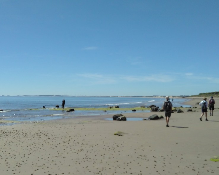
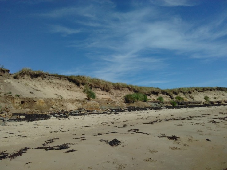
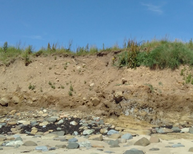
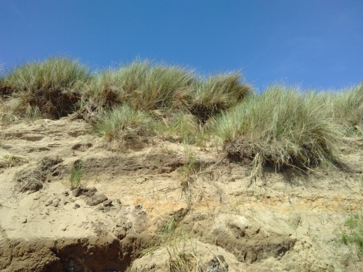
The main aim of the outing was to examine and understand the geological context for the formation of the soils in the area. In the Carboniferous period (359 to 299 million years ago) the Great Limestone sequence was deposited across Northern England. Rothley Crags originated from the sediment of a large river that once flowed through Northumberland. The crags have been exposed by a series of geological faults running SW- NE and subsequent glaciation. From the top of Rothley Crags, the misty view below shows the agricultural field-scape, clearly different from the foreground rough grassland of the Crags. Bilberry and Bracken vegetation predominate on the exposed high ground of the grits. Typical acid plants like Climbing Corydalis and Tormentil were identifiable. OLYMPUS DIGITAL CAMERA

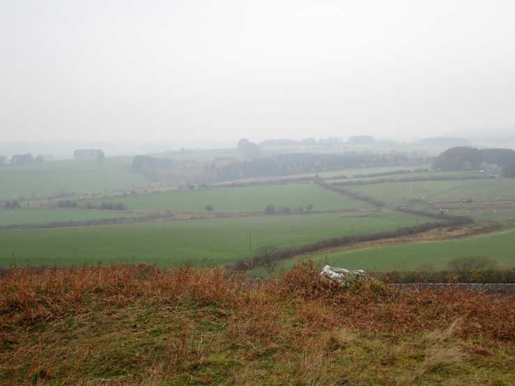
The influence of glacial processes of erosion and deposition can be deduced in the types of soil that we can see today such as clay and silt based loam.plantation core.JPG

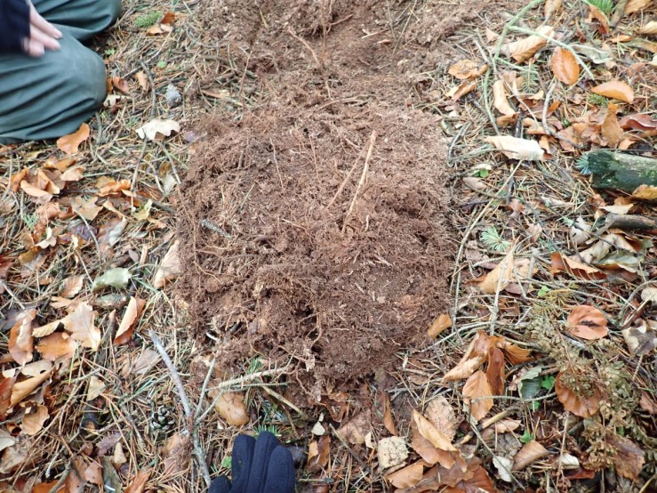
We dug a pit about one foot deep in a modern conifer plantation. The soil was dry Mor with a thick unconsolidated humus layer on top. Conifers like Norway and Sitka Spruce depend on fungal networks (mycorrhiza) within this layer to provide them with nutrients such as nitrogen. The fine roots in this layer had visible white mycorrhizal tips.  A nitrogen supplying fungal associate, (Russula ochroleuca), was fruiting throughout the plantation. The soil was a shallow Ranker. Rankers are soils developed over non-calcareous material, usually sandstone rock. They are are often called A/C soils, as the topsoil or A horizon is immediately over the C horizon (parent rock) and lack a B horizon of leached material.

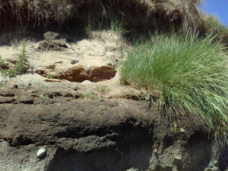
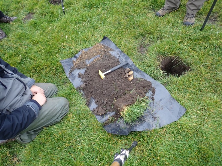
We moved on to test other areas area in the grassland on the approach to the Crags.  The right hand core pictured below was from a wetter rushy area and the left from a drier section nearby. Both of these were well turfed with no unconsolidated humus litter on top. The wet core harboured several worms, common inhabitants of Mull soils. They both contained ABC horizons. The B horizon largely consisted mainly of clay and was gleyed in both cases. The greyish or bluey-grey colours and orange mottling are characteristic  of gley soils but of secondary origin, replacing those inherited from the parent material. They result from the absence or very low levels of oxygen when iron compounds are changed chemically from their usual brown colours (reduction of ferric iron compounds to ferrous compounds).  This layer had no roots visible. The C Horizon in both samples was of unconsolidated parent rock (sandstone). There was a more obvious gleyed horizon in the wet sample due to greater waterlogging.

OLYMPUS DIGITAL CAMERA

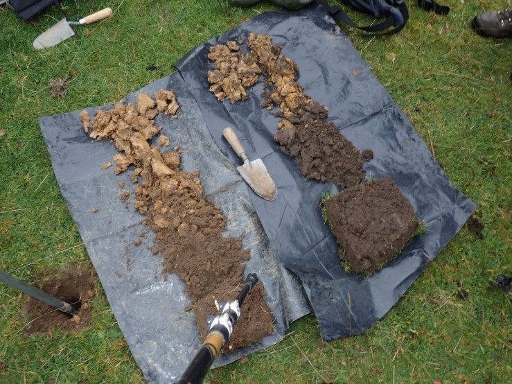
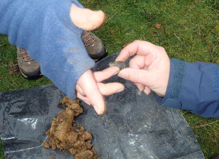
These fields were grazed by cattle and sheep and had been in use since probably late Neolithic/Bronze Age. Janet found evidence of this; a worked flint in the left hand core. The grassland was rich in fungi but mostly associated with the animal manure.

OLYMPUS DIGITAL CAMERA

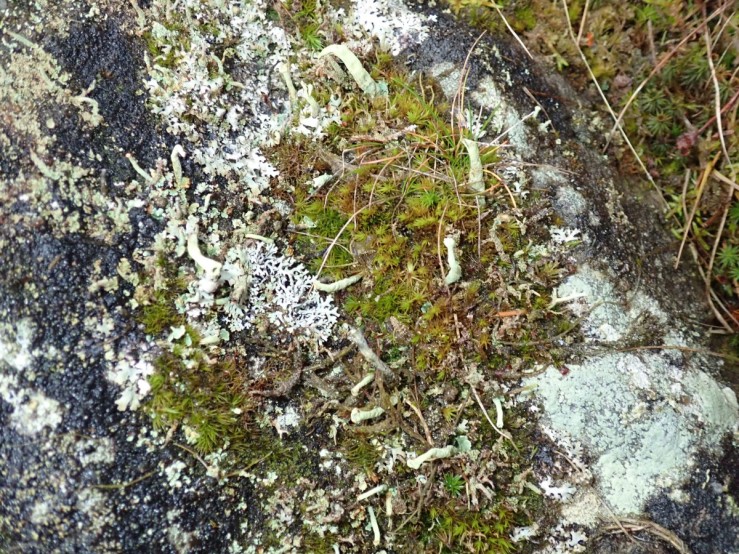
The moss and lichens on the sandstone crags formed intricate gardens of numerous species such as Cladonia sulphurina depicted below. C diversa,  C polydactyla, C macilenta, C ciliata and C furcata were abundant. Crustose lichens such as Pertusaria coralina, Parmelia saxatilis and Acrospora fuscata were visible on the bare sandstone.   Sphagnum mosses, such as S capillifolium and S palustre indicated the waterlogged soil conditions.

OLYMPUS DIGITAL CAMERA

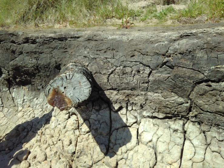
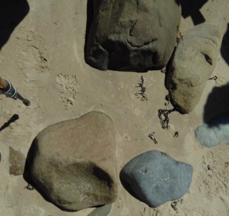
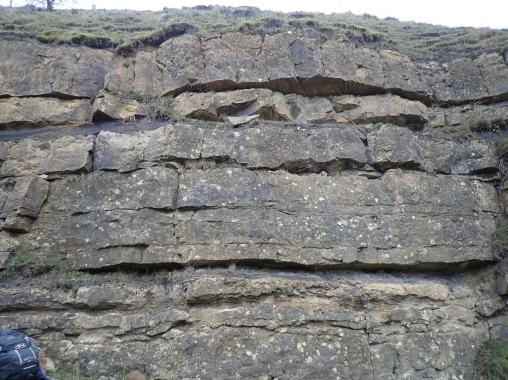
In Greenleighton Quarry the Great limestone was exposed in thick posts with thinly bedded shales between.

OLYMPUS DIGITAL CAMERA

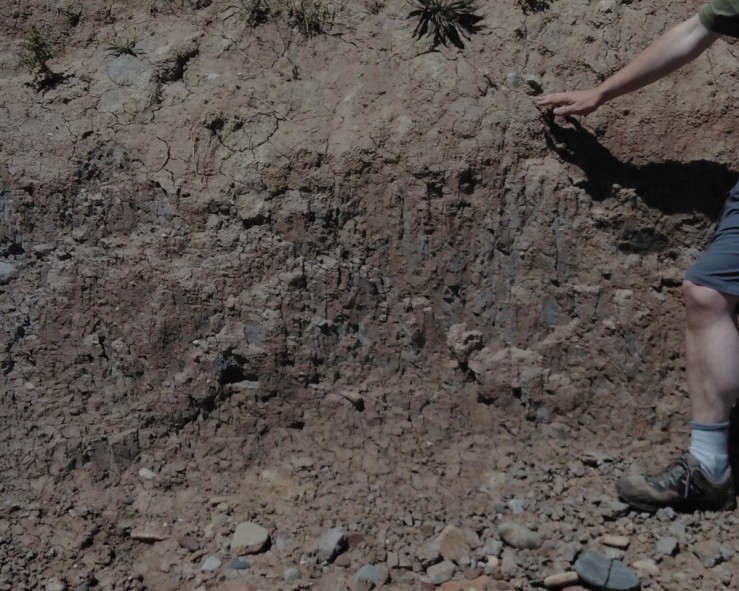
We augured a core from the field on top of the quarry. It was a thick Mull soil with ABC horizons showing little gleying. The deep brown  A layer was thick and wormy. There were many large mole hills in the field suggesting a deep fertile soil. It had been cleared  of large rocks at some time judging by the scatter on the wetter field below.  A thin gleyed B horizon was present but unexpectedly there was no limestone in the C horizon. Unconsolidated pebbly sandstone and some stony material were sandstone. The field looked as if it had been improved since white clover and perennial ryegrass were predominant and fungi was scarce.

OLYMPUS DIGITAL CAMERA

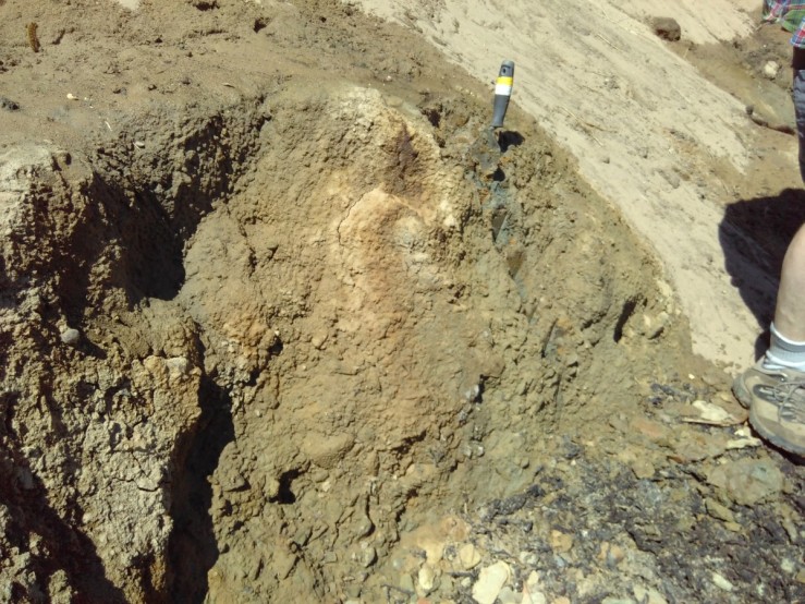
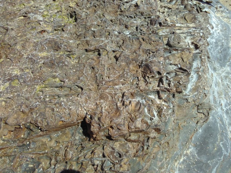
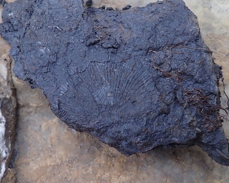
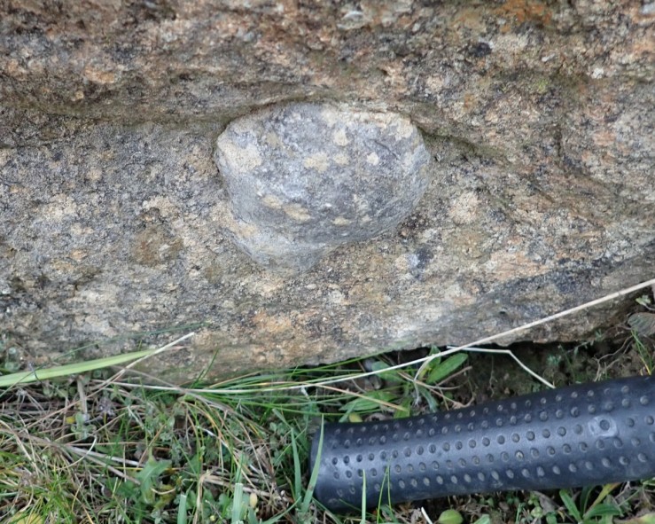
The quarry floor was rich in fossils found in tumbled rock including the type fossil of Pleuoplugnoides greenleightonensis, a carboniferous brachiopod pictured below in the shale.

OLYMPUS DIGITAL CAMERA

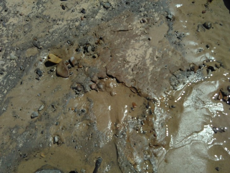
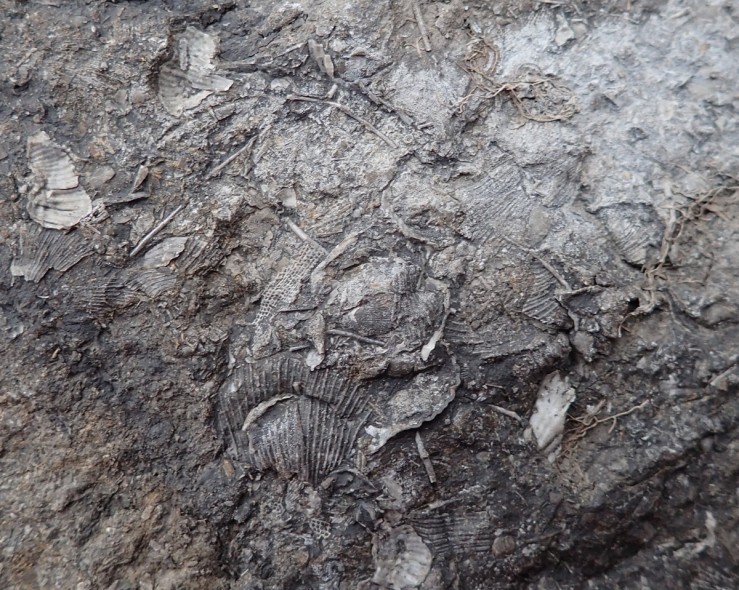
A  broken mass of fossils below hints at the turbulent history of the shale, the chainmail like pieces are possibly the bryozoan (Fenestella plebeia).

OLYMPUS DIGITAL CAMERA

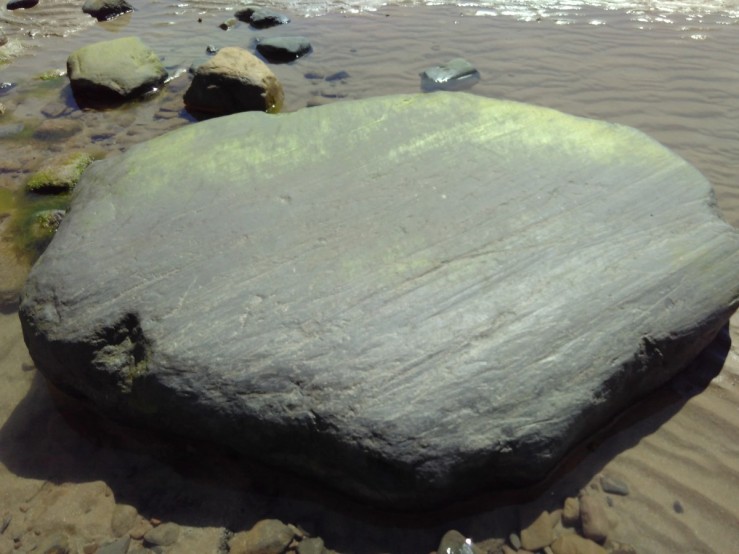
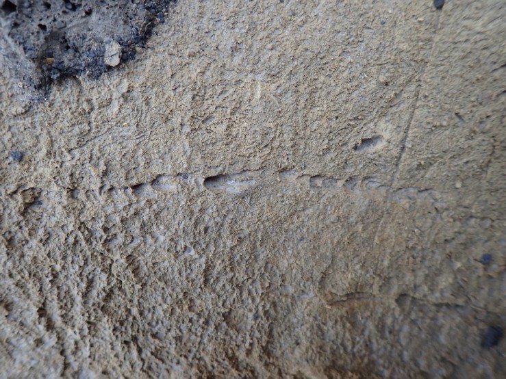
I was intrigued by these traces along this rock,

OLYMPUS DIGITAL CAMERA

and this Echinoid fossil.

OLYMPUS DIGITAL CAMERA

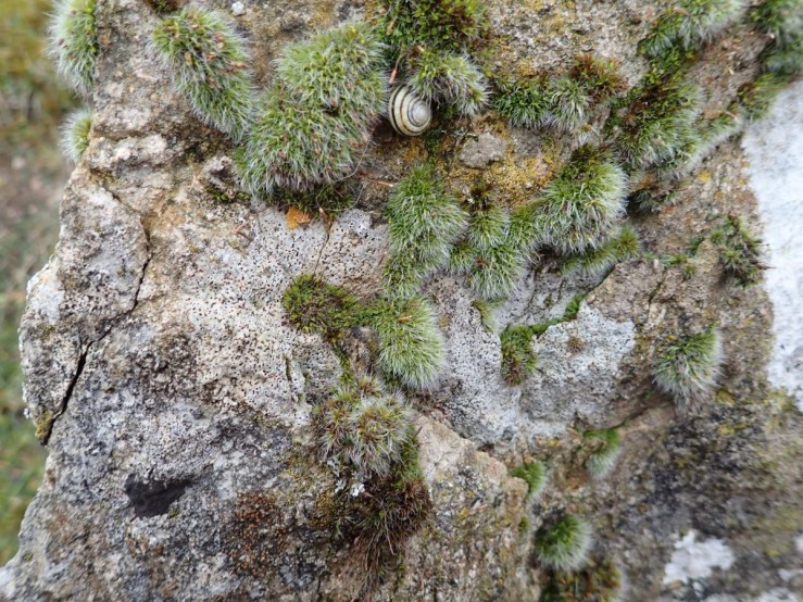
The species of moss and lichen were different here, reflecting the calcareous nature of the limestone rock. The crustose lichen, with marked pitting. is probably Verrucaria baldensis,  a species common on hard limestone. The acrocarpous moss is Grimmia pulvinata.

OLYMPUS DIGITAL CAMERA


References: Mycorrhiza

Sandy Bay Cliffs and Glacial Till


OLYMPUS DIGITAL CAMERA

The Cliffs at Sandy Bay are almost entirely made up of Upper Carboniferous (Pennine Middle Coal Measures Formation) rocks. These rocks are between 299 to 280 million years old. The vegetation on top consisted of Bramble and Gorse indicative of sandy soil.

The rocks seen are a mix of sedimentary types. These include light grey brown or yellow brown sandstones, darker mudstones, silty mudstones, black shales and a prominent Coal seam. This Coal seam clearly seen in the picture above is present almost the whole length of this cliff until terminated by a fault adjacent to the northern edge of the Caravan park. The coal is associated with a Seat-earth (fossilised soil) of variable thickness. Above it lies a substantial bed of hard sandstone known as the Seventy Fathom Post bed. Below the cliff is a wave cut platform. Erosion was evident from fallen rocks and slumped till.

OLYMPUS DIGITAL CAMERA

This heap is composed of quarry spoil and slumped topsoil. Heather, Thrift and thin grasses formed a thin peat layer. The photo below reveals a lichen, Cladonia humilis, a cliff dweller that thrives on disturbed soil.

OLYMPUS DIGITAL CAMERA

This outcrop of thick sandstone topped with eroded irregularly broken layers may have been disturbed by glacial processes. The sandstone contained mica crystals and crumbled easily.

OLYMPUS DIGITAL CAMERA

After the cliffs terminate glacial boulder clay formed thick deposits 6 metres deep. The basal layer of wet grey coloured clay was succeeded by reddish/brown deposits and cracked gleyed (greyish blue) patches under the humus horizon. It is thought that the ice sheets moved from North to South down the coast so this is a transverse section through the till.

OLYMPUS DIGITAL CAMERA

A closer view of the gley soil reveals the associated vertical cracks. Gleying occurs because soil is waterlogged for all or most of the year. This waterlogging deprives the soil of oxygen that the soil organisms need to survive. The organisms left in the soil extract the oxygen they need to survive from the iron compounds and the soil gradually turns grey, blue or green as the oxygen is depleted. The presence of reddish or orange mottling indicates localised re-oxidation of ferrous salts in the soil matrix.

OLYMPUS DIGITAL CAMERA

We came across many fossils in the rocks on the beach such as Gigantoproductus, fossil sponges, corals, carbonicola and mussels. An example of a fossil Crinoid is pictured in this limestone rock.

fossil.JPG

Towards the River Wansbeck estuary,  beyond the fault, on Sandy Bay Spit was an area of well established and growing dunes supporting  Marram Grass and Sea Buckthorn (Hippophae rhamnoides).

OLYMPUS DIGITAL CAMERA

Nearby at Lynemouth, we visited the power station now converted to burning wood chip.

lynemouth power.JPG

Our aim was to examine industrial beach deposits of Anthropocene age. Composed of slag waste from the Power Station when it was coal fired supplying power to an aluminium smelter,  similar erosional processes were happening. But here, a layer of sulphur had washed down to accumulate as a yellow coloured deposit with the characteristic smell of rotten eggs. In general, there was a different flora: abundantly flowering Yellow-wort (Blackstonia perfoliata) favouring the thin calcareous soils and Bloody Cranesbill (Geranium sanguineum) still in flower.

OLYMPUS DIGITAL CAMERA

Behind the eroding beach a pond waiting to be filled with ash waste looked eerily devoid of life.

OLYMPUS DIGITAL CAMERA


Reference:

Stratigraphy of lodgement till

Newbigging geology

Derwentwater – Some Lichens

usnea lobaria

This Hazel branch is covered in Usnea subfloridana amid Parmelia sulcata but when zooming in Tree Lungwort (Lobaria pulmonaria) is revealed. Nearby is Great Wood, a remnant of Atlantic Oak forest especially rich in lichen.

Flavoparmelia caperata is the apple green lichen common on acid barked trees.

Flavoparmelia caperata

Pertusaria amara below, identified by its bitter taste, growing among mosses.

p amara

A lichen mosaic with a two spot ladybird (Adalia bipunctata) in attendance. Although Ochrolechia parelle was abundant in Keswick, the white lichen with tan coloured disks could be Ochrolechia tartarea and the green foliose (Parmelia subreducta)? Arthonia radiata is recognised by its crowded black apothecia.

a radiata

Another common form of Arthonia  shown below (A puntiformis).

A puntiformis

Lichen are hard to identify from photographs. The white crust looks like a Porpidea of some kind, Parmotrema perlatum at the bottom left corner with Hynogymnia tubulosa above it.

porpidea?

A Peltigera of some species probably (P menbranacea) was among the variety of lichen here.

p membranica

Many were impossible to identify such as the one below spreading across an Andesite boulder.

unknown

Derwent Water – Lakeside Geology

A classic misty view of the lake from Friars Crag seems to conceal more than it reveals, But a huge span (500 million years) of geological history is represented underneath.

friars

Following  ‘The Rocks and Landscape of the Keswick Area’ booklet I looked for some of the geological features around the Eastern part of the lake. Keswick and the Lake lie on rocks forming the Skiddaw Group dating from the Ordovician period. By the lakeside I came across an exposure of dull grey rock that cleaved easily. These rocks formed on the muddy floor of an ancient ocean, the ‘Iapetus’. Eventually they were compressed and folded into mountains of the Skiddaw Group. Those in the photo look like they have been disturbed and left lying on their side. Weathered fragments and slivers of the slates are visible at the bottom of the picture.

skidaw group slate

Most of the Skiddaw Group are concealed by an overlay of glacial and alluvial till sculpted into Drumlins by the moving ice. Crow Park, shown below, is a large drumlin. Drumlins are oval mounds left behind as the glaciers retreated, their crests and direction often indicate the movement of the ice streams. Keswick is built on these drumlin features.

drumlin

A closer view of the till reveals an assortment of boulders and pebbles embedded in finer sandy/ silt material. Much of this material comes from further up the Borrowdale valley, transported down by the ice. The direction of the embedded rocks shows that the ice was moving from South to North down the valley. The green boulder on the top left is probably made from fine volcanic ash that is valued for its sea-green colour and decorative features.

boulder till

It is thought that Lord’s Island, one of the seven islands on the lake, forms part of the drumlin field.


lords island drumlin

Friars Crag is, however, formed from dolerite, an intrusive volcanic rock made up of small crystals. It looks rougher and more chunky than the slate. Beneath the lake district at some depth is a large mass of granite. It appeared to have been pushed up to the surface during volcanic activity as small intrusions like this one.

friars crag dolerite

This dolerite boulder displays quartz veining and may also contain calcite crystals.

dolerite rock

Along the shore by Calf Close Bay is a commemorative sculpture made from Andesite lava from the Borrowdale Volcanic Group. There is a plaque overlooking the sculpture made from fine grain ash-fall tuff, however, I could not find it.

andesite boulkder

Towards the end of the bay a moss covered jumble of  rocks marks the appearance of the Borrowdale volcanic Group.  During the collision of ancient continents and the closure of the Iapetus Ocean that formed the Skiddaw Group, the consequent long lasting volcanic activity created the Borrowdale Volcanic Group. It is formed from a variety of rock types from volcanic extrusions such as air-fall tuff, molten lavas and pyroclastic flows.

mossy rocks

Getting closer they reveal a reddish, purple tone. The red is due to haematite staining in the rock.

Borrowdale volcanic

Not having time to go further up towards Falcon Crag I took a somewhat brooding  photograph of the imposing andesite lava crag.

falcon clint

Falcon Crag with Brown Knots in the far distance.

borrowdale volcanics


Reference: Falcon Crag

The Rocks and Landscape of the Keswick Area by Alan Smith.

Annstead Dunes-Seahouses

beach

A view of the beach with juvenile Herring Gull and Serrated wrack covering the rocks. We went there to survey the plants. Sea Arrow grass and Sea Plantain were growing abundantly by this creek.


sea plantain

The Small Scabious  (Scabiosa columbaria) displayed below is one of the specialist dune plants.

small scabious.JPG

Wild Basil (Clinopodium vulgare) was identified, seeming to have benefited from the recent rainfall.

wildbasil

Sea Mayweed (Tripleurospermum maritimum) liked similar conditions to the Silverweed growing beside it.

seamayweed

The Goosefoot family was well represented. Pictured below is Babington’s Orache (Atriplex glabriuscula).

babingtons

The willowherbs were still in flower, the one below proved to be Short-fruited Willowherb (Epilobium obscurum).

willowherb

While exploring the dunes this Wall Brown butterfly (Lasiommata megera) was noticeable.wallbrown

We explored the beach where Sea Milkweed (Glaux maritima) and Sea Pink (Armeria maritima) were inhabiting the cracks in the limestone pavement.

pavement

These rocks are fossiliferous. The fossil shown below looks like part of a Coelacanth. Coelacanths  were once known only from fossils and were thought to have gone extinct approximately 65 million years ago (mya), during the great extinction in which the dinosaurs disappeared. Once coelacanths were a large group comprising about 90 valid species that were distributed worldwide in both marine and freshwaters. Today, there are only two known living species.

fish

This fossil in this limestone looks like the stem of a Crinoid. Crinoids are an ancient fossil group that first appeared in the seas of the Middle Cambrian, about 300 million years before dinosaurs. They flourished in the Palaeozoic and Mesozoic, and some survive to the present day.

crinoid

Many other types of fossil were present such as brachiopods, bivalves and this ‘Cock’s Tail’ trace fossil Zoophycus.

zoophycus

Of course there were many lichens: Black Tar lichen (Verrucaria maura) and a Caloplaca of some kind on the limestone pavement.

black lichen


References: Coelacanth   Crinoid

lantlist for monad NU2231 – Seahouses Golf Club
Friday, August 17, 2018
Recorders: Mima Cattan, Pru Hamed, Jonathan Hewitt
Achillea millefolium Yarrow
Aegopodium podagraria Ground-elder
Alliaria petiolata Garlic Mustard
Alnus glutinosa Alder
Ammophila arenaria Marram
Anagallis arvensis Scarlet Pimpernel
Anthriscus sylvestris Cow Parsley
Armeria maritima Thrift
Arrhenatherum elatius False Oat-grass
Artemisia vulgaris Mugwort
Aster tripolium Sea Aster
Atriplex glabriuscula Babington’s Orache
Atriplex laciniata Frosted Orache
Atriplex littoralis Grass-leaved Orache
Atriplex patula Common Orache
Ariplex prostrata Spear-leaved Orache
Bellis perennis Daisy
Betula pubescens Downy Birch
Bolboschoenus maritimus Sea Club-rush
Brassica napus Rape
Cakile maritima Sea Rocket
Calystegia sepium Hedge Bindweed
Calystegia silvatica Large Bindweed
Campanula rotundifolia Harebell
Capsella bursa-pastoris Shepherd’s Purse
Carex arenaria Sand Sedge
Centaurea nigra Common Knapweed
Cerastium fontanum Common Mouse-ear
Cirsium arvense Creeping Thisle
Cirsium vulgare Spear Thistle
Cochlearia officinalis Common Scurvygrass
Conium maculatum Hemlock
Crataegus monogyna Hawthorn
Cytisus scoparius Broom
Dactylis glomerata Cocksfoot
Daucus carota Wild Carrot
Elytrigia juncea Sand Couch
Elytrigia repens Common Couch
Epilobium hirsutum Great Willow-herb
Epilobium obscurum Short-fruited Willowherb
Equisetum arvense Field Horsetail
Euphrasia agg. Eyebright
Festuca rubra Red Fescue
Fraxinus excelsior Ash
Fumaria officinalis Common Fumitory
Galium aparine Cleavers
Galium verum Lady’s Bedstraw
Geranium molle Dove’s-foot Cranesbill
Glaux maritima Sea Milkwort
Heracleum sphondylium Hogweed
Holcus lanatus Yorkshire Fog
Hypochaeris radicata Common Cat’s-ear
Juncus gerardii Saltmarsh Rush
Juncus inflexus Hard Rush
Lamium album White Deadnettle
Leymus arenarius Lyme-grass
Linum catharticum Fairy Flax
Lolium perenne Perennial Rye Grass
Lotus corniculatus Common Bird’s-foot Trefoil
Malus pumila Apple
Matricaria discoidea Pineapple-weed
Medicago lupulina Black Medick
Mentha aquatica Water Mint
Mentha suaveolens Round-leaved Mint
Myosotis arvensis Field Forget-me-not
Myosotis scorpioides Water Forget-me-not
Papaver dubium Long-headed Poppy
Papaver somniferum Opium Poppy
Plantago coronopus Buck’s-horn Plantain
Plantago lanceolata Ribwort Plantain
Plantago major Greater Plantain
Plantago maritima Sea Plantain
Polygonum aviculare Knotgrass
Potentilla anserina Silverweed
Potentilla reptans Creeping Cinquefoil
Prunella vulgaris Sef-heal
Prunus spinosa Blackthorn
Puccinellia distans Reflexed Saltmarsh Grass
Puccinellia maritima Common Saltmarsh Grass
Ranunculus repens Creeping Buttercup
Reseda luteola Weld
Rubus fruticosus agg. Bramble
Rumex crispus Curled Dock
Rumex obtusifolius Broad-leaved Dock
Schoenoplectus lacustris Common Club rush
Scorzoneroides autumnalis Autumn Hawkbit
Sedum acre Biting Stonecrop
Senecio jacobaea Common Ragwort
Senecio vulgaris Groundsel
Silene dioica Red Campion
Silene latifolia White Campion
Sisymbrium officinale Hedge Mustard
Sonchus arvensis Corn Sow-thistle
Sonchus asper Rough Sow-thistle
Sonchus oleraceus Smooth Sow-thistle
Spergularia marina Lesser Sea-spurrey
Spergularia media Greater Sea-spurrey
Stellaria media Common Chickweed
Taraxacum agg. Dandelion
Thymus polytrichus Wild Thyme
Torilis japonica Upright Hedge-parsley
Tragopogon pratensis Goatsbeard
Trifolium pratense Red Clover
Trifolium repens White Clover
Triglochin maritimum Sea Arrowgrass
Tripleurospermum inodorum Scentless Mayweed
Tripleurospermum maritimum Sea Mayweed
Tussilago farfara Coltsfoot
Ulex europaeus Gorse
Urtica dioica Common Nettle
Veronica persica Common Field Speedwell
Vicia cracca Tufted Vetch

Noses Point and Blast Beach Botany

blast beach

Noses Point is an area of clifftop magnesian Limestone grasslands with a variety of habitats and an interesting collection of wild flowers. Blast Beach is recovering from being used as a industrial spoil storage site. The Centaurea scabiosa, pictured below, and Devils-bit Scabious (Succisa pratensis) were abundant and colourful.

centaurea

Sea Plantain (Plantago maritima) was luxuriant as was Wild Carrot (Daucus carota) also in the picture.

plantago

The still flowering heads of Wild Parsnip (Pastinaca sativa) proved attractive to these ladybirds.

wild parsnip

Many of the plants had gone to seed already like this Dyer’s Greenweed (Genista tinctoria).

dyersgreenweed

and the Carline Thistle (Carlina vulgaris).

carline thistle

The Corn Sow Thistles (Sonchus arvensis) were mostly in flower but some had set their round white pappi seedheads.

Sonchua arvense

Tall Melilot (Melilotus altissima) was found growing on the beach at the foot of the cliff.

tall mellilot

Hoary Ragwort (Senecio erucifolius) and leaved of wild Teasel (Dipsacus fullonum) were growing on the cliff tops.

Hoary Ragwort (Senecio erucifolius)

Most perplexing were the Oraches. Apparently there are two species of Atriplex in this photo, Babington’s Orache (Atriplex glabriuscula) and Spear leaved Orache (A prostrata).

Until recently they were classed as an aggregate species. The plant guides suggest various differences.  A prostrata appeared to have longer, more hastate leaves and looked less mealy than A glabriuscula.

Babbington's Orache(Atriplex glabriuscula), Spear leaved orache

Plant Species Noted:

Melilotus altissima Tall Melilot

Daucus carota Wild Carrot

Senecio erucifolius Hoary Ragwort

Genista tinctoria Dyer’s Greenweed

Achillea millefolium Yarrow

Lathyrus pratensis Meadow Vetchling

Vicia cracca Tufted Vetch

Centaurea scabiosa Greater Knapweed

Centaura nigra Knapweed

Pastinaca sativa Wild Parsnip

Potentilla reptans Cinquefoil

Blackstonia perfoliata Yellow Wort

Eupatorium cannabinum Hemp Agrimony

Urtica dioica Stinging Nettle

Tussilago farfara Coltsfoot

Artemesia vulgaris Mugwort

Linaria vulgaris Toadflax

Diplotaxis muralis Annual Wall Rocket

Carlina vulgaris Carline Thistle

Rhinanthus minor Yellow Rattle

Centaurium littorale Seaside Centaury

Pilosella officinarum Mouse-ear Hawkweed

Lotus corniculatus Birdsfoot Trefoil

Plantago maritima Sea Plantain

Anthyllis vulneraria Kidney Vetch

Gentianella amarella Autumn Gentian

Leontodon hispidus Rough Hawkbit

Chamerion angustifolium Rosebay Willowherb

Filipendula ulmaria Meadowsweet

Agrimonia eupatoria Agrimony

Plantago lanceolata Ribwort Plantain

Cardus crispus Welted Thistle

Geranium pratense Meadow Cranesbill

Dipsacus fullonum Wild Teasel

Cirsium arvense Creeping Thistle

Origanum vulgare Marjoram

Angelica sylvestris Angelica

Reseda lutea Wild Mignonette

Medicago lupulina Black Medick

Prunella vulgaris Self-heal

Arctium minus ssp.minus Lesser Burdock

Campanula rotundifolia Harebell

Prunus spinosa Blackthorn (Sloe)

Geranium sanguineum Bloody Cranesbill

Betonica officinalis Betony

Succisa pratensis Devilsbit Scabious

Galium verum Lady’s Bedstraw

Heracleum sphondylium Hogweed

Pimpinella saxifraga Burnet-saxifrage

Knautia arvensis Field Scabious

Euphrasia nemerosa Eyebright

Crepis capillaries Smooth Hawksbeard

Sonchus arvensis Perennial Sow-thistle

Epilobium hirsutum Great Willowherb

Veronica beccabunga Brooklime

Persicaria maculosa Redleg

Equisetum arvense Field Horsetail

Atriplex prostrate Spear-leaved Orache

Convolvulus arvensis Field Bindweed

Potentilla anglica Trailing Tormentil

Odontites vernus Red Bartsia

Atriplex glabriuscula Babington’s Orache

Atriplex prostrata Hastate Leaved Orache

Epilobium parviflora Hoary Willowherb

Pteridium aquilinum Bracken

Artemisia vulgaris Mugwort

Holcus mollis Creeping Soft Grass

Arrhenatherum elatius False Oat Grass

Festuca arundinacea Tall Fescue

Briza media Common Quaking Grass

Brachypodium sylvaticum False Brome

Brachypodium pinnatum Tor Grass

Elytrigia atherica Sea Couch

Carex pulicaria Flea sedge

Carex flacca Glaucous sedge

Linum catharticum Fairy Flax

Rosa pimpinifollia Burnet Rose

Hypericum pulchrum Slender St John’s Wort

Lysimachia vulgaris Yellow Loosestrife

Rubus caesius Dewberry

Tragopogon pratensis Goatsbeard

Scorzoneroides autumnalis Autumn Hawkbit

Plantago media Hoary Plantain

Diplotaxis tenuifolia Perennial Wall Rocket

Pulicaris dysenterica Common Fleabane

Centaurium erythraea Common Centaury

Rumex crispus Cuurled Dock

Rumes acetosa Common sorrel


Beadnell – Beach and Dunes

tern colony

A view of the beach showing the crates where Little Tern nests are raised above the incoming tides. The beach at Long Nanny is important for nesting Little Tern (Sternula albifrons), Arctic tern (Sterna paradisaea) and Ringed plover (Charadrius hiaticula). Starting with only three pairs of Little Terns in 1977, the numbers have increased each breeding season to a current total of 30-50 pairs. This makes Long Nanny a nationally important site for the Little Terns, with approximately 2% of the British breeding population using the site. It is also home to the largest mainland breeding colony of Arctic terns in the UK.  The site is protected by a 24 hour watch since the birds are in danger from high tides, foxes, dogs, birds of prey and egg thieves. We saw many Arctic Tern with sandeels in their beaks or noisily cavorting on the dunes. The Little Terns can be viwed through a scope at the Ranger Shed.

arctic tern

This dainty Common Gull pictured below was picking its way along the beach on yellow legs. We also noticed  Kestrel, Skylark, Linnet, Black headed gull, Black Backed and Herring gulls, Oyster Catcher, Dunlin and Eider Duck.

common gull

The dunes are covered with Marram and other grasses. As the day was sunny, flying insects such as this Small Copper ( Lycaena phlaeas) butterfly were flying. The larval foodplants of this species are Common and Sheeps’s Sorrel which I noticed growing along the dunes.

small copper

Butterflies are difficult to photograph but Common Blue, Meadow Brown, Ringlet, Small Tortoiseshell, Six -Spot Burnet, Narrow bordered Five Spot Burnet moths and a Cinnabar Moth caterpillar were noted. A large strong fast flying butterfly with orange splashed wings proved to be a Dark Green Fritillary (Argynnis aglaja). It as a dune specialist and the larvae eat Dog Violet leaves.

This long green caterpillar was huge and easier to photograph. It is the larval form of the Emperor Moth (Saturnia pavonia); the adult has a wingspan of 9cm.

Emperor moth caterpillarP1010195

The Dune plants were flowering well. A Marmalade Hoverfly was sipping from the flowers of the Storksbill (Erodium cicutarium).

hoverfly

Some of the plants were in white flower. Restharrow (Ononis repens) is rare in in this form.

White ononis repens

Harebell (Campanula rotundifolium) also in its its much rarer white form.

harebell

The Burnet Rosa (Rosa pimpininellifolia) is usually white but some plants were showing its classic black glossy hips already.

Burnet rose.JPG

Crow garlic (Allium vineale) was coming into flower continuing the theme of white flowers.

crow

Angelica (Angelica sylvestris) had begun to flower. undeterred by the coarse dune grasses.

angelica

On the sandier areas away from the coarse grasses,  Mayweed was flourishing. We thought this one was Scented Mayweed (Matricaria chamomilla) since it had a detectable scent bit it is more likely Sea Mayweed.

scented mayweed

Growing nearby, more prostate and fleshy in form was Sea Mayweed (Tripleurospermum maritimum).

sea mayweed

Sea Rocket (Cakile maritima) often occurs near Sea Mayweed since they both are salt tolerant.

sea rocket

Frosted Orache (Atriplex laciniata) likes growing at the foot of the dunes straight up  through the beach sand. It has a mealy appearance.

frosted orache

Bloody Cranesbill (Geranium sanguineum) and Creeping cinquefoil (Potentilla reptans) added the contrasting colours of deep pink and yellow flowers to the grey dune grasses.

dune

Greenleighton Quarry Visit- Highlights

quarry

A general view of the site shows the effect of the dry weather on the plants. Noticeably the Bracken was still green. Although we went there for botany, the disused quarry at Greenleighton is an SSSI site for Geology. It exhibits an exposure of the Great Limestone and overlying sediments of Namurian age (330 mya).  The Namurian is a subdivision of the Carboniferous Period. The limestone is 15 metres thick in places consisting of large posts and shaly beds between, a section is seen below.

great limstone.JPG

The limestone floor is calcareous with normally wet flushes. Adder’s-tongue fern (Ophioglossum vulgatum), although yellowing was distinctive and occurred in two areas.

addertongue

Red Bartsia (Odontites vernus) looking very stressed but coming into flower.

red bartsia

Many of the wet areas had dried out but this Shoreweed (Litterella uniflora) was identifiable sprouting through the mud.

Littorella uniflora

The delicate white flowers of the Knotted Pearlwort (Sagina nodosa) looked exquisite.

knotted pearlwort1010113

In a wetter patch the Harebell (Campanula rotundifolia) made a striking splash of blue.

campanula

We found a few spikes of Autumn Gentian (Gentianella amarella) a biennial plant, this one was just coming into flower.

autumn gentian.JPG

There were many other plants but I was not familiar with this Yellow Sedge (Carex demissa) smaller than the taller  growing glaucous and common sedges.

yellow sedge.JPG

Unfortunately we came across a young Ash (Fraxinus excelior) showing clear signs of ash dieback disease, in the diamond shaped lesions on the stem. First confirmed in Britain in 2012, Chalara or ash dieback is a disease of ash trees caused by a fungus called Hymenoscyphus fraxineus.

ash dieback

Comb Moss (Ctenidium molluscum), looking very dry, is a typical  moss of calcareous habitats.

Comb moss

A loose rock composed of a fossil colonial coral.

colonial coral chaetetes.JPG

The shell fragment below looks like Pleuropugnoides greenleightonensis one of the marine shell fossils the site is noted for.

Pleuropugnoides greenleightonensis?

The soft shales above the Great Limestone contained fossil Brachiopods as in the photo below. We did not find the other famous fossil, Cravenoceras leion, mentioned in the SSSI citation.brachiopod

The fossil rock provided a resting place for this colourful Meadow Grasshopper.

meadow grasshopper

As we were leaving this bird pellet was found. It could be from a Little Owl since it is rich in insect remains.

little owl pellet

References: SSSI citation


Bradford Kaimes & Newham Fen


Bradford Kames is of national importance in the Pleistocene/Quaternary geology of north-east England. Geomorphological features such an an esker ridge, a series of plateaux and mounds consisting of glacial till and fluvioglacial deposits form an assemblage providing a striking example of the complex landform and sediment associations that developed during the ending of the last Ice Age.  The linear feature pictured below is an esker. Eskers are depositional features that form by drainage channels under glaciers and remain as sinuous mounds as the ice retreats. We looked at the constituents  of an esker noticing a bed of boulders (mostly limestone and sandstone and shale) topped with sandier clay deposits.

esker and lake

The boggy area above is the remnant of a larger lake formed as the ice retreated. The calcareous grassland surrounding surprisingly contained many lime loving plants such as Ladies Bedstraw,  Birds- foot Trefoil and Soft Brome grass. The esker formed beads with natural breaks where the roads run. Running alongside the esker were intriguing Kame terraces; flat topped deposits usually of sand and gravel. The one shown below is known as Golden Hill.

Golden hill Kame

The presence of eskers and Kame terraced in close proximity is puzzling.  It is thought that Bradford Kames belt can be interpreted as  a string of glaciofluvial ice-contact deposits that probably formed sequentially northwards as the Tweed Ice and North Sea Lobe Ice masses decoupled and separated. It forms a complex linear assemblage of features that stretches 13 km south-south-east from Spindlestone. The photo of a kame  below shows scrapes which appear to be sandy.

Kame terrace

The geomorphology suggested a complex and interconnected ecology of post glacial features, soils, vegetation and human exploitation since the Palaeolithic times. Beyond the line of the esker the outlines of an Iron Age Fort can be discerned.

esker

The Kame feature below shows ridge and furrow marks dating from the Early Middle Ages.

kame with rig and furrow marks

Present day cereal production, illustrated below, shows fields of bearded wheat and barkey.

bearded wheat

A line of ancient Hawthorn trees formed the field boundary but did not appear to have been hedged.

ancient hawthorn boundary

Nearby Newham Fen (SSSI), shown below, supports a remnant mire next to an esker and also the mainline railway to Edinburgh.

newham

It has become overgrown with Common Reed, Downy birch and Salix sp. We noticed Exmoor ponies and Belted Galloway cattle had been introduced to manage the overgrowth. The botany reflected the underlying bedrock geology of Oxford Limestone strata which forms a calcareous fen basin. From top right: Lesser Butterfly Orchid (Platanthera bifolia), Spotted orchid in its white form (Dactylorhiza fuchsii), Marsh Helleborine (Epipactis palustris) and Hemp Agrimony (Eupatorium cannabinum).

The Fen is also an ancient site of  human occupation. From the Neolithic to Bronze age it was occupied and recent excavations near Hoppen Hall farm have revealed extensive burnt mounds and an associated timber platforms, preserved under the peat.


References:

Bradford Kames SSSI

Bradford Kaims archaeology

Newham Fen SSSI

Low Hauxley- Geology

Low Hauxley beach

Low Hauxley Beach at low tide showing a cluster of boulders mostly whinstone,  poitioned possibly for shore protection. Low Hauxley Shore is an SSSI and shows fascinating Quaternary features such as an extensive layer of woody peat resting on Late Devension glacial till, overlain with blown sand containing buried soil horizons. Over the last 5000 years the geology illustrates environmental, coastal and archaeological changes.

Below is a peat layer dating to 7400- 7100 years before the present. The tree trunk is in situ. Trees present at that time from pollen analysis: Birch, Pine, Willow, Hazel, Alder. Beneath the peat is  brown Glacial  till.

lower peat layer

Further down the shore on a wave cut platform this peat layer revealed fossil footprints of human, horse and Wild Boar tracks. Humans were thought to have been here as early as 10,000 BP as nomadic hunter gatherers. These footsteps in the peat date from a period after this, when the sea level was lower and land wooded. They are now subject to tidal erosion.

footprints

The view below shows how the peat accumulated in hollows between outcropping bedrock sandstone. The join in the sand near the left hand side is the edge of a recently filled in archaeological investigation. Various colours of Boulder clay are exposed between.

end of peat basin

A closer view of the Glacial Boulder till shows its rough pebbly texture and an edge between the grey/green softer slate till.

Boulder till

The till seemed to come in various colours, grey/brown below.

Till light brown

Some was lighter brown in colour and showed surface cracking. The streaky pattern  of grey/blue till is indicative of watery conditions under the ice suggestive of faster moving but thinner ice.

Re brown till, blue grey till

A large boulder clearly displaying striations  indicative of ice movement. The direction was from North to South at that point.

Glacial striations in situ

Loose rocks on the beach were probably dropped here by glaciers and indicated the types of bedrock dragged here. Whin Stone, Sandstone, Carboniferous Limestone and Red Sandstone imply some of the variety present.

Beach rocks

The underlying sandstone bedrock is visible below in the profile below. Significantly there is no peat layer and the glacial till contains larger boulders.

boulder layers

They grey mud streaks are evidence of soil formation above the till. Gley soils have greyish or bluey-grey colours with orange mottling.  Of secondary origin they gradually replace those inherited from the parent material. They result from the absence or very low levels of oxygen when iron compounds are changed chemically from their usual brown colours to bluey grey in this case.

Gley soil

Sand dunes formed above peat layers on three separate occasions. The photo below reveals darker peat levels interspersed with lighter coloured sandy layers.

sand dune level

Although much can be dated and interpreted from the dunes there are gaps or unconformities where erosion or other changes have obscured the succession. This layer of cracked iron containing material outcropped on the beach above a strata of slaty deposit. It was crumbly to the touch and looked rusty brown.

slaty iron deposit over shale

Although evidence of a tsunami in a deposit at Low Hauxley dating from ~8150yr BP at the Archaeological site has been recorded we did not locate any clear indication of this.

Rapid erosion from the sea is a feature of this area of the Northumbrian coast. Although vegetation is important to the formation and stabilization of the dunes, it also falls victim to undermining in winter storms as this slipped clump of Marram Grass reveals.

Marram grass erosion

Surprisingly a large caterpillar had fallen onto the dune slopes and was laboriously climbing up to the top. It proved to be a the caterpillar of the Drinker Moth (Euthrix potatoria) which tends to a coastal distribution in the Northumberland.


Reference for Archaeology: Low Hauxley Excavation Report